CSK AO project workshop. AO CSK 3655 Continuous subsidence monitoring employing Cosmo-Skymed constellation.
|
|
|
- Erika Neal
- 5 years ago
- Views:
Transcription

1 CSK AO project workshop AO CSK 3655 Continuous subsidence monitoring employing Cosmo-Skymed constellation. Pablo Blanco Sánchez, Roman Arbiol, Fernando Pérez Roma 8/5/11
2 Outline Project objectives Data description. Comments on Baselines distribution. Cosmo-Skymed for DInSAR deformation monitoring: Single interferograms (vs. Envisat) Persistent scatterers (vs. Envisat) Conclusions, future work and recommendations.
3 Project main objectives Analyze CSK data for Persistent Scatterers deformation monitoring. Performance/improvements w.r.t Envisat data. CSK performances in a regional subsidence monitoring project. Catalonian government project in partnership with the geological survey of Catalonia (IGC). 3
4 Project s data Data obtained: 1 Stripmap Bages area [June 1, December 11] 19 Stripmap Barcelona area [July 1,January 1] 3 Stripmap Girona area [May 1, February 1] Stripmap Tarragona area [May 1, February 1] Number of images < 5 per frame, coherence approach. Low baseline approach in order to avoid geometrical decorrelation. CSK large orbital tube. 4

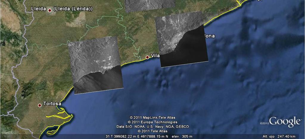
5 CSK data coverage 5
6 Bages 8 Distribucio espacio-temporal 18 Baseline distribution Bncrit = 497 m Baseline (m) 4 % interferograms Bn (meters) Baseline distribution Bncrit = 497 m Temps (anys) Temporal distribution % interferograms % interferograms Bn (meters) T (days) 6
7 Girona 14 Distribucio espacio-temporal Baseline distribution Bncrit = 39 m Baseline (m) % interferograms Bn (meters) - 5 Baseline distribution Bncrit = 39 m -4-6 % interferograms Temps (anys) Temporal distribution T (days) % interferograms Bn (meters) º incidence angle, lower critical baseline, rejection of some interferograms. 7
8 Underground mining subsidence monitoring Case study: Surface subsidence monitoring caused by underground potasic mining activities. Single interferogram along time approach due to temporal decorrelation. Fringe pattern correlated with mine exploitation. Low spatial baselines required. 8
 azimuth 16/3 days good compromise movement magnitude vs. temporal decorrelation.")
9 Underground mining subsidence monitoring 1 tall def. filtre mitjana, th =.33,size filt = Envisat 5 CSK ( days) azimuth 16/3 days good compromise movement magnitude vs. temporal decorrelation. Spatial resolution improvement, better spatial pattern detection. No large and frequent images stacks needed but low baselines pairs required 9


10 Single interferogram analysis High resolution/wavelength sensitivity allows to detect high spatial deformation gradients 1

11 Persistent Scatter DInSAR Large spatial deformation pattern, spatial averaging may cause magnitude understimation. CSK vs. Envisat: Increasing of useful points. Improvement of the deformation pattern retrieval. Structure damage identification. 11
 x utm = 4851, y utm = 4631, coher =.43, vel = -1.66 cm/a - -4 1.4 1.6 1.8 11 11. 11.4 11.6 11.8 temps (a) x utm = 48578, y utm = 463178, coher =.34, vel = -.")
12 Persistent Scatterers DInSAR x utm = 48646, y utm = , coher =.3, vel = -.48 cm/a temps (a) x utm = 4836, y utm = , coher =.3, vel = -.74 cm/a temps (a) x utm = 4851, y utm = 4631, coher =.43, vel = cm/a temps (a) x utm = 48578, y utm = , coher =.34, vel = -.43 cm/a temps (a) x utm = 48476, y utm = 46393, coher =.7, vel = -3.3 cm/a temps (a) 1

13 Persistent Scatterers DInSAR 13

14 Persistent Scatterers DInSAR 14
 x utm = 4811, y utm = 4663656, coher =.56, vel = -.49 cm/a 1-1 - 1.4 1.6 1.8 11 11. 11.4 11.6 11.8 1 1. temps (a) x utm = 4811, y utm = 4663368, coher =.")
15 Persistent Scatterers DInSAR x utm = 48398, y utm = , coher =.57, vel = -.68 cm/a temps (a) x utm = 48, y utm = , coher =.46, vel = -.56 cm/a temps (a) x utm = 4811, y utm = , coher =.56, vel = -.49 cm/a temps (a) x utm = 4811, y utm = , coher =.58, vel = -.46 cm/a temps (a) 15

16 Barcelona CSK AO project wokshop. Rome March 1 16

17 Airport 17

18 Delta Industrial area 18
19 Conclusions/Recommendations Still work to do to analyze all data Csk: High resolution + X band + higher repeat time, improvement on the density of coherent pixels, improvement of the results and interpretation of phenomena. At least our geologist colleagues are happy with that. New phenomena is observed, surface + structural deformation, refinement of the models? e-geos: Two years gap Interferometric dataset reduced price. Something similar for several frames within a regional framework? Baseline information on catalogue data to select suitable data. 19
COAL MINE LAND SUBSIDENCE MONITORING BY USING SPACEBORNE INSAR DATA-A CASE STUDY IN FENGFENG, HEBEI PROVINCE, CHINA
 COAL MINE LAND SUBSIDENCE MONITORING BY USING SPACEBORNE INSAR DATA-A CASE STUDY IN FENGFENG, HEBEI PROVINCE, CHINA Li Cao a, Yuehua Zhang a, Jianguo He a, Guang Liu b,huanyin Yue b, Runfeng Wang a, Linlin
Deformation measurement using SAR interferometry: quantitative aspects
 Deformation measurement using SAR interferometry: quantitative aspects Michele Crosetto (1), Erlinda Biescas (1), Ismael Fernández (1), Ivan Torrobella (1), Bruno Crippa (2) (1) (2) Institute of Geomatics,
Retrieving 3D deformation pattern of a landslide with hiresolution InSAR and in-situ measurements: Just landslide case-study
 Retrieving 3D deformation pattern of a landslide with hiresolution InSAR and in-situ measurements: Just landslide case-study Zbigniew Perski (1), Petar Marinković (2), Yngvar Larsen (3), Tomasz Wojciechowski
High-resolution temporal imaging of. Howard Zebker
 High-resolution temporal imaging of crustal deformation using InSAR Howard Zebker Stanford University InSAR Prehistory SEASAT Topographic Fringes SEASAT Deformation ERS Earthquake Image Accurate imaging
MODELING INTERFEROGRAM STACKS FOR SENTINEL - 1
 MODELING INTERFEROGRAM STACKS FOR SENTINEL - 1 Fabio Rocca (1) (1) Politecnico di Milano, Via Ponzio 34/5, 20133 Milano, Italy, Email: rocca@elet.polimi.it ABSTRACT The dispersion of the optimal estimate
The Potential of High Resolution Satellite Interferometry for Monitoring Enhanced Oil Recovery
 The Potential of High Resolution Satellite Interferometry for Monitoring Enhanced Oil Recovery Urs Wegmüller a Lutz Petrat b Karsten Zimmermann c Issa al Quseimi d 1 Introduction Over the last years land
Sentinel-1 IW mode time-series analysis
 Fringe 2015 Workshop Sentinel-1 IW mode time-series analysis When / How / Whether to stitch? Petar Marinkovic Yngvar Larsen PPO.labs Norut Objective Sentinel-1 InSAR for routine and operational monitoring
ALOS PI Symposium 2009, 9-13 Nov 2009 Hawaii MOTION MONITORING FOR ETNA USING ALOS PALSAR TIME SERIES
 ALOS PI Symposium 2009, 9-13 Nov 2009 Hawaii ALOS Data Nodes: ALOS RA-094 and RA-175 (JAXA) MOTION MONITORING FOR ETNA USING ALOS PALSAR TIME SERIES Urs Wegmüller, Charles Werner and Maurizio Santoro Gamma
The Tohoku Earthquake 2011 Case.
 Wide Area Deformation map generation with TerraSAR-X Data. The Tohoku Earthquake 2011 Case. N. Yague-Martinez (1), C. Minet (2), M. Eineder (2), B. Schättler (2) (1) Starlab, Spain (2) Remote Sensing Technology
SAR interferometry Status and future directions. Rüdiger Gens
 SAR interferometry Status and future directions Rüdiger Gens Polarimetric InSAR Polarimetric InSAR InSAR - Status and future directions sensitivity to changes in surface scattering, even in the presence
J. Manuel Delgado (1,2), Roberto Cuccu (1), Giancarlo Rivolta (1)
, Roberto Cuccu (1), Giancarlo Rivolta (1)") MONITORING GROUND DEFORMATION USING PERSISTENT SCATTERS INTERFEROMETRY (PSI) AND SMALL BASELINES (SBAS) TECHNIQUES INTEGRATED IN THE ESA RSS SERVICE: THE CASE STUDY OF VALENCIA, ROME AND SOUTH SARDINIA
MONITORING GROUND DEFORMATION USING PERSISTENT SCATTERS INTERFEROMETRY (PSI) AND SMALL BASELINES (SBAS) TECHNIQUES INTEGRATED IN THE ESA RSS SERVICE: THE CASE STUDY OF VALENCIA, ROME AND SOUTH SARDINIA
Improved PSI Performance for Landslide Monitoring Applications. J. Duro, R. Iglesias, P. Blanco-Sánchez, F. Sánchez and D. Albiol
 Improved PSI Performance for Landslide Monitoring Applications J. Duro, R. Iglesias, P. Blanco-Sánchez, F. Sánchez and D. Albiol Outline Area of Study Previous PSI (and others) studies Main conclusions
APPLICABILITY OF PSINSAR FOR BUILDING HAZARD IDENTIFICATION
 APPLICABILITY OF PSINSAR FOR BUILDING HAZARD IDENTIFICATION. STUDY OF THE 29 JANUARY 2006 KATOWICE EXHIBITION HALL COLLAPSE AND THE 24 FEBRUARY 2006 MOSCOW BASMANNY MARKET COLLAPSE Zbigniew Perski (1),
Implementation of Multi-Temporal InSAR to monitor pumping induced land subsidence in Pingtung Plain, Taiwan
 Implementation of Multi-Temporal InSAR to monitor pumping induced land subsidence in Pingtung Plain, Taiwan Presenter: Oswald Advisor: Chuen-Fa Ni Date: March 09, 2017 Literature Review Pingtung Plain
Supplement of Brief Communication: Rapid mapping of landslide events: the 3 December 2013 Montescaglioso landslide, Italy
 Supplement of Nat. Hazards Earth Syst. Sci., 14, 1835 1841, 2014 http://www.nat-hazards-earth-syst-sci.net/14/1835/2014/ doi:10.5194/nhess-14-1835-2014-supplement Author(s) 2014. CC Attribution 3.0 License.
Ice & Snow Session. Chairs: J. Mouginot & N. Gourmelen
 Ice & Snow Session Chairs: J. Mouginot & N. Gourmelen Session 12 talks and 10 posters Antarctic ice motion, ground-line detection and monitoring, dynamics ice-fluctuations in Antarctica and Greenland,
ATMOSPHERIC ERROR, PHASE TREND AND DECORRELATION NOISE IN TERRASAR-X DIFFERENTIAL INTERFEROGRAMS
 ATMOSPHERIC ERROR, PHASE TREND AND DECORRELATION NOISE IN TERRASAR-X DIFFERENTIAL INTERFEROGRAMS Steffen Knospe () () Institute of Geotechnical Engineering and Mine Surveying, Clausthal University of Technology,
Advanced interpretation of land subsidence by validating multiinterferometric SAR data: the case study of Anthemountas basin (Northern Greece)
") Revision of paper Advanced interpretation of land subsidence by validating multiinterferometric SAR data: the case study of Anthemountas basin (Northern Greece) By Raspini et al. General comments This
Revision of paper Advanced interpretation of land subsidence by validating multiinterferometric SAR data: the case study of Anthemountas basin (Northern Greece) By Raspini et al. General comments This
Strategies for Measuring Large Scale Ground Surface Deformations: PSI Wide Area Product Approaches
 Strategies for Measuring Large Scale Ground Surface Deformations: PSI Wide Area Product Approaches J. Duro (1), R. Iglesias (1), P. Blanco-Sánchez (1), D. Albiol (1), T. Wright (2), N. Adam (3), F. Rodríguez
INGV. Giuseppe Pezzo. Istituto Nazionale di Geofisica e Vulcanologia, CNT, Roma. Sessione 1.1: Terremoti e le loro faglie
 Giuseppe Pezzo Istituto Nazionale di Geofisica e Vulcanologia, CNT, Roma giuseppe.pezzo@ingv.it The study of surface deformation is one of the most important topics to improve the knowledge of the deep
ERS-ENVISAT Cross-interferometry for Coastal DEM Construction
 ERS-ENVISAT Cross-interferometry for Coastal DEM Construction Sang-Hoon Hong and Joong-Sun Won Department of Earth System Sciences, Yonsei University, 134 Shinchon-dong, Seodaemun-gu, 120-749, Seoul, Korea
Land subsidence induced by groundwater extraction in the Alto Guadalentín aquifer, SE Spain.
 Land subsidence induced by groundwater extraction in the Alto Guadalentín aquifer, SE Spain. Pablo Ezquerro, Marta Béjar-Pizarro, Gerardo Herrera, José A. Fernández Merodo, Roberto Tomás, Carolina Guardiola-Albert,
PSI Precision, accuracy and validation aspects
 PSI Precision, accuracy and validation aspects Urs Wegmüller Gamma Remote Sensing AG, Gümligen, Switzerland, wegmuller@gamma-rs.ch Contents - Precision - Accuracy - Systematic errors - Atmospheric effects
Università di Roma La Sapienza, Facoltà d Ingegneria, Dipartimento di Idraulica,Trasporti e Strade (D.I.T.S.) 00185, Roma, Italy
 00185, Roma, Italy") DORIS FP7-EU PROJECT: EXPLOITATION OF 20 YEARS DINSAR DATA ARCHIVE FOR LANDSLIDE MONITORING Manunta M. (1), Calò F. (1), Paglia L., (1), Bonano M. (1,2), Lanari R. (1) (1) IREA-CNR, Via Diocleziano 328,
DORIS FP7-EU PROJECT: EXPLOITATION OF 20 YEARS DINSAR DATA ARCHIVE FOR LANDSLIDE MONITORING Manunta M. (1), Calò F. (1), Paglia L., (1), Bonano M. (1,2), Lanari R. (1) (1) IREA-CNR, Via Diocleziano 328,
Ivana Zinno, Francesco Casu, Claudio De Luca, Riccardo Lanari, Michele Manunta. CNR IREA, Napoli, Italy
 An Unsupervised Implementation of the P-SBAS DiNSAR Algorithm for Processing Large Data Volumes through Distributed Computing Infrastructures within Operational Environments Ivana Zinno, Francesco Casu,
Castaldo R. (1) De Novellis V. (1) Lollino P. (2) Manunta M. (1) Tizzani P. (1) 1: IREA-CNR, Napoli, Italy. 2: IRPI-CNR, Bari, Italy.
 De Novellis V. (1) Lollino P. (2) Manunta M. (1) Tizzani P. (1) 1: IREA-CNR, Napoli, Italy. 2: IRPI-CNR, Bari, Italy.") Advanced Numerical Modelling for Slow Landslide Analyses through the Effective Integration of SBAS-DInSAR and in situ Observations: the Case Study of Ivancich Landslide (Assisi, Italy) Castaldo R. (1)
Advanced Numerical Modelling for Slow Landslide Analyses through the Effective Integration of SBAS-DInSAR and in situ Observations: the Case Study of Ivancich Landslide (Assisi, Italy) Castaldo R. (1)
TEMPORAL VARIABILITY OF ICE FLOW ON HOFSJÖKULL, ICELAND, OBSERVED BY ERS SAR INTERFEROMETRY
 TEMPORAL VARIABILITY OF ICE FLOW ON HOFSJÖKULL, ICELAND, OBSERVED BY ERS SAR INTERFEROMETRY Florian Müller (1), Helmut Rott (2) (1) ENVEO IT, Environmental Earth Observation GmbH, Technikerstrasse 21a,
P079 First Results from Spaceborne Radar Interferometry for the Study of Ground Displacements in Urban Areas SUMMARY
 P079 First Results from Spaceborne Radar Interferometry for the Study of Ground Displacements in Urban Areas C.M. Crosetto (Instituto de Geomatica), C.A. Casas (University of Barcelona), R.G. Ranieri (University
Evaluation of subsidence from DinSAR techniques using Envisat-ASAR data at Toluca Valley Basin, Mexico.
 Evaluation of subsidence from DinSAR techniques using Envisat-ASAR data at Toluca Valley Basin, Mexico. Norma Angélica Dávila Hernández 1 Delfino Madrigal Uribe 1 Xanat Antonio Némiga 1 1 Autonomous University
ACHIEVING THE ERS-2 ENVISAT INTER-SATELLITE INTERFEROMETRY TANDEM CONSTELLATION.
 ACHIEVING THE ERS-2 ENVISAT INTER-SATELLITE INTERFEROMETRY TANDEM CONSTELLATION M. A. Martín Serrano (1), M. A. García Matatoros (2), M. E. Engdahl (3) (1) VCS-SciSys at ESA/ESOC, Robert-Bosch-Strasse
DIFFERENTIAL INSAR STUDIES IN THE BOREAL FOREST ZONE IN FINLAND
 DIFFERENTIAL INSAR STUDIES IN THE BOREAL FOREST ZONE IN FINLAND Kirsi Karila (1,2), Mika Karjalainen (1), Juha Hyyppä (1) (1) Finnish Geodetic Institute, P.O. Box 15, FIN-02431 Masala, Finland, Email:
Journal of Geodynamics
 Journal of Geodynamics 49 (2010) 161 170 Contents lists available at ScienceDirect Journal of Geodynamics journal homepage: http://www.elsevier.com/locate/jog Recent advances on surface ground deformation
Effect of Unmodelled Reference Frame Motion on InSAR Deformation Estimates
 Effect of Unmodelled Reference Frame Motion on InSAR Deformation Estimates Hermann Bähr 1, Sami Samiei-Esfahany 2 and Ramon Hanssen 2 1 Karlsruhe Institute of Technology, Germany 2 Delft University of
Innovative InSAR approach to tackle strong nonlinear time lapse ground motion
 FMGM 2015 PM Dight (ed.) 2015 Australian Centre for Geomechanics, Perth, ISBN 978-0-9924810-2-5 https://papers.acg.uwa.edu.au/p/1508_15_salva/ Innovative InSAR approach to tackle strong nonlinear time
Ground deformation monitoring at the Phlegrean Fields (Naples, Italy) from the exploitation of SAR data in the framework of CAT-1 and DUP activities
 from the exploitation of SAR data in the framework of CAT-1 and DUP activities") Ground deformation monitoring at the Phlegrean Fields (Naples, Italy) from the exploitation of SAR data in the framework of CAT-1 and DUP activities Borgström S., Aquino I., Del Gaudio C., Ricco C., Siniscalchi
Ground deformation monitoring at the Phlegrean Fields (Naples, Italy) from the exploitation of SAR data in the framework of CAT-1 and DUP activities Borgström S., Aquino I., Del Gaudio C., Ricco C., Siniscalchi
USING SAR INTERFEROGRAMS AND COHERENCE IMAGES FOR OBJECT-BASED DELINEATION OF UNSTABLE SLOPES
 USING SAR INTERFEROGRAMS AND COHERENCE IMAGES FOR OBJECT-BASED DELINEATION OF UNSTABLE SLOPES Barbara Friedl (1), Daniel Hölbling (1) (1) Interfaculty Department of Geoinformatics Z_GIS, University of
MAPPING DEFORMATION OF MAN-MADE LINEAR FEATURES USING DINSAR TECHNIQUE
 MAPPING DEFORMATION OF MAN-MADE LINEAR FEATURES USING DINSAR TECHNIQUE H. Wu a, *, Y. Zhang a, J. Zhang a, X. Chen b a Key Laboratory of Mapping from Space of State Bureau of Surveying and Mapping, Chinese
MONITORING THE CAMPI FLEGREI CALDERA BY EXPLOITING SAR AND GEODETICAL DATA: RECENT RESULTS AND FUTURE APPLICATIONS
 MONITORING THE CAMPI FLEGREI CALDERA BY EXPLOITING SAR AND GEODETICAL DATA: RECENT RESULTS AND FUTURE APPLICATIONS P. Berardino (1), S. Borgström (2), I. Aquino (2), F. Casu (1), C. Del Gaudio (2), R.
Application of Sentinel-1 SAR for monitoring surface velocity of Greenland outlet glaciers
 pplication of Sentinel-1 SR for monitoring surface velocity of Greenland outlet glaciers Thomas Nagler, Markus Hetzenecker, Helmut Rott and Jan Wuite ENVEO IT GmbH Fringe 2015 OUTLINE Ice Surface Velocity
GLOBAL FOREST CLASSIFICATION FROM TANDEM-X INTERFEROMETRIC DATA: POTENTIALS AND FIRST RESULTS
 GLOBAL FOREST CLASSIFICATION FROM TANDEM-X INTERFEROMETRIC DATA: POTENTIALS AND FIRST RESULTS Michele Martone, Paola Rizzoli, Benjamin Bräutigam, Gerhard Krieger Microwaves and Radar Institute German Aerospace
3D temporal evolution of displacements recorded on Mt. Etna from the 2007 to 2010 through the SISTEM method
 3D temporal evolution of displacements recorded on Mt. Etna from the 2007 to 2010 through the SISTEM method Bonforte A., Guglielmino F.,, Puglisi G. INGV Istituto Nazionale di Gofisica e vulcanologia Osservatorio
PHASE UNWRAPPING. Sept. 3, 2007 Lecture D1Lb4 Interferometry: Phase unwrapping Rocca
 PHASE UNWRAPPING 1 Phase unwrapping 2 1D Phase unwrapping Problem: given the wrapped phase ψ=w(φ) find the unwrapped one ψ. The wrapping operator: W(φ)=angle(exp(j φ)), gives always solution -π π and is
Assessing the Ground Response to Urbanization in the Fiumicino area by Combining Geological and Geotechnical Data with Satellite InSAR Data
 Assessing the Ground Response to Urbanization in the Fiumicino area by Combining Geological and Geotechnical Data with Satellite InSAR Data P. Mazzanti F. Bozzano, C. Esposito, M. Patti, A. Rocca La Missione
(2) INERIS-RNOS, Ecoles des Mines de Nancy - Parc de Saurupt Nancy Cedex - France
 INERIS-RNOS, Ecoles des Mines de Nancy - Parc de Saurupt Nancy Cedex - France") DETECTION AND CHARACTERISATION OF RESIDUAL MINING SUBSIDENCE USING DINSAR AND PS INTERFEROMETRY: APPLICATION TO NORD/PAS-DE-CALAIS COALBASIN (NORTHERN FRANCE) Guéguen, Y. (1,2), Deffontaines, B. (1), Al
DETECTION AND CHARACTERISATION OF RESIDUAL MINING SUBSIDENCE USING DINSAR AND PS INTERFEROMETRY: APPLICATION TO NORD/PAS-DE-CALAIS COALBASIN (NORTHERN FRANCE) Guéguen, Y. (1,2), Deffontaines, B. (1), Al
Noise covariance model for time-series InSAR analysis. Piyush Agram, Mark Simons
 Noise covariance model for time-series InSAR analysis Piyush Agram, Mark Simons Motivation Noise covariance in individual interferograms has been well studied. (Hanssen, 2001) Extend the noise model to
Slow Deformation of Mt. Baekdu Stratovolcano Observed by Satellite Radar Interferometry
 Slow Deformation of Mt. Baekdu Stratovolcano Observed by Satellite Radar Interferometry Sang-Wan Kim and Joong-Sun Won Department of Earth System Sciences, Yonsei University 134 Shinchon-dong, Seodaemun-gu,
PROVENCE INTER-COMPARISON. Marta Agudo, Michele Crosetto Institute of Geomatics
 PROVENCE INTER-COMPARISON Marta Agudo, Michele Crosetto Institute of Geomatics Final version Castelldefels, 16 March 2007 INDEX INDEX... 2 1. INTRODUCTION... 3 2. PRE-PROCESSING STEPS... 5 2.1 Input data...
Urban land and infrastructure deformation monitoring by satellite radar interferometry
 Urban land and infrastructure deformation monitoring by satellite radar interferometry Lei Zhang and Xiaoli Ding Department of Land Surveying and Geo-Informatics (LSGI) The Hong Kong Polytechnic University
Time and resolution : COSMO-SkyMed VHR data in support to precision farming applications
 17 th GEOCAP Conference Geomatics in Support of the CAP Tallinn, 24 November 2011 Time and resolution : COSMO-SkyMed VHR data in support to precision farming applications e-geos Headquarter Contrada Terlecchie
Application of PSI technique to slope stability monitoring in the Daunia mountains, Italy
 ESA ESRIN - Frascati 28 November- 2 December Application of PSI technique to slope stability monitoring in the Daunia mountains, Italy F. Bovenga (1) (fabio.bovenga@ba.infn.it) L. Guerriero (1) R. Nutricato
ERS-ENVISAT CROSS-INTERFEROMETRY SIGNATURES OVER DESERTS. Urs Wegmüller, Maurizio Santoro and Christian Mätzler
 ERS-ENVISAT CROSS-INTERFEROMETRY SIGNATURES OVER DESERTS Urs Wegmüller, Maurizio Santoro and Christian Mätzler Gamma Remote Sensing AG, Worbstrasse 225, CH-3073 Gümligen, Switzerland, http://www.gamma-rs.ch,
Infrastructure monitoring using SAR interferometry
 Infrastructure monitoring using SAR interferometry Hossein Nahavandchi Roghayeh Shamshiri Norwegian University of Science and Technology (NTNU), Department of Civil and Environmental Engineering Geodesy
Coherence Exploitation Session. Session Summary
 Coherence Exploitation Session Session Summary Presented Papers 1/2 On the Estimation and Interpretation of Sentinel-1 TOPS InSAR Coherence Wegmüller, Urs; Santoro, Maurizio; Werner, Charles Gamma Remote
CAPABILITY OF DETECTING RAPID SUBSIDENCE WITH COSMO SKYMED AND SENTINEL-1 DATASET OVER KONYA CITY
 CAPABILITY OF DETECTING RAPID SUBSIDENCE WITH COSMO SKYMED AND SENTINEL-1 DATASET OVER KONYA CITY Fatma CANASLAN ÇOMUT (1), Aydın USTUN (2), Milan LAZECKY (3), Daniele PERISSIN (4) (1) Disaster & Emergency
EO, Land Motion and Climate Adaptation in Mediterranean Cities June 2014, Athens
 EO, Land Motion and Climate Adaptation in Mediterranean Cities 10-11 June 2014, Athens 1 Context UN Report: Water and Cities Facts and Figures 2 Context UN Report: Water and Cities Facts and Figures 3
Available online at GHGT-9. Detection of surface deformation related with CO 2 injection by DInSAR at In Salah, Algeria
 Available online at www.sciencedirect.com Energy Procedia 100 (2009) (2008) 2177 2184 000 000 Energy Procedia www.elsevier.com/locate/procedia www.elsevier.com/locate/xxx GHGT-9 Detection of surface deformation
Ground deformation in Thessaly, Central Greece, between 1992 and 2000 by means of ERS multi-temporal InSAR
 INGV Ground deformation in Thessaly, Central Greece, between 1992 and 2000 by means of ERS multi-temporal InSAR S. Atzori (1), C. Tolomei (1), S. Salvi (1), A. Ganas (2), S. Stramondo (1) and L. Colini
The financial and communal impact of a catastrophe instantiated by. volcanoes endlessly impact on lives and damage expensive infrastructure every
 Chapter 1 Introduction The financial and communal impact of a catastrophe instantiated by geophysical activity is significant. Landslides, subsidence, earthquakes and volcanoes endlessly impact on lives
The Removal of Lava Flow Subsidence Signals from deformation interferograms at Nyamuragira Volcano, D.R. Congo
 The Removal of Lava Flow Subsidence Signals from deformation interferograms at Nyamuragira Volcano, D.R. Congo Andy Toombs & Geoff Wadge Environmental Systems Science Centre National Centre for Earth Observation
TERRAFIRMA 6 th USER WORKSHOP. Use of displacement space measurements in geotechnical engineering: Application at Thessaly plain
 TERRAFIRMA 6 th USER WORKSHOP Greek group: Stamatopoulos and Associates Ltd. Harokopio University of Athens Use of displacement space measurements in geotechnical engineering: Application at Thessaly plain
ANALYSIS OF VERTICAL MOVEMENTS DETECTED BY RADAR INTERFEROMETRY IN URBAN AREAS
 10TH CZECH-POLISH WORKSHOP ON RECENT GEODYNAMICS OF THE SUDETEN AND ADJACENT AREAS Szklarska Poręba, Poland, November 5 7, 2009 ANALYSIS OF VERTICAL MOVEMENTS DETECTED BY RADAR INTERFEROMETRY IN URBAN
to: Interseismic strain accumulation and the earthquake potential on the southern San
 Supplementary material to: Interseismic strain accumulation and the earthquake potential on the southern San Andreas fault system by Yuri Fialko Methods The San Bernardino-Coachella Valley segment of the
Observing Dam s Movements with Spaceborne SAR Interferometry
 Observing Dam s Movements with Spaceborne SAR Interferometry 26 Milan Lazecký, Daniele Perissin, Wang Zhiying, Lei Ling, and Qin Yuxiao Abstract Advantages of satellite synthetic aperture radar (SAR) interferometry
Gravitational deformation after the April 6, 2009 L Aquila Earthquake detected by Cosmo-SkyMed
 Gravitational deformation after the April 6, 2009 L Aquila Earthquake detected by Cosmo-SkyMed Christian Bignami 1 ; Matteo Albano 1 ; Salvatore Barba 1 ; Mario Costantini 2 ; Fabio Malvarosa 2 ; Marco
CHAPTER-7 INTERFEROMETRIC ANALYSIS OF SPACEBORNE ENVISAT-ASAR DATA FOR VEGETATION CLASSIFICATION
 147 CHAPTER-7 INTERFEROMETRIC ANALYSIS OF SPACEBORNE ENVISAT-ASAR DATA FOR VEGETATION CLASSIFICATION 7.1 INTRODUCTION: Interferometric synthetic aperture radar (InSAR) is a rapidly evolving SAR remote
GPS and GIS Assisted Radar Interferometry
 GPS and GIS Assisted Radar Interferometry Linlin Ge, Xiaojing Li, Chris Rizos, and Makoto Omura Abstract Error in radar satellite orbit determination is a common problem in radar interferometry (INSAR).
Mapping small reservoirs in semi-arid regions using multitemporal SAR: methods and applications
 Mapping small reservoirs in semi-arid regions using multitemporal SAR: methods and applications Donato Amitrano Gerardo Di Martino Antonio Iodice Daniele Riccio Giuseppe Ruello University of Napoli, Italy
Impact of the Envisat Mission Extension on SAR data
 Impact of the Envisat Mission Extension on SAR data Impact of Envisat extension on SAR data Prepared by nuno miranda Reference Issue 0.9 Revision Date of Issue 23 August 2010 Status Preliminary version
Application of Net Present Benefit to InSAR Monitoring. Audrey K. Moruza, Virginia Transportation Research Council (VDOT)
") Application of Net Present Benefit to InSAR Monitoring Audrey K. Moruza, Virginia Transportation Research Council (VDOT) 11/27/2017 2 11/27/2017 3 11/27/2017 4 In S A R Interferometric Synthetic Aperture
Application of Net Present Benefit to InSAR Monitoring Audrey K. Moruza, Virginia Transportation Research Council (VDOT) 11/27/2017 2 11/27/2017 3 11/27/2017 4 In S A R Interferometric Synthetic Aperture
InSAR, structural analyses and dating of Paka volcanic products, Northern Kenya Rift
 Andrea Friese InSAR, structural analyses and dating of Paka volcanic products, Northern Kenya Rift Final Report TECHNICAL COOPERATION PROJECT NO.: 2009.2222.9 FEDERAL INSTITUTE FOR GEOSCIENCES AND NATURAL
Application of advanced InSAR techniques for the measurement of vertical and horizontal ground motion in longwall minings
 University of Wollongong Research Online Coal Operators' Conference Faculty of Engineering and Information Sciences 2013 Application of advanced InSAR techniques for the measurement of vertical and horizontal
Application of satellite InSAR data for hydrocarbon reservoir monitoring
 Application of satellite InSAR data for hydrocarbon reservoir monitoring A. Tamburini, A. Belson, A. Ferretti, F. Novali TRE Milano, Italy Copyright - Tele-Rilevamento Europa - 2004 Outline SqueeSAR TM
Ground deformation monitoring in Pearl River Delta region with Stacking D-InSAR technique
 Ground deformation monitoring in Pearl River Delta region with Stacking DInSAR technique Zhao Qing*, LIN Hui, JIANG Liming Institute of Space and Earth Information Science, Room 615, Esther Lee Building,
DEMONSTRATION OF TERRASAR-X SCANSAR PERSISTENT SCATTERER INTERFEROMETRY
 DEMONSTRATION OF TERRASAR-X SCANSAR PERSISTENT SCATTERER INTERFEROMETRY Fernando Rodriguez Gonzalez (1) Ramon Brcic (1) Nestor Yague-Martinez (1) Robert Shau (1) Alessandro Parizzi (1) Nico Adam (1) (1)
Geodesy (InSAR, GPS, Gravity) and Big Earthquakes
 and Big Earthquakes") Geodesy (InSAR, GPS, Gravity) and Big Earthquakes Mathew Pritchard Teh-Ru A. Song Yuri Fialko Luis Rivera Mark Simons UJNR Earthquake Research Panel, Morioka, Japan - Nov 6, 2002 Goals Accurate and high
Geodesy (InSAR, GPS, Gravity) and Big Earthquakes Mathew Pritchard Teh-Ru A. Song Yuri Fialko Luis Rivera Mark Simons UJNR Earthquake Research Panel, Morioka, Japan - Nov 6, 2002 Goals Accurate and high
Impact of the Envisat Mission Extension on SAR data
 Impact of the Envisat Mission Extension on SAR data Impact of Envisat Mission Extension on SAR data - 1.0 Prepared by Nuno Miranda, Berthyl Duesmann, Monserrat Pinol, Davide Giudici, Davide D Aria Reference
NICMOS Focus Field Variations (FFV) and Focus Centering
 and Focus Centering") Instrument Science Report NICMOS-98-005 NICMOS Focus Field Variations (FFV) and Focus Centering A.Suchkov & G.Galas March 16, 1998 ABSTRACT NICMOS foci are known to vary across detector s field of view.
Instrument Science Report NICMOS-98-005 NICMOS Focus Field Variations (FFV) and Focus Centering A.Suchkov & G.Galas March 16, 1998 ABSTRACT NICMOS foci are known to vary across detector s field of view.
Atmospheric Phase Screen (APS) estimation and modeling for radar interferometry
 estimation and modeling for radar interferometry") Atmospheric Phase Screen (APS) estimation and modeling for radar interferometry Ramon Hanssen¹, Alessandro Ferretti², Marco Bianchi², Rossen Grebenitcharsky¹, Frank Kleijer¹, Ayman Elawar¹ ¹ Delft University
Atmospheric Phase Screen (APS) estimation and modeling for radar interferometry Ramon Hanssen¹, Alessandro Ferretti², Marco Bianchi², Rossen Grebenitcharsky¹, Frank Kleijer¹, Ayman Elawar¹ ¹ Delft University
Towards Routine Monitoring of Tectonic and Volcanic Deformation with Sentinel-1
 INSARAP Towards Routine Monitoring of Tectonic and Volcanic Deformation with Sentinel-1 Wright, Tim J (1); Biggs, Juliet (2); Crippa, Paula (3); Ebmeier, Susanna K. (2); Elliott, John (4); Gonzalez, Pablo
On the Exploitation of Target Statistics for SAR Interferometry Applications
 On the Exploitation of Target Statistics for SAR Interferometry Applications A. Monti Guarnieri, S. Tebaldini Politecnico di Milano Abstract This paper focuses on multi-image Synthetic Aperture Radar Interferometry
In order to obtain a long term monitoring result for the Kilauea Volcano, ALOS PALSAR images taken on Track 287, Frame 38, ascending orbit with 21.5 d
 ALOS PALSAR OBSERVATION OF KILAUEA VOLCANO ACTIVITIES FROM 2006 TO 2009 Zhe Hu, Linlin Ge, Xiaojing Li, Kui Zhang, Alex Hay-Man NG and Chris Rizos Cooperative Research Centre for Spatial Information &
Integration of InSAR and GIS for Monitoring of Subsidence Induced by Block Caving Mining
 Integration of InSAR and GIS for Monitoring of Subsidence Induced by Block Caving Mining Dr. Andrew JAROSZ and Mr. Hani ZAHIRI, Australia Key words: subsidence, block caving, mine deformation, GIS, InSAR,
Dr. Simon Plank. German Remote Sensing Data Center (DFD), German Aerospace Center (DLR)
, German Aerospace Center (DLR)") Pre-survey suitability analysis of the differential and persistent scatterer synthetic ti aperture radar interferometry t method for deformation monitoring of landslides Dr. Simon Plank German Remote Sensing
Pre-survey suitability analysis of the differential and persistent scatterer synthetic ti aperture radar interferometry t method for deformation monitoring of landslides Dr. Simon Plank German Remote Sensing
APPEARANCE OF PERSISTENT SCATTERERS FOR DIFFERENT TERRASAR-X ACQUISITION MODES
 APPEARANCE OF PERSISTENT SCATTERERS FOR DIFFERENT TERRASAR-X ACQUISITION MODES Stefan Gernhardt a, Nico Adam b, Stefan Hinz c, Richard Bamler a,b a Remote Sensing Technology, TU München, Germany b Remote
Geohazard Supersites and Natural Laboratories
 Geohazard Supersites and Natural Laboratories FRINGE 2011, Frascati, Italy, September 19, 2011 Wolfgang Lengert, ESA Falk Amelung, University of Miami, GEO task lead Craig Dobson, NASA, CEOS task lead
Diverse deformation patterns of Aleutian volcanoes from InSAR
 Diverse deformation patterns of Aleutian volcanoes from InSAR Zhong Lu 1, Dan Dzurisin 1, Chuck Wicks 2, and John Power 3 U.S. Geological Survey 1 Cascades Volcano Observatory, Vancouver, Washington 2
The Santorini Inflation Episode, Monitored by InSAR and GPS
 The Santorini Inflation Episode, Monitored by InSAR and GPS Ioannis Papoutsis 1,2, Xanthos Papanikolaou 2, Michael Floyd 3, Kang Hyeun Ji 4, Charalampos Kontoes 1, Demitris Paradissis 2, Demitris Anastasiou
6.0 TDMT, M W. IREA-CNR, Napoli, Italy 2. DISPUTER, Università G. D Annunzio, Chieti, Italy 3. Dipartimento della Protezione Civile, Roma, Italy
 An intriguing perspective on the source geometry and slip distribution of the 2016 Amatrice Mw 6.2 earthquake (central Italy) from geological and satellite data P. Tizzani 1, M. Bonano 1, P. Boncio 2,
A DInSAR Investigation of the Ground Settlement Time Evolution of Ocean-Reclaimed Lands in Shanghai
 A DInSAR Investigation of the Ground Settlement Time Evolution of Ocean-Reclaimed Lands in Shanghai Dr 3 project Id. 10644 Zhao, Qing 1 ; Pepe, Antonio 2 ; Gao, Wei 1 ; Li, Xiaofeng 3,4 ; Lu, Zhong 5 ;
SMALL TEMPORAL BASELINE SUBSET ANALYSIS (STBAS): AN INSAR TECHNIQUE FOR MULTI-TEMPORAL WATER LEVEL MONITORING IN WETLANDS
: AN INSAR TECHNIQUE FOR MULTI-TEMPORAL WATER LEVEL MONITORING IN WETLANDS") SMALL TEMPORAL BASELINE SUBSET ANALYSIS (STBAS): AN INSAR TECHNIQUE FOR MULTI-TEMPORAL WATER LEVEL MONITORING IN WETLANDS Shimon Wdowinski (1), Sang-Hoon Hong (1), Sang-Wan Kim (2), Joong-Sun Won (3) (1)
SMALL TEMPORAL BASELINE SUBSET ANALYSIS (STBAS): AN INSAR TECHNIQUE FOR MULTI-TEMPORAL WATER LEVEL MONITORING IN WETLANDS Shimon Wdowinski (1), Sang-Hoon Hong (1), Sang-Wan Kim (2), Joong-Sun Won (3) (1)
Landslide Monitoring in Three Gorges Area By Joint Use of Phase Based and Amplitude Based Methods
 Landslide Monitoring in Three Gorges Area By Joint Use of Phase Based and Amplitude Based Methods Xuguo Shi, Lu Zhang, Mingsheng Liao, Timo Balz LIESMARS, Wuhan University Outlines Introduction InSAR Results
Spatiotemporal analysis of ground deformation at Campi Flegrei and Mt Vesuvius, Italy, observed by Envisat and Radarsat-2 InSAR during
 Spatiotemporal analysis of ground deformation at Campi Flegrei and Mt Vesuvius, Italy, observed by Envisat and Radarsat InSAR during 233 Sergey V. Samsonov, Pablo J. González, Kristy F. Tiampo, Antonio
3-Dimension Deformation Mapping from InSAR & Multiaperture. Hyung-Sup Jung The Univ. of Seoul, Korea Zhong Lu U.S. Geological Survey, U.S.A.
 3-Dimension Deformation Mapping from InSAR & Multiaperture InSAR Hyung-Sup Jung The Univ. of Seoul, Korea Zhong Lu U.S. Geological Survey, U.S.A. Outline Introduction to multiple-aperture InSAR (MAI) 3-D
Joint measurement of height and deformation by radar Interferometry: the example of the Eiffel Tower
 Joint measurement of height and deformation by radar Interferometry: the example of the Eiffel Tower Flora Weissgerber, Jean-Marie Nicolas To cite this version: Flora Weissgerber, Jean-Marie Nicolas. Joint
Feasibility of snow water equivalent retrieval by means of interferometric ALOS PALSAR data
 Feasibility of snow water equivalent retrieval by means of interferometric ALOS PALSAR data, Florian Müller, Helmut Rott, and Markus Heidinger ENVEO Technikerstrasse 21a, A 6020 Innsbruck, Austria www.galahad-euproject.org
DUAL-POLARIZED COSMO SKYMED SAR DATA TO OBSERVE METALLIC TARGETS AT SEA
 DUAL-POLARIZED COSMO SKYMED SAR DATA TO OBSERVE METALLIC TARGETS AT SEA F. Nunziata, M. Montuori and M. Migliaccio Università degli Studi di Napoli Parthenope Dipartimento per le Tecnologie Centro Direzionale,
Detecting Illegal Mining Activities Using DInSAR
 Detecting Illegal Mining Activities Using DInSAR H.S. Kutoglu 1, H. Akcin 1, T. Deguchi 2, H. Kemaldere 1 1 Zonguldak Karaelmas Universitesi,, Türkiye; T 2 ERSDAC, Japan 17.06.2008 TS4D_3031 Study Area
Source identification for situational awareness of the August 24 th 2016 Central Italy event
 Source identification for situational awareness of the August 24 th 2016 Central Italy event CHRISTIAN BIGNAMI*, CRISTIANO TOLOMEI, GIUSEPPE PEZZO, FRANCESCO GUGLIELMINO, SIMONE ATZORI, ELISA TRASATTI,
Publication V Finnish Society of Photogrammetry and Remote Sensing (FSPRS)
") Publication V Kirsi Karila, Mika Karjalainen, and Juha Hyyppä. 2005. Urban land subsidence studies in Finland using synthetic aperture radar images and coherent targets. The Photogrammetric Journal of
Publication V Kirsi Karila, Mika Karjalainen, and Juha Hyyppä. 2005. Urban land subsidence studies in Finland using synthetic aperture radar images and coherent targets. The Photogrammetric Journal of
THE USE OF DIFFERENT REMOTE SENSING TECHNIQUES FOR LANDSLIDE CHARACTERIZATION
 THE USE OF DIFFERENT REMOTE SENSING TECHNIQUES FOR LANDSLIDE CHARACTERIZATION Ph.D. candidate: ANNA DE AGOSTINI Tutor: Dr. M. FLORIS Cycle: XXVI Abstract The aim of my research is to investigate the potential