Unidata: An Overview. Tom Yoksas. Unidata Program Center / UCAR Boulder, Colorado USA
|
|
|
- Alfred Dalton
- 5 years ago
- Views:
Transcription

1 Unidata: An Overview Tom Yoksas Unidata Program Center / UCAR Boulder, Colorado USA
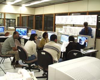
2 Unidata - Principle Activities Providing Tools to visualize, analyze, organize, receive, & share data Facilitating Data Access to a broad spectrum of observations & forecasts (most in real-time) Supporting Faculty who use Unidata systems at universities Building a Community where data, tools, & best practices in education/research are shared


3 Unidata Community Unidata user community is interdisciplinary - 2/3rd of sites have users outside atmospheric sciences We are moving from an era of data provision towards one in which data- and related web-services are important; Multidisciplinary integration and synthesis are emphasized.
4 Tools and Support Are Central Enhance and distribute software developed by others Meteorological display and analysis tools from UW-Madison (McIDAS-X), National Weather Service/NCEP (GEMPAK), etc. Remote access technologies: OPeNDAP (U of RI, NASA, and others), ADDE (UW-Madison) Develop software in-house Widely used tools for managing scientific data (e.g., LDM, netcdf, UDUNITS, data decoders, etc.) Java-based tools (IDV Framework built on top of VisAD) for 2D, 3D, & 4D visualization and next-generation collaborative data analyses Build systems from the software we support Internet Data Distribution (IDD) system THematic Realtime Environmental Data Distributed Services (THREDDS) Support the use of software by offering training, consultation, bug fixes, and upgrades

5 Unidata Visualization Software GEMPAK IDV McIDAS-X McIDAS-X


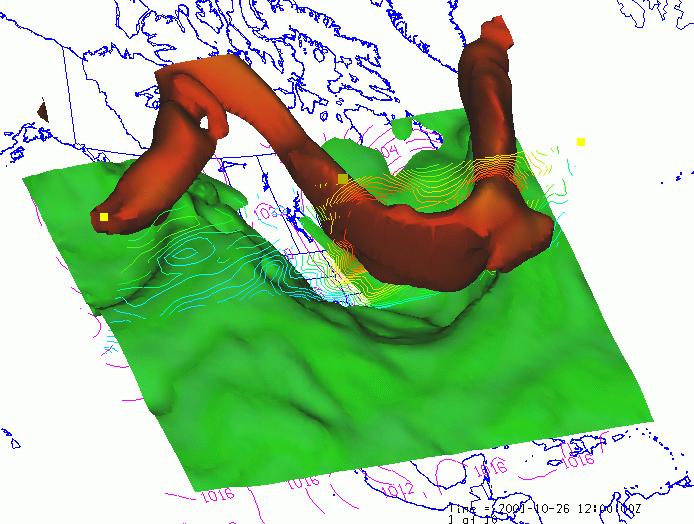
6 IDV Visualization Examples Sea-level Pressure and Upper-level Jet Upper-mantle convection Thunderstorm simulation S-POL Radar Thunderstorm Cross-section NO 2 concentration
7 Internet Data Distribution System Initiated in the mid-1990s in response to weather-data ingest challenges: Solar occultation data loss Terrestrial interference Campus beautification committees Event-driven network of cooperating Unidata Local Data Manager (LDM) servers interconnected by TCP/IP Ethernet Built to realize a communications goal laid out in the earliest Unidata planning documents (Cooper, 1985) Active use of local-area and national network infrastructure Allow for multi-way sharing of data including locally-held datasets Evolved in lock-step with national and international networking capabilities
8 Internet Data Distribution System Concept LDM Source LDM Source LDM LDM LDM Source LDM LDM Internet LDM LDM Sharing data from multiple sources using cooperating LDMs

9 SuomiNet GPS Met and Geodetic Sites Unidata s LDM is used for real-time data transport
 25 20 15 10 5 LDM-6 Introduced LDM-6 Announced LDM-6 at NCEP for CONDUIT Data NEXRAD-II Data Introduced Start TIGGE Testing Stop TIGGE Testing a dizzying volume of")
10 Real-time Data Flows In the Beginning... Now Flow of LDM Data on Internet-II vs. Time Flow/(1 Terabyte/Week) LDM-6 Introduced LDM-6 Announced LDM-6 at NCEP for CONDUIT Data NEXRAD-II Data Introduced Start TIGGE Testing Stop TIGGE Testing a dizzying volume of information on the order of 100 MB/day, aggregate (Davis and Rew, 1990) Time LDM-6 Internet2 bandwidth use Typically 21 TB/week & growing
 4 distributed real data servers (64-bit Linux Web 100 kernels) 2 data collectors (Linux and FreeBSD) Demonstrated relay of sustained >500 Mbps")
11 LDM/IDD Incremental Development Continue to push LDM-6 to its technological limit Unidata top-level IDD relay cluster Built using IP Virtual Server built in current Linux distributions Mixed OS environment 2 distributed directors (64-bit FC6 Linux) 4 distributed real data servers (64-bit Linux Web 100 kernels) 2 data collectors (Linux and FreeBSD) Demonstrated relay of sustained >500 Mbps (5.4 TB/day) during three day live trial; peak rates exceeded 900 Mbps Ability to relay data limited only by underlying network bandwidth (1 Gbps) Services > 400 concurrent downstream connections with zero added latency Cluster-based relay installations: NOAA/GDS (formerly FSL) Penn State University (in progress) TAMU (?)

12 Real-Time Data Distribution Unidata s reach is global. IDD use: Over 200 sites on six continents and growing!


13 LDM Technology Transfer US NWS CRAFT: NEXRAD Level II CONDUIT: NCEP High resolution model output Korean Met. Admin. distribute all data to forecast offices Spain deliver MSG data to offices Brazil IDD-Brasil
14 The Impending Data Deluge More Data and New Data Sources GOES-R (2014) / NPOESS (201?) Both GOES-R and NPOES will have data rats times the current METOP (Europe polar orbiter(s)) Raw data rate: 3 terabytes per day Global, coupled models at a grid spacing of 1-5 km, integrated for multi-decades NCAR Global WRF model for use in Weather and Climate research NEXRAD Level II expansion by 27x TIGGE SCOOP AMPS New initiatives
15 Historic Data Paradigm Unidata user running GEMPAK, IDV, McIDAS Forecast Model Output Weather station observations Application specific protocols Decoders Satellite imagery Local data decoded into application specific formats Decoders Decoders Decoders Decoders IDD Radar data Lightning, aircraft, GPSmet, etc.
16 Thematic Real-time Environmental Distributed Data Servers (THREDDS) User applications: e.g., McIDAS, IDV, LAS, IDL, MatLab... OpenDAP, OPeNDAP, ADDE, & FTP THREDDS protocols DS Discovery DLESE NSDL Digital Library for Earth-System Education DL interchange protocol To make it possible to publish, locate, analyze, visualize, and integrate a variety of environmental data People Hydrology Data, e.g. IDD Geophysical Data, e.g. IDD Satellite Satellite Satellite Images, e.g. Images, Images, e.g. e.g. Imagery... Discovery and Publication Tools Analysis and Visualization Tools IDD IDD IDD Combines IDD push with several forms of pull and DL discovery About 25 data providers are partners in THREDDS Discovery and Publication Services Catalog Generation Tools THREDDS Middleware Data Services Documents Data Connecting People with Documents and Data Data Catalog Services


17 NetCDF / HDF5 Merger netcdf-3 Interface netcdf-4 Library HDF5 Library 17

18 LEAD: A Large Grid Computing Project Linked Environments for Atmospheric Discovery Identify, Access, Assimilate, Predict, Manage, Mine, and Visualize a broad array of meteorological data and model output, independent of format and physical location Develop a range of Grid and Web Services for dynamic, ondemand, end-to-end weather prediction Institutions: U. Oklahoma Unidata U. Alabama U. Illinoi U. Indiana Millersville U Howard U. Colorado State U.
19 LEAD Prototype 4 IDD Data Stream GWSTBs Decoders ADAS ADAS Output WRF Model WRF Output IDV,NCL ADAM Employ components of WRF prediction as a series of linked web services in a Grid Environment

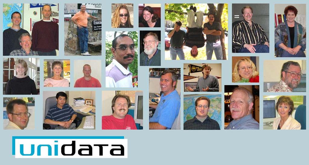


20 Unidata People
21 Contact Information Unidata HomePage: Unidata LDM HomePage Unidata IDV HomePage Unidata User Support:
RHOAPS. Real-time Hydrology Ocean Atmosphere Prediction System. Pronunciation: Ropes Motto: More than just THREDDS
 RHOAPS Real-time Hydrology Ocean Atmosphere Prediction System Pronunciation: Ropes Motto: More than just THREDDS Key Aspects Integrated real-time data systems Atmospheric Hydrologic Coastal oceans Societal
National Climatic Data Center Data Management Issues Tom Karl Director, NOAA s National Climatic Data Center
 National Climatic Data Center Data Management Issues Tom Karl Director, NOAA s National Climatic Data Center Opening Meeting NOAA Science Advisory Board s Data Archiving and Access Requirements Working
Climate Data for Non-experts: Standards-based Interoperability
 Climate Data for Non-experts: Standards-based Interoperability Ben Domenico Unidata Program Center University Corporation for Atmospheric Research April 2010 Working Together on A Mosaic for Atmospheric
Towards Dynamically Adaptive Weather Analysis and Forecasting in LEAD
 Towards Dynamically Adaptive Weather Analysis and Forecasting in LEAD Beth Plale 1, Dennis Gannon 1, Dan Reed 2, Sara Graves 3, Kelvin Droegemeier 4, Bob Wilhelmson 5, Mohan Ramamurthy 6 1 Indiana University
GIS at UCAR. The evolution of NCAR s GIS Initiative. Olga Wilhelmi ESIG-NCAR Unidata Workshop 24 June, 2003
 GIS at UCAR The evolution of NCAR s GIS Initiative Olga Wilhelmi ESIG-NCAR Unidata Workshop 24 June, 2003 Why GIS? z z z z More questions about various climatological, meteorological, hydrological and
Tool for Storm Analysis Using Multiple Data Sets
 Tool for Storm Analysis Using Multiple Data Sets Robert M. Rabin 1,2 and Tom Whittaker 2 1 NOAA/National Severe Storms Laboratory, Norman OK 73069, USA 2 Cooperative Institute for Meteorological Satellite
The Future of the USAP Antarctic Internet Data Distribution System
 The Future of the USAP Antarctic Internet Data Distribution System A discussion on LDM Efforts at ASC with Satellite Ground Stations update Andrew B. Archer Antarctic Support Contract Matthew A. Lazzara
onboard of Metop-A COSMIC Workshop 2009 Boulder, USA
 GRAS Radio Occultation Measurements onboard of Metop-A A. von Engeln 1, Y. Andres 1, C. Cardinali 2, S. Healy 2,3, K. Lauritsen 3, C. Marquardt 1, F. Sancho 1, S. Syndergaard 3 1 2 3 EUMETSAT, ECMWF, GRAS
The Antarctic-IDD. Matthew A. Lazzara
 The Antarctic-IDD Matthew A. Lazzara Antarctic Meteorological Research Center, Space Science and Engineering Center University of Wisconsin-Madison, Madison, WI Robert Vehorn and Jason Stokes SPAWAR System
Data Format and Visualization Agenda
 Data Format and Visualization Agenda- 7.2.2 ET-SUP-8 (14.04.2014) Suman Goyal, Satellite Meteorology Division, India Meteorological Department, Suman_goyal61@yahoo.co.in Visualization Methods The satellite
Mid course Progress and Opportunities for Unidata Outreach. Ben Domenico May 2011
 Mid course Progress and Opportunities for Unidata Outreach Ben Domenico May 2011 Outline Overview Relationship to Unidata 2013 Proposal Collaborating Communities Recent Progress Current Focus Future Directions
What s new in GIS. RAL Retreat Oct 5, 2005
 What s new in GIS RAL Retreat Oct 5, 2005 Overview GIS Initiative milestones Major activities in 2004-2005 GALEON UNIDATA OGC project New functionality in ESRI software GIS Initiative Team Olga Wilhelmi
Atmospheric Science and GIS Interoperability issues: some Data Model and Computational Interface aspects
 UNIDATA Boulder, Sep. 2003 Atmospheric Science and GIS Interoperability issues: some Data and Computational Interface aspects Stefano Nativi University of Florence and IMAA-CNR Outline Service-Oriented
IMPACT OF GROUND-BASED GPS PRECIPITABLE WATER VAPOR AND COSMIC GPS REFRACTIVITY PROFILE ON HURRICANE DEAN FORECAST. (a) (b) (c)
 (b) (c)") 9B.3 IMPACT OF GROUND-BASED GPS PRECIPITABLE WATER VAPOR AND COSMIC GPS REFRACTIVITY PROFILE ON HURRICANE DEAN FORECAST Tetsuya Iwabuchi *, J. J. Braun, and T. Van Hove UCAR, Boulder, Colorado 1. INTRODUCTION
9B.3 IMPACT OF GROUND-BASED GPS PRECIPITABLE WATER VAPOR AND COSMIC GPS REFRACTIVITY PROFILE ON HURRICANE DEAN FORECAST Tetsuya Iwabuchi *, J. J. Braun, and T. Van Hove UCAR, Boulder, Colorado 1. INTRODUCTION
The NOAA Meteorological Assimilation Data Ingest System (MADIS)
") The NOAA Meteorological Assimilation Data Ingest System (MADIS) Patricia A. Miller, Michael F. Barth, Leon A. Benjamin, Randall S. Collander, Thomas B. Kent, and Gopa Padmanabhan (OAR/ESRL/GSD) Steven
The NOAA Meteorological Assimilation Data Ingest System (MADIS) Patricia A. Miller, Michael F. Barth, Leon A. Benjamin, Randall S. Collander, Thomas B. Kent, and Gopa Padmanabhan (OAR/ESRL/GSD) Steven
Linked Environments for Atmospheric Discovery: Web Services for Meteorological Research and Education
 Linked Environments for Atmospheric Discovery: Web Services for Meteorological Research and Education What Would YOU Do if These Were About to Occur? What THEY Do to Us!!! Each year in the US, mesoscale
5B.2 AN UPDATE ON THE NWS WSR-88D LEVEL II DATA COLLECTION AND DISTRIBUTION NETWORK AND PLANS FOR CHANGES
 5B.2 AN UPDATE ON THE NWS WSR-88D LEVEL II DATA COLLECTION AND DISTRIBUTION NETWORK AND PLANS FOR CHANGES Tim Crum * and Steve Smith WSR-88D Radar Operations Center, Norman, Oklahoma Jami Casamento, Warren
We have processed RO data for climate research and for validation of weather data since 1995 as illustrated in Figure 1.
 Real-time Analysis of COSMIC Data Christian Rocken, Doug Hunt, Bill Schreiner University Corporation for Atmospheric Research (UCAR) COSMIC Project Office Boulder, CO Abstract UCAR has analyzed GPS radio
James P. Koermer * Plymouth State College Plymouth, New Hampshire
 5.5 THE PSC WEATHER CENTER WEB PORTAL James P. Koermer * Plymouth State College Plymouth, New Hampshire 1. INTRODUCTION The Plymouth State College (PSC) Weather Center web page went online in April 1994
A. Title Page. Proposal to
 A. Title Page Proposal to UNIDATA COMMUNITY EQUIPMENT GRANT titled: A proposal to upgrade the Creighton University meteorology lab to enhance operational meteorology education duration: 1 June 2014-31
NOAA Research and Development Supporting NextGen. Darien Davis NOAA Office of Oceanic and Atmospheric Research June 22, 2009
 NOAA Research and Development Supporting NextGen Darien Davis Darien.l.davis@noaa.gov NOAA Office of Oceanic and Atmospheric Research June 22, 2009 FAA/NOAA Coordination Developing an integrated science
Proposal Title: Transitioning to the IDV-CAVE: Improving Classroom Technology for Meteorology
 Proposal Title: Transitioning to the IDV-CAVE: Improving Classroom Technology for Meteorology Date: 3/4/2014 Principal Investigator Name: Brendon Hoch Title: Technology Manager Institution: Plymouth State
McIDAS Activities Within The NASA Langley Research Center Clouds And Radiation Group
 McIDAS Activities Within The NASA Langley Research Center Clouds And Radiation Group Kristopher Bedka Science Systems and Applications Inc @ NASA LaRC In Collaboration With (in alphabetical order) J. K.
Using McIDAS-V for Satellite-Based Thunderstorm Research and Product Development
 Using McIDAS-V for Satellite-Based Thunderstorm Research and Product Development Kristopher Bedka UW-Madison, SSEC/CIMSS In Collaboration With: Tom Rink, Jessica Staude, Tom Whittaker, Wayne Feltz, and
Access to IOOS Data Relevant to OOI. Kathleen Bailey NOAA/NOS/IOOS January 6, 2016
 Access to IOOS Data Relevant to OOI Kathleen Bailey NOAA/NOS/IOOS January 6, 2016 The U.S. Integrated Ocean Observing System (IOOS) Federal Regional Satellites 600+: Buoys, Water Level stations, Coastal
NCEP Update. Brent Gordon NCEP/NCO/Systems Integration Branch. Unidata Policy Committee Meeting Arlington, VA. May 12, 2009
 NCEP Update Brent Gordon NCEP/NCO/Systems Integration Branch Unidata Policy Committee Meeting Arlington, VA May 12, 2009 Where America s Climate, Weather and Ocean Prediction Services Begin Overview NAWIPS/GEMPAK
Services for Inland Marine Data Integration. USGS Center for Integrated
 Services for Inland Marine Data Integration USGS Center for Integrated Data Analytics Outline GeoDataPortal Tools Coastal Use Cases Beach hhealth lthmodeling Distributed Rainfall Analysis for Integration
Northrop Grumman Concept Paper
 Northrop Grumman Concept Paper A Comprehensive Geospatial Web-based Solution for NWS Impact-based Decision Support Services Glenn Higgins April 10, 2014 Northrop Grumman Corporation Information Systems
APRSWXNET/CWOP - a beneficial partnership of NOAA, Amateur Radio, And Other Good Citizens
 APRSWXNET/CWOP - a beneficial partnership of NOAA, Amateur Radio, And Other Good Citizens Russ Chadwick, KBOTVJ NOAA Forecast Systems Laboratory Boulder, Colorado Abstract APRSWXNET/CWOP is a group of
Jordan Gerth Cooperative Institute for Meteorological Satellite Studies University of Wisconsin at Madison 27 January 2011
 Jordan Gerth Cooperative Institute for Meteorological Satellite Studies University of Wisconsin at Madison 27 January 2011 91 st American Meteorological Society Annual Meeting First Conference on Transition
Using the LEAD Portal for Customized Weather Forecasts on the TeraGrid
 Using the LEAD Portal for Customized Weather Forecasts on the TeraGrid Keith Brewster Center for Analysis and Prediction of Storms, Univ. of Oklahoma Dan Weber, Suresh Marru, Kevin Thomas, Dennis Gannon,
MADIS Airlines for America Briefing
 MADIS Airlines for America Briefing Meteorological Assimilated Data Ingest System (MADIS) FPAW Briefing Steve Pritchett NWS Aircraft Based Observations Program Manager MADIS Defined MADIS is a meteorological
RESEARCH METHODOLOGY
 III. RESEARCH METHODOLOGY 3.1 Time and Location This research has been conducted in period March until October 2010. Location of research is over Sumatra terrain. Figure 3.1 show the area of interest of
EUMETSAT Climate Activities
 EUMETSAT Climate Activities Jörg Schulz EUMETSAT s Role in Climate Monitoring EUMETSAT has a prominent role in the world for providing services relevant to climate: EUMETSAT maintains some of the longest
GIS in Weather and Society
 GIS in Weather and Society Olga Wilhelmi Institute for the Study of Society and Environment National Center for Atmospheric Research WAS*IS November 8, 2005 Boulder, Colorado Presentation Outline GIS basic
WMO Coordination Group on Satellite Data Requirements for Region III and IV Sept 5-8, 2016 Willemstad, Curaçao
 WMO Coordination Group on Satellite Data Requirements for Region III and IV Sept 5-8, 2016 Willemstad, Curaçao 1. Current Satellite Reception 2. Preparation for Next-Gen GOES-R JPSS 3. Satellite Data Applications
Unidata Outreach Activities
 Unidata Outreach Activities focusing on Evolving Standards for Delivering Atmospheric Data into the GIS Realm (mainly OGC GALEON) Ben Domenico, Unidata Stefano Nativi, CNR/IMAA Jeff Weber, Unidata With
EUMETSAT SAF NETWORK. Lothar Schüller, EUMETSAT SAF Network Manager
 1 EUMETSAT SAF NETWORK Lothar Schüller, EUMETSAT SAF Network Manager EUMETSAT ground segment overview METEOSAT JASON-2 INITIAL JOINT POLAR SYSTEM METOP NOAA SATELLITES CONTROL AND DATA ACQUISITION FLIGHT
Threats to the Power System
 Threats to the Power System Energy Risk and Critical Infrastructure Workshop National Conference of State Legislatures William P. Mahoney III Deputy Director, Research Applications Laboratory National
Real-Time Meteorological Gridded Data: What s New With HEC-RAS
 Real-Time Meteorological Gridded Data: What s New With HEC-RAS Acquisition and Application of Gridded Meteorological Data in Support of the USACE s Real-Time Water Management Mission Fauwaz Hanbali, Tom
ABI and AIRS Retrievals in McIDAS-V
 ABI and AIRS Retrievals in McIDAS-V Kaba Bah Content Introduction to McIDAS V Introduction to GOES R ABI Visualize simulated ABI using McIDAS V Analyze simulated ABI using McIDAS V Introduction to AIRS
Using netcdf and HDF in ArcGIS. Nawajish Noman Dan Zimble Kevin Sigwart
 Using netcdf and HDF in ArcGIS Nawajish Noman Dan Zimble Kevin Sigwart Outline NetCDF and HDF in ArcGIS Visualization and Analysis Sharing Customization using Python Demo Future Directions Scientific Data
4.6 NWS WSR-88D AND TDWR-SPG DATA COLLECTION AND DISTRIBUTION NETWORK STATUS AND PLANS
 4.6 NWS WSR-88D AND TDWR-SPG DATA COLLECTION AND DISTRIBUTION NETWORK STATUS AND PLANS Tim Crum *, Donald Horvat, Christina Horvat, and Chris Calvert WSR-88D Radar Operations Center, Norman, Oklahoma Mike
The Open Geospatial Consortium and EarthCube
 The Open Geospatial Consortium and EarthCube An EarthCube Technology Paper Prepared by David Maidment 1, Ben Domenico 2, Alastair Gemmell 3, Kerstin Lehnert 4, David Tarboton 5 and Ilya Zaslavsky 6 Introduction
A Web Portal for Regional Projection of Weather Forecast Using GRID Middleware
 A Web Portal for Regional Projection of Weather Forecast Using GRID Middleware A.S. Cofiño, D. San-Martín, and J.M. Gutiérrez Dept. of Applied Mathematics and Computer Science, University of Cantabria.
The NASA Short-term Prediction Research and Transition (SPoRT) Center:
 Center:") The NASA Short-term Prediction Research and Transition (SPoRT) Center: Opportunities for Collaboration in the Great Lakes Region Andrew Molthan NASA Marshall Space Flight Center, Huntsville, AL andrew.molthan@nasa.gov
The NASA Short-term Prediction Research and Transition (SPoRT) Center: Opportunities for Collaboration in the Great Lakes Region Andrew Molthan NASA Marshall Space Flight Center, Huntsville, AL andrew.molthan@nasa.gov
LINKED ENVIRONMENTS FOR ATMOSPHERIC DISCOVERY (LEAD): A CYBERINFRASTRUCTURE FOR MESOSCALE METEOROLOGY RESEARCH AND EDUCATION
: A CYBERINFRASTRUCTURE FOR MESOSCALE METEOROLOGY RESEARCH AND EDUCATION") 6.1 LINKED ENVIRONMENTS FOR ATMOSPHERIC DISCOVERY (LEAD): A CYBERINFRASTRUCTURE FOR MESOSCALE METEOROLOGY RESEARCH AND EDUCATION 1,2 Kelvin K. Droegemeier, 3 V. Chandrasekar, 4 Richard Clark, 5 Dennis
6.1 LINKED ENVIRONMENTS FOR ATMOSPHERIC DISCOVERY (LEAD): A CYBERINFRASTRUCTURE FOR MESOSCALE METEOROLOGY RESEARCH AND EDUCATION 1,2 Kelvin K. Droegemeier, 3 V. Chandrasekar, 4 Richard Clark, 5 Dennis
Observatories in the context of the Digital Continent: CZO s and HIS
 Observatories in the context of the Digital Continent: CZO s and HIS Dr. Richard P. Hooper, President, Consortium of Universities for the Advancement of Hydrologic Science, Inc. Why Observatories? From
Network of Direct Broadcast Antenna Systems to Provide Real-Time Infrared and Microwave Sounder Data to NOAA for Numerical Weather Prediction
 Sandy Supplemental Grant Recipient Quarterly Progress Report Network of Direct Broadcast Antenna Systems to Provide Real-Time Infrared and Microwave Sounder Data to NOAA for Numerical Award Number: NA13NES4830007
Innovation. The Push and Pull at ESRI. September Kevin Daugherty Cadastral/Land Records Industry Solutions Manager
 Innovation The Push and Pull at ESRI September 2004 Kevin Daugherty Cadastral/Land Records Industry Solutions Manager The Push and The Pull The Push is the information technology that drives research and
NOAA Surface Weather Program
 NOAA Surface Weather Program Maintenance Decision Support System Stakeholder Meeting #9 Jim O Sullivan NOAA Surface Weather Program Manager NWS Office of Climate, Water, and Weather Services September
NEXRAD Severe Weather Signatures in the NOAA Severe Weather Data Inventory. Steve Ansari *, Mark Phillips, Stephen Del Greco
 NEXRAD Severe Weather Signatures in the NOAA Severe Weather Data Inventory Steve Ansari *, Mark Phillips, Stephen Del Greco NOAA National Climatic Data Center, Asheville, North Carolina ABSTRACT The Severe
Great Lakes Information Network GIS (Queryable by topic, geography, organization, and upload date 73 layers as of October, 2009)
") Google Earth Files for the Great Lakes and Beyond GLOS Mapping Workshop Alpena, Michigan November 9, 2009 David Hart GIS Specialist University of Wisconsin Sea Grant Institute GREAT LAKES Great Lakes Information
Google Earth Files for the Great Lakes and Beyond GLOS Mapping Workshop Alpena, Michigan November 9, 2009 David Hart GIS Specialist University of Wisconsin Sea Grant Institute GREAT LAKES Great Lakes Information
Progress on GCOS-China CMA IOS Development Plan ( ) PEI, Chong Department of Integrated Observation of CMA 09/25/2017 Hangzhou, China
 PEI, Chong Department of Integrated Observation of CMA 09/25/2017 Hangzhou, China") Progress on GCOS-China CMA IOS Development Plan (2016-2020) PEI, Chong Department of Integrated Observation of CMA 09/25/2017 Hangzhou, China 1. Progress on GCOS-China 1 Organized GCOS-China GCOS-China
Progress on GCOS-China CMA IOS Development Plan (2016-2020) PEI, Chong Department of Integrated Observation of CMA 09/25/2017 Hangzhou, China 1. Progress on GCOS-China 1 Organized GCOS-China GCOS-China
Himawari-8 BUFR Development for Winds Processing and Radiances Cloud Mask, Cloud Phase, Cloud Height
 Sandy Supplemental Grant Recipient Quarterly Progress Report Himawari-8 BUFR Development for Winds Processing and Radiances Award Number: NA14NES4830006 The National Oceanic and Atmospheric Administration
THE UNIVERSlTY. -=-==-=---tl/'----- WISCONSIN OFFICE OF RESEARCH AND SPONSORED PROGRAMS. UW Reference# MSN163691
 THE UNIVERSlTY -=-==-=---tl/'----- WISCONSIN OFFICE OF RESEARCH AND SPONSORED PROGRAMS UW Reference# MSN163691 University Corporation for Atmospheric Research PI: Wayne Feltz Unidata Community Equipment
The use of Direct Broadcast Processing System in Poland
 The use of Direct Broadcast Processing System in Poland B.Łapeta, P.Struzik Satellite Remote Sensing Department, Institute of Meteortology and Water Management National Reasearch Institute About IMWM-NRI
Weather Forecasting. March 26, 2009
 Weather Forecasting Chapter 13 March 26, 2009 Forecasting The process of inferring weather from a blend of data, understanding, climatology, and solutions of the governing equations Requires an analysis
GRIB naming in CDM. John Caron and Ethan Davis 4/2/2012
 GRIB naming in CDM John Caron and Ethan Davis 4/2/2012 Outline GRIB background and issues Questions What is best naming scheme for GRIB / netcdf library? What is best way for applications to present variable
EuroPlanet Integrated and Distributed Information Service (IDIS)
") EuroPlanet Integrated and Distributed Information Service (IDIS) Maria Teresa Capria, Gérard Chanteur, Walter Schmidt and the teams of the IDIS Nodes December 3, 2009 ESAC, Madrid, Spain PV2009 IDIS OVERVIEW
EuroPlanet Integrated and Distributed Information Service (IDIS) Maria Teresa Capria, Gérard Chanteur, Walter Schmidt and the teams of the IDIS Nodes December 3, 2009 ESAC, Madrid, Spain PV2009 IDIS OVERVIEW
Himawari-8 BUFR Development for Winds Processing and Radiances - Packaging for Algorithm Integration Team (AIT)
") Sandy Supplemental Grant Recipient Quarterly Progress Report Himawari-8 BUFR Development for Winds Processing and Radiances - Packaging for Algorithm Integration Team (AIT) Award Number: NA14NWS4830052
Sandy Supplemental Grant Recipient Quarterly Progress Report Himawari-8 BUFR Development for Winds Processing and Radiances - Packaging for Algorithm Integration Team (AIT) Award Number: NA14NWS4830052
Direct Readout at the Meteorological Service of Canada
 Direct Readout at the Meteorological Service of Canada CSPP Users Meeting 2015 Darmstadt, Germany April 14-16, 2015 David Bradley Manager, Earth Observation and Geomatics Meteorological Service of Canada
4DWX program, and select applications. 26 August, 2003
 4DWX program, and select applications 26 August, 2003 Outline 4DWX overview Demos: Global Meteorology on Demand VisAD-based Plume Visualization Tool JVIS: Java 2-D integrated display PDA apps 4DWX program
ON LINE ARCHIVE OF STORM PENETRATING DATA
 ON LINE ARCHIVE OF STORM PENETRATING DATA Matthew Beals, Donna V. Kliche, and Andrew G. Detwiler Institute of Atmospheric Sciences, South Dakota School of Mines and Technology, Rapid City, SD Steve Williams
The Open Geospatial Consortium and EarthCube
 The Open Geospatial Consortium and EarthCube An EarthCube Technology Paper Prepared by David Maidment 1, Ben Domenico 2, Alastair Gemmell 3, Kerstin Lehnert 4, David Tarboton 5 and Ilya Zaslavsky 6 Introduction
First European Space Weather Week. Space weather - atmospheres, drag, global change future needs. 29 November-3 December 2004
 First European Space Weather Week Space weather - atmospheres, drag, global change future needs 29 November-3 December 2004 Timescales of important phenomena Weather Climate No single statement of requirement
SCOTIA WEATHER SERVICES INC.
 SCOTIA WEATHER SERVICES INC. Mission To provide high quality, reliable valued-added environmental information services based on measured and modeled atmospheric, land and/or oceanographic physical parameters
interpreted by András Horányi Copernicus Climate Change Service (C3S) Seasonal Forecasts Anca Brookshaw (anca.brookshaw.ecmwf.int)
 Seasonal Forecasts Anca Brookshaw (anca.brookshaw.ecmwf.int)") interpreted by András Horányi (C3S) Seasonal Forecasts Anca Brookshaw (anca.brookshaw.ecmwf.int) Seasonal forecasts in C3S essential climate variables climate indicators reanalysis Climate Data Store (CDS)
interpreted by András Horányi (C3S) Seasonal Forecasts Anca Brookshaw (anca.brookshaw.ecmwf.int) Seasonal forecasts in C3S essential climate variables climate indicators reanalysis Climate Data Store (CDS)
JOINT WMO TECHNICAL PROGRESS REPORT ON THE GLOBAL DATA PROCESSING AND FORECASTING SYSTEM AND NUMERICAL WEATHER PREDICTION RESEARCH ACTIVITIES FOR 2016
 JOINT WMO TECHNICAL PROGRESS REPORT ON THE GLOBAL DATA PROCESSING AND FORECASTING SYSTEM AND NUMERICAL WEATHER PREDICTION RESEARCH ACTIVITIES FOR 2016 New Zealand / Meteorological Service of New Zealand
ESCI 110: 2 s.h. Introduction to Earth Sciences Programs ESCI 322: 3 s.h. Environmental Hydrology ESCI 241: 4 s.h. Meteorology (G2, L)
") ESCI 110: 2 s.h. Introduction to Earth Sciences Programs General introduction to each of the earth sciences disciplines and to college life. 2 hrs. lec. Offered in fall. Restricted to earth sciences majors.
ESCI 110: 2 s.h. Introduction to Earth Sciences Programs General introduction to each of the earth sciences disciplines and to college life. 2 hrs. lec. Offered in fall. Restricted to earth sciences majors.
US National Spatial Data Infrastructure A Spatial Framework for Governance and Policy Development to Enable a Location-Based Digital Ecosystem
 GeoPlatform Workshop 7 Dec 2016, Department of the Interior Washington, D.C. US National Spatial Infrastructure A Spatial Framework for Governance and Policy Development to Enable a Location-Based Digital
Operational Forecasting With Very-High-Resolution Models. Tom Warner
 Operational Forecasting With Very-High-Resolution Models Tom Warner Background Since 1997 NCAR Has Been Developing Operational Mesoscale Forecasting Systems for General Meteorological Support at Army Test
Launch of Data Collection or Production Centre for World Weather Information Service
 Launch of Data Collection or Production Centre for World Weather Information Service The Hong Kong Observatory (HKO) announces that the Data Collection or Production Centre (DCPC) for the World Weather
Advanced Geostationary Observations for the OzEWEX Community. Leon Majewski Bureau of Meteorology
 Advanced Geostationary Observations for the OzEWEX Community Leon Majewski Bureau of Meteorology Overview Geostationary satellite missions & sensors Meteorological applications Access for OzEWEX researchers
AMPS Update June 2017
 AMPS Update June 2017 Kevin W. Manning Jordan G. Powers Mesoscale and Microscale Meteorology Laboratory National Center for Atmospheric Research Boulder, CO 12th Workshop on Antarctic Meteorology and Climate
GEOGRAPHIC INFORMATION SYSTEMS Session 8
 GEOGRAPHIC INFORMATION SYSTEMS Session 8 Introduction Geography underpins all activities associated with a census Census geography is essential to plan and manage fieldwork as well as to report results
WMO Priorities and Perspectives on IPWG
 WMO Priorities and Perspectives on IPWG Stephan Bojinski WMO Space Programme IPWG-6, São José dos Campos, Brazil, 15-19 October 2012 1. Introduction to WMO Extended Abstract The World Meteorological Organization
McIDAS-V Tutorial Displaying Point Observations from ADDE Datasets updated July 2016 (software version 1.6)
") McIDAS-V Tutorial Displaying Point Observations from ADDE Datasets updated July 2016 (software version 1.6) McIDAS-V is a free, open source, visualization and data analysis software package that is the
McIDAS-V Tutorial Displaying Point Observations from ADDE Datasets updated July 2016 (software version 1.6) McIDAS-V is a free, open source, visualization and data analysis software package that is the
Using the EartH2Observe data portal to analyse drought indicators. Lesson 4: Using Python Notebook to access and process data
 Using the EartH2Observe data portal to analyse drought indicators Lesson 4: Using Python Notebook to access and process data Preface In this fourth lesson you will again work with the Water Cycle Integrator
The Mauna Kea Weather Center: Custom Atmospheric Forecasting Support for Mauna Kea. Brief History of Weather Center. Weather Hazard Mitigation
 The Mauna Kea Weather Center: Custom Atmospheric Forecasting Support for Mauna Kea Brief History of Weather Center Memorandum of understanding between UH Meteorology & IfA established the Mauna Kea Weather
COSMIC-2: Next Generation Atmospheric Remote Sensing System using Radio Occultation Technique
 COSMIC-2: Next Generation Atmospheric Remote Sensing System using Radio Occultation Technique Bill Kuo, Bill Schreiner, Doug Hunt, Sergey Sokolovskiy UCAR COSMIC Program Office www.cosmic.ucar.edu GPS
WIGOS, the RRR, and the Vision for WIGOS in 2040
 WIGOS, the RRR, and the Vision for WIGOS in 2040 Lars Peter Riishojgaard WIGOS Project Office, WMO Secretariat WMO; Observing and Information Systems Department) Overview 1. Brief introduction to WIGOS
Flash flood forecasting and warning infrastructures of National Meteorology and Hydrological Services of Cambodia
 Development and Implementation of the South East Asia Flash Flood Guidance System (SEAFFGS) Ha Noi, Viet Nam, 20-23 November 2017 Flash flood forecasting and warning infrastructures of National Meteorology
MSC HPC Infrastructure Update. Alain St-Denis Canadian Meteorological Centre Meteorological Service of Canada
 MSC HPC Infrastructure Update Alain St-Denis Canadian Meteorological Centre Meteorological Service of Canada Outline HPC Infrastructure Overview Supercomputer Configuration Scientific Direction 2 IT Infrastructure
Delivering Met to the Military User
 Delivering Met to the Military User Andy Kirkman Met Office Defence Business Manager ECMWF MOS Workshop - November 2007 Crown copyright 2006 Page 1 Delivering Met to the Military User This Presentation
WRF Modeling System Overview
 WRF Modeling System Overview Jimy Dudhia What is WRF? WRF: Weather Research and Forecasting Model Used for both research and operational forecasting It is a supported community model, i.e. a free and shared
Final Submitted Version of the UCAR Proposal A prototype Earth-gauging system integrating weather and health data to manage meningitis
 Final Submitted Version of the UCAR Proposal A prototype Earth-gauging system integrating weather and health data to manage meningitis Submitted to Google.org by the University Corporation for Atmospheric
EUMETSAT SAF NETWORK. Lothar Schüller, EUMETSAT SAF Network Manager
 1 EUMETSAT SAF NETWORK Lothar Schüller, EUMETSAT SAF Network Manager EUMETSAT ground segment overview METEOSAT JASON-2 INITIAL JOINT POLAR SYSTEM METOP NOAA SATELLITES CONTROL AND DATA ACQUISITION FLIGHT
P5.7 THE ADVANCED SATELLITE AVIATION WEATHER PRODUCTS (ASAP) INITIATIVE: PHASE I EFFORTS AT THE UNIVERSITY OF ALABAMA IN HUNTSVILLE
 INITIATIVE: PHASE I EFFORTS AT THE UNIVERSITY OF ALABAMA IN HUNTSVILLE") P5.7 THE ADVANCED SATELLITE AVIATION WEATHER PRODUCTS (ASAP) INITIATIVE: PHASE I EFFORTS AT THE UNIVERSITY OF ALABAMA IN HUNTSVILLE John R. Mecikalski #1, Todd A. Berendes #, U. S. Nair #, Wayne F. Feltz*,
P5.7 THE ADVANCED SATELLITE AVIATION WEATHER PRODUCTS (ASAP) INITIATIVE: PHASE I EFFORTS AT THE UNIVERSITY OF ALABAMA IN HUNTSVILLE John R. Mecikalski #1, Todd A. Berendes #, U. S. Nair #, Wayne F. Feltz*,
Status of EUMETSAT Current and Future Programmes
 Status of EUMETSAT Current and Future Programmes Ernst Koenemann Director Programme Development Spanish Industry Day 15 th Slide: 1 Brief Status of MSG and EPS All operational Missions are performing as
Regional Hazardous Weather Advisory Centres (RHWACs)
") Regional Hazardous Weather Advisory Centres (RHWACs) The following outlines the criteria for the selection of RHWACs based on operational and functional requirements 1. Basic Principles The RHWAC must:
Regional Hazardous Weather Advisory Centres (RHWACs) The following outlines the criteria for the selection of RHWACs based on operational and functional requirements 1. Basic Principles The RHWAC must:
Importance of Technology as part of the NWS New Orleans/Baton Rouge Impact- Based Decision Support Pilot Project
 Importance of Technology as part of the NWS New Orleans/Baton Rouge Impact- Based Decision Support Pilot Project NWS New Orleans Meteorologist-In-Charge: Ken Graham Emergency Response Specialist Team:
The National Operational Hydrologic Remote Sensing Center Operational Snow Analysis
 The National Operational Hydrologic Remote Sensing Center Operational Snow Analysis World Meteorological Organization Global Cryosphere Watch Snow-Watch Workshop Session 3: Snow Analysis Products Andrew
EUMETSAT Training activities. Vesa Nietosvaara Mark Higgins
 EUMETSAT Training activities Vesa Nietosvaara Mark Higgins EUMETSAT Partnerships Europe: SAFs and regional networks EUMeTrain training recourses and tools Eumetcal coordination and infrastructure Africa:
STATUS AND DEVELOPMENT OF SATELLITE WIND MONITORING BY THE NWP SAF
 STATUS AND DEVELOPMENT OF SATELLITE WIND MONITORING BY THE NWP SAF Mary Forsythe (1), Antonio Garcia-Mendez (2), Howard Berger (1,3), Bryan Conway (4), Sarah Watkin (1) (1) Met Office, Fitzroy Road, Exeter,
MSC Monitoring Renewal Project. CMOS 2012 Montreal, Quebec Thursday, May 31 Martin Elie on behalf of Dave Wartman
 MSC Monitoring Renewal Project CMOS 2012 Montreal, Quebec Thursday, May 31 Martin Elie on behalf of Dave Wartman Presentation Overview Context Monitoring Renewal Components Conclusions Q & A Page 2 Context
Monitoring Extreme Weather Events. February 8, 2010
 Monitoring Extreme Weather Events February 8, 2010 Extensive network of over 800 stations across the Prairies Good coverage across entire agriculture production region Network of networks strategy includes
The Canadian Ceoscience Knowledge Network. - A Collaborative Effort for Unified Access to Ceoscience Data
 The Canadian Ceoscience Knowledge Network - A Collaborative Effort for Unified Access to Ceoscience Data The Canadian Geoscience Knowledge Network A Collaborative Effort for Unified Access to Geoscience
THE WEATHER RESEARCH AND FORECAST MODEL VERSION 2.0
 THE WEATHER RESEARCH AND FORECAST MODEL VERSION 2.0 J. MICHALAKES, J. DUDHIA, D. GILL J. KLEMP, W. SKAMAROCK, W. WANG Mesoscale and Microscale Meteorology National Center for Atmospheric Research Boulder,
Proposal Requesting to use NSF Facilities for Education. Project: TOM: Teaching flow Over Mountains
 Proposal Requesting to use NSF Facilities for Education Project: TOM: Teaching flow Over Mountains Requestor: Drs. Katja Friedrich & Julie Lundquist Department of Atmospheric and Ocean Sciences University