What is a King Tide? How frequently do King Tides happen?
|
|
|
- Emerald Kelly
- 6 years ago
- Views:
Transcription
1
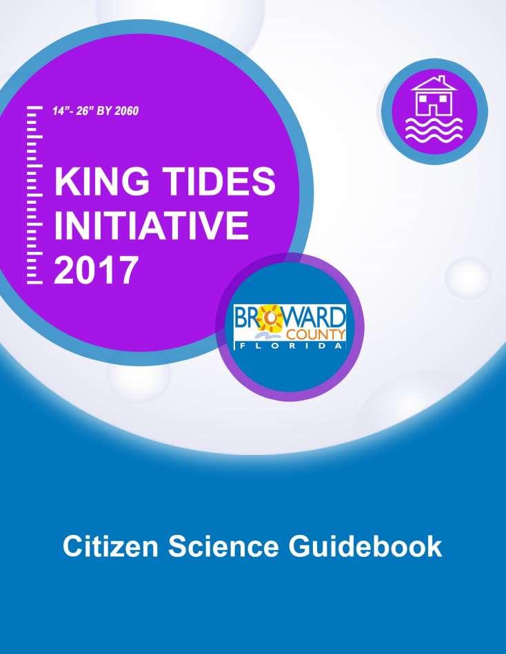
2 2 Contents What is a King Tide?... 3 What Can You Do?... 3 King Tide Kit... 6 King Tide Dates & Times Tidal Flooding Locations... 8 How to Report Data... 8 Steps to Document Flooding: Using a refractometer to measure salinity in flood waters: Tips for Effective King Tides Photos: Photos of flooding are used in several ways to help people: Classroom & Other Resources... 19

3 3 What is a King Tide? The King Tide is the highest predicted high tide of the year at a coastal location, produced by the orbits and alignments of the Earth, Moon and Sun. It is above the highest water level reached at high tide on an average day. In Broward County, the king tides usually occur during the months of September, October, and November. King tides are a glimpse of the water levels we will see in the years to come as the sea level continues to rise. How frequently do King Tides happen? King tides are a normal occurrence three to five times every year in coastal areas. In the United States, they are predicted by the National Oceanic and Atmospheric Administration (NOAA). The NOAA Tides and Currents station map can be used to locate stations that provide water levels, meteorological observations, and current observations (Sources: US Environmental Protection Agency). Low-lying coastal areas of Broward County can be impacted by flooding from high tide events. These often time occur during the fall (August-November) with the peak usually occurring the King Tide (Highest tide of year) in October. As sea level rises, the frequency of king tides is expected to increase to nearly 50 times per year by 2030 and over 200 times per year by 2045 (Dahl et al, 2017).
4 4 Why does flooding occur during King Tides? King Tides have always occurred but did not always cause flooding. The change is that sea level today is higher than when neighborhoods were originally built. Since neighborhoods were designed based on historic tide ranges, they are not equipped to handle the higher high tides of today. Flooding occurs when seawater moves inland by flowing over seawalls or in through drainage pipes or openings and collects in low lying areas. Property owners and local governments are creating and improving barriers to the incoming water. As a result, in some areas where flooding occurred last year, the ground may be dry because the barrier is effective at the current sea level and tidal conditions. In order to prepare for future sea level, higher tide levels and increased water levels during storms, our community needs to continue to find ways to reduce impacts from flooding.
5 5 What Can You Do? Do not drive through flooded areas, turn around and find another way. It can be a threat to your life as well as cause short and long term damage to your vehicle. Do not put yourself and others at risk of injury by walking or driving through flood water six inches of fast flowing water can knock you off your feet and less than a meter of water can float a car. If you drive through tidal floods, wash the undercarriage of your car to remove the salt water. You can go through a car wash equipped with an undercarriage sprayer. Avoid coming into direct contact with flood water as it may be contaminated with sewage and other pollutants. Internal and external flooding can result in hazards below the surface you cannot see that could cause injury e.g. nails, broken glass, debris and displaced manhole covers. Do not allow children to play in or near flood water and encourage them to wash their hands regularly. If you are a boater, be aware that these high tides cause lower clearances under fixed bridges so check the tides before leaving the dock. If your landscape encounters salt water flooding, make sure the area is rinsed off and/or rained on thoroughly before adding fertilizer or pesticides. Participate in citizen science through the Broward County King Tides Initiative and help us document tidal flooding in the community! Educate yourself and peers on the causes of sea level rise and what you can do to reduced greenhouse gas emissions.

6 6 King Tide Kit King Tide Kits are available for community groups to borrow to help track and report tidal flooding. Groups can sign up to monitor a location for either October or November. Group leaders are responsible for returning the refractometers to the Broward County Government Center at 115 South Andrews Avenue, Rm 329H, Fort Lauderdale, FL Safety Precautions Participants should be wearing proper footwear (close-toed footwear i.e. sneakers, boots or rain boots). Do not trespass on private property. Stay out of deep or rushing water. Do NOT drive through flooded areas. Participants should wear closed toe shoes (not flip flops or sandals), preferably rain boots. Do NOT document tidal flooding during inclement weather. Be aware of your surroundings, stay together as a group. Avoid walking through flood waters, it is dangerous and can be a health hazard. Stay back a distance and take a photo to document flooding. Avoid driving, walking, or parking on private property.
7 7 King Tide Dates & Times Date Time 09/22/ :04 AM 10/07/2017* 10:44 AM 11/04/2017* 9:36 AM 11/05/2017* 9:25 AM 11/06/ :16 AM 12/03/2017 8:17 AM 12/04/2017 9:08 AM 12/05/2017 9:59 AM 12/06/ :51 AM *Dates available for community groups to volunteer to track and report. These are also anticipated to be the highest tides of the year. Tidal predictions are not exact. The dates and times listed above are approximate. Flooding levels may vary.


8 8 Tidal Flooding Locations Groups can register to help document and record flood data for their choice of one of the six sites below. These sites commonly experience tidal flooding, and data on inundation levels should be recorded. These regions are expected to experience flooding; however, since flood levels and locations can vary, not all locations may be flooded. If there is flooding within the general vicinity, but not the exact location, that occurrence should be recorded. Site 1: Pompano Beach Canal Drive around loop to N Riverside Drive Ideal for small group. Input for GPS for driving directions: 1621 N Ocean Blvd, Pompano Beach, FL Prone to tidal flooding, group should record data in the vicinity of these areas Site 2: Fort Lauderdale 1 E Las Olas Blvd from Isle of Capri to SE 25 th Ave Ideal for large group with ability to break out into smaller groups and walk. Input for GPS for driving directions: 1750 E Las Olas Blvd, Fort Lauderdale, FL Prone to tidal flooding, group should record data in the vicinity of these areas


9 9 Site 3: Fort Lauderdale 2 Cordova Road from SE 7 th St to SE 12 th St Ideal for medium group with the ability to walk. Input for GPS for driving directions: 1414 SE 12 th St, Fort Lauderdale, FL Prone to tidal flooding, group should record data in the vicinity of these areas Site 4: Hollywood 1 N North Lake Drive and N Ocean Drive (at intersections) Ideal for medium group with ability to break into two smaller groups, carpool, and walk. Input for GPS for driving directions: 921 N North Lake Dr, Hollywood, FL Prone to tidal flooding, group should record data in the vicinity of these areas


10 10 Site 5: Hollywood 2 S Southlake Drive down to Adams St Ideal for medium group with ability to walk and possibly break into smaller groups. Input for GPS for driving directions: 1230 S Southlake Dr, Hollywood, FL Prone to tidal flooding, group should record data in the vicinity of these areas Site 6: Hallandale Beach Golden Isles Drive Ideal for small group with ability to walk. Input for GPS for driving directions: 1900 E Hallandale Beach Blvd, Hallandale Beach, FL Prone to tidal flooding, group should record data in the vicinity of these areas

11 11 How to Report Data Steps to Document Flooding: Step 1. On your phone s internet browser, go to Press Participate in the bottom right hand corner.


12 12 Step 2. Choose Upload a Photo to either take a picture of a flooded area or to upload a picture already in your photo library. If there is no flooding, take a photo of a dry area near a water source.

13 13 Step 3. Enter a title for the picture.


14 14 Step 4. Enter your location in the description box. If you do not know your exact location, click Locate Me or Find on Map. These will ask to use your current location. Agreeing will allow the device to automatically pinpoint your location on the map. Once your pinpoint comes up on the map, select Save Location.
, use it to measure the depth")
15 15 Step 5. Provide a description (time, date, appearance, etc.). If you have access to a ruler and/or salinity measurement tool (such as a refractometer), use it to measure the depth flooding and/or salt content, then enter it in the description box.

16 16 Step 6. Once all of these steps are completed, select Accept Terms and Submit.
17 17 Using a refractometer to measure salinity in flood waters: 1. Open the daylight plate and apply one or two drops of the sample solution using a pipette (or eyedropper) to the surface of the prism. Hold the refractometer at an angle, so the sample will not run off. 2. Gently close the daylight plate to avoid splashing. The sample solution should make a thin film over the entire surface of the prism. If the sample does not cover the entire prism, reapply the sample solution. If the prism is not completely covered or has bubbles it could result in inaccurate readings. 3. Look through the eyepiece. Focus the scale until it is sharp to your eyes by gently turning the eyepiece either clockwise or counterclockwise. 4. The upper field of view appears blue and the lower field will be white. The reading is taken at the line where the blue and white fields meet. 5. After taking a salinity reading, gently wipe the prism with a provided cloth. 6. You will need to calibrate your refractometer periodically. To calibrate it, take a reading using distilled water. Turn the calibration screw with the included screwdriver while looking through the eyepiece until the boundary line falls on 0. Using the Refractometer: Be gentle with the instrument: do not drop it or handle it roughly. Do not use a rough or abrasive material to clean the prism. Do not hold the refractometer under water or splash it with water.
18 18 Tips for Effective King Tides Photos: Take pictures at or near peak high tide. You can track high tides and water levels in your area using NOAA s Tides and Currents page. Take pictures where the impact of tides can be gauged against familiar landmarks, such as buildings, roads, sidewalks, parking lots, jetties, bridges, sea walls, & shorelines. Take contrasting shots of peak high and low tides, to help show the tidal range/variation. Most importantly- be safe! Use good judgment when you are taking photos; stay away from dangerous situations such as stormy conditions and avoid taking risks. Photos of flooding are used in several ways to help people: Document current flood risk in coastal areas Visualize the impacts of future sea level rise in their community Verify climate change models by comparing model predictions with the high-tide reality Serve as a living record of change for future generations Photos may be used in presentations, exhibitions, websites and publications on sea level rise impacts, coastal initiatives and climate action. Photos may also be used by Broward County and its partners for research and planning to assess where coastline is most vulnerable, and to better predict future sea level rise.
19 19 Classroom & Other Resources City of Fort Lauderdale King Tides: Environmental Protection Agency (EPA) King Tides and Climate Change: Photography Tips for Citizen Scientists: National Ocean Service (NOS), National Oceanic and Atmospheric Administration (NOAA), U.S. Department of Commerce Resources for students and teachers What is a King Tide? NOAA Education Website: Direct link to Tides resources for students and teachers: Video Eyes on the Rise Documentaries: Eyes on the Rise Web Series: CBS Miami, King Tide: Reference Dahl, K., Fitzpatrick, M., Spanger-Siegfried, E Sea level rise drives increased tidal flooding frequency at tide gauges along the U.S. East and Gulf Coasts: Projections for 2030 and PLoS ONE 12(2)
Contents. Broward.org/Climate
 2 Contents What is a King Tide?... 3 What Can You Do?... 3 King Tide Kit... 6 King Tide Dates & Times 2018... 6 Tidal Flooding Locations... 8 How to Report Data... 8 Steps to Document Flooding:... 11 Using
Activity 2.2: Recognizing Change (Observation vs. Inference)
") Activity 2.2: Recognizing Change (Observation vs. Inference) Teacher Notes: Evidence for Climate Change PowerPoint Slide 1 Slide 2 Introduction Image 1 (Namib Desert, Namibia) The sun is on the horizon
Activity 2.2: Recognizing Change (Observation vs. Inference) Teacher Notes: Evidence for Climate Change PowerPoint Slide 1 Slide 2 Introduction Image 1 (Namib Desert, Namibia) The sun is on the horizon
Table 1. August average temperatures and departures from normal ( F) for selected cities.
 for selected cities.") Climate Summary for Florida August 2016 Prepared by Lydia Stefanova and David Zierden Florida Climate Center, The Florida State University, Tallahassee, Florida Online at: http://climatecenter.fsu.edu/products-services/summaries
Climate Summary for Florida August 2016 Prepared by Lydia Stefanova and David Zierden Florida Climate Center, The Florida State University, Tallahassee, Florida Online at: http://climatecenter.fsu.edu/products-services/summaries
Objective: Science Classroom Laboratory Safety
 Science Classroom Laboratory Safety Objective: Learn safety rules for working with chemicals and participating in a safe manner when carrying out lab procedures. Complete the safety and equipment assignment
NJ Community Collaborative Rain, Hail and Snow Network
 NJ Community Collaborative Rain, Hail and Snow Network Mathieu Gerbush NJ Assistant State Climatologist/Climate Services Co-CoCoRaHS Coordinator NJ Agricultural Experiment Station School of Environmental
3301 Rickenbacker Causeway, Miami, FL 33149
 Virginia Key and Miami Beach 2016 King Tide Report and Projections (to 2045) using: 3301 Rickenbacker Causeway, Miami, FL 33149 *THIS REPORT IS PROVIDED SUBJECT TO THE COASTAL RISK CONSULTING, LLC, PRINTED
2.8-1 SCIENCE EXPERIMENTS ON FILE Revised Edition. Dew Formation
 2.8-1 SCIENCE EXPERIMENTS ON FILE Revised Edition Dew Formation Topic Dew Time 30 minutes! Safety Please click on the safety icon to view safety precautions. Be careful using the thermometer. Be careful
Please give me the background details of the warning system the US had before and the new improvements now.
 ----- Original Message ----- From: VADM Conrad C. Lautenbacher Jr., USN (Ret.) To: Announcement@noaa.gov Sent: Friday, January 28, 2005 1:30 PM Subject: Message from the Under Secretary -- NOAA Tsunami
Safety and Rules of the Lab
 Safety and Rules of the Lab 1 Lab Safety Rules Part of this PowerPoint has been taken from the power point of. Tim Baker, Adam Kueltzo, and Todd Katz.former NCHS students And from Lyndon B. Johnson High
Sea-Level Rise Impacts on South Florida
 Sea-Level Rise Impacts on South Florida Keren Prize Bolter, PhD Science Director, Coastal Risk Consulting. LLC 5/3/16 FAQ list What is happening? What impacts are we already seeing? Just how vulnerable
Ice Sheets and Sea Level -- Concerns at the Coast (Teachers Guide)
") Ice Sheets and Sea Level -- Concerns at the Coast (Teachers Guide) Roughly 153 million Americans (~53% of the US population) live in coastal counties. World wide some 3 billion people live within 200 km
Ice Sheets and Sea Level -- Concerns at the Coast (Teachers Guide) Roughly 153 million Americans (~53% of the US population) live in coastal counties. World wide some 3 billion people live within 200 km
Draft for Discussion 11/11/2016
 Coastal Risk Consulting (CRC) Climate Vulnerability Assessment for Village of Key Biscayne Deliverable 1.1 in Statement of Work. Preliminary Vulnerability Assessment Identifying Flood Hotspots Introduction...
Tornado Preparedness. Monthly Safety Meeting
 Tornado Preparedness Monthly Safety Meeting Introduction Tornadoes can occur anywhere and at any time during the year. In an average year, 800 tornadoes are reported throughout the nation. The most violent
The Three Things You Need to Know About Tsunami Preparedness Patrick Corcoran, Oregon Sea Grant,
 The Three Things You Need to Know About Tsunami Preparedness Patrick Corcoran, Oregon Sea Grant, 10.11.13 NSF/CEETEP Workshop for Coastal Educators, October 11-14, Astoria, OR The Bottom Line Giant Earthquakes
Sea level rise Web GIS Applications
 Florida International University FIU Digital Commons GIS Center GIS Center 2018 Sea level rise Web GIS Applications Zhaohui Fu GIS-RS Center, Florida International University, Fujen@fiu.edu Sheyla Santana
Hurricane Wilma Post Storm Data Acquisition Estimated Peak Wind Analysis and Storm Tide Data. December 27, 2005
 Hurricane Wilma Post Storm Data Acquisition Estimated Peak Wind Analysis and Storm Tide Data December 27, 2005 Hurricane Wilma was the sixth major hurricane of the record-breaking 2005 Atlantic hurricane
Activity 2 Changes Close to Home
 Activity 2 Changes Close to Home Forces of Change >> Arctic >> Activity 2 >> Page 1 ACTIVITY 2 CHANGES CLOSE TO HOME ORAL CLIMATE HISTORY PROJECT Documenting Cultural Knowledge, Savoonga, Alaska Smithsonian
Plant Indicators for Acids and Bases
 SCIENCE EXPERIMENTS ON FILE Revised Edition 5.28-1 Plant Indicators for Acids and Bases Carole R. Goshorn Topic Acid/base indicators Time Preparation by teacher 50 minutes; Part B, 45 minutes! Safety Adult
Climate Adaptation Challenges for Boston s Water and Sewer Systems
 National Association of Flood & Stormwater Management Agencies Climate Adaptation Challenges for Boston s Water and Sewer Systems John P Sullivan P.E. October 15,2014 Boston 1630 Boston 1630-2012 Boston
Surviving Tsunamis on the Oregon Coast
 Slide 1 Surviving Tsunamis on the Oregon Coast Coastal Engineers Think Inside the Box This talk generally covers civil engineering, coastal engineering, and how engineers work within limitations to create
Module 10 Summative Assessment
 Module 10 Summative Assessment Activity In this activity you will use the three dimensions of vulnerability that you learned about in this module exposure, sensitivity, and adaptive capacity to assess
Santos Alvarado Juanita Casanova Ana Cavazos Gayle Robinson Lupita Sanchez 1900 Galveston Hurricane ESS Analysis
 1900 Galveston Hurricane ESS Analysis Problem Statement: Hurricanes are natural disasters that are presented every year; they cause catastrophic disaster to the area they approach. The problem is that
Environmental Geology Lab 6 Coastal Hazards. Tropical cyclones are classified based on substained wind speed as indicated below.
 Environmental Geology Lab 6 Coastal Hazards page - 1 In the continental United States there are two fundamental types of shorelines. Tectonically passive margins that have low relief and consist of smooth
"The Big One" by sea and not by land
 "The Big One" by sea and not by land By Los Angeles Times, adapted by Newsela staff on 03.24.14 Word Count 629 Surfer Lee Johnson emerges from the water at San Onofre State Beach, Calif., with the twin
Whether you are driving or walking, if you come to a flooded road, Turn Around Don't Drown
 Whether you are driving or walking, if you come to a flooded road, Turn Around Don't Drown You will not know the depth of the water nor will you know the condition of the road under the water. Many people
Scientific Inquiry. Standards B 1.2 & B 1.9
 Scientific Inquiry Standards B 1.2 & B 1.9 Scientific Inquiry The student will demonstrate an understanding of how scientific inquiry and technological design, including mathematical analysis, can be used
THE IMPACT OF WEATHER
 The United States is the most severe weather prone country in the world. Each year, people in this country cope with an average of 10,000 thunderstorms, 5,000 floods, 1,200 tornadoes and two landfalling
Effective January 2008 All indicators in Standard / 11
 Scientific Inquiry 8-1 The student will demonstrate an understanding of technological design and scientific inquiry, including process skills, mathematical thinking, controlled investigative design and
Marine Corps Base. Disaster Preparedness Activity Book
 Marine Corps Base Disaster Preparedness Activity Book Dear Parents and Educators News stories of disaster regularly make headlines around the globe. As you ve watched others deal with these emergencies,
Between 6 am to 4 pm the next day approximately 7.5 inches fell. Chesapeake Bay Bridge Tunnel NOAA Tide Gage
 Ocean Park Alternative Drainage Route Analysis February, 2012 November 11 14, 2009 Between 6 am to 4 pm the next day approximately 7.5 inches fell Chesapeake Bay Bridge Tunnel NOAA Tide Gage Hurricane
HURRICANE PREPAREDNESS GUIDE
 HURRICANE PREPAREDNESS GUIDE BE PREPARED! TABLE OF CONTENTS Basic Preparedness Tips... 3 Preparing Your Home... 4 What To Do... 5 Make a Hurricane Plan... 6 Important Information... 7 pacu.com 800.433.7228
Western Treatment Plant (WTP)
") Western Treatment Plant (WTP) Venue and Safety Information Please complete the following important actions in preparation for your tour: Read and pass on the below information to all WTP tour participants.
Western Treatment Plant (WTP) Venue and Safety Information Please complete the following important actions in preparation for your tour: Read and pass on the below information to all WTP tour participants.
Vulnerability of Bangladesh to Cyclones in a Changing Climate
 Vulnerability of Bangladesh to Cyclones in a Changing Climate Susmita Dasgupta Kiran Pandey Mainul Huq Zahirul Huq Khan M.M. Zahid Ahmed Nandan Mukherjee Malik Fida Khan 2010 Bangladesh: Tropical Cyclone
How to Read These Flood Hazard Maps
 How to Read These Flood Hazard Maps The United States Geological Survey (USGS) has developed the Coastal Storms Modeling System (CoSMoS), which projects coastal flooding and erosion from coastal storms,
Weather Permitting/Meteorology. North Carolina Science Olympiad Coaches Clinic October 6, 2018 Michelle Hafey
 Weather Permitting/Meteorology North Carolina Science Olympiad Coaches Clinic October 6, 2018 Michelle Hafey hafeym@uncw.edu Read the Rules Weather Permitting Division A Team Of Up To: 2 Bring writing
MIAMI-SOUTH FLORIDA National Weather Service Forecast Office
 MIAMI-SOUTH FLORIDA National Weather Service Forecast Office http://www.weather.gov/miami June 2015 South Florida Weather Summary Dry East, Wet West...Drought Remains SE Florida July 3, 2015: Depending
PUBLIC SAFETY POWER SHUTOFF POLICIES AND PROCEDURES
 PACIFIC GAS AND ELECTRIC COMPANY PUBLIC SAFETY POWER SHUTOFF POLICIES AND PROCEDURES SEPTEMBER 2018 1 PACIFIC GAS AND ELECTRIC COMPANY PUBLIC SAFETY POWER SHUTOFF POLICIES AND PROCEDURES SEPTEMBER 2018
Tsunami! Beyond the Book. FOCUS Book
 FOCUS Book Use the engineering design process to design a structure that will protect a coastal town from possible tsunami damage. Brainstorm design ideas for your structure with a group of classmates.
Rising Sea Simulation in Buzzards Bay! Via the Augmented Reality Sandbox
 Rising Sea Simulation in Buzzards Bay! Via the Augmented Reality Sandbox Teacher Copy Concepts: Contour Maps Buzzards Bay Estuary Sea Level change Hurricanes Storm surge/coastal Flooding Human development
Hurricanes form over warm ocean water.
 KEY CONCEPT Low-pressure systems can become storms. BEFORE, you learned Moving air masses cause changes in weather A low-pressure system brings stormy weather NOW, you will learn How hurricanes develop
Chemistry Lab Safety
 Slide 1 / 23 Slide 2 / 23 Chemistry Lab Safety 2015-10-27 www.njctl.org Slide 2 (Answer) / 23 Teacher Notes Click the link on the bottom of slide 3 to see a 10 minute lab safety video. Chemistry Identify
Complete Weather Intelligence for Public Safety from DTN
 Complete Weather Intelligence for Public Safety from DTN September 2017 White Paper www.dtn.com / 1.800.610.0777 From flooding to tornados to severe winter storms, the threats to public safety from weather-related
HURRICANE SURVIVAL KIT
 HURRICANE SURVIVAL KIT DEFINITION-A hurricane is a very vast and powerful storm that originates in the tropics of the Atlantic Ocean. They become hurricanes when the sustained winds associated with it
Bay Drift. An activity for middle or high school students on ocean currents, marine debris, and citizen science, created by CARTHE
 Bay Drift An activity for middle or high school students on ocean currents, marine debris, and citizen science, created by CARTHE (Part of the Ocean Currents & Oil Spills STEAM Lessons by CARTHE and Piano
Hurricane Matthew Threats and Impacts Briefing for Eastern NC
 Hurricane Matthew Threats and Impacts Briefing for Eastern NC October 6 th, 2016 Date/Time Created: 10/6/2016, Noon EDT National Weather Service Newport/Morehead City, NC Hurricane Matthew Key Points Changes
Snow Removal Policy WARREN COUNTY ENGINEER S OFFICE (WCEO) WARREN COUNTY HIGHWAY DEPARTMENT. October 16, 2014
 WARREN COUNTY HIGHWAY DEPARTMENT. October 16, 2014") Snow Removal Policy WARREN COUNTY ENGINEER S OFFICE (WCEO) October 16, 2014 Presented by: Neil F. Tunison, Warren County Engineer Snow Removal Policy OPERATIONS SAFETY WARREN COUNTY ENGINEER S OFFICE (WCEO)
Snow Removal Policy WARREN COUNTY ENGINEER S OFFICE (WCEO) October 16, 2014 Presented by: Neil F. Tunison, Warren County Engineer Snow Removal Policy OPERATIONS SAFETY WARREN COUNTY ENGINEER S OFFICE (WCEO)
Hurricane Matthew. Life Threatening Flash Flooding Likely. National Weather Service Wilmington NC. Josh Weiss, Meteorologist
 Hurricane Matthew Life Threatening Flash Flooding Likely Threat Assessment for northeast South Carolina & southeast North Carolina National Weather Service Wilmington NC 630 PM EDT Friday October 7, 2016
Inclement Weather Preparedness. Tornadoes and Severe Thunderstorms
 Inclement Weather Preparedness Tornadoes and Severe Thunderstorms Let s find out How do we prepare ahead of time? What is the difference between a watch and a warning? What are the severe weather communications
Hurricanes and Storm Surge : Before coming to lab, visit the following web site:
 Geol 108 Lab #7 Week of October 15-19, 2012 Coastal Studies Hurricanes and Storm Surge : Before coming to lab, visit the following web site: http://www.usatoday.com/graphics/weather/gra/gsurge/flash.htm
Winter guide for HGV drivers
 Winter guide for HGV drivers How to keep safe during the winter period Know your responsibilities, be informed and be prepared: As a professional driver, it is your responsibility to make allowance for
Denton County SKYWARN Guidelines
 Emergency traffic, tornadic activity or weather that is an imminent threat to life and/or property has top priority. Repeater Operations during a Skywarn Net: NOTE: When the repeater announces WEATHER
Honors Chemistry 2016 Summer Assignment
 This Honors Chemistry Summer Assignment will review mathematical concepts necessary when performing mathematical calculation and laboratory experiments and focus on laboratory safety. Measurements are
Tornado Safety: 2013 Practical Steps for Weather-Related Emergencies
 Tornado Safety: 2013 Practical Steps for Weather-Related Emergencies Campbell County Public Safety One County, One Mission, One Call Away Tornado Preparedness Day March 12, 2013 As 62 tornadoes struck
CLIMATE READY BOSTON. Climate Projections Consensus ADAPTED FROM THE BOSTON RESEARCH ADVISORY GROUP REPORT MAY 2016
 CLIMATE READY BOSTON Sasaki Steering Committee Meeting, March 28 nd, 2016 Climate Projections Consensus ADAPTED FROM THE BOSTON RESEARCH ADVISORY GROUP REPORT MAY 2016 WHAT S IN STORE FOR BOSTON S CLIMATE?
HURRICANE Information for the Teacher
 HURRICANE Information for the Teacher This hurricane simulation activity and STELLA model were adapted from materials developed by Jan Mons and Cathy Eaton of the Glynns Integration of Systems Thinking
Report on the Damage Survey Caused by Hurricane Katrina (Tentative Report)
") Report on the Damage Survey Caused by Hurricane Katrina (Tentative Report) November 1, 2005 Coastal Disaster Prevention Technology Survey Team 1. Introduction Hurricane Katrina struck the United States
Report on the Damage Survey Caused by Hurricane Katrina (Tentative Report) November 1, 2005 Coastal Disaster Prevention Technology Survey Team 1. Introduction Hurricane Katrina struck the United States
Making a Climograph: GLOBE Data Explorations
 Making a Climograph: A GLOBE Data Exploration Purpose Students learn how to construct and interpret climographs and understand how climate differs from weather. Overview Students calculate and graph maximum
CoCoRaHS. Community Collaborative Rain, Hail, & Snow Network. Ashley Wolf Meteorologist NWS Green Bay Northeast Wisconsin CoCoRaHS Coordinator
 CoCoRaHS Community Collaborative Rain, Hail, & Snow Network Ashley Wolf Meteorologist NWS Green Bay Northeast Wisconsin CoCoRaHS Coordinator What is CoCoRaHS Who, What, Where and Whys of CoCoRaHS What?
Active Weather Threat Halloween Week Nor easter October 28 th 31 st 2012
 Active Weather Threat Halloween Week Nor easter October 28 th 31 st 2012 Prepared 1130 AM EDT Wednesday, October 24, 2012 Gary Szatkowski NOAA s NJ Forecast Office Weather.gov/phi Purpose of Briefing Briefing
National Environmental Education Foundation
 National Environmental Education Foundation The National Environmental Education Foundation (NEEF) provides knowledge to trusted professionals who, with their credibility, amplify messages to national
Snow Plow Safety Quick Reference Guide
 PUBLIC WORKS INITIATIVE Snow Plow Safety Quick Reference Guide INTRODUCTION This quick reference guide highlights snow removal/snow plow safety practices. Its purpose is to help prevent personal injury
Emergency Preparedness Questions
 Emergency Preparedness Questions 1. A family emergency plan should NOT include which of the following? a) Information about your children's school(s) b) The name and phone number of an out-of-town contact
Hurricanes and coastal storms pose a risk because powerful winds and storm surges can:
 HURRICANES A hurricane is a violent area of low pressure forming in the tropical Atlantic Ocean from June to November. August and September are peak months. (Similar Western Pacific Ocean storms are called
Topic 6A: Geographical Investigations fieldwork Investigating coastal landscapes
 Topic 6A: Geographical Investigations fieldwork Investigating coastal landscapes Enquiry question When completing a geographical study, it is important to have an aim. We can do this by asking a task question,
Eastern Shore Weather and Climate. Bill Sammler Warning Coordination Meteorologist National Weather Service Wakefield, VA
 Eastern Shore Weather and Climate Bill Sammler Warning Coordination Meteorologist National Weather Service Wakefield, VA About The NWS The National Weather Service is: A Federal Government Agency Part
Table G - 6. Mitigation Actions Identified for Implementation by the City of Kent ( ) (From Wilkin County Master Mitigation Action Chart)
 (From Wilkin County Master Mitigation Action Chart)") Table G - 6. Actions Identified by the () (From Master Action Chart) Multi-Hazard Plan, 2017 Action Comments 5 All-Hazards Local Planning & Regulations Update the Operations Plan on an annual basis. Work
Table G - 6. Actions Identified by the () (From Master Action Chart) Multi-Hazard Plan, 2017 Action Comments 5 All-Hazards Local Planning & Regulations Update the Operations Plan on an annual basis. Work
Name Earth Science Pd. Hurricanes. Directions: Read the information, view diagrams and answer the questions in the worksheet.
 Hurricanes Directions: Read the information, view diagrams and answer the questions in the worksheet. Hurricane Basics The ingredients for a hurricane include a pre-existing weather disturbance, warm tropical
Chancellor s Memorandum CM-64 Tornado Policy
 Chancellor s Memorandum CM-64 Tornado Policy To: Vice Chancellors, Deans, Administrative Staff, and Department Heads. From: LSU Health Sciences Center New Orleans Chancellor July 11, 2017 Revised on September
Exploring Habitats. Study Habitat Drawings to Identify Living Things & Nonliving Conditions. Safety Precautions
 4.01 Junior Environmental Activities On File TM Exploring Habitats Study Habitat Drawings to Identify Living Things & Nonliving Conditions INTRODUCTION A habitat is made up of both living (biotic) and
Homework 8: Hurricane Damage (adapted from Pipkin et al.)
") 1 Homework 8: Hurricane Damage (adapted from Pipkin et al.) Tropical cyclones have a significant impact on coastal areas of the world. In the Atlantic and Eastern Pacific Oceans they are called hurricanes
1 Homework 8: Hurricane Damage (adapted from Pipkin et al.) Tropical cyclones have a significant impact on coastal areas of the world. In the Atlantic and Eastern Pacific Oceans they are called hurricanes
5E's. View the video clip:
 5E's TEKS 8.10 (C) identify the role of the oceans in the formation of weather systems such as hurricanes Engage View the video clip: http://www.youtube.com/watch?v=h9vpwmtnozc What is a hurricane? How
Tropical Update. 12 PM EDT Friday, October 7, 2016 Hurricane Matthew & Tropical Storm Nicole
 Tropical Update 12 PM EDT Friday, October 7, 2016 Hurricane Matthew & Tropical Storm Nicole This update is intended for government and emergency response officials, and is provided for informational and
General Rules. Be alert and responsible at all times in the laboratory.
 Lab Safety General Rules Be alert and responsible at all times in the laboratory. Follow all written and verbal instructions carefully. If you do not understand a direction or part of a procedure, ASK
MAST ACADEMY OUTREACH. WOW (Weather on Wheels)
") MAST ACADEMY OUTREACH ELEMENTARY PROGRAM Adventures Aboard WOW (Weather on Wheels) Teacher Instructions / Answer Keys MAST Academy Maritime and Science Technology High School Miami-Dade County Public Schools
MAST ACADEMY OUTREACH ELEMENTARY PROGRAM Adventures Aboard WOW (Weather on Wheels) Teacher Instructions / Answer Keys MAST Academy Maritime and Science Technology High School Miami-Dade County Public Schools
Monitoring Scour Critical Bridges During Floods For Local Bridge Owners. Presented by
 Monitoring Scour Critical Bridges During Floods For Local Bridge Owners Presented by SAFETY FIRST DO NOT ENDANGER YOURSELF OR OTHERS WHILE MONITORING BRIDGES DO NOT ENTER FLOOD WATERS FLOOD WATERS INCLUDE
Natural Disasters. in Florida. Severe Thunderstorms
 Natural Disasters in Florida SC.6.E.7.7 Investigate how natural disasters have affected human life in Florida. Severe Thunderstorms While the typical afternoon thunderstorm in Florida may not appear to
MS20 Laboratory Seawater Salinity and Density
 MS20 Laboratory Seawater Salinity and Density Introduction As you perform these experiments, pay particular attention to the results different methods produce different levels of precision and accuracy.
New Jersey Department of Transportation Extreme Weather Asset Management Pilot Study
 New Jersey Department of Transportation Extreme Weather Asset Management Pilot Study Overview Prepared for: June 26, 2018 Introduction Overview of Pilot Study New Jersey s Climate New Jersey s Transportation
TORNADOES. DISPLAY VISUAL A Tornado Is... Tornadoes can: Rip trees apart. Destroy buildings. Uproot structures and objects.
 TORNADOES Introduce tornadoes by explaining what a tornado is. DISPLAY VISUAL A Tornado Is... A powerful, circular windstorm that may be accompanied by winds in excess of 250 miles per hour. Tell the participants
Compound Words. Eye of the Storm. Spelling Words. Name
 Compound Words Generalization A compound word is made of two or more words. Keep all the letters when spelling compounds: shoelace. Word Sort Sort the list words by words you know how to spell and words
Ocean in Motion 7: El Nino and Hurricanes!
 Ocean in Motion 7: El Nino and Hurricanes! A. Overview 1. Ocean in Motion -- El Nino and hurricanes We will look at the ocean-atmosphere interactions that cause El Nino and hurricanes. Using vocabulary
3 Severe Weather. Critical Thinking
 CHAPTER 2 3 Severe Weather SECTION Understanding Weather BEFORE YOU READ After you read this section, you should be able to answer these questions: What are some types of severe weather? How can you stay
Studying the Ocean Using Live Data
 Studying the Ocean Using Live Data Overview The Argo buoy project is a major oceanographic study that harnesses the power of automated unmanned buoys traveling the world s oceans (http://www.argo.ucsd.edu/).
4 Forecasting Weather
 CHAPTER 2 4 Forecasting Weather SECTION Understanding Weather BEFORE YOU READ After you read this section, you should be able to answer these questions: What instruments are used to forecast weather? How
Local Flood Hazards. Click here for Real-time River Information
 Local Flood Hazards Floods of the White River and Killbuck Creek are caused by runoff from general, and/or intense rainfall. Other areas of flooding concern are from the Boland Ditch and Pittsford Ditch.
DISASTER PROCEDURES th AVE NE, Suite 100 Bellevue WA, Tel: (425)
") DISASTER PROCEDURES 2281 116 th AVE NE, Suite 100 Bellevue WA, 98004 Tel: (425)247-7495 Disaster Procedures Updated September, 2013 TABLE of CONTENTS 1. Power Outage 2. Terrorism 3. Tornado 4. Missing
DISASTER PROCEDURES 2281 116 th AVE NE, Suite 100 Bellevue WA, 98004 Tel: (425)247-7495 Disaster Procedures Updated September, 2013 TABLE of CONTENTS 1. Power Outage 2. Terrorism 3. Tornado 4. Missing
Community Collaborative RAin, Hail and Snow network. CoCoRaHS.
 Community Collaborative RAin, Hail and Snow network CoCoRaHS http://ks.cocorahs.org An observer s guide to measuring and reporting precipitation data! Equipment Each volunteer participating in CoCoRaHS
IN VEHICLES: Do not try to outrun a tornado. Abandon your vehicle and hide in a nearby ditch or depression and cover your head.
 TORNADO SAFETY TORNADO! The very word strikes fear in many people. While a tornado is perhaps nature's most destructive storm, deaths and injuries can be prevented. By following Tornado Safety Rules, lives
Earth Science Floods
 Non-fiction: Earth Science - Floods Earth Science Floods When dry land is covered by water, we call it a flood. Floods are very dangerous. If they are very bad, homes can be destroyed, and people can die.
Residents Emergency Response Checklist
 COMMUNITY RESILIENCE PLAN Residents Emergency Response Checklist A helpful guide in the event of extreme weather or bushfire events. < PREVIOUS I NEXT > 02 Purchasing an existing property or building a
STORM COWBOY. FANNIN COUNTY A.R.E.S. and R.A.C.E.S. Reference Manual SKYWARN MISSION
 FANNIN COUNTY A.R.E.S. and R.A.C.E.S. STORM COWBOY Reference Manual SKYWARN MISSION TO LOCATE POSSIBLE THREATS TO LIFE AND PROPERTY AND PROVIDE INFORMATION FROM WHICH WARNINGS CAN ISSUED TABLE OF CONTENTS
Boy Scout Badge Workshop ASTRONOMY
 Boy Scout Badge Workshop ASTRONOMY Welcome to the Schenectady Museum & Suits-Bueche Planetarium! During this workshop, you will explore the museum, see a show in the planetarium, and try out some other
Year 7 Health & Safety
 Year 7 Health & Safety Key staff member: Richard Atkinson Attitude to learning: Subject criteria: Research Always Usually Occasionally Rarely Class work 1 2 3 4 Homework 1 2 3 4 Participation 1 2 3 4 Ideas
7.3 Magnitude Earthquake Strikes Iran-Iraq Border
 7.3 Magnitude Earthquake Strikes Iran-Iraq Border KEY POINTS A magnitude 7.3 earthquake has struck the Iran-Iraq border with at least 348 fatalities reported. Thousands more have been injured and many
Advisory #35 Briefing 630 PM EDT Thursday October 06, 2016
 Advisory #35 Briefing 630 PM EDT Thursday October 06, 2016 Disclaimer: The information contained within this briefing is time-sensitive, do not use beyond 6 hours after the issuance Next Webinar Update:
Jr. Meteorologist Club
 Vintage Math, Science and Technology Magnet School Jr. Meteorologist Club Hey, you 5 th Grade WeatherBugs Complete the four required activities plus two activities of your choice in this Jr. Meteorologist
Coastal Weather and Climate
 Coastal Weather and Climate The UNIVERSITY of OKLAHOMA Authors Elizabeth Fly, PhD Formerly of S.C. Sea Grant Consortium and Carolina Integrated Sciences and Assessments (CISA) Susan Lovelace, PhD Assistant
Climate Change. Grades 5-8. Written by Darcy J. Gentleman Illustrated by S&S Learning Materials. ISBN Copyright 2008
 Climate Change Grades 5-8 Written by Darcy J. Gentleman Illustrated by S&S Learning Materials About the author: Darcy J. Gentleman has a Ph.D. in analytical chemistry from Arizona State University. His
KING TIDE 2016: A GLIMPSE AT WHAT SOUTH FLORIDA S FUTURE COULD LOOK LIKE
 KING TIDE 2016: A GLIMPSE AT WHAT SOUTH FLORIDA S FUTURE COULD LOOK LIKE Briefing Book for U. S. Congressman Ted Deutch Las Olas Isles at Mola Canal, Fort Lauderdale: The Venice of America. Image Source:
2013 Tornado and Severe Weather Awareness Drill
 2013 Tornado and Severe Weather Awareness Drill Scheduled for Thursday April 18, 2013 The 2013 Tornado Drill will consist of a mock tornado watch and a mock tornado warning for all of Wisconsin. This is