Climate change and effects on the European spread pattern of Scaphoideus titanus Ball
|
|
|
- Oliver Clark
- 5 years ago
- Views:
Transcription


1 Climate change and effects on the European spread pattern of Scaphoideus titanus Ball Ivo E. Rigamonti 1, Luigi Mariani 2, Gabriele Cola 2, Johann Baumgärtner 3 1 DeFENS, Università degli Studi di Milano 2 DiSAA, Università degli Studi di Milano 3 - CASAS, Kensington (CA)
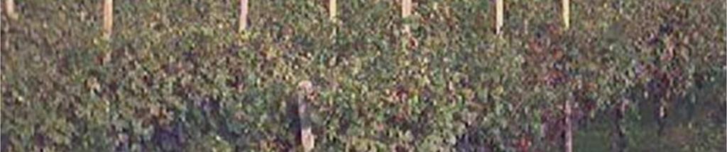
2 Introductiory remarks Scaphoideus titanus is a major pest in viticulture, since its establishment in Europe, as vector of a quarantine pathogen, the Flavescence Dorée phytoplasma Its management is based on mandatory control measures (insecticide spraying) Its distribution in Europe has dramatically changed at the end of the 1980ies, after an abrupt climate change Nowadays it has colonized Europe from the Atlantic Ocean to the Black sea and it is still spreading
3 Purpose of the presentation To contribute to an explanation of the changing distribution of the leafhopper Scaphoideus titanus in Europe Aim of the paper The analysis of the spatio-temporal distribution on the basis of the predicted geographical distribution within the and the time periods in Europe

4 European spread pattern of S. titanus before ? sporadic Chuche and Thiéry, Agron. Sustain. Dev., 34:

5 Mean yearly temperature in Europe 1950/2011

6 Mean yearly temperature in Switzerland 1961/2011 (by Meteoswiss) Temperatures are expressed as positive (red) or negative (blue) anomaly compared to the average. The colors red (hot years) affected only 10% of the years , and the percentage rises to 90% after 1988.

7 The new European climate (after 1987) Temperature: +0.5 C Precipitation: increase Solar Radiation: decrease Temperature: +1.5 C Solar radiation: increase.
8 Modelling approach An age-structured mechanistic model built on biophysical (development, including diapause) and demographic (natality and mortality) processes for poikilotherm organisms Model development, parametrization and validation Time-varying distributed delay with attrition; the model simulates vine plant canopy occupancy by diapausing eggs, post-diapausing eggs, nymphs and adults The temperature controls development, survival and reproduction. Survival of nondiapausing life stages is further controlled by the plant phenology. The distribution in Europe requires the explicit consideration of photoperiodic (latitudinal) effects on diapause Model use The assessment of the colonization potential of S. titanus on the basis of a Climatic Suitability Index ξ
9 Model performance: prediction and explanation of the occupancy in a Swiss vineyard Observed occurences Simulated occurrences Days Rigamonti et al., The Canadian Entomologist, 146: 67-79
10 Definition of the Climatic Suitability Index ξ The index has been obtained on the basis of the number of diapausing and post diapausing eggs at the beginning of grapevine vegetative development (BBCH 11), one of the model outputs. The index is quantified by dividing the number of eggs obtained in one year by the number of eggs obtained in the previous year
11 Predicted geographical distribution in Europe Maximum and minimum daily temperatures (TX, TN) for period gathered for the 6690 synoptic stations from the NOAA GSOD dataset located within the ranges 28 N 72 N and 11 W 55 E. Reference grid: 0.25 degrees lat lon with heights upscaled from the Nasa SRTM Digital Elevation Model Spatialization of TX,TN for each grid node: IDWM method (Inverse Distance Weighted Mean on daily TX, TN previously homogenized to the height of each grid node). Model run: the model was applied to each point of the grid. Reference runs hereafter discussed: Run 1) from 1981 to 1990, ξ is the mean value of the period Run 2) from 1991 to 2000, ξ is the mean value of the period Run 3) from 2001 to 2010, ξ is the mean value of the period Run 4) from 2007 to 2013, ξ is the mean value of the period

12 Mean ξ value in Europe for the five-year period Mean ξ rate
13 Mean ξ value in Europe for the five-year period Mean ξ rate

14 Mean ξ value in Europe for the five-year period Mean ξ rate

15 Mean ξ value in Europe for the five-year period Mean ξ rate


16 Variation of the Mean ξ value in Europe Mean ξ variation


17 Mean ξ value in Europe for the year 2004 Mean ξ rate
18 Concluding remarks A northern shift of the potential distribution area of S. titanus has been observed within the study time period An increase in the ξ values has been observed in Central and Eastern Europe A stability in the ξ values has been observed at the southern potential distribution limit A high suitability of Northern Italy, Central and Eastern Europe along the 45 latitude has been confirmed The climate change occurred in the 980 may contribute to an explanation of - the changing distribution of S. titanus in Europe - the spatio-temporal dynamics as summarized on the previously shown maps


19 Thank you for your attention
Global Warming is a Fact of Life
 RECENT HISTORICAL TEMPERATURE AND TRADE-WIND INVERSION VARIATIONS IN HAWAI I Global Warming is a Fact of Life Tom Giambelluca Geography UH Manoa 1976-2005: 0.177 o C per decade 1906-2005: 0.074 o C per
Reconstructing sunshine duration and solar radiation long-term evolution for Italy: a challenge for quality control and homogenization procedures
 14th IMEKO TC10 Workshop Technical Diagnostics New Perspectives in Measurements, Tools and Techniques for system s reliability, maintainability and safety Milan, Italy, June 27-28, 2016 Reconstructing
IMPACTS OF A WARMING ARCTIC
 The Earth s Greenhouse Effect Most of the heat energy emitted from the surface is absorbed by greenhouse gases which radiate heat back down to warm the lower atmosphere and the surface. Increasing the
Establishing a high-resolution precipitation dataset for the Alps
 Federal Department of Home Affairs FDHA Federal Office of Meteorology and Climatology MeteoSwiss Establishing a high-resolution precipitation dataset for the Alps F. A. Isotta, C. Lukasczyk, and C. Frei
A RADAR-BASED CLIMATOLOGY OF HIGH PRECIPITATION EVENTS IN THE EUROPEAN ALPS:
 2.6 A RADAR-BASED CLIMATOLOGY OF HIGH PRECIPITATION EVENTS IN THE EUROPEAN ALPS: 2000-2007 James V. Rudolph*, K. Friedrich, Department of Atmospheric and Oceanic Sciences, University of Colorado at Boulder,
ALARO experience in Romania
 ALARO experience in Romania S. Briceag, M. Pietrisi, S. Tascu, A. Craciun, R. Iordache National Meteorological Administration, Romania Operational model setup ALARO cy36t1: 1 January 2014 31 March 2016
Geography Mile Post 1
 Mile Post 1 Use world maps, atlases and globes to identify the UK and its countries, as well as the countries, continents and oceans studied at this key stage Key Skills IPC learning Goals 1.11 Be able
Spatial Effects on Current and Future Climate of Ipomopsis aggregata Populations in Colorado Patterns of Precipitation and Maximum Temperature
 A. Kenney GIS Project Spring 2010 Amanda Kenney GEO 386 Spring 2010 Spatial Effects on Current and Future Climate of Ipomopsis aggregata Populations in Colorado Patterns of Precipitation and Maximum Temperature
Nonlinear atmospheric response to Arctic sea-ice loss under different sea ice scenarios
 Nonlinear atmospheric response to Arctic sea-ice loss under different sea ice scenarios Hans Chen, Fuqing Zhang and Richard Alley Advanced Data Assimilation and Predictability Techniques The Pennsylvania
Ocean Temperatures. Key Words: No new key words.
 Key Words: No new key words. Ocean Temperatures Getting Started: 1. In this activity, you will simulate the work of climatologists who sample ocean surface temperatures and compile that data to investigate
The Climatology of Clouds using surface observations. S.G. Warren and C.J. Hahn Encyclopedia of Atmospheric Sciences.
 The Climatology of Clouds using surface observations S.G. Warren and C.J. Hahn Encyclopedia of Atmospheric Sciences Gill-Ran Jeong Cloud Climatology The time-averaged geographical distribution of cloud
World Geography Chapter 3
 World Geography Chapter 3 Section 1 A. Introduction a. Weather b. Climate c. Both weather and climate are influenced by i. direct sunlight. ii. iii. iv. the features of the earth s surface. B. The Greenhouse
Climate Change 2007: The Physical Science Basis
 Climate Change 2007: The Physical Science Basis Working Group I Contribution to the IPCC Fourth Assessment Report Presented by R.K. Pachauri, IPCC Chair and Bubu Jallow, WG 1 Vice Chair Nairobi, 6 February
A process-based guide to
 A process-based guide to data collection in plant health Luigi Ponti utagri.enea.it EFSA, Parma Wed 2 April 2014 A process-based approach is key to managing pests effectively The biology matters Cost of
Gridding of precipitation and air temperature observations in Belgium. Michel Journée Royal Meteorological Institute of Belgium (RMI)
") Gridding of precipitation and air temperature observations in Belgium Michel Journée Royal Meteorological Institute of Belgium (RMI) Gridding of meteorological data A variety of hydrologic, ecological,
Gridding of precipitation and air temperature observations in Belgium Michel Journée Royal Meteorological Institute of Belgium (RMI) Gridding of meteorological data A variety of hydrologic, ecological,
CHAPTER 1: INTRODUCTION
 CHAPTER 1: INTRODUCTION There is now unequivocal evidence from direct observations of a warming of the climate system (IPCC, 2007). Despite remaining uncertainties, it is now clear that the upward trend
Inter- Annual Land Surface Variation NAGS 9329
 Annual Report on NASA Grant 1 Inter- Annual Land Surface Variation NAGS 9329 PI Stephen D. Prince Co-I Yongkang Xue April 2001 Introduction This first period of operations has concentrated on establishing
An assessment of the risk of aerial transport of rust pathogens to the Western Hemisphere and within North America
 An assessment of the risk of aerial transport of rust pathogens to the Western Hemisphere and within North America Scott A. Isard Departments of Plant Pathology and Meteorology Pennsylvania State University
Year 1 name and locate the four countries and capital cities of the United Kingdom and its surrounding seas
 Long Term Objective Organisation for Geography Please note that only statutory requirements should be included in this document; any supplementary guidance and information should be retained by Subject
New National Curriculum Geography Skills Planning KS1
 New National Curriculum Geography Skills Planning KS1 Enquiry Question Objective-essential knowledge skills or understanding Locational Knowledge Standards /Success Criteria Lesson progression over half
Current Status of the Stratospheric Ozone Layer From: UNEP Environmental Effects of Ozone Depletion and Its Interaction with Climate Change
 Goals Produce a data product that allows users to acquire time series of the distribution of UV-B radiation across the continental USA, based upon measurements from the UVMRP. Provide data in a format
PYROGEOGRAPHY OF THE IBERIAN PENINSULA
 PYROGEOGRAPHY OF THE IBERIAN PENINSULA Teresa J. Calado (1), Carlos C. DaCamara (1), Sílvia A. Nunes (1), Sofia L. Ermida (1) and Isabel F. Trigo (1,2) (1) Instituto Dom Luiz, Universidade de Lisboa, Lisboa,
Daily, Monthly and Yearly Norm Temperature ( ): TnormD8110, TnormM8110 and TnormY8110
: TnormD8110, TnormM8110 and TnormY8110") Federal Department of Home Affairs FDHA Federal Office of Meteorology and Climatology MeteoSwiss Documentation of MeteoSwiss Grid-Data Products Daily, Monthly and Yearly Norm Temperature (1981-2010): TnormD8110,
Federal Department of Home Affairs FDHA Federal Office of Meteorology and Climatology MeteoSwiss Documentation of MeteoSwiss Grid-Data Products Daily, Monthly and Yearly Norm Temperature (1981-2010): TnormD8110,
Observed changes in climate and their effects
 1 1.1 Observations of climate change Since the TAR, progress in understanding how climate is changing in space and time has been gained through improvements and extensions of numerous datasets and data
Major Domain of the Earth
 Major Domain of the Earth The surface of the earth is a complex zone in which three main components of the environment meet, overlap and interact. The solid portion of the earth on which we live is called
Global Temperature Report: December 2018
 Jan 2, 2019 Vol. 28, No. 9 For Additional Information: Dr. John Christy, (256) 961-7763 christy@nsstc.uah.edu Dr. Roy Spencer, (256) 961-7960 spencer@nsstc.uah.edu Global Temperature Report: December 2018
Credibility of climate predictions revisited
 European Geosciences Union General Assembly 29 Vienna, Austria, 19 24 April 29 Session CL54/NP4.5 Climate time series analysis: Novel tools and their application Credibility of climate predictions revisited
Witchampton CofE First School Geography Curriculum Map
 2016-2017 Autumn People and : 30-50 Show interest in the lives of people who are familiar to them. Shows interest in different occupations. Remembers and talks significant events in their own experience.
The role of teleconnections in extreme (high and low) precipitation events: The case of the Mediterranean region
 precipitation events: The case of the Mediterranean region") European Geosciences Union General Assembly 2013 Vienna, Austria, 7 12 April 2013 Session HS7.5/NP8.4: Hydroclimatic Stochastics The role of teleconnections in extreme (high and low) events: The case of
European Geosciences Union General Assembly 2013 Vienna, Austria, 7 12 April 2013 Session HS7.5/NP8.4: Hydroclimatic Stochastics The role of teleconnections in extreme (high and low) events: The case of
Factors That Affect Climate
 Factors That Affect Climate Factors That Affect Climate Latitude As latitude (horizontal lines) increases, the intensity of solar energy decreases. The tropical zone is between the tropic of Cancer and
Supplementary Figures
 Supplementary Figures Supplementary Figure 1: The partial correlation coefficient of NDVI GS and GT for the first 15 years (1982-1996) and the last 15 years (1997-211) with five different definition of
Climate and the Atmosphere
 Climate and Biomes Climate Objectives: Understand how weather is affected by: 1. Variations in the amount of incoming solar radiation 2. The earth s annual path around the sun 3. The earth s daily rotation
Name Class Date. For each pair of terms, explain how the meanings of the terms differ.
 Skills Worksheet Chapter Review USING KEY TERMS For each pair of terms, explain how the meanings of the terms differ. 1. biome and tropical zone 2. weather and climate 3. temperate zone and polar zone
Attribution of Estonian phyto-, ornitho- and ichtyophenological trends with parameters of changing climate
 Attribution of Estonian phyto-, ornitho- and ichtyophenological trends with parameters of changing climate Rein Ahas*, Anto Aasa, Institute of Geography, University of Tartu, Vanemuise st 46, Tartu, 51014,
SUPPLEMENTARY INFORMATION
 doi:10.1038/nature12310 We present here two additional Tables (Table SI-1, 2) and eight further Figures (Figures SI-1 to SI-8) to provide extra background information to the main figures of the paper.
European grapevine moth in 2012: How to time insecticide sprays and the importance of monitoring with traps
 European grapevine moth in 2012: How to time insecticide sprays and the importance of monitoring with traps Lucia G. Varela North Coast IPM Advisor 2010 Male moth trap catches Total # moths caught per
SUPPLEMENTARY INFORMATION
 SUPPLEMENTARY INFORMATION DOI: 10.1038/NCLIMATE2336 Stormiest winter on record for Ireland and UK Here we provide further information on the methodological procedures behind our correspondence. First,
High resolution spatiotemporal distribution of rainfall seasonality and extreme events based on a 12-year TRMM time series
 High resolution spatiotemporal distribution of rainfall seasonality and extreme events based on a 12-year TRMM time series Bodo Bookhagen, Geography Department, UC Santa Barbara, Santa Barbara, CA 93106-4060
Prentice Hall EARTH SCIENCE
 Prentice Hall EARTH SCIENCE Tarbuck Lutgens Chapter 21 Climate 21.1 Factors That Affect Climate Factors That Affect Climate Latitude As latitude increases, the intensity of solar energy decreases. The
Examples of using gridded observed climate datasets at the Finnish Environment Institute
 Examples of using gridded observed climate datasets at the Finnish Environment Institute Stefan Fronzek, Timothy Carter, Nina Pirttioja Finnish Environment Institute (SYKE) Workshop New gridded climate
Complete Geography Overview: Year 1 to Year 6
 Option 1 Complete Geography Overview: Year 1 to Year 6 Autumn Term Spring Term Summer Term Year 1 Where do I live? Around the World The Four Seasons Year 2 At the Farm Let s go on Safari My World and Me
By: J Malherbe, R Kuschke
 2015-10-27 By: J Malherbe, R Kuschke Contents Summary...2 Overview of expected conditions over South Africa during the next few days...3 Significant weather events (27 October 2 November)...3 Conditions
Enabling Climate Information Services for Europe
 Enabling Climate Information Services for Europe Report DELIVERABLE 6.5 Report on past and future stream flow estimates coupled to dam flow evaluation and hydropower production potential Activity: Activity
MeteoSwiss Spatial Climate Analyses: Documentation of Datasets for Users
 Federal Department of Home Affairs FDHA Federal Office of Meteorology and Climatology MeteoSwiss MeteoSwiss Spatial Climate Analyses: Documentation of Datasets for Users Figure 1: Distribution of the 48-hour
The performance expectation above was developed using the following elements from the NRC document A Framework for K-12 Science Education:
 MS-ESS2-1 Earth's Systems Students who demonstrate understanding can: MS-ESS2-1. Develop a model to describe the cycling of Earth's materials and the flow of energy that drives this process. [Clarification
Climate Downscaling 201
 Climate Downscaling 201 (with applications to Florida Precipitation) Michael E. Mann Departments of Meteorology & Geosciences; Earth & Environmental Systems Institute Penn State University USGS-FAU Precipitation
Earth Science Lesson Plan Quarter 2, Week 6, Day 1
 Earth Science Lesson Plan Quarter 2, Week 6, Day 1 1 Outcomes for Today Standard Focus: Earth Sciences 5.f students know the interaction of wind patterns, ocean currents, and mountain ranges results in
Regional offline land surface simulations over eastern Canada using CLASS. Diana Verseghy Climate Research Division Environment Canada
 Regional offline land surface simulations over eastern Canada using CLASS Diana Verseghy Climate Research Division Environment Canada The Canadian Land Surface Scheme (CLASS) Originally developed for the
Weather and climate outlooks for crop estimates
 Weather and climate outlooks for crop estimates CELC meeting 2016-04-21 ARC ISCW Observed weather data Modeled weather data Short-range forecasts Seasonal forecasts Climate change scenario data Introduction
Northwest Outlook September 2017
 Northwest Outlook September 2017 Hot and dry August August 2017 continued with the pattern established in June and July that featured a large, semipermanent ridge in the flow of the jet stream. Temperatures
Earth s Climate Patterns
 Earth s Climate Patterns Reading: Chapter 17, GSF 10/2/09 Also Jackson (linked on course web site) 1 What aspects of climate affect plant distributions? Climate: long-term distribution of weather in an
Manfred A. Lange Energy, Environment and Water Research Center The Cyprus Institute. M. A. Lange 11/26/2008 1
 Manfred A. Lange Energy, Environment and Water Research Center The Cyprus Institute M. A. Lange 11/26/2008 1 Background and Introduction Mediterranean Climate Past and Current Conditions Tele-Connections
Geography Long Term Plan. Autumn Spring Summer
 Geography Long Term Plan Autumn Spring Summer Year 1 Working Scientifically covered throughout the year Location Geography of UK Name, locate and identify characteristics of the four countries and capital
Expansion of geographic range in the pine processionary moth caused by increased winter temperatures. Ecological Applications :
 Expansion of geographic range in the pine processionary moth caused by increased winter temperatures Andrea Battisti, Michael Stastny, Sigrid Netherer, Christelle Robinet, Axel Schopf, Alain Roques, Stig
Modeling CO 2 sinks and sources of European land vegetation using remote sensing data
 Modeling CO 2 sinks and sources of European land vegetation using remote sensing data K. Wißkirchen, K. Günther German Aerospace Center (DLR), German Remote Sensing Data Center (DFD), Climate and Atmospheric
Bugs in JRA-55 snow depth analysis
 14 December 2015 Climate Prediction Division, Japan Meteorological Agency Bugs in JRA-55 snow depth analysis Bugs were recently found in the snow depth analysis (i.e., the snow depth data generation process)
Original (2010) Revised (2018)
 Revised (2018)") Section 1: Why does Climate Matter? Section 1: Why does Climate Matter? y Global Warming: A Hot Topic y Data from diverse biological systems demonstrate the importance of temperature on performance across
Section 1: Why does Climate Matter? Section 1: Why does Climate Matter? y Global Warming: A Hot Topic y Data from diverse biological systems demonstrate the importance of temperature on performance across
THEME: Seasonal forecast: Climate Service for better management of risks and opportunities
 CENTRE AFRICAIN POUR LES APPLICATIONS DE LA METEOROLOGIE AU DEVELOPPEMENT AFRICAN CENTRE OF METEOROLOGICAL APPLICATIONS FOR DEVELOPMENT Institution Africaine parrainée par la CEA et l OMM African Institution
Prentice Hall EARTH SCIENCE
 Prentice Hall EARTH SCIENCE Tarbuck Lutgens Chapter 21 Climate 21.1 Factors That Affect Climate Factors That Affect Climate Latitude As latitude increases, the intensity of solar energy decreases. The
Laboratory Exercise #7 - Introduction to Atmospheric Science: The Seasons
 Laboratory Exercise #7 - Introduction to Atmospheric Science: The Seasons page - 1 Section A - Introduction: This lab consists of both computer-based and noncomputer-based questions dealing with atmospheric
Where is the tropical zone? What are three biomes found in the tropical zone?
 Name CHAPTER 17 Class Date SECTION 2 The Tropics BEFORE YOU READ After you read this section, you should be able to answer these questions: Where is the tropical zone? What are three biomes found in the
About places and/or important events Landmarks Maps How the land is, hills or flat or mountain range Connected to maps World Different countries
 What do you think you know about geography? About places and/or important events Landmarks Maps How the land is, hills or flat or mountain range Connected to maps World Different countries What do you
Importance of a thick snow cover on viticulture in the cool wine growing regions. Juha Karvonen Vitinord, July 31, 2018
 Importance of a thick snow cover on viticulture in the cool wine growing regions Vitinord, July 31, 2018 1 Content How much snow is on the Earth? Winter air and snow conditions in vineyards - Southern
SpringerBriefs in Agriculture
 SpringerBriefs in Agriculture More information about this series at http://www.springer.com/series/10183 Marina Dermastia Assunta Bertaccini Fiona Constable Nataša Mehle Grapevine Yellows Diseases and
SPECIAL PROJECT PROGRESS REPORT
 SPECIAL PROJECT PROGRESS REPORT Progress Reports should be 2 to 10 pages in length, depending on importance of the project. All the following mandatory information needs to be provided. Reporting year
Observed State of the Global Climate
 WMO Observed State of the Global Climate Jerry Lengoasa WMO June 2013 WMO Observations of Changes of the physical state of the climate ESSENTIAL CLIMATE VARIABLES OCEANIC ATMOSPHERIC TERRESTRIAL Surface
Utility of National Spatial Data for Conservation Design Projects
 Utility of National Spatial Data for Conservation Design Projects Steve Williams Biodiversity and Spatial Information Center North Carolina State University PIF CDW St. Louis, MO April 11, 2006 Types of
Cape Verde. General Climate. Recent Climate. UNDP Climate Change Country Profiles. Temperature. Precipitation
 UNDP Climate Change Country Profiles C. McSweeney 1, M. New 1,2 and G. Lizcano 1 1. School of Geography and Environment, University of Oxford. 2. Tyndall Centre for Climate Change Research http://country-profiles.geog.ox.ac.uk
Application of the Integrated Aerobiology Modeling System to Soybean Rust Forecasting in 2006
 Application of the Integrated Aerobiology Modeling System to Soybean Rust Forecasting in 2006 Scott A. Isard Penn State University & Joseph M. Russo ZedX Inc. Integrated Aerobiology Modeling System (IAMS)
Presentation Overview. Southwestern Climate: Past, present and future. Global Energy Balance. What is climate?
 Southwestern Climate: Past, present and future Mike Crimmins Climate Science Extension Specialist Dept. of Soil, Water, & Env. Science & Arizona Cooperative Extension The University of Arizona Presentation
Chapter 6, Part Colonizers arriving in North America found extremely landscapes. It looked different to region showing great.
 Social Studies 9 Unit 1 Worksheet Chapter 6, Part 1. 1. Colonizers arriving in North America found extremely landscapes. It looked different to region showing great. 2. The Earth is years old and is composed
EPIDEMIOLOGY FOR URBAN MALARIA MAPPING
 TELE-EPIDEMIOLOGY EPIDEMIOLOGY FOR URBAN MALARIA MAPPING @IRD/M Dukhan Vanessa Machault Observatoire Midi-Pyrénées, Laboratoire d Aérologie Pleiades days 17/01/2012 The concept of Tele-epidemiology The
Relationship between atmospheric circulation indices and climate variability in Estonia
 BOREAL ENVIRONMENT RESEARCH 7: 463 469 ISSN 1239-695 Helsinki 23 December 22 22 Relationship between atmospheric circulation indices and climate variability in Estonia Oliver Tomingas Department of Geography,
J1.7 SOIL MOISTURE ATMOSPHERE INTERACTIONS DURING THE 2003 EUROPEAN SUMMER HEATWAVE
 J1.7 SOIL MOISTURE ATMOSPHERE INTERACTIONS DURING THE 2003 EUROPEAN SUMMER HEATWAVE E Fischer* (1), SI Seneviratne (1), D Lüthi (1), PL Vidale (2), and C Schär (1) 1 Institute for Atmospheric and Climate
The Use of Geographic Information Systems to Assess Change in Salt Marsh Ecosystems Under Rising Sea Level Scenarios.
 The Use of Geographic Information Systems to Assess Change in Salt Marsh Ecosystems Under Rising Sea Level Scenarios Robert Hancock The ecological challenges presented by global climate change are vast,
Impacts of Changes in Extreme Weather and Climate on Wild Plants and Animals. Camille Parmesan Integrative Biology University of Texas at Austin
 Impacts of Changes in Extreme Weather and Climate on Wild Plants and Animals Camille Parmesan Integrative Biology University of Texas at Austin Species Level: Climate extremes determine species distributions
arxiv: v1 [q-bio.pe] 15 Jul 2014
![arxiv: v1 [q-bio.pe] 15 Jul 2014](/thumbs/88/115732841.jpg "arxiv: v1 [q-bio.pe] 15 Jul 2014") A Mathematical Model of Flavescence Dorée Epidemiology Federico Lessio 1, Alessandro Portaluri 1, Francesco Paparella 2,3 and Alberto Alma 1 arxiv:1407.4003v1 [q-bio.pe] 15 Jul 2014 1 Department of Agricultural,
A Mathematical Model of Flavescence Dorée Epidemiology Federico Lessio 1, Alessandro Portaluri 1, Francesco Paparella 2,3 and Alberto Alma 1 arxiv:1407.4003v1 [q-bio.pe] 15 Jul 2014 1 Department of Agricultural,
Introduction to Climatology. GEOG/ENST 2331: Lecture 1
 Introduction to Climatology GEOG/ENST 2331: Lecture 1 Us Graham Saunders graham.saunders@lakeheadu.ca Jason Freeburn (RC 2004) jtfreebu@lakeheadu.ca Graham Saunders Australian Weather Bureau Environment
Biomes Section 1. Chapter 6: Biomes Section 1: What is a Biome? DAY ONE
 Chapter 6: Biomes Section 1: What is a Biome? DAY ONE What is a Biome? Biomes are large regions characterized by a specific type of climate and certain types of plant and animal communities. The climate
Climate Models and Snow: Projections and Predictions, Decades to Days
 Climate Models and Snow: Projections and Predictions, Decades to Days Outline Three Snow Lectures: 1. Why you should care about snow 2. How we measure snow 3. Snow and climate modeling The observational
TNO (M. Schaap, R. Kranenburg, S. Jonkers, A. Segers, C. Hendriks) METNO (M. Schulz, A. Valdebenito, A. Mortier, M. Pommier, S.Tsyro, H.
 METNO (M. Schulz, A. Valdebenito, A. Mortier, M. Pommier, S.Tsyro, H.") This document has been produced in the context of the Copernicus Atmosphere Monitoring Service (CAMS). The activities leading to these results have been contracted by the Source contributions to EU cities
This document has been produced in the context of the Copernicus Atmosphere Monitoring Service (CAMS). The activities leading to these results have been contracted by the Source contributions to EU cities
Mesoscale and High Impact Weather in the South American Monsoon Leila M. V. Carvalho 1 and Maria A. F. Silva Dias 2 1
 Mesoscale and High Impact Weather in the South American Monsoon Leila M. V. Carvalho 1 and Maria A. F. Silva Dias 2 1 University of California, Santa Barbara 2 University of Sao Paulo, Brazil Objectives
P1.34 MULTISEASONALVALIDATION OF GOES-BASED INSOLATION ESTIMATES. Jason A. Otkin*, Martha C. Anderson*, and John R. Mecikalski #
 P1.34 MULTISEASONALVALIDATION OF GOES-BASED INSOLATION ESTIMATES Jason A. Otkin*, Martha C. Anderson*, and John R. Mecikalski # *Cooperative Institute for Meteorological Satellite Studies, University of
3. Carbon Dioxide (CO 2 )
") 3. Carbon Dioxide (CO 2 ) Basic information on CO 2 with regard to environmental issues Carbon dioxide (CO 2 ) is a significant greenhouse gas that has strong absorption bands in the infrared region and
3. Carbon Dioxide (CO 2 ) Basic information on CO 2 with regard to environmental issues Carbon dioxide (CO 2 ) is a significant greenhouse gas that has strong absorption bands in the infrared region and
Name the surface winds that blow between 0 and 30. GEO 101, February 25, 2014 Monsoon Global circulation aloft El Niño Atmospheric water
 GEO 101, February 25, 2014 Monsoon Global circulation aloft El Niño Atmospheric water Name the surface winds that blow between 0 and 30 What is the atmospheric pressure at 0? What is the atmospheric pressure
Energy Systems, Structures and Processes Essential Standard: Analyze patterns of global climate change over time Learning Objective: Differentiate
 Energy Systems, Structures and Processes Essential Standard: Analyze patterns of global climate change over time Learning Objective: Differentiate between weather and climate Global Climate Focus Question
Laboratory Exercise #7 - Introduction to Atmospheric Science: The Seasons and Daily Weather
 Laboratory Exercise #7 - Introduction to Atmospheric Science: The Seasons and Daily Weather page - Section A - Introduction: This lab consists of questions dealing with atmospheric science. We beginning
Influence of solar activity on the occurrence of weather types over Europe from 1763 to 2009
 Influence of solar activity on the occurrence of weather types over Europe from 1763 to 2009 05.10.2016 SCOSTEP Workshop Mikhaël Schwander & Stefan Brönnimann Oeschger Centre for Climate Change Research
St. James C of E Primary School
 St. James C of E Primary School Geography Policy St. James C of E Primary School Geography Policy Written by: Lisa Harford Written: April 2016 Reviewed: April 2018 1. Introduction Geography is concerned
... Europe. Based on Bloom s Taxonomy. Environment Interactions Movement. Human & Location. Regions. Place
 ... Europe Location Place Human & Environment Interactions Movement Regions LEVEL 1 Knowledge Match Show or Label List Information Recall Details (5Ws + H) Find Information LEVEL 2 Comprehension Describe
Geography Progression
 Geography Progression This document aims to track expectations for History within George Grenville Academy. What the National Curriculum says: KS1: Locational Knowledge: Name and locate the world s 7 continents
remain on the trees all year long) Example: Beaverlodge, Alberta, Canada
 Example: Beaverlodge, Alberta, Canada") Coniferous Forest Temperature: -40 C to 20 C, average summer temperature is 10 C Precipitation: 300 to 900 millimeters of rain per year Vegetation: Coniferous-evergreen trees (trees that produce cones
Coniferous Forest Temperature: -40 C to 20 C, average summer temperature is 10 C Precipitation: 300 to 900 millimeters of rain per year Vegetation: Coniferous-evergreen trees (trees that produce cones
Tuition, Medical and Behaviour Support Service
 Tuition, Medical and Behaviour Support Service Curriculum Policy - Primary Geography Reviewed: October 2018 Next Review: October 2019 Responsibility: Andrea Snow AIMS AND PRINCIPLES The national curriculum
GEOGRAPHY POLICY STATEMENT. The study of geography helps our pupils to make sense of the world around them.
 GEOGRAPHY POLICY STATEMENT We believe that the study of geography is concerned with people, place, space and the environment and explores the relationships between the earth and its peoples. The study
FOREST FIRE HAZARD MODEL DEFINITION FOR LOCAL LAND USE (TUSCANY REGION)
") FOREST FIRE HAZARD MODEL DEFINITION FOR LOCAL LAND USE (TUSCANY REGION) C. Conese 3, L. Bonora 1, M. Romani 1, E. Checcacci 1 and E. Tesi 2 1 National Research Council - Institute of Biometeorology (CNR-
FOREST FIRE HAZARD MODEL DEFINITION FOR LOCAL LAND USE (TUSCANY REGION) C. Conese 3, L. Bonora 1, M. Romani 1, E. Checcacci 1 and E. Tesi 2 1 National Research Council - Institute of Biometeorology (CNR-
Lecture 8. The Holocene and Recent Climate Change
 Lecture 8 The Holocene and Recent Climate Change Recovery from the last ice age About 15,000 years ago, the earth began to warm and the huge ice sheets covering much of North America and Eurasia began
Predicting ectotherm disease vector spread. - Benefits from multi-disciplinary approaches and directions forward
 Predicting ectotherm disease vector spread - Benefits from multi-disciplinary approaches and directions forward Naturwissenschaften Stephanie Margarete THOMAS, Carl BEIERKUHNLEIN, Department of Biogeography,
Using NEWA Resources in a Vineyard IPM Strategy. Tim Weigle and Juliet Carroll NYS IPM Program, Cornell Cooperative Extension
 Using NEWA Resources in a Vineyard IPM Strategy Tim Weigle and Juliet Carroll NYS IPM Program, Cornell Cooperative Extension Historically, control practices for vineyard pests in the eastern United States
Regents Earth Science Unit 7: Water Cycle and Climate
 Regents Earth Science Unit 7: Water Cycle and Climate Name Section Coastal and Continental Temperature Ranges Lab # Introduction: There are large variations in average monthly temperatures among cities
Module 11: Meteorology Topic 3 Content: Climate Zones Notes
 Introduction Latitude is such an important climate factor that you can make generalizations about a location's climate based on its latitude. Areas near the equator or the low latitudes are generally hot