About E-GVAP and the collaboration between geodesy and meteorology
|
|
|
- Annabel Byrd
- 5 years ago
- Views:
Transcription
1 EIG EUMETNET GNSS Water Vapour Programme E-GVAP About E-GVAP and the collaboration between geodesy and meteorology Henrik Vedel, DMI and E-GVAP team Siebren de Haan, KNMI and E-GVAP team Jonathan Jones, UKMO and E-GVAP team
2 What is E-GVAP? EIG EUMETNET GNSS Water Vapour Programme. EUMETNET = organisation of European national meteorological offices (West European + number of East European, enlarging). E-GVAP is a separate observing programme under EUMETNET. Not all EUMETNET members are members of E-GVAP (currently 15). It is those members that finance E-GVAP.
3 Purpose of E-GVAP To provide quality checked, ground based GNSS delay and integrated water vapour data (ZTDs and IWVs) in near real-time (NRT) for use in operational numerical weather prediction (NWP) models and in now-casting to the participating EUMETNET members. To improve on the NRT GNSS ZTD data quality and enlarge data coverage To assist users in utilising the data for weather forecasting.
4 Method Collaboration with geodesy. Through EUREF and on national level. Examples: Exchange of data. Exchange of knowhow Collaboration in national and international cross dicipline projects. From joint article level to EU projects. Sharing of facilities.
 KNMI Users EUCOS UKMO UKMO ftp ftp server server and and work work station station BUFR BUFR encoding encoding of")
5 NRT GNSS ZTD data flow Today METO UKMO LPT(R) Switzerland GOPE Czech Rep. ASI Italy BKG Germany GFZ Germany ROB Belgium IGE Spain SGN France NGAA SMHI KNMI(1) KNMI Users EUCOS UKMO UKMO ftp ftp server server and and work work station station BUFR BUFR encoding encoding of of UKMO UKMO data data copy copy to to second second ftp ftp server server BUFR UKMO UKMO Database Database BUFR UKMO UKMO ftp ftp server server Data Data in in COST COST format format Monitoring and and validation data data BUFR KNMI validation NRT ftp users & mirror sites Analysis centres (ACs), each processing raw GNSS data from many sites. In many cases only national AC can get access to the raw data.
6 Number of GNSS sites versus time. About 1250 unique GNSS sites end of Increase from about 1000 during 2009.

7 DATA COVERAGE Negotiating access to global NRT ZTD data, on request of members. Expect access to North American data during this year.

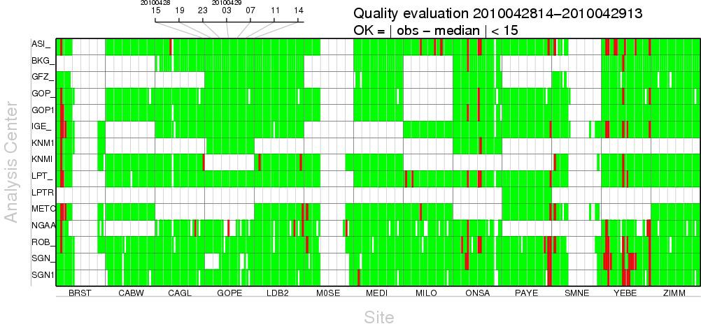
8 DATA COVERAGE, Europe Colour according to latency. Validation statistics and graphs are created automatically and shown via click at each square representing a GNSS site. Available via homepage, egvap.dmi.dk item validation
9 DATA COVERAGE From E-GVAP we are highly interested in NRT GNSS from even more sites in Europe, as raw data for conversion to ZTDs or as ZTDs. The holds for all countries, but in particular Eastern Europe is under-represented in the E-GVAP coverage. The metoffices of Croatia, Hungary and Serbia have now become members of E-GVAP.
10 Timeliness. Percentage of NRT ZTD data arriving within 90 minutes of their valid time. The NRT aspect of E-GVAP has implications for the quality of the processing. Most of the time it is good, but now and then there are intermittent problems.
11 Examples of NRT processing problems Intermittent problem with NGAA solution (based on ppp processing).

12 Problem in SGN/IGN network solution due the movement of a site by a site owner, without the SGN analysis centre knowning in proper advance.
13 AQC, active quality control While the vast majority of the NRT ZTDs are of high quality, there is from time to time a few which contain significant errors. Due to the intrinsics of the GNSS system and processing these errors are in many cases strongly correlated. Correlated errors in observations are poisonous to numerical weather prediction models. Because NWP models are not very good at humidity, it is not robust to rely only on NWP identification of multi GNSS site errors from an AC To identify such events, on the fly, E-GVAP is setting up AQC, in which NRT ZTD data from super-sites, and other GNSS sites processed by many ACs, are inter compared. If ZTDs from one AC deviates simultaneously at many sites, it is a strong warning signal, and the ACs data of the time will be flagged accordingly

14 The supersites To be processed by all ACs. At the supersites auxiliary measurements are available, e.g. from radiosonde or WVR. This is useful in validation studies, for both meteorology and geodesy. In addition to the above, a lot of meteorological measurements of surface pressure, temperature and humidity, as well as radiosonde data from other sites are made available via E-GVAP and the EUREF EUMETNET MoU for use by geodesist in their scientific work.

15 Bias of supersite ZTDs relative to KNMI HIRLAM (over few days)

16 Standard deviation of supersite ZTDs against KNMI HIRLAM (Over few days)
17
18 For SGN Days 87 to 92.
19 For SGN Days 87 to 92.
20 For GFZ Days 87 to 92.
21 Deviations larger than 10 mm with respect to median of medians of ACs. Unit is mm. Day -1 Clearly the AQC is effective in picking out the correlated large offsets in the afternoon of May 31.
22 Clearly this type of multiple error detection will be useful in NWP and in notifying ACs in case of errors. The plan is to include also other types of offsets (with respect to NWP forecasts, e.g.) and make real-time flagging of AC performance available to users. It certainly shows the strength of having different ACs processing common sites using slightly different methods. Is this type of early inter comparison and multiple error detection of NRT ZTD data useful also on the geodesy side? In addition combined solutions will be made available by ASI and KNMI, based on two different combination methods. Rosa Pacione described the ASI approach at the previous EUREF Symposium.
23 NRT GNSS ZTD data flow Future METO NGAA UKMO SMHI LPT(R) Switzerland GOPE Czech Rep. ASI Italy BKG Germany GFZ Germany ROB Belgium IGE Spain SGN France NMS BUFR Distribution to GTS and WIS KNMI(1) KNMI GTS & WIS EUCOS UKMO UKMO ftp ftp server server and and work work station station BUFR BUFR encoding encoding of of UKMO UKMO data data copy copy to to second second ftp ftp server server BUFR UKMO UKMO Database Database Monitoring Monitoring BUFR BUFR UKMO UKMO ftp ftp server server Data Data in in COST COST format format NRT ftp users & mirror sites Active quality control with flagging of poor data Validation KNMÌ+DMI ACs which are not at an NMS, will have to transmit BUFR via NMS to GTS and WIS
24 Use of NRT GNSS data in meteorology Two institutes, Météo France and UK Metoffice, use NRT ZTDs in their numerical weather predictions operations today. A number of institutes are expected to follow with assimilation of NRT ZTDs this year, in particular those using the HIRLAM and HARMONIE model setups. When AQC becomes operational, later this year, it is expected to lead to use of more of the NRT GNSS data.
25 Impact study from KNMI (the Netherlands) by Siebren de Haan Precipitation in KNMI HIRLAM with hourly assimilation cycle, so-called rapid update cycle. Surface pressure and profiles of temperature and wind from landing and ascenting aircraft assimilated. No GNSS data

26 Precipitation measured by radar. From Siebren de Haan.

27 Included ZTDs from shown sites in data assimilation Surface pressure and profiles of temperature and wind still assimilated From Siebren de Haan.
28 Precipitation in KNMI HIRLAM with hourly assimilation cycle Surface pressure and profiles of temperature and wind from landing and ascenting aircraft assimilated, but now with NRT GNSS ZTDs from mainly Dutch sites included. Notice improvement over Dutch area From Siebren de Haan.
29 X. Yan et al, The benefit of GPS zenith delay assimilation to highresolution quantitative precipitation forecasts: A case-study from COPS IOP 9, Quarterly Journal of the Royal Met. Soc., 2009, vol 135, p Clear positive effect on short-range quantitative precipitation forecasts. Assimilation of ZTD induces changes in the low-to-middle tropospheric water vapour vertical structure that are consistent with water vapour measurements from radiosonde and lidar. Reima Eresmaa, Impact of ground-based GPS ZTD data assimilation in HIRLAM: 3D-var analyses and forecasts, HIRLAM Newsletter, 2009, no 55, p Small impact on standard verification scores....without bias correction there is a systematic moistening impact..and increase in temperatures and upper tropospheric geopotential height. Impact appear most positive in the regions of Europe where GPS station density is highest.

30 IWV maps Based on the ZTDs and additional pressure and temperature information maps of integrated water vapour (IWV) are made. Such maps are useful in meteorological now-casting, where they can help foresee rain events. Purple marks on map are lightning observations
31 Final words From E-GVAP we are thankful for the good coorporation with European geodetical institutions. This includes both ACs (analysis centres), the owners of the GNSS sites providing the raw data for processing, and EUREF. The NRT GNSS ZTDs are a benefit to NWP forecasts. ZTDs from additional sites will increase benefit. Through E-GVAP meteorological data are made available for geodetic institutions. Useful in validation and improvement of processing methods. Results from E-GVAP AQC can be made available when it has become operational. The possibility of site sharing is now being used in practice. There is a growing pressure for access to GNSS data for climate monitoring. It is a joint interest to ensure climate researches utilise a type of GNSS data which are processed suited to their intended use. THANK YOU
32 Contact Details Henrik Vedel E-GVAP programme manager GIE/EIG EUMETNET E-GVAP Programme Manager Henrik Vedel, PhD, Senior scientist Danish Meteorological Institute, FM Lyngbyvej 100 DK 2100 Copenhagen Denmark Tel: hev@dmi.dk Web: egvap.dmi.dk GIE EUMETNET Secretariat c/o L Institut Royal Météorologique de Belgique Avenue Circulaire Bruxelles, Belgique Tel: +32 (0) Fax: +32 (0) info@eumetnet.eu Web:
33 Comparison against radiosonde data of AROME NWP forecasts with and without GNSS data. From Yan et al., Quar. Jour. Roy. Met. Soc, 2009, vol 135, p 1788.
34
E-GVAP Status and outlook
 EIG EUMETNET GNSS Water Vapour Programme E-GVAP E-GVAP Status and outlook Henrik Vedel, hev@dmi.dk, DMI and E-GVAP team Siebren de Haan, siebren.de.haan@knmi.nl KNMI and E-GVAP team Jonathan Jones, jonathan.jones@metoffice.gov.uk,
E-GVAP. (EUMETNET GPS Water Vapour Programme) Workshop. November 6, 2008 DMI, Copenhagen
 Workshop. November 6, 2008 DMI, Copenhagen") E-GVAP (EUMETNET GPS Water Vapour Programme) Workshop November 6, 2008 DMI, Copenhagen Images courtsy Chalmers Programme 9:30-9:45 Introduction, Henrik Vedel 9:45-10:30 Processing of ground based GNSS
E-GVAP (EUMETNET GPS Water Vapour Programme) Workshop November 6, 2008 DMI, Copenhagen Images courtsy Chalmers Programme 9:30-9:45 Introduction, Henrik Vedel 9:45-10:30 Processing of ground based GNSS
EUREF E-GVAP Memorandum of Understanding. Status of E-GVAP
 EUREF E-GVAP Memorandum of Understanding and Status of E-GVAP What is E-GVAP? EUMETNET GPS Water Vapour Programme EUMETNET = organisation of European national meteorological offices (West European + number
COST-716, EUMETNET and possible role of EUREF
 EUREF TWG Meeting, Budapest, Hungary, March 22-23, 2004 COST-716, EUMETNET and possible role of EUREF Hans VAN DER MAREL, Elmar BROCKMANN Delft University of Technology, Aerospace Engineering (DEOS/MGP)
MEMORANDUM OF UNDERSTANDING
 MEMORANDUM OF UNDERSTANDING between A: EUREF, the Reference Frame Sub-Commission for Europe of the International Association of Geodesy (IAG) and B: EUMETNET, the Network of European Meteorological Services.
Using Signals Emitted by Global Navigation Satellite Systems
 Using Signals Emitted by Global Navigation Satellite Systems Eric Pottiaux PhD. Thesis submitted for the Degree of Doctor in Sciences Co-Promotors: Carine Bruyninx and Pascale Defraigne Université Catholique
On the use of meteo data. How to raise the value of EPN s
 On the use of meteo data or How to raise the value of EPN s ZTD product? Jan Dousa & Wolfgang Söhne 50th EUREF TWG, Florence, 2009-05-26 Introduction Last TWG (Jan Dousa's presentation): ti Towards more
Actual coordination activities within C-SRNWP
 Actual coordination activities within C-SRNWP Balázs Szintai with inputs from many of you... Outline News from EUMETNET OPERA and NWP SRNWP support for EUCOS (Obs-SET) BUFR migration Extension of the ECMWF
Observations Programme Management EUCOS Quality Monitoring
 Observations Programme Management EUCOS Quality Monitoring 1 st Monitoring Workshop Reading, 3 rd 4 th July 2013 OBS Programme Management Team: Stefan Klink, Sabine Hafner, Tanja Kleinert Content EUCOS
Observations System Needs EUMETNET Observations Programme
 Observations System Needs EUMETNET Observations Programme CIMO/WIGOS Exploratory Workshop: Improving Surface-Based Data Quality through Improved Standardization of Procedures Langen, Germany, 3 rd - 5
Use of ground-based GNSS measurements in data assimilation. Reima Eresmaa Finnish Meteorological Institute
 Use of ground-based GNSS measurements in data assimilation Reima Eresmaa Finnish Meteorological Institute 16 June 2006 Outline 1) Introduction GNSS * positioning Tropospheric delay 2) GNSS as a meteorological
Development of a UK National Water Vapour Processing System
 Development of a UK National Water Vapour Processing System Jonathan Jones and John Nash Met Office, Exeter, United Kingdom. Tel +44 (0) 1392 885646, Fax +44 (0) 1392 885681, Email jonathan.jones@metoffice.com
COST Action ES1206 Advanced Global Navigation Satellite Systems tropospheric products for monitoring severe weather events and climate (GNSS4SWEC)
") COST Action ES1206 Advanced Global Navigation Satellite Systems tropospheric products for monitoring severe weather events and climate (GNSS4SWEC) R. Pacione, J. Jones, G. Guerova, J. Dousa, G. Dick, S.
COST Action ES1206 Advanced Global Navigation Satellite Systems tropospheric products for monitoring severe weather events and climate (GNSS4SWEC) R. Pacione, J. Jones, G. Guerova, J. Dousa, G. Dick, S.
Monitoring radar derived precipitation data, satellite data
 Monitoring radar derived precipitation data, satellite data Outline Current practices Assessing radar data quality Radar alone Radar vs. radar Radar vs. NWP Radar rainfall vs. raingauges Radar wind Some
TOUGH. EVG1-CT th Periodic Report 1 February January Section 6. Final report
 TOUGH Targeting Optimal Use of GPS Humidity Measurements in Meteorology EVG1-CT-2002-00080 6 th Periodic Report 1 February 2003 31 January 2006 Section 6. Final report Co-ordinator: Dr. Henrik Vedel email:
Meteorology in Continuous Descent Operations
 Meteorology in Continuous Descent Operations Rosalind Lapsley, EUMETNET EIG SESAR WP11.2 Leader 19 March 2013 Contents a) Why is meteorology important to CDO? b) What MET information is currently available?
Atmospheric Water Vapour Observations
 Royal Observatory of Belgium Solar-Terrestrial Centre of Excellence Atmospheric Water Vapour Observations AT ROB AND RMI FOR WEATHER AND CLIMATE MONITORING Eric Pottiaux Roeland Van Malderen Julie Berckmans
Mode-S EHS data usage in the meteorological domain:
 Mode-S EHS data usage in the meteorological domain: derivation of Wind and Temperature observations; and assimilation of these observations in a numerical weather prediction model. Jan Sondij, MBA Senior
SESAR 1 & SESAR Deployment Meteorological Services for Aviation
 SESAR 1 & SESAR Deployment Meteorological Services for Aviation EUMETNET EIG Rosalind Lapsley Eurocontrol Agency Research Team Workshop on Weather and Atmosphere, London, 25 April 2017 Context of MET in
Ground-based GPS networks for remote sensing of the atmospheric water vapour content: a review
 Ground-based GPS networks for remote sensing of the atmospheric water vapour content: a review Gunnar Elgered Earth and Space Sciences, Chalmers University of Technology, Onsala Space Observatory, SE-43992
EMADDC. towards operational collection of Mode-S EHS observations in Europe
 EMADDC towards operational collection of Mode-S EHS observations in Europe Jan Sondij MBA Programme Manager EMADDC Senior Advisor Aviation Meteorology KNMI Content About EMADDC History of Mode-S EHS research
Exploitation of ground based GPS for Climate and Numerical Weather Prediction applications COST action 716
 Exploitation of ground based GPS for Climate and Numerical Weather Prediction applications COST action 716 COST Objectives and status of COST 716 Overview of work packages / projects Near real-time demonstration
Hirlam implementations and ideas on RUC/RAP
 Hirlam implementations and ideas on RUC/RAP LACE Kick-off meeting on 1-h RUC 17-18 March, ZAMG, Vienna Jan Barkmeijer Hirlam RUC landscape FMI runs an experimental configuration Harmonie-LAPS MET Norway
GNSS Analysis for Climate Monitoring and Meteorological Applications at ASI/CGS, Matera
 GNSS Analysis for Climate Monitoring and Meteorological Applications at ASI/CGS, Matera R. Pacione, B. Pace e-geos ASI/CGS Matera, Italy G. Bianco, Agenzia Spaziale Italiana, CGS Matera, Italy Where ASI/CGS
S E S S I O N 2 : R E A L - T I M E A P P L I C A T I O N S A N D P R O D U C T S
 I G S S E S S I O N 2 : R E A L - T I M E A P P L I C A T I O N S A N D P R O D U C T S 40 Position Paper for the Real Time Applications and Products Session Yoaz Bar-Sever, JPL, and John Dow, ESOC Guided
Characteristics of GPS ZTD products. Jan Douša EUREF Analysis Centre Workshop
 Characteristics of GPS ZTD products Jan Douša EUREF Analysis Centre Workshop March 15-16, 2006 Outline ZTD and PWV products Stragegy changes GPS constellation effect solution characteristics ZTD differences
Status of the EUMETNET C-SRNWP project
 Status of the EUMETNET C-SRNWP project Balázs Szintai with inputs from experts of ALADIN, COSMO, HIRLAM, LACE, SEECOP, UKMO Outline Observation Programme support SRNWP data pool Global Lake Database SEECOP
Meteorological Services for Aviation SWIM & MET-GATE EUMETNET EIG. Rosalind Lapsley & Bart Nicolai World ATM Congress 2017 EUROCONTROL SWIM Workshop
 Meteorological Services for Aviation SWIM & MET-GATE EUMETNET EIG Rosalind Lapsley & Bart Nicolai World ATM Congress 2017 EUROCONTROL SWIM Workshop Context of MET in SESAR1 & Deployment The most significant
Emerging GNSS based tropospheric products
 Emerging GNSS based tropospheric products Jaroslaw Bosy, Witold Rohm, Jan Kaplon, Tomasz Hadas, Karina Wilgan, Pawel Hordyniec, Krzysztof Sosnica, Kamil Kazmierski, Jan Sierny The 7th China Satellite Navigation
E-SURFMAR Report. Jean ROLLAND Gilbert EMZIVAT Pierre BLOUCH Jon TURTON
 E-SURFMAR Report Jean ROLLAND Gilbert EMZIVAT Pierre BLOUCH Jon TURTON DBCP 30 WEIHAI 27-31 October 2014 E-SURFMAR EUMETNET members 31 European Meteorological Services. Austria, Belgium, Croatia, Cyprus,
The Status of GNSS Data Processing Systems to Estimate Integrated Water Vapour for Use in Numerical Weather Prediction Models
 Manuscript Click here to download Manuscript: IAG_Furqan.tex Click here to view linked References myjournal manuscript No. (will be inserted by the editor) The Status of GNSS Data Processing Systems to
E-SURFMAR Report. Jean ROLLAND Michel TREMANT Pierre BLOUCH Jon TURTON
 E-SURFMAR Report Jean ROLLAND Michel TREMANT Pierre BLOUCH Jon TURTON DBCP 28-Fremantle 2nd-6th October 2012 E-SURFMAR EUMETNET Members 29 European Meteorological Services. Austria, Belgium, Croatia, Cyprus,
ASCAT NRT Data Processing and Distribution at NOAA/NESDIS
 ASCAT NRT Data Processing and Distribution at NOAA/NESDIS Paul S. Chang, Zorana Jelenak, Seubson Soisuvarn, Qi Zhu Gene Legg and Jeff Augenbaum National Oceanic and Atmospheric Administration (NOAA) National
ESURFMAR Report to DBCP
 ESURFMAR Report to DBCP by Jean Rolland, Pierre Blouch, Michel Trémant DBCP 23 -Jeju 15-19 October ESURFMAR E-SURFMAR is an optional programme of the ground based EUMETNET Composite Observing System (EUCOS)
First Summer School. Advanced Global Navigation Satellite Systems tropospheric products for monitoring severe weather events and climate GNSS4SWEC
 First Summer School Advanced Global Navigation Satellite Systems tropospheric products for monitoring severe weather events and climate GNSS4SWEC Golden Sands, Bulgaria 8 11 September 2014 GNSS4SWEC 1st
SMHI activities on Data Assimilation for Numerical Weather Prediction
 SMHI activities on Data Assimilation for Numerical Weather Prediction ECMWF visit to SMHI, 4-5 December, 2017 Magnus Lindskog and colleagues Structure Introduction Observation usage Monitoring Methodologies
OPERA: Operational Programme for the Exchange of Weather Radar Information
 OPERA: Operational Programme for the Exchange of Weather Radar Information ALADIN-HIRLAM workshop, Toulouse Maud Martet 26-28 April 2016 OPERA: An EUMETNET Project EUMETNET: EIG of 31 European National
E-SURFMAR Report. Jean ROLLAND Michel TREMANT Pierre BLOUCH Jon TURTON
 E-SURFMAR Report Jean ROLLAND Michel TREMANT Pierre BLOUCH Jon TURTON DBCP 29 PARIS 23-27 September 2013 E-SURFMAR EUMETNET Members 29 European Meteorological Services. Austria, Belgium, Croatia,Cyprus,
SPECIAL PROJECT PROGRESS REPORT
 SPECIAL PROJECT PROGRESS REPORT Progress Reports should be 2 to 10 pages in length, depending on importance of the project. All the following mandatory information needs to be provided. Reporting year
OPAG on Integrated Observing Systems. Workshop to Improve the Usefulness of Operational Radiosonde Data. (Submitted by the Secretariat)
") WORLD METEOROLOGICAL ORGANIZATION COMMISSION FOR BASIC SYSTEMS CBS MANAGEMENT GROUP Fourth session Langen, Germany, 13-16 October 2003 Distr.: RESTRICTED CBS/MG-IV/Doc. 3.1(5) (24.IX.2003) ITEM: 3.1 ENGLISH
WORLD METEOROLOGICAL ORGANIZATION COMMISSION FOR BASIC SYSTEMS CBS MANAGEMENT GROUP Fourth session Langen, Germany, 13-16 October 2003 Distr.: RESTRICTED CBS/MG-IV/Doc. 3.1(5) (24.IX.2003) ITEM: 3.1 ENGLISH
COSMO model simulations for COPS, 15 July 2007 (IOP 8b)
") COSMO model simulations for COPS, 15 July 2007 (IOP 8b) Jörg Trentmann, Björn Brötz, Heini Wernli Institute for Atmospheric Physics Johannes Gutenberg University Mainz OUTLINE The Convective and Orographically-
COSMO model simulations for COPS, 15 July 2007 (IOP 8b) Jörg Trentmann, Björn Brötz, Heini Wernli Institute for Atmospheric Physics Johannes Gutenberg University Mainz OUTLINE The Convective and Orographically-
REGIONAL SPECIALISED METEOROLOGICAL CENTRE (RSMC), EXETER, VOS MONITORING REPORT. (Submitted by Colin Parrett (United Kingdom), RSMC Exeter)
, EXETER, VOS MONITORING REPORT. (Submitted by Colin Parrett (United Kingdom), RSMC Exeter)") WORLD METEOROLOGICAL ORGANIZATION JOINT WMO/IOC TECHNICAL COMMISSION FOR OCEANOGRAPHY AND MARINE METEOROLOGY (JCOMM) SHIP OBSERVATIONS TEAM (SOT) SEVENTH SESSION VICTORIA, CANADA, 22-26 APRIL 2013 INTERGOVERNMENTAL
WORLD METEOROLOGICAL ORGANIZATION JOINT WMO/IOC TECHNICAL COMMISSION FOR OCEANOGRAPHY AND MARINE METEOROLOGY (JCOMM) SHIP OBSERVATIONS TEAM (SOT) SEVENTH SESSION VICTORIA, CANADA, 22-26 APRIL 2013 INTERGOVERNMENTAL
Recent quest for GNSS severe weather and NWP using the state of the art Australian national GNSS positioning infrastructure
 Recent quest for GNSS severe weather and NWP using the state of the art Australian national GNSS positioning infrastructure Kefei Zhang, John Le Marshall, Suqin Wu, Jan Kaplon, Toby Manning, Robert Norman,
REGIONAL SPECIALIZED METEOROLOGICAL CENTRE (RSMC), EXETER, VOS MONITORING REPORT. (Submitted by Colin Parrett (United Kingdom), RSMC, Exeter)
, EXETER, VOS MONITORING REPORT. (Submitted by Colin Parrett (United Kingdom), RSMC, Exeter)") WORLD METEOROLOGICAL ORGANIZATION JOINT WMO/IOC TECHNICAL COMMISSION FOR OCEANOGRAPHY AND MARINE METEOROLOGY (JCOMM) SHIP OBSERVATIONS TEAM (SOT) EIGHTH SESSION CAPE TOWN, SOUTH AFRICA, 20-24 APRIL 2015
WORLD METEOROLOGICAL ORGANIZATION JOINT WMO/IOC TECHNICAL COMMISSION FOR OCEANOGRAPHY AND MARINE METEOROLOGY (JCOMM) SHIP OBSERVATIONS TEAM (SOT) EIGHTH SESSION CAPE TOWN, SOUTH AFRICA, 20-24 APRIL 2015
Current Limited Area Applications
 Current Limited Area Applications Nils Gustafsson SMHI Norrköping, Sweden nils.gustafsson@smhi.se Outline of talk (contributions from many HIRLAM staff members) Specific problems of Limited Area Model
International and regional network status
 WORLD METEOROLOGICAL ORGANIZATION JOINT MEETING OF CBS EXPERT TEAM ON SURFACE-BASED REMOTELY- SENSED OBSERVATIONS (Second Session) AND CIMO EXPERT TEAM ON OPERATIONAL REMOTE SENSING (First Session) CBS/ET-SBRSO-2
project Gergely Bölöni based on inputs from many of you GIE/EIG EUMETNET, Registered Number RPM Bruxelles
 Status of the EUMETNET C-SRNWP project Gergely Bölöni based on inputs from many of you Outline OPERA and NWP SRNWP support for EUCOS (Obs-SET) SRNWP data pool Global Lake Data Base Extension of the ECMWF
2 Sofia University, Sofia, Bulgaria. C Hackman 1, Guergana Guerova 2, S Byram 1, J Dousa 3 and U Hugentobler 4
 International GNSS Service (IGS) Troposphere Products and Working Group Activities C Hackman 1, Guergana Guerova 2, S Byram 1, J Dousa 3 and U Hugentobler 4 1 United States Naval Observatory, Washington,
Austria (ZAMG) Implementation and development of AROME. Upgrade ALADIN-LAEF. Research on land surface data assimilation, e.g. ASCAT.
 Implementation and development of AROME. Upgrade ALADIN-LAEF. Research on land surface data assimilation, e.g. ASCAT.") Austria (ZAMG) Implementation and development of AROME Upgrade ALADIN-LAEF Research on land surface data assimilation, e.g. ASCAT. Belgium (RMI) Multi-scale behavior of ALARO-0 for extreme summer precipitation
Austria (ZAMG) Implementation and development of AROME Upgrade ALADIN-LAEF Research on land surface data assimilation, e.g. ASCAT. Belgium (RMI) Multi-scale behavior of ALARO-0 for extreme summer precipitation
Visualising and communicating probabilistic flow forecasts in The Netherlands
 Visualising and communicating probabilistic flow forecasts in The Netherlands Eric Sprokkereef Centre for Water Management Division Crisis Management & Information Supply 2-2-2009 Content The basins Forecasting
USER REQUIREMENTS FOR THE AO DM FRAMEWORK. Data Policy aspects for Aircraft Observing System Data. (Submitted by The Secretariat)
") WORLD METEOROLOGICAL ORGANIZATION WMO AMDAR PANEL WORKSHOP ON AIRCRAFT OBSERVING SYSTEM DATA MANAGEMENT Workshop on Aircraft Observing System Data Management/Doc. 3.4 (30.V.2012) (GENEVA, SWITZERLAND,
WORLD METEOROLOGICAL ORGANIZATION WMO AMDAR PANEL WORKSHOP ON AIRCRAFT OBSERVING SYSTEM DATA MANAGEMENT Workshop on Aircraft Observing System Data Management/Doc. 3.4 (30.V.2012) (GENEVA, SWITZERLAND,
Use and impact of ATOVS in the DMI-HIRLAM regional weather model
 Use and impact of ATOVS in the DMI-HIRLAM regional weather model J. Grove-Rasmussen B. Amstrup and K.S. Mogensen E-mail: jgr@dmi.dk, bja@dmi.dk and ksm@dmi.dk Danish Meteorological Institute Lyngbyvej,
EWGLAM/SRNWP National presentation from DMI
 EWGLAM/SRNWP 2013 National presentation from DMI Development of operational Harmonie at DMI Since Jan 2013 DMI updated HARMONIE-Denmark suite to CY37h1 with a 3h-RUC cycling and 57h forecast, 8 times a
Sofia University GNSS Analysis Center (SUGAC)
") Tzvetan SIMEONOV, Bulgaria, Dmitry SIDOROV, Luxembourg, Norman TEFERLE, Luxembourg, Guergana GUEROVA, Bulgaria, Evgenia EGOVA, Bulgaria, Keranka VASSILEVA, Bulgaria, Ivo MILEV, Germany, Key words: GNSS
Tzvetan SIMEONOV, Bulgaria, Dmitry SIDOROV, Luxembourg, Norman TEFERLE, Luxembourg, Guergana GUEROVA, Bulgaria, Evgenia EGOVA, Bulgaria, Keranka VASSILEVA, Bulgaria, Ivo MILEV, Germany, Key words: GNSS
RA-VI Working Group on Technology Development and Implementation
 WORLD METEOROLOGICAL ORGANIZATION SECOND MEETING OF THE RA VI MANAGEMENT GROUP GENEVA, 17-18 FEBRUARY 2010 RA VI MG/2-2010/Doc. 3 ITEM 4.1 Original: ENGLISH RA-VI Working Group on Technology Development
UPDATE ON RARS. Action/Recommendation proposed:
 Prepared by WMO Agenda Item: IV.4 Discussed in WG IV UPDATE ON RARS A brief report is provided on the global network of Regional ATOVS Retransmission Services (RARS). As of 1 October 2009, the global RARS
Copyright Eumetnet Graphic Design: Charlotte Gibson
 GIE Eumetnet Secretariat c/o L Institut Royal Météorologique Avenue Circulaire 3 1180 Bruxelles, Belgique T: +32 (0)2 373 05 18 F: +32 (0)2 890 98 58 www.eumetnet.eu info@eumetnet.eu Copyright Eumetnet
EUMETNET Statement for the EASA Workshop Volcanic Ash Cloud: Detection, Observation, Measurement, Modelling The Way Forward
 EUMETNET Statement for the EASA Workshop Volcanic Ash Cloud: Detection, Observation, Measurement, Modelling The Way Forward Cologne, 21 st June 2010 Background GIE EUMETNET (the network of European Meteorological
Developments at DWD: Integrated water vapour (IWV) from ground-based GPS
 from ground-based GPS") 1 Working Group on Data Assimilation 2 Developments at DWD: Integrated water vapour (IWV) from ground-based Christoph Schraff, Maria Tomassini, and Klaus Stephan Deutscher Wetterdienst, Frankfurter Strasse
1 Working Group on Data Assimilation 2 Developments at DWD: Integrated water vapour (IWV) from ground-based Christoph Schraff, Maria Tomassini, and Klaus Stephan Deutscher Wetterdienst, Frankfurter Strasse
AMDAR Temperature Bias. (Submitted by Siebren de Haan) Summary and purpose of document
 Summary and purpose of document") WORLD METEOROLOGICAL ORGANIZATION COMMISSION FOR INSTRUMENTS AND METHODS OF OBSERVATION TASK TEAM ON AIRCRAFT-BASED OBSERVATIONS (TT-AO) First Session Geneva, Switzerland, 18-20 February 2014 CIMO/TT-AO-1/Doc.
WORLD METEOROLOGICAL ORGANIZATION COMMISSION FOR INSTRUMENTS AND METHODS OF OBSERVATION TASK TEAM ON AIRCRAFT-BASED OBSERVATIONS (TT-AO) First Session Geneva, Switzerland, 18-20 February 2014 CIMO/TT-AO-1/Doc.
Commercialisation. Lessons learned from Dutch weather market
 Commercialisation Lessons learned from Dutch weather market Where information comes together weather traffic public transport Weather, traffic and public transport. Daily actual information that influences
Global reanalysis: Some lessons learned and future plans
 Global reanalysis: Some lessons learned and future plans Adrian Simmons and Sakari Uppala European Centre for Medium-Range Weather Forecasts With thanks to Per Kållberg and many other colleagues from ECMWF
- an Operational Radio Occultation System
 - an Operational Radio Occultation System Frans Rubek, Georg Bergeton Larsen, Hans-Henrik Benzon, Kent Bækgaard Lauritsen, Martin Bjært Sørensen Danmarks Meteorologiske Institut (Denmark) Josep M. Aparicio,
WWRP RDP COPS Coordination Structure Science Questions Status Outlook
 WWRP RDP COPS Volker Wulfmeyer Institute of Physics and Meteorology University of Hohenheim Stuttgart, Germany, the COPS International Science Steering Committee, and the D-PHASE Steering Committee Coordination
EUMETSAT. A global operational satellite agency at the heart of Europe. Presentation for the Spanish Industry Day Madrid, 15 March 2012
 EUMETSAT A global operational satellite agency at the heart of Europe Presentation for the Spanish Industry Day Madrid, Angiolo Rolli EUMETSAT Director of Administration EUMETSAT objectives The primary
2014 HIGHLIGHTS. SHC Task 46 is a five-year collaborative project with the IEA SolarPACES Programme and the IEA Photovoltaic Power Systems Programme.
 2014 HIGHLIGHTS SHC Solar Resource Assessment and Forecasting THE ISSUE Knowledge of solar energy resources is critical when designing, building and operating successful solar water heating systems, concentrating
ENSEMBLES multimodel simulations forced by ERA40: Analysis of CLM results
 ENSEMBLES multimodel simulations forced by ERA40: Analysis of CLM results Ivonne Anders, Burkhardt Rockel Contents ENSEMBLES Project Model Simulation Subregions Simulation Results Conclusion Outlook ENSEMBLES
EUMETSAT SAF NETWORK. Lothar Schüller, EUMETSAT SAF Network Manager
 1 EUMETSAT SAF NETWORK Lothar Schüller, EUMETSAT SAF Network Manager EUMETSAT ground segment overview METEOSAT JASON-2 INITIAL JOINT POLAR SYSTEM METOP NOAA SATELLITES CONTROL AND DATA ACQUISITION FLIGHT
Ocean and Sea Ice TAC
 Ocean and Sea Ice TAC A CMEMS Element provided by the WITS Consortium (Wind, Ice and Temperature at the Sea Surface) Bruce Hackett, on behalf of the WITS team Presented at CMEMS User Workshop, Brussels,
Humidity 3D field comparisons between GNSS tomography, IASI satellite observations and ALARO model. Belgian Institute for Space Aeronomy BIRA 3
 Oral Presentation, EGU0-85 Humidity D field comparisons between, H. Brenot, C. Champollion, A. Deckmyn, R. van Malderen, N. Kumps, R. Warnant, E. Goudenhoofdt, L. Delobbe and M. De Mazière contact: Belgian
Data assimilation of Mode-S MRAR over Slovenia. Benedikt Strajnar
 Data assimilation of Mode-S MRAR over Slovenia Benedikt Strajnar 1 Outline Types of Mode-S data Preprocessing Impact experiments Conclusions 2 Mode-S system Primary radars (a pulse is reflected back by
Climate Variables for Energy: WP2
 Climate Variables for Energy: WP2 Phil Jones CRU, UEA, Norwich, UK Within ECEM, WP2 provides climate data for numerous variables to feed into WP3, where ESCIIs will be used to produce energy-relevant series
The International AMDAR Program
 Aircraft Meteorological DAta Relay The International AMDAR Program Improving Weather Forecasts With AMDAR data are used operationally to support a wide range of meteorological applications and are considered
EUMETSAT Satellite Programmes Use of McIDAS at EUMETSAT
 EUMETSAT Satellite Programmes Use of McIDAS at EUMETSAT Marianne König Peter Miu McIDAS Users' Group Meeting, 07-10 May 2012 Slide 1 EUMETSAT Headquarters Darmstadt McIDAS Users' Group Meeting, 07-10 May
State of the art of wind forecasting and planned improvements for NWP Helmut Frank (DWD), Malte Mülller (met.no), Clive Wilson (UKMO)
, Malte Mülller (met.no), Clive Wilson (UKMO)") State of the art of wind forecasting and planned improvements for NWP Helmut Frank (DWD), Malte Mülller (met.no), Clive Wilson (UKMO) thanks to S. Bauernschubert, U. Blahak, S. Declair, A. Röpnack, C.
State of the art of wind forecasting and planned improvements for NWP Helmut Frank (DWD), Malte Mülller (met.no), Clive Wilson (UKMO) thanks to S. Bauernschubert, U. Blahak, S. Declair, A. Röpnack, C.
The 37th EWGLAM and the 22nd SRNWP Meeting
 The 37th EWGLAM and the 22nd SRNWP Meeting 5-8 October 2015 Belgrade, Serbia Data assimilation on convective scales in HIRLAM consortium : the status and the challenges Jelena Bojarova & the HIRLAM team
World Meteorological Organization Organisation météorologique mondiale Organizaci6n Meteorol6gica Mundial BceMHpHan MeTeoponorHYecKan oprahh3al..
 WMOOMM Our ref.: World Meteorological Organization Organisation météorologique mondiale Organizaci6n Meteorol6gica Mundial BceMHpHan MeTeoponorHYecKan oprahh3al..\hn ~I..1~.;)U 4.:J.WI d...j:.:j.1 1!t~S\~filffi
E-AMDAR (Aircraft Meteorological DAta Relay) AEMET, Madrid, 27 de Mayo de 2016 Steve Stringer, E-AMDAR Programme Manager
 AEMET, Madrid, 27 de Mayo de 2016 Steve Stringer, E-AMDAR Programme Manager") E-AMDAR (Aircraft Meteorological DAta Relay) AEMET, Madrid, 27 de Mayo de 2016 Steve Stringer, E-AMDAR Programme Manager Content of Presentation Why do we need aircraft observation data? - Impacts & benefits
E-AMDAR (Aircraft Meteorological DAta Relay) AEMET, Madrid, 27 de Mayo de 2016 Steve Stringer, E-AMDAR Programme Manager Content of Presentation Why do we need aircraft observation data? - Impacts & benefits
Progress Report. Data Manager Activity. Regional Cooperation for Limited Area Modeling in Central Europe. Prepared by: Period: Date:
 ` Data Manager Activity Progress Report Prepared by: Period: Date: Data Manager Alena Trojáková 01/2015-12/2015 26/02/2015 1 Progress summary The core of RC LACE Data Manager (DM) activity has been the
Royal Netherlands Meteorological Institute Ministry of Infrastructure and the Environment
 Royal Netherlands Meteorological Institute Ministry of Infrastructure and the Environment 3D Exploration of Weather Data in Combination with IASI L2 Products for Better Understanding of Potential Applications
Assimilation of Doppler radar observations for high-resolution numerical weather prediction
 Assimilation of Doppler radar observations for high-resolution numerical weather prediction Susan Rennie, Peter Steinle, Mark Curtis, Yi Xiao, Alan Seed Introduction Numerical Weather Prediction (NWP)
New COST Action: Towards a European Network on Chemical Weather Forecasting and Information Systems
 New COST Action: Towards a European Network on Chemical Weather Forecasting and Information Systems Proposer: Mikhail Sofiev Finnish Meteorological Institute Historical background EUMETNET Workshop on
Ninth Workshop on Meteorological Operational Systems. Timeliness and Impact of Observations in the CMC Global NWP system
 Ninth Workshop on Meteorological Operational Systems ECMWF, Reading, United Kingdom 10 14 November 2003 Timeliness and Impact of Observations in the CMC Global NWP system Réal Sarrazin, Yulia Zaitseva
EUMETNET highlights. 23 rd annual meeting WGCEF, Warsaw, October 2017
 EUMETNET highlights Dick Blaauboer with thanks to Michael Staudinger, Rainer Kaltenberger, Yong Wang, Ingo Meirold- Mautner, Balazs Szintai, Alessandro Chiariello, Heleen ter Pelkwijk, Jose A Garcia Moya,
10/27/2015. Content. Well-homogenized national datasets. Difference (national global) BEST (1800) Difference BEST (1911) Difference GHCN & GISS (1911)
 BEST (1800) Difference BEST (1911) Difference GHCN & GISS (1911)") Content Is the global mean temperature trend too low? Victor Venema, Phil Jones, Ralf Lindau, Tim Osborn and numerous collaborators @VariabilityBlog variable-variability.blogspot.com 1. Comparison trend
Content Is the global mean temperature trend too low? Victor Venema, Phil Jones, Ralf Lindau, Tim Osborn and numerous collaborators @VariabilityBlog variable-variability.blogspot.com 1. Comparison trend
STATUS AND DEVELOPMENT OF SATELLITE WIND MONITORING BY THE NWP SAF
 STATUS AND DEVELOPMENT OF SATELLITE WIND MONITORING BY THE NWP SAF Mary Forsythe (1), Antonio Garcia-Mendez (2), Howard Berger (1,3), Bryan Conway (4), Sarah Watkin (1) (1) Met Office, Fitzroy Road, Exeter,
Application of ALADIN/AROME at the Hungarian Meteorological Service
 ORSZÁGOS METEOROLÓGIAI SZOLGÁLAT Application of ALADIN/AROME at the Hungarian Meteorological Service Balázs Szintai Head, Unit of Methodology Development Host presentation at the ALADIN 20 th General Assembly
The European height reference system and its realizations
 The European height reference system and its realizations Martina Sacher, Gunter Liebsch EUREF symposium 2015 Tutorial Height & Gravity June 02, Leipzig, Germany Contents 1. UELN-forerunner - Steps of
Weather Information for Europe 3 May 2018
 Weather Information for Europe 3 May 2018 Weatherproofing the network A collaborative approach Jaakko Nuottokari EUMETNET WG AVIMET Chair Head of Aviation and Defence Finnish Meteorological Institute Jaakko.Nuottokari@fmi.fi
WGCEF, the Working Group for the Cooperation between European Forecasters, was established in 1995 and is open to forecasters from all the European
 WGCEF, the Working Group for the Cooperation between European Forecasters, was established in 1995 and is open to forecasters from all the European National Meteorological Services. Task Team: European
Speedwell High Resolution WRF Forecasts. Application
 Speedwell High Resolution WRF Forecasts Speedwell weather are providers of high quality weather data and forecasts for many markets. Historically we have provided forecasts which use a statistical bias
A COMPREHENSIVE WORLDWIDE WEB-BASED WEATHER RADAR DATABASE
 A COMPREHENSIVE WORLDWIDE WEB-BASED WEATHER RADAR DATABASE Oguzhan SİRECİ 1, Paul JOE 2, Serkan EMINOGLU 3, Kamuran AKYILDIZ 4 1 Turkish State Meteorological Service(TSMS), Kecioren, Ankara Turkey,osireci@gmail.com
WLS70: A NEW COMPACT DOPPLER WIND LIDAR FOR BOUNDARY LAYER DYNAMIC STUDIES.
 WLS70: A NEW COMPACT DOPPLER WIND LIDAR FOR BOUNDARY LAYER DYNAMIC STUDIES. VALIDATION RESULTS AND INTERCOMPARISON IN THE FRAME OF THE 8TH CIMO-WMO CAMPAIGN. S. Lolli 1, L.Sauvage 1, M. Boquet 1, 1 Leosphere,
Implementation of global surface index at the Met Office. Submitted by Marion Mittermaier. Summary and purpose of document
 WORLD METEOROLOGICAL ORGANIZATION COMMISSION FOR BASIC SYSTEMS OPAG on DPFS MEETING OF THE CBS (DPFS) TASK TEAM ON SURFACE VERIFICATION GENEVA, SWITZERLAND 20-21 OCTOBER 2014 DPFS/TT-SV/Doc. 4.1a (X.IX.2014)
EUMETSAT EXPERIENCES IN RESPONDING TO THE REQUIREMENTS OF OPERATIONAL USERS
 EUMETSAT EXPERIENCES IN RESPONDING TO THE REQUIREMENTS OF OPERATIONAL USERS Outlook What is EUMETSAT How does EUMETSAT work Building capacity for a better utilisation of satellite data Example working
ASSIMILATION OF CLOUDY AMSU-A MICROWAVE RADIANCES IN 4D-VAR 1. Stephen English, Una O Keeffe and Martin Sharpe
 ASSIMILATION OF CLOUDY AMSU-A MICROWAVE RADIANCES IN 4D-VAR 1 Stephen English, Una O Keeffe and Martin Sharpe Met Office, FitzRoy Road, Exeter, EX1 3PB Abstract The assimilation of cloud-affected satellite
Verification of the meteorological observations on the EPN stations
 Institute of Geodesy and Geoinformatics Wroclaw University of Environmental and Life Sciences Verification of the meteorological observations on the EPN stations Jarosław aw Bosy Witold Rohm bosy@kgf.ar.wroc.pl;
Development of the Czech National Geodetic Control
 252 National Reports Development of the Czech National Geodetic Control J. KOSTELECKÝ 1,2, J. IMEK 1, F. BENEš 3, J. PROVŠZEK 3 1. Densification of EUREF in the Czech Republic, DGPS method In the years
Swedish Meteorological and Hydrological Institute
 Swedish Meteorological and Hydrological Institute Norrköping, Sweden 1. Summary of highlights HIRLAM at SMHI is run on a CRAY T3E with 272 PEs at the National Supercomputer Centre (NSC) organised together
OSI SAF Sea Ice products
 OSI SAF Sea Ice products Lars-Anders Brevik, Gorm Dybkjær, Steinar Eastwood, Øystein Godøy, Mari Anne Killie, Thomas Lavergne, Rasmus Tonboe, Signe Aaboe Norwegian Meteorological Institute Danish Meteorological