THE GEOLOGY OF SCULPTING STONE COLUMBIA RIVER BASALT
|
|
|
- Dwayne Haynes
- 5 years ago
- Views:
Transcription
1 THE GEOLOGY OF SCULPTING STONE COLUMBIA RIVER BASALT 1 Michael E. Yeaman

2 OUTLINE The Stone Defined General Description, Physical/Chemical Properties and Historic Use Specimens (macro and thin section) Specific Occurrences Geology Age and Geologic Description Formation Environment and Processes Global Paleogeographic Setting Modern Analogs Select Creations Art Architecture 2

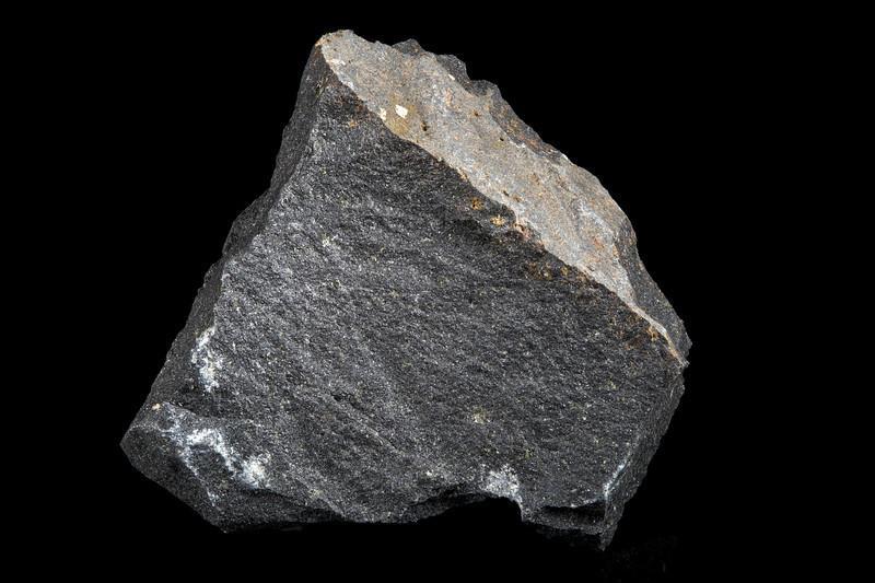
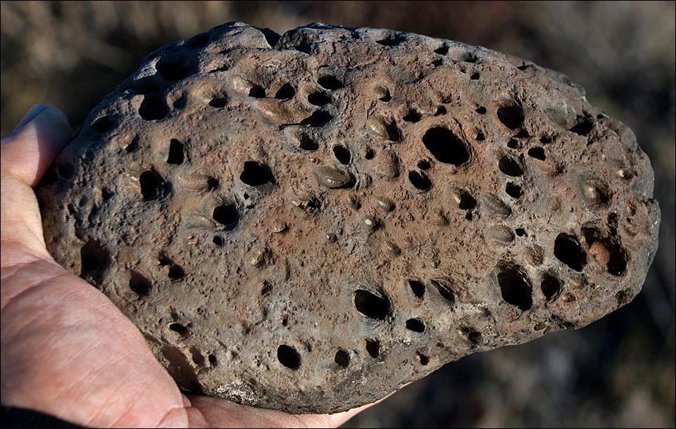
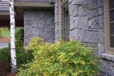
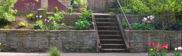
3 GENERAL DESCRIPTION, PHYSICAL/CHEMICAL PROPERTIES AND HISTORIC USE Columbia River Basalt (CRB) Group is the name given to a series of dark volcanic rocks which flooded SE Washington and adjacent parts of Idaho and Oregon from about 17.5 to 6 million years ago. CRB ranges from 0, at the edge of the Columbia Basin, to over 6000 feet thick at its center Generally chemically homogeneous, CRB is dark brown to black which weathers to a medium brown rough rind. Unlike most basalts, CRB overall has a high percentage of quartz with its main component, the Grande Ronde member close to an andesite. In addition, it is contains dark minerals (e.g. hornblende, proxenes, biotite, olivine, magnetite) and some feldspars. It is of medium density and has a tendency to fracture conchondially CRB has been locally used since the 1800s and is most commonly crushed for use as aggregate in industrial/ construction projects. It is also used as dimension stone for walls, tiling and occasionally veneers. Artistically, CRB is used for monuments and sculpture, often in some modified columnar form Chemical Composition of CRB* SiO % Al 2 O FeO MgO 5.25 CaO 8.97 Na 2 O 2.92 K 2 O 1.10 TiO P 2 O MnO 0.19 *Grande Ronde Member 3
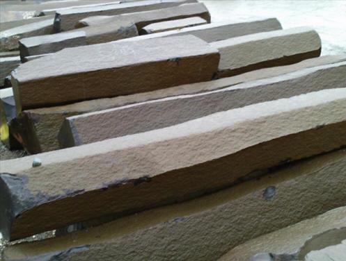
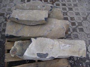
4 SPECIMENS: MACRO Outcrop Hand Specimen Prepped Slabs Quarried Columns 4


5 SPECIMENS: THIN SECTIONS ENTABLATURE (towards flow top) COLONNADE (towards flow bottom) 5

6 SPECIMENS: THIN SECTIONS 6
; medium-gray grains, pyroxene (Px); dark laths, plagioclase (Pl);")
7 SPECIMENS: THIN SECTIONS ENTABLATURE COLONNADE 1.1 mm Light colored grains, titaniferous magnetite (Mt); medium-gray grains, pyroxene (Px); dark laths, plagioclase (Pl); interstitial areas, glass plus inclusions of aphanitic groundmass (Ms) 7

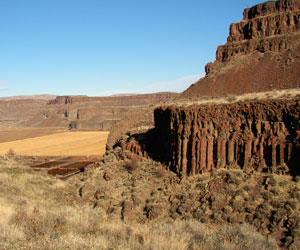
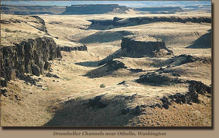
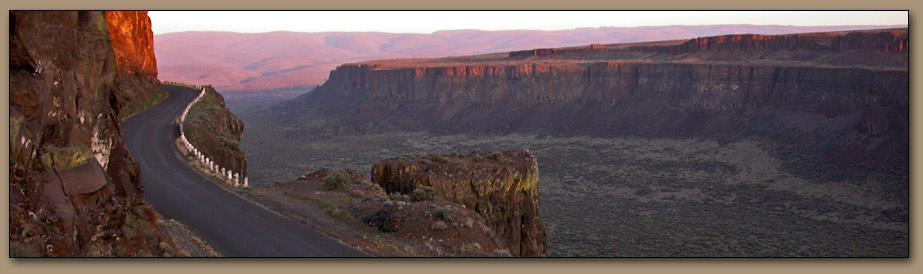
8 SPECIFIC OCCURRENCES The CRB occupies about 63,000 square miles of the Pacific Northwest. It is one of the largest basaltic lava floods in earth s history During a period 10 to 15 million years multiple flows of CRB occurred, eventually accumulating to a maximum thickness of more than 6,000 feet Over 300 high-volume individual lava flows have been identified, along with countless smaller flows. Numerous linear vents, some over 90 miles long, show where lava erupted near the eastern edge of the Columbia River Basalts As the CRB accumulated, the earths crust slowly sank under the weight of the basalt and into the space left by the rising lava. The subsidence of the crust produced a large, slightly depressed lava plain now known as the Columbia Basin (Plateau). 8
9 SPECIFIC OCCURRENCES 9

10 SPECIFIC OCCURRENCES The CRB basin and its subsequent erosion dominates the SE corner of Washington state Columbia River Basin Basalt Group 10

11 SPECIFIC OCCURRENCES The overall CRBG distribution is now recognized to cover a much larger area. 11

12 SPECIFIC OCCURRENCES: CRBG THICKNESS Isopach map of the CRBG shows that it is over feet thick in the center of the Columbis River Basin. Thicknesses have been determined by field and borehole stratigraphic sections. 12
 fed the Imnaha Basalt, which is confined to the southeast part of the province Most of the group was formed during a 1.5-m.y. period between about 17 and 15.")
13 AGE AND GEOLOGIC DESCRIPTION CRB erupted between 17.5 and 6 million years ago Early eruptions ( Ma) fed the Imnaha Basalt, which is confined to the southeast part of the province Most of the group was formed during a 1.5-m.y. period between about 17 and 15.5 Ma, resulting in the Grande Ronde Basalt and the greatly subordinate and geographically limited Picture Gorge Basalt Later eruptions formed the Wanapum Basalt (about Ma) and the Saddle Mountains Basalt (about 14-6 Ma) Relatively little erosion took place between flows, owing to the rapid rate of accumulation, except during Saddle Mountains time However, a regionally extensive saprolite (fossil soil) or a sedimentary interbed separates the Grande Ronde and Wanapum in most places; flows just below and above the contact typically are normally magnetized, so that the time represented by the break is most likely less than 100,000 years. In Saddle Mountains time, however, interflow erosion was significant, and most contacts are erosional unconformities. 13
14 AGE AND GEOLOGIC DESCRIPTION: TEMPORAL DISTRIBUTION AND DIFFERENTIATION OF BASALT FLOWS 14

15 AGE AND GEOLOGIC DESCRIPTION: SAMPLE OUTCROPS The base of the Wanapum Basalt and the uppermost Grande Ronde Basalt exposed in Crab Creek Coulee near Irby, a few miles west of Odessa, Washington. 15

16 AGE AND GEOLOGIC DESCRIPTION: SAMPLE OUTCROPS 16


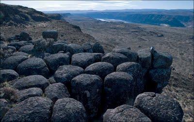
17 FORMATION ENVIRONMENT AND PROCESSES: CRB INTRAFLOW STRUCTURES METERS / FEET Vesicular Flow Top Upper Colonnade Hackly, Slender Columns Entablature Fanning Columns Sharp Base Blocky Divided Columns Lower Colonnade Pillow Zone (if CRB flowed into water 17


18 FORMATION ENVIRONMENT AND PROCESSES: CRB FLOW DYNAMICS Growth and inflation of lobes of lava by the internal injection of more lava Each pulse of new lava creates a thicker flow Flows advance by breakouts at the front of the flow 18


19 SHEET FLOW VS COMPOUND FLOW CRBG sheet flow volcanics have a different internal makeup and component distribution than conventional point source compound flows 19
20 FORMATION ENVIRONMENT AND PROCESSES: CRB CREATION - CURRENT IDEAS 20

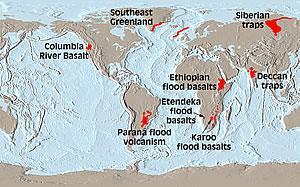
21 GLOBAL PALEOGRAPHIC SETTING 21

22 CRB 22


23 GLOBAL PALEOGRAPHIC SETTING: INTO THE PLIO- PLIESTOCENE Lake Missoula Floods: Plio-Pleistocene glacial and associated erosional activity created much of the current landscape of the CRB basin Massive flooding tied to the cyclical build-up and collapse of Lake Missoula gouged deep channels, coulees, across the CRB as the flood water surged west following the ancestral Columbia river path to the sea The floods flowed at 10 times the combined rates of all the rivers of the world with flood approaching 65 miles per hour Flooding repeatedly occurred for approximately 2,500 years 23

24 Dry Falls Frenchman Coulee 24


25 MODERN ANALOGS No exact modern analogs to the scale and tectonic locations of the CRB are active today However, active shield volcanoes and some current rifting zones may generally reflect the CRB s depositional environment Krafla, Iceland Mount Etna, Sicily Kīlauea, Hawaii


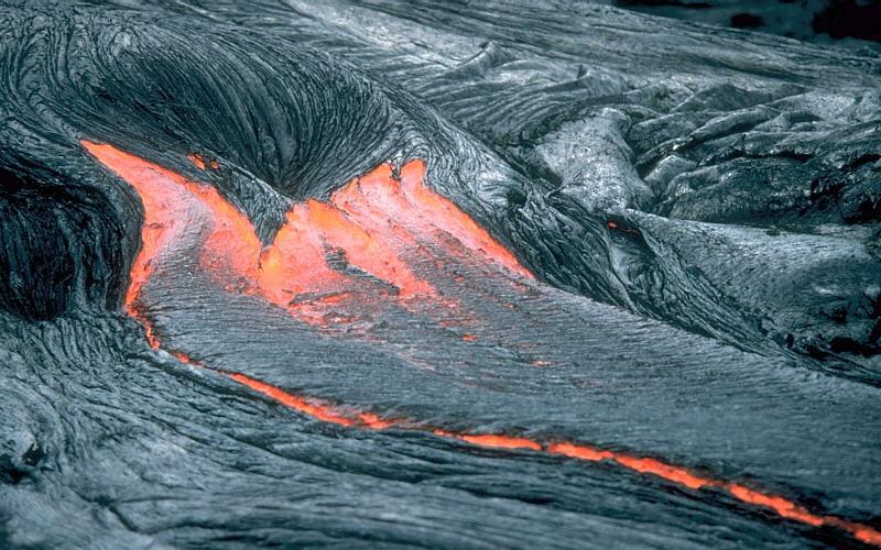
26 MODERN ANALOGS These flows, like the CRB, have low viscosity demonstrating rapid fluid flow 26


27 ART Galileo 2020 Basalt Goldleaf Tom Small Middle Columbia River region, Pile Driver, pre- 19th century, carved basalt, 10½" x 7" 3½". Opening to Grace" 36" high Basalt Sabah Al-Dhaher 27


28 ARCHITECTURE Harnish Boat House 1929 Lake Oswego First Congregation Church, Portland 28

29 29
 thick. The dry river canyons and scablands (extensively eroded basalt surfaces) were carved by glacial meltwaters.")
30 COLUMBIA RIVER BASIN Underlying the 100,000 square miles ( square kilometers) of the Columbia Basin are deposits of lava (mainly basalt) interbedded with sedimentary rock nearly 10,000 feet (3050 meters) thick. The dry river canyons and scablands (extensively eroded basalt surfaces) were carved by glacial meltwaters. An important agricultural and grazing area, the basin is also a major source of hydroelectric power The river alters its course to the west because of numerous lava beds, turns again to the south, where it is entrenched in a narrow valley through the central plateau region, and joins the Snake River south of Richland near Lake Wallula. 30
INTRODUCTION TO THE GEOLOGY AND HYDROGEOLOGY OF THE COLUMBIA RIVER BASALT GROUP
 INTRODUCTION TO THE GEOLOGY AND HYDROGEOLOGY OF THE COLUMBIA RIVER BASALT GROUP Prepared for: Columbia Basin GWMA Tour October 31, 2007 By: Terry L. Tolan, LHG Kevin A. Lindsey, LHG, PhD GSI Water Solutions,
The Example of the Lake Missoula Flood
 Chapter 85 The Example of the Lake Missoula Flood As already noted, uniformitarian hypotheses rarely, if ever, can be supported by extensive geological evidence. Part of this is due to the nature of the
GEOL1 Physical Geology Laboratory Manual College of the Redwoods Lesson Five: Volcanoes Background Reading: Volcanoes Volcanic Terms: Silca:
 Name: Date: GEOL1 Physical Geology Laboratory Manual College of the Redwoods Lesson Five: Volcanoes Background Reading: Volcanoes Volcanic Terms: Silca: SiO 2 silicon dioxide. This is quartz when it crystallizes.
Practice Test Rocks and Minerals. Name. Page 1
 Name Practice Test Rocks and Minerals 1. Which rock would be the best source of the mineral garnet? A) basalt B) limestone C) schist D) slate 2. Which mineral is mined for its iron content? A) hematite
The Nature of Igneous Rocks
 The Nature of Igneous Rocks Form from Magma Hot, partially molten mixture of solid liquid and gas Mineral crystals form in the magma making a crystal slush Gases - H 2 O, CO 2, etc. - are dissolved in
GEOLOGICAL FEATURES OF THE BADGER SPRINGS TRAIL FOR HIKERS Rev. 3,
 GEOLOGICAL FEATURES OF THE BADGER SPRINGS TRAIL FOR HIKERS Rev. 3, 12-3-02 http://ensayoes.com/docs/176/index-2111121.html Trail location The Badger Springs trail is just a short distance North of the
9/4/2015. Feldspars White, pink, variable Clays White perfect Quartz Colourless, white, red, None
 ENGINEERING GEOLOGY Chapter 1.0: Introduction to engineering geology Chapter 2.0: Rock classification Igneous rocks Sedimentary rocks Metamorphic rocks Chapter 3.0: Weathering & soils Chapter 4.0: Geological
THE GEOLOGY OF SCULPTING STONE INDIANA LIMESTONE
 THE GEOLOGY OF SCULPTING STONE INDIANA LIMESTONE 1 Michael E. Yeaman OUTLINE The Stone Defined General Description, Physical/Chemical Properties and Historic Use Specimens (macro and thin section) Specific
The Geology of Two Lights State Park. Cape Elizabeth, Maine
 Maine Geologic Facts and Localities June, 2002 Cape Elizabeth, Maine 43 33 33.48 N, 70 12 13.32 W Text by Henry N. Berry IV and Robert G. Marvinney, Department of Agriculture, Conservation & Forestry 1
Happy Tuesday. Pull out a ½ sheet of paper
 Happy Tuesday Pull out a ½ sheet of paper 1. Physical properties of a mineral are predominantly related to 1. the external conditions of temperature, pressure, and amount of space available for growth.
Gravel Transport Can Determine Late Flood Tectonics
 Chapter 23 Gravel Transport Can Determine Late Flood Tectonics The locations of all the quartzite gravel in the northwest states and adjacent Canada provide more information about the Flood than just reinforcing
23/9/2013 ENGINEERING GEOLOGY. Chapter 2: Rock classification:
 ENGINEERING GEOLOGY Chapter 2: Rock classification: ENGINEERING GEOLOGY Chapter 1.0: Introduction to engineering geology Chapter 2.0: Rock classification Igneous rocks Sedimentary rocks Metamorphic rocks
Igneous Rock Classification, Processes and Identification Physical Geology GEOL 100
 Igneous Rock Classification, Processes and Identification Physical Geology GEOL 100 Ray Rector - Instructor Major Concepts 1) Igneous rocks form directly from the crystallization of a magma or lava 2)
Directed Reading. Section: Rocks and the Rock Cycle. made of a. inorganic matter. b. solid organic matter. c. liquid organic matter. d. chemicals.
 Skills Worksheet Directed Reading Section: Rocks and the Rock Cycle 1. The solid part of Earth is made up of material called a. glacial ice. b. lava. c. rock. d. wood. 2. Rock can be a collection of one
Imagine the first rock and the cycles that it has been through.
 A rock is a naturally formed, consolidated material usually composed of grains of one or more minerals The rock cycle shows how one type of rocky material gets transformed into another The Rock Cycle Representation
Overview of Ch. 4. I. The nature of volcanic eruptions 9/19/2011. Volcanoes and Other Igneous Activity Chapter 4 or 5
 Overview of Ch. 4 Volcanoes and Other Igneous Activity Chapter 4 or 5 I. Nature of Volcanic Eruptions II. Materials Extruded from a Volcano III.Types of Volcanoes IV.Volcanic Landforms V. Plutonic (intrusive)
What mainly controls eruptive style?
 Introduction to volcanoes, volcanic eruptions, and volcanic landforms Previous: Magmatic differentiation, Bowens Reaction series (mineral melting points), mafic vs. felsic (fluid vs. sticky) Video: Lava
Introduction to Earth s s Spheres The Benchmark
 Introduction to Earth s s Spheres The Benchmark Volcanism Volcanic eruptions Effusive: lavas (e.g., Kilauea) Volcanism Volcanic eruptions Explosive: pyroclastic rocks (e.g., Krakatau) Factors Governing
Sculpted by Floods Learning Resource Guide
 Sculpted by Floods Learning Resource Guide Overview: KSPS s Sculpted by Floods tells the story of the ice age floods in the Pacific Northwest. It is a story of the earth's power, scientific discovery and
VOLCANOES. {Singing} I don t know, I don t know, I don t know where I am-a gonna go when the volcano blows!
 Name: Tymesha B, Manny U, Malaika R VOLCANOES {Singing} I don t know, I don t know, I don t know where I am-a gonna go when the volcano blows! --Jimmy Buffett Part 1 Volcanic History of New Jersey Use
Chapter 5 9/10/2011. Introduction. Volcanoes and Volcanism. Volcanism. Introduction. Introduction. Introduction
 Introduction Chapter 5 Volcanism is the eruption of magma, and associated gases at the surface. Some magma erupts explosively as pyroclastic (fire-broken) rock and other erupts as lava flows. Volcanoes
Today I will describe the groundwater/surface water interaction in the CRB in Mosier basin.
 Today I will describe the groundwater/surface water interaction in the CRB in Mosier basin. 1 Ken Lite, studying groundwater resource in Mosier basin since 1980 s (photo by A. Bouchier) 2012 with Jonathan
Lecture 3 Rocks and the Rock Cycle Dr. Shwan Omar
 Rocks A naturally occurring aggregate of one or more minerals (e.g., granite), or a body of non-crystalline material (e.g., obsidian glass), or of solid organic material (e.g., coal). Rock Cycle A sequence
Foundations of Earth Science, 6e Lutgens, Tarbuck, & Tasa
 Foundations of Earth Science, 6e Lutgens, Tarbuck, & Tasa Fires Within: Igneous Activity Foundations, 6e - Chapter 7 Stan Hatfield Southwestern Illinois College The nature of volcanic eruptions Characteristics
The Bishop Tuff : An Overview of the World s Roughest and Toughest Volcanic Landform
 The Bishop Tuff : An Overview of the World s Roughest and Toughest Volcanic Landform Charity J. Southworth Indiana University, 2012 Abstract The Bishop Tuff is a welded tuff that was created 760,000 years
EXTENSION MODULE A. Introduction. B. Dynamics of Glacial Lakes
 EXTENSION MODULE 18.1 Humongous Ice-Age Floods in the Pacific Northwest This module describes the unusual landscape features produced by dozens of humongous-discharge floods that crossed the Pacific Northwest
Term 1 final review ES
 Name: Date: 1. t what approximate altitude in the atmosphere can stratospheric ozone be found?. 10 km. 30 km. 70 km D. 100 km 2. What percentage of Earth s history represents human existence?. less than
Page 1. Name:
 Name: 1) Which property would best distinguish sediment deposited by a river from sediment deposited by a glacier? thickness of sediment layers age of fossils found in the sediment mineral composition
What is Inside a Volcano?
 Volcanoes What is Inside a Volcano? A magma chamber filled with molten rock deep underground that feeds the volcano Magma is released through vents during an eruption Types of Volcanic Eruptions Non-Explosive
Chapter 4 Rocks & Igneous Rocks
 Chapter 4 Rocks & Igneous Rocks Rock Definition A naturally occurring consolidated mixture of one or more minerals e.g, marble, granite, sandstone, limestone Rock Definition Must naturally occur in nature,
Magma. Objectives. Describe factors that affect the formation of magma. Compare and contrast the different types of magma. Vocabulary.
 Magma Objectives Describe factors that affect the formation of magma. Compare and contrast the different types of magma. Vocabulary viscosity Magma Magma The ash that spews from some volcanoes can form
Geology 1 st Semester Exam YSBAT
 1. What is the role of a geologist? Geology 1 st Semester Exam YSBAT 2016-2017 2. Earth is subdivided into three main layers based on what? 3. What features do you find at divergent boundaries? 4. Rock
Chapter 10. Chapter Rocks and the Rock Cycle. Rocks. Section 1 Rocks and the Rock Cycle
 Chapter 10 Rocks 1 Chapter 10 Section 1 Rocks and the Rock Cycle 2 10.1 Rocks and the Rock Cycle Magma is the parent material for all rocks. Once the magma cools and hardens, many changes can occur. Geology:
GEOLOGY MEDIA SUITE Chapter 12
 UNDERSTANDING EARTH, SIXTH EDITION GROTZINGER JORDAN GEOLOGY MEDIA SUITE Chapter 12 Volcanoes 2010 W.H. Freeman and Company Plate tectonics explains the global pattern of volcanism. Key Figure 12.20 (page
The Marine Environment
 The Marine Environment SECTION 16.1 Shoreline Features In your textbook, read about erosional landforms, beaches, estuaries, longshore currents, and rip currents. For each statement below, write or. 1.
The Rock Cycle The Rock Cycle illustrates the origin of igneous, sedimentary and metamorphic rocks
 The Rock Cycle The Rock Cycle illustrates the origin of igneous, sedimentary and metamorphic rocks Igneous rocks form as molten magma or lava cools and solidifies. Magma is completely or partly molten
Volcano Vocabulary ROCK CYCLE. Igneous REMELTED REMELTED BURIED BURIED HEAT ERODED DEPOSITED. Metamorphic Sedimentary ERODED, TRANSPORTED DEPOSITED
 Volcano Vocabulary VOLCANISM VENT CRATER CALDERA QUIET ERUPTION EXPLOSIVE ERUPTION PYROCLASTIC DEBRIS CINDER CONE SHIELD VOLCANO COMPOSITE VOLCANO STRATO VOLCANO ACTIVE DORMANT EXTINCT INTRUSION DIKE SILL
Movement of the Earth s Crust: Formation of: Mountain s Plateau's and Dome s
 Movement of the Earth s Crust: Formation of: Mountain s Plateau's and Dome s References Information taken from several places including Prentice Hall Earth Science: @ http://www.eram.k12.ny.us/education/components/docmgr/default.php?sectiondetaili
Block: Igneous Rocks. From this list, select the terms which answer the following questions.
 Geology 12 Name: Mix and Match: Igneous Rocks Refer to the following list. Block: porphyritic volatiles mafic glassy magma mixing concordant discontinuous reaction series igneous vesicular partial melting
Continental Landscapes
 Continental Landscapes Landscape influenced by tectonics, climate & differential weathering Most landforms developed within the last 2 million years System moves toward an equilibrium Continental Landscapes
Rocks. Types of Rocks
 Rocks Rocks are the most common material on Earth. They are naturally occurring aggregates of one or more minerals. 1 Igneous rocks, Types of Rocks Sedimentary rocks and Metamorphic rocks. 2 1 3 4 2 IGNEOUS
State the principle of uniformitarianism. Explain how the law of superposition can be used to determine the relative age of rocks.
 Objectives State the principle of uniformitarianism. Explain how the law of superposition can be used to determine the relative age of rocks. Compare three types of unconformities. Apply the law of crosscutting
What Do You See? Learning Outcomes Goals Learning Outcomes Think About It Identify classify In what kinds of environments do igneous rocks form?
 Section 2 Igneous Rocks and the Geologic History of Your Community What Do You See? Learning Outcomes In this section, you will Goals Text Learning Outcomes In this section, you will Identify and classify
GIFFORD PINCHOT STATE PARK DIABASE (MOLTEN LIQUID ROCK)
") PENNSYLVANIA TRAIL OF GEOLOGY PARK GUIDE 10 GIFFORD PINCHOT STATE PARK DIABASE (MOLTEN LIQUID ROCK) Gifford Pinchot State Park contains examples of the three major rock classes: igneous, metamorphic, and
PENNSYLVANIA TRAIL OF GEOLOGY PARK GUIDE 10 GIFFORD PINCHOT STATE PARK DIABASE (MOLTEN LIQUID ROCK) Gifford Pinchot State Park contains examples of the three major rock classes: igneous, metamorphic, and
Earth has more than 600 active volcanoes. An active volcano is one that has erupted within recorded history.
 Volcanoes A volcano is an opening in Earth s surface that erupts gases, ash, and lava. These materials pile up in layers around the opening, forming volcanic mountains. Earth has more than 600 active volcanoes.
From Punchbowl to Panum: Long Valley Volcanism and the Mono-Inyo Crater Chain
 From Punchbowl to Panum: Leslie Schaffer E105 2002 Final Paper Long Valley Volcanism and the Mono-Inyo Crater Chain Figure 1. After a sequence of earthquakes during the late 1970 s to the early 1980 s
The Geology of Sebago Lake State Park
 Maine Geologic Facts and Localities September, 2002 43 55 17.46 N, 70 34 13.07 W Text by Robert Johnston, Department of Agriculture, Conservation & Forestry 1 Map by Robert Johnston Introduction Sebago
Page 1. Name:
 Name: Questions 1 through 3 refer to the following: The diagrams below represent two rock outcrops found several miles apart in New York State. Individual rock layers are lettered, and fossils and rock
Earth s Changing Surface
 Earth s Changing Surface Fourth grade scientists are introduced to the scope of geologic time and learn about forces that change our Earth s surface. During their study, students use scientific modeling
How 2 nd half labs will work
 How 2 nd half labs will work Continue to use your mineral identification skills Learn to describe, classify, interpret rock hand samples: Igneous sedimentary metamorphic volcanic plutonic (1 week) (1 wk)
Earth, the Lively* Planet. * not counting the life on the planet!
 Earth, the Lively* Planet * not counting the life on the planet! What We Will Learn Today What are planet Earth s features? What processes shape planetary surfaces? How does Earth s surface move? How did
Hydraulic Modeling of the Missoula Ice Dam Failure. Christopher R. Goodell, P.E., D.WRE WEST Consultants, Salem, OR
 Hydraulic Modeling of the Missoula Ice Dam Failure Christopher R. Goodell, P.E., D.WRE WEST Consultants, Salem, OR 1 Introduction 10-40 thousand years ago during the last ice age Image courtesy gis4geomorphology.com
Engineering Geology ECIV 2204
 Engineering Geology ECIV 2204 2017-2016 Chapter (4) Volcanoes Chapter 4: Volcanoes and Other Igneous Activity cataclysmic relating to or denoting a violent natural even Eventually the entire
core mantle crust the center of the Earth the middle layer of the Earth made up of molten (melted) rock
 rock") core the center of the Earth mantle the middle layer of the Earth made up of molten (melted) rock crust the surface layer of the Earth that includes the continents and oceans 1 continental drift the theory
core the center of the Earth mantle the middle layer of the Earth made up of molten (melted) rock crust the surface layer of the Earth that includes the continents and oceans 1 continental drift the theory
One of the tasks of the Floods Study Team was to determine if any new facilities
 8. Development and Enhancement of Interpretive Facilities One of the tasks of the Floods Study Team was to determine if any new facilities would be needed to help interpret the Floods story, or if any
The Little Colorado River
 The Little Colorado River The Little Colorado River Junction of the Little Colorado River and the Colorado Grand Falls of the Little Colorado River The relief/topo map at the right shows the junction of
The spectacular scenery that one sees while traveling through the Columbia River
 The spectacular scenery that one sees while traveling through the Columbia River Gorge from The Dalles to the city of Portland has its origins 40-36 million years ago in the late Eocene and early Oligocene
4. Starting with a supercontinent, order the following tectonic actions of the Wilson cycle from oldest (1) to most recent (4)
 to most recent (4)") Geology 101 Sample final exam (Chapters 1 9, 13, 16) Open textbook, notes, handouts, labs, field trip module, group projects, midterm exams, calculators. No collaboration. 100 points total, two hours.
Geology 101 Sample final exam (Chapters 1 9, 13, 16) Open textbook, notes, handouts, labs, field trip module, group projects, midterm exams, calculators. No collaboration. 100 points total, two hours.
Exploring Geography. Chapter 1. Chapter 1, Section
 Chapter 1, Section World Geography Chapter 1 Exploring Geography Copyright 2003 by Pearson Education, Inc., publishing as Prentice Hall, Upper Saddle River, NJ. All rights reserved. Chapter 1, Section
OCN 201 Mantle plumes and hot spots
 OCN 201 Mantle plumes and hot spots Question Long-term (>50 million years) changes in sea level are caused by: A. Changes in the volume of water in the ocean B. Changes in the volume of the ocean basins
Engineering Geology. Igneous rocks. Hussien Al - deeky
 Igneous rocks Hussien Al - deeky 1 The Geology Definition of Rocks In Geology Rock is defined as the solid material forming the outer rocky shell or crust of the earth. There are three major groups of
Principles of Geology
 Principles of Geology Essential Questions What is Uniformitarianism? What is Catastrophism? What is Steno s s Law? What are the other geologic principles? How is relative age determined using these principles?
Question #1: What are some ways that you think the climate may have changed in the area where you live over the past million years?
 Reading 5.2 Environmental Change Think about the area where you live. You may see changes in the landscape in that area over a year. Some of those changes are weather related. Others are due to how the
Plate Tectonics Lab II: Background Information
 Plate Tectonics Lab II: Background Information This lab is based on a UW ESS101 Lab. Note: Hand in only the Answer Sheet at the back of this guide to your Instructor Introduction One of the more fundamental
Jordan Craters Volcanic Field
 14 July 2018 Jordan Craters Volcanic Field Nick Pollock, Ph.D. Candidate Department of Geosciences, Boise State University First, A Note of Caution! The Jordan Craters Volcanic Field contains a few potential
Columbia River Gorge Near Perfection... And Only 40+ Million Years in the Making
 Columbia Gorge Geology and the Ice Age Floods Columbia River Gorge Near Perfection... And Only 40+ Million Years in the Making Lloyd DeKay, Ice Age Floods Institute - Columbia Gorge Chapter GorgeFloods.org
Magma. Objectives. Describe factors that affect the formation of magma. Compare and contrast the different types of magma. Vocabulary.
 Magma Objectives Describe factors that affect the formation of magma. Compare and contrast the different types of magma. Vocabulary viscosity Magma Magma The ash that spews from some volcanoes can form
Effects of Eruptions. Most active in the world Kilauea, Hawaii.
 Inside of Old Smokey, All covered with snow, Lurk tons of hot magma, Getting ready to blow, Objectives: From deep in the chamber, Describe how volcanoes can affect people. Up a vent to the top, Describe
Engineering Geology ECIV 2204
 Engineering Geology ECIV 2204 Instructor : Dr. Jehad Hamad 2017-2016 Chapter (3) Igneous Rocks Chapter 3: Rocks: Materials of the Solid Earth Igneous Rocks Chapter 3: Rocks: Materials of the Solid Earth
The boulder was most likely moved to this location by A) glacial ice B) prevailing wind C) streamfiow D) volcanic action
 glacial ice B) prevailing wind C) streamfiow D) volcanic action") 1. Which rock material was most likely transported to its present location by a glacier? A) rounded sand grains found in a river delta B) rounded grains found in a sand dune C) residual soil found on a
1. Which rock material was most likely transported to its present location by a glacier? A) rounded sand grains found in a river delta B) rounded grains found in a sand dune C) residual soil found on a
24. Ocean Basins p
 24. Ocean Basins p. 350-372 Background The majority of the planet is covered by ocean- about %. So the majority of the Earth s crust is. This crust is hidden from view beneath the water so it is not as
THE DISSECTED VOLCANO OF CRANDALL BASIN, WYOMING.*
 THE DISSECTED VOLCANO OF CRANDALL BASIN, WYOMING.* THE writer in exploring the north-eastern corner of the Yellowstone National Park and the country east of it came upon evidences of a great volcano, which
Introduction. Volcano a vent where molten rock comes out of Earth
 Introduction Volcano a vent where molten rock comes out of Earth Example: Kilauea Volcano, Hawaii Hot (~1,200 o C) lava pools around the volcanic vent. Hot, syrupy lava runs downhill as a lava flow. The
EROSIONAL FEATURES. reflect
 reflect Have you ever looked at the land around you and wondered what processes shaped what you see? Perhaps you see mountains, valleys, rivers, or canyons. Do you know how long these geologic features
Essentials of Geology, 11e
 Essentials of Geology, 11e Igneous Rocks and Intrusive Activity Chapter 3 Instructor Jennifer Barson Spokane Falls Community College Geology 101 Stanley Hatfield Southwestern Illinois College Characteristics
Pacific NW Rocks and Minerals GEO143 Activity 5: Radioactive Decay and CRB Ages
 Name: Date: The Columbia River Flood Basalts (CRB) geologic province is a region of eastern Washington, eastern Oregon, the extreme northwest Nevada, and western Idaho where continental flood basalts erupted
=%REPORT RECONNAISSANCE OF CHISHOLM LAKE PROSPECT. October 25, 1977
 =%REPORT ON FIELD RECONNAISSANCE OF CHISHOLM LAKE PROSPECT October 25, 1977 Bruce D. Vincent Imperial Oil Limited, Minerals - Coal, CALGARY, ALBERTA CHISHOLM LAKE PROSPECT Introduction The Chisholm Lake
4. The map below shows a meandering stream. Points A, B, C, and D represent locations along the stream bottom.
 1. Sediment is deposited as a river enters a lake because the A) velocity of the river decreases B) force of gravity decreases C) volume of water increases D) slope of the river increases 2. Which diagram
1. minerals - A naturally occurring substance that takes a solid Crystal form and is made of only a single (one) type of compound
 type of compound") Science Name: Mr. G/Mrs. Kelly KEY Date: Study Guide - Lessons 5 and 6 Test Define the following terms: 1. minerals - A naturally occurring substance that takes a solid Crystal form and is made of only
Science Name: Mr. G/Mrs. Kelly KEY Date: Study Guide - Lessons 5 and 6 Test Define the following terms: 1. minerals - A naturally occurring substance that takes a solid Crystal form and is made of only
Forces That Shape Earth. How do continents move? What forces can change rocks? How does plate motion affect the rock cycle?
 Forces That Shape Earth How do continents move? What forces can change rocks? How does plate motion affect the rock cycle? Plate Motion Mountain ranges are produced by plate tectonics. The theory of plate
Rock Cart for High School Students
 Rock Cart for High School Students Goals and Objectives for high school students (9 th 12 th grade): 1) Define igneous rocks 2) Discuss chemical composition of rocks 3) Understand the plate tectonics and
The 3 types of rocks:
 Igneous Rocks and Intrusive Igneous Activity The 3 types of rocks:! Sedimentary! Igneous! Metamorphic Marble 1 10/7/15 SEDIMENTARY ROCKS Come from rocks sediments (rock fragments, sand, silt, etc.) Fossils
INTRODUCTION ROCK COLOR
 LAST NAME (ALL IN CAPS): FIRST NAME: 6. IGNEOUS ROCKS Instructions: Some rocks that you would be working with may have sharp edges and corners, therefore, be careful when working with them! When you are
PALEOGEOGRAPHY of NYS. Definitions GEOLOGIC PROCESSES. Faulting. Folding 9/6/2012. TOPOGRAPHIC RELIEF MAP of NYS GRADATIONAL TECTONIC
 TOPOGRAPHIC RELIEF MAP of NYS PALEOGEOGRAPHY of NYS Prof. Anthony Grande AFG 2012 Definitions GEOLOGIC PROCESSES Geography: study of people living on the surface of the earth. Geology: the scientific study
Figure 1 The map shows the top view of a meandering stream as it enters a lake. At which points along the stream are erosion and deposition dominant?
 1. In which type of climate does chemical weathering usually occur most rapidly? 1. hot and dry 3. cold and dry 2. hot and wet 4. cold and wet 2. Figure 1 The map shows the top view of a meandering stream
WHAT IS A MAGMA. Magma is a mixture of molten rock, volatiles and solids that is found beneath the surface of the Earth.
 UNIT - 8 VOLCANOES WHAT IS A MAGMA Magma is a mixture of molten rock, volatiles and solids that is found beneath the surface of the Earth. In some instances, it solidifies within the crust to form plutonic
Types of Volcanoes KEY CONCEPT: TECTONIC PLATE MOTIONS CAN RESULT IN VOLCANIC ACTIVITY AT PLATE BOUNDARIES.
 Types of Volcanoes KEY CONCEPT: TECTONIC PLATE MOTIONS CAN RESULT IN VOLCANIC ACTIVITY AT PLATE BOUNDARIES. Volcanoes How do volcanoes work? How do volcanoes work? Magma is forced onto Earth s surface.
Draw a picture of an erupting volcano and label using the following words/phrases: magma; lava; cools slowly; cools quickly; intrusive; extrusive
 Lesson 3.2a NOTES: Igneous Rocks (Unlock) Essential Question: How are igneous rocks described? Learning Target: I can describe how igneous rocks are formed and classified Igneous Rock How does igneous
Copyright McGraw-Hill Education. All rights reserved. No reproduction or distribution without the prior written consent of McGraw-Hill Education
 Copyright McGraw-Hill Education. All rights reserved. No reproduction or distribution without the prior written consent of McGraw-Hill Education Tibetan Plateau and Himalaya -southern Asia 11.00.a VE 10X
Maine Geologic Facts and Localities October, Lobster Lake, Maine. Text by Robert G. Marvinney. Maine Geological Survey
 Maine Geologic Facts and Localities October, 1998 Lobster Lake, Maine 45 o 51 7.91 N, 69 o 30 53.88 W Text by Robert G. Marvinney, Department of Agriculture, Conservation & Forestry 1 Map by Introduction
Midterm Review. Nata/Lee
 Name: 1. Which statement best supports the theory that all the continents were once a single landmass? (1) Rocks of the ocean ridges are older than those of the adjacent sea floor. (2) Rock and fossil
6. IGNEOUS ROCKS AND VOLCANIC HAZARDS
 LAST NAME (ALL IN CAPS): FIRST NAME: 6. IGNEOUS ROCKS AND VOLCANIC HAZARDS Instructions: Refer to Laboratory 5 in your lab book on pages 129-152 to answer the questions in this work sheet. Your work will
Plio-Pleistocene Geology
 UNIVERSITY OF SOUTH ALABAMA GY 112: Earth History Plio-Pleistocene Geology Instructor: Dr. Douglas W. Haywick Last Time A) Cenozoic Tectonics Western North American tectonic provinces Plateaus and canyons
2-D potential field modeling across the Hawtmi and Wiahatya faults in search of geothermal resources within the Umatilla Indian Reservation
 2-D potential field modeling across the Hawtmi and Wiahatya faults in search of geothermal resources within the Umatilla Indian Reservation Grober, Benjamin L. 1 & Palmer, Zachary A. 1 1 U.S. Geological
Objectives: Describe how volcanoes can affect people. Describe conditions that cause volcanoes. Describe the relationship between volcanoes and Earth
 Objectives: Describe how volcanoes can affect people. Describe conditions that cause volcanoes. Describe the relationship between volcanoes and Earth s moving plates. Inside of Old Smokey, All covered
Lesson 3: Understanding the Properties of Rocks
 Lesson 3: Understanding the Properties of Rocks 1 Igneous Sedimentary Metamorphic Magma 2 I. Igneous rocks are called fire rocks and are formed either underground or above ground. A. Underground, they
ES 104 Lab Quiz Name: _ Sample _KEY DO NOT WRITE ON THIS SHEET. USE THE SCANTRON FORM!
 ES 104 Lab Quiz Name: _ Sample _KEY DO NOT WRITE ON THIS SHEET. USE THE SCANTRON FORM! 1.1 Color in the shadowed side of Moon. This side is in shadow this side is lighted This diagram shows the moon in
Marine Science and Oceanography
 Marine Science and Oceanography Marine geology- study of the ocean floor Physical oceanography- study of waves, currents, and tides Marine biology study of nature and distribution of marine organisms Chemical
A Geological Tour of Tumbledown Mountain, Maine
 Maine Geologic Facts and Localities April, 1998 A Geological Tour of Tumbledown Mountain, Maine 44 45 3.21 N, 70 32 50.24 W Text by Robert G. Marvinney, Department of Agriculture, Conservation & Forestry
Landscape. Review Note Cards
 Landscape Review Note Cards Last Ice Age Pleistocene Epoch that occurred about 22,000 Years ago Glacier A large, long lasting mass of ice which forms on land and moves downhill because of gravity. Continental