3-D Seismic Design on Land a juggling act with image, economics and the environment
|
|
|
- Edith Fletcher
- 5 years ago
- Views:
Transcription
1 3-D Seismic Design on Land a juggling act with image, economics and the environment Presented to the Geological Society of Trinidad and Tobago by Norm Cooper, President of Mustagh Resources Ltd. April 21, 2005 While many courses have been taught on the theory of seismic program design, Norm Cooper will review a common sense approach to the process. Beginning with the problem of designing a 3D grid to capture desired elements of the acoustic wavefield, we will introduce the use of full wave equation modeling. Viewing animated wavefields for a few simple examples will allow us to visualize the significance of wavefield elements and apparent dips. Once spatial sampling is evaluated (either by calculations or by modeling), then it is an easy matter to design a survey that will do an excellent job of imaging our objectives. Only three things stand between us and a great seismic survey: economics, a concern for our environment and a myriad of types of noise! We must compromise our design by contemplating how sparse can we decimate our ideal grid and still be able to achieve a certain objective (too often expressed as a target fold ). This will lead us towards a sparser, but affordable grid. However, the value of the program is not retained if it does not lead to successful imaging of our targets. Perhaps the greatest (and most often underestimated) factor is the magnitude and type of noise we may encounter in our prospect. Study of surface conditions and previous seismic data should lead us towards a more optimal solution. Therefore, we begin our juggling act by weighing seismic imaging against affordability, hopefully with a good understanding of the local noise characteristics. However, we must ensure that our surveys minimize environmental impact and that they are achievable with available equipment and within appropriate time frames. These harsh realities add more elements to our juggling act. While each constraint serves to restrict our choice of design, many options remain open. 3-D design remains an under-constrained problem, were there are more possible design solutions than there are constraints to direct the solution. The best design will depend on the importance given to each constraint. One thing we know whatever design we start with on paper, it will be modified by reality when we implement it in the field. Our choices should favor the designs which are most robust in the presence of perturbation. There will be lots of room for imagination and examples of some unconventional solutions will be reviewed.


2 3-D Seismic Design on Land - a juggling act Norm Cooper and Yajaira Herrera 1 2 Norm Cooper Graduated from UBC in 1977 BSc with a major in Geophysics Amoco Canada 1977 to 1981 Voyager Petroleums Ltd to 1983 Mustagh Resources Ltd. Founded in Yajaira Herrera Graduated from University of Zulia, Venezuela in 1994 BSc in Industrial Engineering PDVSA Lubvenca MSc in Mechanical Engineering from U of C in 1999 Mustagh 1998 to present Mustagh Resources Ltd. Since 1983 we have specialized in all types of Geophysical Consulting: Design and Management of 2D and 3D seismic programs. Quality Assurance and Parameter Optimization on program start ups


3 Mustagh Resources Ltd. We provide training programs in: Application of Seismic Methods, Land Seismic Acquisition, Array Theory, Instrumentation 3D design, Vibroseis Theory, and Basic Processing Mustagh Resources Ltd. We have worked extensively throughout onshore Canadian basins. We design and implement programs each year. We visit about 20 seismic crews per year. 7 8 Mustagh Resources Ltd. We have worked in over 26 countries across 6 continents Image Quality Economics Environment Timing Canada, USA, Mexico, Nicaragua Argentina, Venezuela, Trinidad England, North Ireland, Poland, France, Germany Algeria, Tunisia, Libya, Egypt, Sudan, Chad, Mozambique Russia, Iran, Oman, Yemen, Qatar, Pakistan, Malaysia, Borneo, Japan, New Zealand 9 3-D Seismic Design on Land - a juggling act 10 Objectives of Seismic From the surface of the earth, create images of subsurface geologic features to assist in finding and producing Oil and/or Gas reservoirs Image quality should be accurate in shape, character and location of stratigraphic and structural features Cost of obtaining seismic images should be small compared to drilling costs 11 Our Model of the Exploration Cycle Modeling Design Interpretation Acquisition Processing 12 2


4 Horizon Slice from a 3D Data Volume Basal Cretaceous Fluvial System, Alberta 13 Henry Posamentier, Shore Margin Deposits - Michael River Horizon Slice from a 3D Data Volume Shore Margin Gerry Reinson, Henry Posamentier, Visualization 2-D imaging From VeritasDGC webpage


5 3-D imaging The Need for 3D Seismic Mustagh Resources Ltd. An example of an Orthogonal 3D grid... Overview of 3-D Theory An example of an Orthogonal 3D grid... An example of an Orthogonal 3D grid... Source Interval Source Line Spacing Receiver Line Spacing Receiver Interval


6 An example of an Orthogonal 3D grid... 3D Survey with the Bin Grid Superimposed BOX area A Single Source-Receiver Pair and the associated Mid-Point Two Source-Receiver Pairs can share the same Mid-Point This represents a Near Offset 27 We have added a Mid Offset 28 Three Source-Receiver Pairs sharing a common Mid-Point 20 Source-Receiver Pairs sharing a common Mid-Point Now we have added a Far Offset 29 Note the Offset and Azimuth Distribution 30 5


7 Mustagh Resources Ltd. Bin Size Considerations Continuous wavefield in space exhibits different apparent wavelengths


8 Continuously measured wavefield discretely measured with geophone groups discretely measured with geophone groups 20 m Bins 10 m trace spacing 100 m trace spacing m Bins 40 m Bins

9 50 m Bins Tesseral Model based on Kugler Cross-section Tesseral Model based on Kugler Cross-section Tesseral Model wavefield propogation secs Tesseral Model wavefield propogation secs Tesseral Model wavefield propogation secs
10 Tesseral Model wavefield propogation secs Tesseral Model wavefield propogation secs Tesseral Model wavefield propogation secs Tesseral Model wavefield propogation secs Tesseral Model wavefield propogation secs Tesseral Model wavefield propogation secs
11 Tesseral Model wavefield propogation secs Tesseral Model wavefield propogation secs Tesseral Model wavefield propogation secs Tesseral Model with five prospective zones Tesseral Simulated Stacked Section unmigrated Tesseral Simulated Stacked Section unmigrated


12 Tesseral Simulated Stacked Section Stolt F-K Migration Mustagh Resources Ltd. Modeling Tesseral Model based on Kugler Cross-section 65 Shot Wavefield Animation 66 11


13 shot simulation 67 shot simulation 68 Before Normal Move Out After Normal Move Out 100m After Mute 10 % stretch After Mute 15 % stretch 12


14 After Mute 20 % stretch Gjis Vermeer s Crossed Line view Gjis Vermeer s Crossed Line view... Gjis Vermeer s Crossed Line view Gjis Vermeer s Crossed Line view... Crossed Line - offset limited


15 Crossed Line - Nine intersections Crossed Line - 25 intersections Effect of changing Mute m Effect of changing Mute m Effect of changing Mute m Effect of changing Mute m

 fold will be : 4 SL R 2 RL.")

16 Effect of changing Mute m Our patch should be large enough to encompass all useable offsets longer offsets may not contribute to the fold at our zone of interest 86 Then the useful subsurface coverage... Calculation of 3-D Fold The rectangular fold will be: Surface Patch Area 4 Source Line Spacing Receiver Line Spacing And the offset limited (circular) fold will be : 4 SL R 2 RL... will be R 2 / Assuming a patch encompassing all useable offsets 2-D Design versus 3-D Design Source interval drives the cost of 2-D: Source Interval Offset max Desired Fold Grid density drives the cost of 3-D: SL RL Offset 4 Desired 2 max Fold Mustagh Resources Ltd. LiDAR
17 1:250,000 Topographic Map 1:50,000 Topographic Map m/pixel Satellite Imagery LiDAR-Based DEM LiDAR-Based Slope Map 1:250,000 Topographic Map
18 1:50,000 Topographic Map 12.5 m/pixel Satellite Imagery LiDAR-Based DEM LiDAR-Based Slope Map Mustagh Resources Ltd. Hilly Terrain - hills are small but quite steep The Field and Some Tools


19 Many sharp hills and gullies Steep Terrain - Hills may be up to 30 o or more East-west Flowlines will be crossed by most north-south lines Road cut showing uniform dry clays in near surface 107 Firm clays vertically laminated near eastern Teak forest Mulchers in Canada


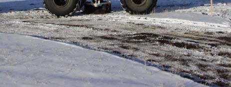


20 2500 RPM Mini-Vib in Canada


21 MiniVib Litton? Max. Theoretical Force 11,970 lb A x P H Piston Area 3.99 in 2??? Reaction Mass Weight 990 lb 7,800 lb Reaction Mass Stroke 2.75 in 3.00 in ServoValve Flow 60 gpm 200 gpm Baseplate Surface Area 1810 in in 2 Baseplate Assembly Weight 855 lb 3,800 lb Hold Down Weight 13,200 lb 60,000 lb 115 I/O X-Vib in Canada 116 This is NOT a marine vibrator!! Buggy Vibrators in Oman SeisPulse in Nicaragua


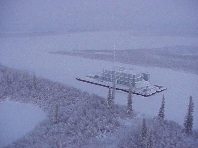
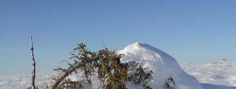


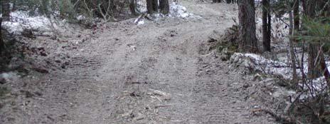
22 AWD-1180 Compressed Nitrogen working in Chad AWG - DigiPulse in Chad Polaris and Apache developed the Explorer in Canada MacKenzie Delta Norm Cooper old tree being devoured by drifted snow 125 During a 3-Day Blizzard
Norm Cooper and Yajaira Herrera and Michael Cooper
 Recent Developments in 3-D Survey Design and Analysis Norm Cooper and Yajaira Herrera and Michael Cooper 1 2 3 4 5 Norm Cooper Graduated from UBC in 1977 BSc with a major in Geophysics Amoco Canada 1977
A long-term global forecast for the extraction of oil and gas from shale formations
 A long-term global forecast for the extraction of oil and gas from shale formations Finding Petroleum, London, 10/10/2012 Per Magnus Nysveen Rystad Energy This document is the property of Rystad Energy.
Design review of the Blackfoot 3C-3D seismic program
 Design review of the Blackfoot 3C-3D seismic program Don C. Lawton, Robert R. Stewart, Andreas Cordsen 1, and Stacey Hrycak 2 ABSTRACT Design of the Blackfoot 3C-3D seismic program was reviewed by evaluating
Seismic Reflection Imaging across the Johnson Ranch, Valley County, Idaho
 Seismic Reflection Imaging across the Johnson Ranch, Valley County, Idaho Report Prepared for the Skyline Corporation Lee M. Liberty Center for Geophysical Investigation of the Shallow Subsurface (CGISS)
A 3D seismic survey for mapping shallow targets
 A 3D seismic survey for mapping shallow targets Don C. Lawton, Robert R. Stewart, and Malcolm B. Bertram Department of Geoscience University of Calgary 2500 University Drive N.W. Calgary, Alberta T2N 1N4
3D land seismic with low environmental impact: a case study from the Murchison Falls National Park, Uganda
 P1-2-12 3D land seismic with low environmental impact: a case study from the Murchison Falls National Park, Uganda Keith Mills 1, Abderrahim Lafram 2, Michael Igoe 3, Sharon Cooper 1, Louise Moorhead 1,
Azimuthal Velocity Analysis of 3D Seismic for Fractures: Altoment-Bluebell Field
 Azimuthal Velocity Analysis of 3D Seismic for Fractures: Altoment-Bluebell Field Khaled Al Dulaijan and Gary F. Margrave CREWES Summary The 3D seismic data was acquired within Bluebell Field, the eastern
Microseismic data illuminate fractures in the Montney
 Spectraseis White Paper August 16, 2012 2013 Spectraseis Microseismic data illuminate fractures in the Montney Brad Birkelo and Konrad Cieslik, Spectraseis High-quality data reveal fracture orientation
Delineating a sandstone reservoir at Pikes Peak, Saskatchewan using 3C seismic data and well logs
 Delineating a sandston reservoir at Pikes Peak Delineating a sandstone reservoir at Pikes Peak, Saskatchewan using 3C seismic data and well logs Natalia L. Soubotcheva and Robert R. Stewart ABSTRACT To
Multi-scale fracture prediction using P-wave data: a case study
 Multi-scale fracture prediction using P-wave data: a case study Wanlu Zhang 1,2,*, Shuangquan Chen 1,2, Jian Wang 3, Lianbo Zeng 1, Xiang-Yang Li 1,2,4, 1. State Key Laboratory of Petroleum Resources and
Multicomponent seismic surveys at Sibbald Flats, Alberta
 Multicomponent seismic surveys at Sibbald Flats, Alberta Robert R. Stewart and Don C. Lawton ABSTRACT We conducted a 3C seismic survey, using vibrators, over a 5 km line in the Sibbald Flats area some
Interpretation of baseline surface seismic data at the Violet Grove CO 2 injection site, Alberta
 Violet Grove seismic interpretation Interpretation of baseline surface seismic data at the Violet Grove CO 2 injection site, Alberta Fuju Chen and Don Lawton ABSTRACT Time-lapse seismic technology has
Summary. We present the results of the near-surface characterization for a 3D survey in thrust belt area in Sharjah, United Arab Emirates.
 Near-surface characterization, challenges, and solutions for high-density, high-productivity, Alexander Zarkhidze*, Claudio Strobbia, Abdallah Ibrahim, WesternGeco; Luis Viertel Herrera, Abdulla Al Qadi,
Geophysical Site Investigation (Seismic methods) Amit Prashant Indian Institute of Technology Gandhinagar
 Amit Prashant Indian Institute of Technology Gandhinagar") Geophysical Site Investigation (Seismic methods) Amit Prashant Indian Institute of Technology Gandhinagar Short Course on Geotechnical Aspects of Earthquake Engineering 04 08 March, 2013 Seismic Waves
Geophysical Site Investigation (Seismic methods) Amit Prashant Indian Institute of Technology Gandhinagar Short Course on Geotechnical Aspects of Earthquake Engineering 04 08 March, 2013 Seismic Waves
OWNER OPERATOR: BLACKWATER EXPLORATIONS LTD. REPORT ON SEISMIC REFRACTION SURVEY PLACER GOLD EXPLORATION
 OWNER OPERATOR: BLACKWATER EXPLORATIONS LTD. REPORT ON SEISMIC REFRACTION SURVEY PLACER GOLD EXPLORATION CARIBOO MINING DISTRICT NTS 93G CLAIM PC682023 Latitude 53 13 35.64 Longitude 122 49 40.65 by Russell
Complex-beam Migration and Land Depth Tianfei Zhu CGGVeritas, Calgary, Alberta, Canada
 Page 1 of 10 Home Articles Interviews Print Editions Complex-beam Migration and Land Depth Tianfei Zhu CGGVeritas, Calgary, Alberta, Canada DECEMBER 2012 FOCUS ARTICLE Summary Gaussian-beam depth migration
Time lapse view of the Blackfoot AVO anomaly
 Time lapse view of the Blackfoot AVO anomaly Han-xing Lu, Gary F. Margrave and Colin C. Potter Time lapse view of the Blackfoot AVO SUMMARY In the Blackfoot field, southeast of Calgary there is an incised
Fred Mayer 1; Graham Cain 1; Carmen Dumitrescu 2; (1) Devon Canada; (2) Terra-IQ Ltd. Summary
 Devon Canada; (2) Terra-IQ Ltd. Summary") 2401377 Statistically Improved Resistivity and Density Estimation From Multicomponent Seismic Data: Case Study from the Lower Cretaceous McMurray Formation, Athabasca Oil Sands Fred Mayer 1; Graham Cain
2401377 Statistically Improved Resistivity and Density Estimation From Multicomponent Seismic Data: Case Study from the Lower Cretaceous McMurray Formation, Athabasca Oil Sands Fred Mayer 1; Graham Cain
Shear wave statics in 3D-3C : An alternate approach
 P-157 C. B. Yadava*, M Singh, Kuldeep Prakash, Kunal Niyogi GEOPIC, Oil & Natural Gas Corporation Ltd, Dehradun Summary 3D-3C data was acquired in Sayan-Tadkeshwar area of Cambay basin to bring out sand
P Wave Reflection and Refraction and SH Wave Refraction Data Processing in the Mooring, TN Area
 P Wave Reflection and Refraction and SH Wave Refraction Data Processing in the Mooring, TN Area Abstract: Author: Duayne Rieger Home Institution: Slippery Rock University of Pennsylvania REU Institution:
PETROLEUM GEOSCIENCES GEOLOGY OR GEOPHYSICS MAJOR
 PETROLEUM GEOSCIENCES GEOLOGY OR GEOPHYSICS MAJOR APPLIED GRADUATE STUDIES Geology Geophysics GEO1 Introduction to the petroleum geosciences GEO2 Seismic methods GEO3 Multi-scale geological analysis GEO4
Feasibility and design study of a multicomponent seismic survey: Upper Assam Basin
 P-276 Summary Feasibility and design study of a multicomponent seismic survey: Upper Assam Basin K.L.Mandal*, R.K.Srivastava, S.Saha, Oil India Limited M.K.Sukla, Indian Institute of Technology, Kharagpur
Seismic methods in heavy-oil reservoir monitoring
 Seismic methods in heavy-oil reservoir monitoring Duojun A. Zhang and Laurence R. Lines ABSTRACT Laboratory tests show that a significant decrease in acoustic velocity occurs as the result of heating rock
Using Curvature to Map Faults, Fractures
 Using Curvature to Map Faults, Fractures by SATINDER CHOPRA and KURT J. MARFURT Editor s note: Chopra is with Arcis Corp., Calgary, Canada; Marfurt is with the University of Oklahoma. Both are AAPG members.
A.K. Khanna*, A.K. Verma, R.Dasgupta, & B.R.Bharali, Oil India Limited, Duliajan.
 P-92 Application of Spectral Decomposition for identification of Channel Sand Body in OIL s operational area in Upper Assam Shelf Basin, India - A Case study A.K. Khanna*, A.K. Verma, R.Dasgupta, & B.R.Bharali,
IMPROVEMENT OF SEISMIC DATA QUALITY USING PRIOR TEST SHOT INFORMATION IN HIGHLY UNPREDICTABLE WEATHERING LAYER (A
 MESHWA RIVER IMPROVEMENT OF SEISMIC DATA QUALITY USING PRIOR TEST SHOT INFORMATION IN HIGHLY UNPREDICTABLE WEATHERING LAYER (A Case Study from Cambay Basin, India) Authors: Manoj Maurya*, Arati Srivastava,
Bulletin of Earth Sciences of Thailand. Evaluation of the Petroleum Systems in the Lanta-Similan Area, Northern Pattani Basin, Gulf of Thailand
 Evaluation of the Petroleum Systems in the Lanta-Similan Area, Northern Pattani Basin, Gulf of Thailand Sirajum Munira Petroleum Geoscience Program, Department of Geology, Faculty of Science, Chulalongkorn
3D beam prestack depth migration with examples from around the world
 A Publication of Petroleum Geo-Services Vol. 8 No. 8 August 2008 3D beam prestack depth migration with examples from around the world Introduction In 1999 AGS specialized in 2D seismic depth processing.
Improving subsurface imaging in geological complex area: Structure PReserving INTerpolation in 6D (SPRINT6D)
") Improving subsurface imaging in geological complex area: Structure PReserving INTerpolation in 6D (SPRINT6D) Dan Negut* and Mark Ng, Divestco Inc. Copyright 2008, ACGGP This paper was selected for presentation
Improving subsurface imaging in geological complex area: Structure PReserving INTerpolation in 6D (SPRINT6D) Dan Negut* and Mark Ng, Divestco Inc. Copyright 2008, ACGGP This paper was selected for presentation
FUNDAMENTALS OF SEISMIC EXPLORATION FOR HYDROCARBON
 FUNDAMENTALS OF SEISMIC EXPLORATION FOR HYDROCARBON Instructor : Kumar Ramachandran 10 14 July 2017 Jakarta The course is aimed at teaching the physical concepts involved in the application of seismic
Improved image aids interpretation: A case history
 Ye Zheng, Scott Cheadle (Veritas GeoServices, Calgary, Canada) Glenn M. Rising (Perez Companc Norcen Corod, Venezuela) SUMMARY The Oritupano-Leona 3D of Eastern Venezuela was originally acquired and processed
Multicomponent seismic survey at Spring Coulee: a data repeatability study
 Multicomponent repeatability Multicomponent seismic survey at Spring Coulee: a data repeatability study Don Lawton, Peter Gagliardi, Malcolm Bertram, Hanxing Lu, Kevin Hall, Joanna Cooper, Eric Gallant,
INTERPRETATION Petroleum Geoengineer MSc
 In-field seismic techniques and interpretati In-field seismic techniques and interpretation on Infield seismic techniques and interpret In-field seismic techniques and interpretation ationexploration SEISMIC
Figure 1 Extensional and Transform Fault Interaction, Influence on the Upper Cretaceous Hydrocarbon System, Equatorial Margin, West Africa.
 Figure 1 Extensional and Transform Fault Interaction, Influence on the Upper Cretaceous Hydrocarbon System, Equatorial Margin, West Africa. Presented to the 10th PESGB/HGS Conference on Africa E + P September
Geophysical, Geological and Environmental Services
 Geophysical, Geological and Environmental Services Experience KAZAKHSTAN MOLDOVA CROATIA SERBIA ROMANIA MONTENEGRO BULGARIA F.Y.R.O.M. ALBANIA ARMENIA PORTUGAL GREECE TURKEY SYRIA IRAN AFGHANISTAN MOROCCO
Synthetic Seismogram A Tool to Calibrate PP & PS Seismic Data
 P-475 Summary Synthetic Seismogram A Tool to Calibrate PP & PS Seismic P. Sugadha*, M. K. Jain, M. Singh, ONGC Conventional P wave technology will not meet all the requirements of the industry. Hence,
UK Onshore Licence PEDL 153 Relinquishment Report September 2010
 UK Onshore Licence PEDL 153 September 2010 Licence Details Licence Number : PEDL 153 Licence Round : UK 12 th Onshore Licensing Round Effective Date: 1 October 2004 Licence Type : Petroleum Exploration
We LHR5 03 Seismic Diffraction Response from Boreholes
 We LHR5 3 Seismic Diffraction Response from Boreholes T.J. Moser* (Moser Geophysical Services), B. Arntsen (Norwegian University of Science and Technology), S. Johansen (Norwegian University of Science
Case Study of the Structural and Depositional-Evolution Interpretation from Seismic Data*
 Case Study of the Structural and Depositional-Evolution Interpretation from Seismic Data* Yun Ling 1, Xiangyu Guo 1, Jixiang Lin 1, and Desheng Sun 1 Search and Discovery Article #20143 (2012) Posted April
Quantitative Seismic Interpretation An Earth Modeling Perspective
 Quantitative Seismic Interpretation An Earth Modeling Perspective Damien Thenin*, RPS, Calgary, AB, Canada TheninD@rpsgroup.com Ron Larson, RPS, Calgary, AB, Canada LarsonR@rpsgroup.com Summary Earth models
High Resolution Seismic for Minerals
 High Resolution Seismic for Minerals Greg Turner HiSeis Pty Ltd MEGWA April 2013 WELCOME HiSeis Pty Ltd, Suite 4 Enterprise Unit 3, 9 DeLaeter Way, Bentley, WA 6102 Ph: +61 8 9470 9866 www.hiseis.com Used
4D stress sensitivity of dry rock frame moduli: constraints from geomechanical integration
 Title 4D stress sensitivity of dry rock frame moduli: constraints from geomechanical integration Authors Bloomer, D., Ikon Science Asia Pacific Reynolds, S., Ikon Science Asia Pacific Pavlova, M., Origin
FINAL REPORT INTEGRATING P-WAVE AND S-WAVE SEISMIC DATA TO IMPROVE CHARACTERIZATION OF OIL RESERVOIRS. Innocent J. Aluka
 1 FINAL REPORT INTEGRATING P-WAVE AND S-WAVE SEISMIC DATA TO IMPROVE CHARACTERIZATION OF OIL RESERVOIRS by Innocent J. Aluka Prepared for U.S. Department of Energy Under Grant No. DE-FG26-00NT40832 Department
Planning and Operating a Transition Zone 2D Seismic Survey on Lake Tanganyika*
 Planning and Operating a Transition Zone 2D Seismic Survey on Lake Tanganyika* Doug Roberts 1 and Jeremy P. FitzPatrick 2 Search and Discovery Article #41765 (2016) Posted January 25, 2016 *Adapted from
Airborne gravity gradiometer surveying of petroleum systems under Lake Tanganyika, Tanzania
 Airborne gravity gradiometer surveying of petroleum systems under Lake Tanganyika, Tanzania D. Roberts Beach Energy P. Roy Chowdhury CGG S. J. Lowe CGG A. N. Christensen CGG Outline Introduction Geology
P066 Duplex Wave Migration for Coal-bed Methane Prediction
 P066 Duplex Wave Migration for Coal-bed Methane Prediction N. Marmalevskyi* (Ukrainian State Geological Prospecting Institute), A. Antsiferov (UkrNIMI), Z. Gornyak (Ukrainian State Geological Prospecting
Near-Surface Seismic Reflection Applications
 Near-Surface Seismic Reflection Applications Don Steeples, The University of Kansas, Lawrence, KS USA Abstract Nonintrusive methods of gaining knowledge about the Earth s subsurface comprise several of
Time-lapse seismic modelling for Pikes Peak field
 Time-lapse seismic modelling for Pikes Peak field Ying Zou*, Laurence R. Bentley and Laurence R. Lines University of Calgary, 2500 University Dr, NW, Calgary, AB, T2N 1N4 zou@geo.ucalgary.ca ABSTRACT Predicting
Th Using Extended Correlation Method in Regional Reflection Surveys - A Case Study from Poland
 Th-07-15 Using Extended Correlation Method in Regional Reflection Surveys - A Case Study from Poland M. Malinowski* (Institute of Geophysics PAS) & P. Brettwood (ION Geophysical) SUMMARY In the effort
Tim Carr - West Virginia University
 Tim Carr - West Virginia University Understanding Seismic Data Resolution (Vertical and Horizontal) Common Depth Points (CDPs) Two way time (TWT) Time versus depth Interpretation of Reflectors 2 Able to
Geophysical Applications Seismic Reflection Processing
 Seismic reflection data are routinely acquired for multiple purposes such as exploration, mining, or engineering problems. The seismic data are generally acquired in shot-gathers, i.e. the data is sorted
Estimation of Converted Waves Static Corrections Using CMP Cross- Correlation of Surface Waves
 Static corrections using CCSW Estimation of Converted Waves Static Corrections Using CMP Cross- Correlation of Surface Waves Roohollah Askari, Robert J. Ferguson, J. Helen Isaac CREWES, Department of Geoscience,
Depth Imaging through Surface Carbonates: A 2D example from the Canadian Rocky Mountains
 Depth Imaging through Surface Carbonates: A 2D example from the Canadian Rocky Mountains Yong Hua* University of Calgary, Calgary, AB yhua@ucalgary.ca and Don Lawton University of Calgary, Calgary, AB,
Seismic Attributes and Their Applications in Seismic Geomorphology
 Academic article Seismic Attributes and Their Applications in Seismic Geomorphology Sanhasuk Koson, Piyaphong Chenrai* and Montri Choowong Department of Geology, Faculty of Science, Chulalongkorn University,
Exploration, Drilling & Production
 Nontechnical Guide to PETMOLEUM Geology, Exploration, Drilling & Production Third Edition Norman J. Hyne, Ph.D. Contents Preface *i Introduction 1 The Nature of Gas and Oil 1 Petroleum 1 The Chemistry
G002 An Integrated Regional Framework for Seismic Depth Imaging in the Deepwater Gulf of Mexico
 G002 An Integrated Regional Framework for Seismic Depth Imaging in the Deepwater Gulf of Mexico M. Davidson (Fugro Multi Client Services), M. Leander (Fugro Multi Client Services), K. Mohn (Fugro Multi
The coherence cube. MIKE BAHORICH Amoco Corporation Denver, CO. Faults parallel to strike. Conventional amplitude time
 3-D seismic discontinuity for faults and stratigraphic features: The coherence cube MIKE BAHORICH Amoco Corporation Denver, CO STEVE FARMER Amoco Corporation Tulsa, OK Seismic data are usually acquired
Petroleum geology framework, West Coast offshore region
 Petroleum geology framework, West Coast offshore region James W. Haggart* Geological Survey of Canada, Vancouver, BC jhaggart@nrcan.gc.ca James R. Dietrich Geological Survey of Canada, Calgary, AB and
Oil and Natural Gas Corporation Ltd., VRC(Panvel), WOB, ONGC, Mumbai. 1
, WOB, ONGC, Mumbai. 1") P-259 Summary Data for identification of Porosity Behaviour in Oligocene Lime Stone of D18 Area Of Western Offshore, India V.K. Baid*, P.H. Rao, P.S. Basak, Ravi Kant, V. Vairavan 1, K.M. Sundaram 1, ONGC
P-259 Summary Data for identification of Porosity Behaviour in Oligocene Lime Stone of D18 Area Of Western Offshore, India V.K. Baid*, P.H. Rao, P.S. Basak, Ravi Kant, V. Vairavan 1, K.M. Sundaram 1, ONGC
Improved Interpretability via Dual-sensor Towed Streamer 3D Seismic - A Case Study from East China Sea
 Improved Interpretability via Dual-sensor Towed Streamer 3D Seismic - A Case Study from East China Sea S. Rongfu (CNOOC Shanghai), C. Hua (CNOOC Shanghai), W. Yun (CNOOC Shanghai), Z. Yabin (CNOOC Shanghai),
A Petroleum Geologist's Guide to Seismic Reflection
 A Petroleum Geologist's Guide to Seismic Reflection William Ashcroft WILEY-BLACKWELL A John Wiley & Sons, Ltd., Publication Contents Preface Acknowledgements xi xiii Part I Basic topics and 2D interpretation
A Study of Uphole to Determine the Shooting Medium for Seismic Reflection Survey at Himalayan Foot Hill Area
 A Study of Uphole to Determine the Shooting Medium for Seismic Reflection Survey at Himalayan Foot Hill Area Summary Binode Chetia Frontier Basins, ONGC, Dehradun E-mail: chetia_binode@ongc.co.in Acquiring
GEOLOGICAL VALUE OF DIGITAL SEISMIC TECHNOLOGY. K. E. Burg *
 GEOLOGICAL VALUE OF DIGITAL SEISMIC TECHNOLOGY K. E. Burg * Introduction: The geologist, in exploring for petroleum. has two basic tcchnologies that he uses to develop prospects. One basic technology cncompasscs
Pre Stack Imaging To Delineate A New Hydrocarbon Play A Case History
 5th Conference & Exposition on Petroleum Geophysics, Hyderabad-2004, India PP 375-379 Pre Stack Imaging To Delineate A New Hydrocarbon Play A Case History D. Srinivas, T.R. Murali Mohan, Ashwani Lamba,
Hague and London Oil Plc
 Hague and London Oil Plc Exploiting Shallow Gas Offshore Netherlands De-Gassing Shallow Hazards or De-Risking Shallow Gas November 2016 The Shallow Gas Play can be Summarized as Schematic evolution of
Application of Remote Sensing and GIS in Seismic Surveys in KG Basin
 P-318 Summary Application of Remote Sensing and GIS in Seismic Surveys in KG Basin M.Murali, K.Ramakrishna, U.K.Saha, G.Sarvesam ONGC Chennai Remote Sensing provides digital images of the Earth at specific
Seismic Inversion on 3D Data of Bassein Field, India
 5th Conference & Exposition on Petroleum Geophysics, Hyderabad-2004, India PP 526-532 Seismic Inversion on 3D Data of Bassein Field, India K.Sridhar, A.A.K.Sundaram, V.B.G.Tilak & Shyam Mohan Institute
Controls on clastic systems in the Angoche basin, Mozambique: tectonics, contourites and petroleum systems
 P2-2-13 Controls on clastic systems in the Angoche basin, Mozambique: tectonics, contourites and petroleum systems Eva Hollebeek, Olivia Osicki, Duplo Kornpihl Schlumberger, London, UK Introduction Offshore
Summary. Introduction
 1540160 Using Microseismicity to Understand Subsurface Fracture Systems and Increase the Effectiveness of Completions: Eagle Ford Shale, TX John P. Detring 1 and Sherilyn Williams-Stroud 2 1. Analysis,
Seismic Reflection Profiling: An Effective Exploration Tool in the Athabasca Basin? An Interim Assessment
 Seismic Reflection Profiling: An Effective Exploration Tool in the Athabasca Basin? An Interim Assessment D.J. White 1, B. Roberts 1, C. Mueller 1, Z. Hajnal 2, I. Gyorfi 2, B. Reilkoff 2, R. Koch 3, and
Multiattributes and Seismic Interpretation of Offshore Exploratory Block in Bahrain A Case Study
 Multiattributes and Seismic Interpretation of Offshore Exploratory Block in Bahrain A Case Study Suresh Thampi, Aqeel Ahmed, Yahya Al-Ansari, Ali Shehab, Ahmed Fateh, Anindya Ghosh, Ghada Almoulani. The
MAINLAND NWT AND YUKON 1,128 MACKENZIE/BEAUFORT BASIN ARCTIC ISLANDS EASTERN ARCTIC HUDSON PLATFORM TOTAL PRAIRIE PROVINCES AND B.C.
 PETROLEUM EXPLORATION IN CANADA'S NORTHERN REGIONS History, Current Activity and Future Potential Gerry Reinson, Reinson Consultants Ltd. and Ken Drummond, Drummond Consulting CANADA'S NORTHERN REGIONS
MUHAMMAD S TAMANNAI, DOUGLAS WINSTONE, IAN DEIGHTON & PETER CONN, TGS Nopec Geological Products and Services, London, United Kingdom
 Geological and Geophysical Evaluation of Offshore Morondava Frontier Basin based on Satellite Gravity, Well and regional 2D Seismic Data Interpretation MUHAMMAD S TAMANNAI, DOUGLAS WINSTONE, IAN DEIGHTON
Baseline VSP processing for the Violet Grove CO 2 Injection Site
 Baseline VSP processing for Violet Grove Baseline VSP processing for the Violet Grove CO 2 Injection Site Marcia L. Couëslan, Don C. Lawton, and Michael Jones * ABSTRACT Injection of CO 2 for enhanced
MITIGATE RISK, ENHANCE RECOVERY Seismically-Constrained Multivariate Analysis Optimizes Development, Increases EUR in Unconventional Plays
 White Paper MITIGATE RISK, ENHANCE RECOVERY Seismically-Constrained Multivariate Analysis Optimizes Development, Increases EUR in Unconventional Plays SM Seismically-Constrained Multivariate Analysis Optimizes
Elements of 3D Seismology Second Edition
 Elements of 3D Seismology Second Edition Copyright c 1993-2003 All rights reserved Christopher L. Liner Department of Geosciences University of Tulsa August 14, 2003 For David and Samantha And to the memory
ZONGE GEOSCIENCES, INC.
 ZONGE GEOSCIENCES, INC. GEOPHYSICAL INVESTIGATION REPORT 2D Seismic Reflection Survey Crump Geyser Geothermal Prospect Warner Valley, Oregon Prepared for: John Casteel District Geologist Nevada Geothermal
Global trends influencing exploration Seismic vessel in the Ceduna Basin, Australia
 Mike Daly Executive Vice President, Exploration Global trends influencing exploration Seismic vessel in the Ceduna Basin, Australia Global trends influencing exploration Future resource trends Deepwater:
Pluto 1.5 2D ELASTIC MODEL FOR WAVEFIELD INVESTIGATIONS OF SUBSALT OBJECTIVES, DEEP WATER GULF OF MEXICO*
 Pluto 1.5 2D ELASTIC MODEL FOR WAVEFIELD INVESTIGATIONS OF SUBSALT OBJECTIVES, DEEP WATER GULF OF MEXICO* *This paper has been submitted to the EAGE for presentation at the June 2001 EAGE meeting. SUMMARY
Ground-Water Exploration in the Worthington Area of Nobles County: Summary of Seismic Data and Recent Test Drilling Results
 Ground-Water Exploration in the Worthington Area of Nobles County: Summary of Seismic Data and Recent Test Drilling Results Jim Berg and Todd Petersen Geophysicists, DNR Waters January 2000 Table of Contents
INTEGRATED GEOPHYSICAL INTERPRETATION METHODS FOR HYDROCARBON EXPLORATION
 INTEGRATED GEOPHYSICAL INTERPRETATION METHODS FOR HYDROCARBON EXPLORATION Instructor : Kumar Ramachandran 31 July 4 August 2017 Jakarta COURSE OUTLINE The course is aimed at imparting working knowledge
X040 Buried Sources and Receivers in a Karsted Desert Environment
 X040 Buried Sources and Receivers in a Karsted Desert Environment C. Berron* (CGGVeritas Services S.A.), E. Forgues (CGGVeritas Services S. A.), M. Jervis (Saudi Aramco), A. Bakulin (Saudi Aramco) & R.
Reprocessing strategy for shallower prospects from the available 3D data set Case history of Cambay Basin
 P-378 Reprocessing strategy for shallower prospects from the available 3D data set Case history of Cambay Basin M.Singh*, Vikash Chandra, USD Pandey Summary The occurrence of non commercial hydrocarbons
Walkaway Seismic Experiments: Stewart Gulch, Boise, Idaho
 Walkaway Seismic Experiments: Stewart Gulch, Boise, Idaho Lee M. Liberty Center for Geophysical Investigation of the Shallow Subsurface Boise State University Boise, Idaho 1. Summary CGISS conducted walkaway
3D Curvature Analysis for Investigating Natural Fractures in the Horn River Basin, Northeast British Columbia
 3D Curvature Analysis for Investigating Natural Fractures in the Horn River Basin, Northeast British Columbia Abdallah Al-Zahrani * University of Calgary aaalzahr@ucalgary.ca and Don C. Lawton University
Overview of Mozambique Digital Atlas MOZDA. MOZDA 2014 Release
 Overview of Mozambique Digital Atlas MOZDA MOZDA 2014 Release MOZDA 2014 - Mozambique Digital Atlas A regional framework of Mozambique Wells, Headers, Formation Tops, Seismic Stratigraphic Framework Key
Depth Imaging for Unconventional Reservoir Characterization: Canadian Plains Case Study
 Depth Imaging for Unconventional Reservoir Characterization: Canadian Plains Case Study Bill Goodway 1, Greg Purdue 1, Shiang Yong Looi 2, Lijuan (Kathy) Du 2, Mark Rowland 2 1 Apache Canada, 2 Schlumberger
Subsurface Geology and Resource Exploration
 LAB 11. Subsurface Geology and Resource Exploration Locating earth resources such as aluminum, copper, gold and gemstones has been an important job for geologists for a long time. This lab deals with the
Geological Mapping using Geophysics
 Geological Mapping using Geophysics Pugin, A.J.M. and T.H. Larson Illinois State Geological Survey, 615 E Peabody Dr., Champaign, IL 61820; E-mail: A.J.M. Pugin at pugin@isgs.uiuc.edu Mapping Techniques.
P306 Seismic Velocity Anisotropy in the Illizi Basin of Eastern Algeria
 P306 Seismic Velocity Anisotropy in the Illizi Basin of Eastern Algeria M. Wallace* (GX Technology), J. Maher (GX Technology), S. Schapper (GX Technology), B. Taylor (BP) & S.R. Tod (BP) SUMMARY The Tiguentourine
HORDA SURVEY HERALDS NEW STRATEGY
 HORDA SURVEY HERALDS NEW STRATEGY CGG sets sights on multi-client market leadership in Norway BY IDAR HORSTAD, ERLING FRANTZEN AND JO FIRTH, CGG 12 seismic profile Figure 1: Reprocessing of the Cornerstone
Experimental comparison of repeatability metrics
 Peter Gagliardi and Don C. Lawton ABSTRACT Time-lapse experiments were performed on the nrms repeatability (NRMS), predictability (PRED) and signal to distortion ratio (SDR) repeatability metrics, and
3D Converted Wave Data Processing A case history
 P-290 3D Converted Wave Data Processing A case history N. B. R. Prasad, ONGC Summary In recent years, there has been a growing interest in shear- wave exploration for hydrocarbons as it facilitates to
Energy Geosciences Research & Development 1/7
 1/7 Muhammad W. Ibrahim is the Director and R&D Manager of Target Exploration Consultants Ltd responsible for concessions evaluation, prospects generation, basins analyses, countries risk analysis, reservoirs
 Tutors: Huw Williams & Paul Davies (Reservoir Geology Consultants Limited) Duration: A six day field and classroom-based reservoir geology and modelling course in Grand Junction, Colorado and Green River,
international geophysical services
 international geophysical services Prospectiuni Facts & Figures 65 years and still growing Experience in 38 countries, with operations in 8 to 10 countries each year No. 1 geological and geophysical services
REGIONAL GEOLOGY IN KHMER BASIN
 CONTENTS 1-Khmere Basin 2-Regional Geology Khmer Basin 3-Regime Tectonic 4-Seismic Database -a/ Acquisition Data -b/ Prospect Angkor -C/ Cross Section Seismic 5-Play Type -a/ Play Schematic -b/ Structure
Multifocusing 3D diffraction imaging for dectection of fractured zones in mudstone reservoirs
 Multifocusing 3D diffraction imaging for dectection of fractured zones in mudstone reservoirs Alana Schoepp, Evgeny Landa, Stephane Labonte Shell Canada Ltd., Geomage, Shell CanadaLtd Summary Unconventional
The Waitsia Field. Onshore North Perth Basin, Western Australia. APPEA Conference, Brisbane 6 June 2016
 Photograph by Roger Xiang The Waitsia Field Onshore North Perth Basin, Western Australia N. Tupper, E. Matthews, G. Cooper, A. Furniss, T. Hicks and S. Hunt APPEA Conference, Brisbane 6 June 2016 1 Disclaimer
Noise suppression and multiple attenuation using full-azimuth angle domain imaging: case studies
 first break volume 33, June 2015 special topic Noise suppression and multiple attenuation using full-azimuth angle domain imaging: case studies Aleksander Inozemtsev 1*, Zvi Koren 1 and Alexander Galkin