PEACE RIVER EAST HILL - HWY 2:60 (PH2) SELECT PHOTOGRAPHS August 22, 2007 File: Photo E003. Station May 2007
|
|
|
- Milo Austin
- 5 years ago
- Views:
Transcription


1 Photo E Viewing looking upslope at Site 4 from highway. Conditions unchanged from Photo E Localized erosion within road fill on upslope side of highway.


2 Photo E Looking east at old slope inclinometers installed above rail line and below highway. Photo E New erosion gullying caused by flow from leaking elephant trunk down drain.


3 Photo E Distressed concrete anchor block and detached elephant trunk on down drain. Photo E Viewing looking upslope at anchor block and erosion/ slumping.


4 Photo E Localized erosion within road fill on downslope side of highway. Photo E Looking downslope at erosion gully below blocked culvert.


5 Photo E Apparently inactive erosion at blocked culvert. Photo E to West end of Site 3 looking upslope. Note relatively active shallow landslides above highway.


6 Photo E to View looking downslope and large active landslides below highway at Site 3. Photo E to View looking downslope and large active landslides below highway at Site 3.


7 Photo E to View looking east at active scarp features below highway. Slope inclinometer SI 89 (shown in foreground) showed an increase rate of movement since Fall Photo E to Minor erosion in upslope ditch.

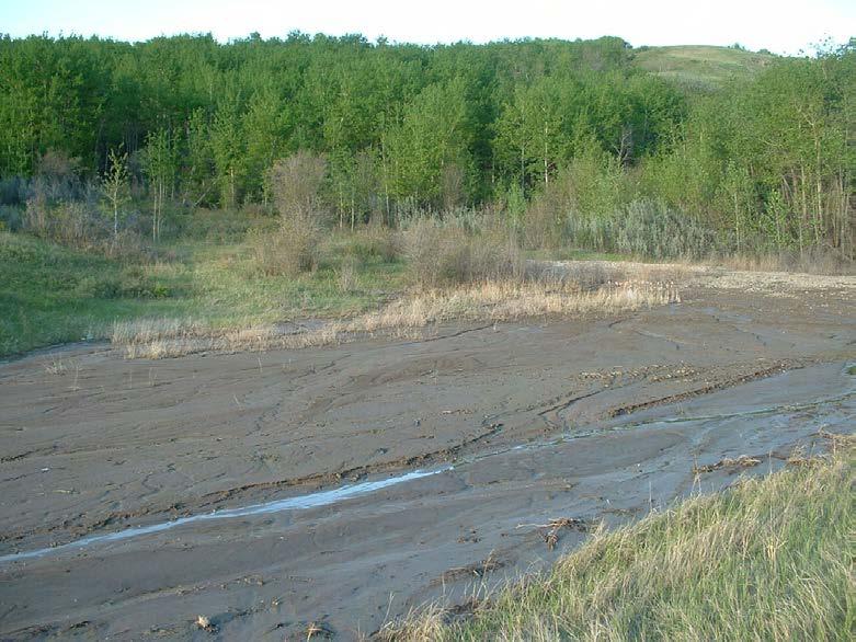
8 Photo E to Looking west at siltation in upslope ditch from debris flow upslope of highway. Photo E to Looking north at siltation in upslope ditch from debris flow upslope of highway.


9 Photo E Active gully erosion approximately 50 m downslope of highway. Photo E Large active erosion/slumping downslope of road culvert.


10 Photo E Moderate erosion occurring at culvert discharge. Photo E Siltation is occurring at outlet of downdrain (gabion structure).


11 Photo E Large active erosion/slumping downslope of down drain discharge. Photo E Siltation developing in front of down drain inlet.


12 Photo E Moderate erosion occurring at culvert discharge. Photo E to Large landslides downslope of highway within Site 2.


13 Photo E Small moderately active shallow instability below highway. Photo E Looking upslope at gullying occurring within road fill below highway.


14 Photo E Damaged culvert and ditch erosion at outlet. Photo E Looking north at new shallow landslide within road fill.


15 Photo E Looking east at new shallow slide within road fill. Note destroyed communication cable and proximity of headscarp to guardrail. Photo E Deep-seated active landslides below highway.


16 Photo E Small shallow slope instability below highway. No immediate concern. Photo E Shallow slumping on upslope side of highway but setback from actual road.


17 Photo E to Looking at upslope portion of landslide at Site 1. Site is considered to be relatively inactive. Photo E to Looking at downslope portion of landslide at Site 1. Site is considered to be relatively inactive.


18 Photo E Large landslide below highway. New tension cracks observed upslope of headscarp (off photo). Photo E Large landslide below gullying and erosion from culvert. No discernible change from 2006.
.")
.")
19 Photo E Significant active gullying and erosion downslope of culvert (looking upslope). Photo E Significant active gullying and erosion downslope of culvert (looking downslope).


20 Photo E View of retaining wall looking east. Piles are tilting outward about 1 degree since Photo E Close-up of pile wall showing increasing gaps and voids as soil in front of wall moves downslope.


21 Photo E to Minor erosion in upslope ditch. Photo E to View looking upslope at upper portion of landslide at Site 2.


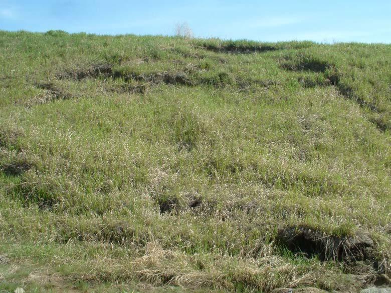
22 Photo E Small shallow slump on upslope side of highway. No immediate threat to the road. Photo E to Minor erosion of upslope ditch.

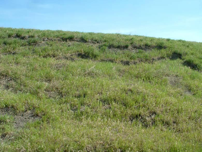
23 Photo E Small shallow slump on upslope side of highway. Photo E Small shallow slump on upslope side of highway.

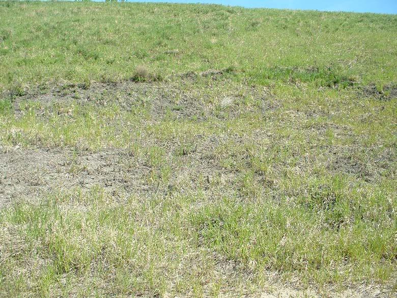
24 Photo E Small shallow slump on upslope side of highway. Photo E Small shallow slump on upslope side of highway.

25 Photo E Small shallow slump on upslope side of highway. Photo E Small shallow slump on upslope side of highway.


26 Photo E Small shallow slump on upslope side of highway. Photo E to Moderately active landslide on upslope side of highway. Potential exists for debris to block drainage in ditch.

27 Photo E to Moderately active landslide on upslope side of highway. Potential exists for debris to block drainage in ditch.
February 18, 2003 File: NORTH CENTRAL REGION LANDSLIDE ASSESSMENT HWY 43:16 WHITECOURT EAST HILL (NC1) 2002 ANNUAL INSPECTION REPORT
 2002 ANNUAL INSPECTION REPORT") February 18, 2003 File: 15-76-11 Alberta Transportation Room 223, Provincial Building 4709 44 Avenue Stony Plain, Alberta T7Z 1N4 Attention: Mr. Rob Lonson, P.Eng. NORTH CENTRAL REGION LANDSLIDE ASSESSMENT
February 18, 2003 File: 15-76-11 Alberta Transportation Room 223, Provincial Building 4709 44 Avenue Stony Plain, Alberta T7Z 1N4 Attention: Mr. Rob Lonson, P.Eng. NORTH CENTRAL REGION LANDSLIDE ASSESSMENT
January 12, 2006 File:
 January 12, 2006 File: 15-85-13 Alberta Infrastructure and Transportation Room 301, Provincial Building 9621-96 Avenue Peace River, Alberta T8S 1T4 Attention: Mr. Ed Szmata PEACE REGION (PEACE HIGH LEVEL
PEACE REGION GRANDE PRAIRIE GEOHAZARD RISK ASSESSMENT SITE INSPECTION FORM NAD 83 COORDINATES N 6,178,811 E 403,309
 PEACE REGION GRANDE PRAIRIE GEOHAZARD RISK ASSESSMENT SITE INSPECTION FORM SITE NUMBER GP-4a LEGAL DESCRIPTION LSD 12-10-78-4-W6M SITE NAME Burnt River Bridge - West Approach Slide HIGHWAY & KM Hwy 49:06
September 3, 2009 File: NORTH CENTRAL REGION GEOHAZARD ASSESSMENT HWY 40:28 NORTH OF CADOMIN (NC50) 2009 ANNUAL INSPECTION REPORT
 2009 ANNUAL INSPECTION REPORT") GEOTECHNICAL ENVIRONMENTAL MATERIALS September 3, 2009 File: 15-16-226 Alberta Transportation 2 nd Floor, Provincial Building 111 54 Street Edson, Alberta T7E 1T2 Attention: Mr. Cliff Corner NORTH CENTRAL
GEOTECHNICAL ENVIRONMENTAL MATERIALS September 3, 2009 File: 15-16-226 Alberta Transportation 2 nd Floor, Provincial Building 111 54 Street Edson, Alberta T7E 1T2 Attention: Mr. Cliff Corner NORTH CENTRAL
January 17, 2008 File:
 January 17, 2008 File: 15-85-73 Alberta Infrastructure and Transportation Room 301, Provincial Building 9621-96 Avenue Peace River, Alberta T8S 1T4 Attention: Mr. Ed Szmata PEACE REGION (SWAN HILLS AREA)
PEACE REGION (PEACE RIVER- HIGH LEVEL AREA) GEOHAZARD ASSESSMENT CALL-OUT PH56: EMBANKMENT FAILURE ON HWY 35:08 SOUTHWEST OF MEIKLE RIVER CROSSING
 GEOHAZARD ASSESSMENT CALL-OUT PH56: EMBANKMENT FAILURE ON HWY 35:08 SOUTHWEST OF MEIKLE RIVER CROSSING") ( (/)...,. - (D
( (/)...,. - (D
design, construction, operation, and maintenance of the BAP is consistent with recognized and generally accepted good engineering standards.
 design, construction, operation, and maintenance of the BAP is consistent with recognized and generally accepted good engineering standards. In addition to the field inspection, Associated Engineers, Inc.
This report was prepared by Klohn Crippen Consultants Ltd. for Alberta Transportation Central Region under Contract No. CE053/2000.
 Alberta Transportation Central Region #401, 4902 51 Street Red Deer, Alberta T4N 6K8 June 7, 2002 Mr. Melvin Mayfield, P.Eng. Project Engineer Dear Mr. Mayfield: Central Region Landslide Assessment Site
1 PROJECT BACKGROUND. August 14, Alberta Transportation Central Region #401, Street Red Deer, Alberta T4N 6K8
 August 14, 2013 Alberta Transportation Central Region #401, 4902 51 Street Red Deer, Alberta T4N 6K8 Mr. Dennis Grace, P.Eng. Construction Engineer Dear Mr. Grace: Central Region Geohazard Assessment 2013
CCR Rule Annual Inspection Report (cont.) 2
 2") The inspection findings consisted of maintenance items and items that were not observed to be signs or potential signs of significant structural weakness. No deficiencies or disrupting conditions that
The inspection findings consisted of maintenance items and items that were not observed to be signs or potential signs of significant structural weakness. No deficiencies or disrupting conditions that
Budge Road Landslide Jackson Extensometer installation report April 2014 with data to 20 May
 Budge Road Landslide Jackson Extensometer installation report 23-27 April 14 with data to May Four extensometers were installed across fissures at the head of the Budge Road landslide on the East Gros
CHRACTERISTICS OF LANDSLIDE OCCURRED IN LOPARE, BOSNIA AND HERZEGOVINA
 CHRACTERISTICS OF LANDSLIDE OCCURRED IN LOPARE, BOSNIA AND HERZEGOVINA Jun Sugawara 1 and Takao Aizawa 2 1 WorleyParsons, Australia 2 Suncoh Consultants, Japan ABSTRACT This paper presents results of detailed
The results of KCB s site inspection observations and our recommendations for further work are presented herein.
 July 14, 2015 Central Region 401, 4902 51 Street Red Deer, Alberta T4N 6K8 Mr. Tony Penney, P.Eng. Construction Engineer Dear Mr. Penney: June 25, 2015 Site Inspection Report The above site was visited
Converse Consultants Geotechnical Engineering, Environmental & Groundwater Science, Inspection & Testing Services
 Converse Consultants Geotechnical Engineering, Environmental & Groundwater Science, Inspection & Testing Services July 27, 2017 Ms. Rebecca Mitchell Mt. San Antonio College Facilities Planning & Management
A Homeowner s Guide to Landslides for Washington and Oregon
 Protect Your Home and Property 1 A Homeowner s Guide to Landslides for Washington and Oregon Washington Geological Survey and Oregon Department of Geology and Mineral Industries LANDSLIDES ARE ONE OF THE
3.12 Geology and Topography Affected Environment
 3 Affected Environment and Environmental Consequences 3.12 Geology and Topography 3.12.1 Affected Environment 3.12.1.1 Earthquakes Sterling Highway MP 45 60 Project Draft SEIS The Kenai Peninsula is predisposed
December 11, 2006 File:
 December 11, 2006 File: 15-85-38 Alberta Infrastructure and Transportation Room 301, Provincial Building 9621-96 Avenue Peace River, Alberta T8S 1T4 Attention: Mr. Ed Szmata PEACE REGION (SWAN HILLS AREA)
CENTRAL REGION GEOHAZARDS RISK ASSESSMENT SITE INSPECTION FORM
 SITE NUMBER AND NAME C55 H861:02 Slide LEGAL DESCRIPTION NW 14-40-14-W4 CENTRAL REGION GEOHAZARDS RISK ASSESSMENT SITE INSPECTION FORM HIGHWAY & KM NAD 83 COORDINATES N 5811217 E 437291 PREVIOUS INSPECTION
CHAPTER FIVE 5.0 STABILITY OF CUT SLOPES IN THE STUDY AREA. them limited by a thick canopy of vegetation and steep slope angles.
 CHAPTER FIVE 5.0 STABILITY OF CUT SLOPES IN THE STUDY AREA 5.1. Introduction Ukay Perdana area is a developing community with continuous building activities and road construction. There are thus only left
1. PROJECT BACKGROUND. July 18, Alberta Infrastructure & Transportation Central Region #401, Street Red Deer, Alberta T4N 6K8
 July 18, 2005 Alberta Infrastructure & Transportation Central Region #401, 4902 51 Street Red Deer, Alberta T4N 6K8 Mr. Alain Momedi, P.Eng. Project Engineer Dear Mr. Momedi: H11:04 km 11.1 Erosion along
Assessing Slope Instabilities. Victoria Leffel & Joey Franzino
 Assessing Slope Instabilities Victoria Leffel & Joey Franzino Slope Stability and Landslides Today s Presentation: Slope instability and landslide terms will be used interchangeably Landslide: downward
LENK, BERNESE ALPS, CH
 Debris Flow & Shallow Landslide Protection LENK, BERNESE ALPS, CH LENK, BERNESE ALPS Debris Flow & Shallow Landslide Protection Project Lenk, Bernese Alps Zip code 3775 Place Lenk Seiten Country/Region
Stormwater Inlet Sediment Traps
 Stormwater Inlet Sediment Traps SEDIMENT CONTROL TECHNIQUES Photo 1 Kerb inlet Photo 2 Field (drop) inlet Table 1 provides the recommended default classification of various sediment control systems suitable
Environmental Geology Lab 5 - Mass Wasting Hazards
 Environmental Geology Lab 5 - Mass Wasting Hazards page - 1 Many landslides, slope failures or sinkholes (collapse structures formed in terrain underlain by limestone rocks) occur during or immediately
CHAPTER GEOLOGICALLY HAZARDOUS AREAS Applicability Regulations.
 CHAPTER 19.07 GEOLOGICALLY HAZARDOUS AREAS 19.07.010 Applicability. Geologically hazardous areas may pose a threat to the health and safety of citizens when incompatible development is sited in areas of
Background. Valley fills Sites in the Area. Construction over Mine Spoil Fills
 Construction over Mine Spoil Fills Wayne A. Karem, PhD, PE, PG, D.GE 2014 KSPE Annual Conference Background Strip mining; mountaintop and contour mining Creates huge quantities of mine spoil The mine spoil
Mass Wasting. Revisit: Erosion, Transportation, and Deposition
 Mass Wasting Revisit: Erosion, Transportation, and Deposition While landslides are a normal part of erosion and surface processes, they can be very destructive to life and property! - Mass wasting: downslope
Looking after Lyme Regis
 Looking after Lyme Regis Lyme Regis sits on one of the most unstable stretches of coastline in the country. The highly active and unstable nature of the land which Lyme Regis is built upon can easily be
Chapter 11 10/30/2013. Mass Wasting. Introduction. Factors That Influence Mass Wasting. Introduction. Factors That Influence Mass Wasting
 Introduction Chapter 11 Mass wasting - The downslope movement of material resulting from the force of gravity. Mass Wasting Mass wasting results when the force of gravity acting on a slope exceeds the
SLOPE FAILURE SLOPES. Landslides, Mudflows, Earthflows, and other Mass Wasting Processes
 GEOL g406 Environmental Geology SLOPE FAILURE Landslides, Mudflows, Earthflows, and other Mass Wasting Processes Read Chapter 5 in your textbook (Keller, 2000) Gros Ventre landslide, Wyoming S. Hughes,
ALBERTA TRANSPORTATION PEACE REGION (PEACE RIVER / HIGH LEVEL) INSTRUMENTATION MONITORING RESULTS
 INSTRUMENTATION MONITORING RESULTS") ALBERTA TRANSPORTATION PEACE REGION (PEACE RIVER / HIGH LEVEL) INSTRUMENTATION MONITORING RESULTS SPRING 1 SECTION C SITE PH7-1: HWY 9:, DEADWOOD SLIDE 1. OBSERVATIONS 1.1 Field Program and Instrumentation
ALBERTA TRANSPORTATION PEACE REGION (PEACE RIVER / HIGH LEVEL) INSTRUMENTATION MONITORING RESULTS SPRING 1 SECTION C SITE PH7-1: HWY 9:, DEADWOOD SLIDE 1. OBSERVATIONS 1.1 Field Program and Instrumentation
9/13/2011 CHAPTER 9 AND SUBSIDENCE. Case History: La Conchita Landslide. Introduction
 CHAPTER 9 SLOPE PROCESSES, LANDSLIDES, AND SUBSIDENCE Case History: La Conchita Landslide La Conchita: small coastal community 80 km (50 mi) northwest of Los Angeles Landslide occurred on January 10, 2005
August 10, 2007 File:
 August 10, 2007 File: 15-85-72 Alberta Infrastructure and Transportation Room 301, Provincial Building 9621-96 Avenue Peace River, AB T8S 1T4 Attention: Mr. Ed Szmata PEACE REGION (PEACE HIGH LEVEL AREA)
Mass Movements. Rock Weathering. Accumulation of Debris on Slopes. Landslides 12/8/2014
 Mass Movements Already talked a little about landslides with earthquakes AKA mass wasting A mass movement is any displacement of large amounts of soil down slopes over (often) a comparatively short period
Mass Wasting. Requirements for Mass Wasting. Slope Stability. Geol 104: mass wasting
 Mass Wasting Movement of earth materials downslope, driven by Gravitational Forces. Landslides - general term for rock or soil movement. In U.S., on average, mass wasting causes 1 to 2 billion dollars
Landslide Mitigation (BYUI)
") Landslide Mitigation (BYUI) The general principle behind landslide mitigation is stabilization. Slopes that are too steep are shallowed or strengthened. Loose rocks can be bolted or cemented into place.
Landslide Mitigation (BYUI) The general principle behind landslide mitigation is stabilization. Slopes that are too steep are shallowed or strengthened. Loose rocks can be bolted or cemented into place.
How Much Can it Cost to Remediate a Large Landslide? Theme Session No. 10 at GSA Cordilleran Section Meeting, May 13-15, 2002
 How Much Can it Cost to Remediate a Large Landslide? Theme Session No. 10 at GSA Cordilleran Section Meeting, May 13-15, 2002 Author and Presenter: Charles M. Hammond, CEG, Landslide Technology, 10250
AN APPROACH TO THE CLASSIFICATION OF SLOPE MOVEMENTS
 Training/workshop on Earthquake Vulnerability and Multi-Hazard Risk Assessment: Geospatial Tools for Rehabilitation and Reconstruction Effort 13 31 March 2006, Islamabad, Pakistan AN APPROACH TO THE CLASSIFICATION
Continuing Education Associated with Maintaining CPESC and CESSWI Certification
 Continuing Education Associated with Maintaining CPESC and CESSWI Certification Module 2: Stormwater Management Principles for Earth Disturbing Activities Sponsors: ODOTs Local Technical Assistance Program
Erosion and Sediment Control Measures 2.7 Silt Fences
 Erosion and Sediment Control Measures Silt fences are designed to intercept sheet flow sediment laden stormwater run-off and filter out both the larger and smaller particles of sediment. Silt fences and
Figure 45. Plan of Pukaroro drawn from aerial photograph. K. Jones, drawn by C. Edkins, DOC.
 Figure 45. Plan of Pukaroro drawn from aerial photograph. K. Jones, drawn by C. Edkins, DOC. 101 length, and there are cross-rows forming semi-enclosures. House floors are also present at the southern
Institute of Space and Earth Information Science & The Center for University and School Partnership, Faculty of Education, CUHK (Sponsored by QEF)
") 1 Landslides and Slope Stability in Hong Kong Introduction: There are many landslides in Hong Kong throughout the years. Some of these are disastrous, such as those occurring on Po Shan Road and in the
1 Landslides and Slope Stability in Hong Kong Introduction: There are many landslides in Hong Kong throughout the years. Some of these are disastrous, such as those occurring on Po Shan Road and in the
THE NORTHRIDGE BLUFF LANDSLIDE: RAPID BLUFF RETREAT ASSOCIATED WITH A MAJOR COASTAL LANDSLIDE IN DALY CITY, CALIFORNIA
 THE NORTHRIDGE BLUFF LANDSLIDE: RAPID BLUFF RETREAT ASSOCIATED WITH A MAJOR COASTAL LANDSLIDE IN DALY CITY, CALIFORNIA Philip L. Johnson 1 & Dale R. Marcum 1 1 Cotton, Shires & Associates, Inc. 330 Village
Chapter 2: Landslides and Debris Flows
 Chapter 2: Landslides and Debris Flows Chapter 2: Landslides and Debris Flows Landslides and debris flows are among the major causes of flash floods in the Himalayan region as the rock, earth, debris,
Yoshinori KAWAMURA, Oriental Consultants Global Co., Ltd.
 Landslides along National Roads in Central Highland in Sri Lanka: Review on Current Situation and Suggestion for Further Development of Landslide Mitigation along Highways in Sri Lanka Yoshinori KAWAMURA,
LANDSLIDE HAZARDS. presented during the. TRAINING-WORKSHOP ON DISASTER RISK MANAGEMENT Rakdell Inn Virac, Catanduanes 03 July 2008
 LANDSLIDE HAZARDS presented during the TRAINING-WORKSHOP ON DISASTER RISK MANAGEMENT Rakdell Inn Virac, Catanduanes 03 July 2008 GEOLOGIC HAZARDS the probability of occurrence, within a specific period
Gully Erosion Part 1 GULLY EROSION AND ITS CAUSES. Introduction. The mechanics of gully erosion
 Gully Erosion Part 1 GULLY EROSION AND ITS CAUSES Gully erosion A complex of processes whereby the removal of soil is characterised by incised channels in the landscape. NSW Soil Conservation Service,
Materials. Use materials meeting the following.
 208.01 Section 208. SOIL EROSION AND SEDIMENTATION CONTROL 208.01 Description. Install and maintain erosion and sedimentation controls to minimize soil erosion and to control sedimentation from affecting
ROCK EXCAVATION (GRADING) OPSS 206 INDEX
 OPSS 206 INDEX") 206-2 - OPSS 206 INDEX 206-2.1 GENERAL 206-2.1.1 Classification of Rock Materials 206-2.1.2 Tender Items 206-2.1.3 Other Excavation Tender Items 206-2.1.4 Specifications 206-2.1.5 Special Provisions 206-2.1.6
206-2 - OPSS 206 INDEX 206-2.1 GENERAL 206-2.1.1 Classification of Rock Materials 206-2.1.2 Tender Items 206-2.1.3 Other Excavation Tender Items 206-2.1.4 Specifications 206-2.1.5 Special Provisions 206-2.1.6
Central Queensland Coal Project Appendix 4b Geotechnical Assessment. Environmental Impact Statement
 Central Queensland Coal Project Appendix 4b Geotechnical Assessment Environmental Impact Statement GEOTECHNICAL ASSESSMENT OF OPEN CUT MINING ADJACENT TO THE BRUCE HIGHWAY, CENTRAL QUEENSLAND COAL PROJECT
What Is Water Erosion? Aren t they the same thing? What Is Sediment? What Is Sedimentation? How can Sediment Yields be Minimized?
 Jerald S. Fifield, Ph.D. CISEC HydroDynamics Incorporated Parker, CO 303-841-0377 Aren t they the same thing? What Is Sediment? Soil particles deposited or suspended in water or air The process of depositing
MANAGEMENT OF LARGE MUDSLIDES
 36 MANAGEMENT OF LARGE MUDSLIDES Three large and active mudslides Poche, 1860?, Super-Sauze, 1960?, La Valette, March 1982, 1 M m 3 900,000 m 3 4-5 M m 3 37 Three large and active mudslides Type of development:
STATEMENT OF EVIDENCE OF SHANE LANDER (GEOTECHNICAL - QD2) ON BEHALF OF MURPHYS DEVELOPMENTS LIMITED
 ON BEHALF OF MURPHYS DEVELOPMENTS LIMITED") IN THE MATTER of the Housing Accords and Special Housing Areas Act 2013 ("HASHAA") AND IN THE MATTER of Proposed Qualifying Development Application ("QD2") for 125 Murphys Road, Flat Bush BETWEEN Murphys
IN THE MATTER of the Housing Accords and Special Housing Areas Act 2013 ("HASHAA") AND IN THE MATTER of Proposed Qualifying Development Application ("QD2") for 125 Murphys Road, Flat Bush BETWEEN Murphys
9/23/2013. Introduction CHAPTER 7 SLOPE PROCESSES, LANDSLIDES, AND SUBSIDENCE. Case History: La Conchita Landslide
 Introduction CHAPTER 7 SLOPE PROCESSES, LANDSLIDES, AND SUBSIDENCE Landslide and other ground failures posting substantial damage and loss of life In U.S., average 25 50 deaths; damage more than $3.5 billion
FAULT RUPTURE AND ASSOCIATED GEO-HAZARDS OF FUKUSHIMA-PREFECTURE HAMADOORI EARTHQUAKE
 Proceedings of the International Symposium on Engineering Lessons Learned from the 2011 Great East Japan Earthquake, March 1-4, 2012, Tokyo, Japan FULT RUPTURE ND SSOCITED GEO-HZRDS OF FUKUSHIM-PREFECTURE
Degradation Concerns related to Bridge Structures in Alberta
 Degradation Concerns related to Bridge Structures in Alberta Introduction There has been recent discussion regarding the identification and assessment of stream degradation in terms of how it relates to
Rock Sizing for Small Dam Spillways
 Rock Sizing for Small Dam Spillways STORMWATER MANAGEMENT PRACTICES Photo 1 Rock-lined spillway on a construction site sediment basin Photo 2 Rock-lined spillway on a small farm dam 1. Introduction A chute
Introduction to Soil Mechanics
 AMRC 2011 MODULE 1 Introduction to Soil Mechanics CONTENTS Overview... 1-1 Objectives... 1-1 Procedures... 1-1 1.1 Introduction... 1-3 1.2 Erosion... 1-5 1.3 Importance of Identification of Soil Problems...
Mass Wasting. Mass Wasting. Earth s s External Processes
 1 Mass Wasting Presentation Modified from Instructor Resource Center on CD-ROM, Foundations of Earth Science, 4 th Edition, Lutgens & Tarbuck Mass Wasting 2 Down-slope movement of rock, loose material
Landslide Remediation Work and Treatment in Taiwan Miau-Bin Su 1, S.M. Chang 2, Y.S.Yen 3
 Landslide Remediation Work and Treatment in Taiwan Miau-Bin Su 1, S.M. Chang 2, Y.S.Yen 3 ABSTRACT Landslides are involved in many human activities. Especially in Taiwan, natural environment is not favor
Chapter 16 Weathering, Erosion, Mass Wasting. Chapter 16 Weathering, Erosion, Mass Wasting. Mechanical Weathering
 Weathering, Erosion and Mass Wasting Weathering is the the breakdown of solid rock at or near the Earth's surface. Chapter 16 Weathering, Erosion, Mass Wasting Does weathering of rock remove or add CO
LAB 5: LANDSLIDE RECOGNITION AND MAPPING
 Geology 350 1 LAB 5: LANDSLIDE RECOGNITION AND MAPPING OBJECTIVES: a. to learn to recognize and classify landslides on airphotos and topographic maps b. to learn to recognize landslide topography on topographic
3.18 GEOLOGY AND SOILS
 3.18 GEOLOGY AND SOILS This section discusses geologic resource concerns as they relate to the environment, public safety, and project design both during construction and after completion of the project.
Crows Landing Naval Base Easement
 1 of 15 West Stanislaus Resource Conservation District Crows Landing Naval Base Easement Annual Reserve Monitoring Report Jamie McFarlin 11/112012 2 of 15 West Stanislaus Resource Conservation District
HILLSLOPE STABILITY. Focus in the Westfork Area of Washington County, Arkansas. Environmental Geology Dr. Paul Lowrey
 Environmental Geology Dr. Paul Lowrey Team Members Christine Gossett Jennifer Lane Lauren Morrison Nicole Sage Focus in the Westfork Area of Washington County, Arkansas HILLSLOPE STABILITY INTRODUCTION
Table 5-1 Sampling Program Summary for Milltown Ford Avenue Redevelopment Area, NJ.
 Table 5- Sampling Program Summary for Milltown Ford Avenue Redevelopment Area, NJ. Transformer Pads (9 pads: PAD 9) Evaluate if PCBs presently exist in soils adjacent to, and/or beneath the transformer
ON CONCAVE SLOPES, landslides usually initiate just above the slope break, where seepage is common.
 To avoid areas more susceptible to failure, slight changes in clearcut boundary locations can often be made: ON CONVEX SLOPES, most open slope landslides occur in or near zones of change in slope angle.
4.5 GEOLOGY AND SOILS
 4.5 GEOLOGY AND SOILS This section addresses the project site geology and soils and analyzes potential changes that would result from development of the Wye Specific Plan project. 4.5.1 Environmental Setting
Flood and Stream Restoration
 2 3 4 Pedestrian bridge under construction 3 CSPs perched on DS side Large area of sand deposition Bottom layer of gabions has been scoured out large bar of gabion stone Gabions slumping bank slope failure
Consists of cliff face (free-face) and talus slope or upper convex slope, a straight slope and a lower concave slope
 and talus slope or upper convex slope, a straight slope and a lower concave slope") 1 2 3 4 5 6 7 8 Introduction to Environmental Geology, 5e Chapter 10 Slope Processes, Landslides, and Subsidence Mass wasting: summary in haiku form Mass wasting: downhill quickly like an avalanche, or
1 2 3 4 5 6 7 8 Introduction to Environmental Geology, 5e Chapter 10 Slope Processes, Landslides, and Subsidence Mass wasting: summary in haiku form Mass wasting: downhill quickly like an avalanche, or
Effect of Toe Excavation on a Deep Bedrock Landslide
 Effect of Toe Excavation on a Deep Bedrock Landslide Timothy D. Stark 1 ; W. David Arellano 2 ; Ryan P. Hillman 3 ; Roger M. Hughes 4 ; Norman Joyal 5 ; and Don Hillebrandt 6 Abstract: Observations, data,
3.12 Geology and Topography Affected Environment
 3 Affected Environment and Environmental Consequences 3.12 Geology and Topography 3.12.1 Affected Environment 3.12.1.1 Earthquakes Sterling Highway MP 45 60 Project Final EIS The Kenai Peninsula is predisposed
Instream Erosion Control General
 Instream Erosion Control General EROSION CONTROL TECHNIQUES Revegetation Temperate Climates Short-Term Non Vegetation Wet Tropics Long-Term Weed Control [1] Semi-Arid Zones Permanent [1] Weed control attributes
Earthquake-induced landslide distribution and hazard mapping. Megh Raj Dhital Central Department of Geology, Tribhuvan University
 Earthquake-induced landslide distribution and hazard mapping Megh Raj Dhital Central Department of Geology, Tribhuvan University Contents Geological setting of Gorkha earthquake Peak ground acceleration
Gold Creek / Rock Creek Inspections Monitoring, Road Deactivation and Environmental Road Maintenance Planning Risk Analysis
 2006 FIA Gold Creek / Rock Creek Inspections Monitoring, Road Deactivation and Environmental Road Maintenance Planning Risk Analysis Prepared for: Prepared by: Forsite Consultants Ltd. #330 42nd St SW
8. Mass movements. Engineering Geology. Engineering Geology is backbone of civil engineering. Eng. Iqbal Marie
 Engineering Geology Engineering Geology is backbone of civil engineering 8. Mass movements Eng. Iqbal Marie All images are taken from the net and not credited to me Mass-Wasting is the down slope movement
Regional-scale landslide and erosion monitoring utilizing airborne LiDAR change detection analysis
 Regional-scale landslide and erosion monitoring utilizing airborne LiDAR change detection analysis October 23, 2017 Andrew Mitchell, Matt Lato, Scott McDougall, Mike Porter, Stephanie Bale, Andrew Watson
SECTION A MASS WASTING
 SECTION A MASS WASTING INTRODUCTION This section summarizes the methods and results of a mass wasting assessment conducted on the Mendocino Redwood Company, LLC (MRC) ownership in the Ackerman Creek and
CONTROLLING FACTORS BASIC ISSUES SAFETY IN OPENCAST MINING WITH SPECIAL REFERENCE TO SLOPE STABILITY
 SAFETY IN OPENCAST MINING WITH SPECIAL REFERENCE TO SLOPE STABILITY CONTROLLING FACTORS Dr. J C. JHANWAR Sr. Principal Scientist CSIR-Central Institute of Mining & Fuel Research Regional Centre, Nagpur
FHWA - HIGHWAY HYDROLOGY
 The unit peak discharge is computed with Equation 5.6 by interpolating c 0, c, and c Table 5.5 using a type II distribution. The peak discharge is also calculated as follows. from Variable SI Unit U Unit.5444
Canadian Consulting Engineering Awards 2017 Southern Alberta Rock Slope Stabilization & Other Work Amec Foster Wheeler
 Southern Alberta Rock Slope Stabilization & Other Work Amec Foster Wheeler To: Mr. Doug Picklyk Editor, Canadian Consulting Engineer magazine Date April 20, 2017 From: Chelsea Johnson, P.Eng. Amec Foster
Black Gore Creek 2013 Sediment Source Monitoring and TMDL Sediment Budget
 Black Gore Creek 2013 Sediment Source Monitoring and TMDL Sediment Budget Prepared for: Prepared By: - I. Introduction The Black Gore Creek Total Maximum Daily Load (TMDL) was developed in collaboration
3.0 SUMMARY OF POTENTIAL GEOTECHNICAL IMPACTS AND MITIGATION MEASURES
 3.0 SUMMARY OF POTENTIAL GEOTECHNICAL IMPACTS AND MITIGATION MEASURES This section summarizes the principal geotechnical conditions that occur in the project area. The potential impact that each condition
Maui Pipeline (403Line) Assessment of Geohazard Features Huntly Offtake to Huntly Power Station
 Assessment of Geohazard Features Huntly Offtake to Huntly Power Station") Auckland Tauranga Wellingn Christchurch PATTLE DELAMORE PARTNERS LTD Maui Pipeline 403Line) of Geohazard Features Huntly Offtake Huntly Power Station A02676751 R004 0416 Vecr Limited solutions for your
Auckland Tauranga Wellingn Christchurch PATTLE DELAMORE PARTNERS LTD Maui Pipeline 403Line) of Geohazard Features Huntly Offtake Huntly Power Station A02676751 R004 0416 Vecr Limited solutions for your
MEMORANDUM. wa.tsr..-z.n~.e.s-t.i~at.i.o.ns... Branch... Mr. Webster contends that prior to excavation of the gravel
 TO... J. C. Foweraker 2... Head Gr o w a t er S e c t i on... Hyar....og~~~.~.~vis.ion... wa.tsr..-z.n~.e.s-t.i~at.i.o.ns... Branch... eernment OF BRITISH COLUMBIA MEMORANDUM II 0 PROM A. P. Kohut, Geological
Rock & Aggregate Drop Inlet Protection
 Rock & Aggregate Drop Inlet Protection SEDIMENT CONTROL TECHNIQUE Type 1 System Sheet Flow Sandy Soils Type 2 System [1] Concentrated Flow Clayey Soils Type 3 System Supplementary Trap Dispersive Soils
Forms of Flat Land Damage
 Appendix B : Forms of Flat Land Damage Table B1.1 EQC Land Damage Categories for the Flat Land Areas in Christchurch Figure B1.1 - Maps of the liquefaction related land damage for the four main earthquake
1.0 INTRODUCTION 2.0 OBSERVATIONS EBA FILE: W nd Avenue Whitehorse, YT Y1A 1C2. Attention:
 August 5, 2013 City of Whitehorse 2121 2 nd Avenue Whitehorse, YT Y1A 1C2 ISSUED FOR USE EBA FILE: W14103182-01 Via Email: ben.campbell@whitehorse.ca Attention: Subject: Ben Campbell, Planner II Planning
Nipigon River Landslide, Ontario, Canada
 Nipigon River Landslide, Ontario, Canada A. Abdelaziz, S. Besner, R. Boger, B. Fu, J. Deng, and A. Farina Presenter: Jian Deng, Ph.D, P.Eng Centre of Excellence for Sustainable Mining and Exploration,
Need of Proper Development in Hilly Urban Areas to Avoid
 Need of Proper Development in Hilly Urban Areas to Avoid Landslide Hazard Dr. Arvind Phukan, P.E. Cosultant/Former Professor of Civil Engineering University of Alaska, Anchorage, USA RI District Governor
APPLICATION TO PAST DISASTERS OF A METHOD OF SETTING THE RANGE OF DEBRIS FLOW DAMAGE TO HOUSES
 APPLICATION TO PAST DISASTERS OF A METHOD OF SETTING THE RANGE OF DEBRIS FLOW DAMAGE TO HOUSES Hideaki MIZUNO Senior Researcher Erosion and Sediment Control National Institute for Land and Infrastructure
GUIDE V DISASTER PREVENTION WORKS
 ROAD DISASTER PREVENTION MANAGEMENT MANUAL GUIDE V DISASTER PREVENTION WORKS CONTENTS GUIDE V DISASTER PREVENTION WORKS 1 BASIC CONCEPT 2 RECOMMENDABLE PREVENTION WORKS 3 DRAINAGE WORKS 4 RIVER REVETMENT
WHITE POINT LANDSLIDE GEOTECHNICAL INVESTIGATION November 29, 2012 Status Report
 Gary Lee Moore, P.E., City Engineer Vince Jones, P.E., Deputy City Engineer WHITE POINT LANDSLIDE GEOTECHNICAL INVESTIGATION November 29, 2012 Status Report White Point Landslide Geotechnical Investigation
SLOPE PROCESSES, LANDSLIDES, AND SUBSIDENCE
 CHAPTER 9 SLOPE PROCESSES, LANDSLIDES, AND SUBSIDENCE La Conchita slide January 10, 2005 Triggered by heavy rainfall, reactivation along an older landslide surface (35,000 years ago, 6000 years ago, and
Internal C Unit Dilatanc y
 2 Grimsby Sub was not at any time definitively established. The preliminary analysis provided by Thurber Engineering Ltd indicates the slope should be stable with a factor of safety of 1.23 for a deep
Ch. 8: Mass Movements, Wind and Glaciers
 Ch. 8: Mass Movements, Wind and Glaciers Every day the landscape around us undergoes changes. Changes that are powered by gravity alone are called mass movement or mass wasting. Mass movement includes
Addis Ababa University, Ethiopia October / November 2013 LANDSLIDE GLOSSARY. Jan Novotný
 Addis Ababa University, Ethiopia October / November 2013 LANDSLIDE GLOSSARY Jan Novotný Charles University in Prague, Faculty of Science, Czech Republic ARCADIS CZ a.s., division Geotechnika, Czech Republic
1. Erosion by Running Water Most powerful cause of erosion
 I. Destructive Forces Notes: Destructive force: a process in which land is destroyed or changed such as weathering and erosion. All landforms are a result of a combination of constructive and destructive
Remediation of Soft Clay Utilizing the Dry Mix Method. of Batavia, New York to its discharge into the Niagara River at Tonawanda, New York.
 Introduction Tonawanda Creek meanders as it flows in a generally westerly direction from its headwaters east of Batavia, New York to its discharge into the Niagara River at Tonawanda, New York. The geologic
Mass Wasting: The Work of Gravity
 Chapter 15 Lecture Earth: An Introduction to Physical Geology Twelfth Edition Mass Wasting: The Work of Gravity Tarbuck and Lutgens Chapter 15 Mass Wasting The Importance of Mass Wasting Slopes are the