St. David's Buried Gorge
|
|
|
- Leslie Roberts
- 6 years ago
- Views:
Transcription

1 1/7

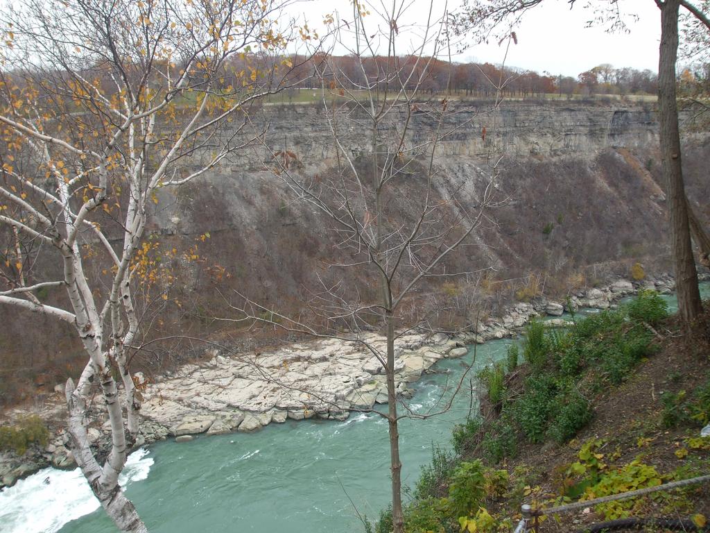
2 cliffs Left: south Niagara of Whirlpool River just in autumn; north of the Bottom Whirlpool Right:inWhirlpool autumn; and Top up Right: the Niagara Gorge River in autumn Photo Gallery {igallery 0} General Information The St. David's buried gorge existed 22,800 years ago. It was once a part of an ancient drainage system which extended the entire width of the NiagaraPeninsula. The was approximately 1200 long, 305 meters wide, and 91 meters deep at the whirlpool. Previously the gorge was 200 feet deeper than the depth of Lake Ontario. The gorge extended into Lake Ontario 2.4 kilometers (1.5 miles) west of the present 2/7
3 Niagara River. The gorges original landscape is no longer visible however, as the widely recognized Whirlpool Gorge was formed in its place. Thus only remnants of its geologic origins exist. TripClip Audio File {mp3}geostdavidsburiedgorge{/mp3} Hours of Operation The Whirlpool Aero Car is open seasonally and is open daily from April 30 to November. Hours are subject to change. 3/7
4 Directions From Toronto: Head Southwest on QEW approximately 108km Slight left at King s Highway 405 approximately 5.1km Take Stanley Ave E Exit toward Niagara Falls approximately 0.6km Merge onto Stanley Ave (south) approximately 1.2km Left (southeast) at Whirlpool Rd approximately 1.3km Right (southeast) at Niagara Parkway approximately 0.7km Continue onto River Rd approximately 0.1km Parking for Whirlpool Aero Car is on the left From Fort Erie: Head west on QEW towards Exit 1A approximately 11.4km 4/7
5 Take Exit 12 for Netherby Rd towards Welland (north) approximately 0.7km Left (north) at Niagara River Parkway approximately 10.7km Continue onto Bridgewater St (southwest) approximately 0.5km Right (northwest) at Welland River Bridge approximately 0.2km Right (northeast) at Macklem St approximately 0.3km Continue onto Niagara River Parkway (northwest) approximately 8.8km Parking for Whirlpool Aero Car is on the right geological significance 5/7
6 The was once a channel for an ancient river that existed before the third Wisconsin Glacier had advanced. It is believed that the gorge was buried in glacial silt during this time approximately 12,000 years ago and failed to reopen. When the Niagara Falls eroded the gorge to its present location at Thompson Point (where we find the Spanish Aero car attraction), the river found erosion of the rock much easier. This lead to the river breaking through the rock barrier which held back the glacial debris. It was later discovered that this had filled into what was previously the ancient gorge of the St. David's River. The Niagara River removed the present whirlpool area of all the glacial debris, and subsequently changed direction to follow the ancient gorge a short distance southward. It is believed that the ancient St. David s River was responsible for carving the now filled and subsequently the Whirlpool Gorge from the rock. Th e gorge was approximately 38 meters (125 feet) wide. During the advance of the late Wisconsin Glacier the ancient Whirlpool gorge and the St. David's gorge were filled with glacial debris. Historical There have been many fossils found in the area. Some of the fossils found include: Trilobites (Trilobata) - sea floor crustaceans ( million years ago) 6/7
7 found in Rochester, Grimsby and Clinton layers of rock Snails (Gastropoda) - spiral shells of snails found in Silurian rocks Sea Lilies (Crinoidea) - sea floor starfish (425 million years ago) found in Rochester shale rock layer - still in existence at bottom of Atlantic Ocean Horn Coral (Enterolasma Caliculum) grew on sea bottom ( million years ago) found in Lockport and Clinton layers of rock Lamp Shells (Phyla Brachiopoda) - clam like shells, eighty different species found in the Clinton & Rochester rock layers Nautilus (Cephalopod) - ancestors of nautilus, squid & cuttlefish (425 million years ago) found in Medina and Queenston rock layers Recreational Participating in the Whirlpool Aero Car Tour is provides an excellent opportunity for visitors to visualize the ancient landscape. The site is located to the southwest (left) of the attraction. This is where the ancient river changed its directional flow due to an increased resistance to erosion. 7/7
Devil s Punchbowl -Virtual Field Trip-
 Devil s Punchbowl -Virtual Field Trip- School of GEOGRAPHY & GEOLOGY Carolyn Eyles & Susan Vajoczki Prepared by Zachary Windus and Liz Kenny From McMaster University take Main Street West towards Ancaster.
The Niagara Escarpment extends from western New York, through the GTA all the way up to Manitoulin Island and into Michigan and Wisconsin.
 is southern Ontario s most prominent topographic feature, extending more than 500 kilometres from western New York, through Niagara Falls and the western part of the Greater Toronto Area (GTA), and north
1. The map below shows a meandering river. A A' is the location of a cross section. The arrows show the direction of the river flow.
 1. The map below shows a meandering river. A A' is the location of a cross section. The arrows show the direction of the river flow. Which cross section best represents the shape of the river bottom at
Illustrations of Selected Ordovician fossils
 Illustrations of Selected Ordovician fossils Appendix 1 Brachiopods Cephalopods Brachiopods (brack'-i-oh-pods) are a group of marine animals with two shells. They all have an upper and lower shell. The
Cattaraugus Creek: A Story of Flowing Water and the Geology of the Channel It Flows Through Presentation to West Valley Citizen Task Force 4/27/16
 Cattaraugus Creek: A Story of Flowing Water and the Geology of the Channel It Flows Through Presentation to West Valley Citizen Task Force 4/27/16 Raymond C. Vaughan, Ph.D. What happens if you drop a
Pratice Surface Processes Test
 1. The cross section below shows the movement of wind-driven sand particles that strike a partly exposed basalt cobble located at the surface of a windy desert. Which cross section best represents the
B) sorted and not layered D) unsorted and layered. 4. The photograph below shows farm buildings partially buried in silt.
 sorted and not layered D) unsorted and layered. 4. The photograph below shows farm buildings partially buried in silt.") Name 1. Base your answer to the following questio the-con our map below, which shows a hill formed by glacial deposition near Rochester, New York. Letters A through E are reference points. Elevations are
Name 1. Base your answer to the following questio the-con our map below, which shows a hill formed by glacial deposition near Rochester, New York. Letters A through E are reference points. Elevations are
W he natural resources of Adams
 Above: Houghton Rock, Town of Adams. Following Page: "The Hole in the Rock" on Rattlesnake Mound--both remnants of rock formed by ancient seas hundreds of millions of year5 ago. (Courtesy, H.H. Bennett
Pat Dryer Half Moon Lake: A True Oxbow Lake? Geography 364 April 1 st, 2007
 Pat Dryer Half Moon Lake: A True Oxbow Lake? Geography 364 April 1 st, 2007 Appendix Abstract 2 Introduction 3 Methods 3 Results 3 Discussion 5 Conclusion 11 1 Abstract Half Moon Lake appears to be an
Glaciers. 1. The photograph below shows the results of a landslide.
 Name: Date: 1. The photograph below shows the results of a landslide. This landslide is an example of A) wind abrasion B) glacial deposition C) wave action D) mass movement 2. Which agent of erosion is
4. The map below shows a meandering stream. Points A, B, C, and D represent locations along the stream bottom.
 1. Sediment is deposited as a river enters a lake because the A) velocity of the river decreases B) force of gravity decreases C) volume of water increases D) slope of the river increases 2. Which diagram
Decoding Topographic Maps
 Name: Date: 1. Base your answer(s) to the following question(s) on the topographic map below and on your knowledge of Earth science. Letters A through F represent locations on the map. What is the contour
TOPOGRAPHIC RELIEF MAP of NYS. LANDFORMS of NYS. Landforms. Creation of NYS Landforms 9/22/2011
 TOPOGRAPHIC RELIEF MAP of NYS LANDFORMS of NYS Prof. Anthony Grande AFG 2011 Landforms The basis of present-day landforms (surface features) is the bedrock geology that has been worked on by the forces
1. Base your answer to the following question on the map below, which shows the generalized bedrock of a part of western New York State.
 1. Base your answer to the following question on the map below, which shows the generalized bedrock of a part of western New York State. 3. The table below describes the deposits that an observer saw while
Maine Geologic Facts and Localities October, Lobster Lake, Maine. Text by Robert G. Marvinney. Maine Geological Survey
 Maine Geologic Facts and Localities October, 1998 Lobster Lake, Maine 45 o 51 7.91 N, 69 o 30 53.88 W Text by Robert G. Marvinney, Department of Agriculture, Conservation & Forestry 1 Map by Introduction
Name. 4. The diagram below shows a soil profile formed in an area of granite bedrock. Four different soil horizons, A, B, C, and D, are shown.
 Name 1. In the cross section of the hill shown below, which rock units are probably most resistant to weathering? 4. The diagram below shows a soil profile formed in an area of granite bedrock. Four different
The St. Croix Dalles Home of the World s Deepest Potholes
 Interstate State Park, at Taylors Falls, Minnesota, contains some of the most outstanding and unique geological features to be found anywhere in the world. The story of how these features came to be as
Name HW - Landscapes
 Name HW - Landscapes 1. New York s Tug Hill landscape region is classified as a plateau because this region has a A) high elevation with distorted bedrock B) high elevation with nearly horizontal layers
Ch 10 Deposition Practice Questions
 1. Base your answer to the following question on the data table below. Six identical cylinders, A through F, were filled with equal volumes of sorted spherical particles. The data table shows the particle
Procedure: 1) Cut out each continent- cut along the dashed line. Cut out the key to paste onto your sheet later.
 Cut out each continent- cut along the dashed line. Cut out the key to paste onto your sheet later.") Name: Pangea and Continental Drift Lab Science: Introduction: Alfred Wegener (a German Geologist), considered the Father of Plate Tectonics, was the first to coin the term Continental Drift. After collecting
Name: Pangea and Continental Drift Lab Science: Introduction: Alfred Wegener (a German Geologist), considered the Father of Plate Tectonics, was the first to coin the term Continental Drift. After collecting
The Geology of Sebago Lake State Park
 Maine Geologic Facts and Localities September, 2002 43 55 17.46 N, 70 34 13.07 W Text by Robert Johnston, Department of Agriculture, Conservation & Forestry 1 Map by Robert Johnston Introduction Sebago
Florida s Changing Shape
 Florida s Changing Shape Background: For much of its history, Florida was underwater. At first, Florida consisted solely of the Florida Platform, a limestone base formed from the calcium carbonate remains
The movement of rivers, the processes of weathering and erosion, and tectonic activity create canyons.
 This website would like to remind you: Your browser (Apple Safari 4) is out of date. Update your browser for more security, comfort and the best experience on this site. Encyclopedic Entry canyon gorge,
Glacial Geology of Moose Point State Park, ME
 Geologic Site of the Month May, 2013 Glacial Geology of Moose Point State Park, Maine 44 o 25 59.18"N, 68 o 56 37.11"W Text and photos by Woodrow B. Thompson, Department of Agriculture, Conservation &
Day 3 Weathering and Erosion.notebook. October 02, Section 7.2. Erosion and Deposition. Objectives
 Objectives Describe the relationship of gravity to all agents of erosion. Contrast the features left from different types of erosion. Analyze the impact of living and nonliving things on the processes
Lesson 2. Antarctic Oceanography: Component I - Ice/Glaciers Component II - Marine Snow
 Lesson 2. Antarctic Oceanography: Component I - Ice/Glaciers Component II - Marine Snow Lesson Objectives: Introduces students to the different kinds of ice found in Antarctica, Students will become familiar
Your web browser (Safari 7) is out of date. For more security, comfort and the best experience on this site: Update your browser Ignore
 is out of date. For more security, comfort and the best experience on this site: Update your browser Ignore") Your web browser (Safari 7) is out of date. For more security, comfort and the best experience on this site: Update your browser Ignore CANYO N gorge, ravine For the complete encyclopedic entry with media
Your web browser (Safari 7) is out of date. For more security, comfort and the best experience on this site: Update your browser Ignore CANYO N gorge, ravine For the complete encyclopedic entry with media
One of the tasks of the Floods Study Team was to determine if any new facilities
 8. Development and Enhancement of Interpretive Facilities One of the tasks of the Floods Study Team was to determine if any new facilities would be needed to help interpret the Floods story, or if any
The boulder was most likely moved to this location by A) glacial ice B) prevailing wind C) streamfiow D) volcanic action
 glacial ice B) prevailing wind C) streamfiow D) volcanic action") 1. Which rock material was most likely transported to its present location by a glacier? A) rounded sand grains found in a river delta B) rounded grains found in a sand dune C) residual soil found on a
1. Which rock material was most likely transported to its present location by a glacier? A) rounded sand grains found in a river delta B) rounded grains found in a sand dune C) residual soil found on a
APPENDIX A M&T/Llano Seco Long-Term Water Reliability Study These photos are examples of rock spurs in use throughout the United States
 APPENDIX A M&T/Llano Seco Long-Term Water Reliability Study These photos are examples of rock spurs in use throughout the United States Glenn Colusa Irrigation District completed a Sacramento River project
Glacial Deposition and Groundwater in Dutchess County
 Glacial Deposition and Groundwater in Dutchess County Name: Period: Thousands of years ago an enormous ice sheet blanketed the Hudson Valley in what was called the Wisconsinan Glaciation. The ice reshaped
 Page 1 of 9 Name: Base your answer to the question on the diagram below. The arrows show the direction in which sediment is being transported along the shoreline. A barrier beach has formed, creating a
Unit 3 Review - Surface Processes
 Unit 3 Review - Surface Processes 1. Why is the surface of Mercury covered with meteor impact craters, while Earth s surface has relatively few craters? A) Mercury is larger than Earth, so it gets hit
A GEOLOGIC TRIP to the SAN ANDREAS FAULT
 A GEOLOGIC TRIP to the SAN ANDREAS FAULT San Andreas Hot Spot Loop Road Hot Spot P Parking San Andreas Fault Interpretive Trail Fault Zone Map: San Andreas Fault Zone During the 25 million years that the
Geologic Trips San Francisco and the Bay Area
 Excerpt from Geologic Trips San Francisco and the Bay Area by Ted Konigsmark ISBN 0-9661316-4-9 GeoPress All rights reserved. No part of this book may be reproduced without written permission in writing,
LANDFORMS of NYS. Landforms. Exercise 4 9/13/2012. TOPOGRAPHIC RELIEF MAP of NYS. Physiographic map of NYS and vicinity showing Surface Features
 TOPOGRAPHIC RELIEF MAP of NYS LANDFORMS of NYS Prof. Anthony Grande AFG 2012 Landforms REMINDER: The basis of present-day landforms (surface features) is the bedrock geology that has been worked on by
A Geological Tour of Tumbledown Mountain, Maine
 Maine Geologic Facts and Localities April, 1998 A Geological Tour of Tumbledown Mountain, Maine 44 45 3.21 N, 70 32 50.24 W Text by Robert G. Marvinney, Department of Agriculture, Conservation & Forestry
Unit 5: Earth s History Practice Problems
 Name: Date: 1. Which bedrock would be most likely to contain fossils? A. Precambrian granite B. Cambrian shale C. Pleistocene basalt D. Middle-Proterozoic quartzite 6. Base your answer(s) to the following
Question #1: What are some ways that you think the climate may have changed in the area where you live over the past million years?
 Reading 5.2 Environmental Change Think about the area where you live. You may see changes in the landscape in that area over a year. Some of those changes are weather related. Others are due to how the
Geologic Time. What have scientists learned about Earth s past by studying rocks and fossils?
 Name Geologic Time What have scientists learned about Earth s past by studying rocks and fossils? Before You Read Before you read the chapter, think about what you know about geologic time Record your
The Little Colorado River
 The Little Colorado River The Little Colorado River Junction of the Little Colorado River and the Colorado Grand Falls of the Little Colorado River The relief/topo map at the right shows the junction of
13. Sedimentary Rocks I (p )
") 13. Sedimentary Rocks I (p. 194-208) Sediment Deposition Weathering results in rock being broken down into smaller fragments, called regolith. This regolith is then broken down to form soil. The regolith
13. Sedimentary Rocks I (p. 194-208) Sediment Deposition Weathering results in rock being broken down into smaller fragments, called regolith. This regolith is then broken down to form soil. The regolith
L.O: HOW GEOLOGISTS SEQUENCE EVENTS IN EARTH'S GEOLOGIC HISTORY IF NOT OVERTURNED, OLDEST ON BOTTOM, YOUNGEST ON TOP
 L.O: HOW GEOLOGISTS SEQUENCE EVENTS IN EARTH'S GEOLOGIC HISTORY IF NOT OVERTURNED, OLDEST ON BOTTOM, YOUNGEST ON TOP 1. Unless a series of sedimentary rock layers has been overturned, the bottom rock layer
mountain rivers fixed channel boundaries (bedrock banks and bed) high transport capacity low storage input output
 high transport capacity low storage input output") mountain rivers fixed channel boundaries (bedrock banks and bed) high transport capacity low storage input output strong interaction between streams & hillslopes Sediment Budgets for Mountain Rivers Little
mountain rivers fixed channel boundaries (bedrock banks and bed) high transport capacity low storage input output strong interaction between streams & hillslopes Sediment Budgets for Mountain Rivers Little
Why is Sebago Lake so deep?
 Maine Geologic Facts and Localities February, 1999 Why is Sebago Lake so deep? 43 51 13.36 N, 70 33 43.98 W Text by Robert A. Johnston, Department of Agriculture, Conservation & Forestry 1 Introduction
Name: Which rock layers appear to be most resistant to weathering? A) A, C, and E B) B and D
 A, C, and E B) B and D") Name: 1) The formation of soil is primarily the result of A) stream deposition and runoff B) precipitation and wind erosion C) stream erosion and mass movement D) weathering and biological activity 2)
Name: 1) The formation of soil is primarily the result of A) stream deposition and runoff B) precipitation and wind erosion C) stream erosion and mass movement D) weathering and biological activity 2)
HW #2 Landscape Travel from A to B 12,
 HW #2 Landscape 2016 Section: Name: ate: 1. ase your answer(s) to the following question(s) on the map below, which represents two bridges that cross the Green River. Letters,, and represent locations
Fossils. Ch. 29 and 30 Overview
 Ch. 29 and 30 Overview What you need to know: Chapter 29: Fossils, Relative Time, Absolute Time Chapter 30: Geologic Time Fossils Study of fossils called paleontology Original remains rare usually dead
Hydraulic Modeling of the Missoula Ice Dam Failure. Christopher R. Goodell, P.E., D.WRE WEST Consultants, Salem, OR
 Hydraulic Modeling of the Missoula Ice Dam Failure Christopher R. Goodell, P.E., D.WRE WEST Consultants, Salem, OR 1 Introduction 10-40 thousand years ago during the last ice age Image courtesy gis4geomorphology.com
THE BEDROCK SURFACE AND FORMER DRAINAGE SYSTEMS OF MONTGOMERY COUNTY, OHIO 1
 THE BEDROCK SURFACE AND FORMER DRAINAGE SYSTEMS OF MONTGOMERY COUNTY, OHIO 1 STANLEY E. NORRIS, Geologist, U. S. Geological Survey, Columbus, Ohio INTRODUCTION The bedrock surface of Montgomery County,
Module 10: Resources and Virginia Geology Topic 4 Content: Virginia Geology Notes
 Virginia is composed of a very diverse landscape that extends from the beaches and barrier islands all of the way to the highly elevated Appalachian Plateau. Geologists have discovered ancient shallow
MOR TIME TEACHERS. ONCE UPON A TIME Activity Overview BIG IDEA
 MOR TIME 04 Activity Overview BIG IDEA OBJECTIVE BACKGROUND The geologic time scale can be challenging for students to understand. This activity explores how scientists divide the Earth s long history
Practice 3rd Quarter Exam Page 1
 Name 1. Which characteristic would most likely remain constant when a limestone cobble is subjected to extensive abrasion? A) shape B) mass C) volume D) composition 2. Which activity demonstrates chemical
Gradualism versus Catastrophism Curriculum written by XXXXX
 Gradualism versus Catastrophism Curriculum written by XXXXX A curriculum written with the goal of educating 8 th grade science students on the difference between gradual and cataclysmic geological events
Which particle of quartz shows evidence of being transported the farthest distance by the stream? A) B) C) D)
 B) C) D)") 1. Base your answer to the following question on the block diagram below, which represents the landscape features associated with a meandering stream. WX is the location of a cross section. Location A
1. Base your answer to the following question on the block diagram below, which represents the landscape features associated with a meandering stream. WX is the location of a cross section. Location A
5. The topographic map below shows a lake and two rivers.
 Mapping A B1 1. The diagram below shows latitude measurements every 10 degrees and longitude measurements every 15 degrees. What is the latitude and longitude of point X? 5. The topographic map below shows
The Great Lakes. Beyond the Book. FOCUS Book
 Build a model to show how the Great s formed. Use soil and large pieces of ice to model the role of ice sheets as they carved out the Great s Basin and then filled it with water. How will you make the
C) use of nuclear power D) number of volcanic eruptions
 use of nuclear power D) number of volcanic eruptions") 3121-1 - Page 1 Name: 1) The graph below shows the change in carbon dioxide concentration in parts per million (ppm) in Earth's atmosphere from 1960 to 1990. The most likely cause of the overall change
3121-1 - Page 1 Name: 1) The graph below shows the change in carbon dioxide concentration in parts per million (ppm) in Earth's atmosphere from 1960 to 1990. The most likely cause of the overall change
GEOLOGICAL AGE OF ROCKS. Absolute geological age
 GEOLOGICAL AGE OF ROCKS Absolute geological age The pioneer of nuclear physics discovered at the turn of centuries that atoms of certain elements, the radioactive ones, spontaneously disintegrate to form
3. The diagram below shows how scientists think some of Earth's continents were joined together in the geologic past.
 1. The map below shows the present-day locations of South America and Africa. Remains of Mesosaurus, an extinct freshwater reptile, have been found in similarly aged bedrock formed from lake sediments
Transfer Model-Evidence Link Diagram Name: Directions: Key supports STRONGLY supports contradicts nothing to do with Evidence #3 Evidence #1 Model A
 Transfer Model-Evidence Link Diagram Name: Directions: draw two arrows from each evidence box. One to each model. You will draw a total of 8 arrows. Key: The evidence supports the model The evidence STRONGLY
Structural Features and Fracture Orientation similarities between outcrops of the Ridgeley Sandstone
 The JUNIATA JOURNAL of GEOLOGY, 1, 1-8 (2014) Original article Structural Features and Fracture Orientation similarities between outcrops of the Ridgeley Sandstone Robert W. Baronner Two outcrops of the
Earth History. What is the Earth s time scale? Geological time Scale. Pre-Cambrian. FOUR Eras
 The Earth is 4.6 billion years old! Earth History Mrs. Burkey ESS Cy Creek HS 17-18 If the Earth formed at midnight 6:00 am First life appears 10:00 pm First animals/plants on land 11:59 pm First humans
Unit 10 Lesson 2 What Was Ancient Earth Like? Copyright Houghton Mifflin Harcourt Publishing Company
 How Rocks and Fossils Tell a Story Sedimentary rock forms in layers. Many sedimentary rocks contain fossils. The oldest rock layers are at the bottom, and the youngest rock layers are at the top. The relative
The Ovens, Bar Harbor, Maine
 Maine Geologic Facts and Localities July, 2003 The Ovens, Bar Harbor, Maine 44 26 15.65 N, 68 15 51.80 W Text by Henry Berry, Department of Agriculture, Conservation & Forestry 1 Postcard courtesy of Wally
The Building of the NYC Region
 The Building of the NYC Region Definitions Fall Line marks the area where an upland region (continental bedrock) and a coastal plain meet Piedmont the plateau region of the eastern United States which
CURRICULUM TR AILING ICE AGE M YST ERI E S
 MIDDLE SCHOOL CURRICULUM TR AILING ICE AGE M YST ERI E S THE Driftless Area CONTENTS I. Enduring Knowledge... 3 II. Teacher Background... 3 III. Before Viewing the Video... 5 IV. Viewing Guide... 5 V.
CHAPTER 28. PHYSIOGRAPHY Cook Inlet Drainages
 PEBBLE PROJECT ENVIRONMENTAL BASELINE DOCUMENT 2004 through 2008 CHAPTER 28. PHYSIOGRAPHY Cook Inlet Drainages PREPARED BY: Knight Piésold Ltd. PHYSIOGRAPHY COOK INLET DRAINAGES TABLE OF CONTENTS TABLE
ADVENTURES IN WATER DEVELOPED BY LOUISVILLE WATER COMPANY
 ADVENTURES IN WATER DEVELOPED BY LOUISVILLE WATER COMPANY Tunneling for Water explains the science behind a first-of-its-kind project in the world! Louisville Water Company is the first water utility
For Sale - 56 Acre Sandstone Quarry State Route 511, Oberlin/Kipton, OH 44075
 14647 State Route 511, Oberlin/Kipton, OH 44075 56 ACRES Vermilion Rd Gifford Rd Haigh Rd 44 Summary The Kipton sandstone quarry is included in 56 acre tract owned by Terry A. Johnson, of Huron, Ohio.
3.13Glaciers past and present
 3.13Glaciers past and present We start with a headline from The Scotsman newspaper that rocked Britain s scientific establishment on the morning of 7 October 1840: 3 Discovery of the Former Existence of
Sherman Falls -Virtual Field Trip-
 Sherman Falls -Virtual Field Trip- School of GEOGRAPHY & GEOLOGY Carolyn Eyles & Susan Vajoczki Prepared by Zachary Windus and Liz Kenny Directions: McMaster University to Sherman Falls From McMaster University
Approximately how many inches of average yearly precipitation does Rochester, New York, receive?
 1. Base your answer to the following question on the isoline map below, which shows the average yearly precipitation, in inches, across New York State. Approximately how many inches of average yearly precipitation
Shale Gas Opportunities in Southern Ontario an Update
 Shale Gas Opportunities in Southern Ontario an Update Terry Carter, Ministry of Natural Resources, London, ON Lee Fortner, Ministry of Natural Resources, London, ON Catherine Béland-Otis, Ontario Geological
Common Fossils in Pennsylvania
 Common Fossils in Pennsylvania Dinosaurs? Not common in Pennsylvania Only found in Southeastern Part of the state Dinosaurs wondered near the lakes and swamps and are preserved there dating from the Triassic
CASE STUDY #9 - Brushy Fork Dam, Sugar Grove, West Virginia
 CASE STUDY #9 - Brushy Fork Dam, Sugar Grove, West Virginia Brushy Fork Dam is a flood control structure built by the Soil Conservation Service southeast of the city of Franklin in Pendleton County, West
Geotrail Wolayersee. Walking on the sea floor. layersee Hütte onto the Rauchkofel (path no. 438) as well as the Carnic High Trail (Karnischer
 as well as the Carnic High Trail (Karnischer") Geotrail Wolayersee Walking on the sea floor 1 Car via the B111 Gailtal Bundesstrasse to Birnbaum, turn off towards Nostra and on to the Hubertuskapelle chapel or via the B110 Plöckenpass Bundesstrasse
Geotrail Wolayersee Walking on the sea floor 1 Car via the B111 Gailtal Bundesstrasse to Birnbaum, turn off towards Nostra and on to the Hubertuskapelle chapel or via the B110 Plöckenpass Bundesstrasse
Crustal Boundaries. As they move across the asthenosphere and form plate boundaries they interact in various ways. Convergent Transform Divergent
 Name: Date: Period: Plate Tectonics The Physical Setting: Earth Science CLASS NOTES Tectonic plates are constantly moving and interacting As they move across the asthenosphere and form plate boundaries
Summer 2014 Reading the Geologic History of Doheny State Beach Rodger More LAYERS LET S TAKE A TOUR THE BLUFFS
 Summer 2014 Reading the Geologic History of Doheny State Beach Rodger More DSBIA Board Officer and Geologist (retired) LAYERS of sediment and rock are like a book. Formations make up chapters and individual
ENVG/SC 10110L-20110L PLANET EARTH LABORATORY. Laboratory #9: Surface Hydrology & Map Scale
 Name: Lab day: Tuesday Wednesday ENVG/SC 10110L-20110L PLANET EARTH LABORATORY Laboratory #9: Surface Hydrology & Map Scale Readings: Chapter 9. http://www.nd.edu/~cneal/physicalgeo/lab-surfacehydrology/index.html
FOSSILS IN YOUR BACKYARD
 MOR BACKYARD 12 Activity Overview BIG IDEA OBJECTIVE BACKGROUND Millions of years ago, dinosaurs roamed all over our planet Why is it then that we only find dinosaurs in certain geographical locations?
Hard Engineering: Lyme Regis
 Hard Engineering: Lyme Regis By The British Geographer Situation Lyme Regis, with a population of 4400 is located in the centre of the Heritage Jurassic Coast in Dorset, South England. It is exposed to
Unit 4: Landscapes Practice Problems
 Name: Date: 1. Soil with the greatest porosity has particles that are A. poorly sorted and densely packed B. poorly sorted and loosely packed C. well sorted and densely packed D. well sorted and loosely
Regents Earth Science
 Regents Earth Science Earth s History Name Section Rock Correlation Lab Lab# Introduction: The Cayuga Lake Basin contains one of the scenic Finger Lakes of central New York State. During the Devonian Period,
Fluvial and Glacial Landforms of West-Central Wisconsin
 Fluvial and Glacial Landforms of West-Central Wisconsin Geography 360 November 7, 2005 Shana Neumann Holly Johnson Table of Contents Page Introduction...1 Stop 1: Turtle Lake Ice-Walled Lake Plain...1
Geology of the Golden Gate National Recreation Area in the Marin Headlands, and Ring Mountain, Tiburon
 Geology of the Golden Gate National Recreation Area in the Marin Headlands, and Ring Mountain, Tiburon May 9, 2006 Field trip guide compiled by Mary Leech Name: Submit this guide with the Subduction lab
Who s On First? A Relative Dating Activity
 NAME: DATE: PERIOD: Who s On First? A Relative Dating Activity Scientists have good evidence that the earth is very old, approximately four and one-half billion years old. Scientific measurements such
SPQ Module 20 Ice Flows
 SPQ Module 20 Ice Flows When Ray, Richard & Kevin received their sleds in Southern Chili they opened them with excitement, and Kevin remarked they look like little canoes. It is perhaps appropriate that
Lecture Outline Lecture Outline Monday April 9-16, 2018 Questions? Announcements:
 Lecture Outline Lecture Outline Monday April 9-16, 2018 Questions? Announcements: Geology 101 Night Video: The Day After Tomorrow Hollywood disaster movie about the onset of a glacial period When: Monday
PROMISED LAND STATE PARK PIKE COUNTY ANCIENT RIVERS AND AGES OF ICE
 PENNSYLVANIA TRAIL OF GEOLOGY PARK GUIDE 18 PROMISED LAND STATE PARK PIKE COUNTY ANCIENT RIVERS AND AGES OF ICE Promised Land State Park is located on a broad upland surface known as the Pocono Plateau.
Unit 2 Lesson 1 Geologic Change over Time. Copyright Houghton Mifflin Harcourt Publishing Company
 Been There, Done That What is the principle of uniformitarianism? The principle of uniformitarianism states that geologic processes that happened in the past can be explained by current geologic processes.
STAAR Science Tutorial 40 TEK 8.9C: Topographic Maps & Erosional Landforms
 Name: Teacher: Pd. Date: STAAR Science Tutorial 40 TEK 8.9C: Topographic Maps & Erosional Landforms TEK 8.9C: Interpret topographic maps and satellite views to identify land and erosional features and
The Palmer Hill Glacial-Marine Delta, Whitefield, Maine
 Maine Geologic Facts and Localities December, 2010, Maine 44 o 10 12.16 N, 69 o 37 18.93 W Text by Woodrow Thompson, Department of Agriculture, Conservation & Forestry 1 Introduction The most recent continental
Your web browser (Safari 7) is out of date. For more security, comfort and the best experience on this site: Update your browser Ignore
 is out of date. For more security, comfort and the best experience on this site: Update your browser Ignore") Your web browser (Safari 7) is out of date. For more security, comfort and the best experience on this site: Update your browser Ignore BEDRO CK For the complete encyclopedic entry with media resources,
Your web browser (Safari 7) is out of date. For more security, comfort and the best experience on this site: Update your browser Ignore BEDRO CK For the complete encyclopedic entry with media resources,
NEW YORK S NATURAL WONDERS
 Landscapes and Drainage Patterns NEW YORK S NATURAL WONDERS New York is not one of the largest states of the United States, nor does it have any large national parks to rival Yosemite or the Grand Canyon.
TAKE HOME EXAM 8R - Geology
 Name Period Date TAKE HOME EXAM 8R - Geology PART 1 - Multiple Choice 1. A volcanic cone made up of alternating layers of lava and rock particles is a cone. a. cinder b. lava c. shield d. composite 2.
Gravel Transport Can Determine Late Flood Tectonics
 Chapter 23 Gravel Transport Can Determine Late Flood Tectonics The locations of all the quartzite gravel in the northwest states and adjacent Canada provide more information about the Flood than just reinforcing
The Geology of Cobscook Bay State Park
 Maine Geologic Facts and Localities August, 2000 44 50 24.67 N, 67 9 3.01 W Text by Robert A. Johnston, Department of Agriculture, Conservation & Forestry 1 Map by USGS Introduction Cobscook Bay State
Grade 4 CURRICULUM MAP CONTENT: Social Studies 17A3 17A4 17A6 17A9 17A10 14A1 14B2 14D1 14E1 17A1 17A2 17A8. Illinois unit
 AUGUST / SEPTEMBER CORE CONTENT Landforms Immunization Government Map skills PROCESS SKILLS/ State maps Hand drawn maps maps maps Landform pictures Diorama mural Food landscapes s 17A3 17A4 17A6 17A9 17A10
THE STRUCTURE AND THICKNESS OF THE CLINTON AND BEREA FORMATIONS IN THE VICINITY OF WOOSTER, OHIO
 THE STRUCTURE AND THICKNESS OF THE CLINTON AND BEREA FORMATIONS IN THE VICINITY OF WOOSTER, OHIO KARL VER STEEG College of Wooster INTRODUCTION AND ACKNOWLEDGMENTS The data used in the construction of