Report on the Geophysical survey undertaken at Kouphovouno between 28 th June and 2 nd July.
|
|
|
- Catherine Cook
- 5 years ago
- Views:
Transcription
1 Report on the Geophysical survey undertaken at Kouphovouno between 28 th June and 2 nd July. Introduction: A team comprising of two undergraduate students (Anna Moles & James Taylor) and two postgraduates (Jackie Whalen & Margarita Lianou) undertook one week of work on the Neolithic and Roman site of Kouphovouno, Sparta (Fig. 1). The Geophysical survey was undertaken by Dr Michael Boyd (report enclosed). The Ephor, Mrs Vassilogamvrou, was very welcoming and she had had the fenced area cleared of vegetation to facilitate the work. We are very grateful for her support. We were fortunate that several nights of rain made it possible to undertake more focused work than is normally possible for the height of summer in Greece and so the results are particularly telling. Summary of Results: It is clear that both archaeological and non-archaeological features lie below the ground surface. The presence of the olive trees (and probably tree-pits see Figs 2 & 11) may have created some non-archaeological anomalies in the resistivity results and the metal survey pegs from the Neolithic excavations created non-archaeological anomalies in the magnetometer survey. Possible archaeological features: The magnetometer survey revealed an anomaly (18 x 13 m) so strongly magnetic to the west of area G (see plan) that it may represent a kiln, oven or furnace (Fig. 8). Other circular features may also represent the same kind of activity on the site. Some of the linear features may represent ancient features and they correspond with some of the resistivity results (Fig. 8 & 9). The resistivity survey revealed N-S linear features on the east side which may be interpreted as terracing or roads (Fig 11). Two possible collapsed architectural features were located in the north central part and the south central part of the survey area. The northern one is oriented NE-SW and may be collapsed architecture. The southern one appears to represent a square (c. 7 x 7m) architectural feature. The results of the magnetometer survey concur with these anomalies (Fig. 11). Future work: At this point in time the results are not as clear cut as we would have liked although we have certainly had the best results we can get from the Geophysical survey. If the project is to continue I would not plan on a large scale excavation right away but three targeted test trenches would be prudent in the areas marked on the plan. Acknowledgments: I am very grateful for the financial support from: the School of Classics, University of St Andrews, the Roman Society and the British School at Athens. I am indebted to the members of the small team and particularly Michael Boyd for all their hard work. I am particularly thankful to the BSA Director, Cathy Morgan and School Administrator, Tania Gerousia for their persistence and endeavours to secure a permit. I would also like to acknowledge the support of the Ephor Mrs Vassilogamvrou and the Ministry of Culture and the BSA fieldwork committee.
2 Encl: 1. Boyd Report on Geophysics 2. Images 3. Overall accounts for the project Brief report on geophysical investigations at Koufovouno, Sparta, 28 June to 1 July 2010 Michael Boyd Resistance and magnetometer surveys were carried out at the Neolithic and Roman site of Koufovouno near Sparta for four days in June and July The aim of the survey, building on previous surveys by Neil Brodie and by this author, was to investigate the area immediately west of the recent excavations of Neolithic layers, where test trenches had indicated the possibility of Roman habitation of the area. The whole area was first surveyed using a Geoscan RM-15 resistance meter with standard survey settings (1m sample interval in six 20m grids covering 2,400m 2, with mobile probes 50cm apart, ideal for remains cm below the ground). Survey grids were oriented at 356 o on their short north-south axis. No surveying equipment was available to record the exact position of the grid in relation to the previous excavation grid, but the southwest, southeast and northwest pegs were left in place for future reference. Because of the extreme dryness of the surface, readings had to be taken manually after checking for good contact. Light rain allowed for better working conditions on the following day, and it was decided to survey almost all of this area (2,284m 2 ) again at 50cm sample resolution. With samples thus at four times standard density, this offered the possibility of better defining the features in the data, as well as discerning between the rather slight features that might be expected with Roman rural architecture. Meanwhile a similarly large area (2,113m 2 ) was surveyed with the magnetometer at 50cm sample resolution. Because the area has recently been fenced, the magnetometer survey could not approach as close to the fenced boundary as the resistivity survey. Features of archaeological and non-archaeological origin are present in the survey results. In the magnetometer data both strong and weak features are present. Certain of the strong features are owed to surface metal (mainly earlier excavation pegs that could not be removed). These are marked on the interpretation. Other strong features (+- 30nT to 60nT) do not seem to result from surface factors. Most apparent is an area of about 18m x 13m to the west of trench G, where the disturbance appears it would continue south of the magnetometer survey area (see arrow on Fig. ). The disturbance is strongest in the southwest corner of this rectangular area, where measurements exceed 100nT. This is exceedingly strong and the suspicion must be that metal must be responsible; however, the feature does not exhibit the standard appearance of an iron spike (as the adjacent trench spikes do); but instead appears to form a well-defined rectangular area 6m x 3.5m. If architectural it is conceivable it could be a kiln, oven or furnace; or just possibly a concentration of magnetic architectural material close to the surface (brick, tile or burned mud brick). Another
3 strong magnetic feature is located at the northwest corner of the survey area, where a linear feature can be detected over 16m, joining with an amorphous magnetic feature at its eastern end (see arrow on Fig. ).. Other strong magnetic features are roughly circular in shape, and if not due to buried iron, may be burned or furnace features. Roughly in the centre of the magnetic survey, a series of weak linear features running at about 50 o with others perpendicular are not aligned with the axis of cultivation and may therefore represent ancient anthropogenic features. These coincide with some of the resistance features described below and may relate to buried architecture. The eastern side of the resistance survey is dominated by weak north-south features apparent for the entire width of the survey area. If unrelated to the recent excavations, these might be terracing features, or possibly pathways/roads. Two main areas of resistance anomalies are apparent. In the north-central part of the survey a large area (maximum 33m x 18m) is dominated by raised resistance readings ca 50-60Ω against a background of ca 35-50Ω. The main orientation is northeast-southwest (50 o ) (see arrow on Fig. ). Major and minor magnetic linear features in this area also agree with this orientation. It is impossible to discern any clear ground plan in the resistance readings here but it is possible that these raised readings are caused by collapsed architectural features. The second main resistance area is immediately to the south, in the south-central zone of the survey. Here the strongest feature (up to 60Ω) is formed of a wide north-south anomaly (10m long and 3m wide) with an attached rectangular area to the east making a squared feature 7m x 7m (see arrow on Fig. ). This feature could be architectural and the apparently very wide walls might be a result of the collapse of the feature. This feature coincides with the very strong magnetic feature described above and could be a built furnace or kiln feature. It is also conceivable that a strong brick foundation might cause this sort of anomaly. To the north of this feature is a broad area of raised readings similar to that described further north, measuring 20m x 7m. Within this on the west side a dogleg feature can be recognised running at approximately 25 o 125 o 40 o, and just to the east a north-south feature is on the same line as the west wall of the strong square feature to the south. Either of these features could be architectural. Throughout the resistance data circular high resistance features are caused by the presence of olives which dehydrate the ground immediately surrounding themselves. Overall, although no features can easily be interpreted as offering a clear architectural plan, the combination of the weak magnetic anomalies with the resistance data in the centre of the survey area suggests constructions in the vicinity. Furthermore, the strongest magnetic and resistance anomalies coincide to suggest a possible built feature. The recognition of Roman architectural layers in parts of the excavations make these interpretations more plausible.


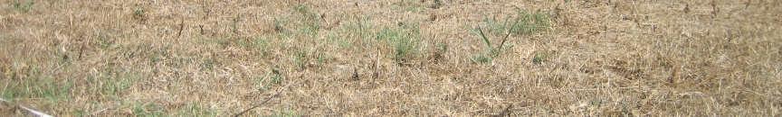
4 Fig 1. Topographic Plan showing location of site and geophysics Fig 2. Area of possible tree pits in West of fenced area (from south)
5 Kouphovouno topoplan 2002 Area E Area C Area B Area F Area G Area A Area D Concreted Cores Cores stations areas 2001 areas Road 0.5m contours Intensive survey Extensive survey N W E Meters S Fig. 3 Kouphovouno Plan Location of possible trial trench (2 x 5m) in the west of the site for 2012 (Marked by blue rectangle (after Cavanagh, Mee & Renard) Fig. 4 Location of possible trial trenches (2 x 5m) in the east of the site for 2012 (Marked by blue rectangles)


")


6 Fig. 5 Image of location of anomalies and possible trial trenches in east (southern section) of site Fig. 6 Image of location of anomalies and possible trial trench in east (northern section) of site


7 Fig. 7 Image of location of anomalies and possible trial trench in west of site Fig 8. Magnetometry results with features outlines in red. Arrows locate the features discussed above.

8 Fig. 9 Magnetometry results overlaid on resistivity results with features outlines in red. Fig. 10 Magnetometry results and location of Neolithic trenches
9 Fig. 11 Resistivity Results including image with outline features in red. Arrows locate the features discussed above. Note location of trenches E & F.
General Editor: Vince Russett
 YCCCART 2014/Y20 North Somerset HER 2015/11 Manual survey using an electronic, hydryostatic level (NIVCOMP) at Wemberham Roman Villa YATTON, CONGRESBURY, CLAVERHAM AND CLEEVE ARCHAEOLOGICAL RESEARCH TEAM
Report on Geophysical Survey Na Vrsku, Sahy, Slovakia Coordinates: 48⁰,4,45 N 18⁰,56,23 E. April 2018
 Report on Geophysical Survey Na Vrsku, Sahy, Slovakia Coordinates: 48⁰,4,45 N 18⁰,56,23 E April 2018 Mark Graham BA(Hons), BSc, MA Grampus Heritage and Training Ltd, Ashgill, Threapland, Wigton, Cumbria,
APPENDIX B: REPORT ON GEOPHYSICAL SURVEY, JULY 1998
 APPENDIX B: REPORT ON GEOPHYSICAL SURVEY, JULY 1998 by Andy Payne Introduction A geophysical survey was carried out at Le Yaudet, Ploulec h, Brittany as part of the ongoing investigation into the archaeology
Geophysical Survey Report
 Geophysical Survey Report Wickham Bushes, Bracknell, Berkshire for Thames Valley Archaeological Services December 2004 J1957 K T Donaldson Document Title: Client: Stratascan Job No: Techniques: Geophysical
GEOPHYSICAL SURVEY REPORT. Timolin, County Kildare. Date: 18/01/2016. Licence: 15R0133
 GEOPHYSICAL SURVEY REPORT Date: 18/01/2016 Licence: 15R0133 J. M. Leigh Surveys 124 Oaklawn West Leixlip County Kildare www.jmlsurveys.com 01 615 4647 Consultants. J. M. Leigh Surveys 124 Oaklawn West,
A Geophysical Survey of a Roman Tile Kiln. Dell Quay, Chichester, West Sussex
 A Geophysical Survey of a Roman Tile Kiln Dell Quay, Chichester, West Sussex Neville Haskins Chichester District Archaeology Society April 2007 Summary A fluxgate gradiometer survey was carried out in
A Survey of St Michael and All Angels Churchyard Hamstall Ridware
 Project No 6 A Survey of St Michael and All Angels Churchyard by M R Holland Annie Saunders MA March 2003 Table of Contents Introduction Methods Acknowledgements Appendix A Geophysics 3 3 5 6 Table of
A geophysical and topographic survey report
 A geophysical and topographic survey report carried out at Weaverthorpe, North Yorkshire on behalf of the Friends of St Andrews Church, Weaverthorpe between June and October, 2011 Landscape Research Centre
Northamptonshire Archaeology
 Northamptonshire Archaeology Archaeological Geophysical Survey At Sulgrave Castle Green, Sulgrave, Northamptonshire August 2007 Adrian Butler November 2007 Report 07/192 Northamptonshire Archaeology 2
Skills Practice Skills Practice for Lesson 11.1
 Skills Practice Skills Practice for Lesson.1 Name Date Conics? Conics as Cross Sections Vocabulary Write the term that best completes each statement. 1. are formed when a plane intersects a double-napped
GEOSYNTEC CONSULTANTS
 GEOSYNTEC CONSULTANTS 2100 Main Street, Suite 150 Huntington Beach, CA 92648 USA Tel (714) 969-0800 Fax (714) 969-0820 15 February 2006 Ms. Tamara Zeier, P.E. Project Manager Project Navigator, Ltd. One
Geophysical Survey Report No. 13. Cornashee Co. Fermanagh. Season 2: Magnetometry survey. Dr Steven Trick
 Geophysical Survey Report No. 13 Cornashee Co. Fermanagh Season 2: Magnetometry survey Dr Steven Trick Cornashee, Co. Fermanagh Season 2: Magnetometry survey Geophysical Survey Report No. 13 Dr Steven
Ground Penetrating Radar Survey Report:
 Ground Penetrating Radar Survey Report: Caiphas Burial Tomb Project Israel Data Acquired May 29, 2008 Report compiled June 4, 2008 Survey and Report Published by Mnemotrix Israel, Ltd. Chief GPR Surveyor,
EXTREMELY FAST IP USED TO DELINEATE BURIED LANDFILLS. Norman R. Carlson, Cris Mauldin Mayerle, and Kenneth L. Zonge
 EXTREMELY FAST IP USED TO DELINEATE BURIED LANDFILLS Norman R. Carlson, Cris Mauldin Mayerle, and Kenneth L. Zonge Zonge Engineering and Research Organization, Inc. 3322 East Fort Lowell Road Tucson, Arizona,
A report on Geophysical Survey work at Castelporziano APRIL 2006
 A report on Geophysical Survey work at Castelporziano APRIL 2006 Timothy Evans Birmingham Archaeology Unit You may use content in this work only for your personal, non-commercial use. Introduction The
Geophysical Survey Report
 Report Lost Mansion of Nydfwch, Penllergare, Swansea for January 2008 J2449 John Cook BSc. (Hons) Document Title: Client: Stratascan Job No: Techniques: Report Lost Mansion of Nydfwch, Penllergare, Swansea
GeoArch. Report 2015/26. Geophysical survey at Hendre r Mynydd, Treherbert, Rhondda Cynon Taff
 GeoArch Report 2015/26 Geophysical survey at Hendre r Mynydd, Treherbert, Rhondda Cynon Taff Dr Tim Young Revised 27 th October 2015 Geophysical survey at Hendre r Mynydd, Treherbert, Rhondda Cynon Taff
CHERHILL. New Village Hall Site JANUARY REPORT No
 CHERHILL New Village Hall Site JANUARY 2016 REPORT No. 1017.205 talits@btinternet.com 01793 731974 Summary TALITS Archaeological Services was commissioned by Project Manager, Simon Tomlinson, to undertake
December 13, Kirk Shields Green Mountain Power 163 Acorn Lane Colchester, VT 05446
 December 13, 2017 Kirk Shields Green Mountain Power 163 Acorn Lane Colchester, VT 05446 RE: End of Field Letter for Archaeological Phase II Site Evaluation at Site VT-CH-1218 within the Proposed Milton
Northamptonshire Archaeology
 Northamptonshire Archaeology Geophysical Surveys at Barn Close and Harpit Harpole, Northamptonshire January 2006 December 2007 Adrian Butler April 2008 Report 08/70 Northamptonshire Archaeology 2 Bolton
Geophysical Survey. Ballymount Co. Dublin. Licence Ref. 02R029. By John Nicholls Margaret Gowen & Co. Ltd. For LRT
 Geophysical Survey Ballymount Co. Dublin Licence Ref. 02R029 By John Nicholls Margaret Gowen & Co. Ltd. For LRT 4 th April 2002 Illustrations List of Figures Figure 1 Site Location 1: 50000 Figure 2 Survey
Geophysical Survey of Wisconsin Burial Site BRO-0033 Wixom Cemetery, Rock County, Wisconsin
 Lawrence University Lux Archaeological Reports Anthropology Department 6-2015 Geophysical Survey of Wisconsin Burial Site BRO-0033 Wixom Cemetery, Rock County, Wisconsin Peter N. Peregrine Lawrence University
Charlmont Road, Tooting, London Borough of Wandsworth
 123-125 Charlmont Road, Tooting, London Borough of Wandsworth An Archaeological Evaluation For Eramo Developments Limited by Andrew Weale and Andrew Taylor Thames Valley Archaeological Services Ltd Site
GeoArch. Report 2016/13. Geophysical survey in the graveyard of the Church of Ss David Lewis & Francis Xavier, Usk
 GeoArch Report 2016/13 Geophysical survey in the graveyard of the Church of Ss David Lewis & Francis Xavier, Usk Dr Tim Young 16 th May 2016 Geophysical survey in the graveyard of the church of Ss David
Pen Selwood Geophysical Survey
 Pen Selwood Geophysical Survey 2015-2017 Prepared for: The South Somerset Archaeological Research Group and the Pen Selwood History Society Prepared by: Geoff Parcell 9 February 2018 Report Number: /GS/1015!
GSB Survey Report No. 12/18. Westerdale 2 Exploratory Wellsite
 GSB Survey Report No. 12/18 Westerdale 2 Exploratory Wellsite Contents Page 1 Page 2 Page 3 Page 4 Appendix Background Project Details Aims Summary of Results Method Data Processing Interpretation General
Evaluation/Monitoring Report No. 259
 SITE 100M EAST OF 16 LEARMORE ROAD CASTLEGORE CASTLEDERG COUNTY TYRONE LICENCE NO.: AE/13/36E NAOMI CARVER 1 Site Specific Information Site Name: 100m east of 16 Learmore Road, Castlederg, Co. Tyrone Townland:
25 Whiteknights Road, Reading, Berkshire
 25 Whiteknights Road, Reading, Berkshire An Archaeological Evaluation for B & M Care by Sean Wallis Thames Valley Archaeological Services Ltd Site Code WRR07/74 July 2007 Summary Site name: 25 Whiteknights
Geophysical Survey Report
 Report Stanley Bank Slitting Mill St Helens, Merseyside for St Helens Council November 2006 J2251 Hannah Heard BSc (Hons) AIFA Document Title: Client: Stratascan Job No: Techniques: Report Stanley Bank
A Geophysical Survey at Storey s Meadow West Meon, Hampshire
 A Geophysical Survey at Storey s Meadow West Meon, Hampshire February 28 th March 1 st 2014 Liss Archaeological Group Ref: SM-14 Carried out by Liss Archaeological Group on behalf of - The Friends of Corhampton
Geophysical Survey Report
 Report Fin Cop Hill Fort for Archaeological Research Services May 2009 Job No. J2591 Richard Smalley BA (Hons) AIFA Document Title: Client: Stratascan Job No: Techniques: Report Fin Cop Hill Fort Archaeological
Geophysical prospection and aerial photography in La Laguna, Tlaxcala, Mexico
 ArcheoSciences Revue d'archéométrie 33 (suppl.) 2009 Mémoire du sol, espace des hommes Geophysical prospection and aerial photography in La Laguna, Tlaxcala, Mexico Luis Barba, Jorge Blancas, Agustin Ortiz
Geophysical Surveys at Moncrieffe Hill Fort, Perthshire
 Geophysical Surveys at Moncrieffe Hill Fort, Perthshire P.Morris Site Type FORT Canmore ID 28058 Site Number NO11NW 7 NGR NO 1313 1988 Council PERTH AND KINROSS Parish DUNBARNEY Geophysical Surveys at
Geophysical Survey, Magnetometry. Azekah 2013 July 23 August 14 Jana Krizova
 Geophysical Survey, Magnetometry Azekah 2013 July 23 August 14 Jana Krizova Instrument: Proton magnetometer PMG-2, SatisGeo Measured quantity: Gradient of the magnetic field of the earth Spacing 1 meter
Geophysics. Jamon Van Den Hoek and William Aylward. Introduction
 . chapter eleven. Geophysics Jamon Van Den Hoek and William Aylward Introduction This chapter weighs the results of the remote sensing program at Zeugma 2000 against topographical features of the city
INTRODUCTION The idea of conductivity survey on archaeological sites.
 Dakhleh Oasis Project Columbia University Excavations at Amheida 2006 Geophysical survey (electrical conductivity and magnetic survey) on the Amheida and Ain el-gezzareen sites Tatyana N. Smekalova and
Oxford Options Resource Centre, Horspath Driftway, Headington, Oxford
 Oxford Options Resource Centre, Horspath Driftway, Headington, Oxford An Archaeological Watching Brief For Oxfordshire County Council by Tim Dawson and Heather Hopkins Thames Valley Archaeological Services
Introducti on. Land Survey. Geomagnetic Survey. Geomagnetic Results and Interpretati ons - Conclusions and Recommendations C
 m M 42A86SW8281 63.42 PRICE 010 C O H T E H l 42A86SW828I 63.42 PRICE 010C Introducti on Land Survey Geomagnetic Survey Geomagnetic Results and Interpretati ons - Conclusions and Recommendations - - -
Papers and Monographs from the Norwegian Institute at Athens. Volume 3. Principal Authors: Gullög C. Nordquist, Mary E. Voyatzis, Erik Østby
 Papers and Monographs from the Norwegian Institute at Athens Volume 3 Tegea I Investigations in the Temple of Athena Alea 1991 94 Principal Authors: Gullög C. Nordquist, Mary E. Voyatzis, Erik Østby Other
Ground Penetrating Radar Survey of a Portion of East End Cemetery, Cadiz, Kentucky
 Ground Penetrating Radar Survey of a Portion of East End Cemetery, Cadiz, Kentucky January 2011 Report prepared by Anthony L. Ortmann, Ph.D. Assistant Professor Department of Geosciences Murray State University
Geophysical Survey Report
 Report for KB Products December 2011 Job ref. J3018 Melanie Biggs BSc (Hons) Document Title: Client: Stratascan Job No: Geophysical Survey Report KB Products J3018 Survey date: November 2011 Techniques:
HADRIANS WALL NEWCASTLE UNIVERSITY
 HADRIANS WALL NEWCASTLE UNIVERSITY WEEK 3 FRONTIER COMMUNITIES: LIFE IN THE NORTHERN FRONTIER LATE 1ST-EARLY 3RD CENTURY EXPLORING MAGNETOMETRY Archaeologists use a number of methods and types of information
Using Ground Conductivity as a Geophysical Survey Technique to Locate Potential Archaeological Sites in the Bad Axe River Valley of Western Wisconsin
 Using Ground Conductivity as a Geophysical Survey Technique to Locate Potential Archaeological Sites in the Bad Axe River Valley of Western Wisconsin Anthony J. Beauchaine, Elizabeth Werdemann Faculty
AN ARCHAEOLOGICAL SURVEY FOR THE EASTHAM STATE PRISON FARM UNIT PROJECT IN HOUSTON COUNTY TEXAS
 AN ARCHAEOLOGICAL SURVEY FOR THE EASTHAM STATE PRISON FARM UNIT PROJECT IN HOUSTON COUNTY TEXAS Antiquities Permit 5693 By William E. Moore and Edward P. Baxter Brazos Valley Research Associates Contract
Geophysical Survey Summary Luas F1 Line Lucan Blackhorse, County Dublin
 Luas F1 Line, Co. Dublin Geophysical Survey Summary Luas F1 Line Lucan Blackhorse, County Dublin Introduction A geophysical survey in three pre-defined survey areas (Areas 1, 2 and 3) has been undertaken
Centre for Archaeological Fieldwork School of Archaeology & Palaeoecology Queen s University Belfast
 Centre for Archaeological Fieldwork School of Archaeology & Palaeoecology Queen s University Belfast Geophysical Survey Report: No. 001 St Jarlath s Church 1 1. Summary 1.1 A combined geophysical and topographical
Geoarchaeology and Geophysics at Feltus
 Geoarchaeology and Geophysics at Feltus Sarah C. Sherwood (Department of Anthropology, University of the South, Sewanee) Bryan S. Haley (Center for Archaeological Research, University of Mississippi) Jay
BUREAU OF MINERAL RESOURCES, GEOLOGY AND GEOPHYSICS.
 COMMONWEALTH OF AUSTRALIA DEPARTMENT OF NATIONAL DEVELOPMENT BUREAU OF MINERAL RESOURCES, GEOLOGY AND GEOPHYSICS. RECORDS 1956, No.59 PRELIMINARY REPORT on AEROMAGNETIC SURVEYS FOR IRON ORE IN TASMANIA
Husky Oil Operations Limited
 Husky Oil Operations Limited 707 8th Avenue S.W. Bus: (403) 298-6111 Box 6525, Station D Fax: (403) 298-6378 Calgary, Alberta, Canada T2P 3G7 October 31, 2014 Sahtu Land &Water Board SLWB File: S13L1-005
Detailed Magnetometer Survey at Whitehawk Camp, Brighton, East Sussex NGR: (TQ ) Scheduled Ancient Monument:
 Scheduled Ancient Monument:") Detailed Magnetometer Survey at Whitehawk Camp, Brighton, East Sussex NGR: 532938 104787 (TQ 32938 04787) Scheduled Ancient Monument: 1010929 ASE Project No: P106 ASE Report No. 2014165 By John Cook BSc
Detailed Magnetometer Survey at Whitehawk Camp, Brighton, East Sussex NGR: 532938 104787 (TQ 32938 04787) Scheduled Ancient Monument: 1010929 ASE Project No: P106 ASE Report No. 2014165 By John Cook BSc
Monitoring Report No. 022 GREENCASTLE BURIALS GREEN CASTLE COUNTY DOWN LICENCE NO. N/A PHILIP MACDONALD
 Monitoring Report No. 022 GREENCASTLE BURIALS GREEN CASTLE COUNTY DOWN LICENCE NO. N/A PHILIP MACDONALD Monitoring Report No. 022 Greencastle Burials (SMR No. Down 057:017) Greencastle Co. Down Philip
Magnetics: Fundamentals and Parameter Extraction
 : Fundamentals and Parameter Extraction Stephen Billings Magnetic module outline fundamentals Sensor systems Data examples and demo Parameter extraction Concepts Real-world examples Classification Using
Topographic Maps and Profiles
 Name: Date: Period: Earth Science Foundations The Physical Setting: Earth Science CLASS NOTES! Topographic Maps [contour maps] -! Topographic maps show three-dimensional shapes in two dimensions Elevation
Land at Model Farm Cottages, Bath Road, Sonning, Berkshire
 Land at Model Farm Cottages, Bath Road, Sonning, Berkshire An Archaeological Evaluation for The Keen Partnership by Andy Taylor Thames Valley Archaeological Services Ltd Site Code BRS 04/55 June 2004 Summary
2007 Raleigh Colony Investigation: Magnetic Anomaly Identification & Assessment Roanoke Sound and Shallowbag Bay Roanoke Island, North Carolina
 2007 Raleigh Colony Investigation: Magnetic Anomaly Identification & Assessment Roanoke Sound and Shallowbag Bay Roanoke Island, North Carolina 2007 Raleigh Colony Investigation: Magnetic Anomaly Identification
Excavations at Clocken Syke Farm, Dairy Lane,Dacre By Nidderdale Iron-age Archaeology community group 2015 and 2016
 Excavations at Clocken Syke Farm, Dairy Lane,Dacre By Nidderdale Iron-age Archaeology community group 2015 and 2016 1 Introduction The Nidderdale Iron-Age group and its forerunners have been investigating
The Search for Ancient Helike: a GPR Case Study. Doria L. Kutrubes 1 Radar Solutions International. Steven Soter Smithsonian Institution
 The Search for Ancient Helike: a GPR Case Study Doria L. Kutrubes 1 Radar Solutions International Steven Soter Smithsonian Institution Dora Katsonopoulou American School of Classical Studies at Athens
Archaeological Monitoring of Land at Seacrest, Cliff Drive, Warden, Isle of Sheppey, Kent
 Archaeological Monitoring of Land at Seacrest, Cliff Drive, Warden, Isle of Sheppey, Kent Site Code SEA/WB/15 Report for Kevin & Lesley O Brian Date of report 14/10/2015 SWAT ARCHAEOLOGY Swale and Thames
GeoArch. Report 2015/32. Geophysical Surveys at Rhossili medieval settlement, Swansea
 GeoArch Report 2015/32 Geophysical Surveys at Rhossili medieval settlement, Swansea Dr Tim Young 25 th November 2015 Geophysical Surveys at Rhossili medieval settlement, Swansea Abstract Dr T.P. Young
MEMORANDUM. Interpretation of Magnetic and Volterra-3DIP survey MC Claims
 11966 95A Avenue, Delta, BC V4C 3W2 Canada Tel +1 (604) 582-1100 www.sjgeophysics.com MEMORANDUM Date: September 13, 2017 From: To: SUBJECT: E. Trent Pezzot Bonanza Mining Corporation Interpretation of
Fishery Bay, D.Shefi 12 Feb. 2006
 Fishery Bay, D.Shefi 12 Feb. 2006 Flinders University Maritime Archaeology Field School Arch 8103 Mount Dutton Bay, Eyre Peninsula, South Australia 1-15 February 2006 Dianna Zwart 2037383 Table of contents
New York State Mathematics Association of Two-Year Colleges
 New York State Mathematics Association of Two-Year Colleges Math League Contest ~ Spring 08 Directions: You have one hour to take this test. Scrap paper is allowed. The use of calculators is NOT permitted,
Geophysical Survey Report No. 8 Killyglen Co. Antrim
 Geophysical Survey Report No. 8 Killyglen Co. Antrim Dr Steven Trick Geophysical Survey Report No. 8 Dr Steven Trick April 2006 1 Introduction 1.1 This report presents the results of a third geophysical
An Investigation of New Philadelphia Using Thermal Infrared Remote Sensing. (Last updated: Nov. 25, 2008)
") An Investigation of New Philadelphia Using Thermal Infrared Remote Sensing (Last updated: Nov. 25, 2008) Bryan S. Haley Center for Archaeological Research University of Mississippi Research results in
An Investigation of New Philadelphia Using Thermal Infrared Remote Sensing (Last updated: Nov. 25, 2008) Bryan S. Haley Center for Archaeological Research University of Mississippi Research results in
Archaeology and Geophysics at the Chillicothe Site, Ohio, USA
 info@gemsys.on.ca Archaeology and Geophysics at the Chillicothe Site, Ohio, USA In this short paper, we summarize the recent procedings of the National Parks Service Archaeology Workshop in Chillicothe,
Graphic Attachment 2 Photo-simulations PROPOSED DAIRY PLANT EXPANSION - STUDHOLME
 Graphic Attachment 2 Photo-simulations PROPOSED DAIRY PLANT EXPANSION - STUDHOLME 1 Methodology for Preparation of Photo Simulations 1 The main objective of a photo simulation is to provide an image that,
Using Map and Compass Together
 Using Map and Compass Together In situations where you foresee a potential evacuation on foot, where there are no roads, and no indication as to the direction of travel (i.e., road signs), it is recommended
Euler Deconvolution Technique for Gravity Survey
 Journal of Applied Sciences Research, 6(11): 1891-1897, 2010 2010, INSInet Publication Euler Deconvolution Technique for Gravity Survey 12,3 Piyaphong Chenrai, 2 Jayson Meyers, 1,4 Punya Charusiri 1 Earthquake
Wheldon View, Wheldon Road, Castleford West Yorkshire
 Wheldon View, Wheldon Road, Castleford West Yorkshire An Archaeological Evaluation for Exemplar plc by Sarah Coles Thames Valley Archaeological Services Ltd Site Code WWC03/23 March 2003 Summary Site name:
Fort McClellan Calhoun County, Alabama. Prepared for: U.S. Army Corps of Engineers, Mobile District 109 St. Joseph Street Mobile, Alabama 36602
 Final Site-Specific Unexploded Ordnance Safety Plan Attachment Supplemental Remedial Investigation at Ranges Near Training Area T-24A, Parcels 187(7), 112Q, 113Q-X, 213Q, and 214Q Fort McClellan Calhoun
Land at Kirkfield Hart Village Hartlepool County Durham
 on behalf of Tees Archaeology Land at Kirkfield Hart Village Hartlepool County Durham geophysical survey report 2871 April 2012 Contents 1. Summary 1 2. Project background 2 3. Historical and archaeological
Roman Farm, Nettleden, Hemel Hempstead, Hertfordshire
 Roman Farm, Nettleden, Hemel Hempstead, Hertfordshire An Archaeological Watching Brief for Mercantile Land Development Ltd by Siân Anthony Thames Valley Archaeological Services Ltd Site Code RFN01/82 October
Thames Valley University, Kings Road, Reading, Berkshire
 Thames Valley University, Kings Road, Reading, Berkshire An Archaeological Evaluation for Thames Valley University by Danielle Milbank and Steve Ford Thames Valley Archaeological Services Ltd Site Code
1. Back and forth: paving the way forward by assessing 10 years of geophysical surveys on Irish road schemes
 1. Back and forth: paving the way forward by assessing 10 years of geophysical surveys on Irish road schemes James Bonsall, Chris Gaffney & Ian Armit 0 50 m 0 Key: Archaeology?Archaeology?Industrial 50
The Rural Settlement of Roman England
 The Rural Settlement of Roman England Roman settlement at Claydon Pike Oxford Archaeology Settlement morphology and regional diversity: establishing a new model Alex Smith Aims of Project Phase 1 To gain
Quadratic Word Problems - Develop an Approach and Solve
 Name: Class: Date: ID: A Quadratic Word Problems - Develop an Approach and Solve Short Answer 1. Suppose you have 54 feet of fencing to enclose a rectangular dog pen. The function A = 7x x, where x = width,
Archaeological Evaluation of Land off Hubbards Lane, Boughton Monchelsea, Kent
 Archaeological Evaluation of Land off Hubbards Lane, Boughton Monchelsea, Kent NGR: 576190 151300 Site Code: HUB/EV/16 (Planning Application: 16/500014/OUT/MA) SWAT Archaeology The Office, School Farm
Land at Larchwood Farm, Whitehorse Lane Finchampstead, Berkshire
 Land at Larchwood Farm, Whitehorse Lane Finchampstead, Berkshire An Archaeological Evaluation for Mr. John Westbrook by James McNicoll-Norbury Thames Valley Archaeological Services Ltd Site Code LFF08/103
181 London Road, Isleworth, London Borough of Hounslow
 181 London Road, Isleworth, London Borough of Hounslow An Archaeological Evaluation for Crest Nicholson Residential (South) Ltd by Jo Pine and Andy Taylor Thames Valley Archaeological Services Ltd Site
General Editor: Vince Russett
 YCCCART 2014 / Y1 North Somerset HER 2014/40 Resistivity Survey on Paddock in front of the Refectory at St Andrew s Church, Congresbury YATTON, CONGRESBURY, CLAVERHAM AND CLEEVE ARCHAEOLOGICAL RESEARCH
Land off Luton Road, Farley Hill, Luton, Bedfordshire
 Land off Luton Road, Farley Hill, Luton, Bedfordshire An Archaeological Evaluation for 3Sixty Construction Ltd by Andrew Mundin Thames Valley Archaeological Services Ltd Site Code LRL 08/82 August 2008
GeoArch. Report 2013/26. Geophysical survey of part of The Paddock, Fulham Palace
 GeoArch Report 2013/26 Geophysical survey of part of The Paddock, Fulham Palace Dr Tim Young 30 th November 2013 Geophysical survey of part of The Paddock, Fulham Palace Abstract Dr T.P. Young This report
Figures Figure 1. Location Plan...4 Figure 2. Location of long wing and short wing of the development...8
 Contents Page Summary...2 Acknowledgements...2 Copyright notice...2 1 Introduction...3 1.1 Project background and commission...3 1.2 Location, topography and geology...3 1.3 Historical and archaeological
MINNESOTA DEEP TEST PROTOCOL PROJECT
 MINNESOTA DEEP TEST PROTOCOL PROJECT Mn/DOT Agreement No. 85878 OSA License No. 04-030 Authorized and Sponsored by: MINNESOTA DEPARTMENT OF TRANSPORTATION FEDERAL HIGHWAY ADMINISTRATION Prepared by COMMONWEALTH
Archaeological Evaluation and Assessment of Land at Roselands, Sedlescombe, East Sussex
 Archaeological Evaluation and Assessment of Land at Roselands, Sedlescombe, East Sussex NGR: TQ 78013 18096 Site Code: ROSE/EV/16 (Planning Application: RR/2015/2248/P) SWAT Archaeology The Office, School
Diddenham Court, Grazeley, Reading, Berkshire, Phase 2
 Diddenham Court, Grazeley, Reading, Berkshire, Phase 2 An Archaeological Watching Brief For Fenchurch Estates (Diddenham) Ltd by Steve Hammond and Simon Cass Thames Valley Archaeological Services Ltd Site
GeoArch. Report 2013/20. Geophysical survey of the supposed findspot of the Gold Cape, Bryn-yr-ellyllon, Mold, Flintshire (pt 2)
") GeoArch Report 2013/20 Geophysical survey of the supposed findspot of the Gold Cape, Bryn-yr-ellyllon, Mold, Flintshire (pt 2) Dr Ti Young 29 th Septeber 2013 Geophysical survey of the supposed findspot
GeoArch Report 2013/20 Geophysical survey of the supposed findspot of the Gold Cape, Bryn-yr-ellyllon, Mold, Flintshire (pt 2) Dr Ti Young 29 th Septeber 2013 Geophysical survey of the supposed findspot
Application of Magnetic Method and Electrical Resistivity Tomography for Imaging Archaeological Structures at Iyekere, Ile-Ife Southwestern Nigeria
 Summary Application of Magnetic Method and Electrical Resistivity Tomography for Imaging Archaeological Structures at Iyekere, Ile-Ife Southwestern Nigeria K. D. Oyeyemi 1, M.A Oladunjoye 2, A.I Olayinka
Case Study: University of Connecticut (UConn) Landfill
 Landfill") Case Study: University of Connecticut (UConn) Landfill Problem Statement:» Locate disposal trenches» Identify geologic features and distinguish them from leachate and locate preferential pathways in fractured
Case Study: University of Connecticut (UConn) Landfill Problem Statement:» Locate disposal trenches» Identify geologic features and distinguish them from leachate and locate preferential pathways in fractured
Combined Geophysical Survey of an Ancient Hittite Dam: New and Old High-Tech
 Geophysical Prospecting 1 Ercan Erkul Andreas Hüser Harald Stümpel Tina Wunderlich Combined Geophysical Survey of an Ancient Hittite Dam: New and Old High-Tech Abstract: Investigating ancient living conditions
KARST MAPPING WITH GEOPHYSICS AT MYSTERY CAVE STATE PARK, MINNESOTA
 KARST MAPPING WITH GEOPHYSICS AT MYSTERY CAVE STATE PARK, MINNESOTA By Todd A. Petersen and James A. Berg Geophysics Program Ground Water and Climatology Section DNR Waters June 2001 1.0 Summary A new
SIXTH SCHEDULE REPUBLIC OF SOUTH SUDAN MINISTRY OF PETROLEUM, MINING THE MINING (MINERAL TITLE) REGULATIONS 2015
 REGULATIONS 2015") SIXTH SCHEDULE REPUBLIC OF SOUTH SUDAN MINISTRY OF PETROLEUM, MINING THE MINING ACT, 2012 THE MINING (MINERAL TITLE) REGULATIONS 2015 Guidelines should be prepared by the Directorate of Mineral Development
SIXTH SCHEDULE REPUBLIC OF SOUTH SUDAN MINISTRY OF PETROLEUM, MINING THE MINING ACT, 2012 THE MINING (MINERAL TITLE) REGULATIONS 2015 Guidelines should be prepared by the Directorate of Mineral Development
A Resistivity Survey Of Combe Hill Causewayed Enclosure Near Willingdon, East Sussex, July-August 2003 Report By David Staveley August 2003
 A Resistivity Survey Of Combe Hill Causewayed Enclosure Near Willingdon, East Sussex, July-August 2003 Report By David Staveley August 2003 Introduction From 28 th July to 8 th August 2003, the Brighton
Bramley Grange, Horsham Road, Bramley, Surrey
 Bramley Grange, Horsham Road, Bramley, Surrey An Archaeological Evaluation for English Villages Housing Association by Stephen Hammond Thames Valley Archaeological Services Ltd Site Code BGB 03/95 October
Acrefield Cottage, Winkfield Street, Maidens Green, Winkfield, Windsor, Berkshire
 Acrefield Cottage, Winkfield Street, Maidens Green, Winkfield, Windsor, Berkshire An Archaeological Watching Brief For Mr and Mrs Elia by Pamela Jenkins Thames Valley Archaeological Services Ltd Site Code
P Forsmark site investigation
 P-3-14 Forsmark site investigation A ground geophysical survey prior to the siting of borehole KFM5A and KFM6A and control of the character of two SW-NE oriented lineaments Timo Pitkänen, Hans Thunehed,
ADDENDA #1 CONTRACT # C May 3, 2013 Page 1 of 1
 State of California Natural Resources Agency Edmund G. Brown Jr., Governor DEPARTMENT OF PARKS AND RECREATION Major General Anthony L. Jackson, USMC (Ret), Director ADDENDA #1 CONTRACT # C1247040 May 3,
Geophysical surveying of the Knights Hospitallers Preceptory site at Hogshaw in Buckinghamshire
 Geophysical surveying of the Knights Hospitallers Preceptory site at Hogshaw in Buckinghamshire English Heritage Monument number 1405586 Case number SL00097304 PROGRESS REPORT AND RESULTS SO FAR Peter
Location, Location, Location: the Construction and Preservation of Roman Burial Mounds in the Dutch River Delta
 Special Volume 3 (2012), pp. 155 159 Marjolein T.I.J. Bouman Kirsten van Kappel Linda P. Verniers Location, Location, Location: the Construction and Preservation of Roman Burial Mounds in the Dutch River
Case Study Las Vegas, Nevada By: Susan Farkas Chika Nakazawa Simona Tamutyte Zhi-ya Wu AAE/AAL 330 Design with Climate
 Case Study Las Vegas, Nevada By: Susan Farkas Chika Nakazawa Simona Tamutyte Zhi-ya Wu AAE/AAL 330 Design with Climate Professor Alfredo Fernandez-Gonzalez School of Architecture University of Nevada,