Monitoring Marine Habitats of West Mainland Orkney: will Wave Energy Extraction contribute to long-term change?
|
|
|
- Jasmin Anderson
- 5 years ago
- Views:
Transcription


1 Monitoring Marine Habitats of West Mainland Orkney: will Wave Energy Extraction contribute to long-term change? Andrew Want Research Associate ICIT Heriot-Watt University


2 Monitoring Marine Habitats of West Mainland Orkney SuperGen II (Workstream 10) Ecological Consequences of Tidal and Wave Energy Conversion Researching littoral and sublittoral communities at exposed shorelines of Orkney since July 2009 Does removing energy by deploying Wave Energy Converting devices produce observable changes to the rocky shore ecosystem?


3 Sampling Sites: A. Northside, Birsay; B: Marwick Bay; C: Nebo Geo, Sandwick; D: Hole o Row, Skaill Bay; E: Billia Croo; F: The Ouse, Finstown; G: Weyland Bay; H: Bay of Sandoyne, Holm; I: Sandside Bay, Deerness;

4 Monitoring Marine Habitats of West Mainland Orkney

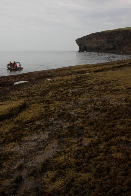
 Wello Penguin en route to Hoy")
5 Monitoring Marine Habitats of West Mainland Orkney Ecological Consequences of deploying wave energy converters may include: Direct physical impacts during construction, operation, decommissioning, etc Hydrodynamic changes to sedimentation, turbidity etc Potential changes to zonation and population dynamics due to reduced energy downstream (especially nonlinear effects) Wello Penguin en route to Hoy Pelamis off Hoy

6 Monitoring Marine Habitats of West Mainland Orkney We have established a monitoring regime to determine biological changes on rocky shores due to: Removal of energy by wave energy converters Long-term climatic change Local seasonal variations Random noise


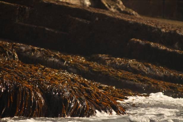
7 Monitoring Marine Habitats of West Mainland Orkney Littoral Monitoring: Sublittoral Surveys and Monitoring: Cliff Surveys:


8 Monitoring Marine Habitats of West Mainland Orkney Littoral Monitoring: Some Candidate Species: Chthamalus stellatus S Fucus distichus anceps N Gibbula umbilicalis S Tectura testudinalis N Patella ulyssiponensis S

9 Length Index (cm) Monitoring Marine Habitats of West Mainland Orkney Fucus distichus anceps -Boreal seaweed specialised for high energy environment -Expected to vacate UK waters with increased sea temperatures -Usually forms discrete zones Quadrat photography of F. distichus anceps Marwick Head: July Low spring tide shore observation: -Monthly photographic survey to determine density of cover -Biweekly measurement of tagged individuals -Quarterly fixed point photography of vertical zonation patterns (including Infra-red) /7/09 30/9/09 30/12/09 31/3/10 30/6/10 29/9/10 29/12/10 30/3/11 29/6/11 Maximum frond length of 23 individual members of F. vesiculosus f. linearis Recorded at Billia Croo: July Current
10 Fucus distichus anceps: vertical zonation monitoring, Northside, Birsay
11 Fucus distichus anceps: vertical zonation monitoring, Northside, Birsay Porphyra umbilicalis F. distichus anceps Palmaria palmata Enteromorpha sp.

12 Fucus distichus anceps: vertical zonation monitoring, Northside, Birsay

13 Fucus distichus anceps: vertical zonation monitoring, Northside, Birsay

14 Fucus distichus anceps: vertical zonation monitoring, Northside, Birsay

15 Fucus distichus anceps: vertical zonation monitoring, Northside, Birsay

16 Fucus distichus anceps: vertical zonation monitoring, Northside, Birsay
17 Fucus distichus anceps: vertical zonation monitoring, Northside, Birsay Porphyra umbilicalis F. distichus anceps Palmaria palmata Enteromorpha sp.
18 Monitoring Marine Habitats of West Mainland Orkney Chthamalus stellatus (Poli s Stellate Barnacle) -Associated with weather-beaten headlands -Studies suggest great sensitivity to sea temperature changes -Distribution is spreading northwards -Monthly photographic survey of cleared rock surface to determine resettlement and competitive zonation patterns with another barnacle species (Semibalanus balanoides)

19 M90 quadrat (10 cm x 10 cm) Marwick Head: 1 March, 2010

20 Red = S. balanoides Green = C. stellatus

21 Percent cover: S. balanoides = 26.6% C. stellatus = 24.9%
22 Percent composition % Chthamalus % Semibalanus Level 13


23 Monitoring Marine Habitats of West Mainland Orkney Newly settled cyprid larvae and juvenile balanoid barnacles Marwick Head 13 April, Marwick Head: 27 August, 2010 Chthamaloid cyprid larvae Juvenile chthamaloid


24 Monitoring Marine Habitats of West Mainland Orkney Sublittoral Survey and Monitoring Methodologies using: ROV -Transects to 75 m depth Drop Frame/Sled -To 150 m Biotope characterisation using subsea video and still imaging Sentinel species monitoring Ground-truthing of hydrodynamic models of tidal energy extraction & field wave energy profiling

25 Sublittoral Studies: Actinia equina, Alaria esculenta and L. digitata - Marwick Head: 5 metres Row Head - Transects: -500m latitudinal intervals -5m depth contours to 50m -Major biological zones Courtesy of the United Kingdom Hydrographic Office 2005
26 Sublittoral Studies: Luidia ciliaris, L. hyperborea, Echinus esculentus and Alcyonium digitatum Row Head: 29 metres


27 Sublittoral Studies: Polychaete casts in fine sediment Stromness Harbour: 3 metres


")
 Lithodes maja")
28 Monitoring Marine Habitats of West Mainland Orkney Candidate sublittoral sentinel species: Cucumaria frondosa (a sea cucumber) Leptasterias muelleri (a sea star) Holothuria forskali ( cotton spinner ) Lithodes maja (Northern Stone Crab) N N S N


29 Monitoring Marine Habitats of West Mainland Orkney Sublittoral Studies: Ground-truthing tidal models and wave field data SUNTANS Tidal flow model of Pentland Firth Terabuoy Bob Beharie: ICIT/SuperGen PhD student
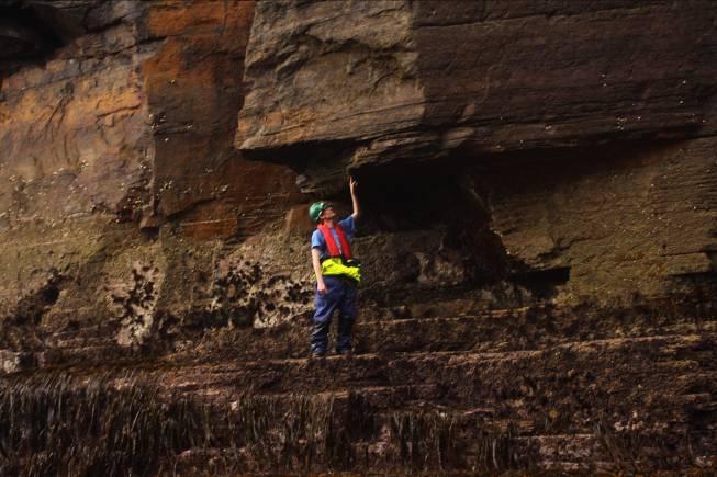
30 Monitoring Marine Habitats of West Mainland Orkney West Mainland Cliff Survey

31 Monitoring Marine Habitats of West Mainland Orkney West Mainland Cliff Survey Fucus distichus anceps Barnacles Mastocarpus stellatus Corallina officinalis Alaria esculenta


32 Monitoring Marine Habitats of West Mainland Orkney West Mainland Cliff Survey

33 N Monitoring Marine Habitats of West Mainland Orkney West Mainland Cliff Survey Provide data for: Courtesy of the Ordnance Survey -detailed description of biotopes along this coastline -comprehensive spatial assessment of F. distichus anceps distribution including hydrodynamic and substrate evaluation -merging with bathymetric data supplied by The Crown Estate -merging with Geographic Information System database -informing Marine Spatial Planning at wave energy extraction sites
34 Recent Presentations/Publications Shields, Woolf, Grist, Kerr, Jackson, Harris, Bell, Beharie, Want, Osalusi, Gibb & Side (2011): Marine Renewable Energy: the Ecological Implications of Altering the Hydrodynamics of the Marine Environment. Ocean and Coastal Management. 54: 2-9. Want, Bell, & Side: Methodologies for the Study of the Ecological Consequences of Wave Energy Extraction on the Rocky Shoreline of Orkney. Journal of Marine Ecology (Publication submitted under review). Want, Bell, & Side: Monitoring Marine Habitats of West Mainland Orkney: will Wave Energy Extraction contribute to long-term change? ICES Annual Science Conference, 22 September, 2011 (Abstract and Presentation). Want, Bell, & Side: Fucus distichus anceps: a sentinel for long-term climatic change. (In preparation) Want, Bell, & Side: West Mainland Orkney a Marine Biological Survey. (In preparation).


35 The Environmental Interactions Of Marine Renewable Energy Technologies

36 Thank You Any Questions or comments?
37 % of Species Relative abundance % of species % of species Energy extraction only Climate change only % Pu % Gu % Cs 40 % Pu % Gu % Cs Reduced exposure Climate change Both energy extraction and climate change Energy extraction or Climate change Both Energy extraction and Climate change % Pu % Gu % Cs Reduced exposure / Climate change Reduced exposure & Climate change Expected change in relative abundance of Fucus distichus anceps in the presence of either or both of reduced exposure and climate change

38 Monitoring Marine Habitats of West Mainland Orkney Barnacle analysis
WELCOME TO ST ANDREWS ON TOUR: ORIELTON 2017
 WELCOME TO ST ANDREWS ON TOUR: ORIELTON 2017 STAFF ANDY BLIGHT (Capt) SAFETY Signature! GRANT BROWN JEFF GRAVES GINNY GREENWAY SUE HEALY FAITH JONES DAVID PATERSON DAVID SHUKER Intertidal ecology: The
Project Report. Irish Sea Reef Survey. On behalf of: National Parks and Wildlife Service Department of the Environment, Heritage and Local Government
 Project Report Irish Sea Reef Survey On behalf of: National Parks and Wildlife Service Department of the Environment, Heritage and Local Government May 2010 Table of Contents 1. INTRODUCTION... 3 2. MATERIALS
ASSOCIATIONS AMONG SPECIES RICHNESS AND PHYSICAL VARIABLES IN NAHANT, MA TIDE POOLS. Kristen Cullity
 ASSOCIATIONS AMONG SPECIES RICHNESS AND PHYSICAL VARIABLES IN NAHANT, MA TIDE POOLS Kristen Department of Biology,, Worcester, MA 01610 USA (kcullity@clarku.edu) Abstract Tide pools along the high, middle,
Larvae survive, grow, develop, disperse. Adult. Juvenile. Rocky Intertidal Ecology
 Rocky Intertidal Ecology Bipartite life cycle of benthic marine organisms with pelagic larvae review I. Population Structure (review) II. Settlement & Recruitment III. Zonation IV. Experiments that changed
DRAFT REPORT. Submitted to: Public Works and Government Services Canada Saint John, New Brunswick
 PWGSC PROJECT #R.078190.002 UNDERWATER BENTHIC HABITAT SURVEY Proposed Construction and Dredge Areas Leonardville DFO-SCH Leonardville, Deer Island, New Brunswick DRAFT REPORT Submitted to: Public Works
Bipartite life cycle of benthic marine organisms with pelagic larvae. Larvae. survive, grow, develop, disperse. Pelagic Environment
 Bipartite life cycle of benthic marine organisms with pelagic larvae Larvae survive, grow, develop, disperse reproduce Pelagic Environment Benthic Environment settlement Adult Juvenile survive, grow, mature
Relatively little hard substrate occurs naturally in the
 CHAPTER FIVE Rock Habitats Relatively little hard substrate occurs naturally in the estuary, owing mainly to the vast quantities of fine sediment that have been deposited by the rivers. Rock habitat is
Scalby Ness to Filey Brigg Rocky Shore Survey
 Omnicom ref: 24772 ITT 394 Final Report Dr Nova Mieszkowska Dr Heather Sugden Contents Executive Summary... 4 1.0 Introduction... 5 1.1 Aims and Objectives... 5 2.0 Methods... 7 2.1 Phase I and II Rocky
ECOLOGICAL CHARACTERISATION SURVEY
 ABERDEEN HARBOUR EXPANSION PROJECT November 2015 Volume 3: Technical Appendices Appendix 12-A INTERTIDAL BENTHIC ECOLOGICAL CHARACTERISATION SURVEY Nigg Bay Intertidal Survey Report Technical Report CMACS
Marine Farming Site North Kilbrannan North Kilbrannan Video Survey March 2017
 Marine Farming Site North Kilbrannan North Kilbrannan Video Survey March 2017 MARINE HARVEST ( SCOTLAND) LIMITED MARCH 2018 Registered in Scotland No. 138843 Registered Office, 1st Floor, Admiralty Park
The Coast: Beaches and Shoreline Processes
 1 2 3 4 5 6 7 8 9 The Coast: es and Shoreline Processes Trujillo & Thurman, Chapter 10 Oceanography 101 Chapter Objectives Recognize the various landforms characteristic of beaches and coastal regions.
TASMANIAN SEAGRASS COMMUNITIES
 TASMANIAN SEAGRASS COMMUNITIES by Christopher Grant Rees, B.Ed (}Ions.) Submitted in partial fulfilment of the requirement for the degree of Master of Environmental Studies (By Coursework) Centre for Environmental
The Coast: Beaches and Shoreline Processes Trujillo & Thurman, Chapter 10
 The Coast: es and Shoreline Processes Trujillo & Thurman, Chapter 10 Oceanography 101 Chapter Objectives Recognize the various landforms characteristic of beaches and coastal regions. Identify seasonal
The Rising Tide: Submerged Landscape of Orkney
 The Rising Tide: Submerged Landscape of Orkney Quarterly Report: June 2009 S Dawson i & CR Wickham-Jones ii i Department of Geography, University of Dundee, S.Dawson@dundee.ac.uk ii Department of Archaeology,
Landscape Systems: Coasts 3 days
 AS Level Geography Edexcel Landscape Systems: Coasts 3 days Deliver two days of fieldwork within an inspiring physical environment covering all the recommended themes in depth. Prepare AS level students
Larvae survive, grow, develop, disperse. Adult. Juvenile. Bipartite life cycle of benthic marine organisms with pelagic larvae. Pelagic Environment
 Bipartite life cycle of benthic marine organisms with pelagic larvae Larvae survive, grow, develop, disperse In the beginning when ecologists first wandered into the intertidal I. Pattern: species distributed
Create your own map for tidepooling, beach field trips, boating, camping, kayaking, fishing, and exploring the beaches in Southcentral Alaska.
 Create your own map for tidepooling, beach field trips, boating, camping, kayaking, fishing, and exploring the beaches in Southcentral Alaska. Here s an opportunity to download and customize your own free
Coastal Landscapes Case Study 3 days
 GCSE Geography OCR A Coastal Landscapes Case Study 3 days In-depth study of a coastal landscape providing a detailed case study, to ensure students are prepared for the Paper 1 exam: Living in the UK Today.
Coastal Landscapes Case Study 3 days
 GCSE Geography OCR B Coastal Landscapes Case Study 3 days In-depth study of a coastal landscape providing a detailed case study, to ensure students are prepared for Paper 1: Our Natural World. Complete
(2) Scientists investigated the diversity of plants in a small area within a forest. The table shows their results. Number of individuals
 Scientists investigated the diversity of plants in a small area within a forest. The table shows their results. Number of individuals") Q1. (a) What is a species? (b) Scientists investigated the diversity of plants in a small area within a forest. The table shows their results. Plant species Number of individuals Himalayan raspberry 20
Q1. (a) What is a species? (b) Scientists investigated the diversity of plants in a small area within a forest. The table shows their results. Plant species Number of individuals Himalayan raspberry 20
The Problem. Which ecosystems are the most sensitive? Where will ecosystems be migrating? Where will investments be overwhelmed?
 BC Parks BC Parks is responsible for the designation, management and conservation of a system of ecological reserves, provincial parks and recreation areas located throughout the province. British Columbia
Species specific geographical distribution patterns in a warm Barents Sea: haddock vs. cod
 Species specific geographical distribution patterns in a warm Barents Sea: haddock vs. cod Nordic Climate-Fish 2nd Conference: Latitudinal changes in marine resources, exploitation and society within the
WIND EFFECTS ON CHEMICAL SPILL IN ST ANDREW BAY SYSTEM
 WIND EFFECTS ON CHEMICAL SPILL IN ST ANDREW BAY SYSTEM PETER C. CHU, PATRICE PAULY Naval Postgraduate School, Monterey, CA93943 STEVEN D. HAEGER Naval Oceanographic Office, Stennis Space Center MATHEW
Coastal Systems and Landscapes 3 days
 AS Level Geography WJEC Coastal Systems and Landscapes 3 days This course is for Welsh schools. This in-depth course prepares students for the physical fieldwork focusing on the Coastal option, for Section
A1.41: Communities of Atlantic littoral rockpools
 European Red List of Habitats - Marine: rth East Atlantic Habitat Group A1.41: Communities of Atlantic littoral rockpools Summary This habitat has a large natural range in the rth East Atlantic region
Exploitation of Ocean Predictions by the Oil and Gas Industry. GODAE OceanView Symposium 2013
 Exploitation of Ocean Predictions by the Oil and Gas Industry GODAE OceanView Symposium 2013 Introduction Information needs Challenges Acknowledgements IMarEST/SUT Metocean Awareness Course Colleagues
Larvae survive, grow, develop, disperse. Juvenile. Adult. Bipartite life cycle of benthic marine organisms with pelagic larvae. Pelagic Environment
 Bipartite life cycle of benthic marine organisms with pelagic larvae Larvae survive, grow, develop, disperse Rocky Intertidal Pattern: species distributed in discrete zones relative to elevation and tidal
Crustose algae communities on Baltic infralittoral rock and mixed substrata
 European Red List of Habitats Marine: Baltic Habitat Group Crustose algae communities on Baltic infralittoral rock and mixed substrata Summary This benthic habitat is present throughout the Baltic where
Eishort 2. Loch Eishort, Isle of Skye. Seabed Video Survey
 Eishort 2 Loch Eishort, Isle of Skye Seabed Video Survey Copyright Hjaltland Seafarms Ltd. All rights reserved. The copyright of this document rests with Hjaltland Seafarms Ltd; no citation from it, in
Rocky Intertidal Ecology -- part II The development of experimental ecology. Connell and the experimental revolution
 Rocky Intertidal Ecology -- part II The development of experimental ecology I. Intertidal Zonation, part II 1. Follow ups on Connell 2. Predation 3. Exceptions II. Horizontal Distribution 1. Variation
Purpose of large scale mapping/inventories
 Mapping of benthic habitats in NE Baltic Sea Georg Martin Estonian Marine Institute, University of Tartu & good colleagues from EMI, IAE and CORPI Protecting the marine ecosystem Lessons learned from project
Types of intertidal communities
 Between the tides Marine ecosystems 1 Intertidal Delimited by the highest high tide and the lowest low tides marks The best studied and best-understood by humans Relatively easy to sample compared to other
Students will work in small groups to collect detailed data about a variety of living things in the study area.
 TEACHER BOOKLET Sampling along a transect Name BIOLOGY Students will work in small groups to collect detailed data about a variety of living things in the study area. Students will need: 10 metre long
The use of MIKE21 to study the. barrier beach system of Inner Dingle Bay, Co. Kerry, Ireland. Dr. Michael O Shea Malachy Walsh and Partners
 The use of MIKE21 to study the morphodynamic evolution of the mid-bay barrier beach system of Inner Dingle Bay, Co. Kerry, Ireland Dr. Michael O Shea Malachy Walsh and Partners Contents Why Study Morphodynamics
by B.A. Foster THE EFFECT OF ASPECT ON POPULATION COMPOSITION
 TANE (1966) 12 : 37-44 37 THE EFFECTS OF WAVE EXPOSURE AND ASPECT ON THE VERTICAL SHORE DISTRIBUTION AND POPULATION COMPOSITION OF MELARHAPHA OLIVERI. by B.A. Foster INTRODUCTION The periwinkle Melarhapha
Annual algae communities on Baltic infralittoral coarse sediment
 European Red List of Habitats Marine: Baltic Sea Habitat Group Annual algae communities on Baltic infralittoral coarse sediment Summary This habitat is found in all the Baltic Sea subbasins and is especially
Coastal Inlets Research Program US Army Corps of Engineers Engineering Research and Development Center
 Coastal Inlets Research Program US Army Corps of Engineers Engineering Research and Development Center Site of Moriches Inlet Nov. 1951 Julie Dean Rosati and Nicholas C. Kraus, CIRP Program Manager Shinnecock
Unit 1: Water Systems on Earth Chapter 2
 Unit 1: Water Systems on Earth Chapter 2 Create a mind map with the driving question, Why are Oceans Important? Remember: Why are oceans so important? Why are oceans so important? Primary water source
Critical Issues in Assessment of Offshore Wind Farm Development on Dispersion and Settling of Scallop Larvae in the Northeast U.S.
 Critical Issues in Assessment of Offshore Wind Farm Development on Dispersion and Settling of Scallop Larvae in the Northeast U.S. Coastal Ocean Changsheng Chen School for Marine Science and Technology
National Report of New Zealand
 National Report of New Zealand Prepared for GLOSS Training Course Tokyo May 2006 Glen Rowe Data Analyst Hydrographic Services Land Information New Zealand National Office 160 Lambton Quay Wellington New
Bob Van Dolah. Marine Resources Research Institute South Carolina Department of Natural Resources
 Bob Van Dolah Marine Resources Research Institute South Carolina Department of Natural Resources Shoreline Change Will Occur! On our front beaches where it is not easy to retreat Shoreline Change Will
PHOTOGRAMMETRY AND GIS TECHNOL 1 OGIES FOR MONITORING COASTAL EROSION ALONG DAR ES SALAAM COASTLINE. By: Z.Y Masele, S.D Mayunga1.
 PHOTOGRAMMETRY AND GIS TECHNOL 1 OGIES FOR MONITORING COASTAL EROSION ALONG DAR ES SALAAM COASTLINE. By: Z.Y Masele, S.D Mayunga1 Abstract Dar Es salaam coastline is seriously suffering from coastal soil
Modeling habitat suitability for the European green crab using the ShoreZone mapping system
 Modeling habitat suitability for the European green crab using the ShoreZone mapping system Jodi N. Harney, Ph.D. and John R. Harper, Ph.D. Coastal and Ocean Resources Inc. Mary Morris, R.P. Bio. Archipelago
Year 1 name and locate the four countries and capital cities of the United Kingdom and its surrounding seas
 Long Term Objective Organisation for Geography Please note that only statutory requirements should be included in this document; any supplementary guidance and information should be retained by Subject
Are Living Shorelines Effective for Erosion Management on North Atlantic Coastlines?
 Are Living Shorelines Effective for Erosion Management on North Atlantic Coastlines? By Kirsten Ellis, BSc, MSc candidate Supervisor: Jeremy Lundholm, PhD Committee: Danika Van Proosdij, PhD and Rosmarie
UNIT 5: ECOLOGY Chapter 15: The Biosphere
 CORNELL NOTES Directions: You must create a minimum of 5 questions in this column per page (average). Use these to study your notes and prepare for tests and quizzes. Notes will be stamped after each assigned
Modeling the Columbia River Plume on the Oregon Shelf during Summer Upwelling. 2 Model
 Modeling the Columbia River Plume on the Oregon Shelf during Summer Upwelling D. P. Fulton August 15, 2007 Abstract The effects of the Columbia River plume on circulation on the Oregon shelf are analyzed
Name Class Date. Section: How Organisms Interact in Communities. In the space provided, explain how the terms in each pair differ in meaning.
 Section: How Organisms Interact in Communities In the space provided, explain how the terms in each pair differ in meaning 1 coevolution, secondary compounds 2 predation, parasitism Complete each statement
Bio 20 Marine Biology Exam 4 Outline
 The Intertidal Zone (Littoral Zone) Bio 20 Marine Biology Exam 4 Outline Between the Tides (Chapter 11) 2 main types of intertidal zones I. Rocky Shore Communities A. Problems that rocky intertidal organisms
Technologies for sea bottom inhabitants' monitoring and Integral Costal Zones Management. Example of the Kandalaksha Bay, White Sea
 Technologies for sea bottom inhabitants' monitoring and Integral Costal Zones Management. Example of the Kandalaksha Bay, White Sea Mikhail Tokarev, Roman Pevzner Transfer Technology Office of Lomonosov
DIVISION OF COASTAL MANAGEMENT TO STUDY CURRENT LONG-TERM EROSION RATES ADJACENT TO TERMINAL GROINS
 DIVISION OF COASTAL MANAGEMENT TO STUDY CURRENT LONG-TERM EROSION RATES ADJACENT TO TERMINAL GROINS North Carolina Department of Environmental Quality Division of Coastal Management February 22, 2018 N.
Marine ecosystem mapping at the Prince Edward Islands
 Marine ecosystem mapping at the Prince Edward Islands Biodiversity Planning Forum NBA special session June 2018 R Adams, C von der Meden, A Dayaram, K Sink, A Lombard, A Bosman, M Dopolo, F Fourie, L Harris,
Project 1.3.1: Improved knowledge of biota, habitats and risks. Project Leader: Dr Mick Haywood, CSIRO Division of Marine and Atmospheric Research
 Marine and Tropical Sciences Research Facility (MTSRF) June 2007 Milestone Report Project 1.3.1: Improved knowledge of biota, habitats and risks Project Leader: Dr Mick Haywood, CSIRO Division of Marine
Science 8 - Water Systems Test - Chapters 1-2
 Science 8 - Water Systems Test - Chapters 1-2 Multiple Choice (30 marks) Identify the choice that best completes the statement or answers the question. 1. What percentage represents the amount of fresh
APPENDIX E-4. Field Report: Intertidal Habitat and Marine Biota Survey
 APPENDIX E-4 Field Report: Intertidal Habitat and Marine Biota Survey Field Report Intertidal Habitat and Marine Biota Survey of the Vallejo Marine Terminal Site, Vallejo, California April 18, 2014 Prepared
CHAPTER 28. PHYSIOGRAPHY Cook Inlet Drainages
 PEBBLE PROJECT ENVIRONMENTAL BASELINE DOCUMENT 2004 through 2008 CHAPTER 28. PHYSIOGRAPHY Cook Inlet Drainages PREPARED BY: Knight Piésold Ltd. PHYSIOGRAPHY COOK INLET DRAINAGES TABLE OF CONTENTS TABLE
Dynamic Coast. Coastal erosion / Management Briefing to THC
 Dynamic Coast Coastal erosion / Management Briefing to THC What is Dynamic Coast? Dynamic Coast is a Scottish Government project, funded by CREW, managed by SNH, with a research team from the University
Coastal Systems and Landscapes 3 days
 AS Level Geography Eduqas Coastal Systems and Landscapes 3 days Deliver two days of fieldwork within an inspiring physical environment. Prepare AS level students for Paper 1 Section B: Fieldwork Investigation
Hydroacoustic survey and bathymetric map creation for Brant Lake, New York
 Hydroacoustic survey and bathymetric map creation for Brant Lake, New York Holly A. Waterfield CLM 1 INTRODUCTION Brant Lake is located in Warren County, New York, within the bounds of the Adirondack Park.
Science. Earth Science. New Jersey Quality Single Accountability Continuum (NJQSAC) Department: Course Title. Textbook(s): Focus on Earth Science
 Department: Course Title. Textbook(s): Focus on Earth Science") New Jersey Quality Single Accountability Continuum (NJQSAC) Textbook(s): Focus on Unit 1, September What is science? What is the Scientific Method? What is matter? How do atoms combine to form compounds?
New Jersey Quality Single Accountability Continuum (NJQSAC) Textbook(s): Focus on Unit 1, September What is science? What is the Scientific Method? What is matter? How do atoms combine to form compounds?
SHORELINE MANAGEMENT PLAN FOR OWEN ANCHORAGE AND COCKBURN SOUND SHORELINE MONITORING PLAN
 SHORELINE MANAGEMENT PLAN FOR OWEN ANCHORAGE AND COCKBURN SOUND SHORELINE MONITORING PLAN CHAPTER EIGHT OF DOCUMENT: LONG-TERM SHELLSAND DREDGING, OWEN ANCHORAGE ENVIRONMENTAL MANAGEMENT PROGRAMME JUNE
BIM FOR SURVEYORS. Survey Economics. Tracking Wildlife. Measuring a Meridian State of recovery. With a total station. Time in 1700s Philadelphia
 JUNE 2017 BIM FOR SURVEYORS Survey Economics Tracking Wildlife Measuring a Meridian State of recovery With a total station Time in 1700s Philadelphia hale Wa Using a Total Station to Track Marine Mammals
Curriculum Links AS and A level Field Studies
 Equipment Includes Human Geography Coastal Management Students examine the conflicts that arise from coastal erosion and the options for coastal management. They investigate different types of coastal
MUDMAP TM. Software Description
 ASA Applied Science Associates, Inc. 70 Dean Knauss Drive Narragansett, RI 02882-1143 U.S.A. Tel: 401-789-6224 Fax: 401-789-1932 asa@asascience.com www.asascience.com MUDMAP TM Software Description MUDMAP
SCONSER QUARRY BASELINE VIDEO SURVE Y JANUARY 2017
 SCONSER QUARRY BASELINE VIDEO SURVE Y JANUARY 2017 Registered in Scotland No. 138843 Registered Office, 1st Floor, Admiralty Park Admiralty Road, Rosyth, Fife KY11 2YW Stob Ban House Glen Nevis Business
CORRELATION ANALYSIS BETWEEN PALAEMONETES SHRIMP AND VARIOUS ALGAL SPECIES IN ROCKY TIDE POOLS IN NEW ENGLAND
 CORRELATION ANALYSIS BETWEEN PALAEMONETES SHRIMP AND VARIOUS ALGAL SPECIES IN ROCKY TIDE POOLS IN NEW ENGLAND Douglas F., Department of Biology,, Worcester, MA 01610 USA (D@clarku.edu) Abstract Palamonetes
TEACHER CERTIFICATION STUDY GUIDE KNOWLEDGE OF THE NATURE OF SCIENCE...1. Skill 1.1 Identify the components of scientific inquiry...
 Table of Contents COMPETENCY 1.0 KNOWLEDGE OF THE NATURE OF SCIENCE...1 Skill 1.1 Identify the components of scientific inquiry...1 Skill 1.2 Skill 1.3 Skill 1.4 Skill 1.5 Identify the consistent patterns
Aim and objectives Components of vulnerability National Coastal Vulnerability Assessment 2
 ASSESSING THE UTILITY OF GEOMORPHIC SENSITIVITY MAPPING ON THE ILLAWARRA COAST Pamela Abuodha, Christina Baker, Chris Sharples, Darren Skene and Colin Woodroffe Geoquest Research Centre, University of
Draft exercise for share fair at Bozeman workshop only. This exercise is not ready for distribution. Please send helpful suggestions to
 Draft exercise for share fair at Bozeman workshop only. This exercise is not ready for distribution. Please send helpful suggestions to foleyd@plu.edu Figure list 1. Trailer photograph 2. Location map
NATIONAL CURRICULUM GEOGRAPHY PLANNING OVERVIEW
 GEOGRAPHY AUTUMN TERM SPRING TERM SUMMER TERM Year 1 Hunting and Hiding Me and My Wonderful World Beside The Sea identify seasonal and daily weather patterns in the United Kingdom and the location of hot
Red Sea - Dead Sea Water Conveyance Study Program Additional Studies
 Red Sea - Dead Sea Water Conveyance Study Program Additional Studies Red Sea Study Final Report Annex 1 Field and laboratory activities carried out during the study and their results July 213 TABLE OF
Edexcel 2 Landscape systems, processes and change
 Edexcel 2 Landscape systems, processes and change Area of the Spec Field Site Research areas Primary data collection Secondary data access Statistical analysis High and low Identifying of different Local
Glacial Geology of Moose Point State Park, ME
 Geologic Site of the Month May, 2013 Glacial Geology of Moose Point State Park, Maine 44 o 25 59.18"N, 68 o 56 37.11"W Text and photos by Woodrow B. Thompson, Department of Agriculture, Conservation &
Spatial variation in the abundance of eelgrass (Zostera marina) at eight sites in western Newfoundland, Canada 5/5/2015 V2.0
 at eight sites in western Newfoundland, Canada 5/5/2015 V2.0") Spatial variation in the abundance of eelgrass (Zostera marina) at eight sites in western Newfoundland, Canada 5/5/2015 V2.0 1 Summary The abundance of eelgrass (Zostera marina) was quantified at eight
Spatial variation in the abundance of eelgrass (Zostera marina) at eight sites in western Newfoundland, Canada 5/5/2015 V2.0 1 Summary The abundance of eelgrass (Zostera marina) was quantified at eight
IMPACTS OF MARINE ENERGY ON COASTAL SEDIMENTATION B) TIDAL POWER C) COASTAL SEDIMENTS D) GRAND CHALLENGES
 TIDAL POWER C) COASTAL SEDIMENTS D) GRAND CHALLENGES") IMPACTS OF MARINE ENERGY ON COASTAL SEDIMENTATION DAVID PRANDLE A) MARINE ENERGY PRACTICALITIES? B) TIDAL POWER C) COASTAL SEDIMENTS D) GRAND CHALLENGES MARINE ENERGY PRACTICALITIES? PARAMETER THEORY LA
IMPACTS OF MARINE ENERGY ON COASTAL SEDIMENTATION DAVID PRANDLE A) MARINE ENERGY PRACTICALITIES? B) TIDAL POWER C) COASTAL SEDIMENTS D) GRAND CHALLENGES MARINE ENERGY PRACTICALITIES? PARAMETER THEORY LA
Everglades National Park
 National Park Service U.S. Department of the Interior Climate Variability and the Coastal Physical Environment (Florida Bay) Presented by: Erik Stabenau - National Park Service Contributions from: Christina
Offshore Video Survey and Oceanographic Analysis: Georges Bank to the Chesapeake project
 Non-Technical Synopsis of the Offshore Video Survey and Oceanographic Analysis: Georges Bank to the Chesapeake project Executive Summary Dave Bethoney Kristin Kleisner Mark Anderson Changsheng Chen Bradley
Bishopville Prong Study
 Bathymetric and Sediment Assessment in the Bishopville Prong of St. Martin River Darlene V. Wells, Richard A. Ortt, Jr., and Stephen Van Ryswick Funded by MCBP 2011-2012 Implementation Grant Objectives
Coastal Processes and Shoreline Erosion on the Oregon Coast, Cascade Head to Cape Kiwanda
 State of Oregon Department of Geology and Mineral Industries Vicki S. McConnell, State Geologist Open File Report OFR O-04-11 Coastal Processes and Shoreline Erosion on the Oregon Coast, Cascade Head to
Complete Geography Overview: Year 1 to Year 6
 Option 1 Complete Geography Overview: Year 1 to Year 6 Autumn Term Spring Term Summer Term Year 1 Where do I live? Around the World The Four Seasons Year 2 At the Farm Let s go on Safari My World and Me
Geoduck Floating Nursery Monitoring Plan, Quarterly Reporting
 December 23, 2014 Mason County Department of Community Development Attn: Grace Miller, Senior Planner 411 N. Fifth Street PO Box 279 Shelton, WA 98584 Re: Geoduck Floating Nursery Monitoring Plan, Quarterly
 Page 1 of 5 Home research global climate enso effects Research Effects of El Niño on world weather Precipitation Temperature Tropical Cyclones El Niño affects the weather in large parts of the world. The
Aggregations on larger scales. Metapopulation. Definition: A group of interconnected subpopulations Sources and Sinks
 Aggregations on larger scales. Metapopulation Definition: A group of interconnected subpopulations Sources and Sinks Metapopulation - interconnected group of subpopulations sink source McKillup and McKillup
U.K. Reduced Species List (RSL) tool
 tool") U.K. Reduced Species List (RSL) tool Emma Wells (Wells Marine), Martin Wilkinson, Paul Wood (Heriot-Watt University), Clare Scanlan (SEPA), Mike Best (EA) Contact: Clare Scanlan clare.scanlan@sepa.org.uk
U.K. Reduced Species List (RSL) tool Emma Wells (Wells Marine), Martin Wilkinson, Paul Wood (Heriot-Watt University), Clare Scanlan (SEPA), Mike Best (EA) Contact: Clare Scanlan clare.scanlan@sepa.org.uk
Geol 117 Lecture 18 Beaches & Coastlines. I. Types of Coastlines A. Definition:
 I. Types of Coastlines A. Definition: 1. Shore = narrow zone where ocean meets land (e.g. beach) 2. Coast is a broad area where both ocean and land processes act a. Includes onshore marshes, dunes, sea
Supplemental Slides. Shore: Junction of Land & Water. Junction of Land & Water. Sea Level Variations. Shore vs. Coast. Sea Level Variations
 Shore: Junction of Land & Water Supplemental Slides Sediments come off land Most get dumped at the beach Sediment interacts with ocean waves and currents Junction of Land & Water Features: Breaking waves,
Shore: Junction of Land & Water. Sediments come off land Most get dumped at the beach Sediment interacts with ocean waves and currents
 Shore: Junction of Land & Water Supplemental Slides Sediments come off land Most get dumped at the beach Sediment interacts with ocean waves and currents Junction of Land & Water Features: Breaking waves,
Time allowed: 1 hour 30 minutes
 SPECIMEN ASSESSMENT MATERIAL GCSE GEOGRAPHY Paper 1 Living with the physical environment Specimen Materials For this paper you must have: a pencil a ruler. Time allowed: 1 hour 30 minutes Instructions
Assessing Storm Tide Hazard for the North-West Coast of Australia using an Integrated High-Resolution Model System
 Assessing Storm Tide Hazard for the North-West Coast of Australia using an Integrated High-Resolution Model System J. Churchill, D. Taylor, J. Burston, J. Dent September 14, 2017, Presenter Jim Churchill
GIS compilation of coastline variability spanning 60 years in the Mackenzie Delta and Tuktoyaktuk in the Beaufort Sea
 GEOLOGICAL SURVEY OF CANADA OPEN FILE 7685 GIS compilation of coastline variability spanning 60 years in the Mackenzie Delta and Tuktoyaktuk in the Beaufort Sea S. Hynes, S.M. Solomon, and D. Whalen 2014
Section 2.1 Ocean Basins. - Has helped determine where ocean basins are located. - Tectonic plates move changing the position of the continents.
 Science 8 Unit 1: Water Systems on Earth Chapter 2: Oceans Control the Water Cycle Section 2.1 Ocean Basins Oceans are important because: 1. Primary water source for the water cycle 2. Control weather
The History of Sea Level Rise in Delaware Bay: SLR has Little Impact on the Morphology of Limulus or its Functional Spawning Habitat
 The History of Sea Level Rise in Delaware Bay: SLR has Little Impact on the Morphology of Limulus or its Functional Spawning Habitat Bob Loveland (Rutgers Univ.) & Mark Botton (Fordham Univ.) There are
Satellite-derived environmental drivers for top predator hotspots
 Satellite-derived environmental drivers for top predator hotspots Peter Miller @PeterM654 South West Marine Ecosystems 2017 21 Apr. 2017, Plymouth University Satellite environmental drivers for hotspots
Coastal Biodiversity Survey Protocols
 Coastal Biodiversity Survey Protocols May, 2011 University of California Santa Cruz SWAT Team Table of Contents Selecting an appropriate location... 1 Set-Up... 1 Point-Contact Surveys... 1 Table 1: List
Broad-scale geographic variation in the organization of rocky intertidal communities in the Gulf of Maine
 Ecological Monographs, 84(4), 2014, pp. 579 597 Ó 2014 by the Ecological Society of America Broad-scale geographic variation in the organization of rocky intertidal communities in the Gulf of Maine ELIZABETH
Tuition, Medical and Behaviour Support Service
 Tuition, Medical and Behaviour Support Service Curriculum Policy - Primary Geography Reviewed: October 2018 Next Review: October 2019 Responsibility: Andrea Snow AIMS AND PRINCIPLES The national curriculum
Geography Long Term Plan. Autumn Spring Summer
 Geography Long Term Plan Autumn Spring Summer Year 1 Working Scientifically covered throughout the year Location Geography of UK Name, locate and identify characteristics of the four countries and capital
Name Hour. Section 4-1 The Role of Climate (pages 87-89) What Is Climate? (page 87) 1. How is weather different from climate?
 What Is Climate? (page 87) 1. How is weather different from climate?") Name Hour Section 4-1 The Role of Climate (pages 87-89) What Is Climate? (page 87) 1. How is weather different from climate? 2. What factors cause climate? The Greenhouse Effect (page 87) 3. Circle the
Name Hour Section 4-1 The Role of Climate (pages 87-89) What Is Climate? (page 87) 1. How is weather different from climate? 2. What factors cause climate? The Greenhouse Effect (page 87) 3. Circle the
Geography Advanced Subsidiary Paper 1
 Pearson Edexcel Level 3 GCE Geography Advanced Subsidiary Paper 1 Sample assessment material for first teaching September 2016 Resource Booklet Paper Reference 8GE0/01 Do not return this Resource Booklet
The surface of the ocean floor is as varied as the land. The five major oceans, from largest to smallest, are
 11.1 Ocean Basins The surface of the ocean floor is as varied as the land. The five major oceans, from largest to smallest, are w the Pacific w the Atlantic w the Indian w the Southern w the Arctic The