P Oskarshamn site investigation
|
|
|
- Moris Mathews
- 5 years ago
- Views:
Transcription
1 P Oskarshamn site investigation Geological single-hole interpretation of KLX09B, KLX09C, KLX09D, KLX09E, KLX09F, KLX11B, KLX11C, KLX11D, KLX11E and KLX11F Seje Carlsten, Allan Stråhle, Geosigma AB Håkan Mattsson, GeoVista AB Carl-Henric Wahlgren, Geological Survey of Sweden September 2008 Svensk Kärnbränslehantering AB Swedish Nuclear Fuel and Waste Management Co Box 250, SE Stockholm Tel
2 ISSN Tänd ett lager: SKB P P, R eller TR. Oskarshamn site investigation Geological single-hole interpretation of KLX09B, KLX09C, KLX09D, KLX09E, KLX09F, KLX11B, KLX11C, KLX11D, KLX11E and KLX11F Seje Carlsten, Allan Stråhle, Geosigma AB Håkan Mattsson, GeoVista AB Carl-Henric Wahlgren, Geological Survey of Sweden September 2008 Keywords: Geophysics, unit, Borehole, Deformation zone, Fractures, Alteration. This report concerns a study which was conducted for SKB. The conclusions and viewpoints presented in the report are those of the authors and do not necessarily coincide with those of the client. Data in SKB s database can be changed for different reasons. Minor changes in SKB s database will not necessarily result in a revised report. Data revisions may also be presented as supplements, available at A pdf version of this document can be downloaded from
3 Abstract This report contains geological single-hole interpretation of the cored boreholes KLX09B, KLX09C, KLX09D, KLX09E, KLX09F, KLX11B, KLX11C, KLX11D, KLX11E and KLX11F at Laxemar. The interpretation combines the geological core mapping, interpreted geophysical logs and borehole radar measurements to identify rock units and possible deformation zones in the boreholes. The geological single-hole interpretation shows that the borehole KLX09B is dominated by Ävrö granite (501044) which constitutes one rock unit (RU1). Subordinate rock types comprise fine-grained granite (511058), fine-grained diorite-gabbro (505102) and sparse occurrence of pegmatite (501061). Two possible deformation zones are identified in KLX09B (DZ1-DZ2). Borehole KLX09C is dominated by Ävrö granite (501044) which constitutes one rock unit (RU1). Subordinate rock types comprise fine-grained granite (511058), fine-grained diorite-gabbro (505102) and very sparse occurrences of fine-grained dioritoid (501030), pegmatite (501061) and granite (501058). Two possible deformation zones are identified in KLX09C (DZ1-DZ2). One rock unit (RU1) occurs in borehole KLX09D. The borehole is dominated by Ävrö granite (501044). Subordinate rock types comprise occurrences of fine-grained granite (511058), finegrained diorite-gabbro (505102) and very sparse occurrences of pegmatite (501061), granite (501058) and fine-grained dioritoid (501030). Two possible deformation zones are identified in KLX09D (DZ1-DZ2). Borehole KLX09E is dominated by Ävrö granite (501044) which constitutes one rock unit (RU1). Subordinate rock types comprise fine-grained diorite-gabbro (505102), fine-grained granite (511058) and very sparse occurrences of pegmatite (501061), fine-grained dioritoid (501030) and granite (501058). Two possible deformation zones are identified in KLX09E (DZ1-DZ2). Borehole KLX09F is dominated by Ävrö granite (501044) which constitutes one rock unit (RU1). Subordinate rock types comprise fine-grained diorite-gabbro (505102), granite (501058), fine-grained granite (511058) and very sparse occurrences of pegmatite (501061) and fine-grained dioritoid (501030). Five possible deformation zones are identified in KLX09F (DZ1-DZ5). The geological single-hole interpretation shows that the borehole KLX11B is dominated by quartz monzodiorite (501036) which constitutes one rock unit (RU1). Subordinate rock type comprises fine-grained granite (511058). Two possible deformation zones are identified in KLX11B (DZ1-DZ2). One rock unit (RU1) occurs in borehole KLX11C. The borehole is dominated by quartz monzodiorite (501036). Subordinate rock types comprise occurrences of fine-grained granite (511058) and very sparse occurrences of fine-grained dioritoid (501030), granite (501058) and pegmatite (501061). No possible deformation zone has been identified in KLX11C. Borehole KLX11D is dominated by quartz monzodiorite (501036) which constitutes one rock unit (RU1). Subordinate rock type comprises fine-grained granite (511058) and very sparse occurrences of pegmatite (501061) and fine-grained dioritoid (501030). Three possible deformation zones are identified in KLX11D (DZ1-DZ3). Borehole KLX11E is dominated by quartz monzodiorite (501036) which constitutes one rock unit (RU1). Subordinate rock types comprise fine-grained granite (511058) and very sparse occurrences of granite (501058) and pegmatite (501061). Four possible deformation zones are identified in KLX11E (DZ1-DZ4). The geological single-hole interpretation shows that the borehole KLX11F is dominated by quartz monzodiorite (501036) which constitutes one rock unit (RU1). Subordinate rock types comprise fine-grained granite (511058) and very sparse occurrence of pegmatite (501061). One possible deformation zone is identified in KLX11F (DZ1). 3
4 Sammanfattning Denna rapport behandlar geologisk enhålstolkning av kärnborrhålen KLX09B, KLX09C, KLX09D, KLX09E, KLX09F, KLX11B, KLX11C, KLX11D, KLX11E och KLX11F i Laxemar. Den geologiska enhålstolkningen syftar till att utifrån den geologiska karteringen, tolkade geofysiska loggar och borrhålsradarmätningar identifiera olika litologiska enheters fördelning i borrhålen samt möjliga deformationszoners läge och utbredning. Den geologiska enhålstolkningen visar att kärnborrhålet KLX09B domineras av Ävrögranit (501044) vilken utgör en bergartsenhet (RU1). Underordnade bergarter utgörs av finkornig granit (511058), finkornig diorit-gabbro (505102) och smärre förekomster av pegmatit (501061). Två möjliga deformationszoner har identifierats i KLX09B (DZ1-DZ2). Kärnborrhålet KLX09C domineras av Ävrögranit (501044) vilken utgör en bergartsenhet (RU1). Underordnade bergarter utgörs av finkornig granit (511058), finkornig diorit-gabbro (505102) och smärre förekomster av finkornig dioritoid (501030), pegmatit (501061) och granit (501058). Två möjliga deformationszoner har identifierats i KLX09C (DZ1-DZ2). En bergartsenhet (RU1) förekommer i borrhålet KLX09D. Borrhålet domineras av Ävrögranit (501044). Underordnade bergarter utgörs av finkornig granit (511058), finkornig diorit-gabbro (505102) och smärre förekomster av pegmatit (501061), granit (501058) och finkornig dioritoid (501030). Två möjliga deformationszoner har identifierats i KLX09D (DZ1-DZ2). Kärnborrhålet KLX09E domineras av Ävrögranit (501044) vilken utgör en bergartsenhet (RU1). Underordnade bergarter utgörs av finkornig diorit-gabbro (505102), finkornig granit (511058) och smärre förekomster av pegmatit (501061), finkornig dioritoid (501030) och granit (501058). Två möjliga deformationszoner har identifierats i KLX09E (DZ1-DZ2). Kärnborrhålet KLX09F domineras av Ävrögranit (501044) vilken utgör en bergartsenhet (RU1). Underordnade bergarter utgörs av finkornig diorit-gabbro (505102), granit (501058), finkornig granit (511058) och smärre förekomster av pegmatit (501061) och finkornig dioritoid (501030). Fem möjliga deformationszoner har identifierats i KLX09F (DZ1-DZ5). Den geologiska enhålstolkningen visar att kärnborrhålet KLX11B domineras av kvartsmonzodiorit (501036) vilken utgör en bergartsenhet (RU1). Underordnad bergart utgörs av finkornig granit (511058). Två möjliga deformationszoner har identifierats i KLX11B (DZ1-DZ2). En bergartsenhet (RU1) förekommer i borrhålet KLX11C. Borrhålet domineras av kvarts monzodiorit (501036). Underordnade bergarter utgörs av finkornig granit (511058) och smärre förekomster av finkornig dioritoid (501030), granit (501058) och pegmatit (501061). Inga deformationszoner har identifierats i KLX11C. Kärnborrhålet KLX11D domineras av kvartsmonzodiorit (501036) vilken utgör en bergartsenhet (RU1). Underordnade bergarter utgörs av finkornig granit (511058) och smärre förekomster av pegmatit (501061) och finkornig dioritoid (501030). Tre möjliga deformationszoner har identifierats i KLX11D (DZ1-DZ3). Kärnborrhålet KLX11E domineras av kvartsmonzodiorit (501036) vilken utgör en bergartsenhet (RU1). Underordnade bergarter utgörs av finkornig granit (511058) och smärre förekomster av granit (501058) och pegmatit (501061). Fyra möjliga deformationszoner har identifierats i KLX11E (DZ1-DZ4). Den geologiska enhålstolkningen visar att kärnborrhålet KLX11F domineras av kvartsmonzo diorit (501036) vilken utgör en bergartsenhet (RU1). Underordnade bergarter utgörs av finkornig granit (511058) och smärre förekomster av pegmatit (501061). En möjlig deformationszon har identifierats i KLX11F (DZ1). 4
5 Contents 1 Introduction 7 2 Objective and scope 9 3 Data used for the geological single-hole interpretation 11 4 Execution General Nonconformities 23 5 Results KLX09B KLX09C KLX09D KLX09E KLX09F KLX11B KLX11C KLX11D KLX11E KLX11F 32 6 Comments 33 7 References 35 Appendix 1 Geological single-hole interpretation of KLX09B 37 Appendix 2 Geological single-hole interpretation of KLX09C 39 Appendix 3 Geological single-hole interpretation of KLX09D 41 Appendix 4 Geological single-hole interpretation of KLX09E 43 Appendix 5 Geological single-hole interpretation of KLX09F 45 Appendix 6 Geological single-hole interpretation of KLX11B 47 Appendix 7 Geological single-hole interpretation of KLX11C 49 Appendix 8 Geological single-hole interpretation of KLX11D 51 Appendix 9 Geological single-hole interpretation of KLX11E 53 Appendix 10 Geological single-hole interpretation of KLX11F 55 5
6 1 Introduction Much of the primary geological and geophysical borehole data stored in the SKB database Sicada need to be integrated and synthesized before they can be used for modeling in the 3D-CAD system Visualization System (RVS). The end result of this procedure is a geological singlehole interpretation, which consists of integrated series of different loggings and accompanying descriptive documents (SKB MD v.3.0, SKB internal controlling document). This document reports the results gained by the geological single-hole interpretation of boreholes KLX09B, KLX09C, KLX09D, KLX09E, KLX09F, KLX11B, KLX11C, KLX11D, KLX11E and KLX11F at Laxemar (Figure 1-1), which is one of the activities performed within the site investigation at Oskarshamn. The work was carried out in accordance with activity plan AP PS The controlling documents for performing this activity are listed in Table 1-1. Both activity plan and method description are SKB s internal controlling documents. type nomenclature that has been used is shown in Table 1-2. Original data from the reported activity are stored in the primary database Sicada, where they are traceable by the Activity Plan number (AP PS ). Only data in SKB s databases are accepted for further interpretation and modelling. The data presented in this report are regarded as copies of the original data. Data in the databases may be revised, if needed. Such revisions will not necessarily result in a revision of the P-report, although the normal procedure is that major data revisions entail a revision of the P-report. Minor data revisions are normally presented as supplements, available at Table 1 1. Controlling documents for the performance of the activity. Activity plan Number Version Geologisk enhålstolkning av KLX09B, KLX09C, KLX09D, KLX09E, AP PS KLX09F, KLX11B, KLX11C, KLX11D, KLX11E och KLX11F Method description Number Version Metodbeskrivning för geologisk enhålstolkning SKB MD Table 1-2. type nomenclature for the site investigation at Oskarshamn. type code Description Dolerite Dolerite Fine-grained Götemar granite Granite, fine- to medium-grained, ( Götemar granite ) Coarse-grained Götemar granite Granite, coarse-grained, ( Götemar granite ) Fine-grained granite Granite, fine- to medium-grained Pegmatite Pegmatite Granite Granite, medium- to coarse-grained Ävrö granite Granite to quartz monzodiorite, generally porphyritic Quartz monzodiorite Quartz monzonite to monzodiorite, equigranular to weakly porphyritic Diorite/gabbro Diorite to gabbro Fine-grained dioritoid Intermediate magmatic rock Fine-grained diorite-gabbro Mafic rock, fine-grained Sulphide mineralization Sulphide mineralization Sandstone Sandstone 7

7 Figure 1 1. Map showing the position of the cored boreholes KLX09B, KLX09C, KLX09D, KLX09E, KLX09F, KLX11B, KLX11C, KLX11D, KLX11E and KLX11F. 8
8 2 Objective and scope A geological single-hole interpretation is carried out in order to identify and to describe briefly the characteristics of major rock units and possible deformation zones within a borehole. The work involves an integrated interpretation of data from the geological mapping of the borehole (Boremap), different borehole geophysical logs and borehole radar data. The geological mapping of the cored boreholes involves a documentation of the character of the bedrock in the drill core. This work component is carried out in combination with an inspection of the oriented image of the borehole walls that is obtained with the help of the Borehole Image Processing System (BIPS). The interpretations of the borehole geophysical and radar logs are available when the single-hole interpretation is performed. The result from the geological single-hole interpretation is presented in a WellCad plot. The work reported here concerns stage 1 in the single-hole interpretation, as defined in the method description. 9
9 3 Data used for the geological single-hole interpretation The following data have been used in the single-hole interpretation of boreholes KLX09B, KLX09C, KLX09D, KLX09E, KLX09F, KLX11B, KLX11C, KLX11D, KLX11E and KLX11F: Boremap data (including BIPS and geological mapping data) /2, 3/ Generalized geophysical logs and their interpretation /4/ Radar data and their interpretation /5, 6/ As a basis for the geological single-hole interpretation a combined WellCad plot consisting of the above mentioned data sets were used. An example of a WellCad plot used during the geological single-hole interpretation is shown in Figure 3-1. The plot consists of nine main columns and several subordinate columns. These include: 1: Length along the borehole 2: Boremap data 2.1: type 2.2: type < 1 m 2.3: type structure 2.4: structure intensity 2.5: type texture 2.6: type grain size 2.7: Structure orientation 2.8: alteration 2.9: alteration intensity 2.10: Crush 3: Generalized geophysical data 3.1: Silicate density 3.2: Magnetic susceptibility 3.3: Natural gamma radiation 3.4: Estimated fracture frequency 4: Unbroken fractures 4.1: Primary mineral 4.2: Secondary mineral 4.3: Third mineral 4.4: Fourth mineral 4.5: Alteration, dip direction 5: Broken fractures 5.1: Primary mineral 5.2: Secondary mineral 5.3: Third mineral 5.4: Fourth mineral 5.5: Aperture (mm) 5.6: Roughness 5.7: Surface 5.8: Slickenside 5.9: Alteration, dip direction 11
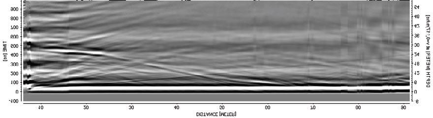
10 6: Crush zones 6.1: Piece (mm) 6.2: Sealed network 6.3: Core loss 7: Fracture frequency 7.1: Sealed fractures 7.2: Open fractures 8: BIPS 9: Length along the borehole The geophysical logs are described below: Magnetic susceptibility: The rock has been classified into sections of low, medium, high, and very high magnetic susceptibility. The susceptibility is strongly connected to the magnetite content in the different rock types. Natural gamma radiation: The rock has been classified into sections of low, medium, and high natural gamma radiation. Low radiation may indicate mafic rock types and high radiation may indicate fine-grained granite or pegmatite. Possible alteration: This parameter has not been used in the geological single-hole interpretation in the area. Silicate density: This parameter indicates the density of the rock after subtraction of the magnetic component. It provides general information on the mineral composition of the rock types, and serves as a support during classification of rock types. Estimated fracture frequency: This parameter provides an estimate of the fracture frequency along 5 m sections, calculated from short and long normal resistivity, SPR, P-wave velocity as well as focused resistivity 140 and 300. The estimated fracture frequency is based on a statistical connection after a comparison has been made between the geophysical logs and the mapped fracture frequency. The log provides an indication of sections with low and high fracture frequencies. Close inspection of the borehole radar data was carried out during the interpretation process, especially during the identification of possible deformation zones. The occurrence and orientation of radar anomalies within the possible deformation zones are commented upon in the text that describes these zones. 12
11 Title GEOLOGY KLX05 Site LAXEMAR Borehole KLX05 Diameter [mm] 76 Length [m] Bearing [ ] Inclination [ ] Activity Type GE041 Date of mapping :38:00 Coordinate System RT90-RHB70 Northing [m] Easting [m] Elevation [m] Drilling Start Date :00:00 Drilling Stop Date :30:00 Surveying Date Plot Date :16:02 Numbers of Fractures Signed data ROCKTYPE LAXEMAR Fine-grained granite Pegmatite Granite Ävrö granite Quartz monzodiorite Diorite / Gabbro Fine-grained dioritoid Fine-grained diorite-gabbro STRUCTURE Veined Massive Foliated TEXTURE Porphyritic Equigranular Unequigranular GRAINSIZE Fine-grained Fine to medium grained Medium to coarse grained Coarse-grained Medium-grained ROCK ALTERATION Oxidized Chloritisized Epidotisized Saussuritization INTENSITY Faint Weak Medium Strong ROUGHNESS Planar Undulating MINERAL Epidote Hematite Calcite Chlorite Quartz Pyrite Clay Minerals FRACTURE ALTERATION Slightly Altered Moderately Altered Highly Altered Fresh SILICATE DENSITY unclassified dens< <dens< <dens< <dens<2890 dens>2890 MAGNETIC SUSCEPTIBILITY unclassified sus< <sus< <sus<0.1 sus>0.1 Stepped STRUCTURE INTENSITY No intensity Faint STRUCTURE ORIENTATION Ductile Shear Zone Brittle-Ductile Shear Zone Irregular NATURAL GAMMA RADIATION unclassified gam<10 ESTIMATED FF Weak Medium Strong Veined Mylonitic Banded Foliated SURFACE Rough Smooth FRACTURE DIRECTION 10<gam<20 20<gam<30 gam>30 LENGTH. BOREMAP DATA GENERALIZED GEOPHYSICAL DATA UNBROKEN FRACTURES BROKEN FRACTURES CRUSH ZONE FRACTURE FREQUENCY BIPS LENGTH 1m:200m Type Type < 1m Type Structure Structure Intensity Type Texture Type Grainsize Structure Orientation 0 90 Alteration Alteration Intensity Crush Silicate Density Magnetic Susceptibility Natural Gamma Radiation Estimated Fracture Freq (fr/m) Primary Mineral Secondary Mineral Third Mineral Fourth Mineral Alteration Dip Direction Dip Primary Mineral Secondary Mineral Third Mineral Fourth Mineral Aperture (mm) 0 10 Roughness Surface Slickensided Alteration Dip Direction Dip Piece mm Sealed Network Coreloss Sealed Fractures 0 20 Open Fractures 0 20 BIPS Length Figure 3-1. Example of WellCad plot (from borehole KLX05 in Laxemar) used as a basis for the single-hole interpretation. 150 Page 1
12 4 Execution 4.1 General The geological single-hole interpretation has been carried out by a group of geoscientists consisting of both geologists and geophysicists. All data to be used (see Chapter 3) are visualized side by side in a borehole document extracted from the software WellCad. The working procedure is summarized in Figure 4-1 and in the text below. The first step in the working procedure is to study all types of data (rock type, rock alteration, silicate density, natural gamma radiation, etc) related to the character of the rock type and to merge sections of similar rock types, or sections where one rock type is very dominant, into rock units (minimum length of c 5 m). Each rock unit is defined in terms of the borehole length interval and provided with a brief description for inclusion in the WellCad plot. This includes a brief description of the rock types affected by the possible deformation zone. The confidence in the interpretation of a rock unit is made on the following basis: 3 = high, 2 = medium and 1 = low. The second step in the working procedure is to identify possible deformation zones by visual inspection of the results of the geological mapping (fracture frequency, fracture mineral, aperture, alteration, etc) in combination with the geophysical logging and radar data. The section of each identified possible deformation zone is defined in terms of the borehole length interval and provided with a brief description for inclusion in the WellCad plot. The confidence in the interpretation of a possible deformation zone is made on the following basis: 3 = high, 2 = medium and 1 = low. Geophysical data Petrophysical data Boremap data Generalized geophysical logs Radar data Single-hole interpretation 1. units 2. Possible deformation zones Figure 4-1. Schematic block-scheme of single-hole interpretation 15

13 Inspection of BIPS images is carried out whenever it is judged necessary during the working procedure. Furthermore, following definition of rock units and deformation zones, with their respective confidence estimates, the drill cores are inspected in order to check the selection of the boundaries between these geological entities. If judged necessary, the location of these boundaries is adjusted. Possible deformation zones that are ductile or brittle in character have been identified primarily on the basis of occurrence of protomylonitic to mylonitic foliation and the frequency of fractures, respectively, according to the recommendations in /1/. Both the transitional parts and the core part have been included in each zone (Figures 4-2 to 4-4). The fracture/m values in Figure 4-4 may serve only as examples. The frequencies of open and sealed fractures have been assessed in the identification procedure, and the character of the zone has been described accordingly. Partly open fractures are included together with open fractures in the brief description of each zone. The presence of bedrock alteration, the occurrence and, locally, inferred orientation of radar reflectors, the resistivity, SPR, P-wave velocity, caliper and magnetic susceptibility logs have all assisted in the identification of primarily the brittle structures. Figure 4-2. Schematic example of a ductile shear zone. Homogeneous rock which is deformed under low- to medium-grade metamorphic conditions (after /1/). 16
.")
 and KLX11B-F (Figures 4-10 4-14). A 5 m window and 1 m steps have been used in the calculation procedure.")
14 Figure 4-3. Schematic example of a ductile shear zone. Heterogeneous rock which is deformed under low- to high-grade metamorphic conditions (after /1/). Figure 4-4. Schematic example of a brittle deformation zone (after /1/). Since the frequency of fractures is of key importance for the definition of the possible deformation zones, a moving average plot for this parameter is shown for the cored boreholes KLX09B-F (Figures ) and KLX11B-F (Figures ). A 5 m window and 1 m steps have been used in the calculation procedure. The moving averages for open fractures alone, the total number of open fractures (open, partly open and crush), the sealed fractures alone, and the total number of sealed fractures (sealed and sealed fracture network) are shown in a diagram. 17
15 Fracture frequency (-1m) KLX09B Open fractures Open fractures, partly open fractures and crush Sealed fractures Sealed fractures and sealed fracture network Borehole length (m) Figure 4-5. Fracture frequency plot for KLX09B. Moving average with a 5 m window and 1 m steps. Fracture frequency (-1m) Open fractures Open fractures, partly open fractures and crush KLX09C Sealed fractures Sealed fractures and sealed fracture network Borehole length (m) Figure 4-6. Fracture frequency plot for KLX09C. Moving average with a 5 m window and 1 m steps. Fracture frequency (-1m) KLX09D Borehole length (m) Open fractures Open fractures, partly open fractures and crush Sealed fractures Sealed fractures and sealed fracture network Figure 4-7. Fracture frequency plot for KLX09D. Moving average with a 5 m window and 1 m steps. 18
16 Fracture frequency (-1m) Open fractures Open fractures, partly open fractures and crush KLX09E Sealed fractures Sealed fractures and sealed fracture network Borehole length (m) Figure 4-8. Fracture frequency plot for KLX09E. Moving average with a 5 m window and 1 m steps. Fracture frequency (-1m) KLX09F Borehole length (m) Open fractures Open fractures, partly open fractures and crush Sealed fractures Sealed fractures and sealed fracture network Figure 4-9. Fracture frequency plot for KLX09F. Moving average with a 5 m window and 1 m steps. Fracture frequency (-1m) KLX11B Borehole length (m) Open fractures Open fractures, partly open fractures and crush Sealed fractures Sealed fractures and sealed fracture network Figure Fracture frequency plot for KLX11B. Moving average with a 5 m window and 1 m steps. 19
17 Fracture frequency (-1m) KLX11C Borehole length (m) Open fractures Open fractures, partly open fractures and crush Sealed fractures Sealed fractures and sealed fracture network Figure Fracture frequency plot for KLX11C. Moving average with a 5 m window and 1 m steps. Fracture frequency (-1m) KLX11D Borehole length (m) Open fractures Open fractures, partly open fractures and crush Sealed fractures Sealed fractures and sealed fracture network Figure Fracture frequency plot for KLX11D. Moving average with a 5 m window and 1 m steps. Fracture frequency (-1m) KLX11E Borehole length (m) Open fractures Open fractures, partly open fractures and crush Sealed fractures Sealed fractures and sealed fracture network Figure Fracture frequency plot for KLX11E. Moving average with a 5 m window and 1 m steps. 20


18 Fracture frequency (-1m) KLX11F Borehole length (m) Open fractures Open fractures, partly open fractures and crush Sealed fractures Sealed fractures and sealed fracture network Figure Fracture frequency plot for KLX11F. Moving average with a 5 m window and 1 m steps. The occurrence and orientation of radar anomalies within these possible deformation zones are used during the identification of zones. Overviews of the borehole radar measurement in KLX09B, KLX09C, KLX09D, KLX09E, KLX09F, KLX11B, KLX11C, KLX11D, KLX11E and KLX11F are shown in Figures A conductive environment causes attenuation of the radar wave, which in turn decreases the penetration. The effect of attenuation can be observed generally in borehole KLX09B, at m in KLX09C, at m in KLX09D and below 60 m in KLX11B. The effect of attenuation varies between the different antenna frequencies (20 MHz, 100 MHz, 250 MHz and 60 MHz directional antenna). In some cases, alternative orientations for oriented radar reflectors are presented. One of the alternatives is considered to be correct, but due to uncertainty in the interpretation of radar data, a decision concerning which of the alternatives that represent the true orientation cannot be made. Orientations from directional radar are presented as strike/dip using the right-hand-rule method, e.g. 040/80 corresponds to a strike of N4E and a dip of 8 to the SE. Figure Overview (20 MHz data) of the borehole radar measurement in KLX09B. Figure Overview (20 MHz data) of the borehole radar measurement in KLX09C. 21
 of the borehole")


19 Figure Overview (20 MHz data) of the borehole radar measurement in KLX09D. Figure Overview (20 MHz data) of the borehole radar measurement in KLX09E. Figure Overview (20 MHz data) of the borehole radar measurement in KLX09F. Figure Overview (20 MHz data) of the borehole radar measurement in KLX11B. 22
 of the borehole radar measurement")


20 Figure Overview (20 MHz data) of the borehole radar measurement in KLX11C. Figure Overview (20 MHz data) of the borehole radar measurement in KLX11D. Figure Overview (20 MHz data) of the borehole radar measurement in KLX11E. Figure Overview (20 MHz data) of the borehole radar measurement in KLX11F. 4.2 Nonconformities Geophysical borehole logging has not been performed in boreholes KLX09C, KLX09E, KLX11C, KLX11D, KLX11E and KLX11F. 23
21 5 Results The detailed result of the single-hole interpretation is presented as print-out from the software WellCad (Appendix 1 for KLX09B, Appendix 2 for KLX09C, Appendix 3 for KLX09D, Appendix 4 for KLX09E, Appendix 5 for KLX09F, Appendix 6 for KLX11B, Appendix 7 for KLX11C, Appendix 8 for KLX11D, Appendix 9 for KLX11E and Appendix 10 for KLX11F). 5.1 KLX09B units The borehole contains one rock unit, RU1. The rock unit has been recognized with a high degree of confidence m RU1: Totally dominated by Ävrö granite (501044). Subordinate rock types comprise fine-grained granite (511058), fine-grained diorite-gabbro (505102) and sparse occurrence of pegmatite (501061). The fine-grained diorite-gabbro (505102) usually constitutes composite intrusions together with fine-grained granite (511058). The fine-grained granite (511058) primarily occurs in sections < 1 m in length. The major part of the rock unit is faintly to weakly foliated. The Ävrö granite (501044) has a density in the range 2,720 2,750 kg/m 3 in the section m and 2,660 2,710 kg/m 3 in the section m. Confidence level = 3. Possible deformation zones Two possible deformation zones have been recognised with a high degree of confidence in KLX09B (DZ1-DZ2) m DZ1: Brittle deformation zone characterized by increased frequency of open and sealed fractures, weak red staining and one crush zone. Decreased resistivity, magnetic susceptibility and partly decreased P-wave velocity. The host rock is dominated by fine-grained granite (511058). Confidence level = m DZ2: Inhomogeneous low-grade ductile shear zone overprinted by brittle deformation. Increased frequency of particularly sealed but also open fractures, faint to strong red staining, two crush zones, large apertures, slickensides and mylonitic sections. The most intensely deformed sections (cores) are m and m. Significantly decreased resistivity, magnetic susceptibility and partly decreased P-wave velocity. At c 78.0 m there is a major drop in fluid water resistivity, which is most likely related to a water bearing structure. One strong radar reflector occurs at 78.9 m with the orientation 288/18 or 108/18. Low radar amplitude at m. The host rock is dominated by Ävrö granite (501044). Subordinate rock types comprise fine-grained granite (511058) and fine-grained diorite-gabbro (505102). Confidence level = 3. 25
22 5.2 KLX09C units One rock unit (RU1) occurs in the borehole. The rock unit has been recognized with a high degree of confidence m RU1: Totally dominated by Ävrö granite (501044). Subordinate rock types comprise fine-grained granite (511058), fine-grained diorite-gabbro (505102) and very sparse occurrences of finegrained dioritoid (501030), pegmatite (501061) and granite (501058). The fine-grained dioritegabbro (505102) usually constitutes composite intrusions together with fine-grained granite (511058). The major part of the rock unit is faintly to weakly foliated. Confidence level = 3. Possible deformation zones Two possible deformation zones have been recognised with a high degree of confidence in KLX09C (DZ1-DZ2) m DZ1: Low-grade ductile shear zone overprinted by brittle deformation. Increased frequency of sealed fractures and a slight increase in open fractures, large apertures and mylonitic sections. The most intensely deformed section (core) is m. One non-oriented radar reflector occurs at 82.9 m with the angle 72 to borehole axis and one reflector at 86.3 m with the orientation 238/11 or 253/53. Low radar amplitude at m. The host rock is totally dominated by Ävrö granite (501044). Subordinate rock type comprises very sparse occurrence of pegmatite (501061). Confidence level = m DZ2: Brittle deformation zone characterized by increased frequency of sealed and open fractures, one crush zone and slickensides. One strong non-oriented radar reflector occurs at m (just below DZ2) with the angle 4 to borehole axis. Low radar amplitude occurs at m. The host rock is dominated by Ävrö granite (501044). Subordinate rock types comprise fine-grained diorite-gabbro (505102), fine-grained granite (511058) and pegmatite (501061). Confidence level = KLX09D units One rock unit (RU1) occurs in the borehole. The rock unit has been recognized with a high degree of confidence m RU1: Totally dominated by Ävrö granite (501044). Subordinate rock types comprise fine-grained granite (511058), fine-grained diorite-gabbro (505102) and very sparse occurrences of pegmatite (501061), granite (501058) and fine-grained dioritoid (501030). The fine-grained diorite-gabbro (505102) usually constitutes composite intrusions together with fine-grained granite (511058). The fine-grained granite (511058) primarily occurs in sections < 1 m in length. The major part of the rock unit is faintly to weakly foliated. The Ävrö granite (501044) has a density in the range 2,710 2,750 kg/m 3 in the section m, 2,670 2,690 kg/m 3 in the section m, 2,700 2,730 kg/m 3 in the section m and 2,670 2,700 kg/m 3 in the section m. Confidence level = 3. 26
23 Possible deformation zones Two possible deformation zones have been recognised with a high degree of confidence in KLX09D (DZ1-DZ2) m DZ1: Low-grade ductile shear zone overprinted by brittle deformation. Increased frequency of sealed and open fractures, faint to medium red staining, large apertures, slickensides and mylonitic sections. Significantly decreased bulk resistivity and bulk magnetic susceptibility. Partly decreased P-wave velocity. Two non-oriented radar reflectors occur at 83.5 m and 84.0 m with the angle 59 and 26 to borehole axis, respectively. Also, one radar reflector occurs at 88.1 m with the orientation 017/44 or 335/21. Low radar amplitude occurs at m. The host rock is dominated by Ävrö granite (501044). Subordinate rock types comprise fine-grained granite (511058) and sparse occurrences of pegmatite (501061) and granite (501058). Confidence level = m DZ2: Brittle deformation zone characterized by increased frequency of sealed fractures and a slight increase in open fractures, medium red staining and slickensides. Significantly decreased resistivity and magnetic susceptibility. One non-oriented radar reflector occurs at m with the angle 67 to borehole axis. The host rock is totally dominated by Ävrö granite (501044). Confidence level = KLX09E units One rock unit (RU1) occurs in the borehole. The rock unit has been recognized with a high degree of confidence m RU1: Totally dominated by Ävrö granite (501044). Subordinate rock types comprise finegrained diorite-gabbro (505102), fine-grained granite (511058) and very sparse occurrences of pegmatite (501061), fine-grained dioritoid (501030) and granite (501058). The fine-grained diorite-gabbro (505102) usually constitutes composite intrusions together with fine-grained granite (511058). The fine-grained granite (511058) primarily occurs as thin sections < 1 m in length. The major part of the rock unit is faintly to weakly foliated. Confidence level = 3. Possible deformation zones Two possible deformation zones have been recognised with a high degree of confidence in KLX09E (DZ1-DZ2) m DZ1: Brittle deformation zone characterized by increased frequency of open fractures and a slight increase in sealed fractures and one crush zone. One non-oriented radar reflector occurs at 71.5 m with the angle 32 to borehole axis. The host rock is totally dominated by Ävrö granite (501044). Confidence level = 3. 27
24 m DZ2: Brittle deformation zone overprinting ductile shear zones. Increased frequency of sealed fractures and partly also of open fractures, faint to medium red staining, one c 0.75 m thick crush zone, one breccia and slickensides. The most intensely deformed sections (cores) are m, m and m. Two oriented radar reflectors occur, one at 83.2 m with the orientation 342/61 and one at 97.6 m with the orientation 133/47 or 010/53, the latter of which is strong. Seven non-oriented radar reflectors occur with angles between 4 and 55 to borehole axis. Low radar amplitude occurs at m. The host rock is totally dominated by Ävrö granite (501044). Subordinate rock types comprise fine-grained granite (511058) and sparse occurrences of fine-grained diorite-gabbro (505102) and granite (501058). Confidence level = KLX09F units One rock unit (RU1) occurs in the borehole. The rock unit has been recognized with a high degree of confidence m RU1: Totally dominated by Ävrö granite (501044). Subordinate rock types comprise finegrained diorite-gabbro (505102), granite (501058), fine-grained granite (511058) and very sparse occurrences of pegmatite (501061) and fine-grained dioritoid (501030). The fine-grained diorite-gabbro (505102) usually constitutes composite intrusions together with fine-grained granite (511058). The fine-grained (511058) granite primarily occurs as thin sections < 1 m in length. The major part of the rock unit displays foliation which is faint to medium in character. The Ävrö granite (501044) has a density in the range 2,680 2,720 kg/m 3. Confidence level = 3. Possible deformation zones Five possible deformation zones have been recognised with a high degree of confidence in KLX09F (DZ1-DZ5) m DZ1: Brittle deformation zone characterized by increased frequency of sealed fractures and partly a slight increase of open fractures, scattered sections of faint to medium red staining, cataclasites, one breccia and slickensides. Decreased resistivity, magnetic susceptibility and partly decreased P-wave velocity. Two non-oriented radar reflectors occur at 14.9 m and 17.9 m with the angle 56 and 25 to borehole axis, respectively. Low radar amplitude at 0 10 m. The host rock is dominated by Ävrö granite (501044). Subordinate rock types comprise particularly fine-grained diorite-gabbro (505102), and also sparse occurrence of fine-grained granite (511058). Confidence level = m DZ2: Brittle deformation zone characterized by increased frequency of open fractures, faint to weak red staining and slickensides. Decreased resistivity, magnetic susceptibility and partly decreased P-wave velocity. One strong non-oriented radar reflector at 68.8 m with the angle 34 to borehole axis. The host rock is dominated by Ävrö granite (501044). Subordinate rock type comprises fine-grained granite (511058). Confidence level = 3. 28
25 m DZ3: Brittle deformation zone overprinting ductile structures. Increased frequency of particularly sealed fractures but also of open fractures, faint to weak red staining, slickensides, mylonitic and brittle-ductile sections. Significantly decreased resistivity and bulk magnetic susceptibility. One minor caliper anomaly but partly increased P-wave velocity. Two non-oriented radar reflectors at 81.1 m and 82.7 m with the angle 59 and 55 to borehole axis, respectively. Low radar amplitude at m. The host rock is dominated by Ävrö granite (501044). Subordinate rock types comprise fine-grained granite (511058), fine-grained diorite-gabbro (505102) and very sparse occurrence of pegmatite (501061). Confidence level = m DZ4: Brittle deformation zone characterized by increased frequency of sealed fractures and slickensides. Mylonitic and brittle-ductile sections occur. The most intensely deformed section (core) is m. Partly decreased resistivity. Two non-oriented radar reflectors at m and m with the angle 41 and 42 to borehole axis, respectively. Low radar amplitude at 135 m. The host rock is dominated by Ävrö granite (501044). Subordinate rock type comprises fine-grained diorite-gabbro (505102). Confidence level = m DZ5: Brittle deformation zone characterized by increased frequency of sealed fractures. Decreased resistivity and magnetic susceptibility and caliper anomalies in the section c m (Note! Also outside zone interval). The host rock is totally dominated by Ävrö granite (501044). Confidence level = KLX11B units One rock unit (RU1) occurs in the borehole. The rock unit has been recognized with a high degree of confidence m RU1: Totally dominated by quartz monzodiorite (501036). Subordinate rock type comprises fine-grained granite (511058). The fine-grained granite (511058) primarily occurs in sections < 1 m in length. Scattered < c 5 m long sections are faintly to weakly foliated. The quartz monzodiorite (501036) has a density in the range 2,750 2,800 kg/m 3. Confidence level = 3. Possible deformation zones Two possible deformation zones have been recognised with a high degree of confidence in KLX11B (DZ1-DZ2) m DZ1: Brittle deformation zone characterized by increased frequency of open and sealed fractures, faint red staining, two crush zones and slickensides. Decreased resistivity and magnetic susceptibility. Partly decreased P-wave velocity and minor caliper anomalies. One non-oriented radar reflector at 75.6 m with the angle 66 to borehole axis. The host rock is totally dominated by quartz monzodiorite (501036). Confidence level = 3. 29
26 m DZ2: Brittle deformation zone characterized by increased frequency of sealed fractures, medium red staining, two breccias. Decreased resistivity and magnetic susceptibility. Partly decreased P-wave velocity and minor caliper anomalies. The host rock is totally dominated by quartz monzodiorite (501036). Confidence level = KLX11C units One rock unit (RU1) occurs in the borehole. The rock unit has been recognized with a high degree of confidence m RU1: Totally dominated by quartz monzodiorite (501036). Subordinate rock types comprise fine-grained granite (511058) and very sparse occurrences of fine-grained dioritoid (501030), granite (501058) and pegmatite (501061). The fine-grained granite (511058) occurs in sections < 1 m in length. Scattered sections up to 17 m in length are faintly to weakly foliated, but subordinate sections display stronger foliation. Confidence level = 3. Possible deformation zones No possible deformation zones have been recognised in KLX11C. 5.8 KLX11D units One rock unit (RU1) occurs in the borehole. The rock unit has been recognized with a high degree of confidence m RU1: Totally dominated by quartz monzodiorite (501036). Subordinate rock types comprise fine-grained granite (511058) and very sparse occurrences of pegmatite (501061) and finegrained dioritoid (501030). The fine-grained granite (511058) primarily occurs in sections < 1 m in length. Scattered sections < c 3 m in length are faintly foliated. Confidence level = 3. Possible deformation zones Three possible deformation zones have been recognised with a high degree of confidence in KLX11D (DZ1-DZ3) m DZ1: Brittle deformation zone characterized by increased frequency of sealed fractures, a slight increase in open fractures and faint to medium red staining. One strong radar reflector at 62.7 m with the orientation 017/70, and one non-oriented radar reflector at 63.8 m with the angle 63 to borehole axis. Low radar amplitude at m. The host rock is totally dominated by quartz monzodiorite (501036). Subordinate rock types comprise very sparse occurrences of finegrained dioritoid (501030) and fine-grained granite (511058). Confidence level = 3. 30
27 m DZ2: Brittle deformation zone characterized by increased frequency of sealed fractures, a slight increase in open fractures and faint to medium red staining. Three non-oriented radar reflectors at 90.6 m, 95.2 m and 97.1 m with the angle 53, 42 and 42 to borehole axis, respectively. Low radar amplitude at m. The host rock is totally dominated by quartz monzodiorite (501036). Subordinate rock type comprises very sparse occurrence of fine-grained granite (511058). Confidence level = m DZ3: Brittle deformation zone characterized by increased frequency of sealed fractures, a slight increase in open fractures, faint to weak red staining and slickensides. One very strong radar reflector at m with the orientation 013/82, and two non-oriented radar reflectors at m and m, with the angle 37 and 42 to borehole axis, respectively. Low radar amplitude at m. The host rock is totally dominated by quartz monzodiorite (501036). Subordinate rock type comprises very sparse occurrence of fine-grained granite (511058). Confidence level = KLX11E units One rock unit (RU1) occurs in the borehole. The rock unit has been recognized with a high degree of confidence m RU1: Totally dominated by quartz monzodiorite (501036). Subordinate rock types comprise finegrained granite (511058) and very sparse occurrences of granite (501058) and pegmatite (501061). The fine-grained granite (511058) primarily occurs in sections < 1 m in length. The major part of the rock unit displays foliation which is faint to medium in character. Confidence level = 3. Possible deformation zones Four possible deformation zones have been recognised with a high degree of confidence in KLX11E (DZ1-DZ4) m DZ1: Brittle deformation zone characterized by increased frequency of sealed fractures, a slight increase in open fractures, faint to weak saussuritization, faint to weak red staining, one slickenside and apertures up to 10 mm. The brittle deformation is overprinting minor brittle-ductile and ductile shear zones. One radar reflector at 19.4 m with the orientation 162/44 or 018/74, and one non-oriented radar reflector at 16.4 m with the angle 61 to borehole axis. The host rock is totally dominated by quartz monzodiorite (501036). Subordinate rock type comprises sparse occurrence of fine-grained granite (511058). Confidence level = m DZ2: Inhomogeneous low-grade ductile deformation zone. Two oriented radar reflectors occur, one at 41.0 m with the orientation 155/45 and one at 55.8 m with the orientation 013/21 or 086/47, the latter of which is strong. Five non-oriented radar reflectors occur with angles between 36 and 65 to borehole axis. The host rock is totally dominated by quartz monzodiorite (501036). Subordinate rock types comprise sparse occurrences of fine-grained granite (511058) and very sparse occurrence of granite (501058). Confidence level = 3. 31
28 m DZ3: Brittle deformation zone characterized by increased frequency of sealed and open fractures. The host rock is totally dominated by quartz monzodiorite (501036). Confidence level = m DZ4: Brittle deformation zone characterized by slightly increased frequency of sealed fractures and open fractures, weak to medium red staining and one slickenside. One very strong radar reflector occurs at m with the orientation 336/62 or 130/73. Low radar amplitude occurs at m. The host rock is totally dominated by quartz monzodiorite (501036). Confidence level = KLX11F units One rock unit (RU1) occurs in the borehole. The rock unit has been recognized with a high degree of confidence m RU1: Totally dominated by quartz monzodiorite (501036). Subordinate rock types comprise fine-grained granite (511058) and very sparse occurrence of pegmatite (501061). The finegrained granite (511058) primarily occurs as thin sections < 1 m in length. Scattered sections up to 10 m in length are faintly to weakly foliated. Confidence level = 3. Possible deformation zones One possible deformation zone has been recognised with a high degree of confidence in KLX11F (DZ1) m DZ1: Brittle deformation zone characterized by increased frequency of sealed and open fractures, faint to weak red staining, two crush zones and one slickenside. One non-oriented radar reflector occurs at 70.9 m with the angle 37 to borehole axis. Low radar amplitude at 70 m. The host rock is totally dominated by quartz monzodiorite (501036). Confidence level = 3. 32
29 6 Comments The results from the geological single-hole interpretation of boreholes KLX09B, KLX09C, KLX09D, KLX09E, KLX09F, KLX11B, KLX11C, KLX11D, KLX11E and KLX11F are presented in WellCad plots (Appendices 1 10). The WellCad plot consists of the following columns: In data Boremap 1: Depth (Length along the borehole) 2: type 3: alteration 4: Frequency of sealed fractures 5: Frequency of open and partly open fractures 6: Crush zones In data Geophysics 7: Silicate density 8: Magnetic susceptibility 9: Natural gamma radiation 10: Estimated fracture frequency Interpretations 11: Description: unit 12: Stereogram for sealed fractures in rock unit (blue symbols) 13: Stereogram for open and partly open fractures in rock unit (red symbols) 14: Description: Possible deformation zone 15: Stereogram for sealed fractures in possible deformation zone (blue symbols) 16: Stereogram for open and partly open fractures in possible deformation zone (red symbols) 33
P Oskarshamn site investigation. Geological single-hole interpretation of KLX11A. Seje Carlsten, Allan Stråhle Geosigma AB
 P-07-69 Oskarshamn site investigation Geological single-hole interpretation of KLX11A Seje Carlsten, Allan Stråhle Geosigma AB Peter Hultgren, Svensk Kärnbränslehantering AB Mikael Keisu, GeoVista AB Carl-Henric
P Oskarshamn site investigation. Geological single-hole interpretation of KLX17A and HLX42
 P-07-209 Oskarshamn site investigation Geological single-hole interpretation of KLX17A and HLX42 Seje Carlsten, Karl-Johan Mattsson, Allan Stråhle Geosigma AB Peter Hultgren, Svensk Kärnbränslehantering
P Oskarshamn site investigation. Geological single-hole interpretation of KAV04A, KAV04B and KLX01. Seje Carlsten, Geosigma AB
 P-04-308 Oskarshamn site investigation Geological single-hole interpretation of KAV04A, KAV04B and KLX01 Seje Carlsten, Geosigma AB Peter Hultgren, Svensk Kärnbränslehantering AB Håkan Mattsson, GeoVista
P Oskarshamn site investigation. Geological single-hole interpretation of KLX10, HLX20 and HLX36. Seje Carlsten, Allan Stråhle, Geosigma AB
 P-06-174 Oskarshamn site investigation Geological single-hole interpretation of KLX10, HLX20 and HLX36 Seje Carlsten, Allan Stråhle, Geosigma AB Peter Hultgren, Svensk Kärnbränslehantering AB Håkan Mattsson,
P Äspö site descriptive model. Geological single-hole interpretation of KA2050A, KA2162B and KA2511A. Seje Carlsten, Allan Stråhle Geosigma AB
 P-14-17 Äspö site descriptive model Geological single-hole interpretation of KA2050A, KA2162B and KA2511A Seje Carlsten, Allan Stråhle Geosigma AB Carl-Henric Wahlgren Geological Survey of Sweden Peter
P Äspö site descriptive model. Geological single-hole interpretation of KAS07, KA1755A and KC0045F. Seje Carlsten, Allan Stråhle Geosigma AB
 P-14-16 Äspö site descriptive model Geological single-hole interpretation of KAS07, KA1755A and KC0045F Seje Carlsten, Allan Stråhle Geosigma AB Carl-Henric Wahlgren Geological Survey of Sweden Peter Hultgren,
P Forsmark site investigation. Geological single-hole interpretation of KFM01D, HFM24, HFM25, HFM27 and HFM29
 P-06-210 Forsmark site investigation Geological single-hole interpretation of KFM01D, HFM24, HFM25, HFM27 and HFM29 Seje Carlsten, Christin Döse, Geosigma AB Jaana Gustafsson, Malå GeoScience AB Håkan
P Forsmark site investigation. Geological single-hole interpretation of HFM11-13 and HFM Revised November 2006
 P-04-120 Revised November 2006 Forsmark site investigation Geological single-hole interpretation of HFM11-13 and HFM16-18 Seje Carlsten, Geosigma AB Jesper Petersson, SwedPower AB Michael Stephens, Geological
P Forsmark site investigation. Geological single-hole interpretation of KFM08A, KFM08B and HFM22 (DS8) Revised October 2006
 Revised October 2006") P-05-262 Revised October 2006 Forsmark site investigation Geological single-hole interpretation of KFM08A, KFM08B and HFM22 (DS8) Seje Carlsten, Geosigma AB Jaana Gustafsson, Malå GeoScience AB Håkan Mattsson,
P-05-262 Revised October 2006 Forsmark site investigation Geological single-hole interpretation of KFM08A, KFM08B and HFM22 (DS8) Seje Carlsten, Geosigma AB Jaana Gustafsson, Malå GeoScience AB Håkan Mattsson,
P Forsmark site investigation. Geological single-hole interpretation of KFM07A and HFM20 21 (DS7) Revised October 2006
 Revised October 2006") P-05-157 Revised October 2006 Forsmark site investigation Geological single-hole interpretation of KFM07A and HFM20 21 (DS7) Seje Carlsten, Geosigma AB Jaana Gustafsson, Malå GeoScience AB Håkan Mattsson,
P-05-157 Revised October 2006 Forsmark site investigation Geological single-hole interpretation of KFM07A and HFM20 21 (DS7) Seje Carlsten, Geosigma AB Jaana Gustafsson, Malå GeoScience AB Håkan Mattsson,
Äspö Hard Rock Laboratory. Boremap mapping of cored drilled boreholes KA3011A01 and KA3065A01. Seje Carlsten, Allan Stråhle Geosigma AB.
 P-13-28 Äspö Hard Rock Laboratory Boremap mapping of cored drilled boreholes KA3011A01 and KA3065A01 Seje Carlsten, Allan Stråhle Geosigma AB July 2013 Svensk Kärnbränslehantering AB Swedish Nuclear Fuel
P Forsmark site investigation. Geological single-hole interpretation of KFM08D. Seje Carlsten, Eva Samuelsson Geosigma AB
 P-07-108 Forsmark site investigation Geological single-hole interpretation of KFM08D Seje Carlsten, Eva Samuelsson Geosigma AB Jaana Gustafsson, Malå GeoScience AB Michael Stephens, Geological Survey of
P Site investigation SFR. Geological single-hole interpretation of KFR102A. Jesper Petersson, Johan Nissen Vattenfall Power Consultant AB
 P-09-60 Site investigation SFR Geological single-hole interpretation of KFR102A Jesper Petersson, Johan Nissen Vattenfall Power Consultant AB Philip Curtis, Niclas Bockgård, Johan Öhman Golder Associates
P Oskarshamn site investigation. Boreholes KLX07A, KLX10, KLX05 and KLX12A
 P-07-63 Oskarshamn site investigation Boreholes KLX07A, KLX10, KLX05 and KLX12A Extensometer measurement of the coefficient of thermal expansion of rock Urban Åkesson SP, Technical Research Institute of
P Forsmark site investigation. Geological single-hole interpretation of KFM11A, HFM33, HFM34 and HFM35
 P-07-109 Forsmark site investigation Geological single-hole interpretation of KFM11A, HFM33, HFM34 and HFM35 Seje Carlsten, Christin Döse, Eva Samuelsson Geosigma AB Jaana Gustafsson, Malå GeoScience AB
P Forsmark site investigation. Geological single-hole interpretation of KFM12A, HFM36 and HFM37. Seje Carlsten, Eva Samuelsson, Geosigma AB
 P-07-110 Forsmark site investigation Geological single-hole interpretation of KFM12A, HFM36 and HFM37 Seje Carlsten, Eva Samuelsson, Geosigma AB Jaana Gustafsson, Malå GeoScience AB Jesper Petersson, Vattenfall
P Forsmark site investigation
 P-06-258 Forsmark site investigation Interpretation of geophysical borehole measurements from KFM10A, KFM08C, HFM30, HFM31, HFM33, HFM34, HFM35 and HFM38 Håkan Mattsson, Mikael Keisu GeoVista AB February
P Oskarshamn site investigation. Boremap mapping of telescopic drilled borehole KLX13A. Gunnar Rauséus, Karl-Johan Mattsson Geosigma AB
 P06255 Oskarshamn site investigation Boremap mapping of telescopic drilled borehole KLX13A Gunnar Rauséus, KarlJohan Mattsson Geosigma AB Jan Ehrenborg, Mírab AB November 2007 Svensk Kärnbränslehantering
P Forsmark site investigation. Borehole: KFM01A Results of tilt testing. Panayiotis Chryssanthakis Norwegian Geotechnical Institute, Oslo
 P-03-108 Forsmark site investigation Borehole: KFM01A Results of tilt testing Panayiotis Chryssanthakis Norwegian Geotechnical Institute, Oslo June 2003 Svensk Kärnbränslehantering AB Swedish Nuclear Fuel
P Oskarshamn site investigation. Modal analyses on rock mechanical specimens
 P-07-03 Oskarshamn site investigation Modal analyses on rock mechanical specimens Specimens from borehole KLX03, KLX04, KQ0064G, KQ0065G, KF0066A and KF0069A Thomas Janson, Björn Ljunggren Tyréns AB Torbjörn
P Oskarshamn site investigation. Interpretation of geophysical borehole measurements from KLX16A. Håkan Mattsson, Mikael Keisu GeoVista AB
 P-07-97 Oskarshamn site investigation Interpretation of geophysical borehole measurements from KLX16A Håkan Mattsson, Mikael Keisu GeoVista AB May 2007 Svensk Kärnbränslehantering AB Swedish Nuclear Fuel
P Oskarshamn site investigation. Petrographic analysis of gravel and boulders in till from the Laxemar area
 P-07-30 Oskarshamn site investigation Petrographic analysis of gravel and boulders in till from the Laxemar area Torbjörn Bergman, Gustav Sohlenius Geological Survey of Sweden March 2007 Svensk Kärnbränslehantering
P Forsmark site investigation. Soil stratigraphy based on samples and protocols in the Forsmark area
 P-07-0 Forsmark site investigation Soil stratigraphy based on samples and protocols in the Forsmark area Joachim Albrecht, Sveriges Geologiska Undersökning January 007 Svensk Kärnbränslehantering AB Swedish
KBS-3H. Single-hole interpretation of borehole K08028F01 P Report. December 2016
 Report P-15-09 December 2016 KBS-3H Single-hole interpretation of borehole K08028F01 Håkan Mattsson Jesper Petersson Oskar Sigurdsson Calle Hjerne Bill Wallin Anders Winberg SVENSK KÄRNBRÄNSLEHANTERING
P Oskarshamn site investigation. Quantitative mapping of fracture minerals in Laxemar. Stefan Eklund, Karl-Johan Mattsson Geosigma AB
 P-08-38 Oskarshamn site investigation Quantitative mapping of fracture minerals in Laxemar Stefan Eklund, Karl-Johan Mattsson Geosigma AB January 2008 Svensk Kärnbränslehantering AB Swedish Nuclear Fuel
P Oskarshamn site investigation. Rock matrix permeability measurements on core samples from borehole KLX03
 P-07-204 Oskarshamn site investigation Rock matrix permeability measurements on core samples from borehole KLX03 Peter Vilks, Atomic Energy of Canada Ltd December 2007 Svensk Kärnbränslehantering AB Swedish
P Forsmark site investigation. Boremap mapping of telescopic drilled borehole KFM04A
 P-04-115 Forsmark site investigation Boremap mapping of telescopic drilled borehole KFM04A Jesper Petersson, Anders Wängnerud, Johan Berglund, Peter Danielsson SwedPower AB Allan Stråhle Geosigma AB May
P Oskarshamn site investigation. Borehole KLX12A. Determination of P-wave velocity, transverse borehole core
 P-06-70 Oskarshamn site investigation Borehole KLX12A Determination of P-wave velocity, transverse borehole core Panayiotis Chryssanthakis, Lloyd Tunbridge Norwegian Geotechnical Institute, Oslo October
P Site investigation SFR. Interpretation of geophysical borehole measurements from KFR102A, KFR102B, KFR103, KFR104 and KFR27 (0 500 m)
") P-09-26 Site investigation SFR Interpretation of geophysical borehole measurements from KFR102A, KFR102B, KFR103, KFR104 and KFR27 (0 500 m) Håkan Mattsson, Mikael Keisu GeoVista AB May 2009 Svensk Kärnbränslehantering
P-09-26 Site investigation SFR Interpretation of geophysical borehole measurements from KFR102A, KFR102B, KFR103, KFR104 and KFR27 (0 500 m) Håkan Mattsson, Mikael Keisu GeoVista AB May 2009 Svensk Kärnbränslehantering
P Oskarshamn site investigation. Drillhole KSH01A. Extensometer measurement of the coefficient of thermal expansion of rock (SINTEF)
") P-05-59 Oskarshamn site investigation Drillhole KSH01A Extensometer measurement of the coefficient of thermal expansion of rock (SINTEF) Lisbeth Alnæs, SINTEF Civil and Environmental Engineering, Rock
P-05-59 Oskarshamn site investigation Drillhole KSH01A Extensometer measurement of the coefficient of thermal expansion of rock (SINTEF) Lisbeth Alnæs, SINTEF Civil and Environmental Engineering, Rock
P Forsmark site investigation. Quantitative mapping of fracture minerals in Forsmark. Stefan Eklund, Karl-Johan Mattsson Geosigma AB
 P-08-47 Forsmark site investigation Quantitative mapping of fracture minerals in Forsmark Stefan Eklund, Karl-Johan Mattsson Geosigma AB December 2009 Svensk Kärnbränslehantering AB Swedish Nuclear Fuel
P Oskarshamn site investigation. Interpretation of geophysical borehole measurements from KLX05. Håkan Mattsson, Mikael Keisu GeoVista AB
 P-05-189 Oskarshamn site investigation Interpretation of geophysical borehole measurements from KLX05 Håkan Mattsson, Mikael Keisu GeoVista AB June 2005 Svensk Kärnbränslehantering AB Swedish Nuclear Fuel
P Forsmark site investigation. Detailed fracture mapping of the outcrops Klubbudden, AFM and Drill Site 4, AFM001097
 P-03-115 Forsmark site investigation Detailed fracture mapping of the outcrops Klubbudden, AFM001098 and Drill Site 4, AFM001097 Jan Hermanson, Lars Hansen, Jon Vestgård, Peter Leiner Golder Associates
P Oskarshamn site investigation. Borehole KLX04A Determination of P-wave velocity, transverse borehole core
 P-04-266 Oskarshamn site investigation Borehole KLX04A Determination of P-wave velocity, transverse borehole core Panayiotis Chryssanthakis, Lloyd Tunbridge Norwegian Geotechnical Institute October 2004
P Forsmark site investigation. Electric soundings supporting inversion of helicopterborne EM-data. Hans Thunehed, Timo Pitkänen GeoVista AB
 P-03-44 Forsmark site investigation Electric soundings supporting inversion of helicopterborne EM-data Hans Thunehed, Timo Pitkänen GeoVista AB January 2003 Svensk Kärnbränslehantering AB Swedish Nuclear
P Forsmark site investigation. Data report from the laboratory investigations of the transport properties of the rock.
 P-06-186 Forsmark site investigation Data report from the laboratory investigations of the transport properties of the rock. Data delivery for data freeze Forsmark 2.2 Eva Gustavsson, Geosigma AB September
P Oskarshamn site investigation. Refraction seismic measurements in Laxemar spring Gustaf Lindqvist, MRM Konsult AB.
 P-06-49 Oskarshamn site investigation Refraction seismic measurements in Laxemar spring 2006 Gustaf Lindqvist, MRM Konsult AB June 2006 Svensk Kärnbränslehantering AB Swedish Nuclear Fuel and Waste Management
P Oskarshamn site investigation. Drill hole: KSH02. Extensometer measurement of the coefficient of thermal expansion of rock
 P-04-60 Oskarshamn site investigation Drill hole: KSH02 Extensometer measurement of the coefficient of thermal expansion of rock Urban Åkesson Swedish National Testing and Research Institute March 2004
P Forsmark site investigation. Boremap mapping of telescopic drilled borehole KFM02A. Jesper Petersson, Anders Wängnerud SwedPower AB
 P-03-98 Forsmark site investigation Boremap mapping of telescopic drilled borehole KFM02A Jesper Petersson, Anders Wängnerud SwedPower AB Allan Stråhle, Geosigma AB August 2003 Svensk Kärnbränslehantering
P Swedish National Seismic Network (SNSN) A short report on recorded earthquakes during the second quarter of the year 2007
 A short report on recorded earthquakes during the second quarter of the year 2007") P-07-163 Swedish National Seismic Network (SNSN) A short report on recorded earthquakes during the second quarter of the year 2007 Reynir Böðvarsson Uppsala University, Department of Earth Sciences July
P-07-163 Swedish National Seismic Network (SNSN) A short report on recorded earthquakes during the second quarter of the year 2007 Reynir Böðvarsson Uppsala University, Department of Earth Sciences July
P Forsmark site investigation. Ground penetrating radar and resistivity measurements for overburden investigations
 P-03-43 Forsmark site investigation Ground penetrating radar and resistivity measurements for overburden investigations Johan Nissen, Malå Geoscience AB April 2003 Svensk Kärnbränslehantering AB Swedish
R Bedrock geology Forsmark Modelling stage 2.3
 R-08-64 Bedrock geology Forsmark Modelling stage 2.3 Implications for and verification of the deterministic geological models based on complementary data Michael B Stephens, Geological Survey of Sweden
P Oskarshamn site investigation. Drill hole KAV01
 P-04-55 Oskarshamn site investigation Drill hole KAV01 Thermal properties: heat conductivity and heat capacity determined using the TPS method and Mineralogical composition by modal analysis Bijan Adl-Zarrabi
P Oskarshamn site investigation. Field investigation of selected lineaments and minor deformation zones in the Laxemar area
 P-06-281 Oskarshamn site investigation Field investigation of selected lineaments and minor deformation zones in the Laxemar area Johan Berglund, Mats Nyborg Vattenfall Power Consultant AB December 2007
COPPERSTONE RESOURCES AB INTERCEPTS ZONE OF CHALCOPYRITE-ARSENOPYRITE- BORNITE MINERALIZATION AT SVARTLIDEN IN FIRST DEEP DRILLHOLE FROM 720m-810m
 COPPERSTONE RESOURCES AB INTERCEPTS ZONE OF CHALCOPYRITE-ARSENOPYRITE- BORNITE MINERALIZATION AT SVARTLIDEN IN FIRST DEEP DRILLHOLE FROM 720m-810m In mid-january 2017 Copperstone Resource published a geological
P Forsmark site investigation. Petrographic analysis of gravel and boulders in the Forsmark candidate area
 P-06-87 Forsmark site investigation Petrographic analysis of gravel and boulders in the Forsmark candidate area Torbjörn Bergman, Anna Hedenström Geological Survey of Sweden January 2006 Svensk Kärnbränslehantering
WEST MCARTHUR UPDATE April 17, Table 1: Winter 2018 Drill Hole Summary
 WEST MCARTHUR UPDATE April 17, 2018. Table 1: Winter 2018 Drill Hole Summary WMA044: Sooty pyrite alteration is disseminated along local beds and coats local fractures between 401.2 m and 724 metres. A
P Swedish National Seismic Network (SNSN) A short report on recorded earthquakes during the third quarter of the year 2006
 A short report on recorded earthquakes during the third quarter of the year 2006") P-06-235 Swedish National Seismic Network (SNSN) A short report on recorded earthquakes during the third quarter of the year 2006 Reynir Böðvarsson Uppsala University, Department of Earth Sciences October
P-06-235 Swedish National Seismic Network (SNSN) A short report on recorded earthquakes during the third quarter of the year 2006 Reynir Böðvarsson Uppsala University, Department of Earth Sciences October
Drill locations for the 2015 program are highlighted in the geology map below.
 2015 Exploration Program The exploration program plan at KSM for 2015 was designed to improve the understanding of block cave targets and support engineering/environmental aspects of development scenarios.
P Site investigation SFR Boremap mapping of core drilled borehole KFR102A Svensk Kärnbränslehantering AB
 P-09-52 Site investigation SFR Boremap mapping of core drilled borehole KFR102A Sofia Winell, Seje Carlsten, Allan Ståhle Geosigma AB November 2009 Svensk Kärnbränslehantering AB Swedish Nuclear Fuel and
Mo MIN 02 Downhole Physical Properties Measurements Supporting Iron-oxide Deep Exploration and Mining in Blötberget, Sweden
 Mo MIN 02 Downhole Physical Properties Measurements Supporting Iron-oxide Deep Exploration and Mining in Blötberget, Sweden G. Maries* (Uppsala University), A. Malehmir (Uppsala University) & E. Backstrom
P Swedish National Seismic Network (SNSN) A short report on recorded earthquakes during the third quarter of the year 2009
 A short report on recorded earthquakes during the third quarter of the year 2009") P-09-61 Swedish National Seismic Network (SNSN) A short report on recorded earthquakes during the third quarter of the year 2009 Reynir Böðvarsson Uppsala University, Department of Earth Sciences October
P-09-61 Swedish National Seismic Network (SNSN) A short report on recorded earthquakes during the third quarter of the year 2009 Reynir Böðvarsson Uppsala University, Department of Earth Sciences October
P Swedish National Seismic Network (SNSN) A short report on recorded earthquakes during the second quarter of the year 2011
 A short report on recorded earthquakes during the second quarter of the year 2011") P-11-35 Swedish National Seismic Network (SNSN) A short report on recorded earthquakes during the second quarter of the year 2011 Reynir Böðvarsson Uppsala University, Department of Earth Sciences July
P-11-35 Swedish National Seismic Network (SNSN) A short report on recorded earthquakes during the second quarter of the year 2011 Reynir Böðvarsson Uppsala University, Department of Earth Sciences July
BOREHOLE ID: SRKGW2A. Geological Profile. Borehole Construction and Water level. Description. Complete. 0.04l/s. Slight. 0.04l/s. Coordinate System:
 BOREHOLE ID: SRKGW2A COA22 33.7868 /8/214 1.7429 318 6.68 22 2 Fern Isle,Section 1 Tel: +27()11 789 949 PVC cased - 22 Highly weathered 1 1 Fine chips, highly weathered gabbro 1 1 2 2 Drilled radius 2,
P Forsmark site investigation
 P-3-14 Forsmark site investigation A ground geophysical survey prior to the siting of borehole KFM5A and KFM6A and control of the character of two SW-NE oriented lineaments Timo Pitkänen, Hans Thunehed,
P Oskarshamn site investigation. Refraction seismic measurements in the water outside Simpevarp and Ävrö and on land on Ävrö
 P-04-201 Oskarshamn site investigation Refraction seismic measurements in the water outside Simpevarp and Ävrö and on land on Ävrö Gustaf Lindqvist, MRM Konsult AB April 2004 Svensk Kärnbränslehantering
P Swedish National Seismic Network (SNSN) A short report on recorded earthquakes during the second quarter of the year 2003
 A short report on recorded earthquakes during the second quarter of the year 2003") P-03-79 Swedish National Seismic Network (SNSN) A short report on recorded earthquakes during the second quarter of the year 2003 Reynir Böðvarsson Uppsala University, Department of Earth Sciences August
P-03-79 Swedish National Seismic Network (SNSN) A short report on recorded earthquakes during the second quarter of the year 2003 Reynir Böðvarsson Uppsala University, Department of Earth Sciences August
R Implementation of uncertainties in borehole geometries and geological orientation data in Sicada. Raymond Munier, Martin Stigsson
 R-7-19 Implementation of uncertainties in borehole geometries and geological orientation data in Sicada Raymond Munier, Martin Stigsson Svensk Kärnbränslehantering AB December 27 Svensk Kärnbränslehantering
R Rock types and ductile structures on a rock domain basis, and fracture orientation and mineralogy on a deformation zone basis
 R-06-78 Rock types and ductile structures on a rock domain basis, and fracture orientation and mineralogy on a deformation zone basis Preliminary site description Forsmark area version 1.2 Michael Stephens,
P D and 3D modelling of magnetic and resistivity data from Äspö. Håkan Mattsson, GeoVista AB. May 2011
 P-11-19 2D and 3D modelling of magnetic and resistivity data from Äspö Håkan Mattsson, GeoVista AB May 2011 Svensk Kärnbränslehantering AB Swedish Nuclear Fuel and Waste Management Co Box 250, SE-101 24
R Geological Site Descriptive Model. A strategy for the model development during site investigations. Raymond Munier, Leif Stenberg
 R-03-07 Geological Site Descriptive Model A strategy for the model development during site investigations Raymond Munier, Leif Stenberg Svensk Kärnbränslehantering AB Roy Stanfors, Roy Stanfors Consulting
SECOND DRILL HOLE IHAD2 INTERSECTS MINERALIZED TAPLEY HILL FORMATION AND MINERALIZED BASEMENT IRON FORMATION
 Suite 304, 22 St Kilda Road St Kilda Vic 3182 Ph: +61 3 9692 7222; Fax: +61 3 9529 8057 For Immediate Release 14 th September 2007 SECOND DRILL HOLE IHAD2 INTERSECTS MINERALIZED TAPLEY HILL FORMATION AND
R Rock mechanics modelling of rock mass properties theoretical approach. Preliminary site description Laxemar subarea version 1.
 R-06-16 Rock mechanics modelling of rock mass properties theoretical approach Preliminary site description Laxemar subarea version 1.2 Anders Fredriksson, Isabelle Olofsson Golder Associates AB June 2007
For personal use only
 ASX ANNOUNCEMENT 2nd February 2012 PROMISING DRILLING RESULTS FROM KUINI PROSPECT IN ACEH ASX: PSP SHARE INFORMATION Issued Shares: 346.54m Unlisted Options: 20.95m BOARD OF DIRECTORS Chairman & MD: M.
FIRST YEAR ASSESSMENT REPORT PROSPECTING LICENCE 16512M MARYSTOWN AREA, BURIN PENINSULA NTS 1M/3
 FIRST YEAR ASSESSMENT REPORT OF PROSPECTING ON LICENCE 16512M MARYSTOWN AREA, BURIN PENINSULA NTS 1M/3 BY NATHANIEL NOEL MSc. FOR E. MICHELE NOEL MINERAL LICENCES: 16512 M WORK CONDUCTED: MID-SEPTEMBER
TR Technical Report. Modelling of temperature in deep boreholes and evaluation of geothermal heat flow at Forsmark and Laxemar
 Technical Report TR-9-14 Modelling of temperature in deep boreholes and evaluation of geothermal heat flow at Forsmark and Laxemar Jan Sundberg, Pär-Erik Back, Märta Ländell, Anders Sundberg GEO INNOVA
WAMUNYU EDWARD MUREITHI I13/2358/2007
 WAMUNYU EDWARD MUREITHI I13/2358/2007 Olkaria geothermal area is situated south of Lake Naivasha on the floor of the southern segment of the Kenya rift. The geology of the Olkaria Geothermal area is subdivided
APPENDIX 2 Table 2. Sample descriptions
 Table 2. descriptions 225 Felsic gneiss, fine-grained and very light-gray. From the upper part of the lower of the two layers, which connect. 226 Amphibolite, even-grained, fine-grained, medium-gray, little
An introduction to the Rock Mass index (RMi) and its applications
 and its applications") Reference: A. Palmström, www.rockmass.net An introduction to the Rock Mass index (RMi) and its applications by Arild Palmström, Ph.D. 1 Introduction Construction materials commonly used in civil engineering
Reference: A. Palmström, www.rockmass.net An introduction to the Rock Mass index (RMi) and its applications by Arild Palmström, Ph.D. 1 Introduction Construction materials commonly used in civil engineering
Geoelectrical and IP Imaging Used for Pre-investigation at a Tunnel Project. Danielsen, Berit Ensted; Arver, Henrik; Karlsson, T; Dahlin, Torleif
 Geoelectrical and IP Imaging Used for Pre-investigation at a Tunnel Project Danielsen, Berit Ensted; Arver, Henrik; Karlsson, T; Dahlin, Torleif 2008 Link to publication Citation for published version
Geological analysis of the Kållered quarry and surrounds Sand & Grus AB Jehander. 20 December By: Björn Sandström and Paul Evins
 quarry and surrounds Sand & Grus AB Jehander 20 December 2013 By: Björn Sandström and Paul Evins Table of Contents 1 Executive Summary 3 2 Introduction 4 3 Purpose 5 4 Previous Work 5 5 Methodology, Field
Downhole Physical Properties Measurements Supporting Iron-oxide Deep Exploration and Mining in Blötberget, Sweden
 Downhole Physical Properties Measurements Supporting Iron-oxide Deep Exploration and Mining in Blötberget, Sweden Georgiana Maries 1, Alireza Malehmir 1, Emma Backstrom 2 1 Uppsala University 2 NIO Motivation
P Swedish National Seismic Network (SNSN) A short report on recorded earthquakes during the first quarter of the year 2003
 A short report on recorded earthquakes during the first quarter of the year 2003") P-03-37 Swedish National Seismic Network (SNSN) A short report on recorded earthquakes during the first quarter of the year 2003 Reynir Böðvarsson Uppsala University, Department of Earth Sciences May 2003
P-03-37 Swedish National Seismic Network (SNSN) A short report on recorded earthquakes during the first quarter of the year 2003 Reynir Böðvarsson Uppsala University, Department of Earth Sciences May 2003
For personal use only
 ABN: 82 138 358 728 ASX: TMZ Level 1, 80 Chandos Street, St Leonards, NSW 2065 PO Box 956, Crows Nest, NSW 1585 Tel: +61 2 9906 6225 Fax: +61 2 9906 5233 Web: www.thomsonresources.com.au Quarter ending
2) Question: Very briefly describe the differences between these two types of metamorphism:
 Question: Very briefly describe the differences between these two types of metamorphism:") Name: Grade: GEOL 101 - Physical Geology Laboratory METAMORPHIC ROCKS PRELAB & LAB WORKSHEETS PRELAB SECTION To be completed before labs starts: I. Introduction & Purpose: The purpose of this laboratory
Name: Grade: GEOL 101 - Physical Geology Laboratory METAMORPHIC ROCKS PRELAB & LAB WORKSHEETS PRELAB SECTION To be completed before labs starts: I. Introduction & Purpose: The purpose of this laboratory
P Oskarshamn site investigation. Hydrochemical logging in KLX11A. Results from isotope determinations ( 3 H, δ 2 H and δ 18 O)
") P-07-37 Oskarshamn site investigation Hydrochemical logging in KLX11A Results from isotope determinations ( 3 H, δ 2 H and δ 18 O) Anna Lindquist, Geosigma AB February 2007 Svensk Kärnbränslehantering
P-07-37 Oskarshamn site investigation Hydrochemical logging in KLX11A Results from isotope determinations ( 3 H, δ 2 H and δ 18 O) Anna Lindquist, Geosigma AB February 2007 Svensk Kärnbränslehantering
IPR Äspö Hard Rock Laboratory. International Progress Report. TRUE Block Scale project Preliminary characterisation stage
 International Progress Report IPR-01-42 Äspö Hard Rock Laboratory TRUE Block Scale project Preliminary characterisation stage September 1998 Structural model; Update using caracterisation data from Kl0023B
Geology 3120: Fault Rocks. Brittle shear zone, CO Natl Mon
 Geology 3120: Fault Rocks Brittle shear zone, CO Natl Mon Outline Fault rocks and strength Fault zone processes Fault rocks Example from Death Valley Fault Rocks and Strength Brittle Fault Zone Processes
New gold discovery in the Paleoproterozoic Mauken greenstone belt
 New gold discovery in the Paleoproterozoic Mauken greenstone belt Mauken greenstone belt The Paleoproterozoic Mauken greenstone belt is situated in an unexplored and untested terrain in Northern Norway.
An Overview of Graphite Projects from Asia to Africa. Dr Mike Cunningham SRK Consulting (Australasia) Pty. Ltd.
 Pty. Ltd.") An Overview of Graphite Projects from Asia to Africa Dr Mike Cunningham SRK Consulting (Australasia) Pty. Ltd. Acknowledgements PT. Granfindo Nusantara RS Mines Pty Ltd Geological Survey and Mining Bureau
An Overview of Graphite Projects from Asia to Africa Dr Mike Cunningham SRK Consulting (Australasia) Pty. Ltd. Acknowledgements PT. Granfindo Nusantara RS Mines Pty Ltd Geological Survey and Mining Bureau
Student Name: College: Grade:
 Student Name: College: Grade: Physical Geology Laboratory IGNEOUS MINERALS AND ROCKS IDENTIFICATION - INTRODUCTION & PURPOSE: In this lab you will learn to identify igneous rocks in hand samples from their
P Oskarshamn site investigation. Detailed fracture mapping of four outcrops at the Simpevarp peninsula and Ävrö
 P-04-35 Oskarshamn site investigation Detailed fracture mapping of four outcrops at the Simpevarp peninsula and Ävrö Jan Hermanson, Lars Hansen, Mattias Wikholm, Tomas Cronquist, Peter Leiner, Jon Vestgård
2013 GEOLOGICAL ASSESSMENT REPORT SHERIDAN HILL PROPERTY
 2013 GEOLOGICAL ASSESSMENT REPORT ON THE SHERIDAN HILL PROPERTY NEW WESTMINSTER MINING DIVISION BRITISH COLUMBIA NTS 092G07 49 16 31 NORTH LATITUDE, 122 39 48 WEST LONGITUDE PREPARED FOR Sheridan Hill
Mine Scale Constrained Geophysical Inversion; A Case Study at the Darlot-Centenary Gold Mine
 Page 1 Mine Scale Constrained Geophysical Inversion; A Case Study at the Darlot-Centenary Gold Mine Sarah Monoury, SRK Consulting, Ben Jupp, SRK Consulting and Andrew Foley, Gold Fields This article was
MEMO. TO: Dennis Lapoint CC: FROM: Eriaan Wirosono DATE: April, 20 th 2014 SUBJECT: Exploration activity report March-April 2014_EW
 TO: Dennis Lapoint CC: FROM: Eriaan Wirosono DATE: April, 20 th 2014 SUBJECT: Exploration activity report March-April 2014_EW MEMO 1. Highlights and Productivity Overview pan sampling on target Areas 1
DISCOVERY OF MINERALISED PORPHYRY & MAGNETITE-COPPER-GOLD AT KAMARANGAN
 MEDUSA MINING LIMITED ABN: 60 099 377 849 Unit 7, 11 Preston Street Como WA 6152 PO Box 860 Canning Bridge WA 6153 Telephone: +618-9367 0601 Facsimile: +618-9367 0602 Email: admin@medusamining.com.au Internet:
GEOLOGI FOR SAMFUNNET
 NGU Norges geologiske undersøkelse Geological Survey of Norway GEOLOGI FOR SAMFUNNET GEOLOGY FOR SOCIETY Geological Survey of Norway Postboks 6315 Sluppen NO-7491 Trondheim, Norway Tel.: 47 73 90 40 00
rock mass structure characteristics accurate and precise
 Introduction Geotechnical data provides information on rock mass and structure characteristics which will be relied upon for slope and underground design at the Back River deposits. It is important that
it AUSIMM COBAR MINING SEMINAR
 Straits Resources Limited it AUSIMM COBAR MINING SEMINAR Brownfields Exploration at Girilambone: Understanding the Mineralised Systems August 2010 Phil Shields / Phil Jones LOCATION TRITTON OPERATIONS
For personal use only
 ASX ANNOUNCEMENT 6th February 2012 HIGH GRADE AU-CU INTERSECTIONS FROM KUINI PROSPECT IN ACEH ASX: PSP SHARE INFORMATION Issued Shares: 346.54m Unlisted Options: 20.95m BOARD OF DIRECTORS Chairman & MD:
Figure 1: Location of principal shallow conductors at Alpala (anomalies C0-C10; 5 Ohm/m surfaces, red) and shallow zones of electrical chargeability
 and shallow zones of electrical chargeability") Figure 1: Location of principal shallow conductors at Alpala (anomalies C0-C10; 5 Ohm/m surfaces, red) and shallow zones of electrical chargeability (85 msecs, yellow-green) shown on iso-surfaces of MVI
Figure 1: Location of principal shallow conductors at Alpala (anomalies C0-C10; 5 Ohm/m surfaces, red) and shallow zones of electrical chargeability (85 msecs, yellow-green) shown on iso-surfaces of MVI
MORE HIGH-GRADE GOLD INTERSECTIONS FROM CITADEL S SHAYBAN PROJECT, SAUDI ARABIA
 Citadel Resource Group Limited ASX Release 7th July 2009 MORE HIGH-GRADE GOLD INTERSECTIONS FROM CITADEL S SHAYBAN PROJECT, SAUDI ARABIA Highlights: LATEST RC IN-FILL AND EXTENSIONAL DRILLING CONTINUES
NEWS RELEASE. Highlights:
 NEWS RELEASE GT Gold Drills a New High-Grade Gold Discovery at Saddle South; Strong Intercepts in Multiple Holes Including 13.03g/t Au Over 10.67m; Drilling Continuing, More Assays Pending Vancouver, British
12. MYRMEKITE IN THE SANTA ROSA MYLONITE ZONE, PALM SPRINGS, CALIFORNIA
 1 ISSN 1526-5757 12. MYRMEKITE IN THE SANTA ROSA MYLONITE ZONE, PALM SPRINGS, CALIFORNIA Lorence G. Collins email: lorencec@sysmatrix.net February 15, 1997 Introduction Myrmekite, containing tiny quartz
3. GEOLOGY. 3.1 Introduction. 3.2 Results and Discussion Regional Geology Surficial Geology Mine Study Area
 3. GEOLOGY 3.1 Introduction This chapter discusses the baseline study of the geology and mineralization characteristics of the mine study area. The study consolidates existing geological data and exploration
P Oskarshamn site investigation. Detailed outcrop mapping on drillsite KLX11
 P-06-06 Oskarshamn site investigation Detailed outcrop mapping on drillsite KLX11 Tomas Cronquist, Ola Forssberg, Lars M Hansen, Sakar Koyi, Jon Vestgård, Matthias Wikholm Golder Associates AB August 2006
Appendix 11. Geology. of the. I60 area
 Appendix 11 Geology of the I60 area 1. Locality The locality of the I60 area is as follows; Northwestern corner; UTM_EW 530513, UTM_NS 7345741 Southwestern corner; UTM_EW 530418, UTM_NS 7301454 Northeastern
R Confidence assessment Site descriptive modelling SDM-Site Laxemar Svensk Kärnbränslehantering AB R
 R-08-101 Confidence assessment Site descriptive modelling SDM-Site Laxemar Svensk Kärnbränslehantering AB Juni 2009 Svensk Kärnbränslehantering AB Swedish Nuclear Fuel and Waste Management Co Box 250,
To get you thinking What natural process is responsible for the appearance of these rocks? Rocks and the Rock Cycle
 To get you thinking What natural process is responsible for the appearance of these rocks? Rocks and the Rock Cycle Bell Ringer Name the 3 types of rock. Is one type of rock able to change into a different
ASX / MEDIA RELEASE 6 MAY MILE SILVER-LEAD-ZINC DISCOVERY; HIGH GRADE SILVER-GOLD IN ROCK CHIPS AT RUBY SILVER
 ASX / MEDIA RELEASE 6 MAY 2011 4-MILE SILVER-LEAD-ZINC DISCOVERY; HIGH GRADE SILVER-GOLD IN ROCK CHIPS AT RUBY SILVER Highlights: Silver-lead-zinc discovery at 4-Mile; mineralisation intersected in all