Connecting Process and Form: New Results on Scaling and Implications for Modeling and Prediction in Ungauged Basins
|
|
|
- Gary Townsend
- 5 years ago
- Views:
Transcription


1 Connecting Process and Form: New Results on Scaling and Implications for Modeling and Prediction in Ungauged Basins Efi Foufoula-Georgiou University of Minnesota Grenoble November, 2006
2 HYDROLOGY AND EARTH-SURFACE DYNAMICS SAFL and NCED Efi Foufoula-Georgiou St. Anthony Falls Laboratory (SAFL) National Center for Earth-Surface Dynamics (NCED) Department of Civil Engineering University of Minnesota


3

4 St. Anthony Falls Laboratory University of Minnesota (1938-present) SAFL s goal is to advance the knowledge of environmental hydrology and hydraulics, turbulence, earthscape evolution, and climate/ ecosystem dynamics via high quality experimental, theoretical and computational research. Transfer this knowledge to the engineering community and to the public through applied research and outreach activities
 Recirculating turbidity-current flume Boundary layer wind tunnel (16x1.5x2.")
5 St. Anthony Falls Laboratory University of Minnesota (1938-present) 5000 m 2 of flumes, basins, tanks and offices Main channel (84 x 2.7m, 300 cfs) Recirculating turbidity-current flume Boundary layer wind tunnel (16x1.5x2.5m) 3m deep aquarium-grade tank with suspended inner channel for subaqueous flow experiments Environmental and Sediment laboratories Jurassic Tank (XES - experimental EarthScape basin)

6 Experimental EarthScapes in Jurassic Tank transport surface This surface remains near its initial level, while experimental deposit this surface subsides via these cells gravel basement rubber membrane stainless steel cone to gravel recycling solenoid valve to water supply pressurized water reservoir 13 x 6.5m; 432 subsidence cells

7 Experimental EarthScapes in Jurassic Tank Stratigraphy, Morphodynamics, Continental Margins
8 Foufoula Paola SAFL Voller EARTHSCAPE PROCESSES Gulliver HYDROLOGIC PROCESSES AND MULTISCALE DYNAMICS CHEMICAL FATE AND TRANSPORT IN THE ENVIRONMENT COMPUTATIONAL MODELING OF TRANSPORT PROCESSES LAND-ATMOSPHERE INTERACTION MEASUREMENTS AND SIMULATIONS Porté-Agel Sotiropoulos ENVIRONMENTAL AND GEOPHYSICAL FLUID DYNAMICS COMPUTATIONAL FLUID DYNAMICS AND APPLICATIONS ENVIRONMENTAL AND BIOCHEMICAL SYSTEMS Hondzo LAKE AND RIVER WATER QUALITY DYNAMICS FLUVIAL AND OCEANIC SEDIMENT TRANSPORT AND MORPHOLOGY Stefan CAVITATION AND BUBBLY FLOWS Arndt Parker


9 WATER AND WASTEWATER TREATMENT SAFL AERATION TECHNIQUES HYDROPOWER ENGINEERING The St. Anthony Falls Laboratory is involved in a wide variety of APPLIED RESEARCH AND ENGINEERING projects commissioned by government agencies, private companies, and consultants. These projects span the areas of river modeling for environmental protection and restoration; water and wastewater treatment; water quality of lakes, rivers and reservoirs; hydropower plants and hydraulic structures; wind engineering; and various performance and calibration testing. CALIBRATION AND PERFORMANCE TESTING WIND ENGINEERING HYDRAULIC STRUCTURES SURFACE WATER QUALITY RIVER ENGINEERING


10 National Center for Earth-surface Dynamics (NCED) sediment transport A NSF Science and Technology Center Established at U of M in 2002 scaling NCED's purpose is to catalyze the development of an integrated predictive science of the processes shaping the surface of the Earth, in order to transform management of ecosystems, resources, and land use hydrology geomorphology ecology sedimentology


11 Landscape and ecosystem response to extreme stress GCMs predict a reduction of precipitation here. How will the system respond (sediment yield, hydrology, ecosystem, landsliding )?
12 Sustainable solutions to stream restoration View downstream from Santa Teresa bridge (courtesy Matt Kondolf, UC Berkeley) Jan 1996


13 Sustainable solutions to stream restoration View downstream from Santa Teresa bridge (courtesy Matt Kondolf, UC Berkeley) Jan 1996 July 1997 After flood of Feb 1996 Could this have been prevented?
 Can climatic variations be inferred from this deposit? Is there recoverable oil in this deposit?")
14 Exploration of natural resources 25ms ( 19m) 230m Late Pleistocene East-Breaks system (western GOM), about 27km from the shelf break at a water depth of about 750m. (Badalini et al., 2000) Can climatic variations be inferred from this deposit? Is there recoverable oil in this deposit? Can the history of the channel be used for landscape prediction?
15 Participating Institutions University of Minnesota (SAFL) University of California, Berkeley University of Colorado, Boulder Fond du Lac Tribal and Community College University of Illinois, Urbana/Champaign Johns Hopkins University Massachusetts Institute of Technology Princeton University Science Museum of Minnesota
16 Research Focus of my group Hydrology/Geomorphology with emphasis on quantifying the space-time organization and interactions of precipitation, landforms and streamflow over a range of scales For the purpose of: 1. Subgrid-scale parameterizations of predictive models, including downscaling 2. Upscaling of flux laws (water and sediment) in view of small-scale variability 3. Statistical prediction of extremes (precipitation depth, floods, large scour in a channelized system, large migration of a channel in a braided river system, etc.) based on observations of more common events
17 Current Research 1. Precipitation (NASA, NSF) Multiscale characterization and downscaling methodologies Multisensor estimation NWP model verification and quantification of forecast prediction uncertainty via ensembles 2. Hydro-geomorphology (NSF) Evolution of braided river systems Channel/floodplain dynamics and effect on hydrologic response Process signatures in high resolution topography 3. Atmospheric boundary layer turbulence (NASA, NSF) Subgrid-scale parameterizations and LES closures Stable boundary layer
18 Connecting Process and Form: New Results on Scaling and Implications for Modeling and Prediction in Ungauged Basins Efi Foufoula-Georgiou SAFL, NCED University of Minnesota Grenoble November, 2006
19 Overarching Questions 1. How much of the physical/mechanistic behavior of the coupled hydrologic/geomorphologic system is reflected in the observed statistical patterns of landscapes and streamflows? 2. Are statistical patterns distinct across physical boundaries and how can they be used in assisting modeling, prediction and observatory design across scales and across environments? 3. Where/what to sample to get the most out of a limited number of observations?
20 MAIN MESSAGES 1. Physical processes do leave important signatures on the statistics of landscapes and streamflows and thus provide a powerful means of inference [to guide modeling and observatory design, to further pose and test hypotheses, etc...] 2. High resolution topography offers new opportunities for connecting process and form at an ever increasing range of scales [hillslope to watershed scales, explicit extraction of channel heads, verification of mechanistic transport laws, spatiallydistributed hydrologic modeling, etc ]
21 Examples to discuss 1. The scaling break in floods reflects important fluvial regime transitions and a channel-floodplain exchange process that is scale & frequency dependent. [Implications for modeling and prediction] 2. High-resolution DEMs offer new opportunities, e.g., objective and explicit identification of the hillslope-to-valley-to-channel transition. [Implications for modeling and subgrid-scale parameterizations] 3. Bedload size distributions and mass flux along river networks are less controlled by the flow pathways and more by the sediment production at the hillslope. [Implications for monitoring, theories of scale-dependent channel formation] 4. New ways of looking at landscapes, e.g., river corridor width functions, highlight the ability to depict important physical boundaries in valley forming processes from the presence of statistical boundaries. [Implications for spatially-distributed modeling]
22 Related Publications 1. Dodov B., E. Foufoula-Georgiou, Fluvial processes and streamflow variability: Interplay in the scale-frequency continuum and implications for scaling, Water Resources Research, 41, W05005, doi: /2004wr003408, Theodoratos, N., I. Iorgulescu, E. Foufoula-Georgiou, A geomorphologic interpretation of the statistical scaling in floods, Water Resources Research, under review, Passalacqua P., F. Porté-Agel, E. Foufoula-Georgiou, C. Paola, Application of dynamic subgrid-scale concepts from large-eddy simulation to modeling landscape evolution, Water Resources Research, 42, W06D11, doi: /2006wr004879, Sklar L. S., W. E. Dietrich, E. Foufoula-Georgiou, B. Lashermes, D. Bellugi, Do gravel bed river size distributions record channel network structure?, Water Resources Research, 42, W06D18, doi: /2006wr005035, Lashermes, B., E. Foufoula-Georgiou, and W. Dietrich, Objective delineation of valleys in canyon systems: a methodology based on wavelets and high resolution DEMs, in preparation, Lashermes, B. and E. Foufoula-Georgiou, Area and width functions of river networks: new results on multifractal properties, Water Resources Research, under review, Gangodagamage C., E. Barnes, and E. Foufoula-Georgiou, Anomalous scaling in river corridor widths reflects localized nonlinearities in valley forming processes, under review, 2006.
23 1. SCALING BREAK IN FLOODS Multiscaling theory of flood peaks, Gupta et al. [1994]: Q(λA) = d G(λ) ) Q(A) CV(A) (reproduced from Smith,, 1992)
 High resolution hydrography data for Osage and Neosho basins, KS Stratigraphic logs for 420 water wells 115 stations of suspended sediment (100 s measurements for different Q/station)")
24 Midwest Region 99 stations for HG (100 s of measurements for different Q/ station) 72 stations for max annual flows (>15 yrs) 70 stations for daily flows (>10 yrs) 72 stations for hourly flows (>5 yrs) High resolution hydrography data for Osage and Neosho basins, KS Stratigraphic logs for 420 water wells 115 stations of suspended sediment (100 s measurements for different Q/station)

25 Scaling of Maximum Annual Floods Scaling of Daily Discharges What controls the scaling break?
26 Channel Bankfull and Floodplain Geometry
27 Frequency of Bankfull Discharge (1)From daily/hourly time-series 10 days/yr 1 day/yr (2) From maximum annual discharges 2 years
28 The scaling break in floods is controlled by the channel/floodplain geometry and interactions Midwest Appalachian
29 Implications for Flood Prediction Hydrologic transitions are imprinted in geomorphologic transitions High resolution DEMs offer potential to explicitly extract channel-floodplain morphometry which can: (a) guide hydrologic predictions over a range of scales, and (b) guide spatially-distributed modeling over large domains
30 Implications for Suspended Sediment Loads
31 2. Objective Extraction of Hillslope-to-Valley Transition from High Resolution DEMs (LIDAR)? -Computation of local slope and curvature hxy (, ) Gradient magnitude: direction: curvature: 2 h h hxy (, ) = + x y 2 θ ( xy) h 1 y = h x, tan (, ) hxy (, ) hxy hxy (, ) = x y -Typically, smooth topography and then take h, 2 h or smooth local h, 2 h by spatial averaging. -Propose a wavelet-based formalism (compute attributes at a range of scales): x ( h g) Ref: Lashermes, Foufoula-Georgiou, Dietrich (2006) h g = g = h x x


32 Angelo Coast Reserve
33 Minimum Scale for Curvature Interpretation? slope = a ~ 71.1m 35.5m 26.7m 17.8m 11.6m

34 Oregon Coast Range
35 Pdf of γa for OCR (a=26.7m) Whole basin MR1
36 OCR: Q-q plots for γa MR1 MR MR4 whole basin


37 MR1 Subbasin γ a γ γ a a, th

38 Curvature vs. Gradient for OCR MR1 MR MR4 whole basin 0.04

39 γ > γ a a, th

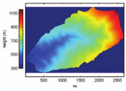
40 d θ > dθ a a, th
41

42
43 3. Bedload size distributions: Importance of hillslope sediment production Do gravel bed size distributions record channel network structure? Ref: Sklar L. S., W. E. Dietrich, E. Foufoula-Georgiou, B. Lashermes, D. Bellugi, Do gravel bed river size distributions record channel network structure?, Water Resources Research, 42, W06D18, doi: /2006wr005035, 2006.
44 Pdfs of entering sediment
45 Pdfs of entering sediment & steady-state bedload sediment As variance of entering sediment distribution increases, bedload steady-state pdf approaches entering pdf
46 Conclusions and Implications Bedload mass flux equilibrates with supply over length scale of 1/alpha, and then it becomes independent of drainage area How do channel cross sections develop under flow which scales with area but bedload mass flux that is constant? The bedload steady-state grain size distribution differs little from the hillslope supply distribution in the case of poorly sorted hillslope sediments Large-scale variability in bed material is due primarily to spatial gradients in hillslope sediment production and transport characteristics Need theory and data to predict the grain size distribution supplied to channels by hillslopes
47 4. River Corridor Geometry: Can statistics reveal the underlying physics? Ref: Gangodagomage, Bamer, Foufoula-Georgiou, et al.
48 4. River Corridor Geometry: Can statistics reveal the underlying physics? Do differences in mechanistic laws governing valleyforming processes leave their signature on the statistical properties of valley geometry? Are statistically-distinct regimes the result of physically-distinct valley-forming processes? Ref: Gangodagomage, Bamer, Foufoula-Georgiou, et al.
")
49 River Corridor Width Functions V V L R ( x; D) ( x; D)

50 South Fork Eel River, CA Area = 351 km 2

51 River Corridor Width Function (D=5m)

52 River Corridor Width Function: South Fork Eel River 6 km 14 km 20 km 28 km 35 km 89 tributaries: (1 km km 2 )

53 River Reach: 0-6 Km
54 MULTIFRACTAL FORMALISM Characterize a signal f(x) in terms of its local singularities ( ) ( ε) f x f x + C 0 0 ε ( ) hx 0 Ex: h(x 0 ) = 0.3 implies f(x) is very rough around x 0. h(x 0 ) = 0.7 implies a smoother function around xo.
55 Spectrum of singularities D(h) Multifractal Formalism D(h) H h D(h) can be estimated from the statistical moments of the fluctuations. ( ) = ( ) ( + ) M q, a f x f x a ~ a τ D ( h) qh τ ( q) q ( q) = min + 1 Legendre Transform q
56 Spectrum of scaling exponents τ(q) Multifractal Formalism monofractal h multifractal h
57 Implications of Multifractality -Normalized moments depend on scale e.g., ( ) CV a 2 ( ) ( ) ( ) ( ) ( ) M a M a M a ( ) τ( ) = = 1= a 1 M a M a τ mono-scaling: τ ( q) = q H CV( a) = constant multi-scaling: τ ( ) ( ) q q H CV a depends on a -Statistical moments of fluctuations increase faster as scale decreases (at very small scales, pdfs have heavy tails) -Chance of getting very high fluctuations locally, although sparsely. -More than one degree of singularities is present. -These singularities are spread throughout the signal intermittently
58 CV of River Corridor Widths Suggests multifractality
59 River Reach: 0-6 km
60 Summary of Results Right-Left asymmetry

61 Physical interpretation of statistical signatures? More localized transport mechanism More localized on R than L side? Smoother overall valleys? Presence of more terraces in R than L?
62 Summary of Overarching Questions 1. How much of the physical/mechanistic behavior of the coupled hydrologic/geomorphologic system is reflected in the observed statistical patterns? 2. Are statistical patterns distinct across physical boundaries and how can they be used in assisting modeling, prediction and observatory design across scales and across environments? 3. Where/what to sample to get the most out of a limited number of observations?
Floodplain Morphometry Extraction from a High Resolution Digital Elevation Model: a Simple Algorithm for Regional Analysis Studies
 Floodplain Morphometry Extraction from a High Resolution Digital Elevation Model: a Simple Algorithm for Regional Analysis Studies B. A. Dodov and E. Foufoula-Georgiou Abstract In this paper we introduce
Lidar data in water resources applications. Paola Passalacqua CE 374K Lecture, April 5 th, 2012
 Lidar data in water resources applications Paola Passalacqua CE 374K Lecture, April 5 th, 2012 Airborne Lidar Airborne laser altimetry technology (LiDAR, Light Detection And Ranging) provides high-resolution
Lidar data in water resources applications
 Lidar data in water resources applications Paola Passalacqua CE 394K 3 Guest Lecture, November 15 th, 2012 Airborne Lidar Airborne laser altimetry technology (lidar, Light Detection And Ranging) provides
Channel network extraction from high resolution topography using wavelets
 GEOPHYSICAL RESEARCH LETTERS, VOL. 34, L23S04, doi:10.1029/2007gl031140, 2007 Channel network etraction from high resolution topography using wavelets Bruno Lashermes, 1 Efi Foufoula-Georgiou, 1 and William
Physical modeling to guide river restoration projects: An Overview
 Physical modeling to guide river restoration projects: An Overview Scott Dusterhoff¹, Leonard Sklar², William Dietrich³, Frank Ligon¹, Yantao Cui¹, and Peter Downs¹ ¹Stillwater Sciences, 2855 Telegraph
SCOPE OF PRESENTATION STREAM DYNAMICS, CHANNEL RESTORATION PLANS, & SEDIMENT TRANSPORT ANALYSES IN RELATION TO RESTORATION PLANS
 DESIGN METHODS B: SEDIMENT TRANSPORT PROCESSES FOR STREAM RESTORATION DESIGN PETER KLINGEMAN OREGON STATE UNIVERSITY CIVIL ENGINEERING DEPT., CORVALLIS 2 ND ANNUAL NORTHWEST STREAM RESTORATION DESIGN SYMPOSIUM
Running Water Earth - Chapter 16 Stan Hatfield Southwestern Illinois College
 Running Water Earth - Chapter 16 Stan Hatfield Southwestern Illinois College Hydrologic Cycle The hydrologic cycle is a summary of the circulation of Earth s water supply. Processes involved in the hydrologic
Diego Burgos. Geology 394. Advisors: Dr. Prestegaard. Phillip Goodling
 Sediment Transport into an Urban Tributary Junction Diego Burgos Geology 394 Advisors: Dr. Prestegaard Phillip Goodling 1 Abstract Tributary junctions are an important component of stream morphology and
Landscape Development
 Landscape Development Slopes Dominate Natural Landscapes Created by the interplay of tectonic and igneous activity and gradation Deformation and uplift Volcanic activity Agents of gradation Mass wasting
Squaw Creek. General Information
 General Information is a tributary to the Salmon River. It enters the north side of the river about 0 miles downstream of North Fork, Idaho. The study reach is about a 30 ft length of stream about 2 miles
Generalized hydraulic geometry: Insights based on fluvial instability analysis and a physical model
 WATER RESOURCES RESEARCH, VOL. 40,, doi:10.1029/2004wr003196, 2004 Generalized hydraulic geometry: Insights based on fluvial instability analysis and a physical model Boyko Dodov and Efi Foufoula-Georgiou
(3) Sediment Movement Classes of sediment transported
 Sediment Movement Classes of sediment transported") (3) Sediment Movement Classes of sediment transported Dissolved load Suspended (and wash load ) Important for scouring algae Bedload (5-10% total load Moves along bed during floods Source of crushing for
(3) Sediment Movement Classes of sediment transported Dissolved load Suspended (and wash load ) Important for scouring algae Bedload (5-10% total load Moves along bed during floods Source of crushing for
GIS feature extraction tools in diverse landscapes
 CE 394K.3 GIS in Water Resources GIS feature extraction tools in diverse landscapes Final Project Anna G. Kladzyk M.S. Candidate, Expected 2015 Department of Environmental and Water Resources Engineering
MEANDER MIGRATION MODEL ASSESSMENT FOR THE JANUARY 2005 STORM, WHITMAN PROPERTY, SAN ANTONIO CREEK, VENTURA COUNTY, CALIFORNIA
 MEANDER MIGRATION MODEL ASSESSMENT FOR THE JANUARY 2005 STORM, WHITMAN PROPERTY, SAN ANTONIO CREEK, VENTURA COUNTY, CALIFORNIA Prepared by Eric Larsen, Ph.D. Mark Rains, Ph.D. October 2006 INTRODUCTION
ES 105 Surface Processes I. Hydrologic cycle A. Distribution % in oceans 2. >3% surface water a. +99% surface water in glaciers b.
 ES 105 Surface Processes I. Hydrologic cycle A. Distribution 1. +97% in oceans 2. >3% surface water a. +99% surface water in glaciers b. >1/3% liquid, fresh water in streams and lakes~1/10,000 of water
The River Restoration Centre therrc.co.uk. Understanding Fluvial Processes: supporting River Restoration. Dr Jenny Mant
 The River Restoration Centre therrc.co.uk Understanding Fluvial Processes: supporting River Restoration Dr Jenny Mant Jenny@therrc.co.uk Understanding your catchment Hydrology Energy associated with the
THE UNIVERSITY of TORONTO at SCARBOROUGH January, 2010 Department of Physical & Environmental Sciences
 THE UNIVERSITY of TORONTO at SCARBOROUGH January, 2010 Department of Physical & Environmental Sciences Environmental Science EES B02H3 PRINCIPLES OF GEOMORPHOLOGY The earth s surface form and its dynamic
OBJECTIVES. Fluvial Geomorphology? STREAM CLASSIFICATION & RIVER ASSESSMENT
 STREAM CLASSIFICATION & RIVER ASSESSMENT Greg Babbit Graduate Research Assistant Dept. Forestry, Wildlife & Fisheries Seneca Creek, Monongahela National Forest, West Virginia OBJECTIVES Introduce basic
B-1. Attachment B-1. Evaluation of AdH Model Simplifications in Conowingo Reservoir Sediment Transport Modeling
 Attachment B-1 Evaluation of AdH Model Simplifications in Conowingo Reservoir Sediment Transport Modeling 1 October 2012 Lower Susquehanna River Watershed Assessment Evaluation of AdH Model Simplifications
Environmental Science EES B02H3 PRINCIPLES OF GEOMORPHOLOGY
 THE UNIVERSITY of TORONTO at SCARBOROUGH January, 2009 Department of Physical & Environmental Sciences Environmental Science EES B02H3 PRINCIPLES OF GEOMORPHOLOGY The earth s surface form and its dynamic
Geomorphology Studies
 Geomorphology Studies Technical Workgroup Meeting February 14, 2012 Prepared by: Tetra Tech Prepared for: Alaska Energy Authority Overall Goal Geomorphology Studies Two studies Geomorphology Study (RSP
Lecture 10: River Channels
 GEOG415 Lecture 10: River Channels 10-1 Importance of channel characteristics Prediction of flow was the sole purpose of hydrology, and still is a very important aspect of hydrology. - Water balance gives
Fluvial Systems Lab Environmental Geology Lab Dr. Johnson
 Fluvial Systems Lab Environmental Geology Lab Dr. Johnson *Introductory sections of this lab were adapted from Pidwirny, M. (2006). "Streamflow and Fluvial Processes". Fundamentals of Physical Geography,
Lab Final Review 4/16/18
 Lab Final Review 4/16/18 Overall goals from lab Think about geology on recent timescales, predict the direction change Be able to identify how different landforms or patterns (e.g. drainage patterns, dune
Geomorphology Geology 450/750 Spring Fluvial Processes Project Analysis of Redwood Creek Field Data Due Wednesday, May 26
 Geomorphology Geology 450/750 Spring 2004 Fluvial Processes Project Analysis of Redwood Creek Field Data Due Wednesday, May 26 This exercise is intended to give you experience using field data you collected
Why Stabilizing the Stream As-Is is Not Enough
 Why Stabilizing the Stream As-Is is Not Enough Several examples of alternatives to the County s design approach have been suggested. A common theme of these proposals is a less comprehensive effort focusing
PHYSICAL GEOGRAPHY. By Brett Lucas
 PHYSICAL GEOGRAPHY By Brett Lucas FLUVIAL PROCESSES Fluvial Processes The Impact of Fluvial Processes on the Landscape Streams and Stream Systems Stream Channels Structural Relationships The Shaping and
Streams. Stream Water Flow
 CHAPTER 14 OUTLINE Streams: Transport to the Oceans Does not contain complete lecture notes. To be used to help organize lecture notes and home/test studies. Streams Streams are the major geological agents
Experimental and Theoretical Study of Strata Formation in Sedimentary Basins
 Experimental and Theoretical Study of Strata Formation in Sedimentary Basins Chris Paola St. Anthony Falls Laboratory University of Minnesota Minneapolis MN 55414 phone: (612) 624-8025 fax: (612) 624-4398
(3) Sediment Movement Classes of sediment transported
 Sediment Movement Classes of sediment transported") 9/17/15 (3) Sediment Movement Classes of sediment transported Dissolved load Suspended load Important for scouring algae Bedload (5-10% total load) Moves along bed during floods Source of crushing for
9/17/15 (3) Sediment Movement Classes of sediment transported Dissolved load Suspended load Important for scouring algae Bedload (5-10% total load) Moves along bed during floods Source of crushing for
Do you think sediment transport is a concern?
 STREAM RESTORATION FRAMEWORK AND SEDIMENT TRANSPORT BASICS Pete Klingeman 1 What is Your Restoration Project Like? k? Do you think sediment transport is a concern? East Fork Lewis River, WA Tidal creek,
Dan Miller + Kelly Burnett, Kelly Christiansen, Sharon Clarke, Lee Benda. GOAL Predict Channel Characteristics in Space and Time
 Broad-Scale Models Dan Miller + Kelly Burnett, Kelly Christiansen, Sharon Clarke, Lee Benda GOAL Predict Channel Characteristics in Space and Time Assess Potential for Fish Use and Productivity Assess
Wetland & Floodplain Functional Assessments and Mapping To Protect and Restore Riverine Systems in Vermont. Mike Kline and Laura Lapierre Vermont DEC
 Wetland & Floodplain Functional Assessments and Mapping To Protect and Restore Riverine Systems in Vermont Mike Kline and Laura Lapierre Vermont DEC NWI+ Hydro-Geomorphic Characterization of Wetlands and
Upper Truckee River Restoration Lake Tahoe, California Presented by Brendan Belby Sacramento, California
 Upper Truckee River Restoration Lake Tahoe, California Presented by Brendan Belby Sacramento, California Mike Rudd (Project Manager), Charley Miller & Chad Krofta Declines in Tahoe s Water Clarity The
BASIS FOR RIVER RESTORATION PROJECT
 The FLUVIO FCT-Doctoral Program Hydromorphological and Habitat Restoration Course Diego García de Jalón and Marta González del Tánago, UPM Madrid BASIS FOR RIVER RESTORATION PROJECT Throughout the course,
Laboratory Exercise #3 The Hydrologic Cycle and Running Water Processes
 Laboratory Exercise #3 The Hydrologic Cycle and Running Water Processes page - 1 Section A - The Hydrologic Cycle Figure 1 illustrates the hydrologic cycle which quantifies how water is cycled throughout
Stream Geomorphology. Leslie A. Morrissey UVM July 25, 2012
 Stream Geomorphology Leslie A. Morrissey UVM July 25, 2012 What Functions do Healthy Streams Provide? Flood mitigation Water supply Water quality Sediment storage and transport Habitat Recreation Transportation
Summary. Streams and Drainage Systems
 Streams and Drainage Systems Summary Streams are part of the hydrologic cycle and the chief means by which water returns from the land to the sea. They help shape the Earth s surface and transport sediment
The Importance of Riparian Vegetation in Channel Restoration: Moving Towards Quantification in Design
 The Importance of Riparian Vegetation in Channel Restoration: Moving Towards Quantification in Design Rob Millar Department of Civil Engineering The University of British Columbia "Nothing is as practical
mountain rivers fixed channel boundaries (bedrock banks and bed) high transport capacity low storage input output
 high transport capacity low storage input output") mountain rivers fixed channel boundaries (bedrock banks and bed) high transport capacity low storage input output strong interaction between streams & hillslopes Sediment Budgets for Mountain Rivers Little
mountain rivers fixed channel boundaries (bedrock banks and bed) high transport capacity low storage input output strong interaction between streams & hillslopes Sediment Budgets for Mountain Rivers Little
GLG362/GLG598 Geomorphology K. Whipple October, 2009 I. Characteristics of Alluvial Channels
 I. Characteristics of Alluvial Channels Self-formed morphology set by entrainment, transport, and deposition They move unconsolidated sedimentary materials present in the valley fill flood plain/bank flow
MATHEMATICAL MODELING OF FLUVIAL SEDIMENT DELIVERY, NEKA RIVER, IRAN. S.E. Kermani H. Golmaee M.Z. Ahmadi
 JOURNAL OF ENVIRONMENTAL HYDROLOGY The Electronic Journal of the International Association for Environmental Hydrology On the World Wide Web at http://www.hydroweb.com VOLUME 16 2008 MATHEMATICAL MODELING
Swift Creek Sediment Management Action Plan (SCSMAP)
") Swift Creek Sediment Management Action Plan (SCSMAP) PHASE 2 PROJECT PLAN PROPOSAL Whatcom County Public Works Department 322 N. Commercial Street, Suite 210 Bellingham, WA 98225 (360) 676-6692 June 2013
Swift Creek Sediment Management Action Plan (SCSMAP) PHASE 2 PROJECT PLAN PROPOSAL Whatcom County Public Works Department 322 N. Commercial Street, Suite 210 Bellingham, WA 98225 (360) 676-6692 June 2013
Annotated Bibliography of River Avulsions Pat Dryer Geography 364 5/14/2007
 Annotated Bibliography of River Avulsions Pat Dryer Geography 364 5/14/2007 1 Table of Contents Introduction 2 Annotations I. River avulsions and their deposits 2 II. Channel avulsion on alluvial fans
6.1 Water. The Water Cycle
 6.1 Water The Water Cycle Water constantly moves among the oceans, the atmosphere, the solid Earth, and the biosphere. This unending circulation of Earth s water supply is the water cycle. The Water Cycle
Overview of fluvial and geotechnical processes for TMDL assessment
 Overview of fluvial and geotechnical processes for TMDL assessment Christian F Lenhart, Assistant Prof, MSU Research Assoc., U of M Biosystems Engineering Fluvial processes in a glaciated landscape Martin
NATURAL RIVER. Karima Attia Nile Research Institute
 NATURAL RIVER CHARACTERISTICS Karima Attia Nile Research Institute NATURAL RIVER DEFINITION NATURAL RIVER DEFINITION Is natural stream of water that flows in channels with ih more or less defined banks.
Prentice Hall EARTH SCIENCE
 Prentice Hall EARTH SCIENCE Tarbuck Lutgens Running Water and Groundwater Running Water The Water Cycle Water constantly moves among the oceans, the atmosphere, the solid Earth, and the biosphere. This
FUTURE MEANDER BEND MIGRATION AND FLOODPLAIN DEVELOPMENT PATTERNS NEAR RIVER MILES 241 TO 235, SACRAMENTO RIVER
 FUTURE MEANDER BEND MIGRATION AND FLOODPLAIN DEVELOPMENT PATTERNS NEAR RIVER MILES 241 TO 235, SACRAMENTO RIVER Eric W. Larsen University of California, Davis With the assistance of Evan Girvetz REPORT
A MULTI-CRITERIA APPROACH SUPPORTING THE INVESTIGATION OF A FLOODPLAIN POTENTIALLY CONTAMINATED BY PESTICIDES
 A MULTI-CRITERIA APPROACH SUPPORTING THE INVESTIGATION OF A FLOODPLAIN POTENTIALLY CONTAMINATED BY PESTICIDES L ZILIANI, B GROPPELLI, S CECCON, F COLOMBO (RAMBOLL ENVIRON) D BOCCHIOLA, M C RULLI, G RAVAZZANI,
Channel Pattern. Channel Pattern, Meanders, and Confluences. Description of Channel Pattern. Bridge (2003)
") Channel Pattern Channel Pattern, Meanders, and Confluences Outline Description of channel pattern Alternate bars Channel pattern continua and evolution Controls of channel pattern Description of Channel
Channel Pattern Channel Pattern, Meanders, and Confluences Outline Description of channel pattern Alternate bars Channel pattern continua and evolution Controls of channel pattern Description of Channel
Stop 1: Marmot Dam Stop 1: Marmot Dam
 Stop 1: Marmot Dam Stop 1: Marmot Dam Following the removal of Marmot Dam in 2007, the fate of the reservoir sediments has been monitored through a series of surveys and sediment transport measurements.
Monitoring Headwater Streams for Landscape Response to
 Monitoring Headwater Streams for Landscape Response to Climate Change Matthew Connor, PhD Connor nvironmental, nc. www.oe-i.com icom Healdsburg, California verview Headwater stream geomorphology Response
!"#$%&&'()*+#$%(,-./0*)%(!
*+#$%(,-./0*)%(!") 8:30 Sign in Hoosic River Revival Coalition!"#$%&&'()*+#$%(,-./0*)%(! 12-#30+4/#"5-(60 9:00 Welcome and Introductions 9:15 Goals for Today s Program: A Description of the Planning Process 9:30 First Session:
8:30 Sign in Hoosic River Revival Coalition!"#$%&&'()*+#$%(,-./0*)%(! 12-#30+4/#"5-(60 9:00 Welcome and Introductions 9:15 Goals for Today s Program: A Description of the Planning Process 9:30 First Session:
Field Observations and One-Dimensional Flow Modeling of Summit Creek in Mack Park, Smithfield, Utah
 Intermountain Center for River Rehabilitation and Restoration, Utah State University 31 July 2018 Field Observations and One-Dimensional Flow Modeling of Summit Creek in Mack Park, Smithfield, Utah I.
Decoupling Allogenic Forcing from Autogenic Processes: Experimental Stratigraphy. Wonsuck Kim
 Decoupling Allogenic Forcing from Autogenic Processes: Experimental Stratigraphy Wonsuck Kim Department of Geological Sciences and Institute for Geophysics, Jackson School of Geosciences, University of
May 7, Roger Leventhal, P.E. Marin County Public Works Laurel Collins Watershed Sciences
 May 7, 2013 Roger Leventhal, P.E. Marin County Public Works Laurel Collins Watershed Sciences Background Funded in 2009 under EPA 2100 Grant for $30k and managed by SFEP Project Goals: Update original
STREAM SYSTEMS and FLOODS
 STREAM SYSTEMS and FLOODS The Hydrologic Cycle Precipitation Evaporation Infiltration Runoff Transpiration Earth s Water and the Hydrologic Cycle The Hydrologic Cycle The Hydrologic Cycle Oceans not filling
Precipitation Evaporation Infiltration Earth s Water and the Hydrologic Cycle. Runoff Transpiration
 STREAM SYSTEMS and FLOODS The Hydrologic Cycle Precipitation Evaporation Infiltration Earth s Water and the Hydrologic Cycle Runoff Transpiration The Hydrologic Cycle The Hydrologic Cycle Oceans not filling
Lecture Outlines PowerPoint. Chapter 5 Earth Science 11e Tarbuck/Lutgens
 Lecture Outlines PowerPoint Chapter 5 Earth Science 11e Tarbuck/Lutgens 2006 Pearson Prentice Hall This work is protected by United States copyright laws and is provided solely for the use of instructors
OSLA. The Observation Network of the Loire river basin Sediments
 OSLA The Observation Network of the Loire river basin Sediments Lauren Valverde, University of Tours, France - 8th International SedNet Conference, 6th-9th November 203 - Integrated sediment management
LAB-SCALE INVESTIGATION ONBAR FORMATION COORDINATES IN RIVER BASED ON FLOW AND SEDIMENT
 LAB-SCALE INVESTIGATION ONBAR FORMATION COORDINATES IN RIVER BASED ON FLOW AND SEDIMENT Mat Salleh M. Z., Ariffin J., Mohd-Noor M. F. and Yusof N. A. U. Faculty of Civil Engineering, University Technology
Sediments and bedrock erosion
 Eroding landscapes: fluvial processes Sediments and bedrock erosion Mikaël ATTAL Marsyandi valley, Himalayas, Nepal Acknowledgements: Jérôme Lavé, Peter van der Beek and other scientists from LGCA (Grenoble)
What do you need for a Marathon?
 What do you need for a Marathon? Water and a snack? What about just a normal day? 1 flush = 3.5 gallons 1 flush = 3.5 gallons 10 minute shower = 20 gal 1 flush = 3.5 gallons 10 minute shower = 20 gal Jeans
Why Geomorphology for Fish Passage
 Channel Morphology - Stream Crossing Interactions An Overview Michael Love Michael Love & Associates mlove@h2odesigns.com (707) 476-8938 Why Geomorphology for Fish Passage 1. Understand the Scale of the
Aquifer an underground zone or layer of sand, gravel, or porous rock that is saturated with water.
 Aggradation raising of the streambed by deposition that occurs when the energy of the water flowing through a stream reach is insufficient to transport sediment conveyed from upstream. Alluvium a general
Distinct landscape features with important biologic, hydrologic, geomorphic, and biogeochemical functions.
 1 Distinct landscape features with important biologic, hydrologic, geomorphic, and biogeochemical functions. Have distinguishing characteristics that include low slopes, well drained soils, intermittent
WATER ON AND UNDER GROUND. Objectives. The Hydrologic Cycle
 WATER ON AND UNDER GROUND Objectives Define and describe the hydrologic cycle. Identify the basic characteristics of streams. Define drainage basin. Describe how floods occur and what factors may make
Lab 13: Fluvial Processes and Landforms
 Name: Lab 13: Fluvial Processes and Landforms Geomorphology is the study of Earth s surface and of the processes acting to shape it. Streams, for example, are significant continental land-shaping agents.
Tom Ballestero University of New Hampshire. 1 May 2013
 Tom Ballestero University of New Hampshire 1 May 2013 1 Hydrology 2 Basic Hydrology Low flows most common Flows that fill the stream to the banks and higher are much less common Filling the stream to the
Down-stream process transition (f (q s ) = 1)
 = 1)") Down-stream process transition (f (q s ) = 1) Detachment Limited S d >> S t Transport Limited Channel Gradient (m/m) 10-1 Stochastic Variation { Detachment Limited Equilibrium Slope S d = k sd A -θ d S
Down-stream process transition (f (q s ) = 1) Detachment Limited S d >> S t Transport Limited Channel Gradient (m/m) 10-1 Stochastic Variation { Detachment Limited Equilibrium Slope S d = k sd A -θ d S
Altered morphodynamics in tidallyinfluenced rivers: re-thinking catchment management, flood risk & material fluxes
 Altered morphodynamics in tidallyinfluenced rivers: re-thinking catchment management, flood risk & material fluxes Paul A. Brewer, Mark G. Macklin, Marc Huband and Sara Rassner Centre for Catchment and
ADDRESSING GEOMORPHIC AND HYDRAULIC CONTROLS IN OFF-CHANNEL HABITAT DESIGN
 ADDRESSING GEOMORPHIC AND HYDRAULIC CONTROLS IN OFF-CHANNEL HABITAT DESIGN Conor Shea - Hydrologist U.S. Fish and Wildlife Service Conservation Partnerships Program Arcata, CA Learning Objectives Examine
Continental-margin response to sea level: Theory and Experiment
 Continental-margin response to sea level: Theory and Experiment John B. Swenson Department of Geological Sciences and Large Lakes Observatory, University of Minnesota Duluth Chris Paola, Wonsuck Kim, Ben
Each basin is surrounded & defined by a drainage divide (high point from which water flows away) Channel initiation
 Channel initiation") DRAINAGE BASINS A drainage basin or watershed is defined from a downstream point, working upstream, to include all of the hillslope & channel areas which drain to that point Each basin is surrounded &
DRAINAGE BASINS A drainage basin or watershed is defined from a downstream point, working upstream, to include all of the hillslope & channel areas which drain to that point Each basin is surrounded &
Results of Intensity-Duration- Frequency Analysis for Precipitation and Runoff under Changing Climate
 Results of Intensity-Duration- Frequency Analysis for Precipitation and Runoff under Changing Climate Supporting Casco Bay Region Climate Change Adaptation RRAP Eugene Yan, Alissa Jared, Julia Pierce,
11/12/2014. Running Water. Introduction. Water on Earth. The Hydrologic Cycle. Fluid Flow
 Introduction Mercury, Venus, Earth and Mars share a similar history, but Earth is the only terrestrial planet with abundant water! Mercury is too small and hot Venus has a runaway green house effect so
Factors affecting confluence scour
 & Wang (eds) River Sedimentation 1999., Balkema, Rotterdam. ISBN 9 9 3. 17 19 Factors affecting confluence scour R. B. Rezaur & A. W. Jayawardena. Department of Civil Engineering, The University of Hong
SECTION G SEDIMENT BUDGET
 SECTION G SEDIMENT BUDGET INTRODUCTION A sediment budget has been constructed for the for the time period 1952-2000. The purpose of the sediment budget is to determine the relative importance of different
Technical Review of Pak Beng Hydropower Project (1) Hydrology & Hydraulics and (2) Sediment Transport & River Morphology
 Hydrology & Hydraulics and (2) Sediment Transport & River Morphology") Technical Review of Pak Beng Hydropower Project (1) Hydrology & Hydraulics and (2) Sediment Transport & River Morphology The 2 nd Regional Stakeholder Forum The Pak Beng Hydropower Project 5 th May 2017
Technical Review of Pak Beng Hydropower Project (1) Hydrology & Hydraulics and (2) Sediment Transport & River Morphology The 2 nd Regional Stakeholder Forum The Pak Beng Hydropower Project 5 th May 2017
Surface Processes Focus on Mass Wasting (Chapter 10)
") Surface Processes Focus on Mass Wasting (Chapter 10) 1. What is the distinction between weathering, mass wasting, and erosion? 2. What is the controlling force in mass wasting? What force provides resistance?
Surface Processes Focus on Mass Wasting (Chapter 10) 1. What is the distinction between weathering, mass wasting, and erosion? 2. What is the controlling force in mass wasting? What force provides resistance?
Unconventional Wisdom and the Effects of Dams on Downstream Coarse Sediment Supply. Byron Amerson, Jay Stallman, John Wooster, and Derek Booth
 Unconventional Wisdom and the Effects of Dams on Downstream Coarse Sediment Supply 3 February 2009 Byron Amerson, Jay Stallman, John Wooster, and Derek Booth Sultan River, WA OBJECTIVE Consider the landscape
RESTORATION DESIGN FOR REROUTED WATERCOURSES
 With thanks to: Thames Water Utilities Limited RESTORATION DESIGN FOR REROUTED WATERCOURSES Project Design Team Colin Thorne, Nick Clifford Gary Priestnall Philip Soar Kieran Conlan, Steve Dangerfield
Lectures Hydrology & Fluvial Geomorphology. Gauley River Images. Ancients' (= Biblical) Model of Water (Hydrologic) Cycle
 Model of Water (Hydrologic) Cycle") Lectures 11-13 13 Hydrology & Fluvial Geomorphology Gauley River Images http://www.youtube.com/watch?v=eulmuyegtz4&feature=related Ancients' (= Biblical) Model of Water (Hydrologic) Cycle Stream Water
Lectures 11-13 13 Hydrology & Fluvial Geomorphology Gauley River Images http://www.youtube.com/watch?v=eulmuyegtz4&feature=related Ancients' (= Biblical) Model of Water (Hydrologic) Cycle Stream Water
Dams, sediment, and channel changes and why you should care
 Dams, sediment, and channel changes and why you should care Gordon E. Grant USDA Forest Service PNW Research Station Corvallis, Oregon Dam effects on river regimes FLOW (Q) SEDIMENT (Qs) TEMP CHEMISTRY
Susquehanna River Basin A Research Community Hydrologic Observatory. NSF-Funded Infrastructure Proposal in Support of River Basin Hydrologic Sciences
 Susquehanna River Basin A Research Community Hydrologic Observatory NSF-Funded Infrastructure Proposal in Support of River Basin Hydrologic Sciences Fundamental Problem: How Do Humans and Climate Impact
River Response. Sediment Water Wood. Confinement. Bank material. Channel morphology. Valley slope. Riparian vegetation.
 River Response River Response Sediment Water Wood Confinement Valley slope Channel morphology Bank material Flow obstructions Riparian vegetation climate catchment vegetation hydrological regime channel
ON SOME MOUNTAIN STREAMS AND RIVERS MORPHODYNAMICAL PARAMETER CHARACTERISTICS USING FIELD AND NUMERICAL MODELING
 Agricultural University of Krakow, Department of Water Engineering Wojciech Bartnik, Leszek Książek, Artur Radecki-Pawlik, Andrzej Strużyński ON SOME MOUNTAIN STREAMS AND RIVERS MORPHODYNAMICAL PARAMETER
ENVIRONMENTAL GEOSCIENCE UNIFORM SYLLABUS
 ENVIRONMENTAL GEOSCIENCE UNIFORM SYLLABUS The Association of Professional Engineers and Geoscientists of the Province of British Columbia Note: 1. This Syllabus May Be Subject To Change 2. These Courses
Diagnostic Geomorphic Methods for Understanding Future Behavior of Lake Superior Streams What Have We Learned in Two Decades?
 Diagnostic Geomorphic Methods for Understanding Future Behavior of Lake Superior Streams What Have We Learned in Two Decades? Faith Fitzpatrick USGS WI Water Science Center, Middleton, WI fafitzpa@usgs.gov
CLIMATE CHANGE DATA PROJECTIONS FOR ONTARIO AND THE GREAT LAKES BASIN
 CLIMATE CHANGE DATA PROJECTIONS FOR ONTARIO AND THE GREAT LAKES BASIN ECO Climate Data Roundtable, January 8, 2014 Richard Peltier, Physics, U Toronto Regional Data Sets of Climate Change Projections 2
Surface Water and Stream Development
 Surface Water and Stream Development Surface Water The moment a raindrop falls to earth it begins its return to the sea. Once water reaches Earth s surface it may evaporate back into the atmosphere, soak
Perspectives on river restoration science, geomorphic processes, and channel stability
 Perspectives on river restoration science, geomorphic processes, and channel stability Stream Restoration Forum: Science and Regulatory Connections Andrew C. Wilcox Department of Geosciences University
Texas A & M University and U.S. Bureau of Reclamation Hydrologic Modeling Inventory Model Description Form
 Texas A & M University and U.S. Bureau of Reclamation Hydrologic Modeling Inventory Model Description Form JUNE, 1999 Name of Model: Two-Dimensional Alluvial River and Floodplain Model (MIKE21 CHD & CST)
Vermont Stream Geomorphic Assessment. Appendix E. River Corridor Delineation Process. VT Agency of Natural Resources. April, E0 - April, 2004
 Vermont Stream Geomorphic Assessment Appendix E River Corridor Delineation Process Vermont Agency of Natural Resources - E0 - River Corridor Delineation Process Purpose A stream and river corridor delineation
Rivers and Streams. Streams. Hydrologic Cycle. Drainage Basins and Divides. Colorado River Drainage Basin. Colorado Drainage Basins.
 Chapter 14 Hydrologic Cycle Rivers and Streams Streams A stream is a body of water that is confined in a channel and moves downhill under the influence of gravity. This definition includes all sizes of
27. Running Water I (p ; )
") 27. Running Water I (p. 424-436; 440-444) Hydrosphere How much of the Earth s surface is covered by water? Earth's water is collectively called the and is stored in a number of so-called as follows: 1.
27. Running Water I (p. 424-436; 440-444) Hydrosphere How much of the Earth s surface is covered by water? Earth's water is collectively called the and is stored in a number of so-called as follows: 1.
Year 6. Geography. Revision
 Year 6 Geography Revision November 2017 Rivers and World knowledge How the water cycle works and the meaning of the terms evaporation, condensation, precipitation, transpiration, surface run-off, groundwater
Revisiting scaling laws in river basins: New considerations across hillslope and fluvial regimes
 WATER RESOURCES RESEARCH, VOL. 47,, doi:10.1029/2010wr009252, 2011 Revisiting scaling laws in river basins: New considerations across hillslope and fluvial regimes Chandana Gangodagamage, 1,2 Patrick Belmont,
What discharge (cfs) is required to entrain the D 84 (84 th percentile of sediment size distribution) in Red Canyon Wash?
 is required to entrain the D 84 (84 th percentile of sediment size distribution) in Red Canyon Wash?") Gregory Indivero 31 October 2011 What discharge (cfs) is required to entrain the D 84 (84 th percentile of sediment size distribution) in Red Canyon Wash? What discharge was required to deposit observed
Gregory Indivero 31 October 2011 What discharge (cfs) is required to entrain the D 84 (84 th percentile of sediment size distribution) in Red Canyon Wash? What discharge was required to deposit observed