Nearshore Habitats Why What You do Matters. Landscapes on the Edge November 2016
|
|
|
- Melinda Hood
- 5 years ago
- Views:
Transcription
1 Nearshore Habitats Why What You do Matters Landscapes on the Edge November 2016
2 Primary Topics Focus on marine shorelines ESA species rely on this area Many other fish and wildlife rely on this area The nearshore is a narrow productive ribbon Nearshore health is dependent upland conditions Humans have options for how they manage their lands & landscapes 2

3 Nearshore Ecosystem Riparian Forest Bluffs Estuary Beach Eelgrass Kelp 3

4 Puget Sound and its Watershed 16, 000 square miles land 10,000 streams and rivers 2,500 miles of shoreline * all figures for WA state alone * 4

5 Puget Sound Nearshore Ecosystem Semi-Enclosed Coastal Sea Steep coastline with narrow nearshore zone Mixed sand/gravel beaches Strong regional gradients Tides-Twice a day Ecology strongly linked to geology and physical processes Rich biological resources 5

6 Puget Sound Chesapeake Bay Curtesy of Hugh Shipman 6


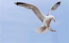
7 Puget Sound Supports 100 s of spp. of wildlife Over 200 spp. of fishes 100 s of spp. of aquatic invertebrates 10+ spp. of marine mammals 7 Photo: Jen Vanderhoof


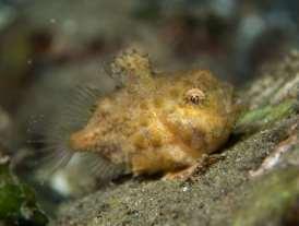
8 Grunt Sculpin Speckled Sanddab Photo: Jen Vanderhoof Spiny Lumpsucker Ratfish Photo: Jen Vanderhoof Photo: Jen Vanderhoof Gunnels Photo: Jen Vanderhoof 8


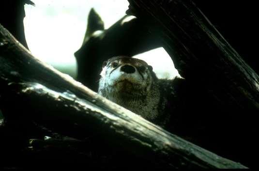
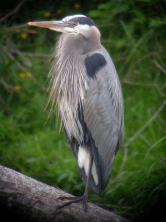
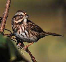
9 Wildlife Photo: Robyn Ricks Photo: Jen Vanderhoof Photo: Robyn Ricks 9

10 10 From Phill Dionne

11 11

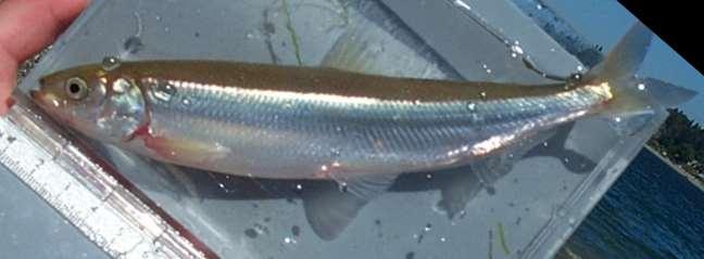
12 What size gravel do they spawn in? Surf Smelt Sand Lance 12 Adapted from Phill Dionne


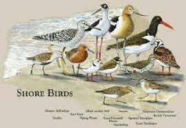
13 Forage Fish Map Spawning Surf smelt Sand lance being foraged 13

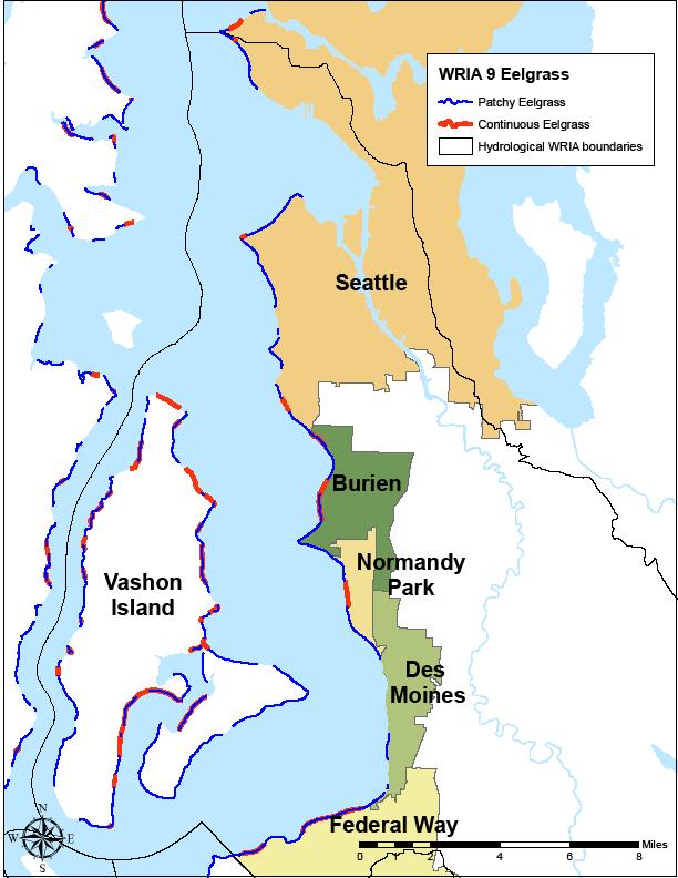
14 Eelgrass 14

15 Kelp Add kelp pictures 15


16 PACIFIC SALMON ARE MARINE FISHES Photo by Hans Berge Pink Coho Chinook Photo by Vali Eberhardt cutthroat Steelhead Photos by Phil Simpson Photo by Geoff Clayton Photo by Rodney Hsu Chum Sockeye 16 Photo by Hans Berge

17 NEARSHORE 17
18 General Functions of Shallow Nearshore Habitats for Juvenile Salmon Feeding Migration Refuge from predators Physiological transition from freshwater to saltwater 18
19 Diet 19


20 Overall diet composition based on prey ecology for juvenile Puget Sound Chinook 100% 90% 2001 n= empty mm mean n empty mm mean Leaf Hopper 80% 70% % Composition 60% 50% 40% 30% 20% Crab Larvae 10% 0% Numerical Gravimetric Numerical Gravimetric terrestrial riparian supralittoral/marsh marine planktonic/neritic plant matter marine benthic/epibenthic other Polychaete 20

21 Switching Gears 21

22 Human Influences Armoring Filling Dredging Pollution Overwater Structures Clearing and Grading Non-native species 22

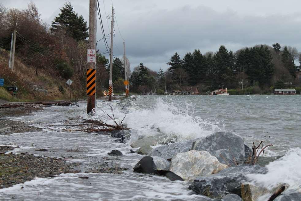
23 Currently, King County has less than 2% of its historic estuarine wetlands left Adapted from Collins and Sheikh 2005 KVI or Point Heyer, Vashon Island, 23 photo from WADOE

24 Historic Elliot Bay Shoreline 24


25 Filling Loss of shallow water habitat Loss of riparian functions Changes in hydrology Elimination of spawning, rearing and refuge habitat 25
 Loss of intertidal/subtidal habitat Introduction of contaminants")
26 Disruption of littoral drift/hydrology Alters juvenile salmon migration patterns Overwater Structures Reduced primary productivity (shade) Loss of intertidal/subtidal habitat Introduction of contaminants 26
27 Seattle Post-Intelligencer 27


28 Shoreline Armoring: What is it? Working definition man-made structures constructed along the shorelines to reduce shoreline erosion Typically called: Bulkheads, Revetments, Sea walls Typically made of: Rock or Rip-Rap, Cement, Sheet Pile, Creosote Logs, ecology blocks, & broken concrete Less typical old tires, box springs, car bodies) 28

29 Shoreline Armoring in the Green-Duwamish Watershed 92 miles of marine shoreline Total=63% is armored Mainland is 80% armored Islands are 50% armored 29
30 Impacts of Shoreline Armoring Beach erosion Impounds sediments Interrupts littoral drift Change in sediments sizes Change in invertebrate spp.composition Loss or change in submerged aquatic veg Loss of riparian vegetation Loss of woody debris Reduces shallow water habitat Loss of forage fish spawning habitat 30


31 Miles Wood Distribution Along WRIA Marine 9's Shorelines Marine ofshorelines King County 64% 64% 15% 15% 21% 21% None LWD DRIFT Unarmored-LWD Unarmored-Drift logs SW Vashon Island Wood Distribution in Relation to Shoreline Armoring % 40 Miles 30 Unarmored Armored % 14% 15% 6.5% 0.5% None LWD Drift Logs Marine View Park 31

32 Armoring below Ordinary High Water reduces LWD and drift logs West Seattle-photo from WDOE 32
33 Shoreline Veg and Armor? Domninant Shoreline Vegetation in Relation to Shoreline Armoring Miles Unarmored Armored None Grass Shrubs Trees 33 From Higgins et al. 2005
34 What s up with those trees? Shoreline Tree Density in Relation to Shoreline Armoring % Miles Unarmored Armored 5 0 Continuous Dense Patchy 34 From Higgins et al. 2005


35 South of Vashon Landing, Vashon Island Piner Point, Vashon Island 35
36 Trees Overhanging the Shoreline in Relation to Shoreline Armoring Miles Unarmored Armored 5 0 Overhanging Not Overhanging 36 From Higgins et al. 2005


37 Loss of riparian vegetation Harbor Heights, Vashon Island Vashon Landing 37
38 Encroachment Sand Lance & Surf Smelt Spawning Area No Spawning Area 38


39 Changes in habitat suitability Armored= Armored= Armored-is lighter Natural is bold Relative Humidity Armored= Armored= Adapted from Rice

40 Chinook Diet in Downtown Seattle unarmored shoreline with some vegetation armored shoreline with very little vegetation Light grey= terrestrial insects Toft et al

41 Recent UW Study & = 41


42 Recent UW Study, continued Armored beaches are on average 15 to 30 feet skinnier than non-armored beaches Drift log area is on average 15 feet skinnier on armored beaches Density of insects much higher on unarmored beaches Unarmored beaches have more wrack Much more of it is of terrestrial origin Density of beach hoppers much higher on unarmored shorelines (due to wrack) 42
43 Sea Level Rise Seattle Tide Gage 8 inches in 100 yrs 43
44 44
45 (~5ft) ~8 inches (~2ft) 45
46 Sea Level Rise impacts/effects? Increase in high water/storm events Recent study in San Juan s predicted a doubling of long term bluff erosion rates 1ft increase in in sea level means an order of magnitude increase in high water events (turns a 10 year event into a 1 year event and 100 year event into a 10 year event) Expect increase in erosion rates Expect loss in shoreline habitats by coastal squeeze 46
47 47 Created by CGS for friends of the San Juans

48 Puget Sound Nearshore Ecosystem Critical zone of transition marine, freshwater, and terrestrial ecosystems Supports complex mosaic of habitats high productivity, complex food webs, large numbers of plants and animals The whole area is important Tidy is not natural Find softer and more creative ways to stabilize slopes & banks Trees are the answer Plan for changing Sea Levels 48 From the Daily Olympian

49 QUESTIONS? 49
Puget Sound Shorelines. Announcements
 Announcements Puget Sound Shorelines Wednesday discussion of Bates paper Bham Bay project: Updates, finals week schedules Last portion of the class: Environmental issues in Puget Sound Puget Sound shorelines:
Introduction. Methods. Keyword: Bulkhead, Armoring, Thurston County, SRFB, Forage Fish
 Bulkheading in Thurston County: Impacts on Forage Fish Spawning Habitat José Carrasquero-Verde (jcarrasquero@herrerainc.com), Tim Abbe (tabbe@herrerainc.com), Herrera Environmental Consultants Steven Morrison
The Refugia Concept: Using Watershed Analysis to Prioritize Salmonid Habitat for Conservation and Restoration
 The Refugia Concept: Using Watershed Analysis to Prioritize Salmonid Habitat for Conservation and Restoration Christopher May Battelle & UW Cumulative Impacts of Urbanization Landscape Alterations Loss
-- Lessons from a successful salmon stream and estuary relocation on Gravina Island
 Re-inventing Government Creek -- Lessons from a successful salmon stream and estuary relocation on Gravina Island Jon Houghton, Ph.D. and Derek Ormerod, M.S., P.E. - Pentec Environmental/Hart Crowser,
Lower South Fork McKenzie River Floodplain Enhancement Project
 Lower South Fork McKenzie River Floodplain Enhancement Project McKenzie River Ranger District Willamette National Forest Project Location The project is located in the South Fork McKenzie River Watershed,
Bob Van Dolah. Marine Resources Research Institute South Carolina Department of Natural Resources
 Bob Van Dolah Marine Resources Research Institute South Carolina Department of Natural Resources Shoreline Change Will Occur! On our front beaches where it is not easy to retreat Shoreline Change Will
Columbia Estuary Province
 Rolling Provincial Review: Implementation 2001-2004 Province 73 Columbia Basin Fish & Wildlife Authority Province FY 2001-2004 Spending Summaries NPCC Recommendations and BPA Spending by Project Category,
ALTERNATIVES TO BULKHEADS IN THE PUGET SOUND REGION: WHAT IS SOFT SHORE PROTECTION? WHAT IS NOT? Jim Johannessen MS, Coastal Geologic Services, Inc.
 Coasts at the Millennium Proceedings of the 17th International Conference of The Coastal Society, Portland, OR USA ALTERNATIVES TO BULKHEADS IN THE PUGET SOUND REGION: WHAT IS SOFT SHORE PROTECTION? WHAT
Presentation Outline. Project Overview. Sea Level Rise Assessment & Decision Tools. Community Engagement. Tina Whitman, Friends of the San Juans
 Healthy Beaches for People & Fish Sea Level Rise Adaptation Tools for San Juan County, WA Tina Whitman & Andrea MacLennan December 10, 2015 Presentation Outline Project Overview Tina Whitman, Friends of
Natural Shoreline Landscapes on Michigan Inland Lakes
 Natural Shoreline Landscapes on Michigan Inland Lakes Excerpts from Chapters 2 and 3 Photo Photo by Jane by Jane Herbert Herbert Did you know? Twenty-four species of amphibians, 25 species of reptiles,
Ecosystem response during the removal of the Elwha River Dams
 Ecosystem response during the removal of the Elwha River Dams Presentation Prepared by George Pess - NOAA Photo by John McMillan December 2015 Elwha The Elwha River Basin Olympic Natl. Park > 90% of habitat
We are interconnected, we are resilient As air temperatures warm forests change, fires increase glaciers retreat, snowpack diminishes sediment
 We are interconnected, we are resilient As air temperatures warm forests change, fires increase glaciers retreat, snowpack diminishes sediment increases rivers change, salmon respond base sea level rises
2.11 STRAIT OF JUAN DE FUCA MARINE NEARSHORE ENVIRONMENT
 Chapter 2.11 Strait of Juan de Fuca Marine Nearshore Environment Page 2.11-1 2.11 STRAIT OF JUAN DE FUCA MARINE NEARSHORE ENVIRONMENT 2.11.1 Overview The coastline of the area covered by this watershed
Armoring on Puget Sound: Progress towards a better baseline
 Western Washington University Western CEDAR Salish Sea Ecosystem Conference 2016 Salish Sea Ecosystem Conference (Vancouver, BC) Armoring on Puget Sound: Progress towards a better baseline Hugh Shipman
Draft Technical Memorandum
 5309 Shilshole Avenue NW Suite 200 Seattle, WA 98107 206.789.9658 phone 206.789.9684 fax www.esassoc.com Draft Technical Memorandum date February 21, 2013 to from subject Renee LaCroix, City of Bellingham
Natural Shoreline Landscapes on Michigan Inland Lakes
 Natural Shoreline Landscapes on Michigan Inland Lakes Excerpts from Chapters 2 and 3 Photo Photo by Jane by Jane Herbert Herbert Session topics Characteristics of natural and altered shorelines Lakes,
3. STRAIT OF JUAN DE FUCA ECOSYSTEM: MARINE SHORELINES
 Clallam County SMP Update - Inventory and Characterization Report 0 0 0. STRAIT OF JUAN DE FUCA ECOSYSTEM: MARINE SHORELINES Clallam County marine shorelines are buffeted directly by wind and waves entering
The River Restoration Centre therrc.co.uk. Understanding Fluvial Processes: supporting River Restoration. Dr Jenny Mant
 The River Restoration Centre therrc.co.uk Understanding Fluvial Processes: supporting River Restoration Dr Jenny Mant Jenny@therrc.co.uk Understanding your catchment Hydrology Energy associated with the
3. STRAIT OF JUAN DE FUCA ECOSYSTEM: MARINE SHORELINES
 Clallam County SMP Update - Inventory and Characterization Report 3. STRAIT OF JUAN DE FUCA ECOSYSTEM: MARINE SHORELINES Clallam County marine shorelines are buffeted directly by wind and waves entering
Relatively little hard substrate occurs naturally in the
 CHAPTER FIVE Rock Habitats Relatively little hard substrate occurs naturally in the estuary, owing mainly to the vast quantities of fine sediment that have been deposited by the rivers. Rock habitat is
Shoreline and Climate Change Adaptation Alternatives for The Letter Parcel, Bolinas Lagoon
 Shoreline and Climate Change Adaptation Alternatives for The Letter Parcel, Bolinas Lagoon Scenic shoreline vista of Bolinas Lagoon and ridges, from Letter Parcel, March 2016 Peter Baye, Coastal Ecologist
3. MARINE HABITAT RESTORATION
 Feasibility Study for Restoration of Titlow Lagoon Fish Passage South Puget Sound Salmon Enhancement Group 3. MARINE HABITAT RESTORATION Marine habitat restoration at Titlow Park could include restoration
DETAILED DESCRIPTION OF STREAM CONDITIONS AND HABITAT TYPES IN REACH 4, REACH 5 AND REACH 6.
 DETAILED DESCRIPTION OF STREAM CONDITIONS AND HABITAT TYPES IN REACH 4, REACH 5 AND REACH 6. The Eklutna River was divided into study reaches (figure 1) prior to this site visit. Prominent geologic or
TEST NAME: Biome Test 10/7 TEST ID: GRADE:05 - Fifth Grade SUBJECT:Life and Physical Sciences TEST CATEGORY: My Classroom
 TEST NAME: Biome Test 10/7 TEST ID:1239163 GRADE:05 - Fifth Grade SUBJECT:Life and Physical Sciences TEST CATEGORY: My Classroom Biome Test 10/7 Page 1 of 8 10/07/16, Biome Test 10/7 Student: Class: Date:
Types of Wetlands. Tidal Systems
 Types of Wetlands Tidal Systems 1 COASTAL WETLAND ECOSYSTEMS Tidal Salt Marshes Tidal Freshwater Marshes Mangrove Wetlands 2 Tidal Estuarine Wetland 3 Definition and Formation of Estuaries Estuary: : partially
Subtidal permanently flooded with tidal water. Irregularly exposed surface exposed by tides less often than daily
 Types of Wetlands Tidal Systems COASTAL WETLAND ECOSYSTEMS Tidal Salt Marshes Tidal Freshwater Marshes Mangrove Wetlands Tidal Estuarine Wetland 1 Definition and Formation of Estuaries u Estuary : partially
Planning for the Future of Humboldt Bay: Sea Level Rise, Sediment Management, Sand Spits and Salt Marshes. Joel Gerwein
 Planning for the Future of Humboldt Bay: Sea Level Rise, Sediment Management, Sand Spits and Salt Marshes Joel Gerwein Introduction to Humboldt Bay Setting Economy, community, and environment Sediment
Mobrand to Jones and Stokes. Sustainable Fisheries Management Use of EDT
 Sustainable Fisheries Management Use of EDT Ecosystem Diagnosis and Treatment EDT EDT designed to provide a practical, science-based approach for developing and implementing watershed plans. Provides decision
Stream Restoration and Environmental River Mechanics. Objectives. Pierre Y. Julien. 1. Peligre Dam in Haiti (deforestation)
") Stream Restoration and Environmental River Mechanics Pierre Y. Julien Malaysia 2004 Objectives Brief overview of environmental river mechanics and stream restoration: 1. Typical problems in environmental
Stream Restoration and Environmental River Mechanics Pierre Y. Julien Malaysia 2004 Objectives Brief overview of environmental river mechanics and stream restoration: 1. Typical problems in environmental
Kootenai River Habitat Restoration Program Update
 Kootenai River Habitat Restoration Program Update Kootenai Tribe of Idaho Kootenai Valley Resource Initiative November 19, 2012 Bonners Ferry, Idaho Changes to Kootenai Basin Beaver trapping Floodplain
Coastal issues: Beaches and Estuaries
 Coastal issues: Beaches and Estuaries Definitions: Coast = broad zone where both marine & terrestrial processes act It includes the beach, lagoons, marshes, bars etc. Coastal processes act to shape the
Developing a nearshore geospatial framework for recovery assessment and planning
 Western Washington University Western CEDAR Salish Sea Ecosystem Conference 2018 Salish Sea Ecosystem Conference (Seattle, Wash.) Apr 6th, 10:30 AM - 10:45 AM Developing a nearshore geospatial framework
Project (Project No. US-CA-62-2) Maintenance Inspection and Reports (Subtask 14.1) Inspection Report No.2
 Maintenance Inspection and Reports (Subtask 14.1) Inspection Report No.2") MEMORANDUM TO: FROM: Jim Well, Ducks Unlimited Mike Harvey, PhD, PG SUBJECT: M&T/ Llano Seco Fish Screen Project (Project No. US-CA-62-2) Maintenance Inspection and Reports (Subtask 14.1) Inspection Report
MEMORANDUM TO: FROM: Jim Well, Ducks Unlimited Mike Harvey, PhD, PG SUBJECT: M&T/ Llano Seco Fish Screen Project (Project No. US-CA-62-2) Maintenance Inspection and Reports (Subtask 14.1) Inspection Report
Ms. A. Mormando's Class *
 8 th Grade Science Essential Standard: 8.E.1.1 Explain the structure of the hydrosphere including: Water distribution on Earth; Local river basin and water availability Stream - A stream is a body of water
FORAGE FISH SPAWNING IN THE ELWHA NEARSHORE: ECOLOGICAL FORM AND FUNCTION IN A CHANGING ENVIRONMENT. Leif T. Wefferling
 FORAGE FISH SPAWNING IN THE ELWHA NEARSHORE: ECOLOGICAL FORM AND FUNCTION IN A CHANGING ENVIRONMENT by Leif T. Wefferling A Thesis Submitted in partial fulfillment of the requirements for the degree Master
FUTURE MEANDER BEND MIGRATION AND FLOODPLAIN DEVELOPMENT PATTERNS NEAR RIVER MILES 200 TO 191 OF THE SACRAMENTO RIVER PHASE III REPORT
 FUTURE MEANDER BEND MIGRATION AND FLOODPLAIN DEVELOPMENT PATTERNS NEAR RIVER MILES 200 TO 191 OF THE SACRAMENTO RIVER PHASE III REPORT Eric W. Larsen REPORT FOR DUCKS UNLIMITED March 31, 2006-1 - Contents
Island Design. UMRS EMP Regional Workshop. Presentation for the
 Island Design Presentation for the UMRS EMP Regional Workshop by Jon Hendrickson Hydraulic Engineer Regional Technical Specialist, Water Quality and Habitat Restoration August 17 19, 2005 Project Delivery
Assessment. Assessment
 2001 SPRINGBROOK CREEK RESTORATION - THREE YEAR POST-CONSTRUCTION REVIEW - Presented by Bruce Henderson and Andy Harris 2005 River Restoration Northwest Symposium Skamania Lodge, Washington www.hendersonlandservices.com
Sea Level Rise in Miami-Dade County Florida Implications for Management of Coastal Wetlands and the Everglades
 Sea Level Rise in Miami-Dade County Florida Implications for Management of Coastal Wetlands and the Everglades Peter W. Harlem Dr. John F. Meeder Florida International University Southeast Environmental
Community Mapping Network. Selected Coastal Atlases and Information Systems in British Columbia, Canada
 Community Mapping Network Selected Coastal Atlases and Information Systems in British Columbia, Canada Outline Community Mapping Network cmnbc.ca Pacific Coastal Resources Atlas for BC cmnbc.ca The Living
ICAN Great Lakes Workshop
 Washington Coastal latlas ICAN Great Lakes Workshop September 13 15, 15 2010 Current Washington Coastal Atlas http://www.ecy.wa.gov/programs/sea/sma/atlas_home.html 1 st version of WA Coastal Atlas was
Supplemental Slides. Shore: Junction of Land & Water. Junction of Land & Water. Sea Level Variations. Shore vs. Coast. Sea Level Variations
 Shore: Junction of Land & Water Supplemental Slides Sediments come off land Most get dumped at the beach Sediment interacts with ocean waves and currents Junction of Land & Water Features: Breaking waves,
Shore: Junction of Land & Water. Sediments come off land Most get dumped at the beach Sediment interacts with ocean waves and currents
 Shore: Junction of Land & Water Supplemental Slides Sediments come off land Most get dumped at the beach Sediment interacts with ocean waves and currents Junction of Land & Water Features: Breaking waves,
Module 10: Resources and Virginia Geology Topic 4 Content: Virginia Geology Notes
 Virginia is composed of a very diverse landscape that extends from the beaches and barrier islands all of the way to the highly elevated Appalachian Plateau. Geologists have discovered ancient shallow
Coastal Impacts of Climate Change in the Northwest: A Summary of the Findings of the upcoming National Climate Assessment
 Western Washington University Western CEDAR Salish Sea Ecosystem Conference 2014 Salish Sea Ecosystem Conference (Seattle, Wash.) May 1st, 3:30 PM - 5:00 PM Coastal Impacts of Climate Change in the Northwest:
Best Management Practices for Coldwater Fisheries Enhancement and Restoration
 Best Management Practices for Coldwater Fisheries Enhancement and Restoration MACC Annual Environmental Conference 2017 March 3, 2017 Tim Dexter, MassDOT Highway Division 1 Leading the Nation in Transportation
SCHUSTER SLOPE LANDSCAPE MANAGEMENT PLAN. January 15, 2015
 SCHUSTER SLOPE LANDSCAPE MANAGEMENT PLAN January 15, 2015 1 WHY DO WE NEED A LANDSCAPE MANAGEMENT PLAN? 2 PROCESS FOR DEVELOPING THE SCHUSTER SLOPE LANDSCAPE MANAGEMENT PLAN 3 NORTH DOWNTOWN SUB AREA PLAN
Carmel River Bank Stabilization at Rancho San Carlos Road Project Description and Work Plan March 2018
 Carmel River Bank Stabilization at Rancho San Carlos Road Project Description and Work Plan March 2018 EXISTING CONDITION The proposed Carmel River Bank Stabilization at Rancho San Carlos Road Project
Overview of Methods. Terrestrial areas that are most important for conservation Conservation
 Overview of Methods The goal of the Western Lake Erie Coastal Conservation Vision project (WLECCV) is to define where we should be working locally to optimally achieve regional conservation impact. The
Sea Level Rise Providing Nature A-Right-of Way
 Sea Level Rise Providing Nature A-Right-of Way Study Area Site 2: Skagit Bay Initial Condition 11.2 Inches by 2050 No Dikes 27.3 Inches by 2100 No Dikes The Problem Loss of coastal wetlands due to submergence
Start of Presentation: No notes (Introductory Slide 1) 1) Salmonid Habitat Intrinsic Potential (IP) models are a type of habitat potential
 1) Salmonid Habitat Intrinsic Potential (IP) models are a type of habitat potential") The What and How of Salmonid Habitat Intrinsic Potential Modeling Start of Presentation: No notes (Introductory Slide 1) 1) Salmonid Habitat Intrinsic Potential (IP) models are a type of habitat potential
The What and How of Salmonid Habitat Intrinsic Potential Modeling Start of Presentation: No notes (Introductory Slide 1) 1) Salmonid Habitat Intrinsic Potential (IP) models are a type of habitat potential
Pee Dee Explorer. Science Standards
 Science Standards About Pee Dee Explorer What does it mean when someone says they are from the "Pee Dee" of South Carolina? A place is bigger than its physical geography. A "sense of place" weaves together
Connecticut Coastal Management Program
 Connecticut Coastal Management Program Fact Sheet for SHORELINE FLOOD AND EROSION CONTROL STRUCTURES What are Shoreline Flood and Erosion Control Structures? The Connecticut General Statutes (CGS) define
Fluvial Driven Alluvial Fans
 Fluvial Driven Alluvial Fans Restoration Project Evaluations - Examples from the Russian and Napa River Watersheds Mia Docto Masters Thesis UC Berkeley 1. Basic Fan Description 2. Fluvial Driven Fan Characteristics
Interactions among Land, Water, and Vegetation in Shoreline Arthropod Communities
 AMERICAN JOURNAL OF UNDERGRADUATE RESEARCH VOL., NO.. () Interactions among Land, Water, and Vegetation in Shoreline Arthropod Communities Randall D. Willoughby and Wendy B. Anderson Department of Biology
ADDRESSING GEOMORPHIC AND HYDRAULIC CONTROLS IN OFF-CHANNEL HABITAT DESIGN
 ADDRESSING GEOMORPHIC AND HYDRAULIC CONTROLS IN OFF-CHANNEL HABITAT DESIGN Conor Shea - Hydrologist U.S. Fish and Wildlife Service Conservation Partnerships Program Arcata, CA Learning Objectives Examine
1 Shoreline Landforms 2. 2 Emergent v. Submergent 2. 3 Wavecutting 3. 4 Planview 4. 5 Marine Terraces 5. 6 California 7. 7 Tombolos, Sea Stacks 8
 Shorelines November 9, 2008 Contents 1 Shoreline Landforms 2 2 Emergent v. Submergent 2 3 Wavecutting 3 4 Planview 4 5 Marine Terraces 5 6 California 7 7 Tombolos, Sea Stacks 8 8 Active Processes 9 9 Emergence
Establishing Baseline Conditions Using Wildlife-Habitat Relationships Definitions. Northwest Habitat Institute
 Establishing Baseline Conditions Using Wildlife-Habitat Relationships Definitions Northwest Habitat Institute Northwest Habitat Institute Wildlife-Habitat Relationships I B I S ntergrated Habitat and iodiversity
UNIT 5: ECOLOGY Chapter 15: The Biosphere
 CORNELL NOTES Directions: You must create a minimum of 5 questions in this column per page (average). Use these to study your notes and prepare for tests and quizzes. Notes will be stamped after each assigned
Introducing IMS. v) Select the Zoom to Full Extent tool. Did you return to the original view?
 Select the Zoom to Full Extent tool. Did you return to the original view?") Ocean/ENVIR 260, Winter 2006 Lab 1, Get to Know the Puget Sound Watershed Name Introducing IMS 1) Open your web browser and navigate to http://128.208.23.127/website/lab1. (This link can be found on the
Ocean/ENVIR 260, Winter 2006 Lab 1, Get to Know the Puget Sound Watershed Name Introducing IMS 1) Open your web browser and navigate to http://128.208.23.127/website/lab1. (This link can be found on the
Landslide & Coastal Erosion Risk Reduction at Oregon s Water/Wastewater Networks
 Landslide & Coastal Erosion Risk Reduction at Oregon s Water/Wastewater Networks Laura Gabel, RG (with Bill Burns, RG & Jonathan Allan, Ph. D) Oregon Department of Geology and Mineral Industries (541)
Upper Mississippi River Basin Environmental Management Program Workshop
 Presentation to the Upper Mississippi River Basin Environmental Management Program Workshop by Michael Rodgers River Engineer US Army Corps of Engineers, St. Louis District August 17, 2007 Engineering
CHAPTER 6 & 7 VOCABULARY
 CHAPTER 6 & 7 VOCABULARY 1. Biome 2. Climate 3. Latitude 4. Altitude 5. Emergent layer 6. Epiphyte 7. Understory 8. Permafrost 9. Wetland 10.Plankton 11.Nekton 12.Benthos 13.Littoral zone 14.Benthic zone
Review of Riparian Function Riparian Management Riparian Monitoring
 Review of Riparian Function Riparian Management Riparian Monitoring Water Shed Water Catchment Water catching creek Water shedding creek Properly functioning riparian area Properly Functioning Riparian
Evaluation of Geomorphic Effects of Removal of Marmot and Little Sandy Dams and Potential Impacts on Anadromous Salmonids
 PRELIMINARY FINAL Evaluation of Geomorphic Effects of Removal of Marmot and Little Sandy Dams and Potential Impacts on Anadromous Salmonids Prepared for: Portland General Electric 121 SW Salmon Street
Taxonomy and Systematics: a broader classification system that also shows evolutionary relationships
 Taxonomy: a system for naming living creatures Carrolus Linnaeus (1707-1778) The binomial system: Genus and species e.g., Macrocystis pyrifera (Giant kelp); Medialuna californiensis (halfmoon) Taxonomy
COASTAL GEOLOGIC SERVICES, INC.
 COASTAL GEOLOGIC SERVICES, INC. Pocket Beach Mapping in San Juan County Prepared for: Friends of the San Juan Prepared by: Andrea MacLennan, MS and Stephanie Williams BS/BA Coastal Geologic Services, Inc.
Upper Truckee River Restoration Lake Tahoe, California Presented by Brendan Belby Sacramento, California
 Upper Truckee River Restoration Lake Tahoe, California Presented by Brendan Belby Sacramento, California Mike Rudd (Project Manager), Charley Miller & Chad Krofta Declines in Tahoe s Water Clarity The
Gespe gewaq Mi gmaq. Resource Council. Coastal Erosion Awareness. Ugpi ganjig Sitmug Eel River Bar Beach
 Gespe gewaq Mi gmaq Resource Council Coastal Erosion Awareness Ugpi ganjig Sitmug Eel River Bar Beach 2 Table of Contents Introduction...1 Driving Force 1:...2 Sensitivity to Sea-Level Rise Driving Force
Biosphere Biome Ecosystem Community Population Organism
 Ecology ecology - The study of living things and how they relate to their environment Levels of Organization in Ecology organism lowest level one living thing population collection of organisms of the
Living Shorelines: The origins of a practice, the sudden rise of interest within the stormwater community, and the debate
 Living Shorelines: The origins of a practice, the sudden rise of interest within the stormwater community, and the debate Jana Davis Chesapeake Bay Trust Definition of Living Shorelines "Living shorelines"
COASTAL DYNAMICS VIRTUAL FIELD TRIP, NORTHEAST FLORIDA. Joann Mossa Department of Geography University of Florida
 COASTAL DYNAMICS VIRTUAL FIELD TRIP, NORTHEAST FLORIDA Joann Mossa Department of Geography University of Florida WHERE ARE WE GOING? In NE Florida (Flagler and St. Johns County, south of St. Augustine),
Habitat Assessment. Peggy Compton UW-Extension Water Action Volunteers Program Coordinator
 Habitat Assessment Peggy Compton UW-Extension Water Action Volunteers Program Coordinator Adapted from a presentation by Jean Unmuth, Water Quality Biologist, WI DNR dnr.wi.gov www.uwex.edu erc.cals.wisc.edu
CR AAO Bridge. Dead River Flood & Natural Channel Design. Mitch Koetje Water Resources Division UP District
 CR AAO Bridge Dead River Flood & Natural Channel Design Mitch Koetje Water Resources Division UP District Old County Road AAO Bridge Map courtesy of Marquette County Silver Lake Basin McClure Basin
South Carolina Coastal Habitats
 South Carolina Coastal Habitats By C. Livingston, 2009 Earth Where is South Carolina? North America United States of America SC Here we are! South Carolina borders the Atlantic Ocean. Did you know? South
Aundrea McBride, Karen Wolf, and Eric Beamer June 2006
 SKAGIT BAY NEARSHORE HABITAT MAPPING Aundrea McBride, Karen Wolf, and Eric Beamer June 2006 INTRODUCTION Juvenile Chinook salmon travel through and utilize nearshore habitats as part of their life cycle.
Soft Shore Protection/Structure Removal Blueprint for San Juan County Forage Fish Beaches
 Soft Shore Protection/Structure Removal Blueprint for San Juan County Forage Fish Beaches Prepared for: Friends of the San Juans Prepared by: Jim Johannessen, MS, LEG and Andrea MacLennan, MS 701 Wilson
Most natural ecosystems are in a state of equilibrium. This means that their biotic and abiotic features remain relatively constant over time.
 Most natural ecosystems are in a state of equilibrium. This means that their biotic and abiotic features remain relatively constant over time. The major biomes, for example, usually maintain a characteristic
MISSISSIPPI COASTAL IMPROVEMENTS
 MISSISSIPPI COASTAL IMPROVEMENTS PROGRAM (MsCIP) Comprehensive Barrier 237 27 200 237 27 200 Island 237 Restoration 27 200 Plan 80 9 27 252 74.59 255 255 255 0 0 0 63 63 63 3 32 22 239 65 53 0 35 20 2
Ecological Succession
 Ecological Succession Most natural ecosystems are in a state of equilibrium. This means that their biotic and abiotic features remain relatively constant over time. The major biomes, for example, usually
Soft Shore Protection As An Alternative To Bulkheads - Projects And Monitoring
 Soft Shore Protection As An Alternative To Bulkheads - Projects And Monitoring Jim W. Johannessen Coastal Geologic Services, Inc. Introduction Beach erosion and improper development along the shore have
Human Impacts to Rivers
 Human Impacts to Rivers Sediment Water Wood Confinement Valley slope Channel morphology Bank material Flow obstructions Riparian vegetation Human Impacts on Rivers dams channelization loss of woody debris/riparian
BZ471, Steam Biology & Ecology Exam
 BZ471, Eam1, p.1 BZ471, Steam Biology & Ecology Eam Name Multiple choice When benthic organisms enter the water column with a regular diel periodicity: a) catastrophic drift b) behavioral drift c) constant
Geomorphic Assessment of the Middle and Lower Swan Lake Watershed, Calhoun Division of Two Rivers National Wildlife Refuge.
 Geomorphic Assessment of the Middle and Lower Swan Lake Watershed, Calhoun Division of Two Rivers National Wildlife Refuge Report Figures 33 34 Figure 1. Location of Middle and Lower Swan Lake watersheds
Watershed concepts for community environmental planning
 Purpose and Objectives Watershed concepts for community environmental planning Dale Bruns, Wilkes University USDA Rural GIS Consortium May 2007 Provide background on basic concepts in watershed, stream,
C. STUDENT FIELD DATA SHEETS
 C. STUDENT FIELD DATA SHEETS Student Name Date Time Stream Location Parameter to find Your Group s Results Units trial trial average Transparency cm Water Temperature Air Temperature Weather N sunny N
200 Meters Down Topic: Ocean Zones (5 th 8 th grade)
") 200 Meters Down Topic: Ocean Zones (5 th 8 th grade) by Lodge 200 Meters Down Have you people heard about the plankton? Just tiny algae and it s floating, right What about the nekton like jellyfish? They
200 Meters Down Topic: Ocean Zones (5 th 8 th grade) by Lodge 200 Meters Down Have you people heard about the plankton? Just tiny algae and it s floating, right What about the nekton like jellyfish? They
Case Study 2: Twenty-mile Creek Rock Fords
 Case Study : Twenty-mile Creek Rock Fords Location Crossing Description Washington. Okanagan National Forest. Methow Valley Ranger District. Chewuch river basin, East Chewuch Road. The Twenty-mile Creek
Setting Priorities for Eelgrass Conservation and Restoration. Robert Buchsbaum Massachusetts Audubon Society
 Setting Priorities for Eelgrass Conservation and Restoration Robert Buchsbaum Massachusetts Audubon Society Eelgrass habitat values A rich, productive habitat for many marine organisms Nursery habitat
Which map shows the stream drainage pattern that most likely formed on the surface of this volcano? A) B)
 B)") 1. When snow cover on the land melts, the water will most likely become surface runoff if the land surface is A) frozen B) porous C) grass covered D) unconsolidated gravel Base your answers to questions
1. When snow cover on the land melts, the water will most likely become surface runoff if the land surface is A) frozen B) porous C) grass covered D) unconsolidated gravel Base your answers to questions
Predicting ecosystem response to the removal of the Elwha River Dams, Washington State, U.S.A.
 Predicting ecosystem response to the removal of the Elwha River Dams, Washington State, U.S.A. G.Pess 1, M. McHenry 2,T. Beechie 1, S. Morley 1, J. Duda 3,H. Coe 1, K. Kloehn 1, M. Liermann 1 1 NOAA, rthwest
Changes to Land 5.7B. landforms: features on the surface of Earth such as mountains, hills, dunes, oceans and rivers
 All the landforms on Earth have changed over time and continue to change. Many of the changes were caused by wind, moving water, and moving ice. Mountains have grown and shrunk. Rivers have cut away land
Appendix B 2: Central Strait Sub-Region
 Appendix B 2: Central Strait Sub-Region Table of Contents Sub-Region Summary. 2 Geographic Location.. 2 Geology and Shoreline Sediment Drift. 2 Information Sources.. 3 Description of Sub-regional Habitat
APPENDIX E-4. Field Report: Intertidal Habitat and Marine Biota Survey
 APPENDIX E-4 Field Report: Intertidal Habitat and Marine Biota Survey Field Report Intertidal Habitat and Marine Biota Survey of the Vallejo Marine Terminal Site, Vallejo, California April 18, 2014 Prepared
River Restoration and Rehabilitation. Pierre Y. Julien
 River Restoration and Rehabilitation Pierre Y. Julien Department of Civil and Environmental Engineering Colorado State University Fort Collins, Colorado River Mechanics and Sediment Transport Lima Peru
MANGROVES. What is a mangrove? Characteristics
 MANGROVES What is a mangrove? Mangrove plants include trees, shrubs, ferns and palms. These plants are found in the tropics and sub- tropics on river banks and along coastlines, being unusually adapted
Think about the landforms where you live. How do you think they have changed over time? How do you think they will change in the future?
 reflect All the landforms on Earth have changed over time and continue to change. Many of the changes were caused by wind, moving water, and moving ice. Mountains have grown and shrunk. Rivers have cut
Fish Species Composition, Timing and Distribution in Nearshore Marine Waters: A Synopsis of Beach Seining Surveys in King County, WA
 Fish Species Composition, Timing and Distribution in Nearshore Marine Waters: A Synopsis of 2001-2002 Beach Seining Surveys in King County, WA James S. Brennan and Kollin F. Higgins King County Department
Salt Marsh Role Play
 Salt Marsh Role Play Grade Level: 3 rd SC Performance Standards: 3-3.5 Focus Questions: 1. What are the roles of producers and consumers in the salt marsh? 2. How do changes in a habitat affect organisms
Chapter 52 An Introduction to Ecology and the Biosphere
 Chapter 52 An Introduction to Ecology and the Biosphere Ecology The study of the interactions between organisms and their environment. Ecology Integrates all areas of biological research and informs environmental