GIS Support for a Traffic. Delaware
|
|
|
- Garry Collins
- 5 years ago
- Views:
Transcription
1 GIS Support for a Traffic Operations Management Plan in Delaware Geospatial Information Systems for Transportation AASHTO GIS-T, Hershey Pennsylvania March 28th, 2011 David Racca Center for Applied Demography and Survey Research University of Delaware dracca@udel.edu
2 DelDOT ITMS The goals of the Delaware Department of Transportation Integrated Transportation Management System (ITMS) is to keep the efficiency of the transportation system at the highest possible level through real time monitoring, control and information, and is composed of 4 functional areas to include control, monitoring, information and telecommunications. New Castle County Delaware is the target area for implementing congestion management strategies and will join existing information, fill in gaps with new data, prioritize and prepare for new project start-ups, and quantify transportation system performance.
3 GIS support for the operations plan and traffic analysis addresses the following areas: Standard and effective ways of referencing traffic data to models of the transportation network. Location and processing of vehicle data Location and processing of fixed device measurement data (infrastructure) Location and processing of environment data Integration, ti visualization and dissemination i of the above
4 The primary issues associated with traffic data and managing it and processing it in GIS are: Travel flow. Most of the data is directional. Standard d and effective ways of referencing traffic data to models of the transportation network. Integrating data of different spatial types, point, line, and polygon. Examples: speed probe data, capacity data, device counters, travel demand Integration of data from different time dimensions. Dealing with large volumes of data. Aggregation and disaggregation. g Integrating across portions of the transportation network. Interrelated measures. Significance of values depend on other factors
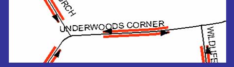
5 DIRECTION


6
7 You are referencing information to the GIS model of the travel way. The flow of the traffic and where data is in that flow is the basis of the integration. Generally you are building performance measures about how traffic flows, contributions to the flow, and impediments to the flow. The fundamental issue of referencing that information are the entities within the GIS representation and what you call them, the identification system. The GIS entities are: * Links portions of road of varying lengths * Approaches * Turns right, left, thru, u * demand points origins and destinations * intersections
8 Data about travel ways is coming in a range of resolutions Some data is about road segments between major intersections Segments between minor intersections and access points Segments that relate to a change in a factor not only dependent on intersections Pavement quality Addresses Elevation Jurisdictional boundaries Property boundaries About points, not segments, incidents
9 Data across a travel way Address Ranges Traffic Volumes Lane Widths Bid Bridges
10 Identifying entities A segmentation scheme based on most major and minor intersections, detailed enough to please most everybody X-Y Y? Nearness? Fixed segmentation Linear referencing dynamic segmentation A consistent and integrated approach and guide/standard for managing road network data is needed.
11 Linear Referencing as Another Option DelDOT Centerline File Delaware Linear Referencing System DELRS Maintenance Rd ID RDWAYID Beginning g and end mile points
12 Integrating Query on LRS Tables Speed Limit i AADT Values Pavement Type Asphalt Concrete Asphalt Skid Values GIS Query Results where: Speed => 45 AADT < Pavement = Asphalt Skid Value =<
13 Linear Referencing Tools Overlay union, intersect, query Dissolve/Concatenate t events Locate points (XY) & polygons along routes- Produce the route and mile point of a point or intersecting polygon in space Transform events Go from one linear referencing system to another. Calibrate a lrs A great deal of data processing potential to work with point and segment data
14 Identification Scheme Based on Delaware s LRS ROAD SEGMENTS: LRSID N 0 = RDWAYID * BEGMP * * ENDMP (in opposite direction) = RDWAYID * ENDMP * * BEGMP
15 Identification Scheme Based on Point Data Delaware s LRS LRSID N 0 = RDWAYID * LRSMP * 1000 Intersections can have more than one Intersections can have more than one unique ID based on segments involved
16 Identification Scheme Based on Approaches Delaware s LRS LRSID n 0 = * RDWAYID + (LRSMP +.002) * LRSMP * 1000 OR = * RDWAYID + (LRSMP -.002) * LRSMP * 1000
17
18
19
20
21
22
23
24 Turns
25 Turns created from 2 arcs and directions
26 LRSID C Identification Scheme Movements / Turns = RDWAYID1+LRSBMP1+LRSEMP1+RDWAYID2+ + LRSEMP1 + RDWAYID2 + LRSBMP2 + LRSEMP2 Where: LRSBMP1 = (begmp ) * 1000 or = (endmp ) * 1000 LRSEMP1 = (begmp1* 1000) or = endmp1 * 1000) LRSBMP2 = endmp2 * 1000 or begmp2 * 1000 LRSEMP2 = ( endmp ) * 1000 or ( begmp ) * 1000
27
28
29
30
31
32
33 A Sample GPS Path
34
35
36 Issues with Speed Probe Data A point measurement of speed from a vehicle is directional though sometimes has no heading information i Issue of where to assign the point in a segment based scheme. The link or the approach? Speed measurements within the intersection are not the approach or link, but the turn Nearness functions used to establish the LRS point don t solve all issues with the raw data
37 Three approaches being investigated For a given route identify vehicles traveling the entire route and tabulate travel times for the entire route for different times (peak). Group speed probe readings for each direction of a link and establish an average speed for the link. Take each vehicle trip/track and develop speed estimates to each link and turning movement crossed in the trip. Allocation of the times and speeds to the turns and links making up the track.
38
39
40
41
42
43
44
45
46 Where We Are With Transportation System Collections Websites managed by separate agencies Separate libraries Massive amount of information for transportation Reports, tables, figures, power points, spreadsheets, GIS files of various kinds, links and other websites, graphics etc Information is used for various purposes and it is often unpredictable what bits of information will be cataloged and how they will be used Data silos, every user, every project, every subproject, organization of data is barely known to the originator. Folders, even shared folders, don t manage it well
47
48 Tagging Tagging is the organization of the information Data type, format, project name, file owner, date, topic area, spatial extent are all examples of tags Views are created from queries on the document library. Such as. select all documents/data referring to traffic counts in Sussex County A balance between search capabilities and amount of time it takes to reference a bit of information.
49
50 View Examples Show me. All Files submitted by a certain person All New Files since September 2009 All power point files that deal with the 301 Project All GIS Files For Sussex County that reference traffic counts
51 Basic Requirements of a Successful Approach Access by various groups and individuals from various places. An adaptable, evolving system Develop a sense of group ownership and the largest involvement by the group. Recognition of user contributions and achievements. Citations. Functional tagging scheme and creation of views. Clear guidelines for use and access The best data security possible given user involvement Ability to group and access content t by various user and group designations
52 Collaboration A move toward more user involvement Interchange of data within a group Users take a more active continuous role in the development of information resources. Involved in the design, building and maintenance. Interchange of Ideas within a group, options for communication Involvement of Users in the group and a sense of ownership Management of tasks for group efforts, maintaining momentum
53 A very promising solution MS Sharepoint Document Libraries
54 A very promising solution MS Sharepoint Document Libraries
55 GIS Related Features Links to web mapping applications where the links themselves are searchable Google maps GIS data collections of all sorts Maps, figures, and presentations Amenable to users formats and preferences
56
57 Link Referencing Similar to Document Referencing
58 Group Sites
59 Projects and Goals
60 Conclusions Integration and archiving require a standard and stable method of referencing point, line, and polygon data, that works across agencies. Traffic data management requires a method for managing data about turns and segments. Preserving and making GIS data available and searchable is as important as the collection of GIS data and the development of applications. MS Sharepoint is a very promising tool that can bring the transportation community and handle the huge amounts of data of many types Integration is most possible at the segment level
An Integrated Approach to Statewide Travel Modeling Applications in Delaware
 TRB 88 th Annual Meeting Washington, D.C. January 14 th, 29 An Integrated Approach to Statewide Travel Modeling Applications in Delaware The Context: Challenges for Today s Modelers: Personnel: Vacant
John Laznik 273 Delaplane Ave Newark, DE (302)
") Office Address: John Laznik 273 Delaplane Ave Newark, DE 19711 (302) 831-0479 Center for Applied Demography and Survey Research College of Human Services, Education and Public Policy University of Delaware
Office Address: John Laznik 273 Delaplane Ave Newark, DE 19711 (302) 831-0479 Center for Applied Demography and Survey Research College of Human Services, Education and Public Policy University of Delaware
Linear Referencing Systems (LRS) Support for Municipal Asset Management Systems
 Support for Municipal Asset Management Systems") Linear Referencing Systems (LRS) Support for Municipal Asset Management Systems Esri Canada Infrastructure Asset Management Leadership Forum November 1, 2017 Toronto, ON David Loukes, P. Eng., FEC Andy
Linear Referencing Systems (LRS) Support for Municipal Asset Management Systems Esri Canada Infrastructure Asset Management Leadership Forum November 1, 2017 Toronto, ON David Loukes, P. Eng., FEC Andy
Creating a Transportation Database Using a Linear Referencing System(LRS)
") Creating a Transportation Database Using a Linear Referencing System(LRS) Project Overview and Methodology Raja Andela and Sujatha Mohanakrishnan Toledo Metropolitan Area Council of Governments 1 TMACOG
Creating a Transportation Database Using a Linear Referencing System(LRS) Project Overview and Methodology Raja Andela and Sujatha Mohanakrishnan Toledo Metropolitan Area Council of Governments 1 TMACOG
Transforming the Maricopa County Department of Transportation (MCDOT) GIS-based Transportation Asset Inventory System June 30, 2016
 GIS-based Transportation Asset Inventory System June 30, 2016") Transforming the Maricopa County Department of Transportation (MCDOT) GIS-based Transportation Asset Inventory System June 30, 2016 Presented By Steve Hossack, GIS Database Administrator 2016 Esri User
Transforming the Maricopa County Department of Transportation (MCDOT) GIS-based Transportation Asset Inventory System June 30, 2016 Presented By Steve Hossack, GIS Database Administrator 2016 Esri User
Linear Referencing in Boulder County, CO. Getting Started
 Linear Referencing in Boulder County, CO Getting Started 1 Authors Janie Pierre GIS Technician, Boulder County Road centerline and storm sewer geodatabases & maps John Mosher GIS Specialist, Boulder County
Accessing and Using Indiana Traffic Data
 Accessing and Using Indiana Traffic Data Purdue Road School March 6, 2013 Presented by: Gregory Katter, PE Asset Planning Indiana Traffic Data 1. Overview of Traffic Data Collection Program 2. Accessing
Louisiana Transportation Engineering Conference. Monday, February 12, 2007
 Louisiana Transportation Engineering Conference Monday, February 12, 2007 Agenda Project Background Goal of EIS Why Use GIS? What is GIS? How used on this Project Other site selection tools I-69 Corridor
Continental Divide National Scenic Trail GIS Program
 CDNST Vision Statement: Provide the most accurate geospatial locational information of the Continental Divide Trail and nearby resources to the public as well as help provide internal management information
LRS Task Force June 13, REVISION HISTORY
 North Carolina Department of Transportation Geographic Information Systems (GIS) Unit LINEAR REFERENCING SYSTEM (LRS) PROJECT DEFINITION Version 1.0 REVISION HISTORY Date Document Manager Revision Purpose
Landmark LRM. MM and RefPts can be same or different
 1 2 This project began in the fall of 2005. At the time CDOT had three different business units maintaining different LRS s. That is, the beginning and ending reference points and the measured length of
Creating a Pavement Management System Using GIS
 Christopher Castruita PPD 631 Prof. Barry Waite & Prof. Bonnie Shrewsbury Creating a Pavement Management System Using GIS Problem Definition As is the case with many cities, the city of La Cañada Flintridge
Introduction to Google Mapping Tools
 Introduction to Google Mapping Tools Google s Mapping Tools Explore geographic data. Organize your own geographic data. Visualize complex data. Share your data with the world. Tell your story and educate
Introduction to GIS I
 Introduction to GIS Introduction How to answer geographical questions such as follows: What is the population of a particular city? What are the characteristics of the soils in a particular land parcel?
GIS ANALYSIS METHODOLOGY
 GIS ANALYSIS METHODOLOGY No longer the exclusive domain of cartographers, computer-assisted drawing technicians, mainframes, and workstations, geographic information system (GIS) mapping has migrated to
What is 511? Need for 511 Services. Development & Deployment of Regional Road and Weather Information Supporting 511 Traveler Services
 Development & Deployment of Regional Road and Weather Information Supporting 511 Traveler Services Leon F. Osborne University of North Dakota Regional Weather Information Center Grand Forks, ND David L.
3.0 ANALYSIS OF FUTURE TRANSPORTATION NEEDS
 3.0 ANALYSIS OF FUTURE TRANSPORTATION NEEDS In order to better determine future roadway expansion and connectivity needs, future population growth and land development patterns were analyzed as part of
What are the Spatial Data Standards?
 What is SDSFIE? 1992 Army, Navy, Air Force and Marine Corps established the Tri- Service CADD/GIS Technology Center at the US Army Engineer Waterways Experiment Station in Vicksburg, Miss. 1999 name was
Evaluating Physical, Chemical, and Biological Impacts from the Savannah Harbor Expansion Project Cooperative Agreement Number W912HZ
 Evaluating Physical, Chemical, and Biological Impacts from the Savannah Harbor Expansion Project Cooperative Agreement Number W912HZ-13-2-0013 FY 2016 - First Quarterly Report January 1, 2016 Submitted
Maricopa County Department of Transportation (MCDOT) GIS Innovations in Transportation Asset Management
 GIS Innovations in Transportation Asset Management") Maricopa County Department of Transportation (MCDOT) GIS Innovations in Transportation Asset Management Presented By Steve Hossack, GIS Database Administrator 2018 ITE/IMSA Spring Conference Maricopa County
Maricopa County Department of Transportation (MCDOT) GIS Innovations in Transportation Asset Management Presented By Steve Hossack, GIS Database Administrator 2018 ITE/IMSA Spring Conference Maricopa County
Road Ahead: Linear Referencing and UPDM
 Road Ahead: Linear Referencing and UPDM Esri European Petroleum GIS Conference November 7, 2014 Congress Centre, London Your Work Making a Difference ArcGIS Is Evolving Your GIS Is Becoming Part of an
APPENDIX IV MODELLING
 APPENDIX IV MODELLING Kingston Transportation Master Plan Final Report, July 2004 Appendix IV: Modelling i TABLE OF CONTENTS Page 1.0 INTRODUCTION... 1 2.0 OBJECTIVE... 1 3.0 URBAN TRANSPORTATION MODELLING
Expanding the GSATS Model Area into
 Appendix A Expanding the GSATS Model Area into North Carolina Jluy, 2011 Table of Contents LONG-RANGE TRANSPORTATION PLAN UPDATE 1. Introduction... 1 1.1 Background... 1 1.2 Existing Northern Extent of
Optimizing work processes by using GIS in the ASFINAG. Peter Aubrecht ASFINAG Service GmbH, AUSTRIA EUC Croatia, Split 15 th October 2014
 Optimizing work processes by using GIS in the ASFINAG Peter Aubrecht ASFINAG Service GmbH, AUSTRIA EUC Croatia, Split 15 th October 2014 AGENDA The ASFINAG Group: Organisation and Tasks The ASFINAG Road
GEOGRAPHIC INFORMATION SYSTEMS Session 8
 GEOGRAPHIC INFORMATION SYSTEMS Session 8 Introduction Geography underpins all activities associated with a census Census geography is essential to plan and manage fieldwork as well as to report results
Basics of GIS. by Basudeb Bhatta. Computer Aided Design Centre Department of Computer Science and Engineering Jadavpur University
 Basics of GIS by Basudeb Bhatta Computer Aided Design Centre Department of Computer Science and Engineering Jadavpur University e-governance Training Programme Conducted by National Institute of Electronics
FHWA GIS Outreach Activities. Loveland, Colorado April 17, 2012
 FHWA GIS Outreach Activities Loveland, Colorado April 17, 2012 GIS for Improved Decision Making FHWA believes that geographic information systems and other geospatial technologies (remote sensing and GPS)
Visualizing Big Data on Maps: Emerging Tools and Techniques. Ilir Bejleri, Sanjay Ranka
 Visualizing Big Data on Maps: Emerging Tools and Techniques Ilir Bejleri, Sanjay Ranka Topics Web GIS Visualization Big Data GIS Performance Maps in Data Visualization Platforms Next: Web GIS Visualization
Iowa Department of Transportation Office of Transportation Data GIS / CAD Integration
 Iowa Department of Transportation Office of Transportation Data GIS / CAD Integration From GIS data to CAD graphics - Iowa DOT's workflow utilizing GeoMedia and MicroStation to develop map products. Mark
5.1 Introduction. 5.2 Data Collection
 Chapter 5 Traffic Analysis 5.1 Introduction This chapter of the EIS assesses the traffic impacts of the proposed N5 Westport to Turlough Road Project (the proposed scheme). The proposed scheme will provide
GIS-T 2010 Building a Successful Geospatial Data Sharing Framework: A Ohio DOT Success Story
 GIS-T 2010 Building a Successful Geospatial Data Sharing Framework: A Ohio DOT Success Story ODOT District 2 GIS John Puente District 1 GIS Coordinator\ Planning Administrator 2 Interoperability 3 District
A BASE SYSTEM FOR MICRO TRAFFIC SIMULATION USING THE GEOGRAPHICAL INFORMATION DATABASE
 A BASE SYSTEM FOR MICRO TRAFFIC SIMULATION USING THE GEOGRAPHICAL INFORMATION DATABASE Yan LI Ritsumeikan Asia Pacific University E-mail: yanli@apu.ac.jp 1 INTRODUCTION In the recent years, with the rapid
Office of Enterprise Technology
 Office of Enterprise Technology Transforming the Maricopa Department of Transportation (MCDOT) GIS-based Transportation Asset Inventory System January 21, 2016 Presented By Steve Hossack, GIS Database
GPS to LRM: Integration of Spatial Point Features with Linear Referencing Methods
 GPS to LRM: Integration of Spatial Point Features with Linear Referencing Methods Final Report Sponsored by the Research and Special Programs Administration, U.S. Department of Transportation, University
transportation research in policy making for addressing mobility problems, infrastructure and functionality issues in urban areas. This study explored
 ABSTRACT: Demand supply system are the three core clusters of transportation research in policy making for addressing mobility problems, infrastructure and functionality issues in urban areas. This study
Application of Geographic Information Systems to Rail-Highway Grade Crossing Safety
 156 TRANSPORTATION RESEARCH RECORD 1495 Application of Geographic Information Systems to Rail-Highway Grade Crossing Safety ARDESHIR FAGHRI AND 5RIRAM PANCHANATHAN The application of geographic information
Application of GIS in Public Transportation Case-study: Almada, Portugal
 Case-study: Almada, Portugal Doutor Jorge Ferreira 1 FSCH/UNL Av Berna 26 C 1069-061 Lisboa, Portugal +351 21 7908300 jr.ferreira@fcsh.unl.pt 2 FSCH/UNL Dra. FCSH/UNL +351 914693843, leite.ines@gmail.com
Integration for Informed Decision Making
 Geospatial and Statistics Policy Intervention: Integration for Informed Decision Making Greg Scott Global Geospatial Information Management United Nations Statistics Division Department of Economic and
DGS Digital Geologic Information Resource (DGIR) User Guide
 User Guide") DGS Digital Geologic Information Resource (DGIR) User Guide Developed by the Delaware Geological Survey. Revised January 2012. TABLE OF CONTENTS I. INTRODUCTION II. DGIR LAYOUT III. TOOLBARS IV. USING
DGS Digital Geologic Information Resource (DGIR) User Guide Developed by the Delaware Geological Survey. Revised January 2012. TABLE OF CONTENTS I. INTRODUCTION II. DGIR LAYOUT III. TOOLBARS IV. USING
South Western Region Travel Time Monitoring Program Congestion Management Process Spring 2008 Report
 South Western Region Travel Monitoring Program Congestion Management Process Spring 2008 Report Prepared by: South Western Regional Planning Agency 888 Washington Boulevard Stamford, CT 06901 Telephone:
Enterprise Linear Referencing at the NYS Department of Transportation
 Enterprise Linear Referencing at the NYS Department of Transportation One Highway Network to Support Many Business Processes May 9, 2018 May 9, 2018 2 Agenda An overview of Linear Referencing How NYSDOT
Using GIS to Determine Goodness of Fit for Functional Classification. Eric Foster NWMSU MoDOT
 Using GIS to Determine Goodness of Fit for Functional Classification Eric Foster NWMSU MoDOT Northwest Missouri State Masters of GIScience Degree Program University All Online Coursework Missouri Department
UTAH S STATEWIDE GEOGRAPHIC INFORMATION DATABASE
 UTAH S STATEWIDE GEOGRAPHIC INFORMATION DATABASE Data Information and Knowledge Management NASCIO Awards 2009 STATE GEOGRAPHIC INFORMATION DATABASE B. EXECUTIVE SUMMARY Utah has developed one of the most
software, just as word processors or databases are. GIS was originally developed and cartographic capabilities have been augmented by analysis tools.
 1. INTRODUCTION 1.1Background A GIS is a Geographic Information System, a software package for creating, viewing, and analyzing geographic information or spatial data. GIS is a class of software, just
why is a national or regional context important?
 The need Accessibility to opportunities, Efficient movement of people and goods, Environmental Health Strength and competitiveness of the economy, Availability and cost of energy, Safety and Security,
Sensitivity of estimates of travel distance and travel time to street network data quality
 Sensitivity of estimates of travel distance and travel time to street network data quality Paul Zandbergen Department of Geography University of New Mexico Outline Street network quality Approaches to
Geodatabase An Introduction
 2013 Esri International User Conference July 8 12, 2013 San Diego, California Technical Workshop Geodatabase An Introduction David Crawford and Jonathan Murphy Session Path The Geodatabase What is it?
1.225 Transportation Flow Systems Quiz (December 17, 2001; Duration: 3 hours)
") 1.225 Transportation Flow Systems Quiz (December 17, 2001; Duration: 3 hours) Student Name: Alias: Instructions: 1. This exam is open-book 2. No cooperation is permitted 3. Please write down your name
1.225 Transportation Flow Systems Quiz (December 17, 2001; Duration: 3 hours) Student Name: Alias: Instructions: 1. This exam is open-book 2. No cooperation is permitted 3. Please write down your name
Your web browser (Safari 7) is out of date. For more security, comfort and. the best experience on this site: Update your browser Ignore
 is out of date. For more security, comfort and. the best experience on this site: Update your browser Ignore") Your web browser (Safari 7) is out of date. For more security, comfort and Activityengage the best experience on this site: Update your browser Ignore Introduction to GIS What is a geographic information
Your web browser (Safari 7) is out of date. For more security, comfort and Activityengage the best experience on this site: Update your browser Ignore Introduction to GIS What is a geographic information
GIS present situation in Japan
 GIS present situation in Japan September 26, 2006 INTERPREVENT 2006 in Niigata University Geographic Information Analysis Research Div. Geography and Crustal Dynamics Research Senter Geographical Survey
Geography for the 2020 Round of Census
 Boundaries Key Census Data EA Id Population Male Female EA Id Area EA Id Num HH Avg HH size Geography for the 2020 Round of Census Linda Peters, Esri lpeters@esri.com Integration of Statistical and Geospatial
INTRODUCTION TO GEOGRAPHIC INFORMATION SYSTEM By Reshma H. Patil
 INTRODUCTION TO GEOGRAPHIC INFORMATION SYSTEM By Reshma H. Patil ABSTRACT:- The geographical information system (GIS) is Computer system for capturing, storing, querying analyzing, and displaying geospatial
GIS Based Transit Information System for Metropolitan Cities in India
 PAPER REFERENCE NO.: PN-250 GIS Based Transit Information System for Metropolitan Cities in India Pal, Sarvjeet. a and Singh, Varun. b a M. Tech. (GIS & Remote Sensing); GIS Cell; Motilal Nehru National
Exercise 2: Working with Vector Data in ArcGIS 9.3
 Exercise 2: Working with Vector Data in ArcGIS 9.3 There are several tools in ArcGIS 9.3 used for GIS operations on vector data. In this exercise we will use: Analysis Tools in ArcToolbox Overlay Analysis
CIV3703 Transport Engineering. Module 2 Transport Modelling
 CIV3703 Transport Engineering Module Transport Modelling Objectives Upon successful completion of this module you should be able to: carry out trip generation calculations using linear regression and category
Encapsulating Urban Traffic Rhythms into Road Networks
 Encapsulating Urban Traffic Rhythms into Road Networks Junjie Wang +, Dong Wei +, Kun He, Hang Gong, Pu Wang * School of Traffic and Transportation Engineering, Central South University, Changsha, Hunan,
Office of Geographic Information Systems
 Office of Geographic Information Systems Print this Page Spring 2009 - Desktop GIS: Dakota County GIS Extensions in ArcMap By Dan Castaneda In the past, the Office of GIS has created desktop extensions
GIS and Remote Sensing Support for Evacuation Analysis
 GIS and Remote Sensing Support for Evacuation Analysis Presented to GIS for Transportation Symposium Rapid City, South Dakota March 28-31, 2004 Demin Xiong Oak Ridge National Laboratory 2360 Cherahala
Visitor Flows Model for Queensland a new approach
 Visitor Flows Model for Queensland a new approach Jason. van Paassen 1, Mark. Olsen 2 1 Parsons Brinckerhoff Australia Pty Ltd, Brisbane, QLD, Australia 2 Tourism Queensland, Brisbane, QLD, Australia 1
Appendix B. Land Use and Traffic Modeling Documentation
 Appendix B Land Use and Traffic Modeling Documentation Technical Memorandum Planning Level Traffic for Northridge Sub-Area Study Office of Statewide Planning and Research Modeling & Forecasting Section
E14- Integrating Civil Design, Mapping and Geospatial Data
 www.bentley.com E14- Integrating Civil Design, Mapping and Geospatial Data Lisa Whitson, Transportation and Local Infrastructure Professional Services, Bentley Systems USA GIS and Engineering Data Integration
HIGH RESOLUTION BASE MAP: A CASE STUDY OF JNTUH-HYDERABAD CAMPUS
 HIGH RESOLUTION BASE MAP: A CASE STUDY OF JNTUH-HYDERABAD CAMPUS K.Manjula Vani, Abhinay Reddy, J. Venkatesh, Ballu Harish and R.S. Dwivedi ABSTRACT The proposed work High Resolution Base map: A Case study
Data for transport planning and management Why integration and management? Issues in transport data integration
 Zhengdong HUANG Wuhan University 1 Data for transport planning and management Why integration and management? Issues in transport data integration Technical aspect Institutional aspect Action examples
ENHANCING ROAD SAFETY MANAGEMENT WITH GIS MAPPING AND GEOSPATIAL DATABASE
 Abstract ENHANCING ROAD SAFETY MANAGEMENT WITH GIS MAPPING AND GEOSPATIAL DATABASE Dr Wei Liu GHD Reliable and accurate data are needed in each stage of road safety management in order to correctly identify
WHAT IS GIS? Source: Longley et al (2005) Geographic Information Systems and Science. 2nd Edition. John Wiley and Sons Ltd.
 Geographic Information Systems and Science. 2nd Edition. John Wiley and Sons Ltd.") WHAT IS GIS? Geographical Information Systems (GIS) are a special class of information systems that keep track not only of events, activities, and things, but also of where these events, activities, and
WHAT IS GIS? Geographical Information Systems (GIS) are a special class of information systems that keep track not only of events, activities, and things, but also of where these events, activities, and
FNRM 3131 Introduction to GIS in Natural Resource Management
 FNRM 3131 Introduction to GIS in Natural Resource Management Instructors: Andrew C Jenks 215 Green Hall ajenks@umnedu, @acjenks Paul V Bolstad 301H Green Hall pbolstad@umnedu Course Topics Motivation:
2015 Grand Forks East Grand Forks TDM
 GRAND FORKS EAST GRAND FORKS 2015 TRAVEL DEMAND MODEL UPDATE DRAFT REPORT To the Grand Forks East Grand Forks MPO October 2017 Diomo Motuba, PhD & Muhammad Asif Khan (PhD Candidate) Advanced Traffic Analysis
Remote Sensing and GIS Applications for Hilly Watersheds SUBASHISA DUTTA DEPARTMENT OF CIVIL ENGINEERING IIT GUWAHATI
 Remote Sensing and GIS Applications for Hilly Watersheds SUBASHISA DUTTA DEPARTMENT OF CIVIL ENGINEERING IIT GUWAHATI Deciding Alternative Land Use Options in a Watershed Using GIS Source: Anita Prakash
Geospatial Big Data Analytics for Road Network Safety Management
 Proceedings of the 2018 World Transport Convention Beijing, China, June 18-21, 2018 Geospatial Big Data Analytics for Road Network Safety Management ABSTRACT Wei Liu GHD Level 1, 103 Tristram Street, Hamilton,
Oakland County Parks and Recreation GIS Implementation Plan
 Oakland County Parks and Recreation GIS Implementation Plan TABLE OF CONTENTS 1.0 Introduction... 3 1.1 What is GIS? 1.2 Purpose 1.3 Background 2.0 Software... 4 2.1 ArcGIS Desktop 2.2 ArcGIS Explorer
Weather Responsive Traffic Management. Wyoming DOT Variable Speed Limit (VSL) Project. March 2012
 Project. March 2012") Weather Responsive Traffic Management Wyoming DOT Variable Speed Limit (VSL) Project March 2012 I-80 Background Information >50% of I-80 traffic in Wyoming is commercial vehicles Rural AADT 11,000 vehicles
Weather Responsive Traffic Management Wyoming DOT Variable Speed Limit (VSL) Project March 2012 I-80 Background Information >50% of I-80 traffic in Wyoming is commercial vehicles Rural AADT 11,000 vehicles
The State of Michigan Transportation Asset Management Council 2006 PASER Survey Of Shiawassee County
 The State of Michigan Transportation Asset Management Council 2006 PASER Survey Of Shiawassee County Prepared by the Genesee County Metropolitan Planning Commission Staff 1 The State of Michigan Transportation
ESRI Survey Summit August Clint Brown Director of ESRI Software Products
 ESRI Survey Summit August 2006 Clint Brown Director of ESRI Software Products Cadastral Fabric How does Cadastral fit with Survey? Surveyors process raw field observations Survey measurements define high-order
TRAVEL DEMAND MODEL. Chapter 6
 Chapter 6 TRAVEL DEMAND MODEL As a component of the Teller County Transportation Plan development, a computerized travel demand model was developed. The model was utilized for development of the Transportation
FHWA Planning Data Resources: Census Data Planning Products (CTPP) HEPGIS Interactive Mapping Portal
 HEPGIS Interactive Mapping Portal") FHWA Planning Data Resources: Census Data Planning Products (CTPP) HEPGIS Interactive Mapping Portal Jeremy Raw, P.E. FHWA, Office of Planning, Systems Planning and Analysis August 2017 Outline Census
FHWA Planning Data Resources: Census Data Planning Products (CTPP) HEPGIS Interactive Mapping Portal Jeremy Raw, P.E. FHWA, Office of Planning, Systems Planning and Analysis August 2017 Outline Census
Esri UC2013. Technical Workshop.
 Esri International User Conference San Diego, California Technical Workshops July 9, 2013 CAD: Introduction to using CAD Data in ArcGIS Jeff Reinhart & Phil Sanchez Agenda Overview of ArcGIS CAD Support
Project Appraisal Guidelines
 Project Appraisal Guidelines Unit 16.2 Expansion Factors for Short Period Traffic Counts August 2012 Project Appraisal Guidelines Unit 16.2 Expansion Factors for Short Period Traffic Counts Version Date
SECONDARY ROADS LEVERAGING ENTERPRISE GIS. Secondary Road Department & GIS Department Linn County, Iowa April 20, 2015
 SECONDARY ROADS LEVERAGING ENTERPRISE GIS Secondary Road Department & GIS Department Linn County, Iowa April 20, 2015 Brad Ketels, P.E. Linn County Assistant Engineer Matt Boyle, GISP Linn County GIS Analyst
Information for File MVP RMM
 Information for File MVP-2013-03320-RMM Applicant: City of St. Cloud Corps Contact: Ryan Malterud Address: 180 Fifth Street East, Suite 700, St. Paul, MN 55101 E-Mail: Ryan.M.Malterud@usace.army.mil Phone:
Key Steps for Assessing Mission Critical Data for An ebook by Geo-Comm, Inc.
 Key Steps for Assessing Mission Critical Data for 9-1-1 An ebook by Geo-Comm, Inc. If you re reading this, you probably understand transitioning to Next Generation 9-1-1 (NG9-1-1) means your Geographic
WSDOT Upgrading Basemap Data The path to GIS maps, A Modern LRS System, and Local Roads Data
 WSDOT Upgrading Basemap Data The path to GIS maps, A Modern LRS System, and Local Roads Data Shawn Blaesing Thompson Washington State Department of Transportation GIS T T Nashville, TN March 27, 2007 Moving
New Land Cover & Land Use Data for the Chesapeake Bay Watershed
 New Land Cover & Land Use Data for the Chesapeake Bay Watershed Why? The Chesapeake Bay Program (CBP) partnership is in the process of improving and refining the Phase 6 suite of models used to inform
APPLICATION OF GIS IN ELECTRICAL DISTRIBUTION NETWORK SYSTEM
 See discussions, stats, and author profiles for this publication at: https://www.researchgate.net/publication/305263658 APPLICATION OF GIS IN ELECTRICAL DISTRIBUTION NETWORK SYSTEM Article October 2015
Cost-Benefit Analysis of the Pooled- Fund Maintenance Decision Support System: Case Study
 Cost-Benefit Analysis of the Pooled- Fund Maintenance Decision Support System: Case Study Zhirui Ye (WTI) Xianming Shi (WTI) Christopher K. Strong (City of Oshkosh) 12 th AASHTO-TRB TRB Maintenance Management
What are the five components of a GIS? A typically GIS consists of five elements: - Hardware, Software, Data, People and Procedures (Work Flows)
") LECTURE 1 - INTRODUCTION TO GIS Section I - GIS versus GPS What is a geographic information system (GIS)? GIS can be defined as a computerized application that combines an interactive map with a database
LECTURE 1 - INTRODUCTION TO GIS Section I - GIS versus GPS What is a geographic information system (GIS)? GIS can be defined as a computerized application that combines an interactive map with a database
Canadian Board of Examiners for Professional Surveyors Core Syllabus Item C 5: GEOSPATIAL INFORMATION SYSTEMS
 Study Guide: Canadian Board of Examiners for Professional Surveyors Core Syllabus Item C 5: GEOSPATIAL INFORMATION SYSTEMS This guide presents some study questions with specific referral to the essential
Are You Maximizing The Value Of All Your Data?
 Are You Maximizing The Value Of All Your Data? Using The SAS Bridge for ESRI With ArcGIS Business Analyst In A Retail Market Analysis SAS and ESRI: Bringing GIS Mapping and SAS Data Together Presented
Oregon Department of Transportation. Geographic Information Systems Strategic Plan
 Oregon Department of Transportation Geographic Information Systems Strategic Plan Adopted May, 2000 By the GIS Steering Committee Last printed 10/2/2012 4:20:00 PM Page Geographic Information Systems Strategic
M.Y. Pior Faculty of Real Estate Science, University of Meikai, JAPAN
 GEOGRAPHIC INFORMATION SYSTEM M.Y. Pior Faculty of Real Estate Science, University of Meikai, JAPAN Keywords: GIS, rasterbased model, vectorbased model, layer, attribute, topology, spatial analysis. Contents
The File Geodatabase API. Craig Gillgrass Lance Shipman
 The File Geodatabase API Craig Gillgrass Lance Shipman Schedule Cell phones and pagers Please complete the session survey we take your feedback very seriously! Overview File Geodatabase API - Introduction
Steve Pietersen Office Telephone No
 Steve Pietersen Steve.Pieterson@durban.gov.za Office Telephone No. 031 311 8655 Overview Why geography matters The power of GIS EWS GIS water stats EWS GIS sanitation stats How to build a GIS system EWS
City of Saginaw Right of Way Division Snow and Ice Removal Policy January 18, 2016
 Snow and Ice Removal Policy January 18, 2016 It is the policy of the to provide snowplowing and ice removal services in order to: Provide safe traveling conditions for motorists and pedestrians Assist
GIS PROTOCOL AND DATA STRUCTURES FOR THE TEXAS TRAVEL DEMAND PACKAGE. August Research Report
 I. Report No. 2. Government Accession No. TX-94/947-8 4. Title and Subtitle GIS PROTOCOL AND DATA STRUCTURES FOR THE TEXAS TRAVEL DEMAND PACKAGE Technical Report Docwnentation Page 3. Recipient's Catalog
Statistical and GIS Modeling of Crashes on Utah Highways. Eric Scott Johnson
 Statistical and GIS Modeling of Crashes on Utah Highways Eric Scott Johnson A project submitted to the faculty of Brigham Young University in partial fulfillment of the requirements for the degree of Master
WINTER MAINTENANCE DECISIONS SUPPORT SYSTEMS IN POLAND Paweł Sobiesiak
 WINTER MAINTENANCE DECISIONS SUPPORT SYSTEMS IN POLAND Paweł Sobiesiak POLAND Area of Poland - 312 679 km² 69th largest country in the world 9th largest in Europe Population of over 38.5 million people
You are Building Your Organization s Geographic Knowledge
 You are Building Your Organization s Geographic Knowledge And Increasingly Making it Available Sharing Data Publishing Maps and Geo-Apps Developing Collaborative Approaches Citizens Knowledge Workers Analysts
Census Transportation Planning Products (CTPP)
") Census Transportation Planning Products (CTPP) Penelope Weinberger CTPP Program Manager - AASHTO September 15, 2010 1 What is the CTPP Program Today? The CTPP is an umbrella program of data products, custom
Census Transportation Planning Products (CTPP) Penelope Weinberger CTPP Program Manager - AASHTO September 15, 2010 1 What is the CTPP Program Today? The CTPP is an umbrella program of data products, custom
Geo-Spatial Technologies Application To Customs
 Geo-Spatial Technologies Application To Customs Hammamet September 26 th, 2017 GE-Data: previous experience Agenda Leveraging data through geography Geomatics GIS databases Information products and tools
e-pathai GIS (Electronic Project, Administration, Traffic, Highway Assets and Information management system) in Tamil Nadu Highways
 in Tamil Nadu Highways") e-pathai GIS (Electronic Project, Administration, Traffic, Highway Assets and Information management system) in Tamil Nadu Highways Er.G.Kumar¹, Er.R.Sendel Raj², Er.P.Eshwarmoorthy³, Dr.P.Rajakumar 4
e-pathai GIS (Electronic Project, Administration, Traffic, Highway Assets and Information management system) in Tamil Nadu Highways Er.G.Kumar¹, Er.R.Sendel Raj², Er.P.Eshwarmoorthy³, Dr.P.Rajakumar 4
Texas A&M University
 Texas A&M University CVEN 658 Civil Engineering Applications of GIS Hotspot Analysis of Highway Accident Spatial Pattern Based on Network Spatial Weights Instructor: Dr. Francisco Olivera Author: Zachry