Levels of spatial planning, Preparatory Land Use Plan, Sustainable Development. The Stuttgart Example
|
|
|
- Alannah Preston
- 5 years ago
- Views:
Transcription
1 Levels of spatial planning, Preparatory Land Use Plan, Sustainable Development. The Stuttgart Example Dipl.-Ing. Robert Schulze Dieckhoff Urban Planner Department of City Planning and Urban Renewal State Capital Stuttgart, Germany Mumbai, May 29th, 2015
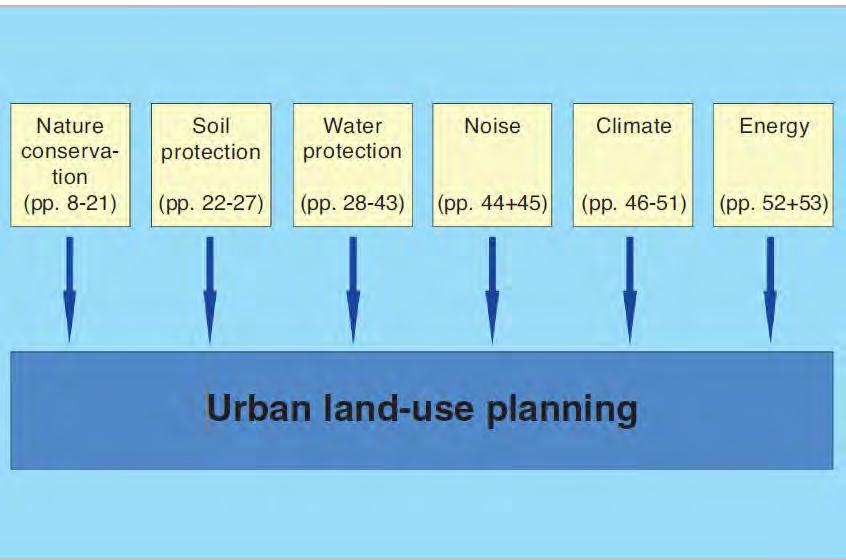
2 Table of contents 1. Stuttgart - facts and figures 2. Levels of spatial planning in Germany 3. The preparatory land use plan Stuttgart urban - compact - green 4. Sustainable management of building areas in Stuttgart 5. Environmental aspects of spatial planning

 y population 82 Mio inh.")

3 The Greater Stuttgart Region within Europe Democratic parliamentary federal republic 16 Federal States (13 Area states, 3 City states) Germany: p ( ) y population 82 Mio inh. density of population 230 inh./km² population in cities 73 Mio inh Urbanisation 88,91% 11Mio. Inh..Stuttgart. Stuttgart

 3.")
4 The Greater Stuttgart Region Stuttgart 179 Municipalities 2.7 mio. Inhabitants (Mumbai Metropolitan Region 18,4 Mio) km² 718 Inhabitants/km²
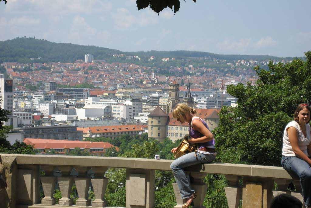
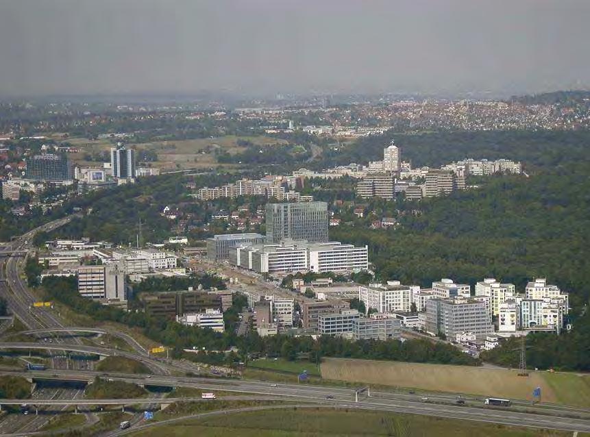
5 View on Stuttgart 594,000 inhabitants (Mumbai 12,5 Mio) 460,000 workplaces Square dimension 207 km² (603 km² ) (2914 inh./ km² (20680 inh./ km²)) Altitude above sea-level: m (11 m)


6 City of Stuttgart Facts and figures - Centrally Located in Germany and Europe - Good accessibility to highways, rail network, airport and water route: Stuttgart Main Station 164 long distance trains p.d. 426 short distance trains p.d travellers and visitors p.d. Stuttgart Airport ~ 400 take offs and landings p.d. ~ 10 mio. passengers p.a. ~ t air freight p.a. Stuttgart Port ~ 2.7 tons freight p.a. Source: LHS
7 Economic Data Business Location Stuttgart Region Facts and figures About 160,000 registered companies 1.5 million economically active people GDP: 110 billion EUR R&D expenses by the companies: 7.5% of GDP High international competitiveness: more than 60% of turnover in manufacturing is generated abroad Low unemployment rate: 4.2% (01/2015)


8 Important Company Headquarters Business Location Stuttgart Region Facts and figures
")
, Regional Public")


9 Facts and figures Basis Public Transport in Stuttgart (City) Organisation: Public Transport Authority (SSB), Regional Public Transport Association (VVS) Since end of 70ies continuous expansion First Light Railway in 1985 Passengers: ~ p.wd. LRT: 16 lines, 209 km route-length Buses: 54 lines, 672 km route-length 815 stops and stations 70% of citizens very comfortable with PT Source: SSB / VVS

10
11
12
13
14
15 Table of contents 1. Stuttgart - facts and figures 2. Levels of spatial planning in Germany 3. The preparatory land use plan Stuttgart urban - compact - green 4. Sustainable management of building areas in Stuttgart 5. Environmental aspects of spatial planning

16 European Union European Land use Development Concept (EUREK) Levels of spatial planning in Germany Federal spatial planning Conference of Ministers of Spatial planning Public agencies Adjustment State spatial planning Regional planning Local planning Reverse Flow / Feedback Sectoral planning


17 Planning in Europeen Context Basic goals of principles of countries spatial organisation taking account of European Union spatial policy and setting a framework for the states legal regulations affecting local plans.


18 Federal spatial planning report Principles and guidelines for spatial Planning as well as guiding principles for spatial development Population projection for Germany Decreasing regions Increasing regions


19 The planning system according to the federal building code and to the state plannig act. Stuttgart Abb. N.Baumüller Germany has a decentralized planning system with the planning jurisdication on the municipal level (local planning autonomy but municipal planninng shall be brought into line with the aims of planning on state and regional level)
20 Abb. N.Baumüller

21 Scale 1: Plan covers the entire state of Baden-Württemberg Regional Planning Act State Planning Act Representation of the desired spatial and structural development for the territory of the state. The plan includes comprehensive, statewide aims of spatial plannig for 1110 municipalities within 12 regions.

22 Scale 1: Plan covers the entire state of Baden-Württemberg Regional Planning Act State Planning Act
23 Abb. N.Baumüller


24 Scale 1: Plan covers the Greater Region Stuttgart (3654 km², 2,6 Mio Inh.) Legal basis: Regional Planning Act State Planning Act

25 It constitutes the link between the state s perspectives for development and the special local decisions in the context of urban land-use planning


26 Regional plan Guideline for urban development of 179 municipalities

27 Classified street network

28 Classified public transport network

29 Basis for the Landscape Framework Plan Regional Green Corridors terminate local decisions by state planning law
30 Abb. N.Baumüller

 Legal Basis: Federal")
31 Scale 1:10000 Pan covers the entire municipality of Stuttgart (207 km², 590,000 Inh.) Legal Basis: Federal Building Code


32 Scale 1:10000 Plan covers the entire municipality of Stuttgart Nature Protection Statute BW
33 Abb. N.Baumüller


34 Scale 1:500 1:1000 Territory covered by plan depending on project Federal Building Code


35 Scale 1:500 1:1000 Territory covered by plan depending on project, partly exceeding the B-plan Territory Natural Protection Statute BW

36 Levels of spatial planning in Stuttgart From State spatial planning to municipal land use and development planning Abb. N.Baumüller
37 Table of contents 1. Stuttgart - facts and figures 2. Levels of spatial planning in Germany 3. The preparatory land use plan Stuttgart urban - compact - green 4. Sustainable management of building areas in Stuttgart 5. Environmental aspects of spatial planning
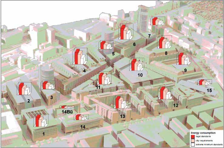
38 The challenges and future tasks of urban development in Stuttgart Globalization of the economy Preservation of the compact mixed use-european city Social and economic polarization of society Demographic changes and spatial disparities Education, poverty and socioeconomic consequences Sustainable land development Greater Region: intercommunal solutions required Trend back in town: creating urban living offers Climate change: 2 C target and adaptation strategies Ensure urban and sustainable mobility


")


39 Urban Sprawl Stuttgart Growth of the Urban Area problem with land consumption Section 1(5) Federal Building Code:.Land shall be used in a manner which is both economical and considerate exploitation of land..?

40 Luftbild Brugger 1959

41 Luftbild Brugger 1990

42 Luftbild Storck 2005
43 2008

 Legal Basis: Federal")
44 Scale 1:10000 Plan covers the entire municipality of Stuttgart (207 km², 580,000 inh.) Legal Basis: Federal Building Code

45 Master Plan: Rail Systems

46 Master Plan: Bicycle Network Stand 01/2008

47 Explanatory Statement Land Use Plan 2010 Guideline: Compact - urban - green -relation development in brownfield areas to greenfield sites 4:1 -high density, mixture of functions and revitalization of the polycentric structures - landscape: protect green areas, develop a green-network through the brownfield-areas


48 Preparatory land use plan Stuttgart compact urban green Protected open areas 7 Naturschutzgebiete nature reserves 1,362 ha 6.6% 27 Landschaftsschutzgebiete landscape conservation areas 6,715 ha 32.4% (Quelle: Landeshauptstadt Stuttgart / LUBW, 2007)
49 Table of contents 1. Stuttgart - facts and figures 2. Levels of spatial planning in Germany 3. The preparatory land use plan Stuttgart urban - compact - green 4. Sustainable management of building areas in Stuttgart 5. Environmental aspects of spatial planning
 within the framework of a pilot project.")
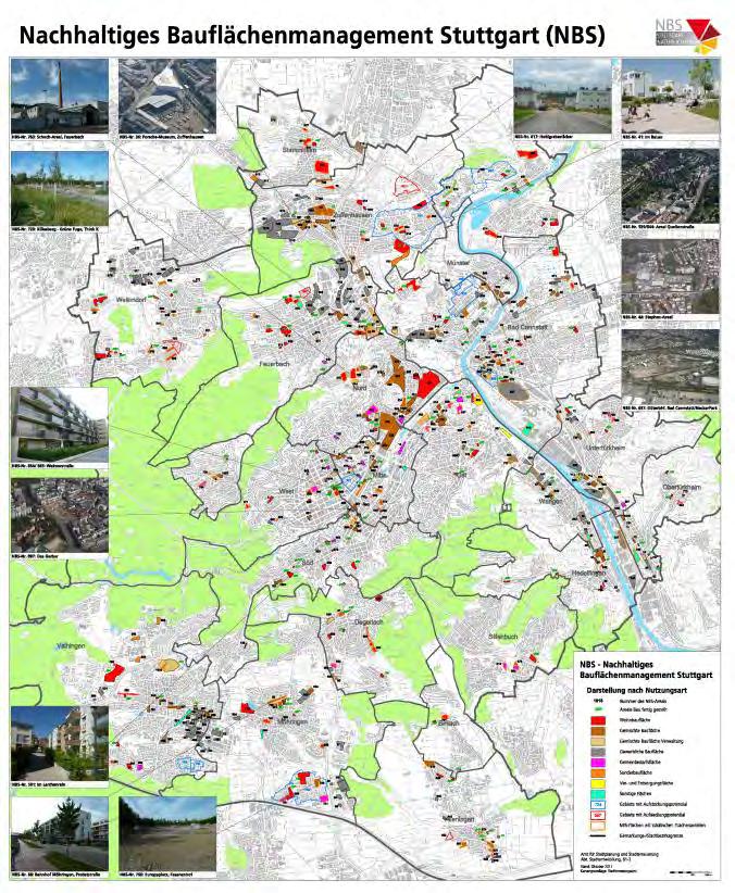
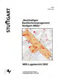
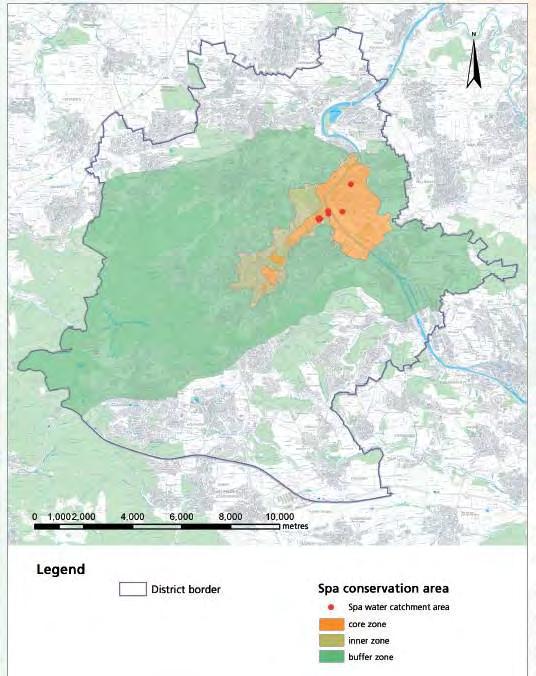
50 Sustainable Management of Building Areas Stuttgart (NBS) Between 2001 and 2003 the City of Stuttgart developed a NBS Management-Tool to support the inner urban development.the result was an information platform of all inner urban potential sites under the Sustainable Management of Building Areas Stuttgart (NBS) within the framework of a pilot project


51 Sustainable Management of Building Areas Stuttgart (NBS) Since 2003 inventarisation of potential building areas providing a city-wide overview Internet based information platform continously updated Strategies to promote revitalization of brownfield areas Concept to promote sustainable development on the base of the Land Use Plan Stuttgart ca. 350 potentials for inner urban development of about 500 ha (1235 acres)
52 Types of areas in NBS Listed types Type I: traditionelle Baulücke empty lot inner zone has never been built-up before Example: Am Rührbrunnen Type II: Brachflächen brownfield site Areas no longer used / lying idle Example: former sugar factory Type III: untergenutzte Grundstücke. developed on a low level Example: Department of Town Cleaning

53 Types of areas in NBS Listed types Type IV: ungenutzte Betriebs- Reserveflächen reserve on developed real estate Example: Plieninger Straße Type V: Umnutzungs-, Konversionsflächen conversion area Example: freight depot Feuerbach Type VI: Neubauflächen FNP Stuttgart undeveloped real estate Example: Hohlgrabenäcker


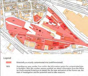
54 Sustainable Management of Building Areas Stuttgart (NBS)


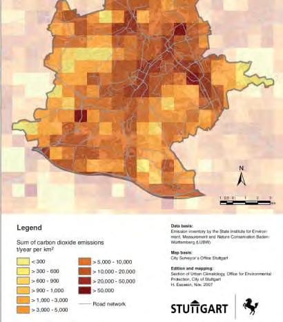
55 Research projects to promote inner urban development in Stuttgart NBS

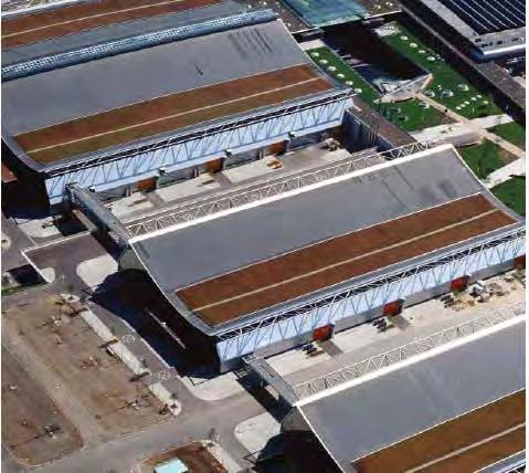
56 Sustainable Management of Building Areas Stuttgart Stuttgart 21


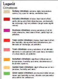
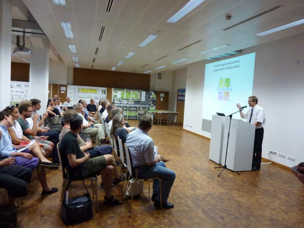
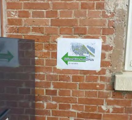
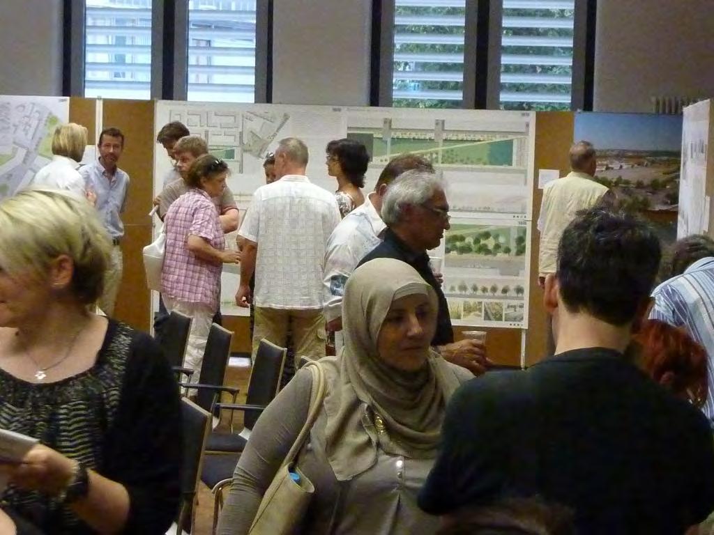
57 nclusion of Stuttgart's main station into the European high-speed rail network From a 16-tracks terminal station to 8-tracks through station below ground Stuttgart 21
 Park extension Stuttgart")
58 S ha (250 acres) 3 km 12,000 Inhabitants 24,000 Workplaces 20 ha (50 acres) Park extension Stuttgart 21

59 Stuttgart 21


60 parks will be enlarged by more than 20 ha (50 acres) Stuttgart 21
61 Table of contents 1. Stuttgart - facts and figures 2. Levels of spatial planning in Germany 3. The preparatory land use plan Stuttgart urban - compact - green 4. Sustainable management of building areas in Stuttgart 5. Environmental aspects of spatial planning
62
63
64 Nature conservation Regional Green Corridors restrict local decisions by state planning law

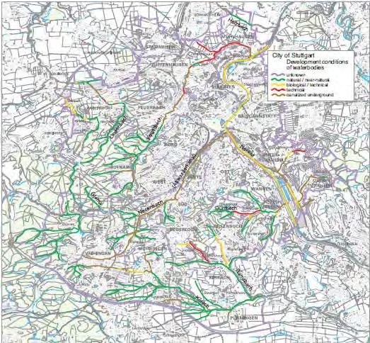

65 Water protection

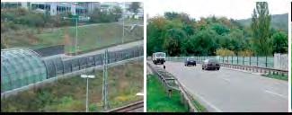
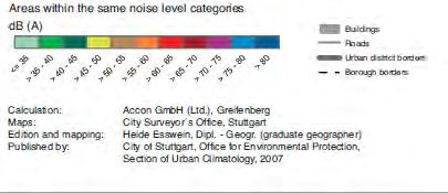
66 Noise abatement plan


67 Clean air and action plan/kliks

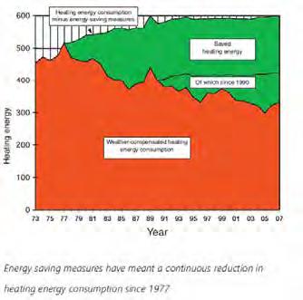
68 Energy
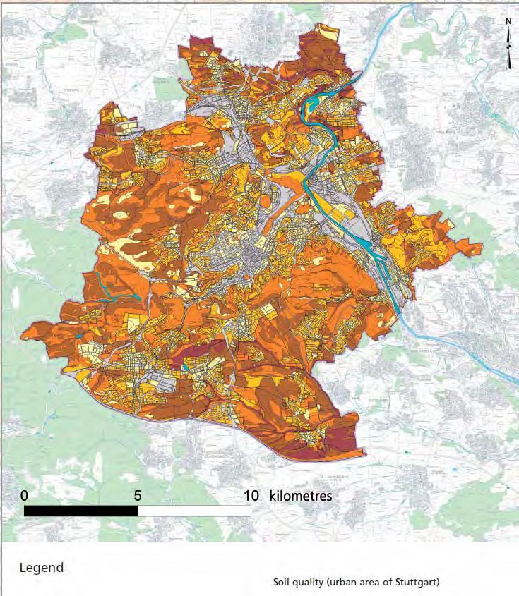
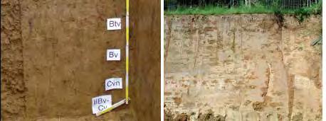
69 Soil protection
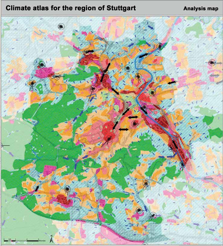


70 Climate protection Climate atlas
71
72 Public participation
73
74
75 Thanks for your attention! Dipl.-Ing. Robert Schulze Dieckhoff Urban Planner Department of City Planning and Urban Renewal State Capital Stuttgart, Germany
The Governance of Land Use
 The planning system Levels of government and their responsibilities The Governance of Land Use Country fact sheet Germany Germany is a federal country with four levels of government. Below the national
Assessment of Sustainable Land Use within the Town Planning Process Experiences with a Multi Criteria Approach (MCA)
") Assessment of Sustainable Land Use within the Town Planning Process Experiences with a Multi Criteria Approach (MCA) Dipl.-Geogr. Sophie Schetke Dipl.-Ing. Benedikt Frielinghaus, University of Bonn, Germany
Assessment of Sustainable Land Use within the Town Planning Process Experiences with a Multi Criteria Approach (MCA) Dipl.-Geogr. Sophie Schetke Dipl.-Ing. Benedikt Frielinghaus, University of Bonn, Germany
Land Use in the context of sustainable, smart and inclusive growth
 Land Use in the context of sustainable, smart and inclusive growth François Salgé Ministry of sustainable development France facilitator EUROGI vice president AFIGéO board member 1 Introduction e-content+
How to measure Territorial Cohesion and Cooperation?
 How to measure territorial cohesion and cooperation? How to measure Territorial Cohesion and Cooperation? Brussels: 21 February Growth, Development or Cohesion? Economic Competitiveness Social Cohesion
Making maps: Traditions and perceptions in Europe. European spatial planning and cartographic representations
 ESPON Create Europe! Making maps: Traditions and perceptions in Europe Dr. Stefanie Dühr University of the West of England, Bristol, UK European spatial planning and cartographic representations Scenarios.
Tackling urban sprawl: towards a compact model of cities? David Ludlow University of the West of England (UWE) 19 June 2014
 19 June 2014") Tackling urban sprawl: towards a compact model of cities? David Ludlow University of the West of England (UWE) 19 June 2014 Impacts on Natural & Protected Areas why sprawl matters? Sprawl creates environmental,
Tackling urban sprawl: towards a compact model of cities? David Ludlow University of the West of England (UWE) 19 June 2014 Impacts on Natural & Protected Areas why sprawl matters? Sprawl creates environmental,
National planning report for Denmark
 National planning report for Denmark from the Minister for Environment and Energy Local identity and new challenges Summary 2000 1 CONTENTS 4 PREFACE: REGIONAL DEVELOPMENT AND SPATIAL PLANNING 6 1. BALANCED
CEMAT results - over the years
 CEMAT results - over the years Technical Conference on Functional Areas capitalization of local potential within the territorial development policies in Europe European Conference of Ministers responsible
The National Policy Strategy for Infrastructure and Spatial Planning CODE24 CONFERENCE. Emiel Reiding
 The National Policy Strategy for Infrastructure and Spatial Planning Emiel Reiding Structure of presentation 1. Spatial planning in the Netherlands 2. National Policy Strategy Aims National interests 3.
Experience and perspectives of using EU funds and other funding for the implementation of district renovation projects
 Experience and perspectives of using EU funds and other funding for the implementation of district renovation projects Ministry of the Interior of Lithuania Regional policy department Administration, coordination,
High speed network in Hauts-de-France Region. Värnamo, 17 th May 2018
 High speed network in Hauts-de-France Region Värnamo, 17 th May 2018 Hauts-de-France at the crossroads of the North-West Europe High speed train approach in France In the 1980s: will to link the main cities
Compact guides GISCO. Geographic information system of the Commission
 Compact guides GISCO Geographic information system of the Commission What is GISCO? GISCO, the Geographic Information System of the COmmission, is a permanent service of Eurostat that fulfils the requirements
Proposed Scope of Work Village of Farmingdale Downtown Farmingdale BOA Step 2 BOA Nomination Study / Draft Generic Environmental Impact Statement
 Proposed Scope of Work Village of Farmingdale Downtown Farmingdale BOA Step 2 BOA Nomination Study / Draft Generic Environmental Impact Statement The scope of work that follows incorporates and covers
Bishkek City Development Agency. Urban Planning Bishkek
 Bishkek City Development Agency Urban Planning Bishkek Bishkek City Development Agency Official name City budget Population Area GRP Import value Export value External trade turnover Foreign direct investments
Why care about metropolitan and regional perspectives?
 Metropolitan challenges and solutions Why care about metropolitan and regional perspectives? Irma Karjalainen, Director, Helsinki Region Environmental Services Authority HSY, LUMAT Conference, 25 September
The ESPON Programme. Goals Main Results Future
 The ESPON Programme Goals Main Results Future Structure 1. Goals Objectives and expectations Participation, organisation and networking Themes addressed in the applied research undertaken in ESPON projects
Land Use Planning and Agriculture: Austrian Experiences and Challenges I
 Land Use Planning and Agriculture: Austrian Experiences and Challenges I SULANET Summer School 2016 Walter Seher BOKU Vienna 1 Land Use Planning and Agriculture 2 Land Use Planning and Agriculture Agriculture
OPINION. Results of EU Structural Policy in NSPA
 OPINION on the future European Cohesion Policy of the Northern Sparsely Populated Areas (NSPA) of Finland and Sweden with the contribution of North Norway The remote Northern Sparsely Populated Areas (NSPA)
Travel Related Urban Zones in Finland
 Travel Related Urban Zones in Finland Theory of Urban Fabrics Seminar in Helsinki, SYKE, 24.10.2013 Mika Ristimäki, Maija Tiitu, Ville Helminen, Panu Söderström, Kari Oinonen Finnish Environment Institute
New Prospects for Peripheral Rural Regions Helmut Hiess Glasgow, 19th of May 2010
 New Prospects for Peripheral Rural Regions Helmut Hiess Glasgow, 19th of May 2010 ÖROK: Organisation & Tasks Austrian Conference on Spatial Planning (ÖROK, since 1971): Joint organisation by Federal level,
The Spatial Structure of Cities: International Examples of the Interaction of Government, Topography and Markets
 Module 2: Spatial Analysis and Urban Land Planning The Spatial Structure of Cities: International Examples of the Interaction of Government, Topography and Markets Alain Bertaud Urbanist Summary What are
TOWARDS STRATEGIC SPATIAL PLANNING IN JAMAICA: THE NATIONAL SPATIAL PLAN
 TOWARDS STRATEGIC SPATIAL PLANNING IN JAMAICA: THE NATIONAL SPATIAL PLAN JIEP 5th Biennial Conference on the Environment: Balancing National Development and Environmental Protection June 6, 2011 Jamaica
COUNCIL OF EUROPE S SPATIAL DEVELOPMENT POLICY
 ESPON 2103 Programme Open Seminar Territorial Challenges and Cooperation in a Wider Europe Portorož, 2-3 June 2008 COUNCIL OF EUROPE S SPATIAL DEVELOPMENT POLICY Maria José Festas Senior Advisor, Directorate
Vienna urban development - seestadt aspern as urban future lab
 Vienna urban development - seestadt aspern as urban future lab PERMACULTURE DESIGN COURSE * 2012 * ASPERN SEESTADT 1 Christof Schremmer, ÖIR Austrian Institute for Regional Studies and Spatial Planning
1. Demand for property on the coast
 1. Demand for property on the coast Key message Irrespective of density and location, population in Europe in general tends to concentrate in coastal areas. Detailed spatial elaboration of processes shows
Central Baltic Programme
 Central Baltic Programme 2014-2020 About the Central Baltic Programme 2014-2020 Builds on the Central Baltic INTERREG IV A Programme 2007-2013 Cross-border cooperation projects in the central Baltic Sea
Frequently Asked Questions
 What is the Regional Transit Engagement Series? As one of the fastest growing regions in the country, there is recognition that long-term transit planning efforts should be accelerated if we are to remain
State initiative following up the 2006 national planning report
 18 ness districts and public institutions, should be integrated with the opportunities for public transport services. State initiative following up the 2006 national planning report The Ministry of the
RURAL-URBAN PARTNERSHIPS: AN INTEGRATED APPROACH TO ECONOMIC DEVELOPMENT
 RURAL-URBAN PARTNERSHIPS: AN INTEGRATED APPROACH TO ECONOMIC DEVELOPMENT William Tompson Head of the Urban Development Programme OECD Public Governance and Territorial Development Directorate JAHRESTAGUNG
COSTA RICA Limon City-Port Project
 COSTA RICA Limon City-Port Project 2008 2013 photos by Stefania Abakerli Stefania Abakerli Cecilia Corvalan Context Costa Rica Well-known tourist destination in CA (8.4% GDP) Long tradition of political
The Governance of Land Use
 The planning system Levels of government and their responsibilities The Governance of Land Use COUNTRY FACT SHEET NORWAY Norway is a unitary state with three levels of government; the national level, 19
The Governance of Land Use
 The Governance of Land Use Country fact sheet Austria The planning system Levels of government and their responsibilities Austria is a federal state with three levels of government; the national level,
Regional collaboration & sharing: pathway to sustainable, just & inclusive cities in Europe
 Berlin s Environmental Justice Map Regional collaboration & sharing: pathway to sustainable, just & inclusive cities in Europe Dr. Andrea I Frank Cardiff University School of Geography & Planning A. Sustainability:
City and SUMP of Ravenna
 City and SUMP of Ravenna Nicola Scanferla Head of Mobility Planning Unit, Municipality of Ravenna nscanferla@comune.ra.it place your logo here 19 April, 2017 1st Steering Committee Meeting, Nicosia, Cyprus
National Spatial Development Perspective (NSDP) Policy Coordination and Advisory Service
 Policy Coordination and Advisory Service") National Spatial Development Perspective (NSDP) Policy Coordination and Advisory Service 1 BACKGROUND The advances made in the First Decade by far supersede the weaknesses. Yet, if all indicators were
National Spatial Development Perspective (NSDP) Policy Coordination and Advisory Service 1 BACKGROUND The advances made in the First Decade by far supersede the weaknesses. Yet, if all indicators were
Implementation of the ESPON 2020 cooperation program. 16 January 2017 Anneloes van Noordt
 Implementation of the ESPON 2020 cooperation program 16 January 2017 Anneloes van Noordt Outline! ESPON Cooperation Program! Specific Objectives! Applied Research! Targeted Analysis! Database & Tools!
MEETING THE CHALLNAGE OF THE URBAN RURAL DIVIDE MAG. SLAVKA ZUPAN
 MEETING THE CHALLNAGE OF THE URBAN RURAL DIVIDE MAG. SLAVKA ZUPAN Urban millenium (Source: GTZ- Services for Sutainable Urban Development))! Today 3 billion of people lives in towns and cities! Every day
The CRP stresses a number of factors that point to both our changing demographics and our future opportunities with recommendations for:
 Plan Overview The CRP represents the first broad planning initiative covering Lake, Porter and LaPorte counties. Unlike previous plans released by NIRPC, which focused primarily on transportation, the
CLLD Cooperation OFFER
 Title of the proposed project (English) CLLD Cooperation OFFER PARKS PROTECTION III - Management, Protection and Economic Development in Protected Areas Type of project (select as many as you want) Cooperation
Navigable maritime and river waterways in the seaside - Danube Delta area and the connected rural development
 SUMMARY OF Ph-D Thesis, with title RESEARCH STUDIES ON MANAGEMENT IMPROVEMENT OF MARITIME AND RIVER TRANSPORT ACTIVITY IN THE COASTAL AND DANUBE DELTA AREA FROM AN ENVIROMENTAL, ECONOMIC AND SOCIAL PERSPECTIVE
Third Cohesion report February 2004
 February 2004 A new partnership for cohesion Convergence, Competitiveness and Co-operation METREX meeting S. Sebastian, Luisa Sanches DG REGIO The 3rd CR structure 1. Analysis of situation and trends in
Integrated Strategies in regional development
 Inspire policy making by territorial evidence ESPON Seminar Territories Acting for Economic Growth: Using territorial evidence to meet challenges towards 2020 Integrated Strategies in regional development
European spatial policy and regionalised approaches
 Findings of the ESPON 2006 Programme COMMIN Final Conference 26-27 April 2007 European spatial policy and regionalised approaches by Dr. Kai BöhmeB ! Territory matters Structure of presentation! Territorial
The European territory: Strategic developmentd
 The European territory: Strategic developmentd Peter Mehlbye Workshop Strategic Development Catalonia 11 June 2002 THE LECTURE Structure I. Territorial trends II. Strategy for European spatial development
CITY WEATHERS: METEOROLOGY AND URBAN DESIGN
 TITLE: Implementation of Urban Climatology in City Planning in the City of Stuttgart AUTHOR: Dr. Ulrich Reuter INSTITUTIONAL AFFLIATION: City of Stuttgart, Office for Environmental Protection, Department
Spatial Planning and Territorial Development at the Regional Level
 Spatial Planning and Territorial Development at the Regional Level Vincent Nadin University of the West of England, UK Spatial Planning and Territorial Development at the Regional Level Vincent Nadin University
São Paulo Metropolis and Macrometropolis - territories and dynamics of a recent urban transition
 São Paulo Metropolis and Macrometropolis - territories and dynamics of a recent urban transition Faculty of Architecture and Urbanism of São Paulo University Prof. Dr. Regina M. Prosperi Meyer WC2 - World
Too Close for Comfort
 Too Close for Comfort Overview South Carolina consists of urban, suburban, and rural communities. Students will utilize maps to label and describe the different land use classifications. Connection to
Legal problems of environmental management. Spatial planning and space management. M. Gajewski 2014 / 2015
 Legal problems of environmental management Spatial planning and space management M. Gajewski 2014 / 2015 Course contents (in brief) Constitutional basis of the environment protection system. General principles
Experiences of public-private partnerships in the Euromediterranean relations and in the Po Valley, promoting a more balanced European territory
 Experiences of public-private partnerships in the Euromediterranean relations and in the Po Valley, promoting a more balanced European territory Claudio Tolomelli PolyMetrexPlus project s objectives To
[ ] MONITORING THE SPATIAL IMPACTS OF THE EGNATIA MOTORWAY egnatia odos observatory
![[ ] MONITORING THE SPATIAL IMPACTS OF THE EGNATIA MOTORWAY egnatia odos observatory](/thumbs/72/66290986.jpg "[ ] MONITORING THE SPATIAL IMPACTS OF THE EGNATIA MOTORWAY egnatia odos observatory") ] egnatia odos observatory MONITORING THE SPATIAL IMPACTS OF THE EGNATIA MOTORWAY 2014 http://observatory.egnatia.gr MINISTRY OF INFRASTRUCTURE, TRANSPORT AND NETWORKS 2 A tool at the service of spatial
] egnatia odos observatory MONITORING THE SPATIAL IMPACTS OF THE EGNATIA MOTORWAY 2014 http://observatory.egnatia.gr MINISTRY OF INFRASTRUCTURE, TRANSPORT AND NETWORKS 2 A tool at the service of spatial
What is Spatial Planning?
 Spatial Planning in the context of the Responsible Governance of Tenure What is Spatial Planning? Text-only version This course is funded by the European Union through the EU-FAO Improved Global Governance
Country Fiche Lithuania
 Country Fiche Lithuania Updated June 2018 1. General information The Lithuanian maritime space is delimited by the Decree of the Government of the Republic of Lithuania of 6 December, 2004, No. 1597 and
Building the Sustainable Network of Settlements on the Caspian Sea Region of Kazakhstan
 Building the Sustainable Network of Settlements on the Caspian Sea Region of Kazakhstan Introduction The Ecological Zoning and Identification of Ecological Capacity of Natural and Socio- Economic Potential
Sustainable and Harmonised Development for Smart Cities The Role of Geospatial Reference Data. Peter Creuzer
 Sustainable and Harmonised Development for Smart Cities The Role of Geospatial Reference Data Peter Creuzer 1. Introduction - Smart Cities and Geodata 2. Geodata in Germany 3. Examples 4. Data and Service
Agglomeration Programme Switzerland: Integrated Planning by Balancing Transport and Urban Development IFHP Congress, Singapore
 Agglomeration Programme Switzerland: Integrated Planning by Balancing Transport and Urban Development IFHP Congress, Singapore May 30, 2014 Susanne Fischer, Head of Regional Planning, Department of Public
European Landscape Convention in the Slovak Republic
 13th COUNCIL OF EUROPE MEETING OF THE WORKSHOPS FOR THE EUROPEAN LANDSCAPE CONVENTION European Landscape Convention in the Slovak Republic Mrs. Ida Vanáková, state advisor, Department of Spatial Planning
Improvements for Kosovo's spatial planning system / [presentation given in May 2011]
![Improvements for Kosovo's spatial planning system / [presentation given in May 2011]](/thumbs/95/122511393.jpg "Improvements for Kosovo's spatial planning system / [presentation given in May 2011]") Rochester Institute of Technology RIT Scholar Works Theses Thesis/Dissertation Collections 2011 Improvements for Kosovo's spatial planning system / [presentation given in May 2011] Luan Nushi Follow this
Rochester Institute of Technology RIT Scholar Works Theses Thesis/Dissertation Collections 2011 Improvements for Kosovo's spatial planning system / [presentation given in May 2011] Luan Nushi Follow this
European Regional and Urban Statistics
 European Regional and Urban Statistics Dr. Berthold Feldmann berthold.feldmann@ec.europa.eu Eurostat Structure of the talk Regional statistics in the EU The tasks of Eurostat Regional statistics Urban
AAG CENTER FOR GLOBAL GEOGRAPHY EDUCATION Internationalizing the Teaching and Learning of Geography
 Using the CGGE Materials in Advanced Placement Human Geography Classes About the CGGE: The AAG Center for Global Geography Education (CGGE) is a collection of online modules for undergraduate courses in
What European Territory do we want?
 Luxembourg, Ministére du Developpement Durable et des Infrastructures 23 April 2015 What European Territory do we want? Alessandro Balducci Politecnico di Milano Three points What the emerging literature
DRAFT PROGRAM Registration of participants, welcome coffee, exhibition tour
 DRAFT PROGRAM 20 Feb 2018 09.00-10.00 Registration of participants, welcome coffee, exhibition tour 10.00 12.00 ROUND TABLE: INTERNATIONAL COOPERATION IN THE ARCTIC PROJECTS: CHALLENGES AND OPPORTUNITIES
Urbanization and Sustainable Development of Cities: A Ready Engine to Promote Economic Growth and Cooperation
 Urbanization and Sustainable Development of Cities: A Ready Engine to Promote Economic Growth and Cooperation Wan Portia Hamzah Institute of Strategic and International Studies (ISIS) Malaysia 10 September
Measurement of the Urban-Housing Deficit:
 Measurement of the Urban-Housing Deficit: Strategies, tools and sources of information The International Network for Urban and Regional Statistics Standing Committee of the International Association for
Jordan's Strategic Research Agenda in cultural heritage
 Jordan's Strategic Research Agenda in cultural heritage Analysis of main results Alessandra Gandini Amman, Jordan 3 rd November 2013 Main objectives The work performed had the main objective of giving
Territorial Cooperation within the Northern Periphery and the Arctic
 Territorial Cooperation within the Northern Periphery and the Arctic 12 March 2013 / By Silvia Curbelo Betancort North charr project, Landösjön lake, Sweden. Source: North Periphery Programme Today we
Regional Plan 4: Integrating Ecosystem Services Mapping into Regional Land Use Planning
 Rural-Urban Outlooks: Unlocking Synergies (ROBUST) ROBUST receives funding from the European Union s Horizon 2020 research and innovation programme under grant agreement No 727988.* October 2018 Natural
Effects of a non-motorized transport infrastructure development in the Bucharest metropolitan area
 The Sustainable City IV: Urban Regeneration and Sustainability 589 Effects of a non-motorized transport infrastructure development in the Bucharest metropolitan area M. Popa, S. Raicu, D. Costescu & F.
Geoservices in Hamburg
 Geoservices in Hamburg Dr.-Ing. Winfried Hawerk Freie und Hansestadt Hamburg Landesbetrieb Geoinformation und Vermessung FIG Commission 7 Symposium Celje 16 May 2006 Hamburg and the Metropolitan Area Hamburg
Policies and implemented tools for digitalization of Natural heritage in Gorenjska region (Slovenia)
") Policies and implemented tools for digitalization of Natural heritage in Gorenjska region (Slovenia) Barbara Špehar, Regional Development Agency of Gorenjska dr. Mirjam Dular, Tadeja Šubic, Institute of
Policies and implemented tools for digitalization of Natural heritage in Gorenjska region (Slovenia) Barbara Špehar, Regional Development Agency of Gorenjska dr. Mirjam Dular, Tadeja Šubic, Institute of
Strengthening the cooperation in the region: Carpathian, Tisa,, Danube and Black Sea areas
 Strengthening the cooperation in the region: Carpathian, Tisa,, Danube and Black Sea areas 14th October 2009 SEE Annual Conference Advancing development through transnational cooperation in South East
Rural Gentrification: Middle Class Migration from Urban to Rural Areas. Sevinç Bahar YENIGÜL
 'New Ideas and New Generations of Regional Policy in Eastern Europe' International Conference 7-8 th of April 2016, Pecs, Hungary Rural Gentrification: Middle Class Migration from Urban to Rural Areas
Poland, European Territory, ESPON Programme Warsaw, 2 July 2007 STRATEGY OF THE ESPON 2013 PROGRAMME
 Poland, European Territory, ESPON Programme 2007-2013 Warsaw, 2 July 2007 STRATEGY OF THE ESPON 2013 PROGRAMME Territory matters Regional diversity as asset Territorial potentials increasing in importance
Explain the impact of location, climate, natural resources, and population distribution on Europe. a. Compare how the location, climate, and natural
 SS6G10 Explain the impact of location, climate, natural resources, and population distribution on Europe. a. Compare how the location, climate, and natural resources of Germany, the United Kingdom and
The Governance of Land Use
 The planning system The Governance of Land Use United Kingdom Levels of government and their responsibilities The United Kingdom is a unitary state with three devolved governments in Northern Ireland,
CHAPTER 4 HIGH LEVEL SPATIAL DEVELOPMENT FRAMEWORK (SDF) Page 95
 Page 95") CHAPTER 4 HIGH LEVEL SPATIAL DEVELOPMENT FRAMEWORK (SDF) Page 95 CHAPTER 4 HIGH LEVEL SPATIAL DEVELOPMENT FRAMEWORK 4.1 INTRODUCTION This chapter provides a high level overview of George Municipality s
CHAPTER 4 HIGH LEVEL SPATIAL DEVELOPMENT FRAMEWORK (SDF) Page 95 CHAPTER 4 HIGH LEVEL SPATIAL DEVELOPMENT FRAMEWORK 4.1 INTRODUCTION This chapter provides a high level overview of George Municipality s
Statement. H.E Dr. Richard Nduhuura Permanent Representative of the Republic of Uganda to the United Nations New York
 Page1 UGANDA Permanent Mission of Uganda To the United Nations New York Tel : (212) 949 0110 Fax : (212) 687-4517 Statement By H.E Dr. Richard Nduhuura Permanent Representative of the Republic of Uganda
Figure 10. Travel time accessibility for heavy trucks
 Figure 10. Travel time accessibility for heavy trucks Heavy truck travel time from Rotterdam to each European cities respecting the prescribed speed in France on the different networks - Road, motorway
How the science of cities can help European policy makers: new analysis and perspectives
 How the science of cities can help European policy makers: new analysis and perspectives By Lewis Dijkstra, PhD Deputy Head of the Economic Analysis Unit, DG Regional and European Commission Overview Data
CircUse News Special: The CircUse Compendium. This project is implemented through the CENTRAL EUROPE Programme co-financed by the ERDF
 CircUse News 9 2013 Special: This project is implemented through the CENTRAL EUROPE Programme co-financed by the ERDF 2 Newly published: Figure 1: Students in Trnava working on brownfield revitalisation.
Spatial information in strategic city planning - Zagreb experience. Darko Šiško City office for strategic planning, Zagreb
 Spatial information in strategic city planning - Zagreb experience Darko Šiško City office for strategic planning, Zagreb Overview Strategic city planning GI tools and trends Spatial data for strategic
HSC Geography. Year 2013 Mark Pages 10 Published Jul 4, Urban Dynamics. By James (97.9 ATAR)
") HSC Geography Year 2013 Mark 92.00 Pages 10 Published Jul 4, 2017 Urban Dynamics By James (97.9 ATAR) Powered by TCPDF (www.tcpdf.org) Your notes author, James. James achieved an ATAR of 97.9 in 2013 while
HSC Geography Year 2013 Mark 92.00 Pages 10 Published Jul 4, 2017 Urban Dynamics By James (97.9 ATAR) Powered by TCPDF (www.tcpdf.org) Your notes author, James. James achieved an ATAR of 97.9 in 2013 while
Maritime Spatial Planning in the Baltic Sea Region
 Maritime Spatial Planning in the Baltic Sea Region Talis Linkaits Head of VASAB Secretariat 20 May 2015 Helsinki A cooperation of ministers of the 11 Baltic Sea Region countries responsible for spatial
OECD PERSPECTIVE ON METROPOLITAN AREAS
 Final conference of ESPON Targeted Analysis SPIMA (Spatial dynamics and strategic planning in Metropolitan Areas) Brussels, 6 February 2018 OECD PERSPECTIVE ON METROPOLITAN AREAS Soo-Jin KIM OECD Centre
The Role of Urban Planning and Local SDI Development in a Spatially Enabled Government. Faisal Qureishi
 The Role of Urban Planning and Local SDI Development in a Spatially Enabled Government Faisal Qureishi 1 Introduction A continuous increase in world population combined with limited resources has lead
THE FUTURE OF FORECASTING AT METROPOLITAN COUNCIL. CTS Research Conference May 23, 2012
 THE FUTURE OF FORECASTING AT METROPOLITAN COUNCIL CTS Research Conference May 23, 2012 Metropolitan Council forecasts Regional planning agency and MPO for Twin Cities metropolitan area Operates regional
Opportunities and challenges of HCMC in the process of development
 Opportunities and challenges of HCMC in the process of development Lê Văn Thành HIDS HCMC, Sept. 16-17, 2009 Contents The city starting point Achievement and difficulties Development perspective and goals
Subject: Note on spatial issues in Urban South Africa From: Alain Bertaud Date: Oct 7, A. Spatial issues
 Page 1 of 6 Subject: Note on spatial issues in Urban South Africa From: Alain Bertaud Date: Oct 7, 2009 A. Spatial issues 1. Spatial issues and the South African economy Spatial concentration of economic
Coimisiún na Scrúduithe Stáit State Examinations Commission
 2008. M.24 Coimisiún na Scrúduithe Stáit State Examinations Commission LEAVING CERTIFICATE EXAMINATION, 2008 GEOGRAPHY HIGHER LEVEL FRIDAY, 6 JUNE AFTERNOON, 2.00 TO 4.50 Examination Number For the Examiner
Marine Spatial Planning in Hellas; Recent Facts and Perspectives
 XXV FIG CONGRESS Engaging the Challenges, Enhancing the Relevance Kuala Lumpur, Malaysia 16 21 June 2014 Marine Spatial Planning in Hellas; Recent Facts and Perspectives Mrs. Chaiditsa BOLANOU Surveying
Urban-Rural Partnerships in Europe
 Disclaimer: The views expressed in this document are those of the author, and do not necessarily reflect the views and policies of the Asian Development Bank (ADB), its Board of Directors, or the governments
Local Development Pilot Project: Island of Cres. Ranka Saračević Würth, Ministry of Culture, Republic of Croatia
 Local Development Pilot Project: Island of Cres Ranka Saračević Würth, Ministry of Culture, Republic of Croatia BACKGROUND, RATIFICATION OF THE FARO CONVENTION BY REPUBLIC OF CROATIA The Framework Convention
Sustainable Suburbs: Restructuring Suburban Development
 Sustainable Suburbs: Restructuring Suburban Development Stephen B. Friedman, AICP, CRE ULI Forum, October 8, 2009 The Vocabulary of Growth CAVE NIMBY BANANA NOTE NOPE NIMEY Triple Bottom Line Profitability
CLAREMONT MASTER PLAN 2017: LAND USE COMMUNITY INPUT
 Planning and Development Department 14 North Street Claremont, New Hampshire 03743 Ph: (603) 542-7008 Fax: (603) 542-7033 Email: cityplanner@claremontnh.com www.claremontnh.com CLAREMONT MASTER PLAN 2017:
Thilo Becker
 Friedrich List Faculty of Transport and Traffic Science, Chair of Transport Ecology CAN THE CONCEPT OF ENVIRONMENTAL JUSTICE IN TRANSPORT BE TRANSFERRED TO CITIES OF THE SOUTH? A CASE STUDY OF NAIROBI
Towards a Polycentric Europe
 Towards a Polycentric Europe European Spatial Perceptions The Blue Banana Brunet, 1989 A Bunch of Grapes Kunzmann & Wegener, 1991 Economic Imbalances Core area of the EU: Pentagon of the metropolises of
Urban Planning Word Search Level 1
 Urban Planning Word Search Level 1 B C P U E C O S Y S T E M P A R E U O E U R B A N P L A N N E R T N S T D H E C O U N T Y G E R E R D W R E N I C I T Y C O U N C I L A A A S U G G C I L A G P R I R
TRANSPORT CHALLENGES AND OPPORTUNITIES FOR LANDLOCKED COUNTRIES FOR ACHIEVING SUSTAINABLE DEVELOPMENT GOALS
 TRANSPORT CHALLENGES AND OPPORTUNITIES FOR LANDLOCKED COUNTRIES FOR ACHIEVING SUSTAINABLE DEVELOPMENT GOALS Robert Earley, consultant 11 th Intergovernmental Regional Environmentally Sustainable Transport
Knowledge claims in planning documents on land use and transport infrastructure impacts
 Knowledge claims in planning documents on land use and transport infrastructure impacts Presentation at the Final Workshop of the research project "Innovations for sustainable public transport in Nordic
accessibility accessibility by-pass bid-rent curve bridging point administrative centre How easy or difficult a place is to reach.
 accessibility accessibility How easy or difficult a place is to reach. How easy or difficult it is to enter a building. administrative centre bid-rent curve The function of a town which is a centre for