Atmosphere and Ocean Research Institute, The
|
|
|
- Vanessa Warren
- 6 years ago
- Views:
Transcription
1 Mapping seagrass and seaweed beds in NOWPAP Teruhisa Komatsu Atmosphere and Ocean Research Institute, The University of Tokyo
2 Contents What is coastal habitat? Important ecological roles of coastal habitats Mapping methods of coastal habitats Direct and indirect methods Mapping by remote sensing Introduction of seagrass mapping
3 What is habitat? Habitat is similar to biotope or biome: An area that is uniform in environmental conditions and in its distribution of animals and plants. On land, forests, meadows and marshes are habitats. They are called ecological engineers.


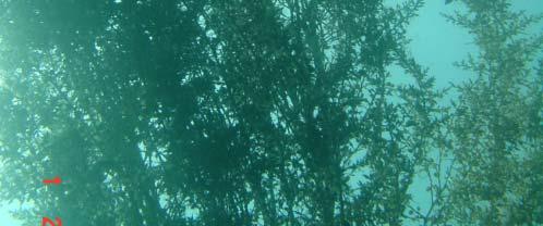
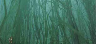

4 What habitats exist in the sea? Seaweed and seagrass beds Zostera marina Sargassum horneri Zostera caulescens
5 Ecosystem services of habitats Gas regulation Climate regulation Disturbance regulation Erosion control and sediment retention Nutrient cycling Waste treatmentt t Refugia (spawning and nursery grounds ) Food production Genetic resources Recreation Cultural Costanza et al. (1997)
6 Ecological services of coastal biomes in the world Biome Area (ha) Total value perha Total globalflow ($ha 1 yr 1 ) value($yr 1 x10 9 ) Estuaries ,832 4,110 Seagrass/seaweed beds ,004 3,801 Coral reefs 62 6, Shelf 2,660 1,610 4,283 Tidal marsh/mangroves 165 9,990 1,648 Total coastal biome 3,267 4,352 14,217 Tropical lforest 1,900 2,007 3,813 Temperate/boreal forests 2, Total forest biome 4, ,707 Constanza et al. (1997)


7 Coastal habitats at risk Agricultural pollution Industrial pollution Reclamation in Seto Inland Sea around 1960s Seagrass beds in Seto Inland Sea
8 Amelioration of water quality in Seto Inland Sea Komatsu (1997) Long term changes in the Zostera bed area in the Seto Inland Sea (Japan), especially along the coast of the Okayama Prefecture, Oceanologica. Acta, 20,
9 Law on Environmental Conservation of the Seto Inland Sea Cumulative reclamation and Zostera marina Cumulative reclamation and Zostera marina Komatsu (1997) Long term changes in the Zostera bed area in the Seto Inland Sea (Japan), especially along the coast of the Okayama Prefecture, Oceanologica. Acta, 20,
10 Counter measure against trawls in seagrass meadows in Okayama Prefecture, Japan Deployment of artificial reefs and columns obstructing trawl operation inside the seagrass beds of Ajino Bay in 1976 Deployment Komatsu (1997) Long term changes in the Zostera bed area in the Seto Inland Sea (Japan), especially along the coast of the Okayama Prefecture, Oceanologica. Acta, 20,
11 Management of coastal habitats Monitoring of habitat distributions Protection of habitat areas Restoration of habitats Mapping coastal habitats is indispensable for sustainable use of coastal resources
12 Mapping coastal habitats by direct and indirect surveys Direct methods Walking Diving Observation from the ship Grabbing bottom sediments
13 Direct methods (ground survey) Characteristics density estimation, species identification assured method Problems low efficiency influence of turbidity of water and high waves on field survey
14 Mapping of habitats by indirect methods Acoustics Optics (satellite remote sensing)
15 Optical methods Introduction of seagrass mapping
16 Lyzenga s Model Sun E sun Lsi L i Satellite Sea surface Deep water Bottom surface Ki Z Ri Li = Lsi +Ai Ri exp( Ki F Z) (W/m 2 /sr sr) (Lyzenga 1978)
17 Lyzenga (1978, 1981) Depth invariant Index (DII) DII = ln( Li Lsi ) [( Ki/Kj )ln( Lj Lsj j )] DII = ln( Ai Ri ) ( Ki/Kj )ln( Aj Rj ) DII = c + ln (Ri/Rj) assuming that Ki/Kj=1 Lyzenga s model: Li = Lsi + Ai Ri exp( Ki f Z)
18 Sagawa et al. (2010) International Journal of Remote Sensing, 31, Reflectance Index (RI) RI = ( Li Lsi )/( exp( Ki f Z ) ) RI = Ai Ri Lyzenga s model: Li = Lsi + Ai Ri exp( Ki f Z)
19 Example of attenuation coeeficient K= m 1 F=2.18 Jerlov Water Type Ⅱ Ⅲ Rlti Relation bt between depth and radiance (green band) Lyzenga s model: Li = Lsi + Ai Ri exp( Ki F Z)) (W/m2/sr sr)
20 DI Index 誤差行列 (Error matrix) 全体の精度 (Overall accuracy) = 54 % Sagawa et al. (2010) International Journal of Remote Sensing, 31,
21 BR Index Sagawa et al. (2010) International Journal of Remote Sensing, 31,
22 Overall accuracy (DI) DI)(%) Overall accuracy (BR)(%) JWT Mahares Ⅱ-Ⅲ Classification with BR Idex is more correct than DI Index Classification with BR Idex is more correct than DI Index (p < 0.05)
23 Sensors Aerial photography h Launch of Landsat satellite (1972) Sensors with spatial resolution (30~100 m) were most widely used (e.g. Landsat Multispectral Scanner, Landsat TM) long-time series/inexpensive data Sensors with better spatial resolution <10 m (e.g. IKONOS, SPOT, Worldview 2, Geo Eye etc) better spectral & spatial versatility/extremely expensive data Launch of ALOS (2006) and stop in April 2011 AVNIR-2 resolution: spatial (10 m)/multispectral (420~890nm)/radiometric (8 bits)
24 Characteristics of Landsat TM Band no. Spectral range (µm) Spatial resolution (m) Bands 1, 2, 3 and 4 are nearly equivalent to those of ALOS We 7 can analyze time series data consisting 30 of LANDSAT TM and ALOS from 1972 to 2011.
25 Characteristics of AVNIR 2 sensor Swath Width Spatial Resolution Wavelength Quantization 70 km ( at nadir) 10 m (at nadir) Band 1: µm (visible blue) Band 2: µm (visible green) Band 3: µm (visible red) Band 4: µm (near infrared) 8 bits We can compare habitat distributions between images of ALOS AVNIR 2 and LANDSAT


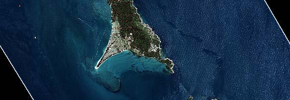

26 Sibu Island, Johor Malaysia tudy S rea A
27 Raw ALOS AVNIR 2 Image (29 July :54 am)
28 Change of coral reef to Sargassum beds from 2005 to 2008 Comparison result of ALOS (2008) and LANDSAT (2005) over Sibu Island Detection of succession from live coral to Sargassum forest Courtesy of Prof. Ibrahim Seeni at UTM, Malaysia 28
29 Tentative proposal to NOWPAP Temporal changes in spatial distributions ib ti of seaweed and seagrass beds with relation to environmental changes such as eutrophication or reclamation Focusing on changes in not only distributions of seagrass and seaweed beds but also land use Selection of test sites, where they are distributed broadly, with time series data of environmental parameters
30 Thank you very much for your attention!
Ocean Remote Sensing Project of Coastal Habitat Mapping
 Ocean Remote Sensing Project of Coastal Habitat Mapping Teruhisa Komatsu Atmosphere and Ocean Research Institute, The University of Tokyo Contents What is coastal habitat? Important ecological roles of
Ocean Remote Sensing (ORS) Programme
 Programme") Ocean Remote Sensing (ORS) Programme Teruhisa KOMATSU Atmosphere and Ocean Research Institute The University of Tokyo W-III 1996 ICAM-P (Huang) Ocean Remote Sensing Programme A history Workshop for ORSP
Ocean Remote Sensing (ORS) Programme Teruhisa KOMATSU Atmosphere and Ocean Research Institute The University of Tokyo W-III 1996 ICAM-P (Huang) Ocean Remote Sensing Programme A history Workshop for ORSP
Satellite Remote Sensing for Ocean
 Satellite Remote Sensing for Ocean August 17, 2017 Masatoshi Kamei RESTEC All rights reserved RESTEC 2015 Contents 1. About RESTEC and Remote Sensing 2. Example of Remote Sensing Technology 3. Remote Sensing
Overview of Remote Sensing in Natural Resources Mapping
 Overview of Remote Sensing in Natural Resources Mapping What is remote sensing? Why remote sensing? Examples of remote sensing in natural resources mapping Class goals What is Remote Sensing A remote sensing
IOC/SC-WESTPAC-XI/11.11 Bangkok, 16 March 2017 English only
 Restricted Distribution IOC/SC-WESTPAC-XI/11.11 Bangkok, 16 March 2017 English only INTERGOVERNMENTAL OCEANOGRAPHIC COMMISSION (of UNESCO) Eleventh Intergovernmental Session of the IOC Sub- Commission
Moreton Bay and Key Geographic Concepts Worksheet
 Moreton Bay and Key Geographic Concepts Worksheet The Australian Curriculum: Geography draws on seven key geographic concepts: place scale space environment change interconnection sustainability They are
Linking the value of ocean space and marine ecosystem to coastal reclamation planning: A case study of Xiamen
 Linking the value of ocean space and marine ecosystem to coastal reclamation planning: A case study of Xiamen Benrong Peng, PhD Coastal and Ocean Management Institute, Xiamen University (COMI) Nov. 20,
NOAA s OCM: Services, tools and collaboration opportunities & Puerto Rico s NE Marine Corridor as a case study
 NOAA s OCM: Services, tools and collaboration opportunities & Puerto Rico s NE Marine Corridor as a case study Dr. Antares Ramos Álvarez NOAA s Office of Coastal Management September 15 th, 2016 Conservation
THE EFFECTS OF LIGHT ON EELGRASS (ZOSTERA MARINA) GROWTH RATES IN SEQUIM BAY. Allie Simpson
 GROWTH RATES IN SEQUIM BAY. Allie Simpson") THE EFFECTS OF LIGHT ON EELGRASS (ZOSTERA MARINA) GROWTH RATES IN SEQUIM BAY Allie Simpson Abstract Seagrasses form meadows that provide many ecological services ranging from supplying food and habitat
THE EFFECTS OF LIGHT ON EELGRASS (ZOSTERA MARINA) GROWTH RATES IN SEQUIM BAY Allie Simpson Abstract Seagrasses form meadows that provide many ecological services ranging from supplying food and habitat
Ecological mapping using satellite imagery: an Abu Dhabi case study Middle East Geospatial Forum 16 th February 2015
 Ecological mapping using satellite imagery: an Abu Dhabi case study Middle East Geospatial Forum 16 th February 2015 Richard Flemmings rf@proteusgeo.com About Proteus Formed in UAE 2011 We specialise in
sentinel-2 COLOUR VISION FOR COPERNICUS
 sentinel-2 COLOUR VISION FOR COPERNICUS SATELLITES TO SERVE By providing a set of key information services for a wide range of practical applications, Europe s Copernicus programme is providing a step
CHAPTER 6 & 7 VOCABULARY
 CHAPTER 6 & 7 VOCABULARY 1. Biome 2. Climate 3. Latitude 4. Altitude 5. Emergent layer 6. Epiphyte 7. Understory 8. Permafrost 9. Wetland 10.Plankton 11.Nekton 12.Benthos 13.Littoral zone 14.Benthic zone
REFERENCE: The Blue Planet An Introduction to Earth System Science. Brian J. Skinner and Barbara W. Murck (2011) Third Edition. John Wiley and Sons
 Third Edition. John Wiley and Sons") REFERENCE: The Blue Planet An Introduction to Earth System Science. Brian J. Skinner and Barbara W. Murck (2011) Third Edition. John Wiley and Sons Inc. Most life on Earth lives within a zone no wider
REFERENCE: The Blue Planet An Introduction to Earth System Science. Brian J. Skinner and Barbara W. Murck (2011) Third Edition. John Wiley and Sons Inc. Most life on Earth lives within a zone no wider
Biodiversität und Fernerkundung im Skalierungskontext des BrahmaTWinn-Projektes
 Biodiversität und Fernerkundung im Skalierungskontext des BrahmaTWinn-Projektes Norbert Exler - Iris Wagner - Georg Janauer 6th EU Framework Programme Priority: Global Change and Ecosystems Contract: No.
A Small Migrating Herd. Mapping Wildlife Distribution 1. Mapping Wildlife Distribution 2. Conservation & Reserve Management
 A Basic Introduction to Wildlife Mapping & Modeling ~~~~~~~~~~ Rev. Ronald J. Wasowski, C.S.C. Associate Professor of Environmental Science University of Portland Portland, Oregon 8 December 2015 Introduction
Home About Us Articles Press Releases Image Gallery Contact Us Media Kit Free Subscription 10/5/2006 5:56:35 PM
 Home About Us Articles Press Releases Image Gallery Contact Us Media Kit Free Subscription 10/5/2006 5:56:35 PM Industry Resources Industry Directory NASA Links Missions/Launches Calendar Human development
Coastal marine ecosystems and Integrated Coastal Zone Management (ICZM); A way forward?
; A way forward?") Coastal marine ecosystems and Integrated Coastal Zone Management (ICZM); A way forward? Erlend Moksness Topic Session S13: Risk management in coastal zone ecosystems around the North Pacific PICES Annual
Coastal marine ecosystems and Integrated Coastal Zone Management (ICZM); A way forward? Erlend Moksness Topic Session S13: Risk management in coastal zone ecosystems around the North Pacific PICES Annual
Catastrophic Events Impact on Ecosystems
 Catastrophic Events Impact on Ecosystems Hurricanes Hurricanes An intense, rotating oceanic weather system with sustained winds of at least 74 mph and a welldefined eye Conditions for formation: Warm water
IMA s ROLE IN COASTAL AND OCEAN GOVERNANCE IN TRINIDAD AND TOBAGO
 IMA s ROLE IN COASTAL AND OCEAN GOVERNANCE IN TRINIDAD AND TOBAGO Presented by Rahanna Juman, Deputy Director (Ag.) About the Institute of Marine Affairs Institute of Marine Affairs (IMA) was established,
Setting Priorities for Eelgrass Conservation and Restoration. Robert Buchsbaum Massachusetts Audubon Society
 Setting Priorities for Eelgrass Conservation and Restoration Robert Buchsbaum Massachusetts Audubon Society Eelgrass habitat values A rich, productive habitat for many marine organisms Nursery habitat
Contents. Preface. IC. Introductory Chapter. 1. The Ocean in the Earth System. Ocean Studies and Pedagogy Acknowledgments
 Contents Preface Ocean Studies and Pedagogy Acknowledgments IC. Introductory Chapter IC.1 Why the Ocean is Important to Us? IC.1.1 Biological Resources IC.1.1.1 Fisheries IC.1.1.2 Other Biological Resources
Remote Sensing I: Basics
 Remote Sensing I: Basics Kelly M. Brunt Earth System Science Interdisciplinary Center, University of Maryland Cryospheric Science Laboratory, Goddard Space Flight Center kelly.m.brunt@nasa.gov (Based on
National Survey on the Natural Environment of Japan. Hajime Hirosawa Biodiversity Center of Japan Ministry of the Environment (MOE)
") National Survey on the Natural Environment of Japan Hajime Hirosawa Biodiversity Center of Japan Ministry of the Environment (MOE) Biodiversity Center of Japan, MOE Establishment: 1998 Purpose: to encourage
National Survey on the Natural Environment of Japan Hajime Hirosawa Biodiversity Center of Japan Ministry of the Environment (MOE) Biodiversity Center of Japan, MOE Establishment: 1998 Purpose: to encourage
Oceanography Curriculum Mapping and Pacing Guide
 Oceanography Curriculum Mapping and Pacing Guide 203-4 Grade/Course Oceanography (information for this map/pacing guide copied and adapted from Ocean Literacy: Essential Principles and Fundamental Concepts);
Fundamentals of Remote Sensing
 Division of Spatial Information Science Graduate School Life and Environment Sciences University of Tsukuba Fundamentals of Remote Sensing Prof. Dr. Yuji Murayama Surantha Dassanayake 10/6/2010 1 Fundamentals
Land Surface Temperature Measurements From the Split Window Channels of the NOAA 7 Advanced Very High Resolution Radiometer John C.
 Land Surface Temperature Measurements From the Split Window Channels of the NOAA 7 Advanced Very High Resolution Radiometer John C. Price Published in the Journal of Geophysical Research, 1984 Presented
The Use of Remote Sensing and GIS in MPA Delineation and Management
 Claire Hodson The Use of Remote Sensing and GIS in MPA Delineation and Management Marine Protected Areas (MPAs) are often defined as clearly distinct geographical space, recognized, dedicated and managed,
TASMANIAN SEAGRASS COMMUNITIES
 TASMANIAN SEAGRASS COMMUNITIES by Christopher Grant Rees, B.Ed (}Ions.) Submitted in partial fulfilment of the requirement for the degree of Master of Environmental Studies (By Coursework) Centre for Environmental
Ecosystems Chapter 4. What is an Ecosystem? Section 4-1
 Ecosystems Chapter 4 What is an Ecosystem? Section 4-1 Ecosystems Key Idea: An ecosystem includes a community of organisms and their physical environment. A community is a group of various species that
Outline. Artificial night lighting as seen from space. Artificial night lighting as seen from space. Applications based on DMSP nighttime lights
 -1 - Outline Satellite observed nighttime lights as an indicator of human induced stress on coral C. Aubrecht, C.D. Elvidge August 22, 2008 Kuffner Observatory Vienna, Austria Artificial night lighting
Using IKONOS Images to Evaluate Coral Reefs in Low versus High Sedimentation Environments
 Using IKONOS Images to Evaluate Coral Reefs in Low versus High Sedimentation Environments David N. Cuevas Miranda Department of Marine Sciences, University of Puerto Rico at Mayagüez P.O. Box 908 Lajas,
New NASA Ocean Observations and Coastal Applications
 New NASA Ocean Observations and Coastal Applications Duane Armstrong Chief, Applied Science & Technology Project Office August 20, 2014 1 Outline NASA s new Earth Science Ocean Science Missions for 2014
DEPENDENCE OF URBAN TEMPERATURE ELEVATION ON LAND COVER TYPES. Ping CHEN, Soo Chin LIEW and Leong Keong KWOH
 DEPENDENCE OF URBAN TEMPERATURE ELEVATION ON LAND COVER TYPES Ping CHEN, Soo Chin LIEW and Leong Keong KWOH Centre for Remote Imaging, Sensing and Processing, National University of Singapore, Lower Kent
Annex VI-1. Draft National Report on Ocean Remote Sensing in China. (Reviewed by the Second Meeting of NOWPAP WG4)
") UNEP/NOWPAP/CEARAC/WG4 2/9 Page1 Draft National Report on Ocean Remote Sensing in China (Reviewed by the Second Meeting of NOWPAP WG4) UNEP/NOWPAP/CEARAC/WG4 2/9 Page1 1. Status of RS utilization in marine
UNEP/NOWPAP/CEARAC/WG4 2/9 Page1 Draft National Report on Ocean Remote Sensing in China (Reviewed by the Second Meeting of NOWPAP WG4) UNEP/NOWPAP/CEARAC/WG4 2/9 Page1 1. Status of RS utilization in marine
Environmental Science
 Environmental Science A Study of Interrelationships Cui Jiansheng Hebei University of Science and Technology CH06 Kinds of Ecosystems and Communities Chapter Objectives After reading this chapter, you
Lesson 4b Remote Sensing and geospatial analysis to integrate observations over larger scales
 Lesson 4b Remote Sensing and geospatial analysis to integrate observations over larger scales We have discussed static sensors, human-based (participatory) sensing, and mobile sensing Remote sensing: Satellite
UNIT 5: ECOLOGY Chapter 15: The Biosphere
 CORNELL NOTES Directions: You must create a minimum of 5 questions in this column per page (average). Use these to study your notes and prepare for tests and quizzes. Notes will be stamped after each assigned
Photosynthetic Habitats
 6. Kelps, Mangroves & Photosynthetic Habitats Photosynthetic Habitats Kelps Anatomy Community Ecosystem Mangroves Anatomy Community Ecosystem Other photosynthetic habitats Seagrasses Dr Rhian G. Waller
> True/False Indicate whether the statement is true or false.
 Class: Date: Biology Chapter 3 Test: Communities, Bionics, and Ecosystems > True/False Indicate whether the statement is true or false. 1. The main abiotic distinction between temperate grassland and tropical
Satellite-based Red-Tide Detection/Monitoring
 Satellite-based Detection/Monitoring Contents 1. Introduction - and Its Monitoring System 2. Detection Using Ocean Color Remote Sensing 3. Satellite-Based Monitoring in the Asian Coastal Seas Hiroshi KAWAMURA
Introduction: The Gulf of Mexico Alliance. The Gulf GAME project MERMAid and PHINS Results & Conclusions What s next? Examples
 AAG Las Vegas March 25, 2009 Introduction: Ocean governance and Ecosystem-Based Management The Gulf of Mexico Alliance Habitat Identification and Characterization The Gulf GAME project MERMAid and PHINS
Quantifying effects of oil on coastal dune vegetation. Thomas Miller and Elise Gornish Biological Science, Florida State University
 Quantifying effects of oil on coastal dune vegetation Thomas Miller and Elise Gornish Biological Science, Florida State University Natural History of Barrier Islands in the Northern Gulf Make up ~70% of
Mark L. Botton 1 and Robert E. Loveland 2
 Sea level rise and the significance of marginal beaches for horseshoe crab spawning Mark L. Botton 1 and Robert E. Loveland 2 1 Fordham University, Dept. Natural Sciences and Environmental Science Program
Research Background: Researcher Sam Bond taking Sediment Elevation Table (SET) measurements in the marsh. A view of salt marsh hay growing in a marsh
 measurements in the marsh. A view of salt marsh hay growing in a marsh") Name Keeping up with the sea level Featured scientist: Anne Giblin from the Marine Biological Laboratory and the Plum Island Ecosystems Long-Term Ecological Research site Research Background: Salt marshes
Name Keeping up with the sea level Featured scientist: Anne Giblin from the Marine Biological Laboratory and the Plum Island Ecosystems Long-Term Ecological Research site Research Background: Salt marshes
Title. Author(s)Radiarta, I Nyoman; Saitoh, Sei-Ichi. Issue Date Doc URL. Type. Note. File Information
Radiarta, I Nyoman; Saitoh, Sei-Ichi. Issue Date Doc URL. Type. Note. File Information") Title Spatial information systems approach toward sustaina Author(s)Radiarta, I Nyoman; Saitoh, Sei-Ichi International Symposium on "Sustainability Science o Citation2009. Hakodate, Japan. Issue Date 2009-11-07
Title Spatial information systems approach toward sustaina Author(s)Radiarta, I Nyoman; Saitoh, Sei-Ichi International Symposium on "Sustainability Science o Citation2009. Hakodate, Japan. Issue Date 2009-11-07
9693 MARINE SCIENCE. Mark schemes should be read in conjunction with the question paper and the Principal Examiner Report for Teachers.
 CAMBRIDGE INTERNATIONAL EXAMINATIONS GCE Advanced Subsidiary Level and GCE Advanced Level www.xtremepapers.com MARK SCHEME for the May/June 01 series 969 MARINE SCIENCE 969/01 Paper 1 (AS Structured Questions),
Pee Dee Explorer. Science Standards
 Science Standards About Pee Dee Explorer What does it mean when someone says they are from the "Pee Dee" of South Carolina? A place is bigger than its physical geography. A "sense of place" weaves together
Exploring the impacts of future global change on mangrove-fishery-community linkages
 Exploring the impacts of future global change on mangrove-fishery-community linkages Rachel Seary University of Cambridge/ UNEP-WCMC Supervisors: Dr Tom Spencer, Dr Mike Bithell & Dr Chris McOwen Photograph:
Module 3. Basic Ecological Principles
 Module 3. Basic Ecological Principles Ecosystem Components Abiotic Biotic Species & Habitat The Biomes of North America Communities Energy & Matter Cycles in Ecosystems Primary Productivity Simple Ecosystem
Habitat mapping over tidal flats and coastal wetland areas
 Habitat mapping over tidal flats and coastal wetland areas Cartographie des habitats naturels des estrans et zones humides littorales Aurélie DEHOUCK Virginie LAFON, Nicolas BAGHDADI, Danielle DUCROT,
Earth-Space Science 6 12
 Earth-Space Science 6 12 Section 08 1 Knowledge of the nature of science 1. Analyze processes of scientific inquiry. 2. Evaluate models used in science to explain patterns observed in nature (e.g., rock
Application of Remote Sensing and GIS in Wildlife Habitat Mapping
 Justice Camillus Mensah December 6, 2011 NRS 509 Application of Remote Sensing and GIS in Wildlife Habitat Mapping Introduction Wildlife habitat represents the physical space within which an organism lives.
Joint Hydrographic Center, National Oceanic and Atmospheric Administration, Durham, NH 03824, USA
 Future directions in hydrography using satellite-derived bathymetry Shachak Pe eri 1, Christopher Parrish 2, 3, Lee Alexander 1, Chukwuma Azuike 1, Andrew Armstrong 1,3 and Maryellen Sault 2 1 Center for
Ocean Zones How are the intertidal, neritic, and oceanic zones different?
 Ocean Zones How are the intertidal, neritic, and oceanic zones different? How deep does sunlight travel into the ocean and how does that affect plants and animals? What technology is used to explore the
Ocean facts continued
 Ocean Facts A dynamic system in which many chemical and physical changes take place Formed over millions of years as precipitation filled low areas on Earth called basins and now covers 70% of the Earth
Data sources and classification for ecosystem accounting g
 Data sources and classification for ecosystem accounting Ken Bagstad 23 February 2015 Wealth Accounting and the Valuation of Ecosystem Services www.wavespartnership.org Data sources and classification
The Water Planet Ch. 22
 The Water Planet Ch. 22 What is Oceanography? the study of the Earth s oceans using chemistry, biology, geology, and physics. Oceans cover 70% of the Earth s surface Ocean Research 22.1 The use of submarines
Overview of Chapter 6
 Overview of Chapter 6 Earth s Major Biomes Aquatic Ecosystems Freshwater ecosystems Estuaries Marine Ecosystems Wildfires and Ecosystems Wildfire unexpected fire in grass, shrub, or forests (a significant
TEST NAME: Biome Test 10/7 TEST ID: GRADE:05 - Fifth Grade SUBJECT:Life and Physical Sciences TEST CATEGORY: My Classroom
 TEST NAME: Biome Test 10/7 TEST ID:1239163 GRADE:05 - Fifth Grade SUBJECT:Life and Physical Sciences TEST CATEGORY: My Classroom Biome Test 10/7 Page 1 of 8 10/07/16, Biome Test 10/7 Student: Class: Date:
Satellite Derived Bathymetry. Dr. Thomas Heege EOMAP, Germany
 Satellite Derived Bathymetry Dr. Thomas Heege EOMAP, Germany heege@eomap.de Motivation Extensive coverage, global scale Spatial and temporal continuity Attractive costs, rapid delivery Independent at remote/inaccessible
This table connects the content provided by Education Perfect to the NSW Syllabus.
 Education Perfect Geography provides teachers with a wide range of quality, engaging and innovative content to drive positive student learning outcomes. Designed by teachers and written by our in-house
Most natural ecosystems are in a state of equilibrium. This means that their biotic and abiotic features remain relatively constant over time.
 Most natural ecosystems are in a state of equilibrium. This means that their biotic and abiotic features remain relatively constant over time. The major biomes, for example, usually maintain a characteristic
Mapping ecosystem services provided by benthic habitats in the European Atlantic Ocean
 Mapping and Assessment Ecosystem Services and Links to Good Environmental Status Mapping ecosystem services provided by benthic habitats in the European Atlantic Ocean Ibon Galparsoro, Angel Borja and
Look For the Following Key Ideas
 Look For the Following Key Ideas * Energy flows through living systems, but matter is recycled. * Primary producers, called autotrophs, synthesize glucose by the process of photosynthesis or chemosynthesis.
Current and Future Technology Applications for Coastal Zone Management. Bruce K. Carlisle, Acting Director Office of Coastal Zone Management
 Current and Future Technology Applications for Coastal Zone Management Bruce K. Carlisle, Acting Director Office of Coastal Zone Management The Massachusetts Coastal Zone Management Program Approved in
Ecological Succession
 Ecological Succession Most natural ecosystems are in a state of equilibrium. This means that their biotic and abiotic features remain relatively constant over time. The major biomes, for example, usually
Coastal Research and Policy Integration COREPOINT EU-INTERREG IIIB. Activity 2.3
 QUANTIFICATION OF THE ECONOMIC BENEFITS OF NATURAL COASTAL ECOSYSTEMS Coastal Research and Policy Integration COREPOINT EU-INTERREG IIIB Activity 2.3 Revised January 2007 EXECUTIVE SUMMARY The European
Geographic Information System (GIS) and its value to Large Marine Ecosystem (LME)-based management
 and its value to Large Marine Ecosystem (LME)-based management") Jesse Stuart Mechling Dept. of Marine Affairs NRS 509 Prof. Peter August Geographic Information System (GIS) and its value to Large Marine Ecosystem (LME)-based management Integrated or ecosystem-based
Jesse Stuart Mechling Dept. of Marine Affairs NRS 509 Prof. Peter August Geographic Information System (GIS) and its value to Large Marine Ecosystem (LME)-based management Integrated or ecosystem-based
CALIBRATION OF THERMAL INFRARED CHANNELS OF FENG YUN SATELLITE DATA. Wan Hazli Wan Kadir, Abd Wahid Rasib, Ab. Latif Ibrahim and Zawatil Azhani Zaini
 CALIBRATION OF THERMAL INFRARED CHANNELS OF FENG YUN SATELLITE DATA Wan Hazli Wan Kadir, Abd Wahid Rasib, Ab. Latif Ibrahim and Zawatil Azhani Zaini Department of Remote Sensing, Faculty of Geoinformation
Marine Ecology Pacing Guide
 Marine Ecology Pacing Guide Course Description: The focus of the course is the interrelationships among marine organisms and the physical, chemical, geological and biological factors. North Carolina coastal
Jurnal KELAUTAN, Volume 3, No.1 April 2010 ISSN : APPLICATION OF REMOTE SENSING IN MANGROVE STUDIES : A LITERATURE REVIEW.
 APPLICATION OF REMOTE SENSING IN MANGROVE STUDIES : A LITERATURE REVIEW Zainul Hidayah Dosen Jurusan Ilmu Kelautan Universitas Trunojoyo E-mail: zainulhidayah@trunojoyo.ac.id ABSTRACT In order to assess
Status and Data Applications of China Highresolution Earth Observation System. Earth Observation System and Data Center, CNSA Sep, 2016
 Status and Data Applications of China Highresolution Earth Observation System Earth Observation System and Data Center, CNSA Sep, 2016 Outlines Introduction Development of the Space-based System CHEOS
Greening of Arctic: Knowledge and Uncertainties
 Greening of Arctic: Knowledge and Uncertainties Jiong Jia, Hesong Wang Chinese Academy of Science jiong@tea.ac.cn Howie Epstein Skip Walker Moscow, January 28, 2008 Global Warming and Its Impact IMPACTS
The Role of Wilderness in Climate Change Adaptation
 The Role of Wilderness in Climate Change Adaptation A Case Study of the Northern Rockies Greg Aplet, Bo Wilmer Goal: Sustaining Ecosystem Services Sustaining the full suite of benefits we receive from
EUMETSAT s Copernicus Marine Data Stream (CMDS)
") EUMETSAT s Copernicus Marine Data Stream (CMDS) Hayley Evers-King (PML, Copernicus Ocean Training Service), Mark Higgins Copernicus Sentinel 3 marine data Sentinel 3 SRAL (Altimetry) SLSTR (SST) OLCI (Ocean
EUMETSAT s Copernicus Marine Data Stream (CMDS) Hayley Evers-King (PML, Copernicus Ocean Training Service), Mark Higgins Copernicus Sentinel 3 marine data Sentinel 3 SRAL (Altimetry) SLSTR (SST) OLCI (Ocean
Coastal Research and Policy Integration COREPOINT EU-INTERREG IIIB. Activity 2.3
 QUANTIFICATION OF THE ECONOMIC BENEFITS OF NATURAL COASTAL ECOSYSTEMS Coastal Research and Policy Integration COREPOINT EU-INTERREG IIIB Activity 2.3 Revised January 2007 Quantify the economic benefits
Mapping and Assessment of Ecosystems and their Services
 Mapping and Assessment of Ecosystems and their Services ALTER-Net Conference 2013: Science underpinning the EU 2020 Biodiversity Strategy. April 2013 Gent Joachim MAES 1 This presentation is based on the
GIS USE IN THE STUDY OF ESTUARINE SOILS AND SEDIMENTS Margot K. Payne NRS 509 November 30, 2005
 GIS USE IN THE STUDY OF ESTUARINE SOILS AND SEDIMENTS Margot K. Payne NRS 509 November 30, 2005 Throughout the world, estuaries are not only some of the most ecologically productive environments, but are
PRINCIPLE OF OCEANOGRAPHY PBBT101 UNIT-1 INTRODUCTION OF OCEANIC ENVIRONMENT. PART-A (2 Marks)
") PRINCIPLE OF OCEANOGRAPHY PBBT101 UNIT-1 INTRODUCTION OF OCEANIC ENVIRONMENT 1. Define marine ecosystem. 2. What is geography? 3. Give two Oceanic zones 4. What is sea? 5. Define oceanography? 6. Enlist
PRINCIPLE OF OCEANOGRAPHY PBBT101 UNIT-1 INTRODUCTION OF OCEANIC ENVIRONMENT 1. Define marine ecosystem. 2. What is geography? 3. Give two Oceanic zones 4. What is sea? 5. Define oceanography? 6. Enlist
Ecosystems. 1. Population Interactions 2. Energy Flow 3. Material Cycle
 Ecosystems 1. Population Interactions 2. Energy Flow 3. Material Cycle The deep sea was once thought to have few forms of life because of the darkness (no photosynthesis) and tremendous pressures. But
What creates a coral reef? Why are corals able to form huge reefs?
 Marine ecosystems 5: Coral Reefs Unique features The foundation of the ecosystem is produced by living things Reef-building corals Similarities with tropical rain forests Richness and complexity 3-dimensional
Coastal and Marine Ecological Classification Standard (CMECS)
") Coastal and Marine Ecological Classification Standard (CMECS) Mark Finkbeiner NOAA Coastal Services Center Presented at the International Workshop on Seabed Mapping Methods and Technology 18 October 2012
Coastal and Marine Ecological Classification Standard (CMECS) Mark Finkbeiner NOAA Coastal Services Center Presented at the International Workshop on Seabed Mapping Methods and Technology 18 October 2012
A new perspective on aerosol direct radiative effects in South Atlantic and Southern Africa
 A new perspective on aerosol direct radiative effects in South Atlantic and Southern Africa Ian Chang and Sundar A. Christopher Department of Atmospheric Science University of Alabama in Huntsville, U.S.A.
Marine spatial planning for fisheries management and biodiversity conservation: More to be done
 Available online at: www.mbai.org.in Marine spatial planning for fisheries management and biodiversity conservation: More to be done Institut Teknologi Brunei, Tungku Highway, Gadong BE1410, Negara Brunei
Remote Sensing the Urban Landscape
 Remote Sensing the Urban Landscape Urban landscape are composed of a diverse assemblage of materials (concrete, asphalt, metal, plastic, shingles, glass, water, grass, shrubbery, trees, and soil) arranged
GCOS High Resolution Land Cover ECV. Slide 11
 GCOS High Resolution Land Cover ECV Slide 11 Detailed Land Cover and Climate Land cover and its changes modify the goods and services provided to human society force climate by altering water and energy
LAND COVER CATEGORY DEFINITION BY IMAGE INVARIANTS FOR AUTOMATED CLASSIFICATION
 LAND COVER CATEGORY DEFINITION BY IMAGE INVARIANTS FOR AUTOMATED CLASSIFICATION Nguyen Dinh Duong Environmental Remote Sensing Laboratory Institute of Geography Hoang Quoc Viet Rd., Cau Giay, Hanoi, Vietnam
3.3 Threats to Biodiversity
 Name: Date: Class: IB Environmental Systems and Societies 3.3 Threats to Biodiversity Significant ideas: While global biodiversity is difficult to quantify, it is decreasing rapidly due to human activity.
Extent. Level 1 and 2. October 2017
 Extent Level 1 and 2 October 2017 Overview: Extent account 1. Learning objectives 2. Review of Level 0 (5m) 3. Level 1 (Compilers): Concepts (15m) Group exercise and discussion (15m) 4. Level 2 (Data Providers)
C o p e r n i c u s f o r H i g h r e s o l u t i o n m a p p i n g o f w a t e r q u a l i t y. Copernicus EU
 C o p e r n i c u s f o r H i g h r e s o l u t i o n m a p p i n g o f w a t e r q u a l i t y Copernicus EU Copernicus EU Copernicus EU www.copernicus.eu M o n i t o r i n g o f s e a w a t e r s i n
An overview of USGS Hurricane Sandy Supplemental Studies along the Delmarva Peninsula
 An overview of USGS Hurricane Sandy Supplemental Studies along the Delmarva Peninsula Neil K. Ganju, Laura L. Brothers, Nathaniel G. Plant, Christopher G. Smith, E. Robert Thieler Coastal and Marine Geology
Why Erosion and Sedimention Control is Important: A Fish s Point of View
 Why Erosion and Sedimention Control is Important: A Fish s Point of View Fisheries Protection Program Department of Fisheries and Oceans June 6, 2014 Basic definition: Sediment is defined as soil particles
Jay Dimond NRS /30/04
 Mapping and Prediction of Coral Bleaching Using GIS Corals on coral reefs bleach when they lose their complement of intracellular symbiotic algae known as zooxanthellae. Coral color varies widely, but
Evolution and Life in the Ocean
 Characteristics of All Living Things Contain matter in a highly organized state Capture, store and transmit energy; all organisms require energy Capable of reproduction Change through time and adapt to
- satellite orbits. Further Reading: Chapter 04 of the text book. Outline. - satellite sensor measurements
 (1 of 12) Further Reading: Chapter 04 of the text book Outline - satellite orbits - satellite sensor measurements - remote sensing of land, atmosphere and oceans (2 of 12) Introduction Remote Sensing:
Kyoto and Carbon Initiative - the Ramsar / Wetlands International perspective
 Kyoto and Carbon Initiative - the Ramsar / Wetlands International perspective (the thoughts of Max Finlayson, as interpreted by John Lowry) Broad Requirements Guideline(s) for delineating wetlands (specifically,
Chapter 32. Australia & New Zealand
 Chapter 32 Australia & New Zealand Lesson 1: Physical Geography of Australia & New Zealand Landforms Australia lies between the Pacific and Indian Oceans in the Southern Hemisphere. Although an island,
Outline Introduction Objectives Study Area Methodology Result Discussion Conclusion
 Land Cover, Land Use of two bioluminescent bays in Puerto Rico Undergraduate Research By: Yadira Soto Viruet Advisor: Fernando Gilbes Santaella, Ph.D Outline Introduction Objectives Study Area Methodology
The Refugia Concept: Using Watershed Analysis to Prioritize Salmonid Habitat for Conservation and Restoration
 The Refugia Concept: Using Watershed Analysis to Prioritize Salmonid Habitat for Conservation and Restoration Christopher May Battelle & UW Cumulative Impacts of Urbanization Landscape Alterations Loss
Spatial variation in the abundance of eelgrass (Zostera marina) at eight sites in western Newfoundland, Canada 5/5/2015 V2.0
 at eight sites in western Newfoundland, Canada 5/5/2015 V2.0") Spatial variation in the abundance of eelgrass (Zostera marina) at eight sites in western Newfoundland, Canada 5/5/2015 V2.0 1 Summary The abundance of eelgrass (Zostera marina) was quantified at eight
Spatial variation in the abundance of eelgrass (Zostera marina) at eight sites in western Newfoundland, Canada 5/5/2015 V2.0 1 Summary The abundance of eelgrass (Zostera marina) was quantified at eight