Using the Online What If? Scenario Planning Tool for City Planning
|
|
|
- Brendan Charles McKenzie
- 5 years ago
- Views:
Transcription

1 Using the Online What If? Scenario Planning Tool for City Planning Chris Pettit Professor of Urban Science Associate Director City Futures Research Centre

2 City Futures Research Centre Our work aims to advance the understanding of Australia s cities, their people, the policies that manage their growth, and their impacts on our society and economy Established 2005, 5 program areas: City Analytics: urban data and analysis, modelling, visualisation City Housing: policy, markets and practice City Shaping: planning, urban renewal and high density living City Wellbeing: planning and public health

3 City Analytics

4 City Dashboard

5 / (Pettit et al, 2015)


6 AURIN Online Workbench (Pettit et al, 2015)
7 Spatial Decision Support Systems Definition: SDSS are explicitly designed to provide the user with a decision-making environment that enables the analysis of geographical information to be carries out in a flexible environment Spraque & Carlson (1982).
8 Planning Support Systems Planning Support Systems (PSS) are computer-based tools introduced a few decades ago with the aim to provide assistance to planning practitioners in completing planning tasks (Te Brömmelstroet 2010). PSS support those involved in planning to explore, represent, analyze, visualize, predict, prescribe, design, implement, monitor and discuss issues associated with the need to plan (Batty, 2005, p666).
9 Scenario Planning Approach Planners require data driven evidenced based decision support tools to assist city planning. Scenario Planning Approach is based on: Best available data Data analytics and modelling Data (geo)-visualisation.to explore an envelope of plausible What if? Future City Scenarios. (Pettit & Pullar, 2004)


10 Spatial Decision Support Tools Metropolitan What if? Map Table Municipality Envision Precinct Envision Scenario Planner
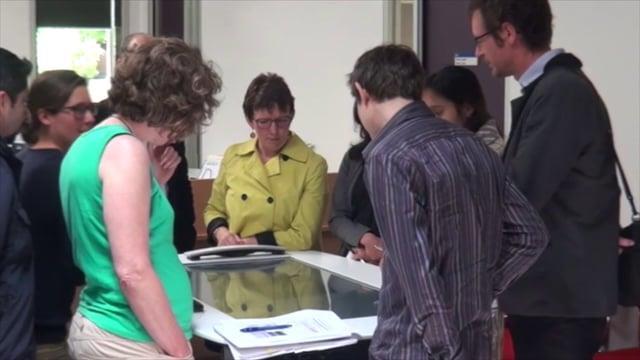
11 Interactive Map Table

12 Interactive Map Table


13 Envision Scenario Planning tool A co-design approach (Pettit et al, 2014)


14 Envision planning support tool

15 Online What if? GIS based collaborative planning support tool (Klosterman, 1999). Enables planning and decision-makers to explore alternative future scenarios (Pettit et al, 2013 & 2015)
16 How it Works Scenario-based Analysis: policy-oriented planning tool used to determine what would happen if the user s policy choices are made and their assumptions concerning the future are correct What if? does NOT attempt to predict the future exactly: it is not an optimization model.
17 Online What if? Tool Setup Module Land Suitability Analysis Multiple Criteria Evaluation. Land use Demand Population & employment driven. Land use Allocation Future land use simulations.
, 3.5m (2050) Significant environmental assets surround the city.")
18 Perth to Peel Case Study Perth Australia s 4 th largest city Estimated population 1.65 m Projected population 2.2m (2031), 3.5m (2050) Significant environmental assets surround the city. Growth corridor North West region
19 Perth to Peel Case Study Western Australia Dept of Planning want to explore the following scenarios: 1. Maximising Employment from universities and the health sector; 2. Promoting the region as a coastal growth zone; 3. Maximising the region s potential to act as a food bowl for the region; and 4. Exploring making the region a hub for international sports events and recreational activities.

20 What if? Set up Module What if? Project Workspace

21 What if? Set up Module Setup Upload Shapefile

22 What if? Set up Module Setup Extract Current Land Use

23 What if? Set up Module Setup Select Suitability Factors
 considered to determine the relative suitability of different locations for land use type i r ij is the rating or relative performance value of the factor j contributing to the")
24 Land Suitability Module If then else, Where, r ij = 0 S i = 0 S i = å j w ij r ij S i is the land suitability score for land use type i; w ij is the relative importance (weight) of a factor (criterion j) considered to determine the relative suitability of different locations for land use type i r ij is the rating or relative performance value of the factor j contributing to the suitability score of a land use type i Multiple Criteria Evaluation

25 Land Suitability Module Assign Weightings of importance

26 Land Suitability Module Suitability Results Low Density

27 Land Suitability Module Suitability Results Medium Density

28 Land Suitability Module Suitability Results High Density

29 Land Suitability Module Suitability Results Industrial

30 Land Suitability Module Suitability Results Commercial

31 Land Suitability Module Suitability Results Education
32 Demand Module High Growth expected Perth-Peel Directions 2031 Report Joondalup 2022 Plan Up to 12,000 new dwellings An increased focus on local employment Automatic Trend identifies mostly shrinking employment market High growth scenario reflects the desired growth pattern of Joondalup (Dept of planning) Growth Projections

33 Demand Module Current Residential Statistics

34 Land Demand Module Employment Sectors

35 Land Demand Module Current Employment
36 Land Demand Module RLD future = i å ( ) b i 1- IR i éæ TotalPopulation ê future ç ê ëè (1-VR i ) AvgHousehold future h i ö ù - HouseCount i ú current ø ú û Where: i is a particular type of residential housing b i future percentage breakdown by housing types (value between 0 and 1 specified by user) h i breakdown of future housing density by type (specified by user) IR i (Infill Rate) is the infill percentage of new housing units that is assumed to be allocated as infill to areas that are already devoted to residential uses (e.g. new residential units created on current vacant residential lots) VR i is the proportion of the housing units which is vacant and available for sale (surplus) Growth Projections - Residential
37 Land Demand Module ED j = i å (pne i - cne i ) Area j (1- IR i ) cne i Where: j is the land use class (that holds Employment Sectors i ) i is the Employment Sector (i.g. commercial, industrial, etc) ED j is an average value of area required by employment sector, for each land use type. pne projected Number of Employment cne current Number of Employment IR i is the infill rate of the employment sector i in certain land use class n i number of employment sectors (count) n i Growth Projections Employment

38 Land Demand Module Growth Projections - Residential
39 Land Demand Module Growth Projections - Employment

40 Demand Scenarios Land Demand Module Outputs generated from the demand process can be revised or via manual input
41 Land Allocation Module Land allocated across suitability layers Land sorted by: Growth Pattern Size Control Scenarios (utility Infrastructure, transport plans) Land is allocated until demand is met

42 Land Allocation Module

43 Land Allocation Module Allocation Results

44 Land Allocation Module Allocation Results
 Spatial Data and Aggregation level : Land Use Data: Cadastral Level (760,430 polygons) DoP Structure Plan Population and Employment forecast: LGA level (DoP) PSMA: street level road network")
45 Perth to Peel Case Study Study Area: Perth Peel Estimated population 1.65 m Projected population 2.2m (2031), 3.5m (2050) Spatial Data and Aggregation level : Land Use Data: Cadastral Level (760,430 polygons) DoP Structure Plan Population and Employment forecast: LGA level (DoP) PSMA: street level road network DoP Infrastructure Footprint: proposed transportation network Baseline Year 2011: due to most recent LU data availability.
46 Department of Planning - 5 Scenarios 1 Peri-urban growth scenario 2 All Infill (compact city) 3 Likely City 4 Transit City 5 Activity Centre City
47 Scenario 3 Likely City Urban expansion in line with Directions 2031 (15 dwellings /hectare) Followed by infill to accommodate any surplus Areas suitable for Urban Expansion: Urban; Urban deferred; Urban expansion/investigation Avoid Environmentally Sensitive Areas Infill along public transport and activity centres
48 Residential Land Land for residential expansion = 32,716.5 ha (passed the total available land constraint ) At 15 dwellings/hectare: Land for residential growth will be exhausted by % of the total residential demand can be supplied on that amount of land(i.e. 490,747 dwellings) Infill required for an extra 283,515 dwellings (the remaining 37% of the house demand by 2050) NhousesBuilt (on available land) 490,746.9 Infill (number houses to Infill) 283,515
49 Residential Demand Year N_Houses Growth (in N.Houses) Residential Land Demand (ha) d=15houses/ha Residential Land Available(ha) ,159-32, , ,768 8,385 24, , ,932 6,995 17, ,064, ,072 7,005 10, ,175, ,373 7,358 2, ,291, ,630 7,775-4, ,361,241 69,308 4,621-9, ,442,547 81,306 5,420-14, ,503,421 60,874 4,058-18,901 Total 774,262 51, ,901

50 Online What If?
51 Summary City-wide land use scenarios can be generated in near real-time using What if? Scenarios can inform environmental assessment and strategic planning. Potential to explore scenarios under a changing climate including for example bush fire overlays
52 Next Steps Online What If? Development Release Open Source Code Foster International Community of Developer and Users Code, functionality extensions
53 Online Open Source code release Help documentation
54 User Metrics The number of registered users for what if? 112 Number of users who logged into the system : 52 Number of users who setup a project: 28 Users are international from countries including: Pakistan, Egypt, USA, UK, South Africa, Iran, Germany, Saudi Arabia, Colombia, Turkey, Australia.
55 REFERENCES Batty, M., Urban modeling in computer-graphic and geographic information system environments. Environment and Planning B: Planning and Design, 19, pp Klosterman, R.E. and Pettit, C. (2005) An update on Planning Support Systems, Environment and Planning B: Planning & Design, 32: Pettit, C.J. Klosterman, R.E., Delaney, P., Whitehead, A, L., Kujala, H.,. Bromage, A., Nino-Ruiz, M. (2015) The Online What if? Planning Support System: A Land Suitability Application in Western Australia, Applied Spatial Analysis and Policy. DOI: /s Pettit, C.J. Barton, J, Goldie, X, Sinnott, R. Stimson, R, Kvan, T. (2015) The Australian Urban Intelligence Network supporting Smart Cities, in Geertman S, Stillwell J, Ferreira J and Goodspeed J (eds) Planning Support Systems and Smart Cities, Lecture Notes in Geoinformation and Cartography, pp 243 Springer, pp Pettit, C.J. Klosterman, R.E. Nino-Ruiz, M. Widjaja, I., Tomko, M., Sinnott, R. (2013). The Online What if? Planning Support System in Planning Support Systems for Sustainable Urban Development, Eds Geertman, S and Stillwell, J. Springer Publishers, pp Pettit C.J., Russel A.B.M., Michael T., Aurambout J-P., Sharma, S., Williams, S., Hunter, D., Chan, P., Borda, A., Bishop, I.D., Abramson, D. (2013) Realising an escience platform to support climate change adaptation in Victoria, Future Computer Generate Systems, Vol 29, Pettit, C. and Pullar, D. (2004) A way forward for land use planning to achieve policy goals using spatial modeling scenarios, Environment and Planning B: Planning and Design, 31: Te Brömmelstroet, M., Equip the Warrior instead of Manning the Equipment: Land Use and Transport Planning Support in the Netherlands. University of Amsterdam. Available at:


56 Acknowledgements Get involved
Transport Planning in Large Scale Housing Developments. David Knight
 Transport Planning in Large Scale Housing Developments David Knight Large Scale Housing Developments No longer creating great urban spaces in the UK (Hall 2014) Transport Planning Transport planning processes
Applying the What if? Planning Support System for Better Planning at the Urban Fringe
 Applying the What if? Planning Support System for Better Planning at the Urban Fringe Christopher Pettit, Jessica Keysers, Ian Bishop and Richard Klosterman In Landscape Analysis and Visualisation: Spatial
Land Use in the context of sustainable, smart and inclusive growth
 Land Use in the context of sustainable, smart and inclusive growth François Salgé Ministry of sustainable development France facilitator EUROGI vice president AFIGéO board member 1 Introduction e-content+
Planning Scenarios for the Growth of Hervey Bay
 Planning Scenarios for the Growth of Hervey Bay Christopher Pettit and David Pullar Department of Geographical Sciences and Planning The University of Queensland. St. Lucia. Australia. 4072 Phone: 07 3365
Key Indicators for Territorial Cohesion & Spatial Planning Stakeholder Workshop - Project Update. 13 th December 2012 San Sebastián, Basque Country
 Key Indicators for Territorial Cohesion & Spatial Planning Stakeholder Workshop - Project Update 13 th December 2012 San Sebastián, Basque Country Key Aims Explore the use of territorial data in developing
AURIN - Geo-spatial Data And Analytic Tools For Better Urban Planning And Decision Making
 AURIN - Geo-spatial Data And Analytic Tools For Better Urban Planning And Decision Making Presentation to World Geo-Spatial Forum - Rotterdam, May 2016 Andrew Dingjan, Director AURIN WHO WE ARE: A Single
Economic Benefit Study on Value of Spatial Information Australian Experience
 Economic Benefit Study on Value of Spatial Information Australian Experience Dr Zaffar Sadiq Mohamed-Ghouse Director, International Relations Cooperative Research Centre for Spatial Information zsadiq@crcsi.com.au
Integrated Infrastructure Planning & Spatial Mapping
 Integrated Infrastructure Planning & Spatial Mapping Presenter: Heidi Dixon, Principal Social Planner, DTPLI 23 May 2014 PART 1 PLAN MELBOURNE : Metropolitan Planning Strategy PART 2 Case Study: DTPLI
DESIGNING PRECINCTS IN THE DENSIFYING CITY - THE ROLE OF PLANNING SUPPORT SYSTEMS
 DESIGNING PRECINCTS IN THE DENSIFYING CITY - THE ROLE OF PLANNING SUPPORT SYSTEMS O. Gudes 1, *, S. Glackin 2, C. Pettit 1 1 City Futures, University of New South Wales - (o.gudes, c.pettit)@unsw.edu.au
Urbanization and Sustainable Development of Cities: A Ready Engine to Promote Economic Growth and Cooperation
 Urbanization and Sustainable Development of Cities: A Ready Engine to Promote Economic Growth and Cooperation Wan Portia Hamzah Institute of Strategic and International Studies (ISIS) Malaysia 10 September
How GIS based Visualizations Support Land Use and Transportation Modeling
 How GIS based Visualizations Support Land Use and Transportation Modeling ESRI International Users Conference San Diego, CA - July 23, 2015 Prepared by: Troy Hightower Introduction This presentation will
Geographical Information Systems Energy Database Report. WP1 T1.3- Deliverable 1.9
 Geographical Information Systems Energy Database Report WP1 T1.3- Deliverable 1.9 March 2015 1 314164 (ENER/FP7/314164) Project acronym: InSMART Project full title: Integrative Smart City Planning Coordination
Assessment of Sustainable Land Use within the Town Planning Process Experiences with a Multi Criteria Approach (MCA)
") Assessment of Sustainable Land Use within the Town Planning Process Experiences with a Multi Criteria Approach (MCA) Dipl.-Geogr. Sophie Schetke Dipl.-Ing. Benedikt Frielinghaus, University of Bonn, Germany
Assessment of Sustainable Land Use within the Town Planning Process Experiences with a Multi Criteria Approach (MCA) Dipl.-Geogr. Sophie Schetke Dipl.-Ing. Benedikt Frielinghaus, University of Bonn, Germany
The Tyndall Cities Integrated Assessment Framework
 The Tyndall Cities Integrated Assessment Framework Alistair Ford 1, Stuart Barr 1, Richard Dawson 1, Jim Hall 2, Michael Batty 3 1 School of Civil Engineering & Geosciences and Centre for Earth Systems
Task A4, Appendix A: Maryland Land Use and Impact Assessment Model
 Task A4, Appendix A: Maryland Land Use and Impact Assessment Model The LEAM Model During the last two decades, spatial analysis tools, geographic information systems (GIS), and remote-sensing (RS) technologies
Comparative Analysis of Three Planning Support Software (PSS) Programs and Current Applications of Planning Support System in China
 Programs and Current Applications of Planning Support System in China") Comparative Analysis of Three Planning Support Software (PSS) Programs and Current Applications of Planning Support System in China Yuan Li 1 and Junfeng Jiao 2 1 Xiamen University, China 2 Ball State
Comparative Analysis of Three Planning Support Software (PSS) Programs and Current Applications of Planning Support System in China Yuan Li 1 and Junfeng Jiao 2 1 Xiamen University, China 2 Ball State
Planning Support by PSS: an inventory
 Planning Support by PSS: an inventory Stan Geertman NexpRI & URU Utrecht University Heidelberglaan 2 P.O.Box 80115 3508 TC Utrecht The Netherlands Tel. ++31.30.2534527 S.Geertman@geog.uu.nl Abstract. In
Local Area Key Issues Paper No. 13: Southern Hinterland townships growth opportunities
 Draft Sunshine Coast Planning Scheme Review of Submissions Local Area Key Issues Paper No. 13: Southern Hinterland townships growth opportunities Key Issue: Growth opportunities for Southern Hinterland
The Role of Urban Planning and Local SDI Development in a Spatially Enabled Government. Faisal Qureishi
 The Role of Urban Planning and Local SDI Development in a Spatially Enabled Government Faisal Qureishi 1 Introduction A continuous increase in world population combined with limited resources has lead
Date: June 19, 2013 Meeting Date: July 5, Consideration of the City of Vancouver s Regional Context Statement
 Section E 1.5 To: From: Regional Planning and Agriculture Committee Lee-Ann Garnett, Senior Regional Planner Planning, Policy and Environment Department Date: June 19, 2013 Meeting Date: July 5, 2013 Subject:
THE ROLE OF REGIONAL SPATIAL PLANNING IN SUPPORTING LONG-TERM ECONOMIC GROWTH IN NORTHERN IRELAND
 THE ROLE OF REGIONAL SPATIAL PLANNING IN SUPPORTING LONG-TERM ECONOMIC GROWTH IN NORTHERN IRELAND Jenny Pyper Director 6 th Annual ICLRD Conference 20 January 2011 PURPOSE OF REGIONAL PLANNING Framework
GIS Geographical Information Systems. GIS Management
 GIS Geographical Information Systems GIS Management Difficulties on establishing a GIS Funding GIS Determining Project Standards Data Gathering Map Development Recruiting GIS Professionals Educating Staff
ENV208/ENV508 Applied GIS. Week 1: What is GIS?
 ENV208/ENV508 Applied GIS Week 1: What is GIS? 1 WHAT IS GIS? A GIS integrates hardware, software, and data for capturing, managing, analyzing, and displaying all forms of geographically referenced information.
The Building Blocks of the City: Points, Lines and Polygons
 The Building Blocks of the City: Points, Lines and Polygons Andrew Crooks Centre For Advanced Spatial Analysis andrew.crooks@ucl.ac.uk www.gisagents.blogspot.com Introduction Why use ABM for Residential
PRIMA. Planning for Retailing in Metropolitan Areas
 PRIMA Planning for Retailing in Metropolitan Areas Metropolitan Dimension to sustainable retailing futures Metropolitan strategies Retailing in city and town centres will be a primary component of any
Assessing the benefit of green infrastructure/wsud on urban microclimate
 Supporting the strategic planning of City of Unley (SA) towards a water sensitive city by quantifying the urban microclimate benefits using the Water Sensitive Cities Modelling Toolkit A Collaboration
3D - Boulder Valley Comprehensive Plan. Lesli Ellis Comprehensive Planning Manager City of Boulder
 3D - Boulder Valley Comprehensive Plan Lesli Ellis Comprehensive Planning Manager City of Boulder Presentation Boulder s use of 3D GIS and other tools in Comprehensive Planning (e.g., story maps, CityEngine,
The Underutilization of GIS & How to Cure It. Adam Carnow Esri
 The Underutilization of GIS & How to Cure It Adam Carnow Esri What is GIS? A framework to organize, communicate, and understand the science of our world Business Intelligence (BI) is the set of
Dr. Demetris Demetriou 1,2
 CLGE General Assembly: Chisinau, Moldova, October 3 5, 2013 Dr. Demetris Demetriou 1,2 Dipl.(Eng.), MSc(Eng.), MSc, PhD 1 District Land Consolidation Officer of Larnaca and Famagusta, Cyprus Land Consolidation
GIS AND GEOSPATIAL INFORMATION MANAGEMENT FOR URBAN PLANNING AND LAND MANAGEMENT IN SAUDI ARABIA
 GIS AND GEOSPATIAL INFORMATION MANAGEMENT FOR URBAN PLANNING AND LAND MANAGEMENT IN SAUDI ARABIA Manal Al-Hajji GIS Consultant Oman Geospatial Forum Oman April 10-11, 2017 CONTENTS 1. Future Saudi Cities
2 nd Semester. Core Courses. C 2.1 City and Metropolitan Planning. Module 1: Urban Structure and Growth Implications
 2 nd Semester Core Courses C 2.1 City and Metropolitan Planning Module 1: Urban Structure and Growth Implications Growth of cities; cities as engine of growth; urban sprawl; land value, economic attributes
Summary Description Municipality of Anchorage. Anchorage Coastal Resource Atlas Project
 Summary Description Municipality of Anchorage Anchorage Coastal Resource Atlas Project By: Thede Tobish, MOA Planner; and Charlie Barnwell, MOA GIS Manager Introduction Local governments often struggle
Technical and Administrative Challenges in Collecting Geoinformation to Function as a Flexible Regional Geoinformation Base.
 Technical and Administrative Challenges in Collecting Geoinformation to Function as a Flexible Regional Geoinformation Base. S.D.P.J. Dampegama Additional Surveyor General Survey Department of Sri Lanka
Riocan Centre Study Area Frontenac Mall Study Area Kingston Centre Study Area
 OVERVIEW the biggest challenge of the next century (Dunham Jones, 2011). New books are continually adding methods and case studies to a growing body of literature focused on tackling this massive task.
Topic 4: Changing cities
 Topic 4: Changing cities Overview of urban patterns and processes 4.1 Urbanisation is a global process a. Contrasting trends in urbanisation over the last 50 years in different parts of the world (developed,
Sustainable and Harmonised Development for Smart Cities The Role of Geospatial Reference Data. Peter Creuzer
 Sustainable and Harmonised Development for Smart Cities The Role of Geospatial Reference Data Peter Creuzer 1. Introduction - Smart Cities and Geodata 2. Geodata in Germany 3. Examples 4. Data and Service
Date: March 31, 2014 PATE; fyril 2.3,2 >H
 aj BRAMPTON fifs Rower City XH-l-f r.t "»* City Council The Corporation of the City of Brampton SRAMPTON CITY COUNCIL Date: March 31, 2014 PATE; fyril 2.3,2 >H File: POO GR VisWhtoJed ^t'th-meeh'^a Subject:
Making maps: Traditions and perceptions in Europe. European spatial planning and cartographic representations
 ESPON Create Europe! Making maps: Traditions and perceptions in Europe Dr. Stefanie Dühr University of the West of England, Bristol, UK European spatial planning and cartographic representations Scenarios.
transportation research in policy making for addressing mobility problems, infrastructure and functionality issues in urban areas. This study explored
 ABSTRACT: Demand supply system are the three core clusters of transportation research in policy making for addressing mobility problems, infrastructure and functionality issues in urban areas. This study
Global Data Catalog initiative Christophe Charpentier ArcGIS Content Product Manager
 Global Data Catalog initiative Christophe Charpentier ArcGIS Content Product Manager ccharpentier@esri.com We are in a global economy Global Economy Business and Operations are now global Strategic need
Urban Spatial Scenario Design Modelling (USSDM) in Dar es Salaam: Background Information
 in Dar es Salaam: Background Information") Urban Spatial Scenario Design Modelling (USSDM) in Dar es Salaam: Background Information Modelling urban settlement dynamics in Dar es Salaam Revision: 2 (July 2013) Prepared by: Katja Buchta TUM team
Urban Spatial Scenario Design Modelling (USSDM) in Dar es Salaam: Background Information Modelling urban settlement dynamics in Dar es Salaam Revision: 2 (July 2013) Prepared by: Katja Buchta TUM team
Economic Activity Economic A ctivity
 5 Economic Economic Activity Activity ECONOMIC ACTIVITY 5.1 EMPLOYMENT... 5-7 5.1.1 OBJECTIVE... 5-7 5.1.2 POLICIES... 5-7 5.2 PROTECTING THE AREA OF EMPLOYMENT... 5-9 5.2.1 OBJECTIVE... 5-9 5.2.2 POLICIES...
City of Jerez Urban Core Densification proposal; An Agent Based Spatio-temporal model
 Modelling urban population allocation City of Jerez Urban Core Densification proposal; An Agent Based Spatio-temporal model Elke Sauter Julia Úbeda Who we are & why we are here Masters programme: Geographical
Proposed Scope of Work Village of Farmingdale Downtown Farmingdale BOA Step 2 BOA Nomination Study / Draft Generic Environmental Impact Statement
 Proposed Scope of Work Village of Farmingdale Downtown Farmingdale BOA Step 2 BOA Nomination Study / Draft Generic Environmental Impact Statement The scope of work that follows incorporates and covers
Subject: Note on spatial issues in Urban South Africa From: Alain Bertaud Date: Oct 7, A. Spatial issues
 Page 1 of 6 Subject: Note on spatial issues in Urban South Africa From: Alain Bertaud Date: Oct 7, 2009 A. Spatial issues 1. Spatial issues and the South African economy Spatial concentration of economic
Trip Distribution Model for Flood Disaster Evacuation Operation
 Trip Distribution Model for Flood Disaster Evacuation Operation The devastating consequences of disasters in both developed and developing countries indicate significant lack or absence of disaster management
geographic patterns and processes are captured and represented using computer technologies
 Proposed Certificate in Geographic Information Science Department of Geographical and Sustainability Sciences Submitted: November 9, 2016 Geographic information systems (GIS) capture the complex spatial
Land Cover Classification Mapping & its uses for Planning
 Land Cover Classification Mapping & its uses for Planning What is Land Cover Classification Mapping? Examples of an actual product Why use Land Cover Classification Mapping for planning? Possible uses
Port Cities Conference: How Regional Planning can Help Support a Competitive Port. Christina DeMarco Metro Vancouver
 Port Cities Conference: How Regional Planning can Help Support a Competitive Port Christina DeMarco Metro Vancouver June 12. 2008 Metro Vancouver Regional Growth Management Three ways to help support the
University of Sheffield Department of Town & Regional Planning. Urban Design & Place- making Credit Value: 20 Level: 2
 TRP210 Urban Design & Place- making Autumn Module Coordinator: Dr Aidan While A3 group report and presentation & Individual report The nature and concerns of urban design Modernism and the contemporary
The ESPON Programme. Goals Main Results Future
 The ESPON Programme Goals Main Results Future Structure 1. Goals Objectives and expectations Participation, organisation and networking Themes addressed in the applied research undertaken in ESPON projects
Measuring connectivity in London
 Measuring connectivity in London OECD, Paris 30 th October 2017 Simon Cooper TfL City Planning 1 Overview TfL Connectivity measures in TfL PTALs Travel time mapping Catchment analysis WebCAT Current and
CERTIFIED RESOLUTION. introduction: and dated May 29, 2017, as attached, as appropriate
 15322 Buena Vista Avenue, White Rock BC, Canada V4B 1Y6 www.whiterockcity.ca City of White Rock P: 604.541.22121 F: 604.541.9348 /2tC% City Clerk s Office IT E ROC K June 13,2017 Stephanie Lam, Deputy
MPOs SB 375 LAFCOs SCAG Practices/Experiences And Future Collaborations with LAFCOs
 Connecting LAFCOs and COGs for Mutual Benefits MPOs SB 375 LAFCOs SCAG Practices/Experiences And Future Collaborations with LAFCOs Frank Wen, Manager Research & Analysis Land Use & Environmental Planning
Geographic Information Infrastructure and Policy Framework for Sustainable Mountain Development in the Hindu Kush-Himalayas
 Geo SMART ASIA 2017 22-24 August, Kualalampur Geographic Information Infrastructure and Policy Framework for Sustainable Mountain Development in the Hindu Kush-Himalayas Basanta Shrestha, Director Strategic
Summary. Recommendations on the Fifth Policy Document on Spatial Planning September 2001
 Summary Recommendations on the Fifth Policy Document on Spatial Planning September 2001 2 Introduction In December 2000 the Dutch Cabinet issued Part 1 of the Fifth National Policy Document on Spatial
ENVISIONING OUR CITY: 2041 PUBLIC INFORMATION CENTRE #2 November 16, 2017
 ENVISIONING OUR CITY: 2041 PUBLIC INFORMATION CENTRE #2 November 16, 2017 Purpose of the Public Information Centre The City of Brantford is undertaking three studies to guide future development to 2041
Esri and GIS Education
 Esri and GIS Education Organizations Esri Users 1,200 National Government Agencies 11,500 States & Regional Agencies 30,800 Cities & Local Governments 32,000 Businesses 8,500 Utilities 12,600 NGOs 11,000
Compact guides GISCO. Geographic information system of the Commission
 Compact guides GISCO Geographic information system of the Commission What is GISCO? GISCO, the Geographic Information System of the COmmission, is a permanent service of Eurostat that fulfils the requirements
WORLD COUNCIL ON CITY DATA
 WORLD COUNCIL ON CITY DATA WCCD ISO 37120 STANDARDIZED CITY DATA TO MEET UN SDG TARGETS UN WORLD DATA FORUM Presented by: James Patava www.dataforcities.org @wccitydata PUBLICATION OF THE FIRST ISO STANDARD
A tale of two cities. John Daley, CEO, Grattan Institute Work and life in cities: City strategy in Australia Melbourne Economic Forum 27 October 2016
 A tale of two cities John Daley, CEO, Grattan Institute Work and life in cities: City strategy in Australia Melbourne Economic Forum 27 October 2016 A tale of two cities Shifts in consumption are driving
HORIZON 2030: Land Use & Transportation November 2005
 PROJECTS Land Use An important component of the Horizon transportation planning process involved reviewing the area s comprehensive land use plans to ensure consistency between them and the longrange transportation
Shall we Dense?: Policy Potentials. Summary. Simon McPherson Director SJB Urban Australia au
 Shall we dense? Shall we Dense?: Policy Potentials Simon McPherson Director SJB Urban Australia smcpherson@sjb.com. au Adam Haddow Director SJB Architects Australia ahaddow@sjb.com.au Summary This paper
Designing smart & Resilient cities:
 Designing smart & Resilient cities: How can Egyptian cities learn from an emerging global practice On the Cuspof Change Professor Samer Bagaeen FRICS MRTPI FRSA AoU 1. GLOBAL CHALLENGES POPULATION GROWTH,
ACCESSIBILITY TO SERVICES IN REGIONS AND CITIES: MEASURES AND POLICIES NOTE FOR THE WPTI WORKSHOP, 18 JUNE 2013
 ACCESSIBILITY TO SERVICES IN REGIONS AND CITIES: MEASURES AND POLICIES NOTE FOR THE WPTI WORKSHOP, 18 JUNE 2013 1. Significant differences in the access to basic and advanced services, such as transport,
September Creating liveable cities in Australia A scorecard and priority recommendations for Melbourne
 September 2018 Creating liveable cities in Australia A scorecard and priority recommendations for Melbourne What makes a liveable city? The term liveability is widely used in Australia and across the world,
STEREO ANALYST FOR ERDAS IMAGINE Stereo Feature Collection for the GIS Professional
 STEREO ANALYST FOR ERDAS IMAGINE Stereo Feature Collection for the GIS Professional STEREO ANALYST FOR ERDAS IMAGINE Has Your GIS Gone Flat? Hexagon Geospatial takes three-dimensional geographic imaging
Exploit your geodata to enable smart cities and countries
 Exploit your geodata to enable smart cities and countries Carsten Rönsdorf, Head of Advisory Services Middle East Practice Manager Future Cities, standards and 3D 24 November 2014 Importance of Standards
About the Author: UID data in SPRS profiler. Representation code. Character. STATE OF INDIA Census code of UID-1
 Formulation of Policy & strategies for slum development through Slum Permanent Record System with GIS as E-TOOL Hema Dudhwala Founder and Principal of SPRS Research foundation Director& Proprietor of AAPIL
Smart Solutions for Spatial Planning
 Smart Solutions for Spatial Planning Aedas R&D [Computational Design Research] Centre for Evolutionary Computing in Architecture [CECA @ UEL] Knowledge Transfer [breaking silos] * constructing consensus
GSDI Global Spatial Data Infrastructure. Convergences between Geo Spatial Communities: key decision for decision making
 GSDI Global Spatial Data Infrastructure Convergences between Geo Spatial Communities: key decision for decision making April 14 th 2010 Bas Kok GSDI Past-President Director of International Affairs, Dutch
City Models to Explore the Impact of New Urban Infrastructures
 June 29 th 2016 City Models to Explore the Impact of New Urban Infrastructures Michael Batty m.batty@ucl.ac.uk @jmichaelbatty http://www.complexcity.info/ http://www.spatialcomplexity.info/ My Main Themes
Spatial Planning & Climate Change
 Spatial Planning & Climate Change A GRIP Approach Joseph Scott, Glasgow & Clyde Valley Strategic Development Plan Authority, Scotland Today s presentation Context Spatial Planning & Climate Change Exploring
Trip Generation Model Development for Albany
 Trip Generation Model Development for Albany Hui (Clare) Yu Department for Planning and Infrastructure Email: hui.yu@dpi.wa.gov.au and Peter Lawrence Department for Planning and Infrastructure Email: lawrence.peter@dpi.wa.gov.au
The CRP stresses a number of factors that point to both our changing demographics and our future opportunities with recommendations for:
 Plan Overview The CRP represents the first broad planning initiative covering Lake, Porter and LaPorte counties. Unlike previous plans released by NIRPC, which focused primarily on transportation, the
Spatial Decision Support Systems for policy support in urban planning contexts
 Spatial Decision Support Systems for policy support in urban planning contexts Roel Vanhout P.O. Box 463 6200 AL Maastricht The Netherlands www.riks.nl About RIKS w Independent research institute w Founded
Stepping away from trend analyses for regional integrated planning and modelling
 University of Wollongong Research Online SMART Infrastructure Facility - Papers Faculty of Engineering and Information Sciences 2015 Stepping away from trend analyses for regional integrated planning and
Breaking away from trend-based analysis for regional modelling and planning
 22nd International Congress on Modelling and Simulation, Hobart, Tasmania, Australia, 3 to 8 December 2017 mssanz.org.au/modsim2017 Breaking away from trend-based analysis for regional modelling and planning
Realizing benefits of Spatial Data Infrastructure A user s perspective from Environment Agency - Abu Dhabi
 Realizing benefits of Spatial Data Infrastructure A user s perspective from Environment Agency - Abu Dhabi Anil Kumar Director, Environment Information Management 26 April 2012 Geospatial World Forum,
European spatial policy and regionalised approaches
 Findings of the ESPON 2006 Programme COMMIN Final Conference 26-27 April 2007 European spatial policy and regionalised approaches by Dr. Kai BöhmeB ! Territory matters Structure of presentation! Territorial
Geodatabase for Sustainable Urban Development. Presented By Rhonda Maronn Maurice Johns Daniel Ashney Jack Anliker
 Geodatabase for Sustainable Urban Development Presented By Rhonda Maronn Maurice Johns Daniel Ashney Jack Anliker Objective Build a Geodatabase that will enable urban planners to create and assess the
EcoServ-GIS. EcoServ GIS Stage I. Why EcoServ GIS? 17/12/2012
 EcoServ-GIS Ecosystem Services Mapping: A Wildlife Trust GIS Toolkit to map ecosystem services at a county scale Dr Jonathan Winn Living Landscape Coordinator Durham Wildlife Trust Dr Chloe Bellamy Ecosystem
Scenario Planning Software Tool Review
 Scenario Planning Software Tool Review A Report for the WA Department of Planning By Curtin University June 01 Acknowledgements The WA Department of Planning (DoP) funded this project. The authors thank
EXPANSION OF THE METROPOLITAN ADELAIDE URBAN BOUNDARY. Submission by the. Planning Institute of Australia (SA Division)
") Submission Expansion of the Metropolitan Urban Boundary 24 August 2007 EXPANSION OF THE METROPOLITAN ADELAIDE URBAN BOUNDARY Submission by the Planning Institute of Australia (SA Division) The Planning
Submission Expansion of the Metropolitan Urban Boundary 24 August 2007 EXPANSION OF THE METROPOLITAN ADELAIDE URBAN BOUNDARY Submission by the Planning Institute of Australia (SA Division) The Planning
Poland, European Territory, ESPON Programme Warsaw, 2 July 2007 STRATEGY OF THE ESPON 2013 PROGRAMME
 Poland, European Territory, ESPON Programme 2007-2013 Warsaw, 2 July 2007 STRATEGY OF THE ESPON 2013 PROGRAMME Territory matters Regional diversity as asset Territorial potentials increasing in importance
TOWARDS CLIMATE-RESILIENT COASTAL MANAGEMENT: OPPORTUNITIES FOR IMPROVED ICZM IN BELIZE
 TOWARDS CLIMATE-RESILIENT COASTAL MANAGEMENT: OPPORTUNITIES FOR IMPROVED ICZM IN BELIZE CHANTALLE SAMUELS Coastal Zone Management Authority and Institute The Caribbean Community Climate Change Centre VULNERABILITY
A Preliminary Model of Community-based Integrated Information System for Urban Spatial Development
 A Preliminary Model of Community-based Integrated Information System for Urban Spatial Development Bauni HAMID 1, Devin DEFRIZA 2 1 2 CAITAD (Center of Applied Information Technology in Planning and Design),
Key Indicators for Territorial Cohesion and Spatial Planning in Preparing Territorial Development Strategies
 ESPON Evidence in a North European Context Challenges and Opportunities for Territorial Development and Cohesion in a North European Macro Region, 10-11 April, 2014, Vilnius, Lithuania Key Indicators for
Model Classification
 Classification Variables Background information Model Classification Technical Platform/software Clue-s ICLUS I-Places3s IPM Own developed ArcGIS-based Web-based system, i.e. no specialized hardware/software
Dar es Salaam - Reality Check Workshop
 Dar es Salaam - Reality Check Workshop hosted by GIZ and Dar es Salaam City Council Introduction: Key Urban Characteristics of Dar es Salaam Challenges and Opportunities for Resilient Development in the
National Spatial Development Perspective (NSDP) Policy Coordination and Advisory Service
 Policy Coordination and Advisory Service") National Spatial Development Perspective (NSDP) Policy Coordination and Advisory Service 1 BACKGROUND The advances made in the First Decade by far supersede the weaknesses. Yet, if all indicators were
National Spatial Development Perspective (NSDP) Policy Coordination and Advisory Service 1 BACKGROUND The advances made in the First Decade by far supersede the weaknesses. Yet, if all indicators were
THE 3D SIMULATION INFORMATION SYSTEM FOR ASSESSING THE FLOODING LOST IN KEELUNG RIVER BASIN
 THE 3D SIMULATION INFORMATION SYSTEM FOR ASSESSING THE FLOODING LOST IN KEELUNG RIVER BASIN Kuo-Chung Wen *, Tsung-Hsing Huang ** * Associate Professor, Chinese Culture University, Taipei **Master, Chinese
SPIMA Spatial dynamics and strategic planning in metropolitan areas
 SPIMA Spatial dynamics and strategic planning in metropolitan areas Dr. Vanya Simeonova Wageningen Environmental Research Wageningen University and research, The Netherlands Key outcomes: SPIMA Framework
Attachment 3. Updating UBC s Regional Context Statement. University of British Columbia CONSIDERATION MEMORANDUM OF CONSULTATION INPUT
 Attachment 3 University of British Columbia Updating UBC s Regional Context Statement CONSIDERATION MEMORANDUM OF CONSULTATION INPUT Campus and Community Planning February 24, 2014 1 CONSIDERATION MEMORANDUM
APPENDIX I: Traffic Forecasting Model and Assumptions
 APPENDIX I: Traffic Forecasting Model and Assumptions Appendix I reports on the assumptions and traffic model specifications that were developed to support the Reaffirmation of the 2040 Long Range Plan.
Better Topographic Map Production Using ArcGIS. A Comprehensive Solution for Mapping Organizations
 Better Topographic Map Production Using ArcGIS A Comprehensive Solution for Mapping Organizations The World Is Always Changing As a member of a national mapping organization, you know this is true. You
Introduction and Project Overview
 Greater New Orleans Regional Land Use Modeling GIS Techniques in a P olitical C ontext Louisiana Remote Sensing and GIS Workshop Wednesday, April 24, 2013 Working Towards a Shared Regional Vision Introduction
EO Information Services. Assessing Vulnerability in the metropolitan area of Rio de Janeiro (Floods & Landslides) Project
 Project") EO Information Services in support of Assessing Vulnerability in the metropolitan area of Rio de Janeiro (Floods & Landslides) Project Ricardo Armas, Critical Software SA Haris Kontoes, ISARS NOA World
EO Information Services in support of Assessing Vulnerability in the metropolitan area of Rio de Janeiro (Floods & Landslides) Project Ricardo Armas, Critical Software SA Haris Kontoes, ISARS NOA World
CHAPTER 4 HIGH LEVEL SPATIAL DEVELOPMENT FRAMEWORK (SDF) Page 95
 Page 95") CHAPTER 4 HIGH LEVEL SPATIAL DEVELOPMENT FRAMEWORK (SDF) Page 95 CHAPTER 4 HIGH LEVEL SPATIAL DEVELOPMENT FRAMEWORK 4.1 INTRODUCTION This chapter provides a high level overview of George Municipality s
CHAPTER 4 HIGH LEVEL SPATIAL DEVELOPMENT FRAMEWORK (SDF) Page 95 CHAPTER 4 HIGH LEVEL SPATIAL DEVELOPMENT FRAMEWORK 4.1 INTRODUCTION This chapter provides a high level overview of George Municipality s
Joint-accessibility Design (JAD) Thomas Straatemeier
 Thomas Straatemeier") Joint-accessibility Design (JAD) Thomas Straatemeier To cite this report: Thomas Straatemeier (2012) Joint-accessibility Design (JAD), in Angela Hull, Cecília Silva and Luca Bertolini (Eds.) Accessibility
Joint-accessibility Design (JAD) Thomas Straatemeier To cite this report: Thomas Straatemeier (2012) Joint-accessibility Design (JAD), in Angela Hull, Cecília Silva and Luca Bertolini (Eds.) Accessibility