Department of Lands Planning and Housing. Development Plan of Mombasa City County
|
|
|
- Erica Griffin
- 5 years ago
- Views:
Transcription


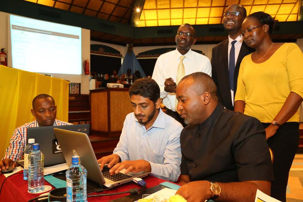
1 Department of Lands Planning and Housing Development Plan of Mombasa City County
2 Mombasa Gate City Profile Location and Linkages Located between the latitudes 3 80 and 4 10 S and longitudes and E. Second largest city in Kenya Connected with other regions by road, rail, water and air. A major port and an international airport Approximately to Nairobi about 483.0km via road (A109) Approximate to Dar-es-salaam - about km, 7-8 hours via road (A14) Mombasa County is a port city that serves countries like Uganda, Rwanda, Burundi, Southern Sudan, Eastern DRC, Northern Tanzania, Ethiopia and Somalia, etc. A well connected port to other parts of the region, with over 33 shipping lines and provides direct connectivity to over 80 ports.

3 Regional Road Connectivity of Mombasa


4 Regional & National settings of Mombasa City Location and Linkages Location Map Mombasa


5 Connectivity by Different Modes Mombasa-Nairobi Railway Line Malindi Road B-8 Nairobi Road A-109 Moi International Airport Mombasa Port Mombasa Ferry service Ukunda-Likoni Road A- 14
6 County Government Administrative & Political units Mombasa County is divided into six sub-counties Constituency/ Sub-County No. of Wards Name of Wards Land Area (km 2 ) Changamwe 5 Port Reitz, Kipevu, Airport, Miritini, Chaani Jomvu 3 Jomvu Kuu, Magongo, Mikindani Kisauni 7 Mjambere, Junda, Bamburi, Mwakirunge, Mtopanga, Magogoni, Shanzu Nyali 5 Frere Town, Ziwa La Ng'ombe, Mkomani, Kongowea, Kadzandani Likoni 5 Mtongwe, Shika Adabu, Bofu, Likoni, Timbwani Mvita 5 Mji wa Kale/ Makadara, Tudor, Tononoka and Shimanzi TOTAL

7 Sub County Administrative Units
8 Mombasa County Government Structure GOVERNOR County Assembly Deputy Governor County Speaker County Assembly Members County Executive Committee Members County Public Service Board County Assembly Committees County Assembly Secretariat CountyChiefSecretary,Headof County PublicServiceand Secretary tothecountyexecutive Committee County Public service Board Secretariat Finance and Economic Planning Agriculture, Livestock Development, veterinary services and Fisheries Water Environment and Natural Resources HealthSe rvices Education and Children Lands Planning and Housing Transport and Infrastructure Youth Gender and Sports Trade, Energy and Industry Tourism and culture development
9 POPULATION Population Projection Population Year High Medium Low , , , ,199,874 1,155,891 1,154, ,476,718 1,373,991 1,302, ,861,471 1,633,244 1,447, ,440,223 1,941,413 1,599, ,150,995 2,307,729 1,757,572 Source: Generated by Consultants
10 VISION VIBRANT MODERN REGIONAL COMMERCIAL HUB WITH A HIGH STANDARD OF LIVING FOR ITS RESIDENTS OPPORTUNITIES STRATEGIC LOCATION/POSITION Gate way to the Far East and Europe Gate way to East Africa and the Great Lakes Region Gate way to the rest of Kenya Rich cultural heritage Conducive weather Fine beaches Indian ocean
11 Mombasa Gateway City Master Plan & Northern Corridor Master Plan Along range plan Prepared in conjunction with JICA To consolidated all the development efforts of the county Government including the SEZ and the port development and its expansion Ensure harmonious development including the vision 2030 projects
12

13 Initiatives to realize the SEZ Modernizing and expansion of Mombasa port to a World class free port

14 Construction of Dongo Kundu bypass Development of the and the Northern by-pass

15 Modernising of transport infrastructure
16

17 Reconstruction of water drainage
18

19 Embracing digital platform in doing business (e-construction permit system)
20

21 Skills development Under the DFID KUZA Program over 8,000 youth will have been trained on entrepreneurship and job market and skills training in the next three years. Training of 3,000 youth already completed EMPOWERING YOUTH

22 Enhancing security

23 Improved Business Climate
24 Possible areas of investment Tourism Infrastructure development through PPP Industrial Special Economic Zone Housing development

25 ENERGY

26 Roads construction Transportation

27 Commerce and Trade
28
29 Housing development
30

31
32 Thank you very much for listening Karibuni Mombasa
Project for Formulation of Comprehensive Development Master Plan in the Mombasa Gate City in Republic of Kenya
 Project for Formulation of Comprehensive Development Master Plan in the Mombasa Gate City in Republic of Kenya WG: Land Use (Development Vision, Structure Plan) January 18, 2016 JICA Expert Team Working
Accelerating Infrastructure Capacity Development. JICA Ethiopia Office April 28, 2015 Addis Ababa
 Accelerating Infrastructure Capacity Development JICA Ethiopia Office April 28, 2015 Addis Ababa 2 Japan s basic policy of assistance for Africa Boost the growth of Africa through trade and investment
Dar es Salaam - Reality Check Workshop
 Dar es Salaam - Reality Check Workshop hosted by GIZ and Dar es Salaam City Council Introduction: Key Urban Characteristics of Dar es Salaam Challenges and Opportunities for Resilient Development in the
COUNTY SPATIAL DATA INFRASTRUCTURE PRESENTATION: BY: GEOFREY CHERUIYOT NAIROBI CITY COUNTY
 . COUNTY SPATIAL DATA INFRASTRUCTURE PRESENTATION: BY: GEOFREY CHERUIYOT NAIROBI CITY COUNTY FRAMEWORK FOR AN INTEGRATED SPATIAL DATA INFRASTRUCTURE County GIS GIS : A computer based information system
The National Spatial Strategy
 Purpose of this Consultation Paper This paper seeks the views of a wide range of bodies, interests and members of the public on the issues which the National Spatial Strategy should address. These views
September 2016 No. ICPAC/02/293 Bulletin Issue October 2016 Issue Number: ICPAC/02/294 IGAD Climate Prediction and Applications Centre Monthly Bulleti
 Bulletin Issue October 2016 Issue Number: ICPAC/02/294 IGAD Climate Prediction and Applications Centre Monthly Bulletin, For referencing within this bulletin, the Greater Horn of Africa (GHA) is generally
Declaration Population and culture
 Declaration Population and culture The ministers of the parties to the Alpine Convention regard the socio-economic and socio-cultural aspects mentioned in Article 2, Paragraph 2, Item a., as being central
I C P A C. IGAD Climate Prediction and Applications Centre Monthly Climate Bulletin, Climate Review for March 2018
 No. ICPAC/02/311 Bulletin Issue April 2018 I C P A C IGAD Climate Prediction and Applications Centre Monthly Climate Bulletin, Climate Review for March 2018 1. INTRODUCTION This bulletin reviews the March
Cambridge International Examinations Cambridge International General Certificate of Secondary Education
 Cambridge International Examinations Cambridge International General Certificate of Secondary Education *6550524820* GEOGRAPHY 0460/22 Paper 2 May/June 2018 Candidates answer on the Question Paper. Additional
Statement. H.E Dr. Richard Nduhuura Permanent Representative of the Republic of Uganda to the United Nations New York
 Page1 UGANDA Permanent Mission of Uganda To the United Nations New York Tel : (212) 949 0110 Fax : (212) 687-4517 Statement By H.E Dr. Richard Nduhuura Permanent Representative of the Republic of Uganda
GEOGRAPHY POLICY STATEMENT. The study of geography helps our pupils to make sense of the world around them.
 GEOGRAPHY POLICY STATEMENT We believe that the study of geography is concerned with people, place, space and the environment and explores the relationships between the earth and its peoples. The study
IGAD Climate Prediction and and Applications Centre Monthly Bulletin, August May 2015
 . IGAD Climate Prediction and and Applications Centre Monthly Bulletin, August May 2015 For referencing within this bulletin, the Greater Horn of Africa (GHA) is generally subdivided into three sub-regions:
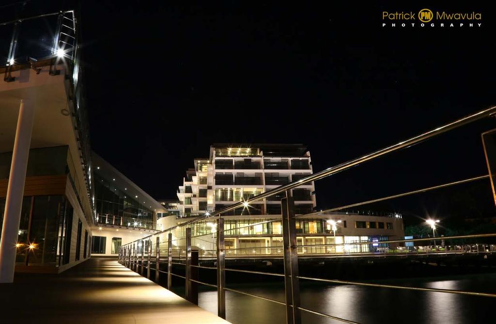
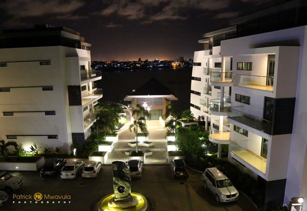
Mombasa raha Mombasa twaja
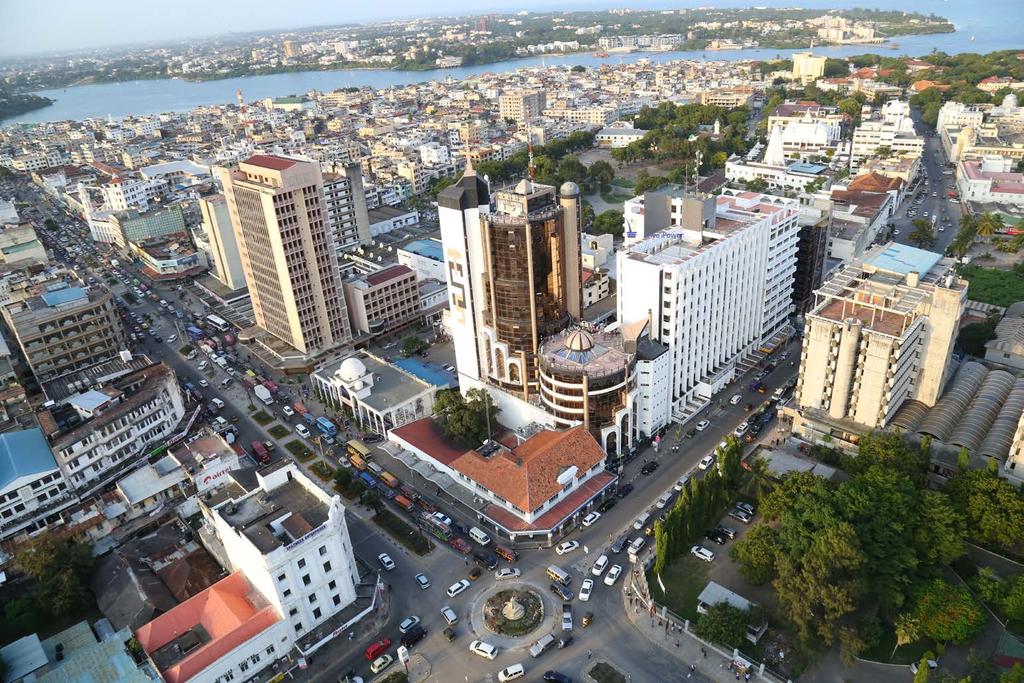
 Mombasa raha Mombasa twaja Mombasa, the second largest city and the smallest county in Kenya, is situated on Kenya's eastern coastline bordering the Indian Ocean. The history of the city is a mixture of
IGAD Climate Prediction and Applications Centre Monthly Bulletin, August 2014
 IGAD Climate Prediction and Applications Centre Monthly Bulletin, 1. HIGHLIGHTS/ ACTUALITES Rainfall activities were mainly observed over the central parts of the northern sector and western parts of equatorial
New National Curriculum Geography Skills Planning KS1
 New National Curriculum Geography Skills Planning KS1 Enquiry Question Objective-essential knowledge skills or understanding Locational Knowledge Standards /Success Criteria Lesson progression over half
Integrated Infrastructure Planning & Spatial Mapping
 Integrated Infrastructure Planning & Spatial Mapping Presenter: Heidi Dixon, Principal Social Planner, DTPLI 23 May 2014 PART 1 PLAN MELBOURNE : Metropolitan Planning Strategy PART 2 Case Study: DTPLI
Map Skills Test. 1. What do we call a person who makes maps? a. mapographer b. cartographer c. geologist d. archaeologist
 Map Skills Test 1. What do we call a person who makes maps? a. mapographer b. cartographer c. geologist d. archaeologist 2. What is the name of the 0 latitude line? a. Equator b. Arctic Circle c. First
Geography Policy 2014
 Geography Policy 2014 DEFINITION Geography education should inspire in pupils a curiosity and fascination about the world and its people that will remain with them for the rest of their lives. Teaching
I C P A C. IGAD Climate Prediction and Applications Centre Monthly Climate Bulletin, Climate Review for April 2018
 No. ICPAC/02/312 Bulletin Issue May 2018 I C P A C IGAD Climate Prediction and Applications Centre Monthly Climate Bulletin, Climate Review for April 2018 1. INTRODUCTION This bulletin reviews the April
Future Visions and Urban Development in Dar es Salaam
 Future Visions and Urban Development in Dar es Salaam There is a building boom in Dar es Salaam. Some of the new skyscrapers include hotels and offices. But most of the space is flats, for example in these
The international patterns of spatial planning system and choice of China. Cai yumei China land use planning and surveying institute (China, beijing)
") FIG Working Week, Rome, Italy 6 10 May 2012 The international patterns of spatial system and choice of China Cai yumei China land use and surveying institute (China, beijing) Outline Background Problem
FIG Working Week, Rome, Italy 6 10 May 2012 The international patterns of spatial system and choice of China Cai yumei China land use and surveying institute (China, beijing) Outline Background Problem
Land Use / Land Cover Mapping in
 Land Use / Land Cover Mapping in Eastern and Southern African Regions RCMRD Experience by 6/24/2013, Nairobi Kenya Dr. Tesfaye Korme Director of RS, GIS and Mapping, RCMRD I. About RCMRD, Its Vision and
Land Use in the context of sustainable, smart and inclusive growth
 Land Use in the context of sustainable, smart and inclusive growth François Salgé Ministry of sustainable development France facilitator EUROGI vice president AFIGéO board member 1 Introduction e-content+
Chapter 1 Data Collection
 Chapter 1 Data Collection 1. Climate of Brunei Darussalam and Temburong District Situated at around four degrees north of the Equator, Brunei Darussalam enjoys an equatorial climate with an abundance of
Excel Geomatics. Rajesh Paul Excel Geomatics Pvt. Ltd., Noida February, 2015 India Geospatial Forum, Hyderabad
 Excel Geomatics Geo-marketing for Product Sales and Customer Services Rajesh Paul Excel Geomatics Pvt. Ltd., Noida 10-12 February, 2015 India Geospatial Forum, Hyderabad Presentation Outline About Excel
Name three countries in Europe.
 Name three countries in Europe. I will be able to identify the 5 themes of geography for Europe and locate the countries and capitals of Europe and the major physical features. People: Past: Through the
Promoting synergy between airports and cities to achieve sustainable development
 Promoting synergy between airports and cities to achieve sustainable development Content 1. Airports / Aviation 2. Urbanization 3. Shared Threads & Opportunities 4. Synergistic Development for Sustainability
I C P A C IGAD Climate Prediction & Applications centre
 s` I C P A C IGAD Climate Prediction & Applications centre Bulletin Issue July 2017 Issue Number: ICPAC/02/303 IGAD Climate Prediction and Applications Centre Monthly Climate Bulletin, June 2017 1. INTRODUCTION
Geography Long Term Plan 2018
 Geography Long Term Plan 2018 Geography Co-ordinator: Megan Frost A high-quality geography education should inspire in pupils a curiosity and fascination about the world and its people that will remain
10-18 February February - 6 April March March - 7 April March 2012
 Training courses under Regional Frameworks during 2011- Training courses Duration Organizers Deadline for application Ayeyawady-Chao Phraya-Mekong Economic Cooperation Strategy (ACMECS) Industrial Policy
Ireland 2040 Our Plan. National Planning Framework
 Ireland 2040 Our Plan National Planning Framework Submission on behalf of Waterford City and County Council Waterford City SE Regional Economic Driver (2040) 1 INTRODUCTION The National Planning Framework
Local Area Key Issues Paper No. 13: Southern Hinterland townships growth opportunities
 Draft Sunshine Coast Planning Scheme Review of Submissions Local Area Key Issues Paper No. 13: Southern Hinterland townships growth opportunities Key Issue: Growth opportunities for Southern Hinterland
Experiences of public-private partnerships in the Euromediterranean relations and in the Po Valley, promoting a more balanced European territory
 Experiences of public-private partnerships in the Euromediterranean relations and in the Po Valley, promoting a more balanced European territory Claudio Tolomelli PolyMetrexPlus project s objectives To
THE ROLE OF SEAMIC IN SUSTAINABLE MINERAL RESOURCES DEVELOPMENT IN AFRICA
 THE ROLE OF SEAMIC IN SUSTAINABLE MINERAL RESOURCES DEVELOPMENT IN AFRICA Ketema Tadesse Director General-SEAMIC Dar es Salaam, Tanzania August 11, 2009 SEAMIC BACKGROUND SEAMIC was established in 1977
Multi-level spatial planning in a cross border context
 Significant Experience No. 7 Multi-level spatial planning in a cross border context Brendan Murtagh School of Environmental Planning Queen s University Belfast 1. Context In many respects the essence of
Together towards a Sustainable Urban Agenda
 Together towards a Sustainable Urban Agenda The City We (Youth) Want Preliminary findings from youth consultations Areas Issue Papers Policy Units 1.Social Cohesion and Equity - Livable Cities 2.Urban
Complete Geography Overview: Year 1 to Year 6
 Option 1 Complete Geography Overview: Year 1 to Year 6 Autumn Term Spring Term Summer Term Year 1 Where do I live? Around the World The Four Seasons Year 2 At the Farm Let s go on Safari My World and Me
Tuition, Medical and Behaviour Support Service
 Tuition, Medical and Behaviour Support Service Curriculum Policy - Primary Geography Reviewed: October 2018 Next Review: October 2019 Responsibility: Andrea Snow AIMS AND PRINCIPLES The national curriculum
A century of experience: Training and knowledge transfer in Africa 30 years of activities: Past, present and future
 Royal Museum for central Africa A century of experience:1898-2012 Training and knowledge transfer in Africa 30 years of activities: Past, present and future Earth Sciences Field Geology Geodynamics Major
I C P A C. IGAD Climate Prediction and Applications Centre Monthly Climate Bulletin, Climate Review for September 2017
 Bulletin Issue October 2017 I C P A C IGAD Climate Prediction and Applications Centre Monthly Climate Bulletin, Climate Review for September 2017 1. INTRODUCTION This bulletin reviews the September 2017
METEOROLOGICAL SERVICE DELIVERY Mozambique Model
 METEOROLOGICAL SERVICE DELIVERY Mozambique Model MOZAMBIQUE INSTITUTE OF METEOROLOGY (INAM) João Atanasio Manhique National Deputy Director atanasio_m@inam.gov.mz http://www.inam.gov.mz Workshop: Achieving
MOMBASA COUNTY PRIORITY BUSINESS AGENDA
 MOMBASA COUNTY PRIORITY BUSINESS AGENDA An Advocacy Tool for the Mombasa County Business Coalition Creating Economic Prosperity for Investors in a Pleasurable Regional Destination Mombasa Business Coalition
Geography Skills Progression Key Stage 2
 Year 3 Year 4 Year 5 Year 6 Expectations at end of key stage Location knowledge the countries of Europe? countries in Europe, environmental regions? countries in Europe, key physical and human characteristics?
SOCIO-ECONOMIC IMPACTS OF FLOODING IN DIRE DAWA, ETHIOPIA
 SOCIO-ECONOMIC IMPACTS OF FLOODING IN DIRE DAWA, ETHIOPIA Alemu Yonas Tadesse * Supervisor: Prof. A.W. Jayawardena ** MEE08182 ABSTRACT Dire Dawa, the second largest city of Ethiopia, has been suffering
Geography Route Planner
 Geography Route Planner Introduction to Route Planners Route Planners outline the Key Stages 1-3 curriculum to be taught within each campus of the Bury St Edmunds Trust. Each Route Planner has been designed
Joint Planning Advisory Council July 19, 2011
 Joint Planning Advisory Council July 19, 2011 Global Cities Program Objectives Helping advance strategic thinking in a variety of critical areas. Facilitating informed decisionmaking on the part of public
The importance of visioning in urban strategic planning By Peter Robinson. MILE Master Class Urban Strategic Planning March 2016
 The importance of visioning in urban strategic planning By Peter Robinson MILE Master Class Urban Strategic Planning March 2016 Typical strategic planning process Where are we now? Where are we going?
ICPAC. IGAD Climate Prediction and Applications Centre Monthly Bulletin, May 2017
 s` ICPAC Bulletin Issue June 2017 Issue Number: ICPAC/02/302 IGAD Climate Prediction and Applications Centre Monthly Bulletin, May 2017 For referencing within this bulletin, the Greater Horn of Africa
Size matters: issues and challenges of local development with a special focus on small and medium sized towns in Czechia
 Size matters: issues and challenges of local development with a special focus on small and medium sized towns in Czechia Luděk Sýkora Charles University, Faculty of Science Dept. of Social Geography and
Proposed AKS for 6 th Grade Social Studies
 Proposed AKS for 6 th Grade Social Studies A. Map and Globe Skills 1. use cardinal directions 2. use intermediate directions 3. use a letter/number grid system to determine location 4. compare and contrast
The CRP stresses a number of factors that point to both our changing demographics and our future opportunities with recommendations for:
 Plan Overview The CRP represents the first broad planning initiative covering Lake, Porter and LaPorte counties. Unlike previous plans released by NIRPC, which focused primarily on transportation, the
National Planning Framework Louth County Council Submission
 National Planning Framework 2040 Louth County Council Submission 10 th November 2017 2 Louth County Council Introduction The primacy of the Dublin / Belfast corridor in the urban network on the island
THE KWAZULU-NATAL SPATIAL ECONOMIC DEVELOPMENT STRATEGY (PSEDS):
:") THE KWAZULU-NATAL SPATIAL ECONOMIC DEVELOPMENT STRATEGY (PSEDS): PROMOTING URBAN AND RURAL LINKAGES IN THE BEST INTEREST OF RURAL AND URBAN DEVELOPMENT By Frikkie Brooks General Manager: Municipal Planning
THE KWAZULU-NATAL SPATIAL ECONOMIC DEVELOPMENT STRATEGY (PSEDS): PROMOTING URBAN AND RURAL LINKAGES IN THE BEST INTEREST OF RURAL AND URBAN DEVELOPMENT By Frikkie Brooks General Manager: Municipal Planning
Complexity in Spatial Planning Practice and Theory The Kiruna Case
 Complexity in Spatial Planning Practice and Theory The Kiruna Case Kristina L Nilsson Architect ass. Prof. in Spatial Planning Department of Urban and Rural development Swedish University of Agricultural
CHAPTER 2. Strategic Context
 CHAPTER 2 Strategic Aim: To facilitate the future development of Cork as a national gateway city within the integrated land use and transportation framework set out in the Cork Area Strategic Plan 2001
NATIONAL CURRICULUM GEOGRAPHY PLANNING OVERVIEW
 GEOGRAPHY AUTUMN TERM SPRING TERM SUMMER TERM Year 1 Hunting and Hiding Me and My Wonderful World Beside The Sea identify seasonal and daily weather patterns in the United Kingdom and the location of hot
Making maps: Traditions and perceptions in Europe. European spatial planning and cartographic representations
 ESPON Create Europe! Making maps: Traditions and perceptions in Europe Dr. Stefanie Dühr University of the West of England, Bristol, UK European spatial planning and cartographic representations Scenarios.
November 29, World Urban Forum 6. Prosperity of Cities: Balancing Ecology, Economy and Equity. Concept Note
 November 29, 2010 World Urban Forum 6 Prosperity of Cities: Balancing Ecology, Economy and Equity Concept Note 1 CONTENT Thematic Continuity Conceptualizing the Theme The 6 Domains of Prosperity The WUF
Written Response Test
 12 th International Geography Olympiad Tver, Russia 11 17 August 2015 Written Response Test Question and Answer Booklet Do NOT open the Booklet before instructed to do so by a supervisor. Name:... Team:...
Botswana National Spatial Plan Botsreal Property Forum- 30 May, 2018
 Botswana National Spatial Plan 2036 Botsreal Property Forum- 30 May, 2018 What is the National Spatial Plan? A framework and process for planning that is: National (to guide national development policies,
GEOGRAPHY POLICY. Date: March Signed: Review: March 2019
 GEOGRAPHY POLICY Date: March 2018 Signed: Review: March 2019 Aims At Hayton C of E Primary School we believe that Geography is an essential part of the curriculum and teachers ensure that the children
St Joseph s R.C. Primary School. Policy for Geography
 St Joseph s R.C. Primary School Policy for Geography 2016-2017 This policy is written with consideration to our school commitment to the Rights of the Child and our achievement of becoming a Rights Respecting
DRAFT PROGRAM Registration of participants, welcome coffee, exhibition tour
 DRAFT PROGRAM 20 Feb 2018 09.00-10.00 Registration of participants, welcome coffee, exhibition tour 10.00 12.00 ROUND TABLE: INTERNATIONAL COOPERATION IN THE ARCTIC PROJECTS: CHALLENGES AND OPPORTUNITIES
The ESPON Programme. Goals Main Results Future
 The ESPON Programme Goals Main Results Future Structure 1. Goals Objectives and expectations Participation, organisation and networking Themes addressed in the applied research undertaken in ESPON projects
St John s Catholic Primary School. Geography Policy. Mission Statement
 St John s Catholic Primary School Geography Policy Mission Statement We at St John s strive for excellence in education by providing a safe, secure and caring family environment where individuals are valued
Map Of Eastern Hemisphere Labeled
 Map Of Eastern Hemisphere Labeled When somebody should go to the books stores, search instigation by shop, shelf by shelf, it is in reality problematic. This is why we give the book compilations in this
Impressive Growth & Relaxed Elegance.
 Impressive Growth & Relaxed Elegance www.culpeperva.org About Culpeper Nestled between Charlottesville and the District of Columbia, Culpeper is a hub of commerce and culture proud to be home to a broad
a division of Teacher Created Materials
 Sample Pages from a division of Teacher Created Materials Thanks for checking us out. Please call us at 877-777-3450 with questions or feedback, or to order this product. You can also order this product
This table connects the content provided by Education Perfect to the NSW Syllabus.
 Education Perfect Geography provides teachers with a wide range of quality, engaging and innovative content to drive positive student learning outcomes. Designed by teachers and written by our in-house
Background and History
 p1 Background and History What is the Indian Ocean Climate Initiative? The Indian Ocean Climate Initiative (IOCI) is a strategic program of research and information transfer to support government decision-making.
LOUISIANA STUDENT STANDARDS FOR SOCIAL STUDIES THAT CORRELATE WITH A FIELD TRIP TO DESTREHAN PLANTATION KINDERGARTEN
 LOUISIANA STUDENT STANDARDS FOR SOCIAL STUDIES THAT CORRELATE WITH A FIELD TRIP TO DESTREHAN PLANTATION KINDERGARTEN Standard 2 Historical Thinking Skills Students distinguish between events, people, and
Chapter 10 Human Settlement Geography Book 1 Class 12
 CHAPTER 10 HUMAN SETTLEMENTS 1. RURAL, SUB URBAN AND URBAN SETTLEMENTS: This classification is common worldwide but the criteria differ from country to country. 5. Criteria for classification differs from
ST AMBROSE CATHOLIC PRIMARY SCHOOL Geography Policy
 ST AMBROSE CATHOLIC PRIMARY SCHOOL Geography Policy 2017-2018 Our school policy is developed in accordance with the National Curriculum for Geography and Foundation Stage Curriculum for Understanding of
GROUNDWATER OCCURRENCE IN KENYA
 GROUNDWATER OCCURRENCE IN KENYA Steven Okoth Owuor Ministry of Water and Sanitation Sunday, January 20, 2019 1 Geography INTRODUCTION The Republic of Kenya is located in East Africa The total area of the
Dublin City Schools Social Studies Graded Course of Study Grade 5 K-12 Social Studies Vision
 K-12 Social Studies Vision The Dublin City Schools K-12 Social Studies Education will provide many learning opportunities that will help students to: develop thinking as educated citizens who seek to understand
R. Cons. Eng. Simon Mwangi REGISTERED CONSULTING ENGINEER
 R. Cons. Eng. Simon Mwangi REGISTERED CONSULTING ENGINEER eng.simon.mwangi@gmail.com Vision 2030 Statement is a national long-term development blue-print to create a globally competitive and prosperous
National Spatial Development Perspective (NSDP) Policy Coordination and Advisory Service
 Policy Coordination and Advisory Service") National Spatial Development Perspective (NSDP) Policy Coordination and Advisory Service 1 BACKGROUND The advances made in the First Decade by far supersede the weaknesses. Yet, if all indicators were
National Spatial Development Perspective (NSDP) Policy Coordination and Advisory Service 1 BACKGROUND The advances made in the First Decade by far supersede the weaknesses. Yet, if all indicators were
DROUGHT INDICES BEING USED FOR THE GREATER HORN OF AFRICA (GHA)
") DROUGHT INDICES BEING USED FOR THE GREATER HORN OF AFRICA (GHA) Christopher Oludhe IGAD Climate Prediction and Applications Centre (ICPAC) Inter-Regional Workshop on Indices and Early Warning Systems for
DROUGHT INDICES BEING USED FOR THE GREATER HORN OF AFRICA (GHA) Christopher Oludhe IGAD Climate Prediction and Applications Centre (ICPAC) Inter-Regional Workshop on Indices and Early Warning Systems for
6 th GLOBAL SUMMIT ON URBAN TOURISM 4 6 December 2017, Kuala Lumpur (Malaysia)
") 6 th GLOBAL SUMMIT ON URBAN TOURISM 4 6 December 2017, Kuala Lumpur (Malaysia) SUMMARY/CONCLUSIONS Esencan TERZIBASOGLU Director Destination Management and Quality eterzibasoglu@unwto.org 6TH GLOBAL SUMMIT
6 th GLOBAL SUMMIT ON URBAN TOURISM 4 6 December 2017, Kuala Lumpur (Malaysia) SUMMARY/CONCLUSIONS Esencan TERZIBASOGLU Director Destination Management and Quality eterzibasoglu@unwto.org 6TH GLOBAL SUMMIT
About places and/or important events Landmarks Maps How the land is, hills or flat or mountain range Connected to maps World Different countries
 What do you think you know about geography? About places and/or important events Landmarks Maps How the land is, hills or flat or mountain range Connected to maps World Different countries What do you
MEADOWS PRIMARY SCHOOL and NURSERY GEOGRAPHY POLICY
 MEADOWS PRIMARY SCHOOL and NURSERY GEOGRAPHY POLICY Purpose of study The teaching of Geography at Meadows is done by following the 2014 National Curriculum. The planning and teaching of the subject aims
GEOGRAPHY PAPER 312/ 1 K.C.S.E 1997 SECTION A Answer all the questions in this section.
 GEOGRAPHY PAPER 312/ 1 K.C.S.E 1997 SECTION A Answer all the questions in this section. 1. The diagram below shows the structure of the earth. Name the parts marked p, q and R Name the minerals that make
DEPARTMENT OF GEOGRAPHY B.A. PROGRAMME COURSE DESCRIPTION
 DEPARTMENT OF GEOGRAPHY B.A. PROGRAMME COURSE DESCRIPTION (3 Cr. Hrs) (2340100) Geography of Jordan (University Requirement) This Course pursues the following objectives: - The study the physical geographical
Why Geography Matters
 Why Geography Matters Vocabulary words geography relative location absolute location physical feature human feature region modify adapt cause effect geography: The study of the Earth s physical and human
THE ROLE OF REGIONAL SPATIAL PLANNING IN SUPPORTING LONG-TERM ECONOMIC GROWTH IN NORTHERN IRELAND
 THE ROLE OF REGIONAL SPATIAL PLANNING IN SUPPORTING LONG-TERM ECONOMIC GROWTH IN NORTHERN IRELAND Jenny Pyper Director 6 th Annual ICLRD Conference 20 January 2011 PURPOSE OF REGIONAL PLANNING Framework
Geography Long Term Plan. Autumn Spring Summer
 Geography Long Term Plan Autumn Spring Summer Year 1 Working Scientifically covered throughout the year Location Geography of UK Name, locate and identify characteristics of the four countries and capital
State initiative following up the 2006 national planning report
 18 ness districts and public institutions, should be integrated with the opportunities for public transport services. State initiative following up the 2006 national planning report The Ministry of the
Geography Progression
 Geography Progression This document aims to track expectations for History within George Grenville Academy. What the National Curriculum says: KS1: Locational Knowledge: Name and locate the world s 7 continents
UN-GGIM: Strengthening Geospatial Capability
 Fifth Plenary Meeting of UN-GGIM: Europe Brussels, 6-7 June 2018 UN-GGIM: Strengthening Geospatial Capability Walking the talk to leave no one behind Greg Scott, UN-GGIM Secretariat Environmental Statistics
CHAPTER 4 HIGH LEVEL SPATIAL DEVELOPMENT FRAMEWORK (SDF) Page 95
 Page 95") CHAPTER 4 HIGH LEVEL SPATIAL DEVELOPMENT FRAMEWORK (SDF) Page 95 CHAPTER 4 HIGH LEVEL SPATIAL DEVELOPMENT FRAMEWORK 4.1 INTRODUCTION This chapter provides a high level overview of George Municipality s
CHAPTER 4 HIGH LEVEL SPATIAL DEVELOPMENT FRAMEWORK (SDF) Page 95 CHAPTER 4 HIGH LEVEL SPATIAL DEVELOPMENT FRAMEWORK 4.1 INTRODUCTION This chapter provides a high level overview of George Municipality s
The Development of Trade Transit Corridors in Africa s Landlocked Countries
 The Development of Trade Transit Corridors in Africa s Landlocked Countries I. Introduction Africa has 15 landlocked countries that face specific challenges. Botswana, Burkina Faso, Burundi, Chad, Central
Geography. Programmes of study for Key Stages 1-3
 Geography Programmes of study for Key Stages 1-3 February 2013 Contents Purpose of study 3 Aims 3 Attainment targets 3 Subject content 4 Key Stage 1 4 Key Stage 2 5 Key Stage 3 6 2 Purpose of study A high-quality
The Governance of Land Use
 The planning system Levels of government and their responsibilities The Governance of Land Use COUNTRY FACT SHEET NORWAY Norway is a unitary state with three levels of government; the national level, 19
Charles Magori. Status Report of GLOSS Tide Gauges in Kenya
 GLOSS Group of Experts Meeting February 2005 Charles Magori Introduction Status Report of GLOSS Tide Gauges in Kenya There is growing concern about the rise in mean sea level around the globe. To address
Range of Opportunities
 Geograhy Curriculum Cropwell Bishop Primary School Range of Opportunities Year 1 Year 2 Year 3 Year 4 Year 5 Year 6 All Key Stage 1 Key Stage 2 Investigate the countries and capitals of the United Kingdom.
Research on Tourism as a Tool for Poverty Reduction (Pro-Poor Tourism)
") Research on Tourism as a Tool for Poverty Reduction (Pro-Poor Tourism) Dr Dorothea Meyer Centre for International Tourism Research (CITouR) Sheffield Hallam University d.meyer@shu.ac.uk Structure Research
Research on Tourism as a Tool for Poverty Reduction (Pro-Poor Tourism) Dr Dorothea Meyer Centre for International Tourism Research (CITouR) Sheffield Hallam University d.meyer@shu.ac.uk Structure Research
ATPC ATPC. No. 10. African Trade Policy Centre. Briefing. I. Introduction. The Development of Trade Transit Corridors in Africa s Landlocked Countries
 September 2010 ATPC ATPC Briefing No. 10 African Trade Policy Centre The Development of Trade Transit Corridors in Africa s Landlocked Countries Economic Commission for Africa I. Introduction Africa has
MAPPING DATA AND INFORMATION SYSTEMS AVAILABILITY AGAINST THE SDGs
 MAPPING DATA AND INFORMATION SYSTEMS AVAILABILITY AGAINST THE SDGs Imelda Atai Musana Uganda Bureau of Statistics imelda.atai@ubos.org Date: November 2015 1 Introduction Uganda Lies Astride the Equator
High speed network in Hauts-de-France Region. Värnamo, 17 th May 2018
 High speed network in Hauts-de-France Region Värnamo, 17 th May 2018 Hauts-de-France at the crossroads of the North-West Europe High speed train approach in France In the 1980s: will to link the main cities
Social Studies Grade 2 - Building a Society
 Social Studies Grade 2 - Building a Society Description The second grade curriculum provides students with a broad view of the political units around them, specifically their town, state, and country.