Carsten Brockmann, Ana Ruescas, Simon Pinnock CoastColour Team: BC D, HZG D, PML UK, RBINS B, LISE F, FCUL P COASTCOLOUR SPOT 4 TAKE 5
|
|
|
- Bridget Rogers
- 5 years ago
- Views:
Transcription


1 Carsten Brockmann, Ana Ruescas, Simon Pinnock CoastColour Team: BC D, HZG D, PML UK, RBINS B, LISE F, FCUL P COASTCOLOUR SPOT 4 TAKE 5
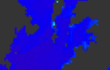
2 CoastColour CoastColour is providing ocean colour products for coastal areas with optimised algorithms for coastal waters Water leaving reflectances Turbidity indicators Inherent optical properties Concentrations of chlorophyll and suspended matter User require these data for Coastal monitoring Marine spatial planning Biological studies Driver for CoastColour Requirement for high spatial resolution (better than 1km and ideally 100m) Exploitation of MERIS FR data Spectral characteristics optimised for coastal applications Spatial resolution of 300m Demonstrating benefit of higher spatial resolution (SPOT4 TAKE5)

 CoastColour v2 Merged NN & OC4 in-water")

3 Products CoastColour v1 MERIS FR globally distributed sites QAA and NN based Water Quality products OWT classification Available May 2013 (ftp) CoastColour v2 Merged NN & OC4 in-water algorithm MERIS FR & RR TB input data Complete global coverage On-demand processing Online since

4 On-Demand Processing


5 Preparing for S2 SPOT4 TAKE5 Chesapeak Bay Korean Coast


6 High Resolution Study Sites Chesapeak Bay Optically complex waters 3 different regimes within the bay Eutrophic, mesotrophic, oceanic Cooperation with NASA US standard coastal site Long time series Korean Coast Highly turbid water Dry fallen intertidal flats Important coastal areas Fishing vs Environmental protection Cooperation with KORDI GOCI Geostationaly Ocean Colour Imager
7 High Resolution Study Demonstrating the potential of spatial high resolution EO data for coastal ocean colour applications Preparing for Sentinel 2 Spatial resolution 100m or better Spectral characteristics of Sentinel 2: not a dedicated ocean colour instrument but spectral bands have the potential to provide good turbidity, TSM and possibly roughly Chl retrievals. This includes bands for marine atmospheric correction SPOT 4 TAKE 5 Data SPOT 4 Sentinel 2 orbit, but less favourable spectral bands Rapid Eye complementing the SPOT dataset Landsat 8 closer to Sentinel 2 spectral bands Approach and Challenges (Rough) Atmospheric correction Single band TSM algorithm Intercalibration with MODIS

 IOPs")
8 Sentinel 2 Spectral and Radiometric Characteristics IOPs IOPs AC SPOT4 AC (very turbid waters) IOPs Cloud/Snow/Ice Screening

9 SPOT 4 Take 5 REFLECTANCES

10 Approach
11 Landsat and CC-turbidity
12 TSM METHODOLOGY Approach developed by Nechad et al to XS2 ( nm) S= AApp pp ww + BB pp SPOT-TSM= XXXXX 1 ppww 1 XXXXX CC pp Comparison of SPOT-TSM (x) and the MODIS TSM (y) in bands 645, 667 and 678 nm (blue, red and green respectively) on
13 SPOT-MODIS PAIRS Chesapeake Conditions Korea Conditions MODIS SPOT MODIS SPOT good good cloudy good moderate glint cloudy glint good glint cloudy glint


 2013-02-21 m)")

")
14 SPOT_RGB TSM SPOT-MODIS Chesapeake Bay SPOT_RGB SPOT_RGB SPOT_TSM_Nechad (20 m) SPOT_TSM_Nechad (20 m) SPOT_TSM_Nechad (20 m) MODIS_Nechad_678 (1 km) MODIS_Nechad_678 (1 km) MODIS_Nechad_678 (1km)
15 Benefits Demonstration of resolution of spatial pattern Simple TSM algorithm provides realistic estimates Sentinel 2 orbit and repetition rate provide improved temporal coverage In the framework of FP7 HighRoc project, Vanhellemont & Ruddick showed the potential to resolve the impact of a windpark on the local TSM field with Landsat-8 (shown on Monday)

 RBINS, J-P.")
![Vogt] [Vanhellemont & Ruddick K (2014).](/docs-images/88/117759259/images/16-2.jpg "Turbid wakes associated with offshore wind turbines observed with Landsat 8.")
16 S2 Offshore Application: Environmental Impact Assessment Environmental Impacts Assessment legal obligation for offshore wind farm construction LANDSA T-8 and S-2 high spatial resolution => new Environmental Impacts visible Sediment wakes in direction of tidal current [(c) RBINS, J-P. Vogt] [Vanhellemont & Ruddick K (2014). Turbid wakes associated with offshore wind turbines observed with Landsat 8. Remote Sensing of Environment, 145, pp Open Access]
17 ERRORS AND LIMITATIONS LIMITATIONS Lack of in situ data for comparison, calibration and validation activities Cloud cover High glint areas Viewing conditions SOURCES OF ERRORS Atmospheric correction related errors Adjacency effect not corrected Mixed pixels not flagged Bottom reflection Difference in viewing conditions (validation) Time differences (validation)
18 Towards Sentinel 2 Application of Landsat 8 for coastal studies FP7 HighRoc Project Valuable information products for coastal and inland waters Not a pre-cursor but 1 st sensor for a merged S2+L8 product Preprocessing needs improvement for spatial high resolution data Cloud screening, cloud shadow Sea Ice Development of a dedicated coastal water atmospheric correction for S2 CoastColour NN-AC adaption is currently under development and will be investigated Adjacency effect correction needs consolidation Study possibilities to resolve variability of global coastal water optical properties with S2 On-demand processing is a good option Offer all available input data Processing and storing of large data quantities only if needed Offer regional algorithms Coastal Thematic Exploitation Platform

19 On-Demand Processing
20 Acknowledgement We would like to acknowledge each one of the PIs contributing with valuable data to the CoastColour in-situ and Mermaid databases: G. Zibordi, J.Icely, J.F. Berthon, E. Canuti, D. Antoine, D. McKee, H. Klein, G. Mitchell, M. Kahru, S.B. Mustapha, S. Belanger, M. Ondrusek, G, Schuster, B. Holben, H. Loisel, R. Doerffer, A. Gilerson, S. Ahmed, V. bando, C. Belin, K, Voss, K.Hughes, K, Ruddick, H. Sosik, H. Feng, N. Nelson, A. Subramaniam, L.Harding, A.Mannino, R. Gould, R. Arnone, S.Hooker, W.Balch, R. Morrison, K.Carder, F. Muller-Karger, J. Werdell, D. Stramski, D. Siegel, G. Mitchell, Z. Lee, S. Kratzer, G. Tilstone, V. Brotas, P.Y. Deschamps, A. Hommersom, A. Weidemann, B. Gibson, as well as ACRI-ST, ARGANS and ESA for access to the MERMAID system (
Sentinel 2 Pre-processing Requirements for coastal and inland waters
 Sentinel 2 Pre-processing Requirements for coastal and inland waters K A I S Ø R E NSEN NIVA CARSTEN B R O CKMANN Ecological and chemical classification of water bodies in Norway Water quality - products
Splinter Session 8 System Vicarious Calibration International Ocean Couleur Science Meeting
 ESA/MERIS vicarious calibration Constant Mazeran 1, Christophe Lerebourg 1, Jean Paul Huot 2, David Antoine 3 1 ACRI ST, 2 ESA/ESTEC, 3 LOV CNRS UPMC Splinter Session 8 System Vicarious Calibration International
MERMAID: Chl and IOPs
 MERMAID: Chl and IOPs Kathryn Barker 1, C. Mazeran 2, C. Lerebourg 2 1 ARGANS Ltd, UK. 2 ACRI-ST, France MERMAID catalogue Chla and IOP definitions have been fixed; Other parameters also. MERMAID columns
Atmospheric correction in presence of sun glint: the POLYMER Algorithm
 Atmospheric correction in presence of sun glint: the POLYMER Algorithm Dominique Jolivet François Steinmetz Pierre-Yves Deschamps Jan 17, 2011 Atelier National Couleur de l'eau - GIS COOC c 2011 Atmospheric
C o p e r n i c u s f o r H i g h r e s o l u t i o n m a p p i n g o f w a t e r q u a l i t y. Copernicus EU
 C o p e r n i c u s f o r H i g h r e s o l u t i o n m a p p i n g o f w a t e r q u a l i t y Copernicus EU Copernicus EU Copernicus EU www.copernicus.eu M o n i t o r i n g o f s e a w a t e r s i n
C M E M S O c e a n C o l o u r S a t e l l i t e P r o d u c t s
 Implemented by C M E M S O c e a n C o l o u r S a t e l l i t e P r o d u c t s This slideshow gives an overview of the CMEMS Ocean Colour Satellite Products Marine LEVEL1 For Beginners- Slides have been
Report Benefits and Challenges of Geostationary Ocean Colour Remote Sensing - Science and Applications. Antonio Mannino & Maria Tzortziou
 Report Benefits and Challenges of Geostationary Ocean Colour Remote Sensing - Science and Applications Antonio Mannino & Maria Tzortziou Time & Space Scales of OC Relevant Missions GOCI I & II Geo from
Above water-protocols, Past and present. Kenneth Voss. 5/17/17, Advances in protocols for water-leaving radiance and related parameters
 Above water-protocols, Past and present Kenneth Voss 5/17/17, Advances in protocols for water-leaving radiance and related parameters Current NASA protocol The parameter I will focus on is the Remote sensing
Minutes of the First Meeting. of the IOCCG Working Group. L1 Requirements for Ocean-Colour Remote Sensing. April 20-21, 2010
 Minutes of the First Meeting of the IOCCG Working Group L1 Requirements for Ocean-Colour Remote Sensing April 20-21, 2010 Bethesda, Maryland (Washington, D.C.), USA Participants: - Charles R. McClain (chair,
EVOLUTION OF THE C2RCC NEURAL NETWORK FOR SENTINEL 2 AND 3 FOR THE RETRIEVAL OF OCEAN COLOUR PRODUCTS IN NORMAL AND EXTREME OPTICALLY COMPLEX WATERS
 EVOLUTION OF THE C2RCC NEURAL NETWORK FOR SENTINEL 2 AND 3 FOR THE RETRIEVAL OF OCEAN COLOUR PRODUCTS IN NORMAL AND EXTREME OPTICALLY COMPLEX WATERS Brockmann, Carsten (1), Doerffer, Roland (1), Peters,
A NEW CLIMATOLOGY OF SEA SURFACE WIND SPEED UNDER CLOUD FREE CONDITIONS FOR THE ESTIMATION OF THE IMPACT OF SUNGLINT IN GMES PHASE A SENTINEL 3
 A NEW CLIMATOLOGY OF SEA SURFACE WIND SPEED UNDER CLOUD FREE CONDITIONS FOR THE ESTIMATION OF THE IMPACT OF SUNGLINT IN GMES PHASE A SENTINEL 3 Mounir Lekouara 1, Bernardo Carnicero Dominguez 2 and Miguel
Impacts of Atmospheric Corrections on Algal Bloom Detection Techniques
 1 Impacts of Atmospheric Corrections on Algal Bloom Detection Techniques Ruhul Amin, Alex Gilerson, Jing Zhou, Barry Gross, Fred Moshary and Sam Ahmed Optical Remote Sensing Laboratory, the City College
Estimation of ocean contribution at the MODIS near-infrared wavelengths along the east coast of the U.S.: Two case studies
 GEOPHYSICAL RESEARCH LETTERS, VOL. 32, L13606, doi:10.1029/2005gl022917, 2005 Estimation of ocean contribution at the MODIS near-infrared wavelengths along the east coast of the U.S.: Two case studies
GEOG Lecture 8. Orbits, scale and trade-offs
 Environmental Remote Sensing GEOG 2021 Lecture 8 Orbits, scale and trade-offs Orbits revisit Orbits geostationary (36 000 km altitude) polar orbiting (200-1000 km altitude) Orbits revisit Orbits geostationary
Automated ocean color product validation for the Southern California Bight
 Automated ocean color product validation for the Southern California Bight Curtiss O. Davis a, Nicholas Tufillaro a, Burt Jones b, and Robert Arnone c a College of Earth, Ocean and Atmospheric Sciences,
Undergraduate Research Final Report: Estimation of suspended sediments using MODIS 250 m bands in Mayagüez Bay, Puerto Rico
 Undergraduate Research Final Report: Estimation of suspended sediments using MODIS 250 m bands in Mayagüez Bay, Puerto Rico Abstract: José F. Martínez Colón Undergraduate Research 2007 802-03-4097 Advisor:
5.5. Coastal and inland waters
 5.5. Coastal and inland waters 5. Atmospheric Correction SeaWiFS and MODIS Experiences Show: High quality ocean color products for the global open oceans (Case-1 waters). Significant efforts are needed
ESA/MERIS vicarious adjustment
 ESA/MERIS vicarious adjustment Constant Mazeran (ACRI-ST Consultant) Christophe Lerebourg (ACRI-ST), Jean-Paul-Huot (ESA) David Antoine (CNRS-LOV, France & Curtin University, Perth, Australia) Ocean Colour
Current Application of Vicarious Calibration for Geostationary Ocean Color Imager (GOCI) DATA
 DATA") Current Application of Vicarious Calibration for Geostationary Ocean Color Imager (GOCI) DATA On behalf of Jae-Hyun Ahn & Young-je Park, Seongick CHO(Secondment at Astrium SAS, France) Korea Ocean Satellite
Current Application of Vicarious Calibration for Geostationary Ocean Color Imager (GOCI) DATA On behalf of Jae-Hyun Ahn & Young-je Park, Seongick CHO(Secondment at Astrium SAS, France) Korea Ocean Satellite
ASSESSMENT OF THE UNCERTAINTY OF ATMOSPHERIC SCATTERING FUNCTIONS USED IN MERIS ATMOSPHERIC CORRECTION OVER WATER.
 ASSESSMENT OF THE UNCERTAINTY OF ATMOSPHERIC SCATTERING FUNCTIONS USED IN MERIS ATMOSPHERIC CORRECTION OVER WATER Francis Zagolski Motivations Ø Contribute to the MERIS validation of L2 optical parameters
MERIS Reprocessing Neural Net Algorithm. Roland Doerffer, Carsten Brockmann,
 MERIS Reprocessing Neural Net Algorithm Roland Doerffer, doerffer@gkss.de Carsten Brockmann, brockmann@brockmann-consult.de MERIS: Aufnahme der Helgoländer Bucht MERIS FR 16.4.2003 Helgoland Bight Section
Chlorophyll-a, Phycocyanin and Phytoplankton type products
 Chlorophyll-a, Phycocyanin and Phytoplankton type products Mariano Bresciani, Monica Pinardi, Claudia Giardino CNR IREA bresciani.m@irea.cnr.it Aims Implementation of algorithms dedicated to phytoplankton's
Bertrand Saulquin 1, François-Régis Martin Lauzer 1, Ludovic Bourg 1. ACRI-ST, all rights reserved 2017
 Alternative vicarious gain estimates for Sentinel-3 OLCI: Investigation of atmosphere-typed spectral optical thickness corrections for the processor vicarious calibration, from the open ocean to the shore
Ocean Colour Remote Sensing in Turbid Waters. Lecture 2: Introduction to computer exercise #1 The Colour of Water.
 Ocean Colour Remote Sensing in Turbid Waters Lecture 2: Introduction to computer exercise #1 The Colour of Water by Kevin Ruddick Overview of this lecture Objective: introduce the HYPERTEACH ocean colour
Bio-optical Algorithms for European Seas
 Bio-optical Algorithms for European Seas Performance and Applicability of Neural-Net Inversion Schemes Davide D Alimonte 1, Giuseppe Zibordi 2, Jean-François Berthon 2, Elisabetta Canuti 2 and Tamito Kajiyama
FIRST VALIDATION OF MERIS AEROSOL PRODUCT OVER LAND
 ABSTRACT FIRST VALIDATION OF MERIS AEROSOL PRODUCT OVER LAND Didier Ramon (1), Richard Santer (2), Jerôme Vidot (2) 1. HYGEOS, 191 rue N. Appert, 59650 Villeneuve d Ascq, France, dr@hygeos.com 2. Université
NASA's Plankton, Aerosol, Cloud, ocean Ecosystem (PACE) mission update
 mission update") NASA's Plankton, Aerosol, Cloud, ocean Ecosystem (PACE) mission update Antonio Mannino1, Jeremy Werdell1, Brian Cairns2 NASA GSFC1 and GISS2 Acknowledgments: PACE Team https://pace.gsfc.nasa.gov 1 Outline
NASA's Plankton, Aerosol, Cloud, ocean Ecosystem (PACE) mission update Antonio Mannino1, Jeremy Werdell1, Brian Cairns2 NASA GSFC1 and GISS2 Acknowledgments: PACE Team https://pace.gsfc.nasa.gov 1 Outline
Revisiting Ocean Color Algorithms for Chlorophyll a and Particulate Organic Carbon in the Southern Ocean using Biogeochemical Floats
 Revisiting Ocean Color Algorithms for Chlorophyll a and Particulate Organic Carbon in the Southern Ocean using Biogeochemical Floats Haëntjens, Boss & Talley SOCCOM Profiling Floats Active floats 80 /
OCEAN COLOUR MONITOR ON-BOARD OCEANSAT-2
 OCEAN COLOUR MONITOR ON-BOARD OCEANSAT-2 Rangnath R Navalgund Space Applications Centre Indian Space Research Organisation Ahmedabad-380015, INDIA OCEANSAT-2 2 MISSION OCEANSAT-2 2 is a global mission
Calibration of Ocean Colour Sensors
 Dr. A. Neumann German Aerospace Centre DLR Remote Sensing Technology Institute Marine Remote Sensing What is Calibration, why do we need it? Sensor Components Definition of Terms Calibration Standards
A Time Series of Photo-synthetically Available Radiation at the Ocean Surface from SeaWiFS and MODIS Data
 A Time Series of Photo-synthetically Available Radiation at the Ocean Surface from SeaWiFS and MODIS Data Robert Frouin* a, John McPherson a, Kyozo Ueyoshi a, Bryan A. Franz b a Scripps Institution of
In-flight Calibration Techniques Using Natural Targets. CNES Activities on Calibration of Space Sensors
 In-flight Calibration Techniques Using Natural Targets CNES Activities on Calibration of Space Sensors Bertrand Fougnie, Patrice Henry (DCT/SI, CNES, Toulouse, France) In-flight Calibration using Natural
The VENμS mission: Earth Observation with High Spatial and Temporal Resolution Capabilities
 Ben Gurion University The VENμS mission: Earth Observation with High Spatial and Temporal Resolution Capabilities G. Dedieu 1, O. Hagolle 2, A. Karnieli 3, S. Cherchali 2 P. Ferrier 2 and Y. Yaniv 4 1
Satellite-based Red-Tide Detection/Monitoring
 Satellite-based Detection/Monitoring Contents 1. Introduction - and Its Monitoring System 2. Detection Using Ocean Color Remote Sensing 3. Satellite-Based Monitoring in the Asian Coastal Seas Hiroshi KAWAMURA
Comparison between MERIS and GOCI in regional seas around Korea
 Comparison between MERIS and GOCI in regional seas around Korea Young-Je Park, Yu-Hwan Ahn, Jung-Mi Yoo KOSC staff Korea Ocean Satellite Center (KOSC), Korea Ocean Research and Development Institute (KODI)
Interactive comment on River bulge evolution and dynamics in a non-tidal sea Daugava River plume in the Gulf of Riga, Baltic Sea by E. Soosaar et al.
 Ocean Sci. Discuss., 12, C1547 C1555, 2016 www.ocean-sci-discuss.net/12/c1547/2016/ Author(s) 2016. This work is distributed under the Creative Commons Attribute 3.0 License. Interactive comment on River
HICO OSU Website and Data Products
 HICO OSU Website and Data Products Curtiss O. Davis College of Earth Ocean and Atmospheric Sciences Oregon State University, Corvallis, OR, USA 97331 cdavis@coas.oregonstate.edu Oregon State Introduction
Vicarious Calibration for MERIS 4 th Reprocessing
 Vicarious Calibration for MERIS 4 th Reprocessing Nicolas Lamquin on behalf of MERIS Quality Working Group FRM4SOC Options for future European satellite OCR vicarious adjustment infrastructure for the
Ocean Color Algorithms for the Southern Ocean Constraining the Carbon cycle
 Ocean Color Algorithms for the Southern Ocean Constraining the Carbon cycle Report Breakout Session No. 5 IOCS 2017 Lisbon, Portugal Maria Vernet Scripps Institution of Oceanography, USA Antarctic Fronts:
CopernicusEU. the EU's Earth Observation Programme. Sara Zennaro Atre Delegation of the European Union to Japan
 Copernicus the EU's Earth Observation Programme Sara Zennaro Atre Delegation of the European Union to Japan Status Overview, Sept 2016 & Ocean Policies Seminar 4 October 2016 ollow us on: Copernicus EU
Preparation and dissemination of the averaged maps and fields of selected satellite parameters for the Black Sea within the SeaDataNet project
 Journal of Environmental Protection and Ecology 11, No 4, 1568 1578 (2010) Environmental informatics Preparation and dissemination of the averaged maps and fields of selected satellite parameters for the
MERIS, A-MODIS, SeaWiFS, AATSR and PARASOL over the Salar de Uyuni March 2006 MAVT 2006 Marc Bouvet, ESA/ESTEC
 MERIS, A-MODIS, SeaWiFS, AATSR and PARASOL over the Salar de Uyuni Plan of the presentation 1. Introduction : from absolute vicarious calibration to radiometric intercomparison 2. Intercomparison at TOA
JRC Activities in Support of Satellite Ocean Color Cal/Val
 JRC Activities in Support of Satellite Ocean Color Cal/Val Ocean Color Team of the Water Resources Unit Institute for Environment and Sustainability Prepared by Giuseppe Zibordi (May 2015) Preface adequately
HICO Calibration and Atmospheric Correction
 HICO Calibration and Atmospheric Correction Curtiss O. Davis College of Earth Ocean and Atmospheric Sciences Oregon State University, Corvallis, OR, USA 97331 cdavis@coas.oregonstate.edu Oregon State Introduction
Extending the Deep Blue aerosol record from SeaWiFS and MODIS to NPP-VIIRS
 Extending the Deep Blue aerosol record from SeaWiFS and MODIS to NPP-VIIRS Andrew M. Sayer, N. Christina Hsu (PI), Corey Bettenhausen, Jaehwa Lee Climate & Radiation Laboratory, NASA Goddard Space Flight
Coastal Water Quality Monitoring in Cyprus using Satellite Remote Sensing
 Coastal Water Quality Monitoring in Cyprus using Satellite Remote Sensing D. G. Hadjimitsis 1*, M.G. Hadjimitsis 1, 2, A. Agapiou 1, G. Papadavid 1 and K. Themistocleous 1 1 Department of Civil Engineering
Validation of the VIIRS Ocean Color
 Validation of the VIIRS Ocean Color Robert Arnone (1), Giulietta Fargion (2), Paul Martinolich (3), Sherwin Ladner (1), Adam Lawson (1), Jennifer Bowers (3), Michael Ondrusek (4), Giuseppe Zibordi (5),
Ocean Colour Remote Sensing in Turbid Waters. Lecture 2: Introduction to computer exercise #1 The Colour of Water
 [1/17] Kevin Ruddick, /RBINS 2012 Ocean Colour Remote Sensing in Turbid Waters Lecture 2: Introduction to computer exercise #1 The Colour of Water by Kevin Ruddick [2/17] Kevin Ruddick, /RBINS 2012 Overview
Science Leaders Discussion
 Science Leaders Discussion Introductions, agenda and expectations Broad thinking Science opportunities Aspirations and plans for Phase 2 FP7 / GMES and long term positioning Specific thinking Co-ordination
Forecasting Coastal Optical Properties using Ocean Color and Coastal Circulation Models
 Forecasting Coastal Optical Properties using Ocean Color and Coastal Circulation Models R. A. Arnone a, B. Casey b, D. Ko a, P. Flynn a, L. Carrolo a, S. Ladner b a Naval Research Laboratory, Stennis Space
Non-meteorological Applications for Next Generation Geostationary Satellites: A 2016 CEOS Chair Initiative
 Committee on Earth Observation Satellites Non-meteorological Applications for Next Generation Geostationary Satellites: A 2016 CEOS Chair Initiative Ian Grant, Australian Bureau of Meteorology (Adapted
Satellite-derived environmental drivers for top predator hotspots
 Satellite-derived environmental drivers for top predator hotspots Peter Miller @PeterM654 South West Marine Ecosystems 2017 21 Apr. 2017, Plymouth University Satellite environmental drivers for hotspots
Ocean fronts as an indicator of marine animals: expediting site selection and survey for offshore renewables
 Ocean fronts as an indicator of marine animals: expediting site selection and survey for offshore renewables Peter Miller and David Sims 1 1 MBA Oceanic fronts for pelagic diversity Detecting ocean fronts
PUBLICATIONS. Journal of Geophysical Research: Oceans
 PUBLICATIONS RESEARCH ARTICLE Key Points: A QA system is developed for spectral remote-sensing reflectance The system consists of a reference and a score metric It is applicable to both remotely sensed
A 2016 CEOS Chair Initiative. Non-meteorological Applications for Next Generation Geostationary Satellites
 A 2016 CEOS Chair Initiative Committee on Earth Observation Satellites Non-meteorological Applications for Next Generation Geostationary Satellites Co-chaired by EUMETSAT (Holmlund), CSIRO (Schroeder),
Long-Term Time Series of Water Vapour Total Columns from GOME, SCIAMACHY and GOME-2
 Graphics: ESA Graphics: ESA Graphics: ESA Long-Term Time Series of Water Vapour Total Columns from GOME, SCIAMACHY and GOME-2 S. Noël, S. Mieruch, H. Bovensmann, J. P. Burrows Institute of Environmental
A proposal for a new IOCCG working group. Theme: ocean colour observations from the geostationary orbit. Proposed by David Antoine
 A proposal for a new IOCCG working group Theme: ocean colour observations from the geostationary orbit Proposed by David Antoine IOCCG working group Ocean colour from the geostationary orbit Plan - Motivations
Cloud masking as cross-cutting issue
 Cloud masking as cross-cutting issue Presentation to CEOS/WGCV activity project planning meeting Rainer Hollmann, Cornelia Schlundt, Satellite based Climate Monitoring Deutscher Wetterdienst Outline Need
Proceedings of the Second Working Meeting on MERIS and AATSR Calibration and Geophysical Validation (MAVT-2006)
") SP-615 July 2006 Proceedings of the Second Working Meeting on MERIS and AATSR Calibration and Geophysical Validation (MAVT-2006) 20-24 March 2006 ESRIN, Frascati, Italy MAVT-2006 Organising Committee Carmen
SP-615 July 2006 Proceedings of the Second Working Meeting on MERIS and AATSR Calibration and Geophysical Validation (MAVT-2006) 20-24 March 2006 ESRIN, Frascati, Italy MAVT-2006 Organising Committee Carmen
THE LAND-SAF SURFACE ALBEDO AND DOWNWELLING SHORTWAVE RADIATION FLUX PRODUCTS
 THE LAND-SAF SURFACE ALBEDO AND DOWNWELLING SHORTWAVE RADIATION FLUX PRODUCTS Bernhard Geiger, Dulce Lajas, Laurent Franchistéguy, Dominique Carrer, Jean-Louis Roujean, Siham Lanjeri, and Catherine Meurey
Earth Observation in coastal zone MetOcean design criteria
 ESA Oil & Gas Workshop 2010 Earth Observation in coastal zone MetOcean design criteria Cees de Valk BMT ARGOSS Wind, wave and current design criteria geophysical process uncertainty modelling assumptions
Results from the Atmosphere & Climate projects in Dragon-3
 Results from the Atmosphere & Climate projects in Dragon-3 R.J. van der A, J. Bai, A. Ding, N. Hao, Y. Xue, C. Varotsos, R. Ma, S. Loiselle, F. Huang, V. Sofieva, Y. Liu, H. Boesch, Z. Liu, O. Reitebuch,
HY-2A Satellite User s Guide
 National Satellite Ocean Application Service 2013-5-16 Document Change Record Revision Date Changed Pages/Paragraphs Edit Description i Contents 1 Introduction to HY-2 Satellite... 1 2 HY-2 satellite data
EO4SEE - THE PATHFINDER OF OPERATIONAL SATELLITE MONITORING FOR THE REGION OF THE BLACK SEA AND CENTRAL EUROPE
 EO4SEE: Pathfinder assessment for regional high volume data access, processing and information service delivery platforms - South East Region EO4SEE - THE PATHFINDER OF OPERATIONAL SATELLITE MONITORING
Harmful Algal Blooms (HABs) 5 Applications
 5 Applications") Harmful Algal Blooms (HABs) 5 Applications Richard P. Stumpf NOAA, National Ocean Service HAB occurrences worldwide Image from whoi.edu/redtide HAB applications: short term Management: Monitoring and Response
Harmful Algal Blooms (HABs) 5 Applications Richard P. Stumpf NOAA, National Ocean Service HAB occurrences worldwide Image from whoi.edu/redtide HAB applications: short term Management: Monitoring and Response
MERIS for Case 2 Waters
 MERIS for Case 2 Waters Roland Doerffer &Helmut Schiller GKSS Forschungszentrum Institute for Coastal Research doerffer@gkss.de Case 2 water reflectance spectra North Sea Dissolved and suspended matter
EUMETSAT s Copernicus Marine Data Stream (CMDS)
") EUMETSAT s Copernicus Marine Data Stream (CMDS) Hayley Evers-King (PML, Copernicus Ocean Training Service), Mark Higgins Copernicus Sentinel 3 marine data Sentinel 3 SRAL (Altimetry) SLSTR (SST) OLCI (Ocean
EUMETSAT s Copernicus Marine Data Stream (CMDS) Hayley Evers-King (PML, Copernicus Ocean Training Service), Mark Higgins Copernicus Sentinel 3 marine data Sentinel 3 SRAL (Altimetry) SLSTR (SST) OLCI (Ocean
Geoscience Australia Report on Cal/Val Activities
 Medhavy Thankappan Geoscience Australia Agency Report I Berlin May 6-8, 2015 Outline 1. Calibration / validation at Geoscience Australia Corner reflector infrastructure for SAR calibration (for information)
REMOTE SENSING AND GIS AS POLLUTION MODEL VALIDATION AND EMISSION ASSESSMENT TOOLS. Athens, Athens, Greece
 REMOTE SENSING AND GIS AS POLLUTION MODEL VALIDATION AND EMISSION ASSESSMENT TOOLS Michael Petrakis 1, Theodora Kopania 1, David Briggs 2, Asbjorn Aaheim 3, Gerard Hoek 4, Gavin Shaddick 5, Adrianos Retalis
An evaluation of two semi-analytical ocean color algorithms for waters of the South China Sea
 28 5 2009 9 JOURNAL OF TROPICAL OCEANOGRAPHY Vol.28 No.5 Sep. 2009 * 1 1 1 1 2 (1. ( ), 361005; 2. Northern Gulf Institute, Mississippi State University, MS 39529) : 42, QAA (Quasi- Analytical Algorithm)
Impact of Climate Change on Polar Ecology Focus on Arctic
 Impact of Climate Change on Polar Ecology Focus on Arctic Marcel Babin Canada Excellence Research Chair on Remote sensing of Canada s new Arctic Frontier Takuvik Joint International Laboratory CNRS & Université
Operation and Calibration Status of GOCI
 2016 GSICS Data & Research Working Groups Meeting @ JAXA, Tsukuba, 29. Feb. 2016 Operation and Calibration Status of GOCI Seongick CHO Korea Ocean Satellite Center, Korea Institute of Ocean Science and
Monitoring of surface water temperature and turbidity from remote sensing platforms activities at BfG
 Monitoring of surface water temperature and turbidity from remote sensing platforms activities at BfG Compiled by Björn Baschek Federal Institute of Hydrology (BfG), Koblenz, Germany Dr. Björn Baschek,
Bldg., Corvallis, OR, USA USA 39529, USA. Arabia 1. INTRODUCTION ABSTRACT
 Evaluating VIIRS Ocean Color Products for West Coast and Hawaiian Waters Curtiss O. Davis a, Nicholas Tufillaro a, Jasmine Nahorniak a, Burton Jones b,d and Robert Arnone c a College of Earth, Ocean and
CNES Activity Report. Patrice Henry - CNES WGCV Plenary # 41 Tokyo Sept. 5-7, Working Group on Calibration and Validation
 Activity Report Patrice Henry - Tokyo Sept. 5-7, 2016 Working Group on Calibration and Validation SUMMARY Calibration Monitoring of in-flight Missions Preparation of future Missions Involvement in CEOS/WGCV
NOAA VIIRS Ocean Color Products over Global Open Oceans and Turbid Coastal/Inland Waters
 NOAA VIIRS Ocean Color Products over Global Open Oceans and Turbid Coastal/Inland Waters Chris Brown Menghua Wang NOAA/NESDIS/STAR E/RA3, Room 3228, 5830 University Research Ct. College Park, MD 20740,
The Orbiting Carbon Observatory (OCO)
") GEMS 2006 Assembly The Orbiting Carbon Observatory (OCO) http://oco.jpl.nasa.gov David Crisp, OCO PI (JPL/Caltech) February 2006 1 of 13, OCO Dec 2005 Page 1 The Orbiting Carbon Observatory (OCO) OCO will
GEMS 2006 Assembly The Orbiting Carbon Observatory (OCO) http://oco.jpl.nasa.gov David Crisp, OCO PI (JPL/Caltech) February 2006 1 of 13, OCO Dec 2005 Page 1 The Orbiting Carbon Observatory (OCO) OCO will
GLOBWETLAND AFRICA TOOLBOX
 The GlobWetland Africa Toolbox is an open source and free-of-charge software toolbox for inventorying, mapping, monitoring and assessing wetlands. The toolbox comes with end-to-end processing workflows
Monitoring Sea Surface temperature change at the Caribbean Sea, using AVHRR images. Y. Santiago Pérez, and R. Mendez Yulfo
 Monitoring Sea Surface temperature change at the Caribbean Sea, using AVHRR images. Y. Santiago Pérez, and R. Mendez Yulfo Department of Geology, University of Puerto Rico Mayagüez Campus, P.O. Box 9017,
A Neural Network-Based Four-Band Model for Estimating the Total. Absorption Coefficients from the Global Oceanic and Coastal waters
 Research Article Journal of Geophysical Research: Oceans DOI 10.1002/2014JC010461 A Neural Network-Based Four-Band Model for Estimating the Total Absorption Coefficients from the Global Oceanic and Coastal
Long-term Change of Ocean Productivity: A case study in the Bay of Bengal
 Long-term Change of Ocean Productivity: A case study in the Bay of Bengal The 3 rd Asian /12 th Korean-Japan Workshop on Ocean Color Dr.Md.Latifur Rahman Sarker, UTM, Malaysia & RU, Bangladesh & Noor Saadah
A Method for MERIS Aerosol Correction : Principles and validation. David Béal, Frédéric Baret, Cédric Bacour, Kathy Pavageau
 A Method for MERIS Aerosol Correction : Principles and validation David Béal, Frédéric Baret, Cédric Bacour, Kathy Pavageau Outlook Objectives Principles Training neural networks Validation Comparison
Coastal Characterization Using EO-1 Hyperion Data
 Coastal Characterization Using EO-1 Hyperion Data Dr. Hsiao-hua K. Burke EO-1 SVT Meeting 18-21 November 2002 Sponsor: NOAA NESDIS GOES 2002-1 Channel Positions of Various Ocean- Color Sensors, 1978-2000*
A NOVEL CONCEPT FOR MEASURING SEAWATER INHERENT OPTICAL PROPERTIES IN AND OUT OF THE WATER
 A NOVEL CONCEPT FOR MEASURING SEAWATER INHERENT OPTICAL PROPERTIES IN AND OUT OF THE WATER Gainusa Bogdan, Alina 1 ; Boss, Emmanuel 1 1 School of Marine Sciences, Aubert Hall, University of Maine, Orono,
Inclusion of Earth Observations and ferrybox data improves status assessments in the Gulf of Finland
 Inclusion of Earth Observations and ferrybox data improves status assessments in the Gulf of Finland Kauppila, P., Attila, J., Keto, V., Fleming-Lehtinen, V., Kaitala, S., Kaartokallio, H., Kallio, K.,
Hyperspectral imaging of river systems
 Hyperspectral imaging of river systems Curtiss O. Davis College of Oceanic and Atmospheric Sciences Oregon State University 104 COAS Admin. Bldg. Corvallis OR 97331-5503 U.S.A. +1 541-737-5707 cdavis@coas.oregonstate.edu
Removal of surface-reflected light for the measurement of remote-sensing reflectance from an above-surface platform
 Removal of surface-reflected light for the measurement of remote-sensing reflectance from an above-surface platform ZhongPing Lee, 1,* Yu-Hwan Ahn, 2 Curtis Mobley, 3 and Robert Arnone 4 1 Geosystems Research
A case for FLH in coastal waters: monitoring the spring bloom in British Columbia, Canada, plus MCI examples
 A case for FLH in coastal waters: monitoring the spring bloom in British Columbia, Canada, plus MCI examples Jim Gower, Stephanie King, Institute of Ocean Sciences, Fisheries and Oceans Canada, Sidney
Copernicus Marine Environment Monitoring Service
 Copernicus Marine Environment Monitoring Service Mercator Ocean March 2017 Implemented by Entrusted to Mercator Ocean by the European Commission Cliquez et modifiez le titre French non-profit company Owned
Algorithm for MERIS land surface BRDF/albedo retrieval and its validation using contemporaneous EO data products
 Algorithm for MERIS land surface BRDF/albedo retrieval and its validation using contemporaneous EO data products Jan-Peter Muller* (UCL) Carsten Brockmann, Marco Zühlke, Norman Fomferra (BC) Jürgen Fischer,
Polarization measurements in coastal waters using a hyperspectral multiangular sensor
 Polarization measurements in coastal waters using a hyperspectral multiangular sensor A. Tonizzo 1, J. Zhou 1, A. Gilerson 1, T. Iijima 1, M. Twardowski 2, D. Gray 3, R. Arnone 3, B. Gross 1, F. Moshary
Annex VI-1. Draft National Report on Ocean Remote Sensing in China. (Reviewed by the Second Meeting of NOWPAP WG4)
") UNEP/NOWPAP/CEARAC/WG4 2/9 Page1 Draft National Report on Ocean Remote Sensing in China (Reviewed by the Second Meeting of NOWPAP WG4) UNEP/NOWPAP/CEARAC/WG4 2/9 Page1 1. Status of RS utilization in marine
UNEP/NOWPAP/CEARAC/WG4 2/9 Page1 Draft National Report on Ocean Remote Sensing in China (Reviewed by the Second Meeting of NOWPAP WG4) UNEP/NOWPAP/CEARAC/WG4 2/9 Page1 1. Status of RS utilization in marine
Ocean front maps for integrating dynamic thermal, colour and salinity features Peter Miller and Weidong Xu
 Ocean front maps for integrating dynamic thermal, colour and salinity features Peter Miller and Weidong Xu 44 th International Liège Colloquium on Ocean Dynamics: Remote sensing of colour, temperature
Space research. Horizon Work Programme. "Countdown to Horizon 2020 Space" Earth Observation topics. Brussels, 12 December 2013
 Space research Horizon 2020 - Work Programme "Countdown to Horizon 2020 Space" Earth Observation topics Brussels, 12 December 2013 richard.gilmore@ec.europa.eu Table of contents FP/Copernicus - general
CNES WGCV-36 Report Cal/Val Activities
 CEOS WGCV Meeting 13-17th May 2013, Shangai, China CNES WGCV-36 Report Cal/Val Activities Bertrand Fougnie, Sophie Lachérade, Denis Jouglet, Eric Péquignot, Aimé Meygret, Patrice Henry CNES 1 Summary Pleiades
Arctic Observing Systems Challenges, New opportunities and Integration
 Arctic Observing Systems Challenges, New opportunities and Integration Japan Norway Arctic Science Week 03 June 2016 By Stein Sandven, NERSC Building an integrated Arctic Observing System Need to collect,
Small-scale effects of underwater bubble clouds on ocean reflectance: 3-D modeling results
 Small-scale effects of underwater bubble clouds on ocean reflectance: 3-D modeling results Jacek Piskozub, 1,* Dariusz Stramski, 2 Eric Terrill, 2 and W. Kendall Melville 2 1 Institute of Oceanology, Polish
M. Liste 1, M. Grifoll 2, I. Keupers 1, J. Fernández 3, H. Ortega 1, J. Monbaliu 1
 M. Liste 1, M. Grifoll 2, I. Keupers 1, J. Fernández 3, H. Ortega 1, J. Monbaliu 1 1 Hydraulics Laboratory (K.U.Leuven, Belgium) 2 Laboratori d Enginyeria Marítima (LIM/UPC, Spain) 3 SIMO, Spain. Motivation
In-Orbit Vicarious Calibration for Ocean Color and Aerosol Products
 In-Orbit Vicarious Calibration for Ocean Color and Aerosol Products Menghua Wang NOAA National Environmental Satellite, Data, and Information Service Office of Research and Applications E/RA3, Room 12,
The Coastal Ocean Applications and Science Team (COAST): Science Support for a Geostationary Ocean Color Imager for Coastal Waters
: Science Support for a Geostationary Ocean Color Imager for Coastal Waters") The Coastal Ocean Applications and Science Team (COAST): Science Support for a Geostationary Ocean Color Imager for Coastal Waters PIs: Curt Davis and Mark Abbott NOAA Technical Contact: Paul Menzel, NOAA/STAR.
The Coastal Ocean Applications and Science Team (COAST): Science Support for a Geostationary Ocean Color Imager for Coastal Waters PIs: Curt Davis and Mark Abbott NOAA Technical Contact: Paul Menzel, NOAA/STAR.