Dr. Li, Pengde Deputy to National Peoples Congress of China Deputy Administrator, NASG, China President, UN-GGIM-AP
|
|
|
- Joella Phillips
- 5 years ago
- Views:
Transcription
1 Surveying and Mapping Capacity Building and Geo-Information Service in China Dr. Li, Pengde Deputy to National Peoples Congress of China Deputy Administrator, NASG, China President, UN-GGIM-AP
2 CONTENTS


3
4 National development strategy The 12th five years plan ( ) The 18 th National Conference of CPC (2012--) Philosiphy of Scientific development Five in one development principle: Economy Construction Political Construction Social Construction Cultural Construction Ecological Construction Four Modernizations: Industrialization; Informatization; Urbanization; Agricultural Industrilization


5 Driving Forces


6 National strategy of geospatial information


7 Smart China (Smart City)


8 Geospatial Monitoring Monitoring key publicly invested projects Monitoring natural disasters Monitoring land coverage change cycles Providing analysis and service platform 8

 Classification")
9 Global Land Coverage Classification 图例水体 Water 居民地 Urban 农田 Cropland 裸地 Bareland 森林 Forest 灌木 Shrub 草地 Grass 未分类 Unclassified Shaanxi Province TM (2009) Classification (2009) 9


10 Geospatial Industry in China 23,000 licensed enterprises 400,000 employees Total output in 2011: RMB 150 billion Yuan Annual growth rate: 25% 10 enterprises in the stock market Geospatial Industrial Parks under construction

11 Geospatial Industry Parks


12 A Leading Country of Geomatics


13


14 New Name: NASG 国家测绘局 State, Surveying and Mapping, Bureau (SBSM) 国家测绘地理信息局 National, Surveying and Mapping, Geoinformation, Administration (NASG) May 23,
15 Organization and Responsibilities State Council Ministry of Land and Resources NASG PASG PASG PASG NASG was founded in 1956, SBSM is a central governme nt agency responsible for su rveying and mapping admi nistration in China MASG MASG MASG CASG CASG CASG
16 Main Responsibilities 1. Formulate laws, regulations, development plans, policies and technical 2. Organize and manage basic, boundary and cadastral surveying and mapping and related key projects 3. Establish and maintain national surveying and mapping reference systems 4. Provide public and emergency services 5. Coordinate geomatics industry development 6. Regulate surveying and mapping market 7. Manage national basic surveying and mapping records 8. Administrate map publication 9. Promote technological innovations and international exchanges 16
17 Legal System Legal Root Constitution 1 Law Law of Surveying and Mapping 4 Statutes Map Publishing Survey Record Management Survey Monument Protection Basic Survey and Mapping Local Law /Bylaw Provincial Bylaw of Surveying & Mapping Provincial Bylaw of Survey Record Management 7 Department Regulations Quality Control Regulation Geospatial Data Administration Regulation


18 Supervision System Registered Surveyor Qualified Workers Quality Inspector Metric Inspector Hardware Testing Software Assessment Instrument Calibration Annual Inspection Super Class A Class A Class B Class C Class D National Provincial Muinicipal


")


19 Standards Administration ISO/TC211 Standardization Administration of China (SAC) National Administration of SMG (NASG) Geospatial information Standardization Tech Committee (SAC/TC230) Standardization Institute of S&M National Geomatics Center 12/02/


20 Education and Training Universities > 200 Professional Training Institutes > 20 Technical Schools > 10 Engineering of Surveying and Mapping Geodesy Engineering Survey Cadastral Survey Photogrametry Cartography Geographical Information System Remote Sensing Geographical Information Monitoring


21


22 Geodetic Reference System National Horizontal Control Network National Vertical Control Network Beijing 1954 National GPS Network Xian 1980 China Geodetic Coordinate System CGCS 2000 National Gravity Network 22

23 Modern Geodetic Datum GNSS continuously operating reference stations 23

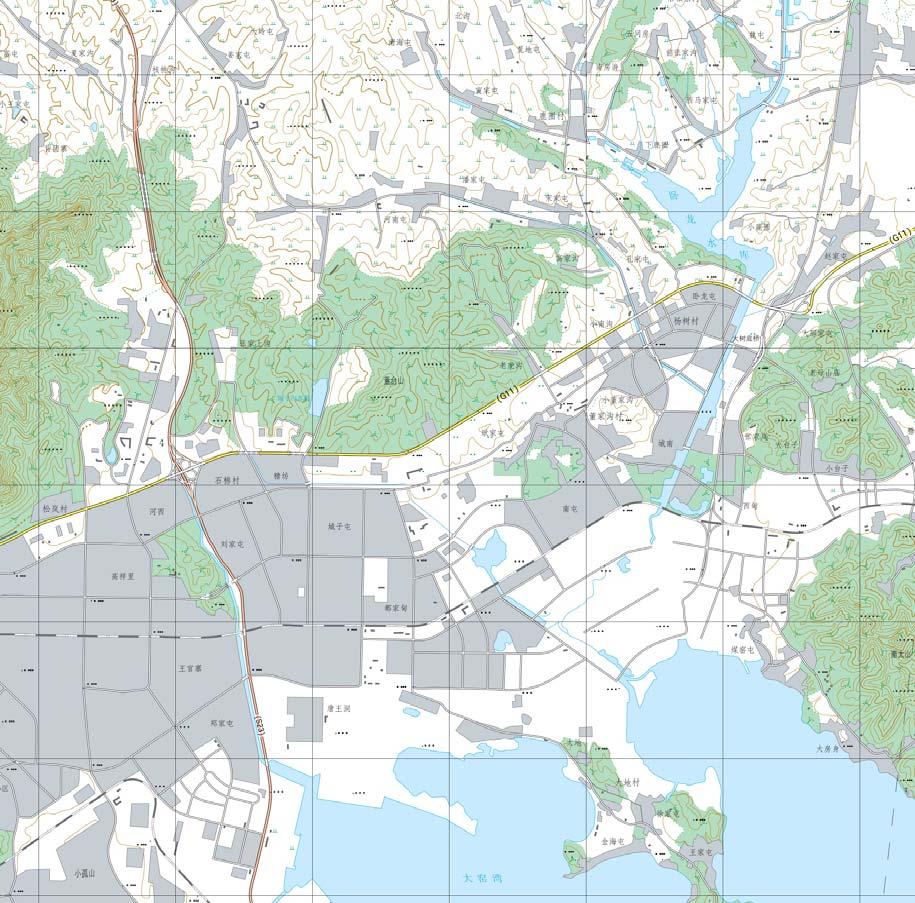
24 Base Map Series and Coverage 1:1 million 1:250,000 Nation 1:100,000 1:50,000 1:10,000 1:5,000 Province Topographic maps and databases at 1:1million, 1:250,000 and 1:100,000 covering 100% land area; 1:50,000 90%;1:10,000 50%;1:2000 most cities 1:2000 1:1000 1:500 City 24


25 Main fundamental data products DOM DLG DEM 30m 5-10m 1-2.5m m Topographic Map Data 1km*1km 100m*100m 25m* 25m 5m*5m National Fundamental Geo-Database 25


26 Records Index and Service
27 General Structure of the Platform Central Government Network 1 Network Prov. Node Prov. Node Bureau of Hydro. 34 Network Munic. Govern. Bureau of Hydro. 333 Government Network: for e-government users Public Network(Internet): for public

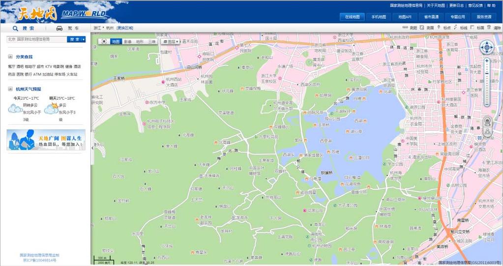
28 Map World

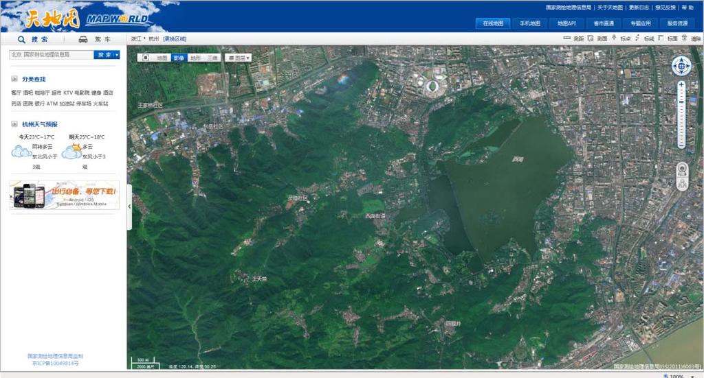
29 Image Browser
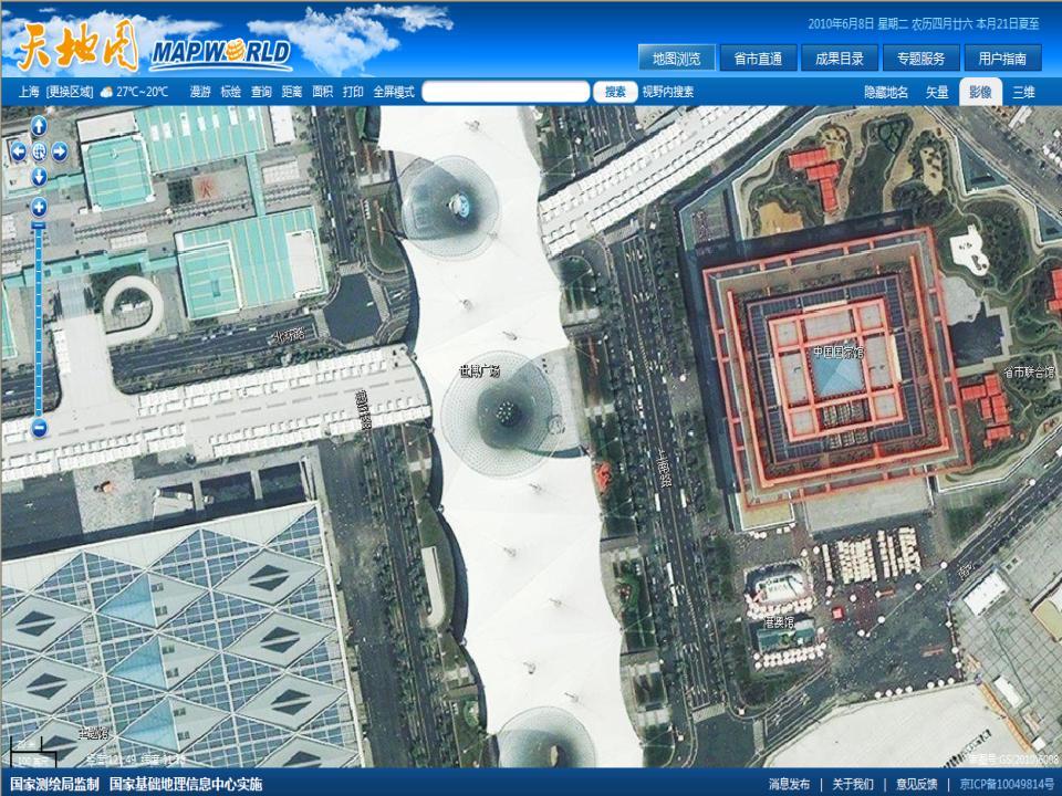
30 3D browse
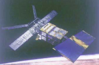
31 Searching,Labeling and Routing


32

 5 Middle")
")

33 Compass (Beidou) Satellites Geostationary Orbit (GEO) 5 Middle Earth Orbit (MEO) 27 Inclined Geostationary Orbit (IGSO) Asia Pacific 2020 Worldwide


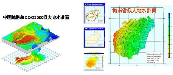
34 Geoid and Regional CORS Network 34


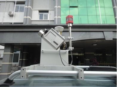
35 Mobile Mapping Systems


36 UAV Photography System 36


37 Digital Aerial Camera 37


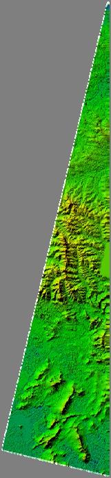
38 Airborne InSAR Mapping System SAR X band antenna POS Integrated System P band antenna


39 DPS and Remote Sensing Software PixelGrid DPGrid 39


40 ZY3 Mapping Satellites Tri-linear Pan cameras Forward Backward 3.5M Nadir 2.1M Strip width 50KM Multi-spectrum 4 bands 5.8M Strip width 50KM B/H Sun-sync 500 KM 3.92M X 14.22M Cycle time 59 D Revisit 5D Global coverage Latitude 84

41 ZY3 Image Global Coverage (Clouds < 20%)


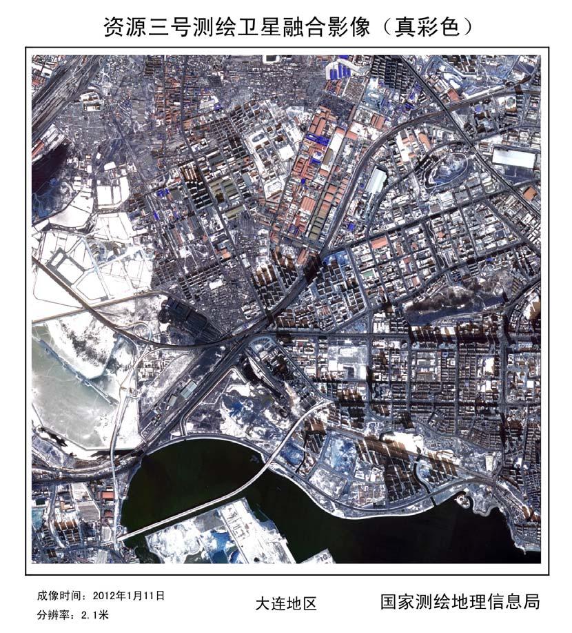
42 ZY3 Image Gallery :Raw Data Backward Dalian,China Nadir forwards


43 ZY3 Image Gallery :Data Products


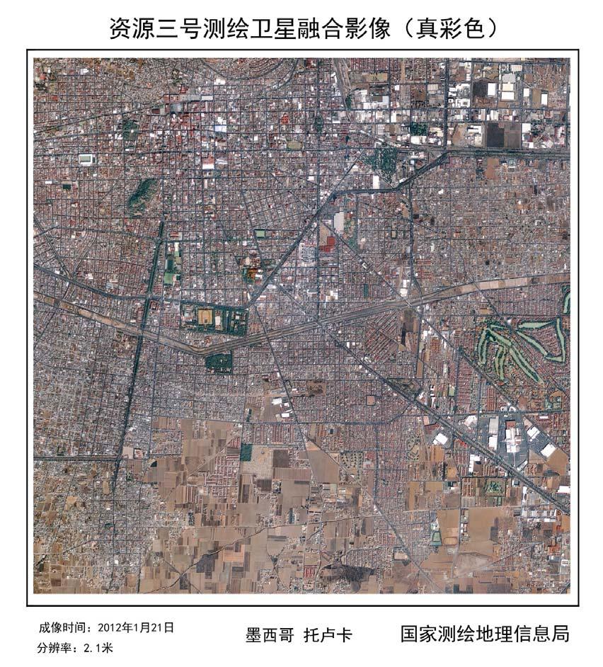


44 ZY3 Image Gallery :Data Products


45 Mapping Satellites Planned 2 5m Pan 6 10m multi spectrum 1 2m Pan 3 6m multi spectrum 0.5 1m Pan 1 3m multi spectrum 3 5m C band/s band SAR 0.5 1m multi band SAR 2 Bands Laser Ranging, 1 m Pan


46


47 International Cooperation Australia UK Germany The Netherlands USA Russia Brazil Pakistan Japan,etc.. PCGIAP UNRCC-AP UN GEO-GEOSS ISCGM IUGG ISPRS ICA FIG GSDI IUG 47

 (US$800,000 per year for 5")
48 UN-China Technical Cooperation Trust Fund Geospatial Information Management Capacity Development in China and other Developing Countries (GIMCD) (US$800,000 per year for 5 years)


49 April 24 to 26,2013 2nd China Forum on UN-GGIM and UN-GGIM-AP Executive Board Meeting

50 Leadership enhancing at Director level Senior Engineer Training and Field works Diploma and degree courses UN-GGIM-Training Center-China(UN-GTC)
51 Willing to share globally 1. Compass Navigation System 2. Chinese Mapping Satellites 3. WebMap service Platform: MapWorld 4. Digital City/Smart City Solutions 5. UAV Remote Sensing Platforms 6. Education and Training 7. Global Geographic Monitoring 8. R&D
52 Conclusion Remarks 1. Government Needs and Emergency Mapping 2. Geodata Resource 3. Technical Supports 4. International Cooperation 5. Private Business Development 6. Educational and HR development 7. Standards and quality assurance 8. Legal system and supervision mechanism
53 Welcome to China for UN-GGIM Forum to be held from April 24 to 26 GGIM benefits the world! Thank you!
Content. 1. Introduction. 2. Strengthening Unified Supervision of Surveying and Mapping. 3. Geospatial Information Resources and Utilization
 1. Introduction Content 2. Strengthening Unified Supervision of Surveying and Mapping 3. Geospatial Information Resources and Utilization 4. Current Situation of the Geospatial Industry 5. Opportunities
Report of the Regional Committee of UN-GGIM for Asia and the Pacific (UN-GGIM-AP)
") Report of the Regional Committee of UN-GGIM for Asia and the Pacific (UN-GGIM-AP) At the Eighth Session of UN-GGIM UN Headquarters, New York, 1 3 August 2018 About UN-GGIM-AP One of the five regional committees
Report of the Regional Committee of UN-GGIM for Asia and the Pacific (UN-GGIM-AP) At the Eighth Session of UN-GGIM UN Headquarters, New York, 1 3 August 2018 About UN-GGIM-AP One of the five regional committees
Upgrade the Datasets in NSDI for Smarter Services with the Cases of China
 Upgrade the Datasets in NSDI for Smarter Services with the Cases of China By Dr. JIANG Jie Dept of GeoInformaiton Service Platform National Geomatics Center of China October 7, 2015 Jeju, Republic of Korea
From PCGIAP to UN GGIM AP: A Regional Perspective on GGIM
 Regional Committee of United Nations Global Geospatial Information Management for Asia and the Pacific (UN-GGIM-AP) Established by a United Nations Resolution From PCGIAP to UN GGIM AP: A Regional Perspective
Institutional Strengthening to Stimulate Geospatial Industry Growth in China *
 UNITED NATIONS ECONOMIC AND SOCIAL COUNCIL E/CONF.100/IP.11 Original: Chinese Eighteenth United Nations Regional Cartographic Conference for Asia and the Pacific Bangkok, 26-29 October 2009 Item 7(b) of
State of Israel Ministry of Housing and Construction Survey of Israel. The Hydrological project case
 State of Israel Ministry of Housing and Construction Survey of Israel The Hydrological project case Survey of Israel Content Introduction To the Survey of Israel The operation assumptions The main responsibilities
Modernization of National Geodetic Datum in China *
 UNITED NATIONS E/CONF.102/IP.16 ECONOMIC AND SOCIAL COUNCIL Nineteenth United Nations Regional Cartographic Conference for Asia and the Pacific Bangkok, 29 October 1 November 2012 Item 6(b) of the provisional
ECONOMIC AND SOCIAL COUNCIL
 UNITED NATIONS E/CONF.102/3 ECONOMIC AND SOCIAL COUNCIL Nineteenth United Nations Regional Cartographic Conference for Asia and the Pacific Bangkok, 29 October 1 November 2012 Item 4 of the provisional
Background Document: Report of the Regional Committee of United Nations Global Geospatial Information Management for Asia and the Pacific
 Background Document: Report of the Regional Committee of United Nations Global Geospatial Information Management for Asia and the Pacific 1. Summary 1. This report highlights the activities carried out
GEOMATICS. Shaping our world. A company of
 GEOMATICS Shaping our world A company of OUR EXPERTISE Geomatics Geomatics plays a mayor role in hydropower, land and water resources, urban development, transport & mobility, renewable energy, and infrastructure
Part : General Situation of Surveying and Mapping. The Development of Surveying and Mapping in China. The contents
 The Development of Surveying and Mapping in China Dr. Ping Xiao China.P.R The contents Part : General Situation of Surveying and Mapping 1. The legal systems of surveying and mapping 2. The technologies
Report of PCGIAP to the 18 th United Nations Regional Cartographic Conference for Asia and the Pacific (UNRCC-AP) for the period
 for the period") Permanent Committee on GIS Infrastructure for Asia and the Pacific (PCGIAP) Established in 1995 by a United Nations Resolution Report of PCGIAP to the 18 th United Nations Regional Cartographic Conference
Permanent Committee on GIS Infrastructure for Asia and the Pacific (PCGIAP) Established in 1995 by a United Nations Resolution Report of PCGIAP to the 18 th United Nations Regional Cartographic Conference
Challenges and Potentials of Place Based Information Management in Nepal"
 Nineteenth United Nations Regional Cartographic Conference for Asia and the Pacific, Bangkok, Thailand, 29 October 1 November 2012 Challenges and Potentials of Place Based Information Management in Nepal"
FIG Asia Pacific Capacity Development Network
 FIG Asia Pacific Capacity Development Network Report to the 41th General Assembly FIG Congress 2018, Istanbul - Turkey Rob Sarib Chair FIG Asia Pacific Capacity Development Network (AP CDN) Story of the
Introduction of Sichuan Surveying and Mapping Emergency System. Zheng Quanhong Sichuan Bureau of Surveying.Mapping and Geoinformation September 2016
 Introduction of Sichuan Surveying and Mapping Emergency System Zheng Quanhong Sichuan Bureau of Surveying.Mapping and Geoinformation September 2016 Background Sichuan province is one of the most serious
Strategic Framework and Practice of Sichuan. Provincial Emergency Surveying and Mapping
 Strategic Framework and Practice of Sichuan PPT www.1ppt.com/moban/ Provincial Emergency Surveying and Mapping Zheng Quanhong Sichuan Bureau of Surveying Mapping and Geoinfomation Contents 1. Background
SDG s and the role of Earth Observation
 SDG s and the role of Earth Observation Christian Heipke IPI - Institute for Photogrammetry and GeoInformation Leibniz Universität Hannover Germany Secretary General, ISPRS 1. No Poverty 2. Zero Hunger
What is the PCGIAP? Overview on PCGIAP Activities and the Asia/Pacific Region. Membership. Background. Aims. Asia-Pacific SDI
 3rd FIG Regional Conference for Asia and the Pacific Jakarta, Indonesia, 3-7th October 2004 Overview on PCGIAP Activities and the Asia/Pacific Region What is the PCGIAP? Haji Matusin Matasan Surveyor General,
Reference Frame in Practice Workshop 1A
 Reference Frame in Practice Workshop 1A Status of Geodetic Infrastructure in the Pacific Region Case Studies Rob Sarib - FIG Commission 5 Vice Chair of Administration Welcome! Bula! Who are the International
The Integrated Ge spatial Information Framework to the strengthening of NSDI, Mongolia
 Young Geospatial Professionals Summit 21 NOV 2018 The Integrated Ge spatial Information Framework to the strengthening of NSDI, Mongolia BAYARMAA ENKHTUR Geospatial information and technology department
Country Report On Sdi Activities In Singapore ( )
") UNITED NATIONS E/CONF.102/IP.4 ECONOMIC AND SOCIAL COUNCIL Nineteenth United Nations Regional Cartographic Conference for Asia and the Pacific Bangkok, 29 October 1 November 2012 Item 6(b) of the provisional
UNITED NATIONS E/CONF.102/IP.4 ECONOMIC AND SOCIAL COUNCIL Nineteenth United Nations Regional Cartographic Conference for Asia and the Pacific Bangkok, 29 October 1 November 2012 Item 6(b) of the provisional
THE ROLE OF GEOSPATIAL AT THE WORLD BANK
 THE ROLE OF GEOSPATIAL AT THE WORLD BANK INSPIRE Conference Barcelona, Spain September 26, 2016 Kathrine Kelm Senior Land Administration Specialist Global Land and Geospatial Unit The World Bank Group
Country Report on SDI Activities in Singapore *
 UNITED NATIONS E/CONF.100/CRP.9 ECONOMIC AND SOCIAL COUNCIL Eighteenth United Nations Regional Cartographic Conference for Asia and the Pacific Bangkok, 26-29 October 2009 Item 7(a) of the provisional
Disaster Management in Mongolia
 The Third UN-GGIM-AP Plenary Meeting Disaster Management in Mongolia ~Coordination among NGIA & Other Related Organizations and Recommendations~ Bali Indonesia 10 November 2014 Khurelshagai Ayurzana, Director
Geospatial Policy Development and Institutional Arrangements *
 HIGH LEVEL FORUM ON GLOBAL GEOSPATIAL MANAGEMENT INFORMATION WORKING PAPER No. 13 First Forum Seoul, Republic of Korea, 24-26 October 2011 Geospatial Policy Development and Institutional Arrangements *
Funding systems used in Mexico to support institutional arrangements: INEGI case
 Funding systems used in Mexico to support institutional arrangements: INEGI case Sistemas de financiamiento usados en México, para soportar arreglos institucionales: Caso INEGI United Nations Committee
Voices from Private Sector: Insights for Future NSDI Development in Indonesia
 Voices from Private Sector: Insights for Future NSDI Development in Indonesia Ta n d a n g Yu l i a d i D w i P u t ra, Ryosuke S h i b a s a k i I n st i t u t e o f I n d u st r i a l S c i e n c e,
PAN AMERICAN INSTITUTE OF GEOGRAPHY AND HISTORY Specialized Organization of the OAS
 PAN AMERICAN INSTITUTE OF GEOGRAPHY AND HISTORY Specialized Organization of the OAS 10 th UNRCC Americas United Nations, New York, 20 August 2013 PAIGH, SIRGAS, PC-IDEA and GeoSUR 2013-2015 Joint Action
UN GGIM and National SDI Strategy
 MSDI Open Forum on 26 th January 2016 Contributing to the successful delivery of MSDI UN GGIM and National SDI Strategy Hiroshi Murakami Deputy Administrator Geospatial Information Authority of Japan Geospatial
March 2007 The Survey Department of Sri Lanka
 Contribution of Survey Department of Sri Lanka for Mitigation of Disasters in Sri Lanka K.A.U.N.Kasthuri Deputy Surveyor General (Information Technology) March 2007 The Survey Department of Sri Lanka 1
Land Administration and Cadastre
 Geomatics play a major role in hydropower, land and water resources and other infrastructure projects. Lahmeyer International s (LI) worldwide projects require a wide range of approaches to the integration
Economic and Social Council
 United Nation E/C.20/2012/4/Add.1 Economic and Social Council Distr.: General 2 July 2012 Original: English Committee of Experts on Global Geospatial Information Management Second session New York, 13-15
Report on the Actions Taken on Resolutions of the Eighteenth United Nations Regional Cartographic Conference for Asia and the Pacific
 UNITED NATIONS E/CONF.102/7 ECONOMIC AND SOCIAL COUNCIL Nineteenth United Nations Regional Cartographic Conference for Asia and the Pacific Bangkok, 29 October 1 November 2012 Item 4 of the provisional
GEOGRAPHY (GE) Courses of Instruction
 Courses of Instruction") GEOGRAPHY (GE) GE 102. (3) World Regional Geography. The geographic method of inquiry is used to examine, describe, explain, and analyze the human and physical environments of the major regions of the
GEOGRAPHY (GE) GE 102. (3) World Regional Geography. The geographic method of inquiry is used to examine, describe, explain, and analyze the human and physical environments of the major regions of the
Development of Geospatial Information in Indonesia: Progress & Challenge
 Development of Geospatial Information in Indonesia: Progress & Challenge Dr. Nurwadjedi Sarbini Deputy of Thematic Geospatial Information Geospatial Information Agency (BIG) Geosmart Asia, September 29
REGIONAL SDI DEVELOPMENT
 REGIONAL SDI DEVELOPMENT Abbas Rajabifard 1 and Ian P. Williamson 2 1 Deputy Director and Senior Research Fellow Email: abbas.r@unimelb.edu.au 2 Director, Professor of Surveying and Land Information, Email:
UN-GGIM: Strengthening Geospatial Capability
 Fifth Plenary Meeting of UN-GGIM: Europe Brussels, 6-7 June 2018 UN-GGIM: Strengthening Geospatial Capability Walking the talk to leave no one behind Greg Scott, UN-GGIM Secretariat Environmental Statistics
SDI DEVELOPMENT UPDATES OF INDONESIA
 SDI DEVELOPMENT UPDATES OF INDONESIA DR. ANTONIUS B. WIJANARTO Center For Management And Dissemination Of Geospatial Information GEOSPATIAL INFORMATION AUTHORITY GOVERNMENT OF THE REPUBLIC OF INDONESIA
XXIII CONGRESS OF ISPRS RESOLUTIONS
 XXIII CONGRESS OF ISPRS RESOLUTIONS General Resolutions Resolution 0: Thanks to the Czech Society commends: To congratulate The Czech Society, its president and the Congress Director Lena Halounová, the
SDI Development in Georgia. Mari Khardziani Head of International Relations Unit National Agency of Public Registry
 SDI Development in Georgia Mari Khardziani Head of International Relations Unit National Agency of Public Registry Kehl, Germany September 5, 2017 2 National Agency of Public Registry Legal Entity of Public
National Spatial Data Infrastructure International workshop 9 th June, 2015 Terelj Hotel, Mongolia
 1 st session: NSDI policy, planning and the legal framework Formation of NSDI policy and legal framework in Mongolia Khurelshagai Ayurzana, Director General, Administration of Land Affairs, Geodesy and
Project based approach developing National Spatial Data Infrastructure in Lithuania
 Project based approach developing National Spatial Data Infrastructure in Lithuania National Land Service under the Ministry of Agriculture of The Republic of Lithuania Cadastres & Geodesy Department Director
Inventory of United Nations Resolutions on Cartography Coordination, Geographic Information and SDI 1
 Inventory of United Nations Resolutions on Cartography Coordination, Geographic Information and SDI I. Resolutions on Cartography Coordination and Establishment of United Nations Regional Cartographic
Faatasi Malologa (PGSC Chair) Director Department of Lands & Survey, Tuvalu
 Director Department of Lands & Survey, Tuvalu") Seventh Session of the United Nations Committee of Experts on Global Geospatial Information Management (UN-GGIM) - 31 July -4 August 2017 Faatasi Malologa (PGSC Chair) Director Department of Lands & Survey,
Seventh Session of the United Nations Committee of Experts on Global Geospatial Information Management (UN-GGIM) - 31 July -4 August 2017 Faatasi Malologa (PGSC Chair) Director Department of Lands & Survey,
Putting the U.S. Geospatial Services Industry On the Map
 Putting the U.S. Geospatial Services Industry On the Map December 2012 Definition of geospatial services and the focus of this economic study Geospatial services Geospatial services industry Allow consumers,
Land Use / Land Cover Mapping in
 Land Use / Land Cover Mapping in Eastern and Southern African Regions RCMRD Experience by 6/24/2013, Nairobi Kenya Dr. Tesfaye Korme Director of RS, GIS and Mapping, RCMRD I. About RCMRD, Its Vision and
Cooperation is the key, FIG can facilitate
 Cooperation is the key, FIG can facilitate Mikael Lilje Vice President 2017-2020 Head, Geodetic infrastructure, Swedish mapping, cadastral and land registration authority Presented at the GIS/RS Conference
INTERNATIONAL WORKSHOP ON LEGAL AND POLICY FRAMEWORKS FOR GEOSPATIAL INFORMATION MANAGEMENT Licensing of Geospatial Information.
 INTERNATIONAL WORKSHOP ON LEGAL AND POLICY FRAMEWORKS FOR GEOSPATIAL INFORMATION MANAGEMENT Licensing of Geospatial Information 7-9 November 2017 Tianjin, China Information Note Organized by United Nations
National Remote Sensing Center of China. Space Technology for Sustainable Development in China Status, Achievements and Futures.
 National Remote Sensing Center of China Space Technology for Sustainable Development in China Status, Achievements and Futures Jing Li National Remote Sensing Center of China Ministry of Science and Technology,
National Cartographic Center
 National Cartographic Center NCC activities and accomplishments Activities of national organizations, institutions and universities in field of geomatics Large scale maps Medium scale maps Small scale
Sustainable Cities and Communities based on Indicators on Urbanization 地理国情监测技术. Prof. Dr. John W. Z. SHI The Hong Kong Polytechnic University
 IAEG- SDGs WG on Geospatial Information, 1 st Expert Group Meeting 12-14 Dec 2016 Mexico City Measure 地理国情监测技术 Sustainable Cities and Communities 专业 based on Indicators on Urbanization Prof. Dr. John W.
NGIAs' roles in successful disaster response
 The Second UN-GGIM-AP Plenary Meeting NGIAs' roles in successful disaster response Japan Teheran Iran 28 October 2013 Shin-ichi SAKABE, Director of International Affairs Division Geospatial Information
UN-GGIM: An Overview Stefan Schweinfest, Director (UNSD) Bangkok, 27 March 2015
 Bangkok, 27 March 2015") UN-GGIM: An Overview Stefan Schweinfest, Director (UNSD) Bangkok, 27 March 2015 ggim.un.org UN-GGIM: A global initiative Formal inter-governmental UN Committee of Experts to: Discuss, enhance and coordinate
UN-GGIM: An Overview Stefan Schweinfest, Director (UNSD) Bangkok, 27 March 2015 ggim.un.org UN-GGIM: A global initiative Formal inter-governmental UN Committee of Experts to: Discuss, enhance and coordinate
The GIS Path Forward Saskatchewan s Geomatics Strategic Plan
 The GIS Path Forward Saskatchewan s Geomatics Strategic Plan John Potter, SK Ministry of Central Services Office of Geomatics Coordination Sept.17/13 Table of Contents 1. 2011-2016, Geomatics Strategic
European Spatial Data Research. EuroSDR. Prof. Dr. Ir. Joep Crompvoets. General Assembly CLGE Tirana 18 March
 EuroSDR Prof. Dr. Ir. Joep Crompvoets General Assembly CLGE - 2016 Tirana 18 March 2016 INTRODUCTORY QUESTIONS Who knows what is EuroSDR? Who does NOT know what is EuroSDR? Who is employed at mapping agencies?
8th FIG Regional Conference November 2012 Montevideo, Uruguay
 8th FIG Regional Conference 26 29 November 2012 Montevideo, Uruguay Platinum Sponsors: Member Associations; Affiliate Members; Academic Members; Corporate Members & Correspondents 120 Countries 1 FIG Foundation
Government GIS and its Application for Decision Support
 Government GIS and its Application for Decision Support Zhang Qingpu (Chinese Academy of Surveying and Mapping, Email: zhangqp@casm.ac.cn) Abstract: Application of GIS in government agencies is called
ECONOMIC AND SOCIAL COUNCIL 13 July 2007
 UNITED NATIONS E/CONF.98/CRP.34 ECONOMIC AND SOCIAL COUNCIL 13 July 2007 Ninth United Nations Conference on the Standardization of Geographical Names New York, 21-30 August 2007 Item 17(b) of the provisional
Pacific Geospatial and Surveying Council (PGSC) Geospatial and GNSS CORS Infrastructure Forum. Kuala Lumpur October
 Geospatial and GNSS CORS Infrastructure Forum. Kuala Lumpur October") Pacific Geospatial and Surveying Council (PGSC) Geospatial and GNSS CORS Infrastructure Forum. Kuala Lumpur 16-17 October Beginning and Progress Members PGSC Charter PGSC Strategy 2017-2027 Meetings Geodetic
Pacific Geospatial and Surveying Council (PGSC) Geospatial and GNSS CORS Infrastructure Forum. Kuala Lumpur 16-17 October Beginning and Progress Members PGSC Charter PGSC Strategy 2017-2027 Meetings Geodetic
Data Origin. Ron van Lammeren CGI-GIRS 0910
 Data Origin Ron van Lammeren CGI-GIRS 0910 How to obtain geodata? Geo data initiative Executive Order 12906, "Coordinating Geographic Data Acquisition and Access: The National Spatial Data Infrastructure,"
Realizing benefits of Spatial Data Infrastructure A user s perspective from Environment Agency - Abu Dhabi
 Realizing benefits of Spatial Data Infrastructure A user s perspective from Environment Agency - Abu Dhabi Anil Kumar Director, Environment Information Management 26 April 2012 Geospatial World Forum,
EuroSDR (European Spatial Data Research)
") EuroSDR (European Spatial Data Research) ROLLING RESEARCH PLAN 2015-2018 EuroSDR Secretariat Public Governance Institute KU Leuven Parkstraat 45 bus 3609 3000 Leuven Belgium Tel.: +32 16 32 31 80 Fax:
EuroSDR (European Spatial Data Research) ROLLING RESEARCH PLAN 2015-2018 EuroSDR Secretariat Public Governance Institute KU Leuven Parkstraat 45 bus 3609 3000 Leuven Belgium Tel.: +32 16 32 31 80 Fax:
Building a National Data Repository
 Building a National Data Repository Mladen Stojic, Vice President - Geospatial 1/30/2013 2012 Intergraph Corporation 1 Information has meaning and gives power only when shared and distributed. Information,
Report for 15th PCGIAP Meeting at 18th UNRCC-AP Working Group 1 Regional Geodesy
 Report for 15th PCGIAP Meeting at 18th UNRCC-AP Working Group 1 Regional Geodesy Chairman Shigeru Matsuzaka, Japan - shigeru@gsi.go.jp Vice Chairman Prof. Pengfei Cheng, China - chengpf@casm.ac.cn John
Introduction of PASCO Corporation
 Technical Seminar Reference Frame in Practice, Introduction of PASCO Corporation MASAKI MIYASAKA Sponsors: Page 1 Company Profile Establishment: October 27, 1953 Head office: Meguro-ku, Tokyo (57 offices
Data Origin. How to obtain geodata? Ron van Lammeren CGI-GIRS 0910
 Data Origin How to obtain geodata? Ron van Lammeren CGI-GIRS 0910 Spatial Data interest Improvement of policy making. ± 90% of all information used by government has spatial characteristics SPATIAL INFORMATION
Spatially Enabled Society
 International Seminar on Land Administration Trends and Issues in Asia and the Pacific Region Spatially Enabled Society Abbas Rajabifard Vice Chair PCGIAP-WG3 Vice-President (President Elect), GSDI Association
SDI Development in the Russian Federation
 , the Russian Federation Key words: SDI development, the Russian Federation SUMMARY A reform in the field of spatial data is gathering headway in Russia. Creation of a single agency, which united state
Evolution and development of National Spatial Data Infrastructure in Republic of Moldova
 Agency for Land Relations and Cadastre of the Republic of Moldova Evolution and development of National Spatial Data Infrastructure in Republic of Moldova Alexandru Morcov Deputy general director ALRC
GSDI: Towards a Spatially Enabled Society
 GSDI: Towards a Spatially Enabled Society Dr. David J. Coleman, President Global Spatial Data Infrastructure Association UN Regional Cartographic Conference for the Americas, United Nations, New York,
Working Group 3 on Regional SDI. Activity Report. for. The 5th UN-GGIM-AP Plenary Meeting
 Regional Committee of United Nations Global Geospatial Information Management for Asia and the Pacific (UN-GGIM-AP) Working Group 3 on Regional SDI Activity Report for The 5th UN-GGIM-AP Plenary Meeting
ISLAMIC REPUBLIC OF IRAN NATIONAL REPORT FOR PHOTOGRAMMETRY, REMOTE SENSING AND SPATIAL INFORMATION SCIENCE
 ISLAMIC REPUBLIC OF IRAN NATIONAL REPORT FOR PHOTOGRAMMETRY, REMOTE SENSING AND SPATIAL INFORMATION SCIENCE 2004-2008 A. Eslami Rad a, M. Sarpoulaki b a Director Technical Advisor, National Cartographic
UNITED NATIONS E/CONF.96/CRP. 5
 UNITED NATIONS E/CONF.96/CRP. 5 ECONOMIC AND SOCIAL COUNCIL Eighth United Nations Regional Cartographic Conference for the Americas New York, 27 June -1 July 2005 Item 5 of the provisional agenda* COUNTRY
Brazil Paper for the. Second Preparatory Meeting of the Proposed United Nations Committee of Experts on Global Geographic Information Management
 Brazil Paper for the Second Preparatory Meeting of the Proposed United Nations Committee of Experts on Global Geographic Information Management on Data Integration Introduction The quick development of
Update to the Association of Ontario Land Surveyors February 27, 2015 Deerhurst, Ontario
 1 Update to the Association of Ontario Land Surveyors February 27, 2015 Deerhurst, Ontario Peter Sullivan CLS, ALS, MBA Director General, Surveyor General Branch Earth Sciences Sector, Natural Resources
Prof Chryssy Potsiou, FIG President
 THE VALUE OF GEOSPATIAL DATA AND ROLE OF SURVEYORS IN SUSTAINABLE DEVELOPMENT Prof Chryssy Potsiou, FIG President National Technical University of Athens School of Rural and Surveying Engineering, Greece
Common geographies for dissemination of SDG Indicators
 5 th High Level Forum on United Nations GGIM, Mexico 2017 Common geographies for dissemination of SDG Indicators Understanding statistical and geodetic division of territory Janusz Dygaszewicz Central
Economic and Social Council 2 July 2015
 ADVANCE UNEDITED VERSION UNITED NATIONS E/C.20/2015/11/Add.1 Economic and Social Council 2 July 2015 Committee of Experts on Global Geospatial Information Management Fifth session New York, 5-7 August
GSDI Global Spatial Data Infrastructure. Convergences between Geo Spatial Communities: key decision for decision making
 GSDI Global Spatial Data Infrastructure Convergences between Geo Spatial Communities: key decision for decision making April 14 th 2010 Bas Kok GSDI Past-President Director of International Affairs, Dutch
Economic and Social Council
 United Nations Economic and Social Council Distr.: General 18 July 2016 Original: English Committee of Experts on Global Geospatial Information Management Sixth session New York, 3-5 August 2016 Item 2
Concept Formulation of Geospatial Infrastructure. Hidenori FUJIMURA*
 Concept Formulation of Geospatial Infrastructure 1 Concept Formulation of Geospatial Infrastructure Hidenori FUJIMURA* (Published online: 28 December 2016) Abstract Technical trends in the field of surveying
Understanding China Census Data with GIS By Shuming Bao and Susan Haynie China Data Center, University of Michigan
 Understanding China Census Data with GIS By Shuming Bao and Susan Haynie China Data Center, University of Michigan The Census data for China provides comprehensive demographic and business information
COUNTRY REPORT THE SEVENTEENTH PERMANENT COMMITTEE ON GIS INFRASTRUCTURE FOR ASIA AND THE PACIFIC (PCGIAP) MEETING JULY 21 22, 2011,
 MEETING JULY 21 22, 2011,") COUNTRY REPORT INDONESIA ACTIVITIES IN 2010 THE SEVENTEENTH PERMANENT COMMITTEE ON GIS INFRASTRUCTURE FOR ASIA AND THE PACIFIC (PCGIAP) MEETING JULY 21 22, 2011, CHINGGIS KHAAN HOTEL, ULAANBAATAR CITY,
COUNTRY REPORT INDONESIA ACTIVITIES IN 2010 THE SEVENTEENTH PERMANENT COMMITTEE ON GIS INFRASTRUCTURE FOR ASIA AND THE PACIFIC (PCGIAP) MEETING JULY 21 22, 2011, CHINGGIS KHAAN HOTEL, ULAANBAATAR CITY,
Key Elements of the Geographical Information System of Mexico *
 UNITED NATIONS E/CONF.99/IP.1 ECONOMIC AND SOCIAL COUNCIL Ninth United Nations Regional Cartographic Conference for the Americas New York, 10-14 August 2009 Item 7(a) of the provisional agenda Strategy,
The International Society for Photogrammetry and Remote Sensing Study on the Status of Mapping on the World
 Joint ISPRS Project with the United Nations Committee of Experts on Geospatial Information Management UN-GGIM Secretariat, New York The International Society for Photogrammetry and Remote Sensing Study
The Campaign to Map the Remote Regions in West China at 1:50,000 Scale *
 UNITED NATIONS E/CONF.99/CRP.12 ECONOMIC AND SOCIAL COUNCIL Ninth United Nations Regional Cartographic Conference for the Americas New York, 10-14 August 2009 Item 5(b) of the provisional agenda Country
Sustainable and Harmonised Development for Smart Cities The Role of Geospatial Reference Data. Peter Creuzer
 Sustainable and Harmonised Development for Smart Cities The Role of Geospatial Reference Data Peter Creuzer 1. Introduction - Smart Cities and Geodata 2. Geodata in Germany 3. Examples 4. Data and Service
Country Report Nepal Geospatial Data Sharing Initiatives of Survey Department Supporting Disaster Management
 Third JPTM Step 2 for Sentinel Asia 6-8 July, 2010 Manila, The Philippines Country Report Nepal Geospatial Data Sharing Initiatives of Survey Department Supporting Disaster Management Durgendra M Kayastha
The Efforts of Building GIS Infrastructure in a Newly Independent State: The case of Timor Leste *
 UNITED NATIONS E/CONF.100/IP.12 ECONOMIC AND SOCIAL COUNCIL Eighteenth United Nations Regional Cartographic Conference for Asia and the Pacific Bangkok, 26-29 October 2009 Item 7(b) of the provisional
Major Opportunities in Spatial Data Infrastructure Communities
 Major Opportunities in Spatial Data Infrastructure Communities Bas Kok President GSDI June 17 th 2008 FIG Working Week: Integrating Generations 14-19 June 2008 Stockholm, Sweden http://www.gsdi.org 1 GSDI
BUILDING AN ACCURATE GIS
 BUILDING AN ACCURATE GIS 2006 GIS in the Rockies Denver, Colorado September 13, 2006 William E. Linzey United States Department of Commerce National Oceanic and Atmospheric Administration National Geodetic
Global Geospatial Information Management Country Report Finland. Submitted by Director General Jarmo Ratia, National Land Survey
 Global Geospatial Information Management Country Report Finland Submitted by Director General Jarmo Ratia, National Land Survey Global Geospatial Information Management Country Report Finland Background
Indian Earth Observation Programme
 Indian Earth Observation Programme Dr. Jai Singh Parihar Dy. Director Remote Sensing Applications Area (RESA) Space Applications Centre (ISRO) Ahmedabad 380 015 India jsparihar@sac.isro.gov.in Presentation
GIS FOR MAZOWSZE REGION - GENERAL OUTLINE
 GIS FOR MAZOWSZE REGION - GENERAL OUTLINE S. Bialousz 1), K Mączewski 2), E. Janczar 2), K. Osinska-Skotak 1) 1) Warsaw University of Technology, Warsaw, Poland 2) Office of the Surveyor of the Mazowieckie
Report of Uruguay The National Spatial Data Infrastructure
 Report of Uruguay The National Spatial Data Infrastructure Prepared for High-Level Forum on Global Geospatial Information Management (GGIM) and Inaugural Session of the UN Committee of Experts on GGIM
Disaster Management in Republic of Korea
 The Third UN-GGIM-AP Plenary Meeting Disaster Management in Republic of Korea ~Coordination among NGIA & Other Related Organizations and Recommendations~ Bali Indonesia 10 November 2014 Sanghoon Lee, Ph.D.
UN-GGIM Arab States Meeting Welcome Address. Denise McKenzie Open Geospatial Consortium 21 February 2017 Doha, Qatar
 UN-GGIM Arab States Meeting Welcome Address Denise McKenzie Open Geospatial Consortium 21 February 2017 Doha, Qatar The Open Geospatial Consortium Not-for-profit, international voluntary consensus standards
Strategic Framework on Geospatial Information and Services for Disasters Relevance for the Americas Region
 Strategic Framework on Geospatial Information and Services for Disasters Relevance for the Americas Region Seventh Session of the Committee of Experts on UN-GGIM Side Event --- UN Headquarters, New York
Working Group 1. Geodetic Reference Frame. Activity Report. for. The UN-GGIM-AP Plenary Meeting
 Regional Committee of United Nations Global Geospatial Information Management for Asia and the Pacific (UN-GGIM-AP) Established by a United Nations Resolution Working Group 1 Geodetic Reference Frame Activity
Yrd. Doç. Dr. Saygın ABDİKAN Öğretim Yılı Güz Dönemi
 Yabancı Dil III (YDL285) Introduction to Geomatics Yrd. Doç. Dr. Saygın ABDİKAN 2017-2018 Öğretim Yılı Güz Dönemi 1 géomatique Geo (Earth) + informatics Geodesy + Geoinformatics Geomatics: The mathematics