Exploring the advances in using social media data for conservation science
|
|
|
- Caren Ramsey
- 5 years ago
- Views:
Transcription
1 Exploring the advances in using social media data for conservation science Workshop at the 5th European Congress of Conservation Biology (ECCB), Jyväskylä, Finland Tuesday, June 12, am - 1pm Room K309 Gustaf
2 Schedule 11 am 1pm Introductions Presentation: recent advances in social media analysis for conservation science Group brainstorming: Which research topics could be addressed using social media data? Report your ideas in the Flinga whiteboard Short break General discussion: What can be done in practice? Together, we will organize the topics in the whiteboard according to how doable they are Wrap up

3 Recent advances in Social Media Data Analysis for Conservation Science Enrico Di Minin, Tuuli Toivonen, Vuokko Heikinheimo, Anna Hausmann & Christoph Fink, Tuui Toivonen Digital Geography Lab, University of Helsinki
4


5 Social media data in conservation 1. THREATS 2. OPPORTUNITIES

6 Elements of a social media post USER INFO GEOTAG TIMESTAMP TEXT CONTENT IMAGE CONTENT LIKES & COMMENTS

7
8 Di Minin, Tenkanen & Toivonen (2015) Frontiers in Environmental Science


9 Proportion of Visitors/ users r= Month

10 PALLAS-YLLÄS NATIONAL PARK

11 PALLAS-YLLÄS NATIONAL PARK Posts from a Finnish Instagram-user. 107 posts in total.


12 PALLAS-YLLÄS NATIONAL PARK Rogers Pass Summit, Canada Schladming-Dachstein, Austria Pallas-Yllästunturi National Park, Finland Posts from a Finnish Instagram-user. 107 posts in total.
13 Source:

14 Source:

15 Social Media Data Analysis Pipeline Spatial analysis Temporal analysis Network analysis WHERE, WHEN, WHAT, WHY, WHO DATA MINING CLEANING FUSION ANALYSIS RESULTS Place-based search Topic-based search User-based search Bot detection Outlier detection Combining complementary data sources Content analysis Manual Automated Crowdsourced Validation
16 Comparison of Instagram and Flickr data Instagram 2015: Whole city: posts by users Green areas: posts by users Flickr 2015: Whole city: posts by 900 users Green areas: 6700 posts by 400 users


17 Comparison of Instagram and Flickr data Instagram Flickr Instagram 2015: Whole city: posts by users Green areas: posts by users Flickr 2015: Whole city: posts by 900 users Green areas: 6700 posts by 400 users


 and Flickr photos (n=1700) from")
18 Comparison of Instagram and Flickr data Instagram Flickr GREEN AREA 40% 7% LANDSCAPE 30% GREEN AREA 56% 4% LANDSCAPE 18 % ACTIVITY 23% ACTIVITY 22% Content types of manually classified Instagram photos (n=9200) and Flickr photos (n=1700) from Green areas in Helsinki.


19 Spatial Precision and Accuracy 10 km Analysis scale! Digital footprints from a game drive in Kruger National Park, South Africa

20 Hausmann, A., Toivonen, T., Slotow, R., Tenkanen, H., Moilanen, A., Heikinheimo, V., & Di Minin, E. (2017). Social Media Data Can Be Used to Understand Tourists Preferences for Nature-Based Experiences in Protected Areas. Conservation Letters.


21 Manual content classification


22 Manual content classification

23 Survey vs social media data Two-sample Kolmogorov-Smirnov test Instagram D = p = Flickr D = p = 0.660


24 Survey vs social media data
. Social media reveal that charismatic species are not the main attractor of ecotourists to sub-saharan protected areas. Sci. Rep., 7. doi:10.")
25 Factors affecting social media use across sub-saharan Africa s protected areas Anna Hausmann, A., Toivonen, T., Heikinheimo, V., Tenkanen, H., Slotow, R. & Minin, E.D. (2017). Social media reveal that charismatic species are not the main attractor of ecotourists to sub-saharan protected areas. Sci. Rep., 7. doi: /s


26 Factors affecting social media use across sub-saharan africa s protected areas Higher Human Development Index Lower travel cost Lower vegetation density Higher population density around the area Lower richness of biodiversity No Effect! richness of charismatic species


27


28
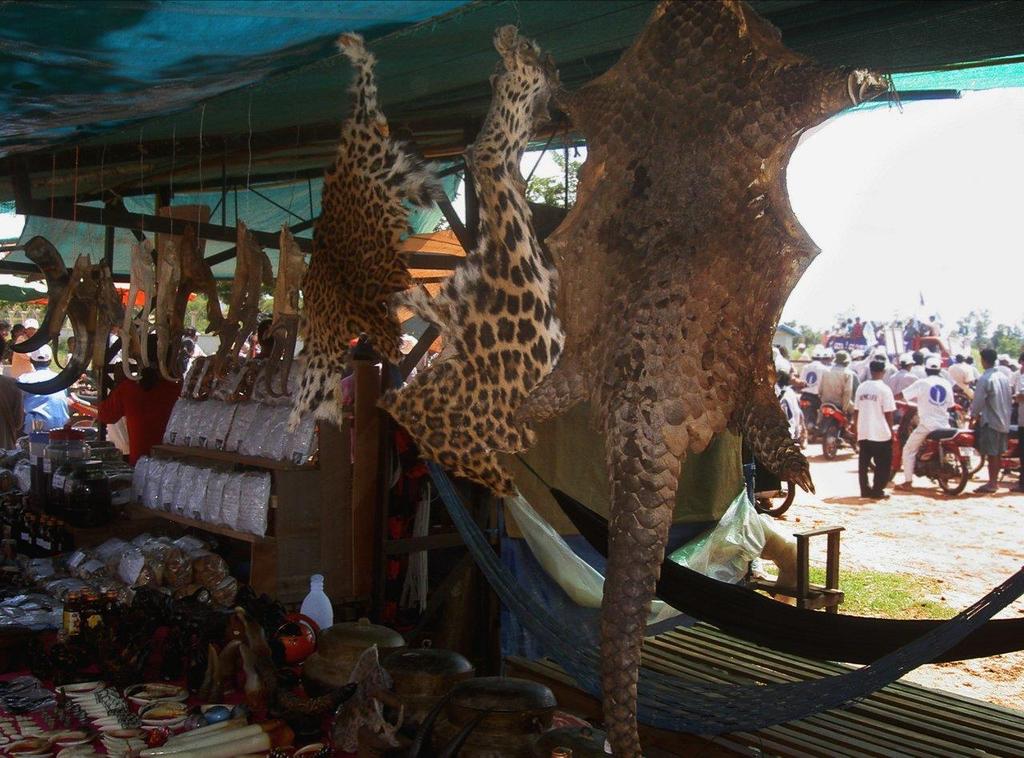
29 Increasing evidence of illegal trade in wildlife moving onto social media Chung et al., 2017, Harrison et al. 2016, Hastie and McCrea-Steele, 2014 (IFAW report), Analysis of social media data, carried out manually, is laborious Tools for automatically analysing text and image content exist and are successfully applied in other fields


30 Di Minin et al., under review


31 Di Minin et al., Nature Ecology & Evolution, 2018

32 #rhino

33
34 THANK YOU! - SOCIAL MEDIA DATA FOR CONSERVATION SCIENCE INVESTIGATING ILLEGAL WILDLIFE TRADE DIGITAL GEOGRAPHY LAB
35 Literature Di Minin, E., Fink, C., Tenkanen, H., & Hiippala, T. (2018). Machine learning for tracking illegal wildlife trade on social media. Nature Ecology & Evolution, 2(3), DOI: /s x Tenkanen, H., Di Minin, E., Heikinheimo, V., Hausmann, A., Herbst, M., Kajala, L., & Toivonen, T. (2017). Instagram, Flickr, or Twitter: Assessing the usability of social media data for visitor monitoring in protected areas. Scientific Reports, 7, [17615]. DOI: /s Hausmann, A., Toivonen, T., Heikinheimo, V., Tenkanen, H., Slotow, R., & Di Minin, E. (2017). Social media reveal that charismatic species are not the main attractor of ecotourists to sub-saharan protected areas. Scientific Reports, 7, [763]. DOI: /s Heikinheimo, V., Di Minin, E., Tenkanen, H., Hausmann, A., Erkkonen, J., & Toivonen, T. (2017). User-Generated Geographic Information for Visitor Monitoring in a National Park: A Comparison of Social Media Data and Visitor Survey. ISPRS International Journal of Geo-Information, 6(3), [85]. DOI: /ijgi Hausmann, A., Toivonen, T. K., Slotow, R., Tenkanen, H. T. O., Moilanen, A. J., Heikinheimo, V. V., & Di Minin, E. (2017). Social Media Data Can Be Used to Understand Tourists Preferences for Nature-Based Experiences in Protected Areas. Conservation Letters, 11(1). DOI: /conl Di Minin, E., Tenkanen, H. T. O., & Toivonen, T. K. (2015). Prospects and challenges for social media data in conservation science. Frontiers in ecology and evolution, 3, [63]. DOI: /fenvs
36 Group brainstorming: Which research topics could be addressed using social media data? (20 min)

37 Flinga whiteboard 1. Go to flinga.fi on your laptop or mobile device 2. Join a session with the access code: F75HANH Or use the Direct link:
38 Flinga.fi, Session: F75HANH Pick a color for your group Write an idea here and press Send also feel free to use pen and paper
39 General discussion: What can be done in practice? Together, we will organize the topics in the whiteboard according to how doable they are.
40 Hungry for more? Time Room Presentation Wed at 12:25 K305 Alvar Anna Hausmann: Assessing global tourism visitation of Important Bird Areas by using social media data Thu at 11:15 A2 Wivi Enrico Di Minin: Social media data for conservation science and practice Thu at 11:30 K309 Gustaf Christoph Fink: Uncovering Illegal Wildlife Trade on Social Media
41 THANK YOU! - SOCIAL MEDIA DATA FOR CONSERVATION SCIENCE INVESTIGATING ILLEGAL WILDLIFE TRADE DIGITAL GEOGRAPHY LAB
MACHINE LEARNING FOR MOBILITY STUDIES IN URBAN AND NATURAL AREAS TUULI TOIVONEN / DIGITAL GEOGRAPHY LAB
 MACHINE LEARNING FOR MOBILITY STUDIES IN URBAN AND NATURAL AREAS TUULI TOIVONEN / DIGITAL GEOGRAPHY LAB MACHINE LEARNING FOR MOBILITY STUDIES IN URBAN AND NATURAL AREAS TUULI TOIVONEN / DIGITAL GEOGRAPHY
The linguistic landscape of social media: A case study of the Senate Square, Helsinki
 The linguistic landscape of social media: A case study of the Senate Square, Helsinki Tuomo Hiippala Digital Geography Lab University of Helsinki tuomo.hiippala@iki.fi cb 23.11.2017 Digital Geography Lab
Generating WUDAPT s Specific Scale-dependent Urban Modelling and Activity Parameters: Collection of Level 1 and Level 2 Data
 ICUC9, Toulouse, France, 2015 Generating WUDAPT s Specific Scale-dependent Urban Modelling and Activity Parameters: Collection of Level 1 and Level 2 Data Linda See, Jason Ching 2, Valéry Masson 3, Johannes
Social media reveal that charismatic species are not the main attractor of ecotourists to sub-saharan protected areas
 https://helda.helsinki.fi Social media reveal that charismatic species are not the main attractor of ecotourists to sub-saharan protected areas Hausmann, Anna 2017-04-10 Hausmann, A, Toivonen, T, Heikinheimo,
DM-Group Meeting. Subhodip Biswas 10/16/2014
 DM-Group Meeting Subhodip Biswas 10/16/2014 Papers to be discussed 1. Crowdsourcing Land Use Maps via Twitter Vanessa Frias-Martinez and Enrique Frias-Martinez in KDD 2014 2. Tracking Climate Change Opinions
Mobility Analytics through Social and Personal Data. Pierre Senellart
 Mobility Analytics through Social and Personal Data Pierre Senellart Session: Big Data & Transport Business Convention on Big Data Université Paris-Saclay, 25 novembre 2015 Analyzing Transportation and
Assessing pervasive user-generated content to describe tourist dynamics
 Assessing pervasive user-generated content to describe tourist dynamics Fabien Girardin, Josep Blat Universitat Pompeu Fabra, Barcelona, Spain {Fabien.Girardin, Josep.Blat}@upf.edu Abstract. In recent
Climate Risk Visualization for Adaptation Planning and Emergency Response
 Climate Risk Visualization for Adaptation Planning and Emergency Response NCR Flood Fact Finding Workshop Ricardo Saavedra ricardo@vizonomy.com Social Media, Mobile, and Big Data St. Peter s Basilica,
* Abstract. Keywords: Smart Card Data, Public Transportation, Land Use, Non-negative Matrix Factorization.
 Analysis of Activity Trends Based on Smart Card Data of Public Transportation T. N. Maeda* 1, J. Mori 1, F. Toriumi 1, H. Ohashi 1 1 The University of Tokyo, 7-3-1 Hongo Bunkyo-ku, Tokyo, Japan *Email:
Geographic Knowledge Discovery Using Ground-Level Images and Videos
 This work was funded in part by a DOE Early Career award, an NSF CAREER award (#IIS- 1150115), and a PECASE award. We gratefully acknowledge NVIDIA for their donated hardware. Geographic Knowledge Discovery
GFS Geography Medium Term Plan Year 8 AUTUMN
 Context: Unit of work that focusing on the continent of Africa. Students will identify the range of variations in climate, culture, population, changing economies and levels of development. This unit will
Year Group: 5 SUMMER 1: WILD WORLD 2018
 Year Group: 5 SUMMER 1: WILD WORLD 2018 Hook: Passport around the world Outcome: Exhibition of work Week 1 16.04 Week 2 1/5 23.04 Week 3 30.04 STEM Week Week 4 07.05 (Bank Hol Mon) Week 5 14.05 Week 6
Kansainvälinen kesäseminaari: URBAANIA SAAVUTETTAVUUTTA ANALYSOIMASSA - Analysing urban accessibility -
 Kansainvälinen kesäseminaari: URBAANIA SAAVUTETTAVUUTTA ANALYSOIMASSA - Analysing urban accessibility - SNAMUTS MetropAccess 2 Carey Curtis Curti Universoty 3 Tilaisuuden ohjelma / program 9:00-9:30 MetropAccess-hankkeen
Place this Photo on a Map: A Study of Explicit Disclosure of Location Information
 Place this Photo on a Map: A Study of Explicit Disclosure of Location Information Fabien Girardin 1, Josep Blat 1 1 Department of ICT, Pompeu Fabra University, 08003 Barcelona, Spain {Fabien.Girardin,
Your web browser (Safari 7) is out of date. For more security, comfort and. the best experience on this site: Update your browser Ignore
 is out of date. For more security, comfort and. the best experience on this site: Update your browser Ignore") Your web browser (Safari 7) is out of date. For more security, comfort and Activityengage the best experience on this site: Update your browser Ignore Introduction to GIS What is a geographic information
Your web browser (Safari 7) is out of date. For more security, comfort and Activityengage the best experience on this site: Update your browser Ignore Introduction to GIS What is a geographic information
MSG/SEVIRI AND METOP/AVHRR SNOW EXTENT PRODUCTS IN H-SAF
 MSG/SEVIRI AND METOP/AVHRR SNOW EXTENT PRODUCTS IN H-SAF Niilo Siljamo, Otto Hyvärinen Finnish Meteorological Institute, Erik Palménin aukio 1, Helsinki, Finland Abstract Weather and meteorological processes
ATINER's Conference Paper Series PLA
 ATINER CONFERENCE PAPER SERIES No: LNG2014-1176 Athens Institute for Education and Research ATINER ATINER's Conference Paper Series PLA2015-1709 A Tool for Quantifying the Urban Gradient Agnes Lipovits
A Cloud Computing Workflow for Scalable Integration of Remote Sensing and Social Media Data in Urban Studies
 A Cloud Computing Workflow for Scalable Integration of Remote Sensing and Social Media Data in Urban Studies Aiman Soliman1, Kiumars Soltani1, Junjun Yin1, Balaji Subramaniam2, Pierre Riteau2, Kate Keahey2,
December 3, Dipartimento di Informatica, Università di Torino. Felicittà. Visualizing and Estimating Happiness in
 : : Dipartimento di Informatica, Università di Torino December 3, 2013 : Outline : from social media Social media users generated contents represent the human behavior in everyday life, but... how to analyze
The Pteranodon. Inside: find out how the two national grants awarded to the Sternberg Museum Paleontology Department in 2016 have been used!
 The Pteranodon Upcoming Programs, Events, and Activities August 2017 Inside: find out how the two national grants awarded to the Sternberg Museum Paleontology Department in 2016 have been used! @SternbergMuseum
GFS Geography Medium Term Plan Year 7 SUMMER
 Context: This unit investigates the processes that cause the Earth s plates to move and the landforms that result. It then investigates the interaction between people and these potentially hazardous environments.
BUILDING GEOSPATIAL COMPETENCES IN TANZANIAN UNIVERSITIES WITH
 BUILDING GEOSPATIAL COMPETENCES IN TANZANIAN UNIVERSITIES WITH OPEN SOURCE SOLUTIONS N. Käyhkö, C. William, J. Mayunga, M.O. Makame, E. Mauya, A. Järvi a b c d e a) University of Turku (UTU), Department
Exploring Urban Areas of Interest. Yingjie Hu and Sathya Prasad
 Exploring Urban Areas of Interest Yingjie Hu and Sathya Prasad What is Urban Areas of Interest (AOIs)? What is Urban Areas of Interest (AOIs)? Urban AOIs exist in people s minds and defined by people s
Received: 29 January 2018; Accepted: 12 March 2018; Published: 13 March 2018
 International Journal of Geo-Information Article Extraction of Tourist Destinations and Comparative Analysis of Preferences Between Foreign Tourists and Domestic Tourists on the Basis of Geotagged Social
Nature on Bonaire and social media behavior
 7 Nature on Bonaire and social media behavior Assessing the spatial distribution of tourism and recreation on Bonaire through social media Wolfs Company, June 2016 Contact: Wolfs Company Bonaire, Caribbean
Health and Medical Geography (GEOG 222)
") Spring 2019 Class meets: Tuesdays and Thursdays 12:30-1:45pm Carolina Hall Room 220 Instructor: Michael Emch Email: emch@unc.edu Course Objectives Health and Medical Geography (GEOG 222) This course is
Spring 2019 Class meets: Tuesdays and Thursdays 12:30-1:45pm Carolina Hall Room 220 Instructor: Michael Emch Email: emch@unc.edu Course Objectives Health and Medical Geography (GEOG 222) This course is
DEBRIEFING DAKAR 2018
 DEBRIEFING DAKAR 2018 1. 4 0 t h E D I T I O N 2. S U S T A I N A B L E 3. P O P U L A R 1. 40th EDITION A) 40 Y E A R S O F H I S T O R Y A N D V A L U E S B ) 2 0 1 8 : A S P E C T A C U L A R E D I
Wayne E. Sirmon GEO 301 World Regional Geography
 Wayne E. Sirmon GEO 301 Geography 301 Geography 301 MAP: A graphic representation of a portion of the earth s surface dawn to scale, as seen from above. Types of Maps Climate maps give general information
DWH Restoration Funding at a Glance
 NCER 2018 DWH Restoration Funding at a Glance Natural Resource Damage Assessment: $8.1 Billion RESTORE Act: $5.3 Billion National Fish and Wildlife Foundation GEBF: $2.5 Billion National Academy of Sciences:
GEOGRAPHY (GEOGRPHY) Geography (GEOGRPHY) 1
 Geography (GEOGRPHY) 1") Geography (GEOGRPHY) 1 GEOGRAPHY (GEOGRPHY) GEOGRPHY 1040 Planet Earth 4 Credits The features of the natural environment (lithosphere, atmosphere and hydrosphere); their character, distribution, origin
Geography (GEOGRPHY) 1 GEOGRAPHY (GEOGRPHY) GEOGRPHY 1040 Planet Earth 4 Credits The features of the natural environment (lithosphere, atmosphere and hydrosphere); their character, distribution, origin
To help those interested in the use of portable planetariums and to provide a support system to assist portable planetarium users.
 IPS COMMITTEE REPORT - 2010 I. Function of the Committee To help those interested in the use of portable planetariums and to provide a support system to assist portable planetarium users. II. Committee
Alleghany County Schools Curriculum Guide GRADE/COURSE: World Geography
 GRADE/COURSE: World 2013-14 GRADING PERIOD: 1 st Six Weeks Time Frame Unit/SOLs SOL # Strand Resource Assessment 8 days* The student will use maps, globes, satellite images, photographs, or diagrams to
Lab 20. Predicting Hurricane Strength: How Can Someone Predict Changes in Hurricane Wind Speed Over Time?
 Predicting Hurricane Strength How Can Someone Predict Changes in Hurricane Wind Speed Over Time? Lab Handout Lab 20. Predicting Hurricane Strength: How Can Someone Predict Changes in Hurricane Wind Speed
Web 2.0, map production & publishing and geospatial information dissemenation
 Web 2.0, map production & publishing and geospatial information dissemenation Professor William Cartwright President, International Cartographic Association William Cartwright 18th UNRCC for Asia and the
Detecting Origin-Destination Mobility Flows From Geotagged Tweets in Greater Los Angeles Area
 Detecting Origin-Destination Mobility Flows From Geotagged Tweets in Greater Los Angeles Area Song Gao 1, Jiue-An Yang 1,2, Bo Yan 1, Yingjie Hu 1, Krzysztof Janowicz 1, Grant McKenzie 1 1 STKO Lab, Department
Latent Geographic Feature Extraction from Social Media
 Latent Geographic Feature Extraction from Social Media Christian Sengstock* Michael Gertz Database Systems Research Group Heidelberg University, Germany November 8, 2012 Social Media is a huge and increasing
ASSESSING THE ARTS COMMUNITY: Mapping with GIS and Social Media Tools
 ASSESSING THE ARTS COMMUNITY: Mapping with GIS and Social Media Tools Gary Coutu Associate Professor Department of Geography and Planning West Chester University July 15, 2014 Mapping with GIS and Social
Curriculum map GEOGRAPHY
 Curriculum map Learning outcomes (LOs): Having completed a major in Geography, a student will be able to: 1. Demonstrate an understanding of the major biophysical and social patterns in the world, and
Chapter 1: Introduction to Safety and Ethics
 Core Curriculum Standards Met by Each Chapter On the Right Trail meets Utah s Social Studies Core Curriculum Standards for grades 3-7. Each chapter has specific standard objectives, which are met by the
Developing a network of tourism operations involved in conservation monitoring and wildlife research
 Developing a network of tourism operations involved in conservation monitoring and wildlife research Ronda Green and Peter Wood Wildlife Tourism Australia Workshop 2013 There is a vision of a network of
GGY 301: Research Methods
 GGY 301: Research Methods Course No GGY 301 Course Title Research Methods Core/Optional Core for Special Degree :This course provides students with a basic knowledge and understanding of the research methodology
ENVIRONMENT AND NATURAL RESOURCES 3700 Introduction to Spatial Information for Environment and Natural Resources. (2 Credit Hours) Semester Syllabus
 Semester Syllabus") ENVIRONMENT AND NATURAL RESOURCES 3700 Introduction to Spatial Information for Environment and Natural Resources COURSE INSTRUCTOR: Dr. Kris Jaeger Assistant Professor 359 Kottman Hall (Mondays and Tuesdays)
ENVIRONMENT AND NATURAL RESOURCES 3700 Introduction to Spatial Information for Environment and Natural Resources COURSE INSTRUCTOR: Dr. Kris Jaeger Assistant Professor 359 Kottman Hall (Mondays and Tuesdays)
Digital access to cultural resources in Tuscany
 Digital access to cultural resources in Tuscany Roberto Ferrari Marco Scerbo Director of Culture Research Department Tuscany Region Miercurea Ciuc - Romania EU Project Manager Foundation for Research Innovation
SEA LIFE Sydney Aquarium. Penguin Expedition Self-Guided Resource Kit. Secondary 7-10
 SEA LIFE Sydney Aquarium Penguin Expedition Self-Guided Resource Kit Secondary 7-10 Introduction The following material has been developed by the SEA LIFE Sydney Aquarium Education Team to support our
FOSS4G 2010 presented by OSGeo Proposal
 FOSS4G 2010 presented by OSGeo Proposal About OSGeo China The China Chapter of OSGeo is formed by Chinese Active Users of Open Source Geospatial Software, hosted by National Remote Sensing Center of China
Course Outline. School Name: Keewaytinook Internet High School. Department Name: Canadian and World Studies. Ministry of Education Course Title:
 School Name: Keewaytinook Internet High School Department Name: Canadian and World Studies Course Outline Ministry of Education Course Title: Travel and Tourism: A Geographic Perspective Grade Level: 11
Nancy L. McConathy Public Library District Newsletter
 Nancy L. McConathy Public Library District Newsletter Hello Sauk Village Residents! McConathy Public Library Newsletter! The following day(s) of January the library will be closed! January 21, 2019 MLK
Exploring the World s Cultures 90 Minute Social Studies Lesson Gallery Program Grades: 3-7. Exploring the World s Cultures. Description.
 TEACHER GUIDE Exploring the World s Cultures 90 Minute Social Studies Lesson Gallery Program Grades: 3-7 Exploring the World s Cultures Description Travel the world and connect with cultures with which
BIOL 280/ENV 280 Introduction to Environmental Science
 KIIS COSTA RICA, Summer 2015 BIOL 280/ENV 280 Introduction to Environmental Science Professor: Dr. J. Anthony Stallins Email: ja.stallins@uky.edu Syllabus subject to change Home page: https://sites.google.com/site/kiiscostarica2015envissues/
Coastal Zones & Ocean Science
 4 th International Conference on Coastal Zones & Ocean Science Theme: Discovering the Innovative methods for the betterment of Coastal and Ocean science Dates: May 15-16, 2019 Venue: https://coastalzonemanagement.conferenceseries.com/
Arctic Spatial Data Infrastructure Enabling Access to Arctic Location-Based Information
 Arctic Spatial Data Infrastructure Enabling Access to Arctic Location-Based Information Arctic SDI Side Event Co-Chairs: Arvo Kokkonen Arctic SDI Board Chair & Director General, National Land Survey of
Not All Apps Are Created Equal:
 Not All Apps Are Created Equal: Analysis of Spatiotemporal Heterogeneity in Nationwide Mobile Service Usage Cristina Marquez and Marco Gramaglia (Universidad Carlos III de Madrid); Marco Fiore (CNR-IEIIT);
Cell-based Model For GIS Generalization
 Cell-based Model For GIS Generalization Bo Li, Graeme G. Wilkinson & Souheil Khaddaj School of Computing & Information Systems Kingston University Penrhyn Road, Kingston upon Thames Surrey, KT1 2EE UK
Generalisation and Multiple Representation of Location-Based Social Media Data
 Generalisation and Multiple Representation of Location-Based Social Media Data Dirk Burghardt, Alexander Dunkel and Mathias Gröbe, Institute of Cartography Outline 1. Motivation VGI and spatial data from
Course Syllabus. Geospatial Data & Spatial Digital Technologies: Assessing Land Use/Land Cover Change in the Ecuadorian Amazon.
 Course Syllabus Geospatial Data & Spatial Digital Technologies: Assessing Land Use/Land Cover Change in the Ecuadorian Amazon Co- Instructors Dr. Carlos F. Mena, Universidad San Francisco de Quito, Ecuador
Historical Fisheries off the Grand Banks (Wet and Dry Fisheries)
") Lesson Overview Historical Fisheries off the Grand Banks (Wet and Dry Fisheries) The French conducted the earliest trans-atlantic fishery with the Portuguese fishermen, soon joined by Basques, who took
Lesson Overview Historical Fisheries off the Grand Banks (Wet and Dry Fisheries) The French conducted the earliest trans-atlantic fishery with the Portuguese fishermen, soon joined by Basques, who took
Creating Basemaps to Manage Buildings and Facilities
 Esri International User Conference San Diego, California Technical Workshops July 26, 2012 Creating Basemaps to Manage Buildings and Facilities Mark Stewart and Tamara Yoder Topics for this Session Overview
A Map Through Time Virtual Historic Cities
 A Map Through Time Virtual Historic Cities NEW WAYS OF EXPLORING DIGITAL COLLECTIONS FLORIDA INTERNATIONAL UNIVERSITY JAMIE ROGERS Coral Gables Virtual Historic City & Unearthing St. Augustine s Colonial
Geographic Systems and Analysis
 Geographic Systems and Analysis New York University Robert F. Wagner Graduate School of Public Service Instructor Stephanie Rosoff Contact: stephanie.rosoff@nyu.edu Office hours: Mondays by appointment
Conference at a Glance
 Conference at a Glance 8:30 AM MONDAY ROOM 333 ROOM 327/328 ROOM 238 ROOM 296/298 WELCOME and KEYNOTE SPEAKER MICHAEL MILASKA 10 AM BREAK 10:30 AM Web Applications I 12 PM 1:30 PM Intro to R Data Science
HIRES 2017 Syllabus. Instructors:
 HIRES 2017 Syllabus Instructors: Dr. Brian Vant-Hull: Steinman 185, 212-650-8514, brianvh@ce.ccny.cuny.edu Ms. Hannah Aizenman: NAC 7/311, 212-650-6295, haizenman@ccny.cuny.edu Dr. Tarendra Lakhankar:
Dynamic Ontology Service for Historical Persons and Places Based on Crowdsourcing
 Dynamic Ontology Service for Historical Persons and Places Based on Crowdsourcing 22.1.2016, COST RRL WG2 Workshop Jouni Tuominen Semantic Computing Research Group (SeCo), http://seco.cs.aalto.fi, Aalto
Twitter s Effectiveness on Blackout Detection during Hurricane Sandy
 Twitter s Effectiveness on Blackout Detection during Hurricane Sandy KJ Lee, Ju-young Shin & Reza Zadeh December, 03. Introduction Hurricane Sandy developed from the Caribbean stroke near Atlantic City,
Renewable Energy Development and Airborne Wildlife Conservation
 Whitepaper ECHOTRACK TM RADAR ACOUSTIC TM SURVEILLANCE SYSTEM Renewable Energy Development and Airborne Wildlife Conservation Renewable energy developers must meet regulatory requirements to mitigate for
CAS GE 365 Introduction to Geographical Information Systems. The Applications of GIS are endless
 Spring 2007 CAS GE 365 Introduction to Geographical Information Systems Boston University Department of Geography and Environment The Applications of GIS are endless images from www.esri.com CAS GE 365
Field Trips: We will have two during class hours field trips and one day long Saturday field trip.
 Spring 2016 Section E8703 Lecture M&W 10:05AM -11:30AM Room HU125 Lab M&W 11:40AM - 1:05PM Room HU125 Instructor: Jason Robert Patton email: jason patton@redwoods.edu Required Text: Harold Levin, The Earth
Data Dictionary for Network of Conservation Areas Transcription Reports from the Colorado Natural Heritage Program
 Data Dictionary for Network of Conservation Areas Transcription Reports from the Colorado Natural Heritage Program This Data Dictionary defines terms used in Network of Conservation Areas (NCA) Reports
from
 8Map Generalization and Classification Our human and natural environments are complex and full of detail. Maps work by strategically reducing detail and grouping phenomena together. Driven by your intent,
INDIANA ACADEMIC STANDARDS FOR SOCIAL STUDIES, WORLD GEOGRAPHY. PAGE(S) WHERE TAUGHT (If submission is not a book, cite appropriate location(s))
 WHERE TAUGHT (If submission is not a book, cite appropriate location(s))") Prentice Hall: The Cultural Landscape, An Introduction to Human Geography 2002 Indiana Academic Standards for Social Studies, World Geography (Grades 9-12) STANDARD 1: THE WORLD IN SPATIAL TERMS Students
Prentice Hall: The Cultural Landscape, An Introduction to Human Geography 2002 Indiana Academic Standards for Social Studies, World Geography (Grades 9-12) STANDARD 1: THE WORLD IN SPATIAL TERMS Students
Global Chemistry Congress. June 10-12, 2019 Rome, Italy
 June 10-12, 2019 Rome, Italy Global Chemistry Congress Phronesis, LLC, 919 North Market Street, Suite 950 Wilmington, Delaware 19801 USA Email: gcc@phronesisonline.net, gcc@phronesisonline.us Tel: +1 (302)
Geography Curriculum. Key Stage 1
 Geography Curriculum Key Stage 1 Year 1 In the first term, students explore a variety of maps of the local environment, including the Academy grounds. They use a paper location to plan a route. They also
The Practical Application of GPS and Spatial Analyses for Field Primatologists
 2012 IPS Pre-Congress Workshop on Use of GPS for Field Primatologists August 10-11, 2012 The Practical Application of GPS and Spatial Analyses for Field Primatologists Co-Organizers: 1 Francine Dolins,
Introduction to Coastal GIS
 Introduction to Coastal GIS Event was held on Tues, 1/8/13 - Thurs, 1/10/13 Time: 9:00 am to 5:00 pm Location: Roger Williams University, Bristol, RI Audience: The intended audiences for this course are
H O W T O G U I D E. Sidewalks, Chalkboards, Apps...We Can All..#ChalkAboutLove
 H O W T O G U I D E Sidewalks, Chalkboards, Apps...We Can All..#ChalkAboutLove ONE month Feb 1 - Feb 28, 2018 14 years 2005 Marked the 1st official year of Teen DV Awareness Teen Dating Violence Awareness
TEACHING ASSISTANT POSITIONS (CUPE 3902, Unit 1) Fall/Winter Department of Geography, University of Toronto Mississauga
 Fall/Winter Department of Geography, University of Toronto Mississauga") TEACHING ASSISTANT POSITIONS (CUPE 3902, Unit 1) Fall/Winter -2019 Department of Geography, University of Toronto Mississauga Posted on: June 13, Applications due: July 5 th, # of ENV100Y5Y The Environment
TEACHING ASSISTANT POSITIONS (CUPE 3902, Unit 1) Fall/Winter -2019 Department of Geography, University of Toronto Mississauga Posted on: June 13, Applications due: July 5 th, # of ENV100Y5Y The Environment
Getting Started with Community Maps
 Esri International User Conference San Diego, California Technical Workshops July 24, 2012 Getting Started with Community Maps Shane Matthews and Tamara Yoder Topics for this Session ArcGIS is a complete
Oak Ridge Urban Dynamics Institute
 Oak Ridge Urban Dynamics Institute Presented to ORNL NEED Workshop Budhendra Bhaduri, Director Corporate Research Fellow July 30, 2014 Oak Ridge, TN Our societal challenges and solutions are often local
ArcGIS Pro: Analysis and Geoprocessing. Nicholas M. Giner Esri Christopher Gabris Blue Raster
 ArcGIS Pro: Analysis and Geoprocessing Nicholas M. Giner Esri Christopher Gabris Blue Raster Agenda What is Analysis and Geoprocessing? Analysis in ArcGIS Pro - 2D (Spatial xy) - 3D (Elevation - z) - 4D
Regional Plan 4: Integrating Ecosystem Services Mapping into Regional Land Use Planning
 Rural-Urban Outlooks: Unlocking Synergies (ROBUST) ROBUST receives funding from the European Union s Horizon 2020 research and innovation programme under grant agreement No 727988.* October 2018 Natural
Trade Show Planning Timeline by Cory Ann Ellis
 Trade Planning Timeline Action +2 9-2 6-9 3-6 -3 At the < After Action +2 9-2 6-9 3-6 -3 At the < After Select your show(s) Clarify Value of Research: cost, history, # of attendees, ROI, past vendors,
Teacher s Resource Pack
 Teacher s Resource Pack Stage 4 & Stage 5 Geography Book your excursion today! Call (02) 8251 7801 Welcome to SEA LIFE Sydney Aquarium s Geography Student Resources Teacher Notes A trip to SEA LIFE Sydney
Australia (National Geographic Adventure Map) By National Geographic Maps - Adventure
 By National Geographic Maps - Adventure") Australia (National Geographic Adventure Map) By National Geographic Maps - Adventure If searched for a ebook by National Geographic Maps - Adventure Australia (National Geographic Adventure Map) in pdf
Australia (National Geographic Adventure Map) By National Geographic Maps - Adventure If searched for a ebook by National Geographic Maps - Adventure Australia (National Geographic Adventure Map) in pdf
My Map Activity MINNESOTA SOCIAL STUDIES STANDARDS & BENCHMARKS
 My Map Activity OVERVIEW & OBJECTIVES Students will learn the basics of Google Maps while using geospatial data to create their neighborhood map with the places they spend time. They will also collect
Contents Research Objects, Tasks and Historical Development of Tourism Earth-science Role of Tourism Earth-science in Tourism Development
 Contents 1 Research Objects, Tasks and Historical Development of Tourism Earth-science.... 1 1.1 Research Objects of Tourism Earth-science.... 1 1.1.1 Definition of Tourism Earth-science... 1 1.1.2 Definition
Geography 1103: Spatial Thinking
 Geography 1103: Spatial Thinking Lecture: T\TH 8:00-9:15 am (McEniry 401) Lab: Wed 2:00-4:30 pm (McEniry 420) Instructor: Dr. Elizabeth C. Delmelle Email: edelmell@uncc.edu Office: McEniry 419 Phone: 704-687-5932
Advances in Geographic Data Science and Urban Analytics
 Advances in Geographic Data Science and Urban Analytics Alex Singleton Professor of Geographic Information Science Department of Geography and Planning Consumer Data Research Centre www.cdrc.ac.uk www.geographicdatascience.com
Heritage and Cultural Tourism Management
 Unit 34: Heritage and Cultural Tourism Management Unit code: L/601/1757 QCF level: 4 Credit value: 15 Aim The aim of this unit is to enable learners to gain understanding of the heritage and cultural,
17 th Annual GeoElections User s Conference
 17 th Annual GeoElections User s Conference When: December 12 th, December 13 th, and December 14 th, 2018 Where: Embassy Suites Hotel Tampa-Brandon 10220 Palm River Road Tampa, FL 33619 Tel: 813-653-1905
Identification of disaster-affected areas using exploratory visual analysis of georeferenced Tweets: application to a flood event
 Identification of disaster-affected areas using exploratory visual analysis of georeferenced Tweets: application to a flood event Valentina Cerutti ITC Faculty of Geo-Information Science and Earth Observation
Science Living Things & Year Their Habitats
 Gillespie Primary School Science Living Things & Year Their Habitats 4 Key Questions Spring 2018 What is a habitat? How do animals adapt to their habitat? How do food chains work? What comparisons can
Why does it matter? Sustainable Tourism, 30 Years On. Sustainable Tourism, research & reality, 2012 review. Protection: tourism contributions
 Sustainable Tourism, 30 Years On Ralf Buckley Distinguished Visiting Professor, Chinese Academy of Sciences. International Chair in Ecotourism Research, Griffith University, Australia. Why does it matter?
DANIEL WILSON AND BEN CONKLIN. Integrating AI with Foundation Intelligence for Actionable Intelligence
 DANIEL WILSON AND BEN CONKLIN Integrating AI with Foundation Intelligence for Actionable Intelligence INTEGRATING AI WITH FOUNDATION INTELLIGENCE FOR ACTIONABLE INTELLIGENCE in an arms race for artificial
B2B Participation
 Asia Chemistry 2018 conferenceseries.com September 12-13, 2018 Singapore 100+ 12+ 6+ 50+ 3+ 5+ B2B Participation Interactive Sessions Keynote Lectures Plenary Lectures Workshops Exhibitors Meetings www.chemistry.conferenceseries.com/asia-pacific/
GIS-based Smart Campus System using 3D Modeling
 GIS-based Smart Campus System using 3D Modeling Smita Sengupta GISE Advance Research Lab. IIT Bombay, Powai Mumbai 400 076, India smitas@cse.iitb.ac.in Concept of Smart Campus System Overview of IITB Campus
KEY QUESTIONS KEY IDEAS SPECIFICATION CONTENT. Extreme environments are susceptible to environmental damage from the development of tourism.
 EXAM SPECIFIATION KEY QUESTIONS KEY IDEAS SPECIFICATION CONTENT AQA GCSE GEOGRAPHY A Unit 2: Human Geography Section B What is an extreme environment? What attracts tourists to Extreme environments? Extreme
Where to find the Young Ones. Paula Dijkstra
 Where to find the Young Ones Paula Dijkstra paula.dijkstra@kadaster.nl Cadastre, Land Registry and Mapping Agency Cables and pipelines 2 The young ones, Darling we're the young ones, And young ones shouldn't
Bruce County s BIG Picture
 Bruce County s BIG Picture Overview Students will learn the importance of this planet we call Earth. Through different topics such as plate tectonics, glacial periods, climate change and endangered species,
STAGE 2 GEOGRAPHY: Natural environments
 STAGE 2 GEOGRAPHY: Natural environments Focus area: The Earth s environment Different environments Significance of environments Key inquiry questions How does the environment support the lives of people
Photo Tourism and im2gps: 3D Reconstruction and Geolocation of Internet Photo Collections Part II
 Photo Tourism and im2gps: 3D Reconstruction and Geolocation of Internet Photo Collections Part II Noah Snavely Cornell James Hays CMU MIT (Fall 2009) Brown (Spring 2010 ) Complexity of the Visual World
Display/Resources ideas:
 Year 3/4 Key Skills to be covered, taken from National Curriculum pitching at the correct year group and differentiation within plan for different groups Be specific in the key skills, and make them more