INTRODUCTION TO GIS. Dartmouth College Research Computing
|
|
|
- Winifred Cross
- 5 years ago
- Views:
Transcription
1 INTRODUCTION TO GIS Dartmouth College Research Computing
2 OVERVIEW Workshops GIS at Dartmouth What is GIS? Types of Data Referencing data to the earth: Datums, Map Projections, and Coordinate Systems Working with GIS Hands-on practice Data Sources, Data Formats & Metadata Software Desktop & Web Data Management
3 WORKSHOPS Training & Workshops Consulting High-Performance Computing
4 GIS AT DARTMOUTH Geography Department, Earth Sciences Department Geography Earth Sci: Geog 50 Geographic Information Systems (Fall 2018) Geog 57 Urban Applications of GIS (Fall 2018) Geog 51 / Ears 65: Remote Sensing Geog 54 Geovisualization (Winter 2019) Geog 59/Ears 77 Environmental Applications of GIS Resources in the Library Reference Research Guides and Evans Map Room Research Computing: Promoting the advancement of research through the use of highperformance computing (HPC), GIS and Life Sciences applications consulting, services and workshops. Accounts for researchers (50 GB for graduate students, 1TB for faculty) List of workshops & events Contact Info: Research.Computing@dartmouth.edu


5 GIS AT DARTMOUTH
6 GIS AT DARTMOUTH: SOFTWARE & DATA Commonly used Desktop GIS Software: ArcGIS Desktop (Windows only, Mac users can use through Parallels or Bootcamp virtual machines running windows) QGIS (Open-source, runs on a Mac) ArcGIS Pro (new software from ESRI, with optimizations for 3-D viewing) Common web-based mapping & GIS tools ArcGIS Online Carto (formerly CartoDB), online mapping platform Google Maps sign up for a gmail account, allows you to make your own maps on top of Google Maps basemaps and imagery Google Earth Pro Other R Statistical package with GIS libraries Python with GIS libraries Some data resources, producers & warehouses and and State government GIS clearinghouses Social Explorer, Simply Map, PolicyMap, American Factfinder, Census Bureau
7 WHAT IS GIS? Geographic Information Systems allow us to interactively work with geographic data. This includes creating, editing, displaying, analyzing and printing geographic information Most GIS s allow for both spatial viewing in a map and tabular viewing in a database tables. Some basic GIS work can be done in a web browser More advanced GIS analysis and editing can be done with Desktop GIS software on basic PC s and Mac s. Often GIS research and analysis requires very powerful desktop computers or high-performance servers.


8 WHAT IS GIS? View and analyze data worldwide at a variety of scales, zooming and panning, using digital map layers

9 WHAT IS GIS? GIS maps and data are sometimes called smart maps, location intelligence, geospatial intelligence With good data, GIS s can be used to answer research questions, provide new insight, assist in navigation

10 WHAT IS GIS? RESEARCH JOURNAL PUBLICATIONS Selected journals: Applied Geography American Geophysical Union EOS Transactions Transactions in GIS Remote Sensing International Journal of Geographical Information Science Geographical Analysis Journal of Biogeography Journal of Economic Geography Cartographica
11 TYPES OF GIS DATA Basic Data Types and Formats: Spatial: Vector Raster Tabular Common Data File Formats Vector: Geodatabase, Shapefile, KML, KMZ, xyz, Raster: IMG, TIFF, JPEG, GRID Tabular: Excel, database tables, csv
12 TYPES OF GIS DATA: VECTOR Shapes, boundaries and regions can be digitally represented by polygons in a geographic model of reality. Polygons
13 TYPES OF GIS DATA: VECTOR Linear features can also be represented using GIS software Map layers and features can be placed on top of one another to create maps and perform geospatial analysis Polygons Lines

14 TYPES OF GIS DATA: VECTOR An individual point, line or polygon is known as a Feature Features such as state capitals and cities can be represented by points Notice how the GIS system uses a stack of map layers. The layers are also sometimes known as themes. Polygons Lines Points

15 TYPES OF GIS DATA: VECTOR & RASTER Raster Datasets can be used for background imagery, land use, elevation models Examples include satellite imagery, aerial photography, other raster or pixel-based data sets Polygons Lines Points Raster

16 TYPES OF GIS DATA: GIS AS A STACK OF MAPS GIS systems handle multiple layers each with many features within each layer Layers can have independent symbols Layers can be partially transparent Analysis can be done within layers, or with multiple layers Layers are MODELS of observations made in the real world


17 TYPES OF DATA: RASTER Imagery, elevation models, scanned maps, surfaces A regular grid of cells in rows and columns Each cell has a value Raster Models Imagery Scanned Maps


18 TYPES OF DATA: RASTER Scan historical maps, paper maps Georeference to base map data Generate new GIS data based on features from paper maps > Scanned Maps


19 TYPES OF GIS DATA: VECTOR ATTRIBUTES Part of the INFORMATION SYSTEM behind the geographic data Much of the power of GIS is the ability to store attributes related to geographic features. This example shows the attributes of the New England States polygons: State Name, Abbreviation, FIP code, year joining the U.S., population and square miles Attribute tables are similar to relational database tables or well-structured spreadsheets


20 TYPES OF DATA: RASTER DATASET STRUCTURE Raster structure and attribution
21 TYPES OF GIS DATA & WORKFLOWS Example of GIS Workflow: Development of a research question Scope of work for the proposal and data needs / data gap assessment Data acquisition and input Data management GIS Data analysis & statistical analysis Data output: Maps, new GIS datasets, journal publications, conference posters, reports, figures GIS Data layers are digital representations of geographic models When properly created, the layers can be overlaid, similar to using a base map with transparent overlay maps Data can include both tabular and spatial data
")
22 TYPES OF GIS DATA & WORKFLOWS Non-geographic tabular data can often be associated with geographic data Tables, such as Excel, CSV text files, database tables from Access or Oracle, can be used in GIS software Tables can be joined with existing spatial data files by a common attribute, such as state name or zip code Tables with latitude and longitude from a global positioning system device (GPS) can be imported in to GIS and placed on a map Geocoding is a process where well-formatted street addresses can be joined to a geocoding service based on a well-formatted street network
 A datum is a mathematical model of")
23 REFERENCING DATA TO THE EARTH: DATUMS, MAP PROJECTIONS, COORDINATE SYSTEMS Geographic Information Systems rely on reference system for data input, display and analysis Locations on the earth s surface can be represented by a geographic coordinate system that includes an approximation of the earth s surface, and a coordinate pair (latitude and longitude) A datum is a mathematical model of the earth s surface A map projection allows us to project all or part of the earth s (spherical) surface on to a flat surface such as a computer screen or a piece of paper A coordinate system is used to identify locations based on the datum and map projection

24 REFERENCING DATA TO THE EARTH DATUMS, MAP PROJECTIONS & COORDINATE SYSTEMS To project a 3-dimension spheroid in to two dimensions (paper, computer screen, etc), at least some of the following will be distorted by the map projection: Area Direction Shape Distance Coordinate systems can use other units, such as feet and meters Read more and see more at Source:

25 REFERENCING DATA TO THE EARTH DATUMS, MAP PROJECTIONS & COORDINATE SYSTEMS


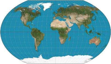
26 REFERENCING DATA TO THE EARTH MAP PROJECTIONS ROBINSON

27 REFERENCING DATA TO THE EARTH MAP PROJECTIONS So, I use Google Maps, Bing Maps and Mapquest all the time Does it have a map projection? Yes! Web Mercator Auxiliary Sphere, WGS 1984 datum Large amount of distortion near the poles Not bad for many locations. Not great near the poles

28 REFERENCING DATA TO THE EARTH MAP 37 Dewey Field Road, Hanover, NH USA ~ , Google Maps is geocoding the address to a map (datum, projection, coordinate system)

29 REFERENCING DATA TO THE EARTH MAP Google maps can accept latitude and longitude as input also
30 WORKING WITH GIS GIS Functionality View geospatial data Create maps View imagery Analyze spatial data Examples: Calculate and show distance away from an object, known as a buffer Calculate what falls inside and outside a polygon or a buffer Classify imagery Create 3-D models using ground elevation data and structure elevation data

31 Note map elements WORKING WITH GIS CREATE MAPS AND VIEW GEOGRAPHIC DATA

32 WORKING WITH GIS CREATE MAPS MAP OF US POPULATION DENSITY IN 2000 BY COUNTY
 US Navy, NGA Geoeye, Google, LandSat, i- cubed State Agencies WORKING WITH GIS VIEW")
33 Imagery sources and vendors include: USGS Digital Orthoquads (DOQs) NOAA imagery USDA National Agricultural Imagery Program (NAIP) US Navy, NGA Geoeye, Google, LandSat, i- cubed State Agencies WORKING WITH GIS VIEW IMAGERY
34 WORKING WITH GIS WEB, DESKTOP, DESKTOP ANALYSIS Web GIS systems Google Maps (mymaps) ArcGIS Online Carto Desktop GIS ArcGIS Desktop QGIS MapWindow Grass GIS Analytical GIS tools ArcGIS Desktop with ArcToolbox, Modelbuilder, Python scripting R with geospatial analysis libraries Python with geospatial data abstraction libraries (GDAL)
35 WORKING WITH GIS GIS synonyms = location intelligence, smart maps, geospatial intelligence What question(s) are you trying to answer? What problem(s) are we trying to solve? How many of the nesting sites are in the boreal forest? How can I get from A to B along the road network? How many of the hospitals are in flood zones? Are there hot spots of contaminants in certain areas?
36 WORKING WITH GIS Google Maps quick & easy Google Fusion Tables AGOL web-based, some analysis possible ESRI Maps for office ArcGIS Desktop ArcGIS Pro ArcGIS Enterprise / Server


37 WORKING WITH GIS HEAT MAPS, CLUSTERS Heat map showing density of features Cluster symbology changes with scale
38 WORKING WITH GIS: ANALYSIS Common GIS Analysis tools Clipping data to a study area Projecting data to a common spatial reference system (datum, map projection and coordinate system) Map Overlay Extract / Select Intersect Proximity Spatial Join Zonal Statistics Raster Math Network analysis Spatial Statistics, Geostatistics Hot Spots Interpolaton Surface from known or estimated points Machine Learning


39 WORKING WITH GIS - SPATIAL ANALYSIS - Spatial Analysis includes a suite of tools, too many to mention here Here we see a proximity tool known as the Buffer tool, with the result showing distances in half-mile rings from the Dartmouth Green and the coffee shops within those rings
40 WORKING WITH GIS - SPATIAL ANALYSIS TOOLS - The Clip tool can be used to extract a dataset to a study area, reduce overall dataset size (86,000 records statewide down to less than 500 for Hanover) Clipping larger datasets allows us to reduce the storage size, focus on certain areas, and perform calculations such as the area of surface water within Hanover town boundary
41 WORKING WITH GIS - SPATIAL ANALYSIS & SPATIAL STATISTICS - Perform Data Queries and Answer Research Questions: analyze spatial distributions, patterns, relationships What percent occurrence of nesting sites within 500 feet of deciduous forests? What percent of the population lives within twenty miles of a farmers market? What would be a good site for a new neighborhood park? What is the average number of health centers per square mile in the state?
42 Proximity Analysis Hotspots and Density Analysis Minimum and Maximum values Surface creation and analysis Focal window analysis Heat Map Representations WORKING WITH GIS SPATIAL STATISTICS


43 DIGITAL ELEVATION MODELS Elevation models can be used to: Determine how water will drain from the surface Create contour lines for elevation Determine watershed boundaries Calculate area and volume Calculate Slope Hillshade model creation for viewing terrain

44 ANALYZE RASTER DATA: SURFACES AND DIGITAL ELEVATION MODELS DEM s can also be used for cut/fill analysis, volume calculations, generation of hillshade models, slope models and aspect models

45 WORKING WITH GIS CHOROPLETH SYMBOLOGY, BUBBLE MAPS In a choropleth map, areas or points are shaded or patterned in proportion to some numerical or statistical value such as population density or per-capita income In a bubble map, points or regions are sized proportionally according to a particular statistical value. Bubble maps are sometimes called intensity maps.


46 WEB MAPPING Today, GIS can be done with desktop software, but also with web-based tools like ArcGIS Online and Google Maps my maps feature.
47 WHERE CAN I FIND DATA? There are a wide variety of GIS data available from many sources Dartmouth Library Research Guide on GIS Data: Located here: Federal Government: Data.Gov: National Map: New Hampshire, Statewide GIS Clearinghouse: Vermont Center for Geographic Information: Other states Most states now have a clearinghouse and office of Geographic Information Contact Research Computing: research.computing@dartmouth.edu or Create your own: GPS devices, professional survey data, digitizing (on-screen creation and editing of data)
48 DATA SOURCES, FORMATS & METADATA Data, depending on its source and the methods used to collect and process, can vary widely. GIS datasets are collected at varying scales and accuracies. Metadata is the term used for the file that should accompany the dataset. This file helps to explain what is in the dataset, who produced the dataset, and what its intended purpose was for producing the data Common Vector formats: geodatabase, shapefile, KML, KMZ, geojson, xyz, comma-separated (csv) Common Raster formats: JPG, TIFF, IMG, GRID

49 DATA & METADATA One way to think about metadata, it is analogous to text that was often imbedded in old photographs The text was used to document where and when the photo was taken, and sometimes who took the photo
50 METADATA Information that describes a dataset, including but not limited to how the data was collected, who collected it, when it was collected Data about data ALWAYS ask for Metadata, and read it to understand the dataset Metadata is often included with a downloaded dataset, but not always. Look for metadata in html, xml, txt or doc format. At times you may need to contact the data producer or data steward for metadata.


51 SAMPLE METADATA FILE Metadata from the National Wetlands Inventory, a US Federal Government data layer published by the US Fish & Wildlife Service, the USGS Geographic Names Inventory


52 CAPTURING GEOGRAPHIC DATA IN THE FIELD Professional Survey GPS Recreational mapping GPS units Laptops or Tablets with GPS card or antenna Smart phones with location services such as GPS chip or cell-phone tower triangulation Drones equipped with cameras capable of producing stero-pair orthoimagery of the terrain

53 HANDS-ON GIS EXERCISE DATA Open a browser, navigate to


54 READY TO MAKE A MAP? Pan, Zoom, Search, Identify, layer transparency Add base map, add data Select, filter Open ArcMap, open a new, blank map


55 ADDING DATA Add data from local drive, or from the web
 Reference map Date of publication, author(s) Funding Info & disclaimers (for planning purposes only, not intended for legal boundary")
56 Make a map to add to a publication or poster, export to PDF, JPG or to send to a printer or plotter Map title North arrow or compass rose Scale bar Legend PUBLISHING MAPS LAYOUT VIEW Sources of data (abbreviated metadata) Reference map Date of publication, author(s) Funding Info & disclaimers (for planning purposes only, not intended for legal boundary use )

57 SPATIAL ANALSYIS Using ArcToolbox

58 ARCGIS ONLINE LIGHTWEIGHT GIS Navigate to nin.html Sign in on the ArcGIS sign-in page, click to Sign in with Enterprise Login Click the Dartmouth College button Once logged in, click Content and then Add Item or Create Access Tutorial at

59 ARCGIS DESKTOP - ARCCATALOG Preview GIS data layers in ArcCatalog Read Metadata Manage data layers Use ArcToolbox tools Write metadata

60 QUESTIONS?
61 SUPPLEMENTAL INFORMATION


62 CREATING GIS DATA GIS Data can be generated by a geocode process. For instance, 2 East Wheelock Street, Hanover, NH can also be described by its WGS84 Latitude and Longitude coordinates, and then placed in a GIS with other base layers

63 SCAN AND GEOREFERENCE OLD MAPS, AERIAL PHOTOS Have an old map or image? They can be scanned and brought in to approximate alignment with other GIS data layers through the process of georeferencing


64 CREATION OF GIS DATA

65 OPEN STREET MAP DATA Open Street Map has open data for you to view, download and use Data can also be openly contributed to Open Street Map
66 DATA FORMATS AND SOFTWARE DATA ArcGIS Geodatabase Shapefile JPG, TIFF KML/KMZ Google Earth KML/KMZ Google Earth Pro Shapefile Open-Source Software QGIS GRASS GIS MapWindow gvsig R Proprietary Software ESRI ArcGIS Desktop Google Earth Pro ERDAS Imagine IDRISI ENVI
67 DATA MANAGEMENT TIPS AND TECHNIQUES GIS datasets can be very large in size A single dataset can at times be comprised of many files on your computer s file system Structure your project data in a way that makes sense to you. Use file names that make sense, and fill out metadata descriptions for files you generate and plan to keep. Keep detailed notes about data sources and data storage Take notes on your processing steps Back up data that can t be recreated easily, storing a copy on a server or external drive, keeping careful track of the authoritative copy of the data.

68 MAPS FOR JOURNAL PUBLICATIONS


69 COMMON MAP ELEMENTS Date of map production Author of map Inset locational map Compass Rose or North Arrow Scale bar Legend / Key Title Data Sources


70 GIS ANALYSIS IN ARCGIS DESKTOP ARCTOOLBOX, MODELBUILDER, PYTHON SCRIPTING Analysis can be done interactively or through scripting with Python. Multistep models can be built with Python or Modelbuilder


71 GPS The project scope of work should drive the type of device required For 2-5 meter accuracy, a $100 GPS device might do the trick if used properly For high accuracy applications such as surveying and construction, device kits can run over $10,000 and require specialized training to use the devices properly. GPS units require the acquisition of signals from at least four GPS satellites, that must be widely distributed in the sky, in order for your device to estimate your position using trilateration Allowing the unit to remain in one location for a longer period of time may improve the trilateration process

72 GPS On the ground, if we knew that we were a certain distance from Boise, ID, Minneapolis, MN and Tucson, AZ we could determine that we are near Denver, CO. With GPS, by knowing the time stamp sent by at least three satellites, we can use Distance = Rate x Time. Rate is the speed of light, the speed of the radio transmission
 QGIS for Android Often difficult to know, record or assess positional accuracy metrics such as PDOP Examples include")
73 GIS COLLECTOR APPS FOR MOBILE Recently, a variety of GIS data collection tools have been developed for mobile devices such as phones and tablets These use the mobile device s GPS chip and towersignal proximity for location Collector For ArcGIS GIS Cloud MDC (mobile data collector) QGIS for Android Often difficult to know, record or assess positional accuracy metrics such as PDOP Examples include Collector for ArcGIS, Mobile Data Collector-MDC GIS Cloud, ArcGIS Survey 123
Popular Mechanics, 1954
 Introduction to GIS Popular Mechanics, 1954 1986 $2,599 1 MB of RAM 2017, $750, 128 GB memory, 2 GB of RAM Computing power has increased exponentially over the past 30 years, Allowing the existence of
These modules are covered with a brief information and practical in ArcGIS Software and open source software also like QGIS, ILWIS.
 Online GIS Training and training modules covered are: 1. ArcGIS, Analysis, Fundamentals and Implementation 2. ArcGIS Web Data Sharing 3. ArcGIS for Desktop 4. ArcGIS for Server These modules are covered
Introduction to Geographic Information Systems (GIS): Environmental Science Focus
: Environmental Science Focus") Introduction to Geographic Information Systems (GIS): Environmental Science Focus September 9, 2013 We will begin at 9:10 AM. Login info: Username:!cnrguest Password: gocal_bears Instructor: Domain: CAMPUS
Introduction to Geographic Information Systems (GIS): Environmental Science Focus September 9, 2013 We will begin at 9:10 AM. Login info: Username:!cnrguest Password: gocal_bears Instructor: Domain: CAMPUS
NR402 GIS Applications in Natural Resources
 NR402 GIS Applications in Natural Resources Lesson 1 Introduction to GIS Eva Strand, University of Idaho Map of the Pacific Northwest from http://www.or.blm.gov/gis/ Welcome to NR402 GIS Applications in
In this exercise we will learn how to use the analysis tools in ArcGIS with vector and raster data to further examine potential building sites.
 GIS Level 2 In the Introduction to GIS workshop we filtered data and visually examined it to determine where to potentially build a new mixed use facility. In order to get a low interest loan, the building
Among various open-source GIS programs, QGIS can be the best suitable option which can be used across partners for reasons outlined below.
 Comparison of Geographic Information Systems (GIS) software As of January 2018, WHO has reached an agreement with ESRI (an international supplier of GIS software) for an unlimited use of ArcGIS Desktop
Acknowledgments xiii Preface xv. GIS Tutorial 1 Introducing GIS and health applications 1. What is GIS? 2
 Acknowledgments xiii Preface xv GIS Tutorial 1 Introducing GIS and health applications 1 What is GIS? 2 Spatial data 2 Digital map infrastructure 4 Unique capabilities of GIS 5 Installing ArcView and the
GIS CONCEPTS ARCGIS METHODS AND. 3 rd Edition, July David M. Theobald, Ph.D. Warner College of Natural Resources Colorado State University
 GIS CONCEPTS AND ARCGIS METHODS 3 rd Edition, July 2007 David M. Theobald, Ph.D. Warner College of Natural Resources Colorado State University Copyright Copyright 2007 by David M. Theobald. All rights
Export Basemap Imagery from GIS to CAD
 Export Basemap Imagery from GIS to CAD This tutorial illustrates how to add high resolution imagery as a basemap into an existing CAD drawing using ArcGIS and AutoCAD. Through this method, the imagery
EnvSci 360 Computer and Analytical Cartography
 EnvSci 360 Computer and Analytical Cartography Lecture 7 Mapping Images, Surfaces, and 3-D Data Brief Overview of Imagery What is Imagery? A spatial data model that defines space as an array of equally
Display data in a map-like format so that geographic patterns and interrelationships are visible
 Vilmaliz Rodríguez Guzmán M.S. Student, Department of Geology University of Puerto Rico at Mayagüez Remote Sensing and Geographic Information Systems (GIS) Reference: James B. Campbell. Introduction to
Learning ArcGIS: Introduction to ArcCatalog 10.1
 Learning ArcGIS: Introduction to ArcCatalog 10.1 Estimated Time: 1 Hour Information systems help us to manage what we know by making it easier to organize, access, manipulate, and apply knowledge to the
Introduction to Geographic Information Systems
 Introduction to Geographic Information Systems Lynn_Carlson@brown.edu 401-863-9917 The Environmental And Remote TecHnologies Lab MacMillan Hall, Room 105 http://www.brown.edu/research/earthlab/ Outline
Introduction INTRODUCTION TO GIS GIS - GIS GIS 1/12/2015. New York Association of Professional Land Surveyors January 22, 2015
 New York Association of Professional Land Surveyors January 22, 2015 INTRODUCTION TO GIS Introduction GIS - GIS GIS 1 2 What is a GIS Geographic of or relating to geography the study of the physical features
Overview key concepts and terms (based on the textbook Chang 2006 and the practical manual)
") Introduction Geo-information Science (GRS-10306) Overview key concepts and terms (based on the textbook 2006 and the practical manual) Introduction Chapter 1 Geographic information system (GIS) Geographically
Introduction Geo-information Science (GRS-10306) Overview key concepts and terms (based on the textbook 2006 and the practical manual) Introduction Chapter 1 Geographic information system (GIS) Geographically
Course overview. Grading and Evaluation. Final project. Where and When? Welcome to REM402 Applied Spatial Analysis in Natural Resources.
 Welcome to REM402 Applied Spatial Analysis in Natural Resources Eva Strand, University of Idaho Map of the Pacific Northwest from http://www.or.blm.gov/gis/ Where and When? Lectures Monday & Wednesday
ArcGIS Pro: Essential Workflows STUDENT EDITION
 ArcGIS Pro: Essential Workflows STUDENT EDITION Copyright 2018 Esri All rights reserved. Course version 6.0. Version release date August 2018. Printed in the United States of America. The information contained
Presenting Tree Inventory. Tomislav Sapic GIS Technologist Faculty of Natural Resources Management Lakehead University
 Presenting Tree Inventory Tomislav Sapic GIS Technologist Faculty of Natural Resources Management Lakehead University Suggested Options 1. Print out a Google Maps satellite image of the inventoried block
GIS Level 2. MIT GIS Services
 GIS Level 2 MIT GIS Services http://libraries.mit.edu/gis Email: gishelp@mit.edu TOOLS IN THIS WORKSHOP - Definition Queries - Create a new field in the attribute table - Field Calculator - Add XY Data
GIS Workshop UCLS_Fall Forum 2014 Sowmya Selvarajan, PhD TABLE OF CONTENTS
 TABLE OF CONTENTS TITLE PAGE NO. 1. ArcGIS Basics I 2 a. Open and Save a Map Document 2 b. Work with Map Layers 2 c. Navigate in a Map Document 4 d. Measure Distances 4 2. ArcGIS Basics II 5 a. Work with
Week 8 Cookbook: Review and Reflection
 : Review and Reflection Week 8 Overview 8.1) Review and Reflection 8.2) Making Intelligent Maps: The map sheet as a blank canvas 8.3) Making Intelligent Maps: Base layers and analysis layers 8.4) ArcGIS
Exercise 3: GIS data on the World Wide Web
 Exercise 3: GIS data on the World Wide Web These web sites are a few examples of sites that are serving free GIS data. Many other sites exist. Search in Google or other search engine to find GIS data for
GIS for ChEs Introduction to Geographic Information Systems
 GIS for ChEs Introduction to Geographic Information Systems AIChE Webinar John Cirucci 1 GIS for ChEs Introduction to Geographic Information Systems What is GIS? Tools and Methods Applications Examples
WlLPEN L. GORR KRISTEN S. KURLAND. Universitats- und Landesbibliothek. Bibliothek Architektur und Stadtebau ESRI
 hj WlLPEN L. GORR KRISTEN S. KURLAND Universitats- und Landesbibliothek Darmstadt Bibliothek Architektur und Stadtebau ESRI Contents Acknowledgments Preface xvii XV GIS Tutorial 1 Introduction Launch ArcMap
Lecture 9: Reference Maps & Aerial Photography
 Lecture 9: Reference Maps & Aerial Photography I. Overview of Reference and Topographic Maps There are two basic types of maps? Reference Maps - General purpose maps & Thematic Maps - maps made for a specific
The Emerging Role of Enterprise GIS in State Forest Agencies
 The Emerging Role of Enterprise GIS in State Forest Agencies Geographic Information System (GIS) A geographic information system (GIS) is a computer software system designed to capture, store, manipulate,
GIS = Geographic Information Systems;
 What is GIS GIS = Geographic Information Systems; What Information are we talking about? Information about anything that has a place (e.g. locations of features, address of people) on Earth s surface,
SCHOOL OF ENGINEERING AND TECHNOLOGY COMPUTER LAB
 PHASE 1_6 TH SESSION ARCGIS TRAINING AT KU GIS LABS: INTRODUCTION TO GIS: EXPLORING ARCCATALOG AND ARCGIS TOOLS 6 TH SESSION REPORT: 3 RD -5 TH SEPTEMBER 2014 SCHOOL OF ENGINEERING AND TECHNOLOGY COMPUTER
GIS Resources for Local Governments
 ISSUE PAPER SERIES GIS Resources for Local Governments February 2018 NEW YORK STATE TUG HILL COMMISSION DULLES STATE OFFICE BUILDING 317 WASHINGTON STREET WATERTOWN, NY 13601 (315) 785-2380 WWW.TUGHILL.ORG
GIS CONCEPTS ARCGIS METHODS AND. 2 nd Edition, July David M. Theobald, Ph.D. Natural Resource Ecology Laboratory Colorado State University
 GIS CONCEPTS AND ARCGIS METHODS 2 nd Edition, July 2005 David M. Theobald, Ph.D. Natural Resource Ecology Laboratory Colorado State University Copyright Copyright 2005 by David M. Theobald. All rights
Spatial Data Analysis with ArcGIS Desktop: From Basic to Advance
 Spatial Data Analysis with ArcGIS Desktop: From Basic to Advance 1. Course overview Modern environmental, energy as well as resource modeling and planning require huge amount of geographically located
Introduction to GIS I
 Introduction to GIS Introduction How to answer geographical questions such as follows: What is the population of a particular city? What are the characteristics of the soils in a particular land parcel?
Outline. Chapter 1. A history of products. What is ArcGIS? What is GIS? Some GIS applications Introducing the ArcGIS products How does GIS work?
 Outline Chapter 1 Introducing ArcGIS What is GIS? Some GIS applications Introducing the ArcGIS products How does GIS work? Basic data formats The ArcCatalog interface 1-1 1-2 A history of products Arc/Info
Delineation of Watersheds
 Delineation of Watersheds Adirondack Park, New York by Introduction Problem Watershed boundaries are increasingly being used in land and water management, separating the direction of water flow such that
GIS Workshop Data Collection Techniques
 GIS Workshop Data Collection Techniques NOFNEC Conference 2016 Presented by: Matawa First Nations Management Jennifer Duncan and Charlene Wagenaar, Geomatics Technicians, Four Rivers Department QA #: FRG
Write a report (6-7 pages, double space) on some examples of Internet Applications. You can choose only ONE of the following application areas:
 on some examples of Internet Applications. You can choose only ONE of the following application areas:") UPR 6905 Internet GIS Homework 1 Yong Hong Guo September 9, 2008 Write a report (6-7 pages, double space) on some examples of Internet Applications. You can choose only ONE of the following application
UPR 6905 Internet GIS Homework 1 Yong Hong Guo September 9, 2008 Write a report (6-7 pages, double space) on some examples of Internet Applications. You can choose only ONE of the following application
GIS Lecture 5: Spatial Data
 GIS Lecture 5: Spatial Data GIS 1 Outline Vector Data Formats Raster Data Formats Map Projections Coordinate Systems US Census geographic files US Census data files GIS Data Sources GIS 2 Vector Data Formats
94-802Z: Geographic Information Systems Summer 2018
 94-802Z: Geographic Information Systems Summer 2018 Instructor: Professor Kristen Kurland Teaching Assistant(s): (Office hours to be posted on Canvas) TBA Class Web Site: http:/www.cmu.edu/canvas
ARCGIS TRAINING AT KU GIS LABS: INTRODUCTION TO GIS: EXPLORING ARCCATALOG AND ARCGIS TOOLS
 PHASE 1_4 th SESSION ARCGIS TRAINING AT KU GIS LABS: INTRODUCTION TO GIS: EXPLORING ARCCATALOG AND ARCGIS TOOLS 4 th SESSION REPORT: 30 TH JUNE - 2 ND JULY SCHOOL OF ENVIRONMENTAL STUDIES COMPUTER LAB
ARCGIS TRAINING AT KU GIS LABS: INTRODUCTION TO GIS: EXPLORING ARCCATALOG AND ARCGIS TOOLS
 PHASE 1_3 rd SESSION ARCGIS TRAINING AT KU GIS LABS: INTRODUCTION TO GIS: EXPLORING ARCCATALOG AND ARCGIS TOOLS 3 rd SESSION REPORT: 25 TH -27 TH JUNE 2014 SCHOOL OF ENVIRONMENTAL STUDIES COMPUTER LAB
GIS Lecture 4: Data. GIS Tutorial, Third Edition GIS 1
 GIS Lecture 4: Data GIS 1 Outline Data Types, Tables, and Formats Geodatabase Tabular Joins Spatial Joins Field Calculator ArcCatalog Functions GIS 2 Data Types, Tables, Formats GIS 3 Directly Loadable
YYT-C3002 Application Programming in Engineering GIS I. Anas Altartouri Otaniemi
 YYT-C3002 Application Programming in Engineering GIS I Otaniemi Overview: GIS lectures & exercise We will deal with GIS application development in two lectures. Because of the versatility of GIS data models
Lecture 2. Introduction to ESRI s ArcGIS Desktop and ArcMap
 Lecture 2 Introduction to ESRI s ArcGIS Desktop and ArcMap Outline ESRI What is ArcGIS? ArcGIS Desktop ArcMap Overview Views Layers Attribute Tables Help! Scale Tips and Tricks ESRI Environmental Systems
Fundamentals of ArcGIS Desktop Pathway
 Fundamentals of ArcGIS Desktop Pathway Table of Contents ArcGIS Desktop I: Getting Started with GIS 3 ArcGIS Desktop II: Tools and Functionality 5 Understanding Geographic Data 8 Understanding Map Projections
Working with ArcGIS Online
 Esri International User Conference San Diego, CA Technical Workshops July 12, 2011 Working with ArcGIS Online Bern Szukalski, Deane Kensok Topics for this Session ArcGIS Online Overview ArcGIS Online Content
Today: GEOL 452/552 - GIS for Geoscientists I. Lecture 3 - Chapter 1. GIS vector Data (review) Let s annotate this layer (draw on paper)
 Let s annotate this layer (draw on paper)") Today: GEOL 452/552 - GIS for Geoscientists I Lecture 3 - Chapter 1 GIS vector data - review raster data history: ArcView/ArcINFO - ArcGIS types of GIS data files Lab: finish Ch. 1 tutorial and HW1 Please
Today: GEOL 452/552 - GIS for Geoscientists I Lecture 3 - Chapter 1 GIS vector data - review raster data history: ArcView/ArcINFO - ArcGIS types of GIS data files Lab: finish Ch. 1 tutorial and HW1 Please
Vector Analysis: Farm Land Suitability Analysis in Groton, MA
 Vector Analysis: Farm Land Suitability Analysis in Groton, MA Written by Adrienne Goldsberry, revised by Carolyn Talmadge 10/9/2018 Introduction In this assignment, you will help to identify potentially
Faculty Disclosures Center for Health Research / Loma Linda University Pramil N. Singh, Dr.PH. No relevant commercial interests.
 Faculty Disclosures Center for Health Research / Loma Linda University Pramil N. Singh, Dr.PH No relevant commercial interests. Geographic Information Systems for Health Care Research, Practice, and Management
Climate Risk Visualization for Adaptation Planning and Emergency Response
 Climate Risk Visualization for Adaptation Planning and Emergency Response NCR Flood Fact Finding Workshop Ricardo Saavedra ricardo@vizonomy.com Social Media, Mobile, and Big Data St. Peter s Basilica,
Week 7 Last week: This week s topics. GIS and Forest Engineering Applications. FE 257. GIS and Forest Engineering Applications.
 FE 257. GIS and Forest Engineering Applications Week 7 Week 7 Last week: Spatial Projections Questions? Next week- read: Chapter 10: Updating GIS Databases Chapter 12: Synthesis of Techniques Applied to
GIS Boot Camp for Education June th, 2011 Day 1. Instructor: Sabah Jabbouri Phone: (253) x 4854 Office: TC 136
 x 4854 Office: TC 136") GIS Boot Camp for Education June 27-30 th, 2011 Day 1 Instructor: Sabah Jabbouri Phone: (253) 833-9111 x 4854 Office: TC 136 Email: sjabbouri@greenriver.edu http://www.instruction.greenriver.edu/gis/ Summer
GIS Boot Camp for Education June 27-30 th, 2011 Day 1 Instructor: Sabah Jabbouri Phone: (253) 833-9111 x 4854 Office: TC 136 Email: sjabbouri@greenriver.edu http://www.instruction.greenriver.edu/gis/ Summer
When Map Quality Matters
 When Map Quality Matters 50% 25% Powerful geospatial mapping tools for Adobe Creative Cloud and offline map solutions for mobile devices 20% When Map Quality Matters 10% We re focused on creating powerful
GEOGRAPHIC INFORMATION SYSTEMS
 GEOGRAPHIC INFORMATION SYSTEMS 4-H Round-Up Community Transitions Workshop Daniel Hanselka June 14, 2011 Goals of the Workshop Answer the question: What is GIS? Uses of GIS. Some of the Common Terminology
GIS for Surveyors: Wetland Studies and Solutions, Inc.
 GIS for Surveyors: Concepts, Solutions, and Applications ` New Jersey Society of Professional Land Surveyors (NJSPLS) SurvCon 2013, Atlantic City, New Jersey Presented by John Cooke and Yeoanny A. Venetsanos,
Lecture 2. A Review: Geographic Information Systems & ArcGIS Basics
 Lecture 2 A Review: Geographic Information Systems & ArcGIS Basics GIS Overview Types of Maps Symbolization & Classification Map Elements GIS Data Models Coordinate Systems and Projections Scale Geodatabases
Dr. ABOLGHASEM AKBARI Faculty of Civil Engineering & Earth Resources, University Malaysia Pahang (UMP)
") Workshop on : Dr. ABOLGHASEM AKBARI Faculty of Civil Engineering & Earth Resources, University Malaysia Pahang (UMP) 14-15 April 2016 Venue: Tehran, Iran GIS definitions GIS: A simplified view of the real
Workshop on : Dr. ABOLGHASEM AKBARI Faculty of Civil Engineering & Earth Resources, University Malaysia Pahang (UMP) 14-15 April 2016 Venue: Tehran, Iran GIS definitions GIS: A simplified view of the real
UNIT 4: USING ArcGIS. Instructor: Emmanuel K. Appiah-Adjei (PhD) Department of Geological Engineering KNUST, Kumasi
 Department of Geological Engineering KNUST, Kumasi") UNIT 4: USING ArcGIS Instructor: Emmanuel K. Appiah-Adjei (PhD) Department of Geological Engineering KNUST, Kumasi Getting to Know ArcGIS ArcGIS is an integrated collection of GIS software products ArcGIS
UNIT 4: USING ArcGIS Instructor: Emmanuel K. Appiah-Adjei (PhD) Department of Geological Engineering KNUST, Kumasi Getting to Know ArcGIS ArcGIS is an integrated collection of GIS software products ArcGIS
Data Aggregation with InfraWorks and ArcGIS for Visualization, Analysis, and Planning
 Data Aggregation with InfraWorks and ArcGIS for Visualization, Analysis, and Planning Stephen Brockwell President, Brockwell IT Consulting, Inc. Join the conversation #AU2017 KEYWORD Class Summary Silos
Geographic Information Systems. Introduction to Data and Data Sources
 Geographic Information Systems Introduction to Data and Data Sources Presented by John Showler, NJDA-SSCC NJ SCD GIS Training Session December 10, 209 The Objectives of this session are 3-fold: 1. Introduce
Time Series Analysis with SAR & Optical Satellite Data
 Time Series Analysis with SAR & Optical Satellite Data Thomas Bahr ESRI European User Conference Thursday October 2015 harris.com Motivation Changes in land surface characteristics mirror a multitude of
GIS Functions and Integration. Tyler Pauley Associate Consultant
 GIS Functions and Integration Tyler Pauley Associate Consultant Contents GIS in AgileAssets products Displaying data within AMS Symbolizing the map display Display on Bing Maps Demo- Displaying a map in
Data Structures & Database Queries in GIS
 Data Structures & Database Queries in GIS Objective In this lab we will show you how to use ArcGIS for analysis of digital elevation models (DEM s), in relationship to Rocky Mountain bighorn sheep (Ovis
Geographic Systems and Analysis
 Geographic Systems and Analysis New York University Robert F. Wagner Graduate School of Public Service Instructor Stephanie Rosoff Contact: stephanie.rosoff@nyu.edu Office hours: Mondays by appointment
ArcGIS Enterprise: What s New. Philip Heede Shannon Kalisky Melanie Summers Shreyas Shinde
 ArcGIS Enterprise: What s New Philip Heede Shannon Kalisky Melanie Summers Shreyas Shinde ArcGIS Enterprise is the new name for ArcGIS for Server ArcGIS Enterprise Software Components ArcGIS Server Portal
Geodatabase Management Pathway
 Geodatabase Management Pathway Table of Contents ArcGIS Desktop II: Tools and Functionality 3 ArcGIS Desktop III: GIS Workflows and Analysis 6 Building Geodatabases 8 Data Management in the Multiuser Geodatabase
Introduction to Coastal GIS
 Introduction to Coastal GIS Event was held on Tues, 1/8/13 - Thurs, 1/10/13 Time: 9:00 am to 5:00 pm Location: Roger Williams University, Bristol, RI Audience: The intended audiences for this course are
Geospatial Products V8i (SELECTseries 1)
") Geospatial Products V8i (SELECTseries 1) Keith Raymond Product Manager Geospatial Desktop Products Presentation Overview What are the various products? Why would you need them? Demonstrations 2 WWW.BENTLEY.COM
Geospatial Products V8i (SELECTseries 1) Keith Raymond Product Manager Geospatial Desktop Products Presentation Overview What are the various products? Why would you need them? Demonstrations 2 WWW.BENTLEY.COM
GEOREFERENCING, PROJECTIONS Part I. PRESENTING DATA Part II
 Week 7 GEOREFERENCING, PROJECTIONS Part I PRESENTING DATA Part II topics of the week Georeferencing Coordinate systems Map Projections ArcMap and Projections Geo-referencing Geo-referencing is the process
Bentley Map Advancing GIS for the World s Infrastructure
 Bentley Map Advancing GIS for the World s Infrastructure Presentation Overview Why would you need Bentley Map? What is Bentley Map? Where is Bentley Map Used? Why would you need Bentley Map? Because your
A Review: Geographic Information Systems & ArcGIS Basics
 A Review: Geographic Information Systems & ArcGIS Basics Geographic Information Systems Geographic Information Science Why is GIS important and what drives it? Applications of GIS ESRI s ArcGIS: A Review
ArcGIS Online Tools and Water-Related Web Services You Can Use Every Day of Your Life!
 ArcGIS Online Tools and Water-Related Web Services You Can Use Every Day of Your Life! Brian Rowley, PE, CFM FMA 2014 Annual Conference 1 Gold Rush (49ers) John Sutter Sutter s Mill South fork of American
Data Creation and Editing
 11.520:A Workshop on Geographical Information Systems 1.188: Urban Planning and Social Science Laboratory Data Creation and Editing Based in part on notes by Prof. Joseph Ferreira and Michael Flaxman Lulu
Introduction to GIS Sarah Watson University of Kentucky Libraries March 6, 2017
 Introduction to GIS Sarah Watson sarahwatson@uky.edu University of Kentucky Libraries March 6, 2017 Outline Overview of various terms Quick overview of ArcGIS and QGIS Geocoding Activity Considering Map
Lecture 1 Introduction to GIS. Dr. Zhang Spring, 2017
 Lecture 1 Introduction to GIS Dr. Zhang Spring, 2017 Topics of the course Using and making maps Navigating GIS Map design Working with spatial data Geoprocessing Spatial data infrastructure Digitizing
Lecture 7: GIS Data Capture and Metadata
 Lecture 7: GIS Data Capture and Metadata Section I: Overview of GIS Data Capture As you read this lecture think about the type of data capture and how metadata can help with your final project. Introduction
Welcome to NR502 GIS Applications in Natural Resources. You can take this course for 1 or 2 credits. There is also an option for 3 credits.
 Welcome to NR502 GIS Applications in Natural Resources. You can take this course for 1 or 2 credits. There is also an option for 3 credits. The 1st credit consists of a series of readings, demonstration,
Steve Pietersen Office Telephone No
 Steve Pietersen Steve.Pieterson@durban.gov.za Office Telephone No. 031 311 8655 Overview Why geography matters The power of GIS EWS GIS water stats EWS GIS sanitation stats How to build a GIS system EWS
URP 4273 Section 8233 Introduction to Planning Information Systems (3 Credits) Fall 2017
 Fall 2017") URP 4273 Section 8233 Introduction to Planning Information Systems (3 Credits) Fall 2017 Instructor: Office Periods: Stanley Latimer 466 ARCH Phone: 352 294-1493 e-mail: latimer@geoplan.ufl.edu Monday
URP 4273 Section 8233 Introduction to Planning Information Systems (3 Credits) Fall 2017 Instructor: Office Periods: Stanley Latimer 466 ARCH Phone: 352 294-1493 e-mail: latimer@geoplan.ufl.edu Monday
PHASE 1_7 TH SESSION ARCGIS TRAINING AT KU GIS LABS: INTRODUCTION TO GIS: EXPLORING ARCCATALOG AND ARCGIS TOOLS
 PHASE 1_7 TH SESSION ARCGIS TRAINING AT KU GIS LABS: INTRODUCTION TO GIS: EXPLORING ARCCATALOG AND ARCGIS TOOLS 7 TH SESSION REPORT: 10 TH - 12 TH SEPTEMBER 2014 SCHOOL OF ENGINEERING AND TECHNOLOGY COMPUTER
Mapping Your Land and Introduction to Web Soil Survey. Elizabeth Cook GIS Specialist USDA-NRCS (retired)
") Mapping Your Land and Introduction to Web Soil Survey Elizabeth Cook GIS Specialist USDA-NRCS (retired) Using Geographic Information Systems (GIS), Global Positioning System (GPS), digital aerial photography
Mapping Your Land and Introduction to Web Soil Survey Elizabeth Cook GIS Specialist USDA-NRCS (retired) Using Geographic Information Systems (GIS), Global Positioning System (GPS), digital aerial photography
You are Building Your Organization s Geographic Knowledge
 You are Building Your Organization s Geographic Knowledge And Increasingly Making it Available Sharing Data Publishing Maps and Geo-Apps Developing Collaborative Approaches Citizens Knowledge Workers Analysts
Introduction to GIS. Phil Guertin School of Natural Resources and the Environment GeoSpatial Technologies
 Introduction to GIS Phil Guertin School of Natural Resources and the Environment dguertin@cals.arizona.edu Mapping GeoSpatial Technologies Traditional Survey Global Positioning Systems (GPS) Remote Sensing
ENV208/ENV508 Applied GIS. Week 1: What is GIS?
 ENV208/ENV508 Applied GIS Week 1: What is GIS? 1 WHAT IS GIS? A GIS integrates hardware, software, and data for capturing, managing, analyzing, and displaying all forms of geographically referenced information.
Lecture 3 GIS outputs. Dr. Zhang Spring, 2017
 Lecture 3 GIS outputs Dr. Zhang Spring, 2017 Model of the course Using and making maps Navigating GIS maps Map design Working with spatial data Geoprocessing Spatial data infrastructure Digitizing File
ESRI Survey Summit August Clint Brown Director of ESRI Software Products
 ESRI Survey Summit August 2006 Clint Brown Director of ESRI Software Products Cadastral Fabric How does Cadastral fit with Survey? Surveyors process raw field observations Survey measurements define high-order
Demystifying ArcGIS Online. Karen Lizcano Esri
 Demystifying ArcGIS Online Karen Lizcano Esri An Integrated Web GIS Platform Desktop Web Device Powered by Services Managed via Portal Access from any Device Portal Server Online Content and Services ArcGIS
GPS Mapping with Esri s Collector App. What We ll Cover
 GPS Mapping with Esri s Collector App Part 1: Overview What We ll Cover Part 1: Overview and requirements Part 2: Preparing the data in ArcGIS for Desktop Part 3: Build a web map in ArcGIS Online Part
Lauren Jacob May 6, Tectonics of the Northern Menderes Massif: The Simav Detachment and its relationship to three granite plutons
 Lauren Jacob May 6, 2010 Tectonics of the Northern Menderes Massif: The Simav Detachment and its relationship to three granite plutons I. Introduction: Purpose: While reading through the literature regarding
GeoWEPP Tutorial Appendix
 GeoWEPP Tutorial Appendix Chris S. Renschler University at Buffalo - The State University of New York Department of Geography, 116 Wilkeson Quad Buffalo, New York 14261, USA Prepared for use at the WEPP/GeoWEPP
The Geodatabase Working with Spatial Analyst. Calculating Elevation and Slope Values for Forested Roads, Streams, and Stands.
 GIS LAB 7 The Geodatabase Working with Spatial Analyst. Calculating Elevation and Slope Values for Forested Roads, Streams, and Stands. This lab will ask you to work with the Spatial Analyst extension.
Louisiana Transportation Engineering Conference. Monday, February 12, 2007
 Louisiana Transportation Engineering Conference Monday, February 12, 2007 Agenda Project Background Goal of EIS Why Use GIS? What is GIS? How used on this Project Other site selection tools I-69 Corridor
All About Spatial Data. Find it, Manage it, Use it
 All About Spatial Data Find it, Manage it, Use it Workshop Outline Define spatial data Spatial data formats Data Sources Metadata Evaluating Spatial Data Data Management Activities: define spatial data,
Introduction-Overview. Why use a GIS? What can a GIS do? Spatial (coordinate) data model Relational (tabular) data model
 data model Relational (tabular) data model") Introduction-Overview Why use a GIS? What can a GIS do? How does a GIS work? GIS definitions Spatial (coordinate) data model Relational (tabular) data model intro_gis.ppt 1 Why use a GIS? An extension
Introduction-Overview Why use a GIS? What can a GIS do? How does a GIS work? GIS definitions Spatial (coordinate) data model Relational (tabular) data model intro_gis.ppt 1 Why use a GIS? An extension
Spatial Analysis in Your Browser
 Spatial Analysis in Your Browser Joseph Kerski Education Manager Esri jkerski@esri.com http://www.youtube.com/geographyuberalles Twitter http://twitter.com/josephkerski 303-449-7779 x 18237 Joseph Kerski
ArcGIS is Advancing. Both Contributing and Integrating many new Innovations. IoT. Smart Mapping. Smart Devices Advanced Analytics
 ArcGIS is Advancing IoT Smart Devices Advanced Analytics Smart Mapping Real-Time Faster Computing Web Services Crowdsourcing Sensor Networks Both Contributing and Integrating many new Innovations ArcGIS
Please note: This presentation was used as speaker s notes for the 2008 Petroleum User Group Conference on Feb. 27, 2008 in Houston, TX.
 Please note: This presentation was used as speaker s notes for the 2008 Petroleum User Group Conference on Feb. 27, 2008 in Houston, TX. This material is not intended as course material nor reference material,
DP Project Development Pvt. Ltd.
 Dear Sir/Madam, Greetings!!! Thanks for contacting DP Project Development for your training requirement. DP Project Development is leading professional training provider in GIS technologies and GIS application
A Basic Introduction to Geographic Information Systems (GIS) ~~~~~~~~~~
 ~~~~~~~~~~") A Basic Introduction to Geographic Information Systems (GIS) ~~~~~~~~~~ Rev. Ronald J. Wasowski, C.S.C. Associate Professor of Environmental Science University of Portland Portland, Oregon 3 September
A Basic Introduction to Geographic Information Systems (GIS) ~~~~~~~~~~ Rev. Ronald J. Wasowski, C.S.C. Associate Professor of Environmental Science University of Portland Portland, Oregon 3 September
GIS: Introductory Guide to MapPlace. Workshop Agenda. How the Maps Work. Geographic Information Systems. -The MapPlace is a web GIS application
 1 Introductory Guide to MapPlace Workshop 2007 Larry Jones MapPlace & Geoscience Databases Pat Desjardins Corporate GIS Gib McArthur Manager, Resource Information Kirk Hancock MINFILE Geologist Ward Kilby
Advanced Algorithms for Geographic Information Systems CPSC 695
 Advanced Algorithms for Geographic Information Systems CPSC 695 Think about Geography What is Geography The 3 W s of Geography What is where Why is it there Why do I care Data - Data - Data We all got