Section C: Management of the Built Environment GIS As A Tool: Technical Aspects of Basic GIS
|
|
|
- Harvey McCarthy
- 5 years ago
- Views:
Transcription
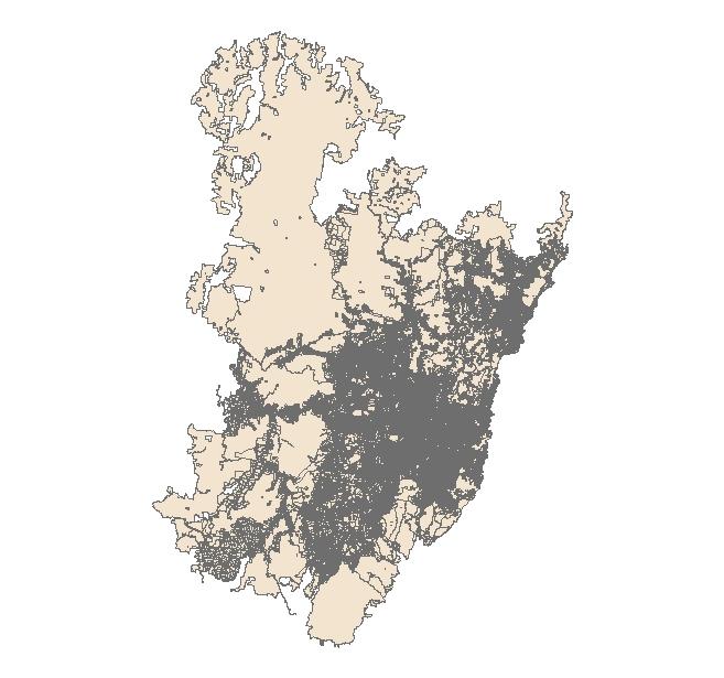
1 Section C: Management of the Built Environment GIS As A Tool: Technical Aspects of Basic GIS This lecture covers five topics: 1.Scale, 2.Framework data, 3.Generalisation, 4.Aggregation, 5.Modifiable unit area problem (MAUP)
2 A list of the sorts of questions we might ask: hy is the concept of scale so important in the generation of information from a GIS? Why do we not mix data that was captured at different scales? What are the issues we face with overlaying features and what alternative approaches could we use? What is framework data and in what sorts of application areas is it used?
3 What do we mean by generalization and how do we undertake that task using ArcGIS software? How do we undertake the aggregation of data using the ArcGIS software and what are some of the issues we face? What is meant by the term MAUP, and what concepts is MAUP linked to in GIS?
4 Topic 1: Scale. Scale as a scale bar and as a representative fraction cadastral Meters 1:25000
5 Resolution and Scale Neutral Bay (Sydney) Landsat 7 20x20 metre Earlybird 6x6 metre
6 Two different units used to describe resolution. High Resolution (small scale) 6 x 6 metre resolution Low Resolution (large scale) 1 degree (200x200 kilometres) 0.25 (50x50 kilometres)
7 Why is scale important in terms of data? 1. Accuracy of features 2. Accuracy of measurement. 3. Visualisation. 4. Relationship between features.

8 Accuracy of features
9 Accuracy of measurement Distance 639 metres (scale 1:25000 data) Distance 695 metres Landsat 7 Image (20x20 pixels)
 Distance 659 metres")
10 Distance 651 metres Earlybird Image (6x6 metres) Distance 659 metres Cadastral

11 Visualisation Cadastral Streets

12 Suburbs

13 National Local Government Areas Collection Districts Statistical Divisions

14 Relationship between features Beach? Relationship more complex in the image
15 Why do we use data captured at different scales? Because that is the only source of data.
16 Different features at different scales Street No Street
17 Shoreline for the census data Shoreline for the cadastral data
18 Changing the form of features as scale increases Post Office as a polygon Post Office as a point
19 Generalising boundaries as scale increases Detail of the shoreline


20 Crowding of features as scale increases
21 General rules of scale 1. Where possible use data captured at the same scale. 2. Work with data at the smallest scale. 3. Always be aware that the information produced is scale dependent.
22 Exceptions to the general rules of scale 1. For some studies where the focus is on a spatial unit (i.e. a neighbourhood) then there is limit to the scale you can go down to. A good example is segregation studies. 2. For some studies the variability in the data sets a limit to the scale you can work at. For example working on climatic change probably means the scale has to be large, in that the climate data has to modelled at a large scale.

23 Topic 2: Framework Data Use cadastral data
24 Street centrelines and cadastral data

25 Census collection districts and cadastral data

26 Cadastral data and imagery (Not Orthorectified)
27 Topic 3: Generalisation ArcToolbox s 4 Tools Dissolve Eliminate Simplify Line Smooth Line

28

29
30
31

32
33 Topic 4: Aggregation Aggregation as opposed to generalisation Aggregation is the process of moving to larger geographical units of space where those spatial units delimit different features. The most common form of aggregation is moving up from the individual to different spatial units of administration. Example from Census Collection Districts, to Local Government Areas, to Statistical Areas, to States, to Countries, to regions, The world.

34
35 Hierarchical Structure Census Data 1. Australian Standard Geographical Classification Areas (ASGC) 2. Census Geographic Areas 3. Indigenous Boundaries ASGC has 7 different hierarchies, all of which build up from collection districts (CDs) Census Geographic Areas. 4 different sets Commonwealth electoral division State electoral division Postal districts Derived suburbs Indigenous Areas. 3 different sets ATSIC Region, Indigenous Area, Indigenous Location
36 Aggregation and the human ecological fallacy The argument is that you cannot infer individual information from aggregate data. Homogeneity of characteristics or behaviour cannot be assumed. The reverse is also true, that you cannot necessarily infer what is best for an administrative area on the basis of a set of individual s behaviour.
37 Aggregation in GIS We use the command dissolve for this task and select both the field we want to aggregate on, plus the attributes we want to aggregate

38 Using Dissolve to Aggregate Data (Multipart checked)

39 Results
40 Topic 5 Modifiable Unit Problem (MAUP) MAUP With aggregation if you change the location of the boundaries you will change the results of the analyses. Classic case is the political gerrymander. Related concepts: 1. Thomlinson s first law of geography 2. Spatial Autocorrelation 3. Spatial Inference
41 Percent Population Rank 1 Rank 2 Sum Lebanese (000s) Canterbury Ashfield Burwood Strathfield Bankstown Hurstville Rockdale Marrickville Suggests Canterbury might be amalgamated with Ashfield, Burwood, Strathfield and maybe Hurstville. That would result in a LGA with 6.5 percent Lebanese (311k pop)

42 First Law of Geography Issues: Spatial Autocorrelation Spatial Inference
43 A list of the sorts of questions we might ask: hy is the concept of scale so important in the generation of information from a GIS? Why do we not mix data that was captured at different scales? What are the issues we face with overlaying features and what alternative approaches could we use? What is framework data and in what sorts of application areas is it used?
44 What do we mean by generalization and how do we undertake that task using ArcGIS software? How do we undertake the aggregation of data using the ArcGIS software and what are some of the issues we face? What is meant by the term MAUP, and what concepts is MAUP linked to in GIS?
Spatial Enablement in Australian Government
 Spatial Enablement in Australian Government Chris Pigram and Greg Scott Geoscience Australia Government is facing a number of key issues and challenges today and into the future Australian Government context
Spatial Analysis 1. Introduction
 Spatial Analysis 1 Introduction Geo-referenced Data (not any data) x, y coordinates (e.g., lat., long.) ------------------------------------------------------ - Table of Data: Obs. # x y Variables -------------------------------------
GIS and the Built Environment
 GIS and the Built Environment GIS Workshop Active Living Research Conference February 9, 2010 Anne Vernez Moudon, Dr. es Sc. University of Washington Chanam Lee, Ph.D., Texas A&M University OBJECTIVES
Spotlight on Population Resources for Geography Teachers. Pat Beeson, Education Services, Australian Bureau of Statistics
 Spotlight on Population Resources for Geography Teachers Pat Beeson, Education Services, Australian Bureau of Statistics Population Population size Distribution Age Structure Ethnic composition Gender
DATA DISAGGREGATION BY GEOGRAPHIC
 PROGRAM CYCLE ADS 201 Additional Help DATA DISAGGREGATION BY GEOGRAPHIC LOCATION Introduction This document provides supplemental guidance to ADS 201.3.5.7.G Indicator Disaggregation, and discusses concepts
Guilty of committing ecological fallacy?
 GIS: Guilty of committing ecological fallacy? David W. Wong Professor Geography and GeoInformation Science George Mason University dwong2@gmu.edu Ecological Fallacy (EF) Many slightly different definitions
Exploring Digital Welfare data using GeoTools and Grids
 Exploring Digital Welfare data using GeoTools and Grids Hodkinson, S.N., Turner, A.G.D. School of Geography, University of Leeds June 20, 2014 Summary As part of the Digital Welfare project [1] a Java
ENV208/ENV508 Applied GIS. Week 1: What is GIS?
 ENV208/ENV508 Applied GIS Week 1: What is GIS? 1 WHAT IS GIS? A GIS integrates hardware, software, and data for capturing, managing, analyzing, and displaying all forms of geographically referenced information.
The Building Blocks of the City: Points, Lines and Polygons
 The Building Blocks of the City: Points, Lines and Polygons Andrew Crooks Centre For Advanced Spatial Analysis andrew.crooks@ucl.ac.uk www.gisagents.blogspot.com Introduction Why use ABM for Residential
GIS 520 Data Cardinality. Joining Tabular Data to Spatial Data in ArcGIS
 GIS 520 Data Cardinality Joining Tabular Data to Spatial Data in ArcGIS Joining Tabular Data to Spatial Data in ArcGIS Outline Working with Zip Code Data Data Cardinality Issues Exploring Data Format Requirements
GIS & Natural Hazards
 GIS & Natural Hazards John McAneney Risk Frontiers 1 mm 10 mm 100 mm 1000 mm 0 1 2 10000 mm kilometres Risk Frontiers An independent and local research capability to: help insurers and reinsurers better
COUNTING BUSHFIRE-PRONE ADDRESSES IN THE GREATER SYDNEY REGION. Keping Chen
 COUNTING BUSHFIRE-PRONE ADDRESSES IN THE GREATER SYDNEY REGION Keping Chen Risk Frontiers Natural Hazards Research Centre Macquarie University, Sydney, NSW 2109, AUSTRALIA ABSTRACT Greater Sydney is one
Urban Spatial Scenario Design Modelling (USSDM) in Dar es Salaam: Background Information
 in Dar es Salaam: Background Information") Urban Spatial Scenario Design Modelling (USSDM) in Dar es Salaam: Background Information Modelling urban settlement dynamics in Dar es Salaam Revision: 2 (July 2013) Prepared by: Katja Buchta TUM team
Urban Spatial Scenario Design Modelling (USSDM) in Dar es Salaam: Background Information Modelling urban settlement dynamics in Dar es Salaam Revision: 2 (July 2013) Prepared by: Katja Buchta TUM team
Overview of Statistical Analysis of Spatial Data
 Overview of Statistical Analysis of Spatial Data Geog 2C Introduction to Spatial Data Analysis Phaedon C. Kyriakidis www.geog.ucsb.edu/ phaedon Department of Geography University of California Santa Barbara
Calculating the Natura 2000 network area in Europe: The GIS approach
 Calculating the Natura 2000 network area in Europe: The GIS approach 1. INTRODUCTION A precise area calculation is needed to check to what extent member states have designated Natura 2000 sites of their
Preparing the GEOGRAPHY for the 2011 Population Census of South Africa
 Preparing the GEOGRAPHY for the 2011 Population Census of South Africa Sharthi Laldaparsad Statistics South Africa; E-mail: sharthil@statssa.gov.za Abstract: Statistics South Africa (Stats SA) s Geography
EpiMAN-TB, a decision support system using spatial information for the management of tuberculosis in cattle and deer in New Zealand
 EpiMAN-TB, a decision support system using spatial information for the management of tuberculosis in cattle and deer in New Zealand J.S. McKenzie 1, R.S. Morris 1, C.J. Tutty 2, D.U. Pfeiffer 1 Dept of
2.2 Geographic phenomena
 2.2. Geographic phenomena 66 2.2 Geographic phenomena 2.2. Geographic phenomena 67 2.2.1 Defining geographic phenomena A GIS operates under the assumption that the relevant spatial phenomena occur in a
Reference: 4880(DOP.ADA)1136 Subject: Survey on the integration of geographic information systems into postal address development
1136 Subject: Survey on the integration of geographic information systems into postal address development") International Bureau Weltpoststrasse 4 P.O. Box 312 3000 BERNE 15 SWITZERLAND To: Union member countries Regulators Designated operators T +41 31 350 31 11 F +41 31 350 31 10 www.upu.int For information
International Bureau Weltpoststrasse 4 P.O. Box 312 3000 BERNE 15 SWITZERLAND To: Union member countries Regulators Designated operators T +41 31 350 31 11 F +41 31 350 31 10 www.upu.int For information
International Journal of Remote Sensing, in press, 2006.
 International Journal of Remote Sensing, in press, 2006. Parameter Selection for Region-Growing Image Segmentation Algorithms using Spatial Autocorrelation G. M. ESPINDOLA, G. CAMARA*, I. A. REIS, L. S.
Michael Harrigan Office hours: Fridays 2:00-4:00pm Holden Hall
 Announcement New Teaching Assistant Michael Harrigan Office hours: Fridays 2:00-4:00pm Holden Hall 209 Email: michael.harrigan@ttu.edu Guofeng Cao, Texas Tech GIST4302/5302, Lecture 2: Review of Map Projection
Using Geographic Information Systems and Remote Sensing Technology to Analyze Land Use Change in Harbin, China from 2005 to 2015
 Using Geographic Information Systems and Remote Sensing Technology to Analyze Land Use Change in Harbin, China from 2005 to 2015 Yi Zhu Department of Resource Analysis, Saint Mary s University of Minnesota,
2. GETTING STARTED WITH GIS
 2. GETTING STARTED WITH GIS What are geographic information systems and what are they used for? ArcGIS: ArcMap, ArcCatalog and ArcToolbox Vector data vs. raster data vs. attribute tables Polygons, polylines,
GEO 465/565 - Lectures 11 and 12 - "Spatial Analysis"
 GEO 465/565 - Lectures 11 and 12 - "Spatial Analysis" (from Longley et al., GI Systems and Science, 2001) 12.2, 12.3 Visualization and interaction A geographic information system provides a rich and flexible
Representation of Geographic Data
 GIS 5210 Week 2 The Nature of Spatial Variation Three principles of the nature of spatial variation: proximity effects are key to understanding spatial variation issues of geographic scale and level of
Principle 3: Common geographies for dissemination of statistics Poland & Canada. Janusz Dygaszewicz Statistics Poland
 Principle 3: Common geographies for dissemination of statistics Poland & Canada Janusz Dygaszewicz Statistics Poland Reference materials Primary: Ortophotomap, Cadastral Data, Administrative division borders,
Geog183: Cartographic Design and Geovisualization Spring Quarter 2018 Lecture 11: Dasymetric and isarithmic mapping
 Geog183: Cartographic Design and Geovisualization Spring Quarter 2018 Lecture 11: Dasymetric and isarithmic mapping Discrete vs. continuous revisited Choropleth suited to discrete areal, but suffers from
CENSUS MAPPING WITH GIS IN NAMIBIA. BY Mrs. Ottilie Mwazi Central Bureau of Statistics Tel: October 2007
 CENSUS MAPPING WITH GIS IN NAMIBIA BY Mrs. Ottilie Mwazi Central Bureau of Statistics E-mail: omwazi@npc.gov.na Tel: + 264 61 283 4060 October 2007 Content of Presentation HISTORICAL BACKGROUND OF CENSUS
Diamonds on the soles of scholarship?
 Educational Performance and Family Income Diamonds on the soles of scholarship? by Introduction Problem Two young girls entering elementary school in Boston aspire to be doctors. Both come from twoparent,
2015 Nigerian National Settlement Dataset (including Population Estimates)
") 2015 Nigerian National Settlement Dataset (including Population Estimates) Data Users Report and Meta Data (version 2.0) A Commercial Spatial Data Product Developed by GeoTerraImage (Pty) Ltd, South Africa
2015 Nigerian National Settlement Dataset (including Population Estimates) Data Users Report and Meta Data (version 2.0) A Commercial Spatial Data Product Developed by GeoTerraImage (Pty) Ltd, South Africa
GeoPostcodes. Luxembourg
 Luembourg Luembourg About.com Launched in 2007, website offers comprehensive and reliable databases of localities, streets, administrative regions, ZIP/postal codes and lots of other information for all
NR402 GIS Applications in Natural Resources
 NR402 GIS Applications in Natural Resources Lesson 1 Introduction to GIS Eva Strand, University of Idaho Map of the Pacific Northwest from http://www.or.blm.gov/gis/ Welcome to NR402 GIS Applications in
Joint International Mechanical, Electronic and Information Technology Conference (JIMET 2015)
") Joint International Mechanical, Electronic and Information Technology Conference (JIMET 2015) Extracting Land Cover Change Information by using Raster Image and Vector Data Synergy Processing Methods Tao
Joint International Mechanical, Electronic and Information Technology Conference (JIMET 2015) Extracting Land Cover Change Information by using Raster Image and Vector Data Synergy Processing Methods Tao
BROOKINGS May
 Appendix 1. Technical Methodology This study combines detailed data on transit systems, demographics, and employment to determine the accessibility of jobs via transit within and across the country s 100
Rules of the territorial division
 Rules of the territorial division Janusz Dygaszewicz Central Statistical Office of Poland Jerusalem, 4-7 December 2016 Rules of territory division (the Polish case) The area of each unit of territorial
Digitization in a Census
 Topics Connectivity of Geographic Data Sketch Maps Data Organization and Geodatabases Managing a Digitization Project Quality and Control Topology Metadata 1 Topics (continued) Interactive Selection Snapping
Report. Developing a course component on disaster management
 Report Developing a course component on disaster management By Chira Prangkio Tawee Chaipimonplin Department of Geography, Faculty of Social Sciences, Chiang Mai University Thailand Presented at Indian
G-NAF. Reflections on the past decade. Brian Marwick. Presented by
 G-NAF Reflections on the past decade Presented by Brian Marwick Overview of presentation Who are PSMA Australia The main features of G-NAF Overview of methodology Reflections on the past ten years of building
AN INTRODUCTION TO GEOSPATIAL TECHNOLOGY AS IT RELATES TO CREATING BASELINE INFORMATION FOR CLIMATE, HEALTH, DISASTER, AND DISEASE MAPPING AND CHANGE
 AN INTRODUCTION TO GEOSPATIAL TECHNOLOGY AS IT RELATES TO CREATING BASELINE INFORMATION FOR CLIMATE, HEALTH, DISASTER, AND DISEASE MAPPING AND CHANGE Carl L. Zimmerman, PhD Tufts University, UEPP and Geospatial
A HIS-GIS for 200 Years of Belgian Territorial Structures ( )
") A HIS-GIS for 200 Years of Belgian Territorial Structures (1796-2000) Ghent University History Department Blandijnberg 2 9000 Gent Belgium Martina.Demoor@rug.ac.be Torsten.Wiedemann@rug.ac.be Ghent VERY
A HIS-GIS for 200 Years of Belgian Territorial Structures (1796-2000) Ghent University History Department Blandijnberg 2 9000 Gent Belgium Martina.Demoor@rug.ac.be Torsten.Wiedemann@rug.ac.be Ghent VERY
Urban Growth Analysis: Calculating Metrics to Quantify Urban Sprawl
 Urban Growth Analysis: Calculating Metrics to Quantify Urban Sprawl Jason Parent jason.parent@uconn.edu Academic Assistant GIS Analyst Daniel Civco Professor of Geomatics Center for Land Use Education
Spatial Process VS. Non-spatial Process. Landscape Process
 Spatial Process VS. Non-spatial Process A process is non-spatial if it is NOT a function of spatial pattern = A process is spatial if it is a function of spatial pattern Landscape Process If there is no
Comparison of spatial methods for measuring road accident hotspots : a case study of London
 Journal of Maps ISSN: (Print) 1744-5647 (Online) Journal homepage: http://www.tandfonline.com/loi/tjom20 Comparison of spatial methods for measuring road accident hotspots : a case study of London Tessa
SPATIAL HIERARCHICAL REASONING APPLIED TO ADMINISTRATIVE BOUNDARY DESIGN USING GIS
 SPATIAL HIERARCHICAL REASONING APPLIED TO ADMINISTRATIVE BOUNDARY DESIGN USING GIS Serryn Eagleson 1 Francisco Escobar 2 Ian Williamson 3 1 Masters Candidate Department of Geomatics, The University of
Understanding and accessing 2011 census aggregate data
 Understanding and accessing 2011 census aggregate data 4 July 11:00 to 16:00 BST Justin Hayes and Richard Wiseman UK Data Service Census Support UK censuses provide an unparalleled resource of high quality
The Choropleth Map Slide #2: Choropleth mapping enumeration units
 The Choropleth Map Slide #2: Choropleth mapping is a common technique for representing enumeration data These are maps where enumeration units, such as states or countries, are shaded a particular color
GIS for compilation and production of new statistics on disaster risk reduction by national governments
 Fourth meeting of the Expert Group on Disaster-related Statistics Organized by UNESCAP in collaboration with the Philippines National Statistics Authority 3 6 October, 2016, Mandaluyong, Philippines GIS
Start of Presentation: No notes (Introductory Slide 1) 1) Salmonid Habitat Intrinsic Potential (IP) models are a type of habitat potential
 1) Salmonid Habitat Intrinsic Potential (IP) models are a type of habitat potential") The What and How of Salmonid Habitat Intrinsic Potential Modeling Start of Presentation: No notes (Introductory Slide 1) 1) Salmonid Habitat Intrinsic Potential (IP) models are a type of habitat potential
The What and How of Salmonid Habitat Intrinsic Potential Modeling Start of Presentation: No notes (Introductory Slide 1) 1) Salmonid Habitat Intrinsic Potential (IP) models are a type of habitat potential
Nature of Spatial Data. Outline. Spatial Is Special
 Nature of Spatial Data Outline Spatial is special Bad news: the pitfalls of spatial data Good news: the potentials of spatial data Spatial Is Special Are spatial data special? Why spatial data require
Display data in a map-like format so that geographic patterns and interrelationships are visible
 Vilmaliz Rodríguez Guzmán M.S. Student, Department of Geology University of Puerto Rico at Mayagüez Remote Sensing and Geographic Information Systems (GIS) Reference: James B. Campbell. Introduction to
Course overview. Grading and Evaluation. Final project. Where and When? Welcome to REM402 Applied Spatial Analysis in Natural Resources.
 Welcome to REM402 Applied Spatial Analysis in Natural Resources Eva Strand, University of Idaho Map of the Pacific Northwest from http://www.or.blm.gov/gis/ Where and When? Lectures Monday & Wednesday
Quiz 1. Quiz Instruc ons. Question 1. Question 2. 2 pts. 3 pts. This is a preview of the published version of the quiz. Started: Jul 3 at 4:29pm
 Quiz 1 This is a preview of the published version of the quiz Started: Jul 3 at 4:29pm Quiz Instruc ons Quiz 1 Question 1 Which of the following is not a basic element of map design that should be considered
In this exercise we will learn how to use the analysis tools in ArcGIS with vector and raster data to further examine potential building sites.
 GIS Level 2 In the Introduction to GIS workshop we filtered data and visually examined it to determine where to potentially build a new mixed use facility. In order to get a low interest loan, the building
Syllabus Reminders. Geographic Information Systems. Components of GIS. Lecture 1 Outline. Lecture 1 Introduction to Geographic Information Systems
 Syllabus Reminders Geographic Information s Lecture Introduction to Geographic Information s. Class Info: www.saigis.com/class/ 2. Office T / TH (8:00-9:30 a.m.) and (2:30 3:30pm) or Appt 3. Email: burgerpr@unk.edu
Understanding and Measuring Urban Expansion
 VOLUME 1: AREAS AND DENSITIES 21 CHAPTER 3 Understanding and Measuring Urban Expansion THE CLASSIFICATION OF SATELLITE IMAGERY The maps of the urban extent of cities in the global sample were created using
The polygon overlay problem in electoral geography
 The polygon overlay problem in electoral geography Romain Louvet *1,2, Jagannath Aryal 2, Didier Josselin 1,3, Christèle Marchand-Lagier 4, Cyrille Genre-Grandpierre 1 1 UMR ESPACE 7300 CNRS, Université
GED 554 IT & GIS. Lecture 6 Exercise 5. May 10, 2013
 GED 554 IT & GIS Lecture 6 Exercise 5 May 10, 2013 Free GIS data sources ******************* Mapping numerical data & Symbolization ******************* Exercise: Making maps for presentation GIS DATA SOFTWARE
Spatial Econometrics
 Spatial Econometrics Lecture 1: The notion of spatial modelling. Visualisation of spatial data in R (1) Spatial Econometrics 1 / 30 Contents 1 Why spatial modelling? Space vs ties between units Applications
THE DIFFICULTY OF LINKING TWO DIFFERENTLY AGGREGATED SPATIAL DATASETS: USING A LOOK-UP TABLE TO LINK POSTAL SECTORS AND 1991
 THE DIFFICULTY OF LINKING TWO DIFFERENTLY AGGREGATED SPATIAL DATASETS: USING A LOOK-UP TABLE TO LINK POSTAL SECTORS AND 1991 CENSUS ENUMERATION DISTRICTS Daniel Vickers School of Geography University of
The 2020 Census Geographic Partnership Opportunities
 The 2020 Census Geographic Partnership Opportunities Web Adams Geographer, U.S. Census Bureau New York Regional Office 1 Geographic Partnership Opportunities The 2020 Census Local Update of Census Addresses
Census Geography, Geographic Standards, and Geographic Information
 Census Geography, Geographic Standards, and Geographic Information Michael Ratcliffe Geography Division US Census Bureau New Mexico State Data Center Data Users Conference November 19, 2015 Today s Presentation
New York City Public Use Microdata Areas (PUMAs) for 2010 Census
 for 2010 Census") New York City Public Use Microdata Areas (PUMAs) for 2010 Census ESRI Shapefile Tags PUMA, Public Use Microdata Area, Census, New York, Manhattan, Queens, Brooklyn, Richmond, Bronx, Kings, Staten Island,
New York City Public Use Microdata Areas (PUMAs) for 2010 Census ESRI Shapefile Tags PUMA, Public Use Microdata Area, Census, New York, Manhattan, Queens, Brooklyn, Richmond, Bronx, Kings, Staten Island,
Mastering ArcGIS Platforms to Build a National Census Web Mapping Tool. Eoghan McCarthy (AIRO)
") Mastering ArcGIS Platforms to Build a National Census Web Mapping Tool Eoghan McCarthy (AIRO) Outline What is AIRO The Census in Ireland Building National Mapping Infrastructure Demographic Profiling through
Mastering ArcGIS Platforms to Build a National Census Web Mapping Tool Eoghan McCarthy (AIRO) Outline What is AIRO The Census in Ireland Building National Mapping Infrastructure Demographic Profiling through
An Introduction to Geographic Information System
 An Introduction to Geographic Information System PROF. Dr. Yuji MURAYAMA Khun Kyaw Aung Hein 1 July 21,2010 GIS: A Formal Definition A system for capturing, storing, checking, Integrating, manipulating,
GEOGRAPHIC INFORMATION ISSUES ASSOCIATED WITH SOCIO- ECONOMIC MODELLING FROM NIGHT-TIME LIGHT REMOTE SENSING DATA
 GEOGRAPHIC INFORMATION ISSUES ASSOCIATED WITH SOCIO- ECONOMIC MODELLING FROM NIGHT-TIME LIGHT REMOTE SENSING DATA C. N. H. Doll a, *, J. G. Morley a, J-P. Muller a a Dept. of Geomatic Engineering, University
GIS = Geographic Information Systems;
 What is GIS GIS = Geographic Information Systems; What Information are we talking about? Information about anything that has a place (e.g. locations of features, address of people) on Earth s surface,
A Guide to Census Geography
 Research Briefing 2013-05 July 2013 A Guide to Census Geography Contents 1 About this Briefing... 3 2 Sub Ward Geography... 3 3 The Geographical Hierarchies... 3 4 The Statistical Hierarchy... 4 5 Nesting...
3/29/11. Why bother with tools? Incorporating Decision Support Tools into Climate Adaptation Planning. A Simplified Planning Process
 Incorporating Decision Support Tools into Climate Adaptation Planning Why bother with tools? Tools don t eliminate complexity but they can help deal with it" Tools can:"! Help incorporate science into
Sample. Contents SECTION 1: PLACE NAMES 6 SECTION 2: CONNECTING TO PLACES 21 SECTION 3: SPACES: NEAR AND FAR 53
 Contents Teachers' Notes 4 National Curriculum Links 5 SECTION 1: PLACE NAMES 6 Teachers' Notes 7-8 Activities Names Of Places 9 Place Names Are Important 1 10 Place Names Are Important 2 11 The Meanings
KAAF- GE_Notes GIS APPLICATIONS LECTURE 3
 GIS APPLICATIONS LECTURE 3 SPATIAL AUTOCORRELATION. First law of geography: everything is related to everything else, but near things are more related than distant things Waldo Tobler Check who is sitting
C) Discuss two factors that are contributing to the rapid geographical shifts in urbanization on a global scale.
 Discuss two factors that are contributing to the rapid geographical shifts in urbanization on a global scale.") AP Human Geography Unit VII. Cities and Urban Land Use Free Response Questions FRQ 1 Rapid urbanization in Least Developed Countries (LDCs) has many profound impacts for the world. Answer the following
AP Human Geography Unit VII. Cities and Urban Land Use Free Response Questions FRQ 1 Rapid urbanization in Least Developed Countries (LDCs) has many profound impacts for the world. Answer the following
Merging statistics and geospatial information
 Merging statistics and geospatial information Demography / Commuting / Spatial planning / Registers Mirosław Migacz Chief GIS Specialist Janusz Dygaszewicz Director Central Statistical Office of Poland
Qatar Statistical Geospatial Integration
 Qatar Statistical Geospatial Integration A Presentation by the Ministry of Development Planning & Statistics (MDPS), State of Qatar http://www.mdps.gov.qa (Fourth UN-GGIM Arab States Committee Meeting,
Subject: Geography- Grade Descriptors
 Subject Grade s Developing - Secure This is the Grade at that level = 9 There are no s for 9 Exceptional ly in the top 20% at 8 is awarded 9 8 for 8 securely at 8 showing of AO1, A02 AO3 Excellent knowledge
POS Tool: Introducing an interactive database on Public Open Space for Perth and Peel
 POS Tool: Introducing an interactive database on Public Open Space for Perth and Peel PROFESSOR FIONA BULL ON BEHALF OF POS TOOL RESEARCH TEAM: BRIDGET BEESLEY, PAULA HOOPER, A/PROF BRYAN BORUFF AND A/PROF
What are we like? Population characteristics from UK censuses. Justin Hayes & Richard Wiseman UK Data Service Census Support
 What are we like? Population characteristics from UK censuses Justin Hayes & Richard Wiseman UK Data Service Census Support Who are we? Richard Wiseman UK Data Service / Jisc Justin Hayes UK Data Service
Lecture 8. Spatial Estimation
 Lecture 8 Spatial Estimation Lecture Outline Spatial Estimation Spatial Interpolation Spatial Prediction Sampling Spatial Interpolation Methods Spatial Prediction Methods Interpolating Raster Surfaces
Spatial Units, Scaling and Aggregation (Level 1) October 2017
 October 2017") Spatial Units, Scaling and Aggregation (Level 1) October 2017 Overview: Spatial Units 1. Learning objectives 2. Review of Level 0 (5m) 3. Level 1 (Compilers): Presentation & group exercise Spatial units
Spatial Units, Scaling and Aggregation (Level 1) October 2017 Overview: Spatial Units 1. Learning objectives 2. Review of Level 0 (5m) 3. Level 1 (Compilers): Presentation & group exercise Spatial units
UK NEA Economic Analysis Report Cultural services: Mourato et al. 2010
 Appendix A Hedonic regressions: Further data description The environmental data used to construct variables for the hedonic regressions come from the Centre for Ecology and Hydrology, the Generalised Land
ENVIRONMENTAL VULNERABILITY INDICATORS OF THE COASTAL SLOPES OF SÃO PAULO, BRAZIL *
 ENVIRONMENTAL VULNERABILITY INDICATORS OF THE COASTAL SLOPES OF SÃO PAULO, BRAZIL * D ANTONA, Álvaro de O. (FCA, NEPO-Unicamp, Brazil) BUENO, Maria do Carmo D. (IBGE; IFCH-Unicamp, Brazil) IWAMA, Allan
Basics of GIS. by Basudeb Bhatta. Computer Aided Design Centre Department of Computer Science and Engineering Jadavpur University
 Basics of GIS by Basudeb Bhatta Computer Aided Design Centre Department of Computer Science and Engineering Jadavpur University e-governance Training Programme Conducted by National Institute of Electronics
Montgomery County Community College GEO 210 Introduction to Geographic Information Systems (GIS) 3-2-2
 3-2-2") Montgomery County Community College GEO 210 Introduction to Geographic Information Systems (GIS) 3-2-2 COURSE DESCRIPTION: This introduction to Geographic Information Systems is structured to develop skills
Montgomery County Community College GEO 210 Introduction to Geographic Information Systems (GIS) 3-2-2 COURSE DESCRIPTION: This introduction to Geographic Information Systems is structured to develop skills
Methods for Space-Time Analysis: Examples From the China Historical GIS
 Methods for Space-Time Analysis: Examples From the China Historical GIS Mark Henderson University of California, Berkeley Merrick Berman Harvard Yenching Institute ESRI International User Conference, San
Work Group A «Core Data» Report and Update François Chirié, Dominique Laurent, France
 JOINT UN-GGIM: EUROPE ESS MEETING ON THE INTEGRATION OF STATISTICAL AND GEOSPATIAL INFORMATION LUXEMBOURG 11 MARCH 2016 Work Group A «Core Data» Report and Update François Chirié, Dominique Laurent, France
Current Status of the Standardization of Geographical Names in Cambodia
 1 Current Status of the Standardization of Geographical Names in Cambodia His Excellency Ith Sotha, Under Secretary of States, MLMUPC Mr Chharom Chin, Deputy Director, Geography Department, MLMUPC Mr Narith
GeoPostcodes. Litauen
 Litauen - Litauen About.com Launched in 2007, website offers comprehensive and reliable databases of localities, streets, administrative regions, ZIP/postal codes and lots of other information for all
Technical Documentation Demostats april 2018
 Technical Documentation Demostats 2018 april 2018 what it is DemoStats is a database of estimates and projections for a comprehensive set of demographic and socioeconomic attributes about the Canadian
Chapter 9: Urban Geography
 Chapter 9: Urban Geography The Five Steps to Chapter Success Step 1: Read the Chapter Summary below, preview the Key Questions, and Geographic Concepts. Step 2: Complete the Pre-Reading Activity (PRA)
GeoPostcodes. Grecia
 Grecia - Grecia About.com Launched in 2007, website offers comprehensive and reliable databases of localities, streets, administrative regions, ZIP/postal codes and lots of other information for all countries.
GeoPostcodes. Trinidad & Tobago
 Trinidad & Tobago Trinidad & Tobago About.com Launched in 2007, website offers comprehensive and reliable databases of localities, streets, administrative regions, ZIP/postal codes and lots of other information