THE INTEGRATION OF SOUTH AMERICA AND THE ROLE OF INFRASTRUCTURE
|
|
|
- Stephany Parsons
- 5 years ago
- Views:
Transcription

1 THE INTEGRATION OF SOUTH AMERICA AND THE ROLE OF INFRASTRUCTURE Panel: Territorial planning, integration hubs and relevant regulatory frameworks Clélio lio Campolina Diniz
2 1. The presentation is based on the Study of Territorial Dimension for Planning Module 3, which I coordinated in response to the request made by the Ministry of Planning of Brazil, through the CGEE (Center for Management and Strategic Studies). The study is composed of 6 modules (Strategic Vision, Regionalization, Strategic selections, Investment portfolio, Economic impacts of the portfolio, Sustainability of the portfolio). Module 3 proposes a new regionalization of Brazil, selects new urban centralities and establishes the articulation of the regional development of Brazil as well as the South American integration.
3 2. The conceptual and theoretical starting point is the relation between territory and development. Territory is not just landscape. Territory means history, attributes, actors, economic, cultural and political identity. The idea of ownership. The territory as an active element in the development process.
4 3. Concept of space and region. Region as a cutting of a territory. Territory and dynamization. The regionalization has a date, it refers to a time or era. Contradiction between region as political-administrative cutting and territorial dynamics. Rescue of the visions related to space and region stated by Perroux and Doudeville:
5 4. Acknowledgement of the fact that the current regionalization of the country is overwhelmed due to planning and public-policies effects. 5. Understanding of the fact that contemporary changes alter the territorial scales and their interactions. Harvey speaks of the compression of the space-time relation. Dorreen Massey speaks of the new geometries of power.
6 6. We have to work in multiple scales. It depends on the objectives or intentions. 7. The idea of working the region in an isolated way is over. Regional policy must set itself as a national policy. Critics to the new regionalism. Need of a third generation of policies. Neither top down or bottom up. 8. Indissolubility of the regional and the urban. The central role of the cities in the structuring of the space. Cities and infrastructure structure and command the territory. Accelerated urbanization. The rural area assimilates urban patterns. 9. The search for economic and social coherence goes through, at least, 4 integration dimensions.
7 a) territorial or physical integration: Urban network and infrastructure, specially transportation b) economic integration complementariness among territories c) social integration patterns and productive structures that are integrated. Priority agenda d) political integration - federal agreement and regional agreement 10. Utopia of a polycentric Brazil and a polycentric Latin America.
8 11. METHODOLOGY 7 STAGES a) plain gravitational model density of the tertiary for the selection of macro-poles and meso-poles. Base: 558 geographic micro-regions. b) gravitational model with population and migratory dynamics 1 st time in Brazil. c) adjustment of accessibility. Geographical or geodesic distance changes to real distance through the bi-modal system (land and river). Base of Mapinfo modifies distances converted to time according to the quality of the roads first time in Brazil.
9 d) consideration of the environmental variables (biomes, ecoregions, sub-basins) e) estimation of the ICTR (index of regional technological training) items, patents, postgraduate students, workers in export firms, training of work force Polarization power f) consideration of political and cultural identity - difficulties g) specialized treatment of the Amazon region. Going down from the micro-regional scale to the municipal scale. Imperative of the nature. Service is not an appropriate variable. Political intentions.
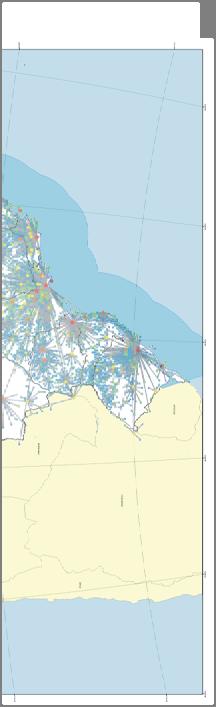
10 Brazil, demography Ref.: Population density (inhab./km 2 )
11 Urban network with more than 50,000 people in 2007 Ref.: Population intervals milhão: million - milhões: millions mil: thousand a: to
12 Geographical micro-regions regions with more than 5,000 industrial jobs Ref.: Employment in the transformation industry a: to

13 Reference: Bioma : Amazon Biome Centro-Norte: Centre-North Litoral Norte : North-Northeast coast Centro-Oeste: Centre-West Semi-árido: Semi-arid Litoral Sul : South-Southeast coast Strategic areas

14 Brazil: Macro-poles, proto-poles and macro-regions eleven macro-regions
15 Reference: Product 4 Sub-regionalization proposal Final version Regions of reference of the study. A subsidy will support the performance of the territorial zoning for the national development in the pluriannual plan PPA Study Center for Strategic Manag. (CGEE) Ministry of Planning (MP) Federal University of Minas Gerais (UFMG) Economics Faculty (FACE) Center for Reg. Dev. and Plan. (CEDEPLAR) Scale: Base map: division by micro-regions IBGE Team: UFMG/FACE/CEDEPLAR Polyconic world projection Central Meridian: -54 Cartography conventions: Capitals IBGE Micro-regions headquarters Territorial sea Island South American countries Oceans/Mass of water Sub-regions
16 118 sub-regions. 12 variables, indicators or sociodemographical reserves. 19 of economic structure. 24 of territory, 6 of urban network.
17 12. SELECTION OF NEW CENTRALITIES Geographical criterion, productive potential, polarization capacity (capacity to organize and command their complementary areas), objective: territorial, economic, social, political unity with South America as well as integration with the mentioned continent UTOPY RELATED TO A POLYCENTRIC BRAZIL


18 Brazil Urban network and polarizing force in 2000


19 Simulation - Polycentric Brazil, 11 consolidated macropoles and 7 new macro-poles

20 Simulation Polycentric Brazil, 11 consolidated macro-poles, 7 new macro-poles and 22 sub-poles
21 Proposal of a polycentric Brazil Ref.: TYPOLOGY OF THE POLES Consolidated macro-poles Induced macro-poles Induced sub-poles

22 Articulation of the Brazilian urban network and South America Ref.: TYPOLOGY OF THE POLES Consolidated macro-poles Induced macro-poles Induced sub-poles
23 Selected municipalities and impacts Centre-North Belém Level: Macro 1,5 São Luís Level: Macro 2,0 Marabá Level: Subregional 2,0 Imperatriz Level: Subregional 2,0 Araguaína Level: Subregional 2,0 Palmas Level: Macro 6,0 Barreiras Level: Subregional 2,0 Amazon Biome Boa Vista Level: Subregional 2,0 Macapá Level: Subregional 2,0 Rio Branco Level: Subregional 2,0 Santarém Level: Subregional 2,0 Itaituba Level: Local 2,0 Cruzeiro do sul Geopolitical 2,0 Tabatinga Geopolitical 1,5 Centre -West Cuiabá Level: Macro 3,0 Porto Velho Level: Macro 3,0 Campo Grande Level: Macro 2,0 Uberlândia Level: Macro 3,0 Sinop Level: Subregional 6,0 Semi-Arid Petrolina-Juazeiro Level: Subregional 2,0 Cariri ou Crajubá Level: Subregional 2,0 Eliseu Martins Level: Local 20,0 Souza Level: Local 2,0 Montes Claros Level: Subregional 2,0 Teófilo Otoni Level: Subregional 2,0 Vitória da Conquista Level: Subregional 2,0 South-Southeast Cascavel Level: Subregional 2,0 Chapecó Level: Subregional 2,0 Santa Maria Level: Subregional 2,0 Source: Own source
Mapping Brazil in 1:250,000 scale. João Bosco de Azevedo
 Mapping Brazil in 1:250,000 scale João Bosco de Azevedo Belo Horizonte, outubro de 2005 Brazil in figures The Brazilian territory attracts attention because of its area, the fifth largest area of the world.
BRAZILIAN'REMOTE SmSING COMKmUTY: HISTORICAL, GEOGRAPHICAL AND ECONOMICAL ASPECTS
 BRAZILIAN'REMOTE SmSING COMKmUTY: HISTORICAL, GEOGRAPHICAL AND ECONOMICAL ASPECTS Tania Maria Sausen Instituto Nacional de Pesquisas Espaciais Secretaria da Ciencia e Tecnologia Avenida dos Astronautas,
16540/14 EE/cm 1 DG E 1A
 Council of the European Union Brussels, 5 December 2014 (OR. en) 16540/14 ENV 965 CULT 139 NOTE From: To: Subject: General Secretariat of the Council Delegations Charter of Rome on Natural and Cultural
National planning report for Denmark
 National planning report for Denmark from the Minister for Environment and Energy Local identity and new challenges Summary 2000 1 CONTENTS 4 PREFACE: REGIONAL DEVELOPMENT AND SPATIAL PLANNING 6 1. BALANCED
Integration of geographical and statistical information: The Brazilian case 1
 UNITED NATIONS SECRETARIAT SA/STAT/AC.279/P16 Department of Economic and Social Affairs October 2013 Statistics Division English only United Nations Expert Group on the Integration of Statistical and Geospatial
The National Spatial Strategy
 Purpose of this Consultation Paper This paper seeks the views of a wide range of bodies, interests and members of the public on the issues which the National Spatial Strategy should address. These views
Johannes Suitner Department of Spatial Planning, TU Wien Polycentricity at different scales
 Johannes Suitner Department of Spatial Planning, TU Wien Polycentricity at different scales ESPON Seminar Territory matters: Keeping Europe and its regions competitive 16-17 June 2016 @ Marine Etablissement
STRATEGY FOR SPATIAL PLANNING AND RENEWAL OF URBAN POLICY: THE SOFA OF CENTRAL METROPOLITAN AREA
 KINGDOM OF MOROCCO MINISTRY OF SPATIAL DEVELOPMENT, WATER AND ENVIRONMENT STRATEGY FOR SPATIAL PLANNING AND RENEWAL OF URBAN POLICY: THE SOFA OF CENTRAL METROPOLITAN AREA STATE AND ORIENTATION OF THE SNAT
European spatial policy and regionalised approaches
 Findings of the ESPON 2006 Programme COMMIN Final Conference 26-27 April 2007 European spatial policy and regionalised approaches by Dr. Kai BöhmeB ! Territory matters Structure of presentation! Territorial
State initiative following up the 2006 national planning report
 18 ness districts and public institutions, should be integrated with the opportunities for public transport services. State initiative following up the 2006 national planning report The Ministry of the
CHAPTER 4 HIGH LEVEL SPATIAL DEVELOPMENT FRAMEWORK (SDF) Page 95
 Page 95") CHAPTER 4 HIGH LEVEL SPATIAL DEVELOPMENT FRAMEWORK (SDF) Page 95 CHAPTER 4 HIGH LEVEL SPATIAL DEVELOPMENT FRAMEWORK 4.1 INTRODUCTION This chapter provides a high level overview of George Municipality s
CHAPTER 4 HIGH LEVEL SPATIAL DEVELOPMENT FRAMEWORK (SDF) Page 95 CHAPTER 4 HIGH LEVEL SPATIAL DEVELOPMENT FRAMEWORK 4.1 INTRODUCTION This chapter provides a high level overview of George Municipality s
National Spatial Development Perspective (NSDP) Policy Coordination and Advisory Service
 Policy Coordination and Advisory Service") National Spatial Development Perspective (NSDP) Policy Coordination and Advisory Service 1 BACKGROUND The advances made in the First Decade by far supersede the weaknesses. Yet, if all indicators were
National Spatial Development Perspective (NSDP) Policy Coordination and Advisory Service 1 BACKGROUND The advances made in the First Decade by far supersede the weaknesses. Yet, if all indicators were
Milford Public Schools Curriculum
 Milford Public Schools Curriculum Department: Social Studies Grade 3 Course Name: Communities Course Description In third grade, students will engage in a yearlong study of communities and specifically
Science for Natural Resources. Luiz E. Mello, MD PhD Department of Technology and Innovation Vale Institute of Technology November, 2013
 Science for Natural Resources Luiz E. Mello, MD PhD Department of Technology and Innovation Vale Institute of Technology November, 2013 Lower grades, deeper, harder to find www.clearonmoney.com Copper
The European territory: Strategic developmentd
 The European territory: Strategic developmentd Peter Mehlbye Workshop Strategic Development Catalonia 11 June 2002 THE LECTURE Structure I. Territorial trends II. Strategy for European spatial development
Vincent Goodstadt. Head of European Affairs METREX European Network
 Vincent Goodstadt Head of European Affairs METREX European Network METREX (Network of 50 European Metropolitan Regions and Areas ) Exchanging Knowledge (e.g. Benchmarking) Climate Change CO2/80/50 Expertise
Urban and rural poles in positive interrelations
 Urban and rural poles in positive interrelations A stake for a better cohesion of the European continent Gérard Peltre president of the international association Rurality-Environment-Development (R.E.D.)
Governance and Functional Urban Areas CEMAT Conference
 Governance and Functional Urban Areas CEMAT Conference Mart Grisel Bucharest, Romania 30/05/2017 FUA: various definitions KEY ASPECTS: CITY & COMMUTING AREA The area occupied by a large city and its surrounding
TERRITORIAL IMPACT ASSESSMENT: AN APPROACH TO IMPROVE THE VERTICAL AND HORIZONTAL INTEGRATION OF EU POLICIES
 TERRITORIAL IMPACT ASSESSMENT: AN APPROACH TO IMPROVE THE VERTICAL AND HORIZONTAL INTEGRATION OF EU POLICIES Naja Marot & Mojca Golobič Biotehnical Faculty, University of Ljubljana, Slovenia RSA Workshop
International Guidelines on Access to Basic Services for All
 International Guidelines on Access to Basic Services for All Presentation and initials lessons from implementation Accessibility to services in regions and cities : measures and policies, OECD 18 June
Labour MarketAreas: ThePortuguese case
 «Labour MarketAreas: ThePortuguese case Elsa Soares Rossano Figueiredo Unit for the Coordination of Territorial Statistics Lisboa, 30 June 2016 « Overview 1 THE IMPORTANCE OF DEFINING FUNCTIONAL REGIONS
How the science of cities can help European policy makers: new analysis and perspectives
 How the science of cities can help European policy makers: new analysis and perspectives By Lewis Dijkstra, PhD Deputy Head of the Economic Analysis Unit, DG Regional and European Commission Overview Data
São Paulo Metropolis and Macrometropolis - territories and dynamics of a recent urban transition
 São Paulo Metropolis and Macrometropolis - territories and dynamics of a recent urban transition Faculty of Architecture and Urbanism of São Paulo University Prof. Dr. Regina M. Prosperi Meyer WC2 - World
FRQ 1 As a country economically develops, the employment mix for various sectors of the economy changes.
 AP Human Geography Unit VI. Industrialization and Economic Development Free Response Questions FRQ 1 As a country economically develops, the employment mix for various sectors of the economy changes. A)
Experiences of public-private partnerships in the Euromediterranean relations and in the Po Valley, promoting a more balanced European territory
 Experiences of public-private partnerships in the Euromediterranean relations and in the Po Valley, promoting a more balanced European territory Claudio Tolomelli PolyMetrexPlus project s objectives To
Overcoming Complexities on the Interface of Infrastructure and Land Use
 Date 22-11-2013 1 Overcoming Complexities on the Interface of Infrastructure and Land Use Towards design preconditions for integrated regional development Niels Heeres & Jos Arts University of Groningen,
NCAVES - Global initiative and national pilots
 NCAVES - Global initiative and national pilots Kavita Sharma UN Environment Pretoria, March 2018 Outline 1. Global initiative > Introduction > Objectives and deliverables >Activities in 2017 and 2018 2.
Ciência e Natura ISSN: Universidade Federal de Santa Maria Brasil
 Ciência e Natura ISSN: 0100-8307 cienciaenaturarevista@gmail.com Universidade Federal de Santa Maria Brasil Venturini Rosso, Flavia; Tissot Boiaski, Nathalie; Teleginski Ferraz, Simone Erotildes Spatial
Third Cohesion report February 2004
 February 2004 A new partnership for cohesion Convergence, Competitiveness and Co-operation METREX meeting S. Sebastian, Luisa Sanches DG REGIO The 3rd CR structure 1. Analysis of situation and trends in
The Department of Urban Planning and Design offers a postgraduate course leading to the degree of Master of Science in Urban Planning.
 (THESE SYLLABUSES ARE APPLICABLE TO MASTER OF SCIENCE IN URBAN PLANNING CANDIDATES ADMITTED TO THE CURRICULUM IN THE ACADEMIC YEAR 2016-2017 AND THEREAFTER) SYLLABUSES FOR THE DEGREE OF MASTER OF SCIENCE
GIS Geographical Information Systems. GIS Management
 GIS Geographical Information Systems GIS Management Difficulties on establishing a GIS Funding GIS Determining Project Standards Data Gathering Map Development Recruiting GIS Professionals Educating Staff
AAG CENTER FOR GLOBAL GEOGRAPHY EDUCATION Internationalizing the Teaching and Learning of Geography
 Using the CGGE Materials in Advanced Placement Human Geography Classes About the CGGE: The AAG Center for Global Geography Education (CGGE) is a collection of online modules for undergraduate courses in
Lombardy Region Territorial Context and Planning Structures
 Lombardy Region Territorial Context and Planning Structures Carlo Palazzoli RUMORE project manager carlo_palazzoli@regione.lombardia.it 15th May 2018 / RUMORE Third Partner Meeting Lombardy Region in Europe
Introduction to the Gozo & Comino Local Plan
 Introduction to the Gozo & Comino Local Plan What is a Local Plan? A Local Plan is a land use document with written text (policies and justifications) and maps; Reconciles local needs with strategic considerations;
Multi-level spatial planning in a cross border context
 Significant Experience No. 7 Multi-level spatial planning in a cross border context Brendan Murtagh School of Environmental Planning Queen s University Belfast 1. Context In many respects the essence of
Implementation of the ESPON 2020 cooperation program. 16 January 2017 Anneloes van Noordt
 Implementation of the ESPON 2020 cooperation program 16 January 2017 Anneloes van Noordt Outline! ESPON Cooperation Program! Specific Objectives! Applied Research! Targeted Analysis! Database & Tools!
Developing Quality of Life and Urban- Rural Interactions in BSR
 Developing Quality of Life and Urban- Rural Interactions in BSR Sakari Saarinen Union of the Baltic Cities, Commission on Environment Seminar on Quality of Life in Small Communities, 27 May 2010, Kärdla,
WORLD GEOGRAPHY GRADE 10
 Parent / Student Course Information SOCIAL STUDIES WORLD GEOGRAPHY GRADE 10 Counselors are available to assist parents and students with course selections and career planning. Parents may arrange to meet
Land Use in the context of sustainable, smart and inclusive growth
 Land Use in the context of sustainable, smart and inclusive growth François Salgé Ministry of sustainable development France facilitator EUROGI vice president AFIGéO board member 1 Introduction e-content+
Launch of the ESPON 2013 Programme. European observation network on territorial development and cohesion
 Launch of the ESPON 2013 Programme European observation network on territorial development and cohesion Framework conditions for the ESPON 2013 Programme Policy development in use of territorial evidence
5 Principles. RehabiMed Method for the rehabilitation of Traditional Mediterranean Architecture ORIENTATION DIAGNOSIS STRATEGY ACTION FOLLOW-UP
 Principles Integration (versus isolation) Globalism (versus specialization) Coordination (sharing versus selfishness) Flexibility (versus rigidity) Adaptability ( versus univocal attitude) RehabiMed Method
PLANNING (PLAN) Planning (PLAN) 1
 Planning (PLAN) 1") Planning (PLAN) 1 PLANNING (PLAN) PLAN 500. Economics for Public Affairs Description: An introduction to basic economic concepts and their application to public affairs and urban planning. Note: Cross-listed
Planning (PLAN) 1 PLANNING (PLAN) PLAN 500. Economics for Public Affairs Description: An introduction to basic economic concepts and their application to public affairs and urban planning. Note: Cross-listed
National Planning Framework Louth County Council Submission
 National Planning Framework 2040 Louth County Council Submission 10 th November 2017 2 Louth County Council Introduction The primacy of the Dublin / Belfast corridor in the urban network on the island
Dr.Sinisa Vukicevic Dr. Robert Summers
 Dr.Sinisa Vukicevic Dr. Robert Summers "Planning" means the scientific, aesthetic, and orderly disposition of land, resources, facilities and services with a view to securing the physical, economic and
PURR: POTENTIAL OF RURAL REGIONS UK ESPON WORKSHOP Newcastle 23 rd November Neil Adams
 PURR: POTENTIAL OF RURAL REGIONS UK ESPON WORKSHOP Newcastle 23 rd November 2012 Neil Adams PURR: Potential of Rural Regions Introduction Context for the project A spectrum of knowledge Rural Potentials
Strengthening the cooperation in the region: Carpathian, Tisa,, Danube and Black Sea areas
 Strengthening the cooperation in the region: Carpathian, Tisa,, Danube and Black Sea areas 14th October 2009 SEE Annual Conference Advancing development through transnational cooperation in South East
Alluvium Consulting Australia Senior integrated water management specialist Position Description March 2018
 Alluvium Consulting Australia Senior integrated water management specialist Position Description March 2018 Overview of Alluvium We are an employee-owned consulting firm founded in 2006 to provide advice
SPIMA Spatial dynamics and strategic planning in metropolitan areas
 SPIMA Spatial dynamics and strategic planning in metropolitan areas Dr. Vanya Simeonova Wageningen Environmental Research Wageningen University and research, The Netherlands Key outcomes: SPIMA Framework
Operational Definitions of Urban, Rural and Urban Agglomeration for Monitoring Human Settlements
 Operational Definitions of Urban, Rural and Urban Agglomeration for Monitoring Human Settlements By Markandey Rai United Nations Human Settlements Programme PO Box-30030 Nairobi, Kenya Abstract The United
Mutah university faculty of Social Sciences The Study plan of the department of Geography 2006/2007
 Mutah university faculty of Social Sciences The Study plan of the department of Geography 2006/2007 Requirements university compulsory 22 Credit hours Course No Credit hours Prerequisite Requirements Faculty
GEOGRAPHY (GE) Courses of Instruction
 Courses of Instruction") GEOGRAPHY (GE) GE 102. (3) World Regional Geography. The geographic method of inquiry is used to examine, describe, explain, and analyze the human and physical environments of the major regions of the
GEOGRAPHY (GE) GE 102. (3) World Regional Geography. The geographic method of inquiry is used to examine, describe, explain, and analyze the human and physical environments of the major regions of the
Challenges in Geospatial Policy Formulation and Programme Management
 Challenges in Geospatial Policy Formulation and Programme Management Luiz Paulo Souto Fortes, PhD An Exchange with the Geospatial Industry for UN-GGIM Seoul, October 23, 2011 BRAZIL Land area 8,514,876.599
European Landscape Convention in the Slovak Republic
 13th COUNCIL OF EUROPE MEETING OF THE WORKSHOPS FOR THE EUROPEAN LANDSCAPE CONVENTION European Landscape Convention in the Slovak Republic Mrs. Ida Vanáková, state advisor, Department of Spatial Planning
Seymour Centre 2017 Education Program 2071 CURRICULUM LINKS
 Suitable for: Stage 5 Stage 6 HSC Subject Links: Seymour Centre 2017 Education Program 2071 CURRICULUM LINKS Science Stage Content Objective Outcomes Stage 5 Earth and Space ES3: People use scientific
Experience and perspectives of using EU funds and other funding for the implementation of district renovation projects
 Experience and perspectives of using EU funds and other funding for the implementation of district renovation projects Ministry of the Interior of Lithuania Regional policy department Administration, coordination,
Urbanization and spatial policies. June 2006 Kyung-Hwan Kim
 Urbanization and spatial policies June 2006 Kyung-Hwan Kim stamitzkim@gmail.com 1 Urbanization Urbanization as a process of development Stages of urbanization Trends of world urbanization Dominance of
EUSAIR on sea topics from Slovenian perspective
 MINISTRY OF FOREIGN AFFAIRS REPUBLIC OF SLOVENIA EUSAIR on sea topics from Slovenian perspective Mag. Andreja Jerina National Coordinator 4 EU MRS: 270 millions of population 19 MS 12 non MS Sea basin
INSTITUTIONAL BRIEF National Secretariat for Housing and Habitat
 INSTITUTIONAL BRIEF National Secretariat for Housing and Habitat Minister Soledad Nuñez @solenu www.senavitat.gov.py ASUNCION, PARAGUAY PARAGUAY LOCATION Landlocked with dry and wet borders PARAGUAY KEY
National Spatial Strategy for Ireland
 National Spatial Strategy for Ireland 2002-2020 People, Places and Potential Printed on recycled paper BAILE ÁTHA CLIATH ARNA FHOILSIÚ AG OIFIG AN TSOLÁTHAIR Le ceannach díreach ón OIFIG DHÍOLTA FOILSEACHÁN
Spatial Planning and Territorial Development at the Regional Level
 Spatial Planning and Territorial Development at the Regional Level Vincent Nadin University of the West of England, UK Spatial Planning and Territorial Development at the Regional Level Vincent Nadin University
Mediterranean Sea and Territorial Development, Opportunities and Risks
 EESC Hearing Towards an EU Macro-Regional Strategy for the Mediterranean Mediterranean Sea and Territorial Development, Opportunities and Risks Michaela Gensheimer Structure of Intervention Part I: What
Mining Contribution to Municipalities Development
 Journal of Environmental Science and Engineering B 6 (2017) 436-442 doi:10.17265/2162-5263/2017.08.005 D DAVID PUBLISHING José Aroudo Mota 1, José Emanoel de Carvalho Nazário 1, Jorge Filipe dos Santos
COSTA RICA Limon City-Port Project
 photos by Stefania Abakerli COSTA RICA Limon City-Port Project 2008 2013 Cecilia Corvalan William Reuben Stefania Abakerli Background Request from GoCR following Caldera-Port Concession Reform Since the
Building the Sustainable Network of Settlements on the Caspian Sea Region of Kazakhstan
 Building the Sustainable Network of Settlements on the Caspian Sea Region of Kazakhstan Introduction The Ecological Zoning and Identification of Ecological Capacity of Natural and Socio- Economic Potential
The Governance of Land Use
 The planning system Levels of government and their responsibilities The Governance of Land Use COUNTRY FACT SHEET NORWAY Norway is a unitary state with three levels of government; the national level, 19
TP4D. Fostering territorial perspective for development. Towards a wider alliance
 Fostering territorial perspective for development Towards a wider alliance FOR several years, territorial approaches to development have been spreading within international organizations and among development
Botswana National Spatial Plan Botsreal Property Forum- 30 May, 2018
 Botswana National Spatial Plan 2036 Botsreal Property Forum- 30 May, 2018 What is the National Spatial Plan? A framework and process for planning that is: National (to guide national development policies,
General considerations of regional policy
 General considerations of regional policy Lect. PhD. Claudia Bentoiu Dimitrie Cantemir Christian University Assoc.PhD. Cristina Athu Dimitrie Cantemir Christian University Lect.PhD. Andreea Monica Predonu
Low Density Areas : Places of Opportunity. Enrique Garcilazo, OECD Directorate for Public Governance and Territorial Development
 Low Density Areas : Places of Opportunity Enrique Garcilazo, OECD Directorate for Public Governance and Territorial Development Open Days, Brussels, 11 th October, 2016 Outline 1. Performance low density
High speed network in Hauts-de-France Region. Värnamo, 17 th May 2018
 High speed network in Hauts-de-France Region Värnamo, 17 th May 2018 Hauts-de-France at the crossroads of the North-West Europe High speed train approach in France In the 1980s: will to link the main cities
World Bank Group GEF Program
 World Bank Group GEF Program Global Environment Facility: -Transport World Bank GEF Coordination Team Content How does GEF work? World Bank s role in the GEF partnership The GEF transport activities What
Figure 10. Travel time accessibility for heavy trucks
 Figure 10. Travel time accessibility for heavy trucks Heavy truck travel time from Rotterdam to each European cities respecting the prescribed speed in France on the different networks - Road, motorway
The Department of Urban Planning and Design offers a postgraduate course leading to the degree of Master of Science in Urban Planning.
 (THESE SYLLABUSES ARE APPLICABLE TO MASTER OF SCIENCE IN URBAN PLANNING CANDIDATES ADMITTED TO THE CURRICULUM IN THE ACADEMIC YEAR 2017-2018 AND THEREAFTER) SYLLABUSES FOR THE DEGREE OF MASTER OF SCIENCE
3 rd Grade Social Studies Pacing Guide Arkansas Frameworks
 3 rd Grade Social Studies Pacing Guide Arkansas Frameworks 1st Nine Weeks Strand1: Geography Standard 1: Physical and Spatial Students shall develop an understanding of the physical and spatial characteristics
MARS AREA SCHOOL DISTRICT CURRICULUM GRADE: Grade 4
 MARS AREA SCHOOL DISTRICT CURRICULUM GRADE: Grade 4 Course Title: Social Studies Brief Description Overview: Students will explore the history, geography, government, and economy of the United States with
Classifying Hungarian sub-regions by their competitiveness
 Classifying Hungarian sub-regions by their competitiveness Péter KOVÁCS, lecturer, Department of Statistics and Demography, Miklós LUKOVICS, lecturer, Institute of Economics and Economic Development, Faculty
TOWARDS STRATEGIC SPATIAL PLANNING IN JAMAICA: THE NATIONAL SPATIAL PLAN
 TOWARDS STRATEGIC SPATIAL PLANNING IN JAMAICA: THE NATIONAL SPATIAL PLAN JIEP 5th Biennial Conference on the Environment: Balancing National Development and Environmental Protection June 6, 2011 Jamaica
Brazil Experience in SDG data production, dissemination and capacity building
 Brazil Experience in SDG data production, dissemination and capacity building Claudio Stenner Coordinator of Geography 4th Meeting of the Working Group on Geospatial Information IAEG-SDG United Nations
Cities and Human Settlements: Operationalising SDGs interlinkages through spatial approaches and place-making Maruxa Cardama
 Cities and Human Settlements: Operationalising SDGs interlinkages through spatial approaches and place-making Maruxa Cardama UN-DESA EGM in preparation of HLPF UN Headquarters, NYC 25-26 January 2018 Is
Socio-Economic and Ecological Indicators of the Metropolitan Area of Bucharest
 12 Socio-Economic and Ecological Indicators of the Metropolitan Area of Bucharest Gabriela Ţigu 1, Olimpia State 2, Delia Popescu 3 1 Prof. PhD, The Bucharest Academy of Economic Studies 2,3 Assoc. Prof.
Urban Climate Resilience
 Urban Climate Resilience in Southeast Asia Partnership Project Introduction Planning for climate change is a daunting challenge for governments in the Mekong Region. Limited capacity at the municipal level,
World Geography Fall 2013 Semester Review Project
 Reporting Category RC 1: History, Government and Citizenship Standard WG.1 History. The student understands how geography and processes of spatial exchange (diffusion) influenced events in the past and
ESPON support for Targeted Analyses Ilona Raugze Director
 ESPON support for Targeted Analyses Ilona Raugze Director ESPON EGTC 14 November 2017 ESPON EGTC workshop Targeted Analysis in support of better policy making in cities and regions Inspire policy making
BRUNO BRANDÃO FISCHER School of Applied Sciences, University of Campinas
 BRUNO BRANDÃO FISCHER bruno.fischer@fca.unicamp.br School of Applied Sciences, University of Campinas SÉRGIO QUEIROZ Department of Science and Technology Policy, University of Campinas NICHOLAS S. VONORTAS
Spatial index of educational opportunities: Rio de Janeiro and Belo Horizonte
 Available online at www.sciencedirect.com Procedia Social and Behavioral Sciences 21 (2011) 287 293 International Conference: Spatial Thinking and Geographic Information Sciences 2011 Spatial index of
Local Area Key Issues Paper No. 13: Southern Hinterland townships growth opportunities
 Draft Sunshine Coast Planning Scheme Review of Submissions Local Area Key Issues Paper No. 13: Southern Hinterland townships growth opportunities Key Issue: Growth opportunities for Southern Hinterland
Improvements for Kosovo's spatial planning system / [presentation given in May 2011]
![Improvements for Kosovo's spatial planning system / [presentation given in May 2011]](/thumbs/95/122511393.jpg "Improvements for Kosovo's spatial planning system / [presentation given in May 2011]") Rochester Institute of Technology RIT Scholar Works Theses Thesis/Dissertation Collections 2011 Improvements for Kosovo's spatial planning system / [presentation given in May 2011] Luan Nushi Follow this
Rochester Institute of Technology RIT Scholar Works Theses Thesis/Dissertation Collections 2011 Improvements for Kosovo's spatial planning system / [presentation given in May 2011] Luan Nushi Follow this
Key Indicators for Territorial Cohesion and Spatial Planning in Preparing Territorial Development Strategies
 ESPON Evidence in a North European Context Challenges and Opportunities for Territorial Development and Cohesion in a North European Macro Region, 10-11 April, 2014, Vilnius, Lithuania Key Indicators for
Measuring Disaster Risk for Urban areas in Asia-Pacific
 Measuring Disaster Risk for Urban areas in Asia-Pacific Acknowledgement: Trevor Clifford, Intl Consultant 1 SDG 11 Make cities and human settlements inclusive, safe, resilient and sustainable 11.1: By
ISoCaRP 44 th International Planning Congress. URBAN GROWTH WITHOUT SPRAWL: A WAY TOWARDS SUSTAINABLE URBANIZATION Dalian, China, September 2008
 ISoCaRP 44 th International Planning Congress URBAN GROWTH WITHOUT SPRAWL: A WAY TOWARDS SUSTAINABLE URBANIZATION Dalian, China, 19-23 September 2008 Urban competitiveness and sprawl as conflicting planning
Conference on Urban Development Strategies in the Mediterranean Barcelona, March 14-15, 2011
 Analysing Urban Development Strategies: the OECD Approach by Adam Knelman Ostry Counsellor, Regional Development Policy adam.ostry@oecd.org Conference on Urban Development Strategies in the Mediterranean
BIG IDEAS. Area of Learning: SOCIAL STUDIES Urban Studies Grade 12. Learning Standards. Curricular Competencies
 Area of Learning: SOCIAL STUDIES Urban Studies Grade 12 BIG IDEAS Urbanization is a critical force that shapes both human life and the planet. The historical development of cities has been shaped by geographic,
A Framework for the Study of Urban Health. Abdullah Baqui, DrPH, MPH, MBBS Johns Hopkins University
 This work is licensed under a Creative Commons Attribution-NonCommercial-ShareAlike License. Your use of this material constitutes acceptance of that license and the conditions of use of materials on this
Key Indicators for Territorial Cohesion & Spatial Planning Stakeholder Workshop - Project Update. 13 th December 2012 San Sebastián, Basque Country
 Key Indicators for Territorial Cohesion & Spatial Planning Stakeholder Workshop - Project Update 13 th December 2012 San Sebastián, Basque Country Key Aims Explore the use of territorial data in developing
Set-up of subnational statistical systems Statistical Development Strategy for the State of Jalisco México, 2016
 Set-up of subnational statistical systems Statistical Development Strategy for the State of Jalisco México, 2016 Statistical and Geographical Information Institute of Jalisco (IIEG) 2013. Merger of three
THE ROLE OF REGIONAL SPATIAL PLANNING IN SUPPORTING LONG-TERM ECONOMIC GROWTH IN NORTHERN IRELAND
 THE ROLE OF REGIONAL SPATIAL PLANNING IN SUPPORTING LONG-TERM ECONOMIC GROWTH IN NORTHERN IRELAND Jenny Pyper Director 6 th Annual ICLRD Conference 20 January 2011 PURPOSE OF REGIONAL PLANNING Framework
Telling our Local Community Story: From Interpretation to Creating Sustainable Hosting Experience
 Telling our Local Community Story: From Interpretation to Creating Sustainable Hosting Experience Prof. Yoel Mansfeld, PhD Head, Centre for Tourism, Pilgrimage & Recreation Research University of Haifa,
Navigable maritime and river waterways in the seaside - Danube Delta area and the connected rural development
 SUMMARY OF Ph-D Thesis, with title RESEARCH STUDIES ON MANAGEMENT IMPROVEMENT OF MARITIME AND RIVER TRANSPORT ACTIVITY IN THE COASTAL AND DANUBE DELTA AREA FROM AN ENVIROMENTAL, ECONOMIC AND SOCIAL PERSPECTIVE
2013 Cartographic Country Report Uruguay **
 ADVANCE UNEDITED VERSION UNITED NATIONS _ STATISTICS DIVISION E/CONF.103/IP.5 Tenth United Nations Regional Cartographic Conference for the Americas New York, 19-23, August 2013 Item 6(b) of the provisional
Generic Success Criteria
 Generic Success Criteria Significance I can identify a short term and long term impact that a development/event/issue has/had locally/globally. I can discuss (verbally, graphically, etc.) how a development/event/issue