SOUTHEAST PLANT POWER FEED AND PRIMARY SWITCHGEAR UPGRADES CIVIC DESIGN REVIEW - PHASE 1 - NOVEMBER 14, 2016
|
|
|
- Richard Cole
- 5 years ago
- Views:
Transcription


1 SOUTHEAST PLANT POWER FEED AND PRIMARY SWITCHGEAR UPGRADES CIVIC DESIGN REVIEW - PHASE 1 - NOVEMBER 14, 2016 CITY & COUNTY OF SAN FRANCISCO PUBLIC UTILITIES COMMISSION
 largest wastewater treatment facility.")

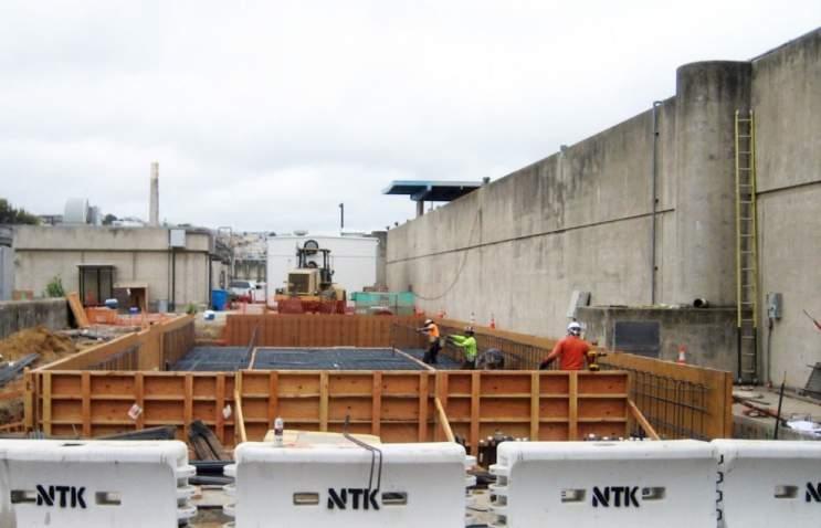
2 PROJECT LOCATION CALTRAIN RAILROAD RANKIN STREET 4 BACKGROUND The proposed electrical building is located at the Southeast Water Pollution Control Plant (SEP), located at the corner of Evans Avenue and Phelps Street. The plant serves 2/3 of the City s citizens and is the San Francisco Public Utilities Commission s (SFPUC) largest wastewater treatment facility. OBJECTIVE To upgrade the main switchgear system to provide power for all existing SEP electrical loads and future Sewer System Improvement Program (SSIP) facilities demand and peak loads. BUILDING SOLUTION To provide a building enclosure for electrical equipment that is contemporary in design and responsive to the existing structures on site. Proposed facility shall also be resistant to the corrosive environment created by the wastewater treatment plant. SURROUNDING BUILDINGS LEGEND 1. Secondary Sedimentation Tanks 2. Secondary Sludge Control Building 3. Gallery 4. Pretreatment Facility 5. Sedimentation Building 6. Aeration Tanks 7. Postchlorination Building 8. Chlorine Contact Channels 9. Administration Laboratory Buildings 10. Sedimentation Buildings 11. Dryer Building 12. Service Building 13. Operators Building 14. Small Concrete Building PHELPS STREET ACCESS ROAD 1 8 PROJECT SITE EVANS AVENUE 3RD STREET O Project Site Civic Design Review - Phase Page 2


3 Southeast Plant - Surrounding Buildings Civic Design Review - Phase Page 3

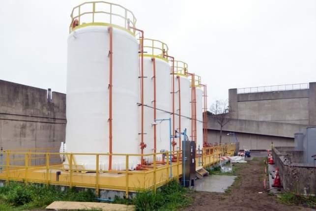
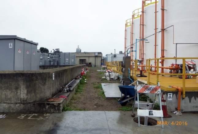
4 SEDIMENTATION BUILDING SODIUM HYPOCHLORITE TANKS AERATION TANKS SECONDARY SLUDGE CONTROL BUILDING PRETREATMENT FACILITY SUBSTATION AREA PROJECT SITE: SEP 032 EVANS AVENUE ACCESS ROAD SECURITY WALL SECONDARY SEDIMENTATION TANKS O Site Plan Civic Design Review - Phase Page 4

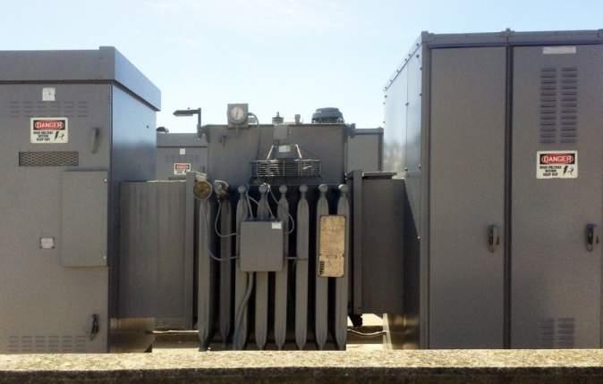


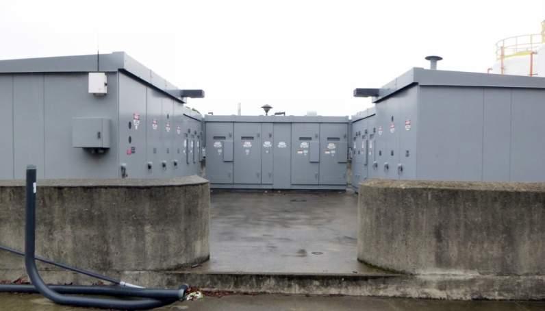
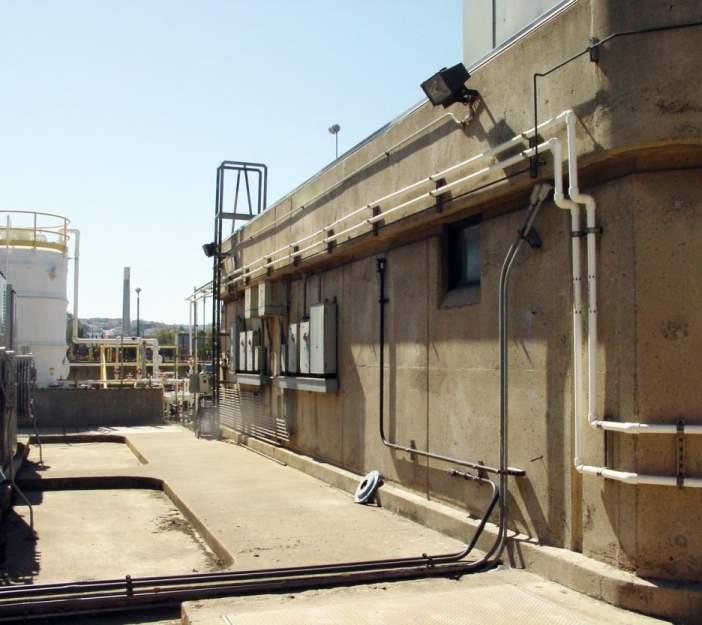
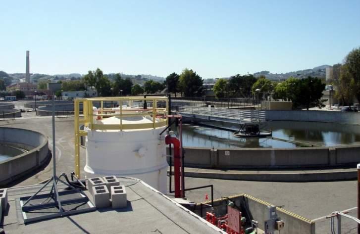
5 SEP Existing Conditions Civic Design Review - Phase Page 5

6 SEDIMENTATION BUILDING SODIUM HYPOCHLORITE TANKS SECONDARY SLUDGE CONTROL BUILDING SEP 032 PRETREATMENT FACILITY ACCESS ROAD EVANS AVENUE SECURITY WALL SECONDARY SEDIMENTATION TANKS O Site Plan Civic Design Review - Phase Page 6

7 SODIUM HYPOCHLORITE TANKS B DN DN UP SWITCHGEAR SUBSTATION AREA MECHANICAL A A BATTERY DN UP Second Floor Plan B O First Floor Plan Civic Design Review - Phase Page 7

8 SWITCHGEAR SODIUM HYPOCHLORITE TANKS MECHANICAL BATTERY SECTION B-B SODIUM HYPOCHLORITE TANKS SWITCHGEAR MECHANICAL SUBSTATION AREA SECTION A-A O Building Sections Civic Design Review - Phase Page 8


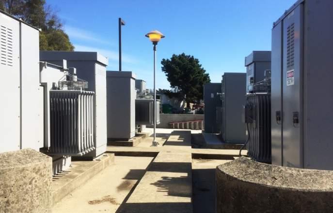
9 Imagery Civic Design Review - Phase Page 9
 - View from Northeast Civic Design Review - Phase 1")
10 Previous Design (CDR Phase 1 Approval ) - View from Northeast Civic Design Review - Phase Page 10
11 ROOF 30-0 SECOND FLOOR 14-0 FIRST FLOOR 0-0 SOUTH ELEVATION EAST ELEVATION O Proposed Design - Exterior Elevations Civic Design Review - Phase Page 11

12 ROOF 30-0 SECOND FLOOR 14-0 FIRST FLOOR 0-0 NORTH ELEVATION WEST ELEVATION O Proposed Design - Exterior Elevations Civic Design Review - Phase Page 12

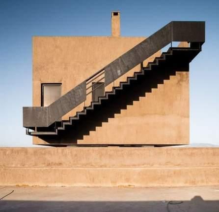
13 Proposed Design - View from Northeast Civic Design Review - Phase Page 13

14 Proposed Design - View from Southeast Civic Design Review - Phase Page 14

15 Proposed Design - View from Northwest Civic Design Review - Phase Page 15
SOUTHEAST PLANT POWER FEED AND PRIMARY SWITCHGEAR UPGRADES CIVIC DESIGN REVIEW - PHASE 1 - MAY 16, 2016
 SOUTHEAST PLANT POWER FEED AND PRIMARY SWITCHGEAR UPGRADES CIVIC DESIGN REVIEW - PHASE 1 - MAY 16, 2016 CITY & COUNTY OF SAN FRANCISCO PUBLIC UTILITIES COMMISSION PROJECT LOCATION CALTRAIN RAILROAD RANKIN
CITY OF PORTLAND, TEXAS SERVICE PLAN FOR ANNEXATION AREA
 CITY OF PORTLAND, TEXAS SERVICE PLAN FOR ANNEXATION AREA Location and Acreage Approximately 1,863 acres of land in San Patricio County, located in the ETJ northwest of the existing City Limits. Metes and
3301 East 120 th Avenue Assited Living & Memory Care
 UTILITY REPORT FOR 3301 East 120 th Avenue Assited Living & Memory Care 1 st Submittal January 23, 2016 2 nd Submittal March 04, 2016 Prepared for: 3301 E. 120 th Ave, LLC. 8200 E. Maplewood Ave., Suite
Eastlake Assited Living & Memory Care
 UTILITY REPORT FOR Eastlake Assited Living & Memory Care 1 st Submittal January 23, 2016 2 nd Submittal March 04, 2016 June 7, 2016 Final Submittal August 08, 2016 Prepared for: 3301 E. 120 th Ave, LLC.
CITY OF PAPILLION PLANNING COMMISSION STAFF REPORT MAY 27, 2015 AGENDA 2015 ANNEXATION MISC
 PLANNING COMMISSION STAFF REPORT MAY 27, 2015 AGENDA 2015 ANNEXATION MISC-15-0005 I. GENERAL INFORMATION A. APPLICANT: City of Papillion 122 East Third St. Papillion, NE 68046 B. LEGAL DESCRIPTION: See
Status Report on Polychlorinated Biphenyls in the Western Storm Drain University of California, Richmond Field Station Richmond, California
 Status Report on Polychlorinated Biphenyls in the Western Storm Drain University of California, Richmond Field Station Richmond, California Introduction Beginning in 1999, the University of California,
Currently, the Plan Area includes over nine acres of impermeable surface parking around the Kmart, Michaels, and Shell station facilities.
 Chapter 2 Currently, the Plan Area includes over nine acres of impermeable surface parking around the Kmart, Michaels, and Shell station facilities. At present, only about six percent of the entire Plan
Noise Maps, Report & Statistics, Dublin City Council Noise Mapping Project Roads and Traffic Department
 Noise Maps, Report & Statistics, Dublin City Council Noise Mapping Project Roads and Traffic Department Produced by Traffic Noise & Air Quality Unit November 2007 Contact: brian.mcmanus@dublincity.ie Ph;
NARRAGANSETT BAY COMMISSION SPECIFICATIONS FOR SODIUM HYPOCHLORITE SOLUTION
 The Narragansett Bay Commission Vincent J. Mesolella Corporate Office Building Chairman One Service Road Providence, RI 02905 Raymond J. Marshall 401 461 8848 Executive Director 401 461 6540 FAX http://www.narrabay.com
THE HISTORY OF WEATHER OBSERVING IN CHEYENNE, WYOMING,
 THE HISTORY OF WEATHER OBSERVING IN CHEYENNE, WYOMING, 1870-2004 Downtown Cheyenne, Wyoming, circa 1890 From Wyoming State Archives, Department of State Parks and Cultural Resources Current as of January
TREASURE COAST REGIONAL PLANNING COUNCIL M E M O R A N D U M. To: Council Members AGENDA ITEM 4B10
 TREASURE COAST REGIONAL PLANNING COUNCIL M E M O R A N D U M To: Council Members AGENDA ITEM 4B10 From: Date: Subject: Staff December 14, 2018 Council Meeting Local Government Comprehensive Plan Review
APPLICATION TO AMEND THE FUTURE LAND USE MAP (FLUM) SMALL SCALE
 SMALL SCALE") DEPARTMENT OF DEVELOPMENT & PLANNING 825 Ohio Avenue - Lynn Haven, FL 32444 (850) 265-2961 - (850) 265-3478 APPLICATION TO AMEND THE FUTURE LAND USE MAP (FLUM) SMALL SCALE Deadline to submit is 30 days
DEPARTMENT OF DEVELOPMENT & PLANNING 825 Ohio Avenue - Lynn Haven, FL 32444 (850) 265-2961 - (850) 265-3478 APPLICATION TO AMEND THE FUTURE LAND USE MAP (FLUM) SMALL SCALE Deadline to submit is 30 days
Major Point/Area Sources Name Type Major Emissions Distance (m) Direction CFB Cold Lake Air Force Base NOx, PM, HC, TRS 3km to aircraft West
 Direction CFB Cold Lake Air Force Base NOx, PM, HC, TRS 3km to aircraft West") Page 1 of 11 Site Documentation: Cold Lake South Continuous Monitoring Station General Site Information Item Description Site ID (CASA ID) LICA01 Station Name Cold Lake South Continuous Monitoring Station
Page 1 of 11 Site Documentation: Cold Lake South Continuous Monitoring Station General Site Information Item Description Site ID (CASA ID) LICA01 Station Name Cold Lake South Continuous Monitoring Station
About places and/or important events Landmarks Maps How the land is, hills or flat or mountain range Connected to maps World Different countries
 What do you think you know about geography? About places and/or important events Landmarks Maps How the land is, hills or flat or mountain range Connected to maps World Different countries What do you
Reserve Forecast Details
 10-26th St South of Maryland Reserve (1552) Opening Balance 158,947 158,947 0 0 0 0 0 0 0 0 1058 - Street Construction 0 (158,947) 0 0 0 0 0 0 0 0 Total 0 (158,947) 0 0 0 0 0 0 0 0 Closing Balance 158,947
Topographic Maps and Profiles
 Name: Date: Period: Earth Science Foundations The Physical Setting: Earth Science CLASS NOTES! Topographic Maps [contour maps] -! Topographic maps show three-dimensional shapes in two dimensions Elevation
UTILITY REPORT FOR THORNTON SELF STORAGE THORNTON, COLORADO
 UTILITY REPORT FOR THORNTON SELF STORAGE THORNTON, COLORADO Prepared by: Bowman Consulting 63 Park Point Dr. Suite 1 Golden, CO 841 (33)-81-29 June 29, 215 Revised August 14, 215 Revised September 3, 215
HOTEL KANATA 160 HEARST WAY KANATA, ONTARIO SERVICING REPORT. Prepared for: David Johnston Architect. Prepared By:
 HOTEL KANATA 160 HEARST WAY KANATA, ONTARIO SERVICING REPORT Prepared for: David Johnston Architect Prepared By: BaseTech Consulting Inc. 309 Roywood Crescent Newmarket, Ontario L3Y 1A6 BCI Project No.
River Realty Services Commercial
 1 4 6 N O R T H U S 9 W, C O N G E R S, N Y 1 0 9 2 0 TA B L E O F C O N T E N T S E X E C U T I V E S U M M A RY 03 Z O N I N G 09 R EG I S T R AT I O N S 04 S U B J EC T P H OTO S 10 M A P V I E W 05
SHADOW STUDY REPORT REGARDING
 SHADOW STUDY REPORT REGARDING an APPLICATION TO REDEVELOP Three 6 Storey Condominiums Regional Road 25 (Ontario Street) and Britannia Road Milton, Ontario KNYMH FILE # 17030 Prepared by: Krista Lilley
CONGLETON INDUSTRIAL PARK LT 6 EX W 300' & E 350' LT 7 BLK 1, a subdivision of land in the City of Overland Park, Johnson County, Kansas.
 NOTICE OF PUBLIC HEARING CITY PLANNING COMMISSION CITY OF OVERLAND PARK, KANSAS Notice is hereby given that the City Planning Commission of Overland Park, Kansas, will hold a public hearing Monday, July
FINAL UTILITY REPORT Creekside Thornton, CO
 FINAL UTILITY REPORT Creekside Thornton, CO March 4, 216 Revised: June 27, 216 JN: 1539 Prepared for: HW Sodbusters, LLC 2733 E. Parleys Way, Suite 3 Salt Lake City, UT 8419 P: 81.485.777 Prepared by:
NOA ASSESSMENT HARRIS QUARRY MENDOCINO COUNTY, CALIFORNIA TABLE OF CONTENTS
 NOA ASSESSMENT HARRIS QUARRY MENDOCINO COUNTY, CALIFORNIA TABLE OF CONTENTS Introduction... 1 Scope of Services... 1 Project Location and Description... 1 Geologic Setting... 1 Regional Geology... 1 Site
OXFORD HEIGHTS SUBDIVISION EMERGENCY EVACUATION PLAN
 OXFORD HEIGHTS SUBDIVISION EMERGENCY EVACUATION PLAN March 27, 2007 Oxford Heights Overview and Historical Conditions Oxford Heights is a medium sized community located on the southern side of Elizabeth
4-3-1 Earthquake and Tsunami Countermeasures of Tokyo s
 4-3-1 Earthquake and Tsunami Countermeasures of Tokyo s Sewerage Masahiro Hikino* and Gaku Sato** *Planning Section, Planning and Coordinating Division, Bureau of Sewerage, Tokyo Metropolitan Government
Villages at Riverdale Thornton, CO
 FINAL UTILITY REPORT Villages at Riverdale Thornton, CO October 14, 216 Revised: March 29, 217 JN: 1539 Prepared for: PCS Group, Inc. 11 16 th Street #3 B-18 Denver, CO 8265 P: 33.531.495 Prepared by:
Proclaiming Certain Lands as Reservation for the Confederated Tribes of the
 This document is scheduled to be published in the Federal Register on 11/05/2018 and available online at https://federalregister.gov/d/2018-24174, and on govinfo.gov [4337-15] DEPARTMENT OF THE INTERIOR
Damage of Sewage Plant by Tsunami
 Damage of Sewage Plant by Tsunami K. Fujima & Y. Shigihara National Defense Acadfemy, Japan SUMMARY: This work describes a damage assessment of a sewage plant in Shizuoka city by next Tokai earthquake
APPENDIX B SHADOW STUDY
 APPENDIX B SHADOW STUDY Shadow Study Methodology and Analysis Douglas Avenue Multi-Family Residential Development Project Methodology Panorama evaluated for accuracy the building foot print data provided
Parts of a Map. Map Skills. The Title. There are 4 main parts of a map: The Title The Compass Rose The Map Key The Scale
 Map Skills Parts of a Map There are 4 main parts of a map: The Title The Compass Rose The Map Key The Scale The Title The title of the map is usually at the top and describes the topic of the map Example:
UNITED STATES ENVIRONMENTAL PROTECTION AGENCY RE.GION BROADWAY NEW YORK, NEW YORK
 UNITED STATES ENVIRONMENTAL PROTECTION AGENCY RE.GION 2 290 BROADWAY NEW YORK, NEW YORK 10007-1866 June 18,2010 Mr. Edward A. Gerdts Managing Principal TRC Environmental Corporation 1430 Broadway - 10
Local Flood Hazards. Click here for Real-time River Information
 Local Flood Hazards Floods of the White River and Killbuck Creek are caused by runoff from general, and/or intense rainfall. Other areas of flooding concern are from the Boland Ditch and Pittsford Ditch.
UA SURVEY CONTROL MONUMENT UA #1 CLEVELAND STREET GARLAND AVENUE. Northing / Easting / Elevation
 #1 Northing 640586.689 / Easting 669419.281 / Elevation 1443.178 Center of bronze cap with UA seal. Located in sidewalk approx. 10 W of curb on Garland Ave. Approx. 24.5 SE of traffic signal post. UA #1
5.11 MINERAL RESOURCES
 5.11 This section of the Draft PEIR evaluates the potential impacts to mineral resources in the Plan Area from implementation of the Clovis General Plan and Development Code Update (proposed project).
Pinellas County Capital Improvement Program, FY2006 Through FY2011 Project Summary Report
 Function : General Government Services Activity : Judicial Project No: 923 Title: Courts/Jails Future Expansion Cost Center: 8160500 Department: General Services Primary Fund: 0401 CIE: No Sub-cost Center:
TOWN OF SEVERANCE, COLORADO. NOTICE OF PUBLIC HEARINGS FOR A PROJECT Hunters Crossing Annexation & Zoning
 TOWN OF SEVERANCE, COLORADO NOTICE OF PUBLIC HEARINGS FOR A PROJECT Hunters Crossing Annexation & Zoning NOTICE IS HEREBY GIVEN that the Public Hearing required by C.R.S. 31-12-108 before the Severance
BEFORE THE PUBLIC SERVICE COMMISSION OF MARYLAND
 BEFORE THE PUBLIC SERVICE COMMISSION OF MARYLAND IN THE MATTER OF THE APPLICATION OF * MASON DIXON SOLAR CENTER, LLC FOR A CERTIFICATE OF PUBLIC * Case No.: 9426 CONVENIENCE AND NECESSITY TO CONSTRUCT
Public Land Survey System Knowledge Remains an Important Skill
 By Douglas S. Helmke, P.G., Water Rights / Source Water Specialist Public Land Survey System Knowledge Remains an Important Skill In our new world of global positioning system (GPS) navigation, with digital
SPRINGVILLE CITY, UTAH PRESSURE IRRIGATION SYSTEM DRAFT. MASTER PLAN & CAPITAL FACILITIES PLAN For the WEST FIELDS. February 11, 2014.
 SPRINGVILLE CITY, UTAH PRESSURE IRRIGATION SYSTEM MASTER PLAN & CAPITAL FACILITIES PLAN For the WEST FIELDS February 11, 2014 Prepared by: J-U-B ENGINEERS, INC. 240 West Center Street, Suite 200 Orem,
SPRINGVILLE CITY, UTAH
 SPRINGVILLE CITY, UTAH PRESSURE IRRIGATION SYSTEM MASTER PLAN & CAPITAL FACILITIES PLAN For the WEST FIELDS February 11, 2014 Adopted May 20, 2014 Prepared by: J-U-B ENGINEERS, INC. 240 West Center Street,
2. That the designated areas consists of approximately acres, the population in the subject area is zero, and the land use type is industrial.
 Joint Resolution City of Lewiston Minnesota Resolution 2016-16 Utica Township Resolution 6A In the matter of the Orderly Annexation Between the City of Lewiston and Utica Township Pursuant to Minnesota
PUP R-4 R-3 R-4 R-3 R-4 B-1 B-3 B-1 B-1 B-1 R-3 C-1 R-3 R-3 A-1 M-2C SUBJECT PROPERTY B-3 R-5 B-3C B-3C B-3C B-3C B-2.
 0 0 0 0 0 00 0 EARLY AVE 00 0 0 0 0 0 R- 0 0 0 C- 0 0 0 0 0 0 R- 0 B- 00 0 0 0 0 0 0 CARTER AVE EAST SIDE LN 0 0 0 JACKSON AVE 00 0 0 A- Parcels or Portions thereof identified on this sheet are within
Jordan Harrison, Planner III, San Francisco Recreation and Park Department
 Date November 18, 2015 To: Through: From: Subject: Recreation and Park Commission Philip A. Ginsburg, General Manager Dawn Kamalanathan, Director, Capital & Planning Division Jordan Harrison, Planner III,
Impact of the Danube River on the groundwater dynamics in the Kozloduy Lowland
 GEOLOGICA BALCANICA, 46 (2), Sofia, Nov. 2017, pp. 33 39. Impact of the Danube River on the groundwater dynamics in the Kozloduy Lowland Peter Gerginov Geological Institute, Bulgarian Academy of Sciences,
SNOW AND ICE REMOVAL PROCEDURES
 SNOW AND ICE REMOVAL PROCEDURES Policy: Expeditious removal of ice and snow from vehicle and pedestrian access ways is essential for the safe operation of the University as referenced in the University
VILLAGE OF ORLAND PARK
 14700 Ravinia Avenue Orland Park, IL 60462 www.orland-park.il.us Ordinance No: File Number: 2013-0239 AN ORDINANCE PROPOSING THE ESTABLISHMENT OF SPECIAL SERVICE AREA NUMBER 2 IN THE, AND PROVIDING FOR
225 Bush Street Suite 1700 San Francisco, CA phone fax
 225 Bush Street Suite 1700 San Francisco, CA 94104 415.896.5900 phone 415.896.0332 fax www.esassoc.com memorandum date July 29, 2009 to from subject Craig Nikitas, San Francisco Planning Department Daniel
HALFF 16196? TRAFFIC MANAGEMENT PLAN. Richardson ISD Aikin Elementary School Dallas, Texas North Bowser Road Richardson, Texas 75081
 30280 16196? TRAFFIC MANAGEMENT PLAN Exhibit 572B Aikin Elementary School Planned Development District No. 572 Approved City Plan Commission October20, 2016 July 12, 2016 Prepared for HALFF AVO 31586 PHO1
ADMINISTRATION BUILDING
 TORNADO PROCEDURES Tornadoes are nature s most violent storms, and over a small area, the most destructive. A tornado s whirling winds may reach 300 miles per hour or more. Generally short-lived and fast
V. THE INTERACTIVE MAP
 V. THE INTERACTIVE MAP The on-line map Missoula County Industrial Lands Survey and Inventory, located at (http://mcgis.maps.arcgis.com/apps/viewer/index.html?appid=b1165eaeb51144c4bf51e630b73d0a08) provides
GIS Monroe Geographic Information System March 14, 2018
 GIS Monroe Geographic Information System March 14, 2018 Goals Maintain Enterprise/County-wide geo-database Increase spatial accuracy of data Build and acquire more data layers Increase use of GIS; as another
Analysis of Hydraulic Impacts on the Schuylkill River
 Analysis of Hydraulic Impacts on the Schuylkill River Manayunk Sewer Basin Construction Project and the Venice Island Recreation Center Reconstruction Project Venice Island, Manayunk, Philadelphia, PA
The World Bank Guilin Integrated Environment Management (P133017)
") EAST ASIA AND PACIFIC China Water Global Practice IBRD/IDA Investment Project Financing FY 2015 Seq No: 7 ARCHIVED on 22-Feb-2018 ISR31453 Implementing Agencies: People's Republic of China, Guilin PMO
EAST ASIA AND PACIFIC China Water Global Practice IBRD/IDA Investment Project Financing FY 2015 Seq No: 7 ARCHIVED on 22-Feb-2018 ISR31453 Implementing Agencies: People's Republic of China, Guilin PMO
Temporal and spatial distributions of urban heat island in Nanjing. Yu Zhou
 Temporal and spatial distributions of urban heat island in Nanjing Yu Zhou 2015.4.17 Outline Background Objectives Method and Data Quality Results and Discussion On-going work Background: UHI The accelerated
73-2 have been satisfied; and
 RESOLUTION NO. R- 86-104 W'dEREAS, the Board of County Commissioners, as the governing body, pursuant to the authority vested in Chapter 163 and Chapter 125, Florida Statutes, is authorized and empowered
SUBJECT: 363 6th Street Shadow Analysis with Cumulative Analysis of 345 6th Street
 June 8, 2015 TO: Clara / 6th LLC 505 Sansome Street, Suite 400 San Francisco, CA 94111 SUBJECT: 363 6th Street Shadow Analysis with Cumulative Analysis of 345 6th Street OVERVIEW The Planning Department
GEOPHYSICAL IMAGING TO ENHANCE ANALYSIS, DESIGN AND DRILLING OF LARGE-SCALE GEOTHERMAL SYSTEMS. Abstract
 GEOPHYSICAL IMAGING TO ENHANCE ANALYSIS, DESIGN AND DRILLING OF LARGE-SCALE GEOTHERMAL SYSTEMS John A. Mundell, Mundell & Associates, Inc., Indianapolis, Indiana Gabriel Hebert, Mundell & Associates, Inc.,
C-62 RELATED ACTS. Priv. Acts 1955, Ch. 275, "An Act to redefine the boundaries of the City of Belle Meade... C-63
 C-62 RELATED ACTS Priv. Acts 1955, Ch. 275, "An Act to redefine the boundaries of the City of Belle Meade... C-63 C-63 CHAPTER NO. 275 1 HOUSE BILL NO. 758 (By Davidson Delegation) AN ACT to redefine the
Different types of maps and how to read them.
 Different types of maps and how to read them. A map is a picture or representation of the Earth's surface, showing how things are related to each other by distance, direction, and size. Maps have been
APPENDIX 5. Master Plan/CIP Status
 APPENDIX 5 FY14 18 Beyond FY18 FY17 Proposed Budget Cycle No Projects from Master Plan Added FY16 Budget Cycle S. 137 Wastewater Central Monitoring Wastewater SCADA/PLC Upgrade 2 FY16 2 Oct 16 Oct 31 7,000
Mr. Michael Malone CPS Energy 145 Navarro Street San Antonio, Texas Project No
 January 17, 2018 Mr. Michael Malone 145 Navarro Street San Antonio, Texas 78205 Project No. 0337367 Environmental Resources Management CityCentre Four 840 West Sam Houston Pkwy N. Suite 600 Houston, Texas
Memorandum. Air Sampling
 Memorandum TO: David Yelton, City of Beverly Hills DATE: December 8, 2015 CC: Heidi Rous, PCR Services FROM: Everest Yan and Audrey Vinant Tang, PCR Services RE: BEVERLY HILLS ARSENIC MONITORING MEMO This
Grade. Why are maps useful? What do maps tell us?
 ACTIVITY 2.1 Follow That DART Bus! DETAILS TYPE Whole-group TIME 20 minutes plus 20 minutes homework (40 minutes total) PRINTED MATERIALS Handouts (Reading A Map, Follow that DART Bus! map and Follow that
COPPER RANCH SKETCH PLAN
 SHEET INDEX VICINITY MAP CONTACTS: THE TOWN OF ERIE LAND SUMMARY CHART TYPE AREA (AC.) % OF TOTAL AREA PARKS AND OPEN SPACE SUMMARY (RESIDENTIAL ONLY - 13.5 ACRES/216 UNITS) REQUIRED (ACRES) PROVIDED (ACRES)
Finding the Size of the Earth using GPS
 Finding the Size of the Earth using GPS Around 240 BC Eratosthenes found the circumference of the Earth by observing shadow from high noon sun in the cities of Alexandria and Syene. His final value for
CCR Rule Annual Inspection Report (cont.) 2
 2") The inspection findings consisted of maintenance items and items that were not observed to be signs or potential signs of significant structural weakness. No deficiencies or disrupting conditions that
The inspection findings consisted of maintenance items and items that were not observed to be signs or potential signs of significant structural weakness. No deficiencies or disrupting conditions that
QAPP AMENDMENT FORM: Amendment # 10
 QAPP AMENDMENT FORM: Amendment # 10 DATE FORM SUBMITTED: 12/02/09 QAPP Title Quality Assurance Project Plan for the Ambient Air Monitoring Program 130 Liberty Street Deconstruction Project September 7,
CASE STUDY #9 - Brushy Fork Dam, Sugar Grove, West Virginia
 CASE STUDY #9 - Brushy Fork Dam, Sugar Grove, West Virginia Brushy Fork Dam is a flood control structure built by the Soil Conservation Service southeast of the city of Franklin in Pendleton County, West
CITY OF PERRIS FLOOD CONTROL MAINTENANCE DISTRICT NO. 1. ANNUAL ENGINEER S REPORT FISCAL YEAR 2015/2016 May 12, 2015
 CITY OF PERRIS FLOOD CONTROL MAINTENANCE DISTRICT NO. 1 ANNUAL ENGINEER S REPORT FISCAL YEAR 2015/2016 May 12, 2015 AGENCY: City of Perris PROJECT: Flood Control Maintenance District No. 1 TO: City Council
Technical Memorandum. City of Salem, Stormwater Management Design Standards. Project No:
 Technical Memorandum 6500 SW Macadam Avenue, Suite 200 Portland, Oregon, 97239 Tel: 503-244-7005 Fax: 503-244-9095 Prepared for: Project Title: City of Salem, Oregon City of Salem, Stormwater Management
NORTHUMBERLAND COUNTY, PA
 QUAKER RUN Stream and Wetland Restoration As-Built Completion Report and First Year Monitoring Data Coal Township NORTHUMBERLAND COUNTY, PA Upstream Before Upstream After Prepared for: COAL TOWNSHIP 805
Reed School/Westover Library U USE PERMIT AMENDMENT. Staff Presentation to the County Board November 17, 2018
 Reed School/Westover Library U-3175-07-1 USE PERMIT AMENDMENT Staff Presentation to the County Board November 17, 2018 Site Location 2 Background 1644 N. McKinley Road 1938: Walter Reed Elementary School
STATE OF COLORADO DESIGN CRITERIA FOR POTABLE WATER SYSTEMS WATER QUALITY CONTROL DIVISION. Price: $5.00. Revised March 31, 1997
 STATE OF COLORADO DESIGN CRITERIA FOR POTABLE WATER SYSTEMS WATER QUALITY CONTROL DIVISION Revised March 31, 1997 Price: $5.00 a. an arrangement where the water pipe to be injected with chlorine enters
1 i12 4( H nnd Fl) (2 F Fxhtht I} Pa:e of
 (2 F Fxhtht I} Pa:e of") 28231 11iB9 Exhibit 621A GIS Approved PROPOSED METES AND BOUNDS PD 621 PROPERTY AND SUBDISTRICT DESCRIPTIONS SUBDISTRICT 1 EXCLUDING Planned Development District (PDD) No. 339 (containing 9,865 square
28231 11iB9 Exhibit 621A GIS Approved PROPOSED METES AND BOUNDS PD 621 PROPERTY AND SUBDISTRICT DESCRIPTIONS SUBDISTRICT 1 EXCLUDING Planned Development District (PDD) No. 339 (containing 9,865 square
Appendix C Fluvial Flood Hazards
 Appendix C Fluvial Flood Hazards Sea Level Rise Vulnerability Assessment and Adaptation Project March 2019 Contents Contents... i Figures... i Tables... i Definitions, Acronyms, & Abbreviations... ii
CHAPTER 2: GROUND FAILURE GROUND FISSURES
 13 CHAPTER 2: GROUND FAILURE GROUND FISSURES 12. Jixiang Road in the city of Tangshan was dislocated in a right lateral slip by a ground fissure. (Photo: Earthquake Research Institute, State Seismological
UNION SANITARY DISTRICT
 UNION SANITARY DISTRICT UNION CITY, CA GIS Application of Wastewater Treatment Plant Infrastructure Union Sanitary District Regional Wastewater District Serve the cities of Fremont, Newark and Union City
Long Term Plan What is planned for Murchison?
 Long Term Plan 2018-2028 What is planned for Murchison? 1.0 Introduction The following information provides an overview of significant projects Council has planned for the Murchison settlement in the Long
L Aquila Earthquake, Abruzzo. Italy May. 06, 2009 M w =6.3 Lifeline Performance by Alex Tang 1, PE, F. ASCE, and Thomas R. Cooper 2, PE, M.
 L Aquila Earthquake, Abruzzo. Italy May. 06, 2009 M w =6.3 Lifeline Performance by Alex Tang 1, PE, F. ASCE, and Thomas R. Cooper 2, PE, M. ASCE Executive Summary The overall performance of lifelines was
For Sale on Bids. Open House By Appointment
 For Sale on Bids Written Bid Deadline: Friday, September 7, by 12:00 P.M. Noon 52+/- Acres & Storage Facility Grand Forks, ND Property Location: Conveniently located off Interstate 29 and North Washington
Milford Public Schools Curriculum
 Milford Public Schools Curriculum Department: Social Studies Grade 3 Course Name: Communities Course Description In third grade, students will engage in a yearlong study of communities and specifically
IV. ENVIRONMENTAL IMPACT ANALYSIS G. GEOLOGY AND SOILS
 IV. ENVIRONMENTAL IMPACT ANALYSIS G. GEOLOGY AND SOILS The following section is a summary of the geotechnical report conducted for the proposed project. The Report of Geotechnical Investigation Proposed
THEORY: SETTLING PROCESSES
 INTRODUCTION MANY METHODS OF MECHANICAL SEPARATION ARE BASED ON THE MOVEMENT OF THE SOLID PARTICLES OR LIQUID DROPS THROUGH A FLUID. IN THIS TOPIC WE ARE FOCUSING ON SOME SITUATIONS OF THE PARTICLES DELIBERATELY
UCONN 2000 Year 16 Proposed FY 2011 Authorized Projects Attachment A Storrs & Regional Campuses Project Name Phase III Funding Arjona & Monteith (new
 UCONN 2000 Year 16 Proposed FY 2011 Authorized Projects Attachment A Storrs & Regional Campuses Project Name Phase III Funding Arjona & Monteith (new classroom buildings) $ 45,900,000 Avery Point Campus
Map Reading: Grades 4 & 5
 Map Reading: Grades 4 & 5 Grades: 4,5 Team Size: 1-2 competitors Duration: 25 minutes Supervisors: Sriram Garapati, Rebecca Neill-Totsuka Summary Description Students will solve a mystery using different
WW CSO WQA IWO PMT IWI NV16-06 Hazardous Waste Treatment Ted Cudal 1 hour 4/14/2016 4/14/2017 X X X X X
 NWEA 2016 Approved Courses for Continuing Education Course # Name of Course Instructor Approved Approval Expiration Contact hours Date Date WW CSO WQA IWO PMT IWI NV16-06 Hazardous Waste Treatment Ted
FINAL Traffic Report for the Proposed Golden Valley Road and Newhall Ranch Road Projects in the City of Santa Clarita, California May 5, 2005
 FINAL Traffic Report for the Proposed Golden Valley Road and Newhall Ranch Road Projects in the City of Santa Clarita, California May 5, 2005 Prepared For: EDAW, Inc. 1420 Kettner Boulevard, Suite 620
Former Guterl Specialty Steel Site
 Former Guterl Specialty Steel Site Environmental Monitoring Report 2013-2014 U. S. ARMY CORPS OF ENGINEERS BUILDING STRONG Buffalo District Formerly Utilized Sites Remedial Action Program May 2015 Site
Appendixx C Travel Demand Model Development and Forecasting Lubbock Outer Route Study June 2014
 Appendix C Travel Demand Model Development and Forecasting Lubbock Outer Route Study June 2014 CONTENTS List of Figures-... 3 List of Tables... 4 Introduction... 1 Application of the Lubbock Travel Demand
Feasibility Noise Assessment. Westgate Shopping Centre Redevelopment. Ottawa, Ontario
 Feasibility Noise Assessment Westgate Shopping Centre Redevelopment Ottawa, Ontario REPORT: GWE15-067 - Feasibility Noise Prepared For: Stuart Craig 2300 Yonge Street, Suite 500 Toronto, Ontario M4P 1E4
CEE 371 Water and Wastewater Systems
 Updated: 21 November 2009 CEE 371 Water and Wastewater Systems Print version Lecture #14 Drinking Water Treatment: Chlorination Reading: Chapter 7, pp.233-238, 259-262 David Reckhow CEE 371 L#14 1 Forms
Information for File # MMJ; Trunk Highway (TH) 7 / Louisiana Ave. Interchange Project
 7 / Louisiana Ave. Interchange Project") Information for File # 2013-00531-MMJ; Trunk Highway (TH) 7 / Louisiana Ave. Interchange Project Applicant: City of St. Louis Park Corps Contact: Melissa Jenny Address: U.S. Army Corps of Engineers Attn:
Information for File # 2013-00531-MMJ; Trunk Highway (TH) 7 / Louisiana Ave. Interchange Project Applicant: City of St. Louis Park Corps Contact: Melissa Jenny Address: U.S. Army Corps of Engineers Attn:
How we made the maps. By Chris Walker. Map US Coast Survey
 How we made the maps By Chris Walker Map 1-1856 US Coast Survey Map 2-1856 US Coast Survey registered to Open Street Map, with landmark and historical resource boundaries. We started with a map that was
IOWA STATE UNIVERSITY
 CAMPUS PARKING SUPPLY AND DEMAND FEASIBILITY STUDY IOWA STATE UNIVERSITY AMES, IOWA Prepared for: IOWA STATE UNIVERSITY WALKER PARKING CONSULTANTS 1660 S. Highway 100, Suite 350 Minneapolis, Minnesota
Risk Assessment and Mitigation. Hurricane Checklist
 Risk Assessment and Mitigation Hurricane Checklist Hurricane Checklist Hurricanes are severe tropical storms with sustained winds of at least 74 miles per hour. Hurricane winds can reach 160 miles per
FOR LEASE ±1,800 SF OUTPARCEL NEW CONSTRUCTION, SINGLE TENANT
 FOR LEASE ±1,800 SF OUTPARCEL NEW CONSTRUCTION, SINGLE TENANT DEERFIELD BEACH FL 33441 ROXANNE REGISTER Vice President of Leasing & Sales RoxanneRegister@dkatz.com (561) 869-4346 HIGHLIGHTS Retail only
[LLAZC03000.L EA0000 LVRCA13SA A, AZ SRP Notice of Temporary Closures of Public Lands in La Paz County, AZ
 This document is scheduled to be published in the Federal Register on 01/15/2013 and available online at http://federalregister.gov/a/2013-00542, and on FDsys.gov 4310-32-P DEPARTMENT OF THE INTERIOR Bureau
Attachment E: CADP Design Shadow Analysis
 Attachment E: CADP Design Shadow Analysis June 6, 2016 TO: Don Lewis San Francisco Planning Department 1650 Mission Street, Suite 400 San Francisco, CA 94103 SUBJECT: 2060 Folsom Street 17 th & Folsom
1951 Flood Photograph Collection
 1951 Flood Photograph Collection This collection of 30 photographs provides images of the 1951 flood taken in the Kansas City area. Descriptive Summary Creator: Unknown Title: 1951 Flood photograph collection
CITY OF FLORENCE, SC Monthly Financial Report January 2017
 CITY OF FLORENCE, SC Monthly Financial Report City of Florence Finance Department City of Florence, SC Monthly Financial Report Table of Contents For the Month Ended January 31, 2017 General Fund 2 Water