Satellite-based climate data records. in support to Climate Services. Steffen Kothe and CM SAF Team
|
|
|
- Evangeline Fox
- 5 years ago
- Views:
Transcription

1 Satellite-based Climate Data Records in support to Climate Services Steffen Kothe and CM SAF Team Satellite-based climate data records in support to Climate Services Steffen Kothe and CM SAF Team


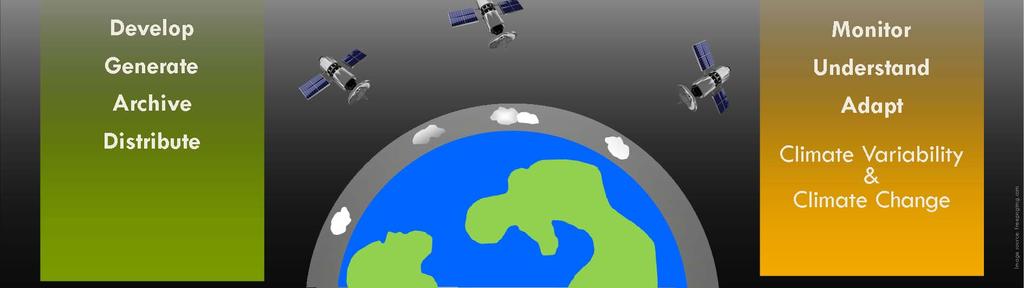
2 Climate Monitoring State of climate system Better understanding of climate variability Global Station Network Global Radiosonde Network EUMETSAT UFA 2018, Abidjan 2

3 Climate Monitoring State of climate system Better understanding of climate variability Basis are in situ measurements and more and more satellite-based data Global Coverage of Satellites EUMETSAT UFA 2018, Abidjan 3


4 Requirements for Climate Data x x Value Time Long-term time series Calibration Homogeneity Quality control EUMETSAT UFA 2018, Abidjan 4

5 The EUMETSAT SAF Network Source: EUMETSAT EUMETSAT UFA 2018, Abidjan 5


6 CM SAF Partners Deutscher Wetterdienst Swedish Meteorological and Hydrological Institute Royal Meteorological Institute of Belgium Finnish Meteorological Institute CM SAF Member States Location of Partner NMHSs Met Office, United Kingdom Centre National de la recherche scientifique EUMETSAT UFA 2018, Abidjan 6

7 EUMETSAT UFA 2018, Abidjan 7

8 EUMETSAT UFA 2018, Abidjan 8

9 Global Energy and Water Cycle Source: Wild et al., 2013 EUMETSAT UFA 2018, Abidjan 9
10 Global Energy and Water Cycle Source: Wild et al., 2013 EUMETSAT UFA 2018, Abidjan 10
 Temporal: hourly-, daily-, monthly means, mean monthly diurnal cycle Coverage Spatial: Meteosat disk Temporal: 2004 to 2015 DOI:10.")
11 CLAAS-2 Variables Cloud properties Liquid and ice water path Resolution Spatial: ( ) Temporal: hourly-, daily-, monthly means, mean monthly diurnal cycle Coverage Spatial: Meteosat disk Temporal: 2004 to 2015 DOI: /EUM_SAF_CM/CLAAS/V002 EUMETSAT UFA 2018, Abidjan 11

12 CLARA-A2 Variables Cloud properties Surface albedo Radiation Resolution Spatial: Temporal: daily-, pentad-, monthly mean Coverage Spatial: global Temporal: 1982 to 2015 DOI: /EUM_SAF_CM/CLARA_AVHRR/V002 EUMETSAT UFA 2018, Abidjan 12

13 HOAPS Variables Wind, humidity (close to surface) Precipitation, evaporation Latent heat flux Fresh water flux Resolution Spatial: Temporal: 6-hourly-, monthly means Coverage Spatial: global ice free ocean Temporal: 1987 to 2015 DOI: /EUM_SAF_CM/HOAPS/V002 EUMETSAT UFA 2018, Abidjan 13

14 SUMET Variables Land surface temperature Resolution Spatial: Temporal: hourly instantaneous, monthly mean diurnal cycle Coverage Spatial: Meteosat disk Temporal: 1991 to 2015 DOI: /EUM_SAF_CM/LST_METEOSAT/V001 EUMETSAT UFA 2018, Abidjan 14

15 COMET Variables Fractional cloud cover Resolution Spatial: Temporal: hourly instantaneous, daily and monthly means, monthly mean diurnal cycle Coverage Spatial: Meteosat disk Temporal: 1991 to 2015 DOI: /EUM_SAF_CM/CFC_METEOSAT/V001 EUMETSAT UFA 2018, Abidjan 15

16 CM SAF AOD Variables Aerosol Optical Depth Resolution Spatial: native Temporal: daily-, monthly means Coverage Spatial: Meteosat disk Temporal: 2004 to 2012 DOI: /EUM_SAF_CM/MSG_AOD/V001 EUMETSAT UFA 2018, Abidjan 16

17 TOA Radiation Variables TOA reflected solar TOA emitted thermal Resolution Spatial: Temporal: daily and monthly means, monthly means of hourly means Coverage Spatial: Meteosat disk Temporal: 2004 to 2015 DOI: /EUM_SAF_CM/CFC_METEOSAT/V001 EUMETSAT UFA 2018, Abidjan 17

18 SARAH-2.1 Variables Global radiation Surface direct irradiance Spectral resolved irradiance Effective cloud albedo Sunshine duration Resolution Spatial: Temporal: 30 min, daily-, monthly means Coverage Spatial: Meteosat disk Temporal: 1983 to 2017 DOI: /EUM_SAF_CM/SARAH/V002 EUMETSAT UFA 2018, Abidjan 18

19 SARAH-2 Sunshine Duration Sunshine duration important parameter Tourism Health Sector Agriculture Vegetation modelling Solar energy EUMETSAT UFA 2018, Abidjan 19

20 SARAH-2 Sunshine Duration Sunshine duration important parameter Tourism Health Sector Agriculture Vegetation modelling Solar energy First satellite-based sunshine duration dataset for Europe and Africa EUMETSAT UFA 2018, Abidjan 20
 EUMETSAT UFA 2018, Abidjan")
21 SARAH-2 Sunshine Duration Sunshine duration important parameter Tourism Health Sector Agriculture Vegetation modelling Solar energy First satellite-based sunshine duration dataset for Europe and Africa Basis SARAH-2 DNI data Evaluation showed good agreement with station data (< 9 %) EUMETSAT UFA 2018, Abidjan 21
 Suitable for many applications EUMETSAT UFA 2018, Abidjan")
22 SARAH-2 Sunshine Duration Sunshine duration important parameter Tourism Health Sector Agriculture Vegetation modelling Solar energy First satellite-based sunshine duration dataset for Europe and Africa Basis SARAH-2 DNI data Evaluation showed good agreement with station data (< 9 %) Suitable for many applications EUMETSAT UFA 2018, Abidjan 22

23 Application Example Sunshine Duration EUMETSAT UFA 2018, Abidjan 23

24 Application Example Sunny Days Global climatology of sunny days based on SARAH and CLARA Sunny day is defined by mean daily global radiation 80 % of maximum possible solar insolation Sunny period is characterized by five consecutive sunny days Sunny days interactive map on CM SAF webpage EUMETSAT UFA 2018, Abidjan 24
25 Application Example Sunny Days EUMETSAT UFA 2018, Abidjan 25
26 Application Example Sunny Days EUMETSAT UFA 2018, Abidjan 26
27 Application Example Sunny Days EUMETSAT UFA 2018, Abidjan 27
28 Application Example Sunny Days EUMETSAT UFA 2018, Abidjan 28
29 Application Example Sunny Days EUMETSAT UFA 2018, Abidjan 29
30 Application Example Sunny Days EUMETSAT UFA 2018, Abidjan 30
 energy yield of Global Irradiation on optimally inclined plane for the year (kwh/m2) Kindly provided by Lucky Ntsangwane (SAWS) EUMETSAT UFA 2018,")
31 Application Example Solar Atlas South Africa Colleagues from SAWS and JRC produced a solar atlas for South Africa using CM SAF radiation data Long-term Annual Mean for Global Horizontal Irradiance, period Photovoltaic (PV) energy yield of Global Irradiation on optimally inclined plane for the year (kwh/m2) Kindly provided by Lucky Ntsangwane (SAWS) EUMETSAT UFA 2018, Abidjan 31
 Trend in CM SAF SARAH global radiation (Spring) Jyotsna Singh and Andries Kruger, 2017 EUMETSAT UFA 2018,")
32 Application Example Solar Energy Trend Investigation of trend in solar energy potential for South Africa Trend in station-based sunshine duration (Spring) Trend in CM SAF SARAH global radiation (Spring) Jyotsna Singh and Andries Kruger, 2017 EUMETSAT UFA 2018, Abidjan 32
33 Application Example Solar Energy Production forecast, planning, monitoring of solar energy needs radiation data for at least 10 years PVGIS tool of Joint Research Centre Free PV online tool Uses CM SAF solar radiation data Production forecast and potential estimation Easy to apply For all African countries PVGIS solar energy potential for Côte d Ivoire EUMETSAT UFA 2018, Abidjan 33

34 Application Example Solar Energy Production forecast, planning, monitoring of solar energy needs radiation data for at least 10 years PVGIS tool of Joint Research Centre Free PV online tool Uses CM SAF solar radiation data Production forecast and potential estimation Easy to apply For all African countries PVGIS solar energy potential for Côte d Ivoire EUMETSAT UFA 2018, Abidjan 34

35 Quality assurance Rigorous review cycle is applied before publishing CDRs DOI is assigned; CDR comes with comprehensive documentation and publications CDR with uncertainty estimates Participation in international assessments and retrieval evaluations EUMETSAT UFA 2018, Abidjan 35


36 CM SAF Users Others 0% State authorities 8% Research institutes 46% Private companies 12% Meteorological Services 34% EUMETSAT UFA 2018, Abidjan 36
 Download via https or sftp All data free of charge User Help Desk https://wui.cmsaf.")
37 Data Access Web User Interface Easy selection and online ordering Postprocessing Spatial, temporal selection Data format (NetCDF) Download via https or sftp All data free of charge User Help Desk EUMETSAT UFA 2018, Abidjan 37

38 Data Access CM SAF products via EUMETCast: Monthly mean fractional cloud cover Monthly mean surface incoming shortwave radiation NetCDF format EUMETCast Africa: Channel: SAF-Africa PID: 301 Multicast Address: EUMETSAT UFA 2018, Abidjan 38
 Visualize Visualization of CM SAF data No R or scripting experiences required www.cmsaf.")
39 CM SAF R Toolbox CM SAF provides CM SAF R Toolbox for free Prepare Preparation of ordered CM SAF data (extract, choose time & region, merge) Analyze cmsaf R-package collection of functions for easy analysis and manipulation of CM SAF NetCDF data (see cran.r-project.org) Visualize Visualization of CM SAF data No R or scripting experiences required EUMETSAT UFA 2018, Abidjan 39


40 EUMETSAT UFA 2018, Abidjan 40


41 CM SAF R Toolbox Examples by UFA 2016 participants Interesting seasonal patterns over Mauritius Solar energy potential in Senegal EUMETSAT UFA 2018, Abidjan 41

42 CM SAF R Toolbox DAT_ html DAT_ html EUMETSAT UFA 2018, Abidjan 42


43 CM SAF R Toolbox EUMETSAT UFA 2018, Abidjan 43


44 Training Training workshops in cooperation with EUMETSAT Practical exercises with CM SAF data and tools To learn more about EUMETSAT training workshops see: EUMETSAT UFA 2018, Abidjan 44
45 CM SAF Training Workshop Pretoria (South Africa) 8 12 June 2015 Training Project COULIBALY Kolotioloma Alama from National Meteorological Service of Cote d Ivoire kcoulibaly2@yahoo.fr


46 Climatology pattern 10 9 Odienné Korhogo 8 Man Bouaké Bondoukou 7 Daloa Yamoussoukro Dimbokro 6 Gagnoa 5 Abidjan Adiaké Sassandra San-Pédro Tabou
47 CM SAF Data Analysis: Burkina Faso Case Study Guillaume NAKOULMA Burkina Faso Meteorological Service
48 Spatial Distribution Climatology SIS CFC PRECIP

 National Meteorological Service of COTE D")

49 Workshop on the Use of Gridded Satellite Data for Climate Services in Africa Pretoria: 20 to 24 November 2017 KANGA Brou Isidore National Meteorological Service of COTE D IVOIRE LOROUGNON Tape Ferdinand (tapefernand99@gmail.com) National Meteorological Service of COTE D IVOIRE 49

50 Time series analysis of satellite data ABIDJAN Name Year Month Satellite data Station data ABIDJAN ,76 80,5
51 ASSESSING THE SHORTWAVE RADIATION DISTRIBUTION PATTERN IN NIGERIA USING CMSAF DATA BY AGATHA OLUCHUKWU ANOKWU Nigerian Meteorological Agency

52
53 Summary Products and services in connection with global energy and water cycle Especially geostationary products excellent suitable for Africa Thoroughly quality assurance and control mechanisms Extensive exchange and support with / of users Free and uncomplicated data access So far more than 140 peer-reviewed publications using CM SAF data Contact data: Contact.cmsaf@dwd.de EUMETSAT UFA 2018, Abidjan 53


54 5 th CM SAF USER-WORKSHOP MAINZ
and their applications in Africa
 Satellite-based climate data records and their applications in Africa Steffen Kothe and CM SAF team Climate Monitoring State of climate system Better understanding of climate change Basis are in situ measurements
Climate Data Records (CDR) provided by CM SAF. Martin Werscheck Deutscher Wetterdienst
 provided by CM SAF. Martin Werscheck Deutscher Wetterdienst") Climate Data Records (CDR) provided by CM SAF Martin Werscheck Deutscher Wetterdienst CM SAF: EUMETSAT Satellite Application Facility on Climate Monitoring GCOS SCIENCE DAY IMPORTANCE OF THE CLIMATE OBSERVATIONS
Climate Data Records (CDR) provided by CM SAF Martin Werscheck Deutscher Wetterdienst CM SAF: EUMETSAT Satellite Application Facility on Climate Monitoring GCOS SCIENCE DAY IMPORTANCE OF THE CLIMATE OBSERVATIONS
Climate Monitoring from Space: Climate Monitoring
 Climate Monitoring from Space: The EUMETSAT Satellite Application i Facility on Climate Monitoring GCOS Science Conference Amsterdam, The Netherlands, 2 4 March 2016 Martin Werscheck Deutscher Wetterdienst
Operational Climate Monitoring
 Operational Climate Monitoring Concept of Climate data records & operational climate monitoring Introduction CM SAF Examples of downstream services in Europe (e.g. WMO RCC RA VI) in US (e.g. drought monitoring)
EUMETSAT SAF NETWORK. Lothar Schüller, EUMETSAT SAF Network Manager
 1 EUMETSAT SAF NETWORK Lothar Schüller, EUMETSAT SAF Network Manager EUMETSAT ground segment overview METEOSAT JASON-2 INITIAL JOINT POLAR SYSTEM METOP NOAA SATELLITES CONTROL AND DATA ACQUISITION FLIGHT
VALIDATION OF MSG DERIVED SURFACE INCOMING GLOBAL SHORT-WAVE RADIATION PRODUCTS OVER BELGIUM
 VALIDATION OF MSG DERIVED SURFACE INCOMING GLOBAL SHORT-WAVE RADIATION PRODUCTS OVER BELGIUM C. Bertrand 1, R. Stöckli 2, M. Journée 1 1 Royal Meteorological Institute of Belgium (RMIB), Brussels, Belgium
(1) AEMET (Spanish State Meteorological Agency), Demóstenes 4, Málaga, Spain ABSTRACT
 AEMET (Spanish State Meteorological Agency), Demóstenes 4, Málaga, Spain ABSTRACT") COMPARISON OF GROUND BASED GLOBAL RADIATION MEASUREMENTS FROM AEMET RADIATION NETWORK WITH SIS (SURFACE INCOMING SHORTWAVE RADIATION) FROM CLIMATE MONITORING-SAF Juanma Sancho1, M. Carmen Sánchez de Cos1,
COMPARISON OF GROUND BASED GLOBAL RADIATION MEASUREMENTS FROM AEMET RADIATION NETWORK WITH SIS (SURFACE INCOMING SHORTWAVE RADIATION) FROM CLIMATE MONITORING-SAF Juanma Sancho1, M. Carmen Sánchez de Cos1,
Report. Northern Africa. RAIDEG-8, 1-2 Nov 2017
 Report Northern Africa RAIDEG-8, 1-2 Nov 2017 Report Northern Africa RAIDEG-8, 1-2 Nov 2017 Important Note: Formal letters have been sent from the PR of Morocco with WMO to PRs of Algeria, Tunisia, Libya
Global solar radiation: comparison of satellite and ground based observations
 Global solar radiation: comparison of satellite and ground based observations Petr Skalak 1,2, Piotr Struzik 3, Aleš Farda 2,1, Pavel Zahradníček 2,1, Petr Štěpánek 2,1 1) Czech Hydrometeorological Institute,
Data Set Description. CM SAF Top of Atmosphere Radiation GERB Data Set
 EUMETSAT Satellite Application Facility on Climate Monitoring Data Set Description DOI: 10.5676/EUM_SAF_CM/TOA_GERB/V001 Reference Number: DataSet/Desc/CMSAF/TOA/GERB Issue/Revision Index: 1.0 1. Intent
EUMETSAT Training activities. Vesa Nietosvaara Mark Higgins
 EUMETSAT Training activities Vesa Nietosvaara Mark Higgins EUMETSAT Partnerships Europe: SAFs and regional networks EUMeTrain training recourses and tools Eumetcal coordination and infrastructure Africa:
Global Solar Dataset for PV Prospecting. Gwendalyn Bender Vaisala, Solar Offering Manager for 3TIER Assessment Services
 Global Solar Dataset for PV Prospecting Gwendalyn Bender Vaisala, Solar Offering Manager for 3TIER Assessment Services Vaisala is Your Weather Expert! We have been helping industries manage the impact
13 th EUMETSAT User Forum in Africa
 13 th EUMETSAT User Forum in Africa GMES & Africa implementation in Western Africa Dogbeda M.Y. Azumah Regional Marine Centre University of Ghana Pictures zone UG GMES Presentation Layout UG G Project
NWC-SAF Satellite Application Facility in Support to Nowcasting and Very Short Range Forecasting
 NWC-SAF Satellite Application Facility in Support to Nowcasting and Very Short Range Forecasting Marianne König Slide 1 Satellite Application Facilities (SAFs) in Europe Member State Cooperating State
EUMETSAT Activities Related to Climate
 EUMETSAT Activities Related to Climate Jörg Schulz joerg.schulz@eumetsat.int Slide: 1 What we do USER REQUIREMENTS European National Meteorological Services Operating Agency! European Space Industry Private
Evapotranspiration monitoring with Meteosat Second Generation satellites: method, products and utility in drought detection.
 Evapotranspiration monitoring with Meteosat Second Generation satellites: method, products and utility in drought detection. Nicolas Ghilain Royal Meteorological Institute Belgium EUMeTrain Event week
EUMETSAT LSA-SAF EVAPOTRANSPIRATION PRODUCTS STATUS AND PERSPECTIVES
 EUMETSAT LSA-SAF EVAPOTRANSPIRATION PRODUCTS STATUS AND PERSPECTIVES Arboleda, N. Ghilain, F. Gellens-Meulenberghs Royal Meteorological Institute, Avenue Circulaire, 3, B-1180 Bruxelles, BELGIUM Corresponding
Climate Prediction Center National Centers for Environmental Prediction
 NOAA s Climate Prediction Center Climate Monitoring Tool Wassila M. Thiaw and CPC International Team Climate Prediction Center National Centers for Environmental Prediction CPC International Team Vadlamani
TAMSAT: LONG-TERM RAINFALL MONITORING ACROSS AFRICA
 TAMSAT: LONG-TERM RAINFALL MONITORING ACROSS AFRICA Ross Maidment, Emily Black, Matthew Young and Dagmawi Asfaw TAMSAT, University of Reading Helen Greatrex IRI, Columbia University 13 th EUMETSAT User
Solar Resource Mapping in South Africa
 Solar Resource Mapping in South Africa Tom Fluri Stellenbosch, 27 March 2009 Outline The Sun and Solar Radiation Datasets for various technologies Tools for Solar Resource Mapping Maps for South Africa
EUMETSAT SAF NETWORK. Lothar Schüller, EUMETSAT SAF Network Manager
 1 EUMETSAT SAF NETWORK Lothar Schüller, EUMETSAT SAF Network Manager EUMETSAT ground segment overview METEOSAT JASON-2 INITIAL JOINT POLAR SYSTEM METOP NOAA SATELLITES CONTROL AND DATA ACQUISITION FLIGHT
P1.34 MULTISEASONALVALIDATION OF GOES-BASED INSOLATION ESTIMATES. Jason A. Otkin*, Martha C. Anderson*, and John R. Mecikalski #
 P1.34 MULTISEASONALVALIDATION OF GOES-BASED INSOLATION ESTIMATES Jason A. Otkin*, Martha C. Anderson*, and John R. Mecikalski # *Cooperative Institute for Meteorological Satellite Studies, University of
The PRECIS Regional Climate Model
 The PRECIS Regional Climate Model General overview (1) The regional climate model (RCM) within PRECIS is a model of the atmosphere and land surface, of limited area and high resolution and locatable over
Air sea satellite flux datasets and what they do (and don't) tell us about the air sea interface in the Southern Ocean
 tell us about the air sea interface in the Southern Ocean") Air sea satellite flux datasets and what they do (and don't) tell us about the air sea interface in the Southern Ocean Carol Anne Clayson Woods Hole Oceanographic Institution Southern Ocean Workshop Seattle,
Air sea satellite flux datasets and what they do (and don't) tell us about the air sea interface in the Southern Ocean Carol Anne Clayson Woods Hole Oceanographic Institution Southern Ocean Workshop Seattle,
EUMETSAT s Support to Climate Services and User Support. Joachim Saalmüller
 EUMETSAT s Support to Climate Services and User Support Joachim Saalmüller 1 User Forum in Africa September 2016 Outline of my talk EUMETSAT in support of climate services Exploring our data and subscribing
REVISION OF THE STATEMENT OF GUIDANCE FOR GLOBAL NUMERICAL WEATHER PREDICTION. (Submitted by Dr. J. Eyre)
") WORLD METEOROLOGICAL ORGANIZATION Distr.: RESTRICTED CBS/OPAG-IOS (ODRRGOS-5)/Doc.5, Add.5 (11.VI.2002) COMMISSION FOR BASIC SYSTEMS OPEN PROGRAMME AREA GROUP ON INTEGRATED OBSERVING SYSTEMS ITEM: 4 EXPERT
WORLD METEOROLOGICAL ORGANIZATION Distr.: RESTRICTED CBS/OPAG-IOS (ODRRGOS-5)/Doc.5, Add.5 (11.VI.2002) COMMISSION FOR BASIC SYSTEMS OPEN PROGRAMME AREA GROUP ON INTEGRATED OBSERVING SYSTEMS ITEM: 4 EXPERT
THE LAND-SAF SURFACE ALBEDO AND DOWNWELLING SHORTWAVE RADIATION FLUX PRODUCTS
 THE LAND-SAF SURFACE ALBEDO AND DOWNWELLING SHORTWAVE RADIATION FLUX PRODUCTS Bernhard Geiger, Dulce Lajas, Laurent Franchistéguy, Dominique Carrer, Jean-Louis Roujean, Siham Lanjeri, and Catherine Meurey
ASSESSMENT OF DIFFERENT WATER STRESS INDICATORS BASED ON EUMETSAT LSA SAF PRODUCTS FOR DROUGHT MONITORING IN EUROPE
 ASSESSMENT OF DIFFERENT WATER STRESS INDICATORS BASED ON EUMETSAT LSA SAF PRODUCTS FOR DROUGHT MONITORING IN EUROPE G. Sepulcre Canto, A. Singleton, J. Vogt European Commission, DG Joint Research Centre,
Variability in Global Top-of-Atmosphere Shortwave Radiation Between 2000 And 2005
 Variability in Global Top-of-Atmosphere Shortwave Radiation Between 2000 And 2005 Norman G. Loeb NASA Langley Research Center Hampton, VA Collaborators: B.A. Wielicki, F.G. Rose, D.R. Doelling February
QualiMET 2.0. The new Quality Control System of Deutscher Wetterdienst
 QualiMET 2.0 The new Quality Control System of Deutscher Wetterdienst Reinhard Spengler Deutscher Wetterdienst Department Observing Networks and Data Quality Assurance of Meteorological Data Michendorfer
Sunshine duration climate maps of Belgium and Luxembourg based on Meteosat and in-situ observations
 Open Sciences doi:1.5194/asr-1-15-213 Author(s) 213. CC Attribution 3. License. Advances in Science & Research Open Access Proceedings Drinking Water Engineering and Science Sunshine duration climate maps
Characterization of the solar irradiation field for the Trentino region in the Alps
 Characterization of the solar irradiation field for the Trentino region in the Alps L. Laiti*, L. Giovannini and D. Zardi Atmospheric Physics Group University of Trento - Italy outline of the talk Introduction
A satellite-based long-term Land Surface Temperature Climate Data Record
 Federal Department of Home Affairs FDHA Federal Office of Meteorology and Climatology MeteoSwiss A satellite-based long-term Land Surface Temperature Climate Data Record, Virgílio A. Bento, Frank M. Göttsche,
Creation of a 30 years-long high resolution homogenized solar radiation data set over the
 Creation of a 30 years-long high resolution homogenized solar radiation data set over the Benelux C. Bertrand in collaboration with M. Urbainand M. Journée Operational Directorate: Weather forecasting
Pilot applications for Egypt related end-users
 GEO-CRADLE Regional Workshop Thursday, 25 th May, 2017 Pilot applications for Egypt related end-users Hesham El-Askary Chapman University Panagiotis Kosmopoulos National Observatory of Athens Stelios Kazadzis
H SAF SATELLITE APPLICATION FACILITY ON SUPPORT TO OPERATIONAL HYDROLOGY AND WATER MANAGEMENT EUMETSAT NETWORK OF SATELLITE APPLICATION FACILITIES
 H SAF SATELLITE APPLICATION FACILITY ON SUPPORT TO OPERATIONAL HYDROLOGY AND WATER MANAGEMENT EUMETSAT NETWORK OF SATELLITE APPLICATION FACILITIES H-SAF: SATELLITE PRODUCTS FOR OPERATIONAL HYDROLOGY H-SAF
Deutscher Wetterdienst. German Climate Services - A contribution to the Global Framework for Climate Services (GFCS) Tobias Fuchs and Paul Becker
 Tobias Fuchs and Paul Becker") Deutscher Wetterdienst German Climate Services - A contribution to the Global Framework for Climate Services (GFCS) Tobias Fuchs and Paul Becker Deutscher Wetterdienst (DWD) Business Area Climate and Environment
Deutscher Wetterdienst German Climate Services - A contribution to the Global Framework for Climate Services (GFCS) Tobias Fuchs and Paul Becker Deutscher Wetterdienst (DWD) Business Area Climate and Environment
Regional climate modelling in the future. Ralf Döscher, SMHI, Sweden
 Regional climate modelling in the future Ralf Döscher, SMHI, Sweden The chain Global H E H E C ( m 3/s ) Regional downscaling 120 adam 3 C HAM 4 adam 3 C HAM 4 trl A2 A2 B2 B2 80 40 0 J F M A M J J A S
Commercialisation. Lessons learned from Dutch weather market
 Commercialisation Lessons learned from Dutch weather market Where information comes together weather traffic public transport Weather, traffic and public transport. Daily actual information that influences
Global reanalysis: Some lessons learned and future plans
 Global reanalysis: Some lessons learned and future plans Adrian Simmons and Sakari Uppala European Centre for Medium-Range Weather Forecasts With thanks to Per Kållberg and many other colleagues from ECMWF
The skill of ECMWF cloudiness forecasts
 from Newsletter Number 143 Spring 215 METEOROLOGY The skill of ECMWF cloudiness forecasts tounka25/istock/thinkstock doi:1.21957/lee5bz2g This article appeared in the Meteorology section of ECMWF Newsletter
SAWIDRA Southern Africa
 SAWIDRA Southern Africa Presenter: Thembani Moitlhobogi Assistant Database and IT Expert SADC Climate Services Centre 13 th EUMETSAT Forum in Africa 24-28 September 2018, Abidjan, Cote d Ivoire Context
Surface UV Irradiance from OMI on EOS Aura. Atmospheric Science Conference ESRIN, 8-12 May 2006 Aapo Tanskanen
 Surface UV Irradiance from OMI on EOS Aura Atmospheric Science Conference ESRIN, 8-12 May 2006 Aapo Tanskanen Contents OMI Surface UV Algorithm N. Krotkov /GEST Center, University of Maryland J. Herman
Mapping Spatial and Temporal Variability of Rainfall in Côte D Ivoire using TRMM Data
 Mapping Spatial and Temporal Variability of Rainfall in Côte D Ivoire using TRMM Data Abaka B.H. Mobio #1, Florent N. DJA #2, Adonis K.D. Kouamé #3, Eric M.V. Djagoua #4 # Centre Universitaire de Recherche
C o p e r n i c u s L a n d M o n i t o r i n g S e r v i c e
 C o p e r n i c u s L a n d M o n i t o r i n g S e r v i c e Integration into existing Snow and Ice Services and draft product specifications Annett BARTSCH b.geos Copernicus High Resolution Snow and
LAND SURFACE ALBEDO AND DOWNWELLING SHORTWAVE RADIATION FROM MSG GEOSTATIONARY SATELLITE (METHOD FOR RETRIEVAL, VALIDATION, AND APPLICATION)
") LAND SURFACE ALBEDO AND DOWNWELLING SHORTWAVE RADIATION FROM MSG GEOSTATIONARY SATELLITE (METHOD FOR RETRIEVAL, VALIDATION, AND APPLICATION) Dominique Carrer, Jean-Louis Roujean, Olivier Hautecoeur, Jean-Christophe
LAND SURFACE ALBEDO AND DOWNWELLING SHORTWAVE RADIATION FROM MSG GEOSTATIONARY SATELLITE (METHOD FOR RETRIEVAL, VALIDATION, AND APPLICATION) Dominique Carrer, Jean-Louis Roujean, Olivier Hautecoeur, Jean-Christophe
4.5 Comparison of weather data from the Remote Automated Weather Station network and the North American Regional Reanalysis
 4.5 Comparison of weather data from the Remote Automated Weather Station network and the North American Regional Reanalysis Beth L. Hall and Timothy. J. Brown DRI, Reno, NV ABSTRACT. The North American
Using a library of downscaled climate projections to teach climate change analysis
 Using a library of downscaled climate projections to teach climate change analysis Eugene Cordero, Department of Meteorology San Jose State University Overview of Dataset Climate change activity Applications
5. General Circulation Models
 5. General Circulation Models I. 3-D Climate Models (General Circulation Models) To include the full three-dimensional aspect of climate, including the calculation of the dynamical transports, requires
Climate Services in Seychelles
 Climate Services in Seychelles Vincent Amelie Seychelles Met. Services Email: v.amelie@meteo.gov.sc Regional Consultation on Climate Services in the Indian Ocean Islands, Ebène, Mauritius, 14-16 March
ECMWF global reanalyses: Resources for the wind energy community
 ECMWF global reanalyses: Resources for the wind energy community (and a few myth-busters) Paul Poli European Centre for Medium-range Weather Forecasts (ECMWF) Shinfield Park, RG2 9AX, Reading, UK paul.poli
RCOF Review [Regional Climate Outlook Forum for the Gulf of Guinea region of Africa - PRESAGG] Status Report
![RCOF Review [Regional Climate Outlook Forum for the Gulf of Guinea region of Africa - PRESAGG] Status Report](/thumbs/78/77466191.jpg "RCOF Review [Regional Climate Outlook Forum for the Gulf of Guinea region of Africa - PRESAGG] Status Report") RCOF Review 2017 [Regional Climate Outlook Forum for the Gulf of Guinea region of Africa - PRESAGG] Status Report Specific Climate features of concerned region This region typically covers the area below
RCOF Review 2017 [Regional Climate Outlook Forum for the Gulf of Guinea region of Africa - PRESAGG] Status Report Specific Climate features of concerned region This region typically covers the area below
Accuracy of Meteonorm ( )
") Accuracy of Meteonorm (7.1.6.14035) A detailed look at the model steps and uncertainties 22.10.2015 Jan Remund Contents The atmosphere is a choatic system, not as exactly describable as many technical
Accuracy of Meteonorm (7.1.6.14035) A detailed look at the model steps and uncertainties 22.10.2015 Jan Remund Contents The atmosphere is a choatic system, not as exactly describable as many technical
MAPPING NATURAL SURFACE UV RADIATION WITH MSG: MAPS SERIES IN SPRING 2004, COMPARISON WITH METEOSAT DERIVED RESULTS AND REFERENCE MEASUREMENTS
 MAPPING NATURAL SURFACE UV RADIATION WITH MSG: MAPS SERIES IN SPRING 2004, COMPARISON WITH METEOSAT DERIVED RESULTS AND REFERENCE MEASUREMENTS Jean Verdebout & Julian Gröbner European Commission - Joint
Climate Change. Climate Change Service
 Service The C3S m ission To support European adaptation and mitigation policies by: Providing consistent and authoritative information about climate Building on existing capabilities and infrastructures
THE CLIMATE INFORMATION MODULE
 Climate Information and Prediction Services (CLIPS) -Curriculum- THE CLIMATE INFORMATION MODULE designed by Dipl.-Met. Peer Hechler Deutscher Wetterdienst P.O. Box 10 04 65 63004 Offenbach Germany THE
Regional offline land surface simulations over eastern Canada using CLASS. Diana Verseghy Climate Research Division Environment Canada
 Regional offline land surface simulations over eastern Canada using CLASS Diana Verseghy Climate Research Division Environment Canada The Canadian Land Surface Scheme (CLASS) Originally developed for the
METEOSAT THIRD GENERATION
 METEOSAT THIRD GENERATION FACTS AND FIGURES MONITORING WEATHER AND CLIMATE FROM SPACE A HIGHLY INNOVATIVE GEOSTATIONARY SATELLITE SYSTEM FOR EUROPE AND AFRICA The Meteosat Third Generation (MTG) system
MAIN ATTRIBUTES OF THE PRECIPITATION PRODUCTS DEVELOPED BY THE HYDROLOGY SAF PROJECT RESULTS OF THE VALIDATION IN HUNGARY
 MAIN ATTRIBUTES OF THE PRECIPITATION PRODUCTS DEVELOPED BY THE HYDROLOGY SAF PROJECT RESULTS OF THE VALIDATION IN HUNGARY Eszter Lábó OMSZ-Hungarian Meteorological Service, Budapest, Hungary labo.e@met.hu
International Desks: African Training Desk and Projects
 The Climate Prediction Center International Desks: African Training Desk and Projects Wassila M. Thiaw Team Leader Climate Prediction Center National Centers for Environmental Predictions 1 African Desk
EUMETSAT. A global operational satellite agency at the heart of Europe. Presentation for the Spanish Industry Day Madrid, 15 March 2012
 EUMETSAT A global operational satellite agency at the heart of Europe Presentation for the Spanish Industry Day Madrid, Angiolo Rolli EUMETSAT Director of Administration EUMETSAT objectives The primary
Uncertainty of satellite-based solar resource data
 Uncertainty of satellite-based solar resource data Marcel Suri and Tomas Cebecauer GeoModel Solar, Slovakia 4th PV Performance Modelling and Monitoring Workshop, Köln, Germany 22-23 October 2015 About
Creating a WeatherSMART nation: SAWS drought related research, services and products
 Creating a WeatherSMART nation: SAWS drought related research, services and products Drought Dialogue 23-24 June 2016 Western Cape Government Hannes Rautenbach South African Weather Service SAWS mandate
Land Surface Temperature in the EUMETSAT LSA SAF: Current Service and Perspectives. Isabel Trigo
 Land Surface Temperature in the EUMETSAT LSA SAF: Current Service and Perspectives Isabel Trigo Outline EUMETSAT Land-SAF: Land Surface Temperature Geostationary Service SEVIRI Polar-Orbiter AVHRR/Metop
INCA-CE achievements and status
 INCA-CE achievements and status Franziska Strauss Yong Wang Alexander Kann Benedikt Bica Ingo Meirold-Mautner INCA Central Europe Integrated nowcasting for the Central European area This project is implemented
EUMETSAT Climate Activities
 EUMETSAT Climate Activities Jörg Schulz EUMETSAT s Role in Climate Monitoring EUMETSAT has a prominent role in the world for providing services relevant to climate: EUMETSAT maintains some of the longest
Mr Riaan Meyer On behalf of Centre for Renewable and Sustainable Energy Studies University of Stellenbosch
 CSP & Solar Resource Assessment CSP Today South Africa 2013 2 nd Concentrated Solar Thermal Power Conference and Expo 4-5 February, Pretoria, Southern Sun Pretoria Hotel Mr Riaan Meyer On behalf of Centre
Satellite-Based Sunshine Duration for Europe
 Remote Sens. 2013, 5, 2943-2972; doi:10.3390/rs5062943 Article OPEN ACCESS Remote Sensing ISSN 2072-4292 www.mdpi.com/journal/remotesensing Satellite-Based Sunshine Duration for Europe Steffen Kothe 1,
Bankable Solar Resource Data for Energy Projects. Riaan Meyer, GeoSUN Africa, South Africa Marcel Suri, GeoModel Solar, Slovakia
 Bankable Solar Resource Data for Energy Projects Riaan Meyer, GeoSUN Africa, South Africa Marcel Suri, GeoModel Solar, Slovakia Solar resource: fuel for solar technologies Photovoltaics (PV) Concentrated
Pilot applications for Greece and Egypt related end-users
 GEO-CRADLE Project Meeting 2 16 th November, 2016 Pilot applications for Greece and Egypt related end-users Panagiotis Kosmopoulos & Hesham El-Askary National Observatory of Athens Chapman University Eratosthenes
Using the EartH2Observe data portal to analyse drought indicators. Lesson 4: Using Python Notebook to access and process data
 Using the EartH2Observe data portal to analyse drought indicators Lesson 4: Using Python Notebook to access and process data Preface In this fourth lesson you will again work with the Water Cycle Integrator
Land Data Assimilation at NCEP NLDAS Project Overview, ECMWF HEPEX 2004
 Dag.Lohmann@noaa.gov, Land Data Assimilation at NCEP NLDAS Project Overview, ECMWF HEPEX 2004 Land Data Assimilation at NCEP: Strategic Lessons Learned from the North American Land Data Assimilation System
Speedwell High Resolution WRF Forecasts. Application
 Speedwell High Resolution WRF Forecasts Speedwell weather are providers of high quality weather data and forecasts for many markets. Historically we have provided forecasts which use a statistical bias
Jay Lawrimore NOAA National Climatic Data Center 9 October 2013
 Jay Lawrimore NOAA National Climatic Data Center 9 October 2013 Daily data GHCN-Daily as the GSN Archive Monthly data GHCN-Monthly and CLIMAT messages International Surface Temperature Initiative Global
REPORT ON EUMETCAST INCLUDING GEONETCAST
 Prepared by EUMETSAT Agenda Item: F.2 Discussed in Plenary REPORT ON EUMETCAST INCLUDING GEONETCAST This paper presents the actual status of the system architecture, data services supported, and registration
Results from the ARM Mobile Facility
 AMMA Workshop, Toulouse, November 2006 Results from the ARM Mobile Facility Background Anthony Slingo Environmental Systems Science Centre University of Reading, UK Selected results, including a major
SuperPack North America
 SuperPack North America Speedwell SuperPack makes available an unprecedented range of quality historical weather data, and weather data feeds for a single annual fee. SuperPack dramatically simplifies
ERA5 and the use of ERA data
 ERA5 and the use of ERA data Hans Hersbach, and many colleagues European Centre for Medium-Range Weather Forecasts Overview Overview of Reanalysis products at ECMWF ERA5, the follow up of ERA-Interim,
SolarGIS: Online Access to High-Resolution Global Database of Direct Normal Irradiance
 SolarGIS: Online Access to High-Resolution Global Database of Direct Normal Irradiance Marcel Suri PhD Tomas Cebecauer, PhD GeoModel Solar Bratislava, Slovakia Conference Conference SolarPACES 2012, 13
Satellite Application Facility on Ocean and Sea Ice (OSI SAF) Cécile Hernandez Plouzané, 20 June 2017
 Cécile Hernandez Plouzané, 20 June 2017") Satellite Application Facility on Ocean and Sea Ice (OSI SAF) Cécile Hernandez Plouzané, 20 June 2017 About OSI SAF EUMETSAT SAFs : dedicated centres of excellence for processing satellite data OSI SAF
Satellite Application Facility on Ocean and Sea Ice (OSI SAF) Cécile Hernandez Plouzané, 20 June 2017 About OSI SAF EUMETSAT SAFs : dedicated centres of excellence for processing satellite data OSI SAF
McIDAS support of Suomi-NPP /JPSS and GOES-R L2
 McIDAS support of Suomi-NPP /JPSS and GOES-R L2 William Straka III 1 Tommy Jasmin 1, Bob Carp 1 1 Cooperative Institute for Meteorological Satellite Studies, Space Science and Engineering Center, University
AN INTERNATIONAL SOLAR IRRADIANCE DATA INGEST SYSTEM FOR FORECASTING SOLAR POWER AND AGRICULTURAL CROP YIELDS
 AN INTERNATIONAL SOLAR IRRADIANCE DATA INGEST SYSTEM FOR FORECASTING SOLAR POWER AND AGRICULTURAL CROP YIELDS James Hall JHTech PO Box 877 Divide, CO 80814 Email: jameshall@jhtech.com Jeffrey Hall JHTech
1. Current atmospheric DA systems 2. Coupling surface/atmospheric DA 3. Trends & ideas
 1 Current issues in atmospheric data assimilation and its relationship with surfaces François Bouttier GAME/CNRM Météo-France 2nd workshop on remote sensing and modeling of surface properties, Toulouse,
OPTIMISING THE TEMPORAL AVERAGING PERIOD OF POINT SURFACE SOLAR RESOURCE MEASUREMENTS FOR CORRELATION WITH AREAL SATELLITE ESTIMATES
 OPTIMISING THE TEMPORAL AVERAGING PERIOD OF POINT SURFACE SOLAR RESOURCE MEASUREMENTS FOR CORRELATION WITH AREAL SATELLITE ESTIMATES Ian Grant Anja Schubert Australian Bureau of Meteorology GPO Box 1289
The benefits and developments in ensemble wind forecasting
 The benefits and developments in ensemble wind forecasting Erik Andersson Slide 1 ECMWF European Centre for Medium-Range Weather Forecasts Slide 1 ECMWF s global forecasting system High resolution forecast
1 Introduction. Station Type No. Synoptic/GTS 17 Principal 172 Ordinary 546 Precipitation
 Use of Automatic Weather Stations in Ethiopia Dula Shanko National Meteorological Agency(NMA), Addis Ababa, Ethiopia Phone: +251116639662, Mob +251911208024 Fax +251116625292, Email: Du_shanko@yahoo.com
Analyzing and Visualizing Precipitation and Soil Moisture in ArcGIS
 Analyzing and Visualizing Precipitation and Soil Moisture in ArcGIS Wenli Yang, Pham Long, Peisheng Zhao, Steve Kempler, and Jennifer Wei * NASA Goddard Earth Science Data and Information Services Center
SOLAR RADIATION ESTIMATION AND PREDICTION USING MEASURED AND PREDICTED AEROSOL OPTICAL DEPTH
 SOLAR RADIATION ESTIMATION AND PREDICTION USING MEASURED AND PREDICTED AEROSOL OPTICAL DEPTH Carlos M. Fernández-Peruchena, Martín Gastón, Maria V Guisado, Ana Bernardos, Íñigo Pagola, Lourdes Ramírez
OSI SAF SST Products and Services
 OSI SAF SST Products and Services Pierre Le Borgne Météo-France/DP/CMS (With G. Legendre, A. Marsouin, S. Péré, S. Philippe, H. Roquet) 2 Outline Satellite IR radiometric measurements From Brightness Temperatures
VALIDATION OF THE OSI SAF RADIATIVE FLUXES
 VALIDATION OF THE OSI SAF RADIATIVE FLUXES Pierre Le Borgne, Gérard Legendre, Anne Marsouin Météo-France/DP/Centre de Météorologie Spatiale BP 50747, 22307 Lannion, France Abstract The Ocean and Sea Ice
Arctic Weather Every 10 Minutes: Design & Operation of ABI for PCW
 Arctic Weather Every 10 Minutes: Design and Operation of ABI for PCW Dr. Paul C. Griffith and Sue Wirth 31st Space Symposium, Technical Track, Colorado Springs, Colorado This document is not subject to
A perturbed physics ensemble climate modeling. requirements of energy and water cycle. Yong Hu and Bruce Wielicki
 A perturbed physics ensemble climate modeling study for defining satellite measurement requirements of energy and water cycle Yong Hu and Bruce Wielicki Motivation 1. Uncertainty of climate sensitivity
Seeking a consistent view of energy and water flows through the climate system
 Seeking a consistent view of energy and water flows through the climate system Robert Pincus University of Colorado and NOAA/Earth System Research Lab Atmospheric Energy Balance [Wm -2 ] 340.1±0.1 97-101
Climate Change Service
 Service Metadata for the Data Store Dick Dee, ECMWF C3S: data + expertise + operational Open and free access to climate data (observations, reanalyses, model predictions) Tools and best scientific practices
YOPP archive: needs of the verification community
 YOPP archive: needs of the verification community B. Casati, B. Brown, T. Haiden, C. Coelho Talk Outline: P1 model and observation data P2 observation uncertainty P2 matched model and observation: time
Regional Consultation on Climate Services at the National Level for South East Europe Antalya, Turkey November
 malsale@meteo.gov.vu Regional Consultation on Climate Services at the National Level for South East Europe Antalya, Turkey 21-22 November 2014 n.rudan@rhmzrs.com Capacities for the management of climatic
eport Nataša Strelec Mahović Meteorological and Hydrological Service, Grič 3, Zagreb, Croatia EUMeTrain project Abstract
 eport Nataša Strelec Mahović Meteorological and Hydrological Service, Grič 3, Zagreb, Croatia EUMeTrain project Abstract The paper presents the concept of eport, an interface enabling the combined analysis
SOLAR POWER FORECASTING BASED ON NUMERICAL WEATHER PREDICTION, SATELLITE DATA, AND POWER MEASUREMENTS
 BASED ON NUMERICAL WEATHER PREDICTION, SATELLITE DATA, AND POWER MEASUREMENTS Detlev Heinemann, Elke Lorenz Energy Meteorology Group, Institute of Physics, Oldenburg University Workshop on Forecasting,
Climate Variables for Energy: WP2
 Climate Variables for Energy: WP2 Phil Jones CRU, UEA, Norwich, UK Within ECEM, WP2 provides climate data for numerous variables to feed into WP3, where ESCIIs will be used to produce energy-relevant series
Operational systems for SST products. Prof. Chris Merchant University of Reading UK
 Operational systems for SST products Prof. Chris Merchant University of Reading UK Classic Images from ATSR The Gulf Stream ATSR-2 Image, ƛ = 3.7µm Review the steps to get SST using a physical retrieval