NASA Disasters Program: Response, Recovery, Mitigation and Resilience
|
|
|
- Christian Horton
- 5 years ago
- Views:
Transcription

1 NASA Disasters Program: Response, Recovery, Mitigation and Resilience Dalia Kirschbaum, PhD NASA Disaster Response Coordinator
2

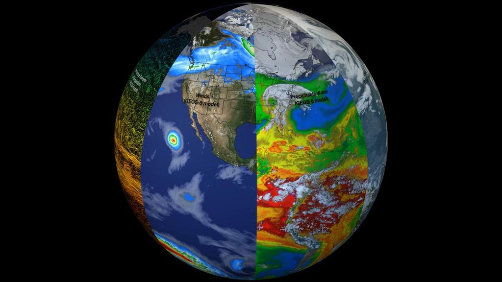
3 NASA s Earth Observation Fleet
 - Grace-FO (Launched May")
4 NASA Earth Science Missions: Currently Operating New Missions: - ICESat-II (Sep 2018) - Grace-FO (Launched May 2018)


5 Find Launch: new mission Launch: slide and Late 2018 May 2018 update Launch: September 2018 Launch: 2021 Launch: 2020 Launch:

6 NASA Disaster Response: Science for Disaster Risk Reduction and Resilience Regional Support Planning Education Training Monitoring Monitoring Natural Laboratories/ Observatories Pre-Disaster Baseline Assessment Prediction and Forecast Detection Recovery Observatory Rapid Assessment - Response Data Collection & Input Modeling, Mapping Continual Assessment Rapid Assessment - Recovery Post Disaster Needs Assessment Post-Disaster Baseline Detailed Assessment 6


 Hydrological (heavy rain/flood)")
7 NASA Disasters Program The Disasters Program collect data, and in combination with NASA scientists, academic partners, and international collaborators, provides produces for situational awareness and decision support. Utilizing the various NASA centers and their resources, a robust response program has been assembled to respond to various disasters worldwide Meteorological (hurricanes, tornadoes) Hydrological (heavy rain/flood) Geophysical (earthquakes, volcanoes)

8 Observing the lifecycle of an event: Hurricane Maria, 2017

9 Rainfall totals over the islands NASA's Integrated Multi-satellitE Retrievals for GPM (IMERG) data were used to estimate the total amount of rain that Hurricane Maria dropped from September 17 to early September 21, During that period Maria dropped heavy rain in the Leeward Islands, Virgin Islands and Puerto Rico. IMERG estimated that rainfall totals greater than 10 inches (254 mm) were common along Maria's track. IMERG rainfall estimates indicated that more than 20 inches (512 mm) of rain fell over a large part of Puerto Rico.
 FEMA used ARIA map for its Urban Search and Rescue team in Puerto Rico NASA / JPL-Caltech / ARIA contains modified Copernicus")

 acquired on 21 September was delivered on 22 September to FEMA.")
10 Response Support for Maria Texas (Harvey) Puerto Rico Damage Proxy Map (Hurricane Maria) Florida (Irma) Puerto Rico (Maria) Dominica (Maria) FEMA used ARIA map for its Urban Search and Rescue team in Puerto Rico NASA / JPL-Caltech / ARIA contains modified Copernicus Sentinel data (2017) European Space Agency Google Earth NASA s ARIA team generated and delivered flood and damage proxy maps using satellite SAR imagery. A damage proxy map of Puerto Rico devastated by Hurricane Maria was generated using SAR data from the Copernicus Sentinel-1 satellites (operated by the European Space Agency) acquired on 21 September was delivered on 22 September to FEMA. FEMA created a damage density map derived from the ARIA damage proxy map and sent it to its Urban Search and Rescue teams in the field in Puerto Rico a breakthrough societal impact
 day-night band, which detects light in a range of wavelengths from green to near-infrared.")
11 Pinpointing Where the Lights Went Out in Puerto Rico Before-and-after images of Puerto Rico s nighttime lights are based on data captured by the Suomi NPP satellite. The data were acquired by the Visible Infrared Imaging Radiometer Suite (VIIRS) day-night band, which detects light in a range of wavelengths from green to near-infrared. These data were provided to the National Guard and other partners to determine where to focus efforts to install generators and aided in the response efforts.


12 Observing Kilauea Volcano The Kilauea Volcano eruption in Hawaii triggered a number of gas- and lava-oozing fissures in the East Rift Zone of the volcano. The fissures and high levels of sulfur dioxide gas prompted evacuations in the area. Images taken from the Advanced Spaceborne Thermal Emission and Reflection Radiometer (ASTER) onboard NASA s Terra satellite picked up these new fissures on May 6 th. These data are being used to characterize potential impacts and exposure. Sulfur dioxide plumes New Fissures Old Lava flows Credits: NASA/METI/AIS T/Japan Space Systems, and U.S./Japan ASTER Science Team

13 Examining Kilauea s fissures


14 Aerial overpasses of main eruption areas: Glisten-III Glacier and Ice Surface Topography Interferometer (GLISTIN)


15 Examining Kilauea plume height Credit: NASA Earth Observatory

16 GPM Rainfall used to observe monsoon rainfall near dam breach in Laos The Challenge: Unique Features: A hydroelectric dam under construction in southeast Laos collapsed late Monday July 23rd in the Attapeu province of Sanamxay district. The collapse has left hundreds missing and an unknown number dead as water went gushing into six villages. Approximately 6,600 people have been left homeless as the result of the flood. he dam, which was under construction and not yet in operation collapsed after heavy monsoon rains in the area. ADPC produced quick time series analysis of GPM satellite precipitation data, comparing with data from the Hydo and Agro Informatics Institute (HAII). Observations matched well with the GPM IMERG data, where daily rainfall was estimated up to 300 mm/day in the days leading up to the dam breach during the period July. Visualization credit: ADPC/Pin Credit: ADPC


17 Laos Dam Flooding July 2018 On July 25, 2018, the Sentinel-1 satellite from the European Space Agency (ESA) Copernicus program captured a clear image of the collapsed Xe-Pian Xe-Namnoy dam and resulting floods. The imagery within the map viewer shows a drastic drop in the reservoir level, the impacts of which were felt on villages downstream. JULY 13th NASA and SERVIR-Mekong processed satellite imagery to estimate the extent of the flooded areas, particularly along the Xe Pian River and village of Sanamxai along the Xe Khong River in Attapeu province. JULY 25th


18 Mapping water extents Before - ESA Sentinel-1 satellite collected data on 25 July The Alaska Satellite Facility, a NASA DAAC, collaborated to provide imagery to MSFC Disasters and SERVIR for their analysis Flood Mappind Pre-RGB Post-RGB 18

19 Mapping water extents After End-users compiled data from NASA and other sources into a web GIS viewer for easy viewing: SERVIR-Mekong Web Viewer Flooded area 19
, Aakash Ahamed (Stanford U.) Photo: EPA ; Contributors: NASA SERVIR, NASA MSFC, U.")
20 Flood Damage Assessment System Activated for July 25th Laos Dam Break Dam location Flooded land PI: John Bolten (NASA GSFC) Project Scientists: Perry Oddo (NASA GSFC), Aakash Ahamed (Stanford U.) Photo: EPA ; Contributors: NASA SERVIR, NASA MSFC, U. of Houston, SIG, ADPC 20
 of potential damage to")
, Aakash Ahamed (Stanford U.) Photo: EPA ; Contributors: NASA SERVIR, NASA MSFC, U.")
21 Flood Damage Assessment System Activated for July 25th Laos Dam Break By the Numbers >3,740 people impacted 1,349 buildings 373 km of affected roads $54 million (USD) of potential damage to infrastructure and land cover PI: John Bolten (NASA GSFC) Project Scientists: Perry Oddo (NASA GSFC), Aakash Ahamed (Stanford U.) Photo: EPA ; Contributors: NASA SERVIR, NASA MSFC, U. of Houston, SIG, ADPC 21

22 NASA Disaster Website:


23

24

25 Near real-time products

26 Thank you! Resources Disaster Webpage: Disaster Mapping Portal: LANCE Near real-time data and imagery: NASA Earth Observatory:
Why Hydrological Services are Important to Business
 Why Hydrological Services are Important to Business Dr. David Green Program Manager, Disasters Earth Science Division David.s.green@nasa.gov May 8, 2018 2 Communities and Areas of Intensive Risk Socio-Economic
NASA Disasters Program Approach/Principles
 Strengthening Disaster Risk Reduction and Reslience the Contributions of Earth Observations Dr. David Green Disasters Program Science Mission Directorate Earth Science Division UNITED NATIONS ESCAP Economic
JRC Emergency Reporting - Activation #14-25 July 2018 EUROPEAN COMMISSION. Lao People's Democratic Republic Flash Flood due to Dam Collapsing
 EUROPEAN COMMISSION JOINT RESEARCH CENTRE 30 July 2018 16:00 UTC Lao People's Democratic Republic Flash Flood due to Dam Collapsing Glide Number: FF-2018-000118-LAO 23 July - ongoing UPDATE # 1 - Results
NASA-led campaign studies Hawaii's iconic volcanoes 9 February 2017, by Alan Buis
 NASA-led campaign studies Hawaii's iconic volcanoes 9 February 2017, by Alan Buis Night view of Hawaii's Kilauea Volcano, one of Earth's most active volcanoes. A NASA-led team is studying Hawaiian volcanoes
Space-based Weather and Climate Extremes Monitoring (SWCEM) Toshiyuki Kurino WMO Space Programme IPET-SUP-3, 2-4 May 2017
 Toshiyuki Kurino WMO Space Programme IPET-SUP-3, 2-4 May 2017") Space-based Weather and Climate Extremes Monitoring (SWCEM) Toshiyuki Kurino WMO Space Programme IPET-SUP-3, 2-4 May 2017 based on outcome from Workshop on Operational SWCEM 15-17 February 2017, Geneva
Space-based Weather and Climate Extremes Monitoring (SWCEM) Toshiyuki Kurino WMO Space Programme IPET-SUP-3, 2-4 May 2017 based on outcome from Workshop on Operational SWCEM 15-17 February 2017, Geneva
Current and Upcoming NASA Hurricane Measurement Missions National Hurricane Conference
 NASA Science Mission Directorate Earth Science Division Applied Sciences Program Current and Upcoming NASA Hurricane Measurement Missions National Hurricane Conference April 18, 2017 Formulation Implementation
Earth observations guided efforts to aid communities swamped by historic flooding 9 August 2017
 Earth observations guided efforts to aid communities swamped by historic flooding 9 August 2017 Credit: NASA Flooding killed more than 125 people in the U.S. in 2016. When disasters threaten the lives
Copernicus Overview. Major Emergency Management Conference Athlone 2017
 Copernicus Overview Major Emergency Management Conference Athlone 2017 Copernicus is a European programme implemented by the European Commission. The services address six thematic areas: land, marine,
CGMS-45-WMO-WP-05 Monitoring Extreme Weather and Climate from Space. World Meteorological Organization (WMO) Space Programme
 Space Programme") CGMS-45-WMO-WP-05 Monitoring Extreme Weather and Climate from Space World Meteorological Organization (WMO) Space Programme Introduction UNOSAT Report Satellite Detected Waters over Xieng Ngneun District,
CGMS-45-WMO-WP-05 Monitoring Extreme Weather and Climate from Space World Meteorological Organization (WMO) Space Programme Introduction UNOSAT Report Satellite Detected Waters over Xieng Ngneun District,
GENERAL. CHAPTER 1 BACKGROUND AND PURPOSE OF THE GUIDELINES Background of the Guidelines Purpose of the Guidelines...
 GENERAL CHAPTER 1 BACKGROUND AND PURPOSE OF THE GUIDELINES... 1 1.1 Background of the Guidelines... 1 1.2 Purpose of the Guidelines... 3 CHAPTER 2 APPLICATION OF THE GUIDELINES... 3 2.1 Potential Users
Effective Utilization of Synthetic Aperture Radar (SAR) Imagery in Rapid Damage Assessment
 Imagery in Rapid Damage Assessment") Effective Utilization of Synthetic Aperture Radar (SAR) Imagery in Rapid Damage Assessment Case Study Pakistan Floods SUPARCO M. Maisam Raza, Ahmad H. Rabbani SEQUENCE Flood Monitoring using Satellite
Effective Utilization of Synthetic Aperture Radar (SAR) Imagery in Rapid Damage Assessment Case Study Pakistan Floods SUPARCO M. Maisam Raza, Ahmad H. Rabbani SEQUENCE Flood Monitoring using Satellite
New NASA Ocean Observations and Coastal Applications
 New NASA Ocean Observations and Coastal Applications Duane Armstrong Chief, Applied Science & Technology Project Office August 20, 2014 1 Outline NASA s new Earth Science Ocean Science Missions for 2014
Sentinel Asia Tsunami Working Group
 Sentinel Asia Tsunami Working Group Co-Chairman: Prof. Shunichi Koshimura Abdul Muhari, PhD 4 th Joint Project Team Meeting (JPTM 2017): Sentinel Asia STEP 3 Abdul MUHARI, PhD Ministry of Marine Affairs
Assessing Hazards and Risk
 Page 1 of 6 EENS 204 Tulane University Natural Disasters Prof. Stephen A. Nelson Assessing Hazards and Risk This page last updated on 07-Jan-2004 As discussed before, natural disasters are produced by
Disaster Management and Spatial Data An Experience of Sri Lanka for Joint project team meeting 2012
 Disaster Management and Spatial Data An Experience of Sri Lanka for Joint project team meeting 2012 1 by Padma Kumara Withana Provincial Surveyor General Uva Province 2 Out line ü Introduction ü Natural
New Concept of Regional Cooperation in Asia for Water Disaster Management Applying Satellite Precipitation Measurement
 New Concept of Regional Cooperation in Asia for Water Disaster Management Applying Satellite Precipitation Measurement Yusuke Muraki Japan Aerospace Exploration Agency (JAXA) Mission Planning Department
NASA Flood Monitoring and Mapping Tools
 National Aeronautics and Space Administration ARSET Applied Remote Sensing Training http://arset.gsfc.nasa.gov @NASAARSET NASA Flood Monitoring and Mapping Tools www.nasa.gov Outline Overview of Flood
Earth Observatory of Singapore. Nina Lin 22 Jan 2018
 Earth Observatory of Singapore Nina Lin 22 Jan 2018 EOS Our Mission Our Mission Director Prof. Kerry Sieh The Earth Observatory of Singapore conducts fundamental research on earthquakes, volcanic eruptions,
Roles of NGII in successful disaster management
 The Second UN-GGIM-AP Plenary Meeting Roles of NGII in successful disaster management Republic of Korea Teheran Iran 28 October 2013 Sanghoon Lee, Ph.D. NGII Outline Type of Disasters Occur in Korea Practical
Thursday, May 17, :30 a.m. EDT
 Thursday, May 17, 2018 8:30 a.m. EDT Significant Activity May 16-17 Significant Events: Kīlauea Volcano eruption Tropical Activity: Western Pacific no activity affecting U.S. interests Significant Weather:
Recent development of the National Hydro-Meteorological Service (NHMS) of Viet Nam for disaster risk reduction
 of Viet Nam for disaster risk reduction") Ministry of Natural Resources and Environment National Hydro-Meteorological Service Recent development of the National Hydro-Meteorological Service (NHMS) of Viet Nam for disaster risk reduction Tran Van
Ministry of Natural Resources and Environment National Hydro-Meteorological Service Recent development of the National Hydro-Meteorological Service (NHMS) of Viet Nam for disaster risk reduction Tran Van
Interagency Remote Sensing Coordination Call Conference Bridge: , Passcode:
 Interagency Remote Sensing Coordination Call Conference Bridge: 800-320-4330, Passcode: 247327 Tropical Activity Atlantic and Pacific Tuesday, September 12, 2018 Remote Sensing - NRCC and HQ: Preparing
Progress Report. Flood Hazard Mapping in Thailand
 Progress Report Flood Hazard Mapping in Thailand Prepared By: Mr. PAITOON NAKTAE Chief of Safety Standard sub-beuro Disaster Prevention beuro Department of Disaster Prevention and Mitigation THAILAND E-mail:
EXTRACTION OF FLOODED AREAS DUE THE 2015 KANTO-TOHOKU HEAVY RAINFALL IN JAPAN USING PALSAR-2 IMAGES
 EXTRACTION OF FLOODED AREAS DUE THE 2015 KANTO-TOHOKU HEAVY RAINFALL IN JAPAN USING PALSAR-2 IMAGES F. Yamazaki a, *, W. Liu a a Chiba University, Graduate School of Engineering, Chiba 263-8522, Japan
Geo-information and Disaster Risk Reduction in the Hindu Kush-Himalayan region
 Geo-information and Disaster Risk Reduction in the Hindu Kush-Himalayan region Basanta Shrestha, Division Head MENRIS, International Centre for Integrated Mountain Development Kathmandu, Nepal The International
2017 Hurricane Season and Beyond
 2017 Hurricane Season and Beyond Ken Graham National Hurricane Center Building a Weather-Ready Nation Much of U.S. Coast Saw Tropical Wind Watches or Warnings 2017 Hurricane Season Facts and Figures 7th
Satellite-based applications for water resources management in Asia and Pacific region
 Satellite-based applications for water resources management in Asia and Pacific region Ko Hamamoto Japan Aerospace Exploration Agency The views expressed in this paper/presentation are the views of the
sentinel-2 COLOUR VISION FOR COPERNICUS
 sentinel-2 COLOUR VISION FOR COPERNICUS SATELLITES TO SERVE By providing a set of key information services for a wide range of practical applications, Europe s Copernicus programme is providing a step
Utilization of Satellite Precipitation Data for Flood Management
 Utilization of Satellite Precipitation Data for Flood Management Toshiro SUZUKI Director, Water and Environment Research Department Infrastructure Development Institute (IDI) Japan 1 Contents 1. Global
Japanese Programs on Space and Water Applications
 Japanese Programs on Space and Water Applications Tamotsu IGARASHI Remote Sensing Technology Center of Japan June 2006 COPUOS 2006 Vienna International Centre Water-related hazards/disasters may occur
National Aeronautics and Space Administration. Earth Day is everyday at NASA. activity booklet
 National Aeronautics and Space Administration Earth Day is everyday at NASA activity booklet Earth Day is everyday at NASA NASA s Fleet of Earth Observing Satellites ACRIMSAT Landsat 7 Aqua SORCE Terra
Preliminary Rapid Flood Assessment Lao People s Democratic Republic Update 1
 Preliminary Rapid Flood Assessment Lao People s Democratic Republic Update 1 2 August 2017 Situation Overview- SAR data over the area- Latest Acquisition SAR Image from 30 July 2017 covering the provinces
Hurricane Preparation and Recovery. October 11, 2011 Jon Nance, Chief Engineer, NCDOT
 Hurricane Preparation and Recovery October 11, 2011 Jon Nance, Chief Engineer, NCDOT North Carolina & Severe Weather Our state often bears the brunt of storms, which include: Ice storms Snow storms Heavy
Interpretive Map Series 24
 Oregon Department of Geology and Mineral Industries Interpretive Map Series 24 Geologic Hazards, and Hazard Maps, and Future Damage Estimates for Six Counties in the Mid/Southern Willamette Valley Including
Overview of Philippine Geohazards Programs
 Overview of Philippine Geohazards Programs 53 rd CCOP Annual Session CCOP-IUGS Task Group on Geohazards Joint Seminar Cebu City, PHILIPPINES October 18, 2017 Renato U. Solidum, Jr. Department of Science
Daily Operations Briefing. Wednesday, November 8, :30 a.m. EST
 Daily Operations Briefing Wednesday, November 8, 2017 8:30 a.m. EST Significant Activity Nov 7-8 Significant Events: Tropical Cyclones Harvey, Irma, and Maria Tropical Activity: Atlantic Tropical Storm
Location Option Details. 1. Florida
 1. Florida Florida has the smallest number of earthquaes in the United States. Florida is the U.S. location where hurricanes are most frequent. Of the six deadliest hurricanes to hit the continental U.S.,
GUIDELINES FOR CONSTRUCTION TECHNOLOGY TRANSFER DEVELOPMENT OF WARNING AND EVACUATION SYSTEM AGAINST SEDIMENT DISASTERS IN DEVELOPING COUNTRIES
 GUIDELINES FOR CONSTRUCTION TECHNOLOGY TRANSFER DEVELOPMENT OF WARNING AND EVACUATION SYSTEM AGAINST SEDIMENT DISASTERS IN DEVELOPING COUNTRIES MARCH 2004 Ministry of Land, Infrastructure and Transport
2014 Annual Mitigation Plan Review Meeting
 2014 Annual Mitigation Plan Review Meeting Highland County EMA MEETING OBJECTIVES Understand Your Natural Disaster Risk Review of Previous Plans Current Plan Status Future Activity Plan/Needs of Each Community
LandScan Global Population Database
 LandScan Global Population Database The World s Finest Population Distribution Data Uncommon information. Extraordinary places. LandScan Global Population Database East View Cartographic is now offering
Supporting the response to the 2018 lower East Rift Zone and summit collapse at Kīlauea Volcano, Hawaiʻi
 Hawaiʻi Supersite success story Supporting the response to the 2018 lower East Rift Zone and summit collapse at Kīlauea Volcano, Hawaiʻi Since 1983, Kīlauea Volcano, on the Island of Hawaiʻi, has actively
GIS and Remote Sensing
 Spring School Land use and the vulnerability of socio-ecosystems to climate change: remote sensing and modelling techniques GIS and Remote Sensing Katerina Tzavella Project Researcher PhD candidate Technology
How does NASA study hurricanes? 17 August 2015, by Max Gleber
 How does NASA study hurricanes? 17 August 2015, by Max Gleber Hurricanes are the most powerful weather event on Earth. NASA's expertise in space and scientific exploration contributes to essential services
NASA Jet Propulsion Laboratory Data Products
 NASA Jet Propulsion Laboratory Data Products 17 April 2014 Emergency Response Spatial Tools Technical Interchange Maggi Glasscoe Margaret.T.Glasscoe@jpl.nasa.gov Sang-Ho Yun Sang-Ho.Yun@jpl.nasa.gov www.nasa.gov
Hurricane Readiness for Coastal Communities
 Hurricane Readiness for Participant Guide Developed for: Federal Emergency Management Agency Emergency Management Institute 16825 South Seton Avenue Emmitsburg, MD 21727-8998 Developed by: C² Technologies,
Regional Flash Flood Guidance and Early Warning System
 WMO Training for Trainers Workshop on Integrated approach to flash flood and flood risk management 24-28 October 2010 Kathmandu, Nepal Regional Flash Flood Guidance and Early Warning System Dr. W. E. Grabs
Interagency Remote Sensing Coordination Call Conference Bridge: , Passcode:
 Interagency Remote Sensing Coordination Call Conference Bridge: 800-320-4330, Passcode: 132811 Tropical Activity Atlantic and Pacific Tuesday, September 12, 2018 FEMA RS Updates: 1. The International Charter
PAGASA s Expectations of New-generation Satellites for Hazard Monitoring
 Country Report Philippines PAGASA s Expectations of New-generation Satellites for Hazard Monitoring VICENTE P. PALCON, JR. (Assistant Weather Services Chief) Weather Division- PAGASA DOST Email: vppalconjr@pagasa.dost.gov.ph
Summary of Available Datasets that are Relevant to Flood Risk Characterization
 Inter-Agency Characterization Workshop February 25-27, 2014 USACE Institute for Water Resources, Alexandria, VA, IWR Classroom Summary of Available Datasets that are Relevant to Characterization National
GEOMATICS AND DISASTER MANAGEMENT: Early Impact assessment in Haiti
 GEOMATICS AND DISASTER MANAGEMENT: Early Impact assessment in Haiti We will talk about... Post-disaster response: the main questions to be answered Post-disaster rapid mapping: the role of Geomatics The
Tuesday, May 29, :30 a.m. EDT
 Tuesday, May 29, 2018 8:30 a.m. EDT Significant Activity May 25-29 Significant Events: Subtropical Depression Alberto; Flooding Ellicott City, MD; Kīlauea Volcano Tropical Activity: Atlantic Subtropical
Bistandsprosjekter i Sørøst-Asia
 Bistandsprosjekter i Sørøst-Asia -Sikre liv og verdier Lars R. Hole, Hanneke Luijting, Tor Ivar Mathisen og Kristine Gjesdal September 2017 Norwegian Meteorological Institute Background Ministry of Foreign
Haiti and Dominican Republic Flash Flood Initial Planning Meeting
 Dr Rochelle Graham Climate Scientist Haiti and Dominican Republic Flash Flood Initial Planning Meeting September 7 th to 9 th, 2016 Hydrologic Research Center http://www.hrcwater.org Haiti and Dominican
Committee on Earth Observation Satellites. The CEOS Volcano Demonstrator Rationale and Implementation
 Committee on Earth Observation Satellites The CEOS Volcano Demonstrator Rationale and Implementation Why focus on volcanoes? Over 300,000 people have been killed by volcanoes since the 1600s Globally,
Subsidence Monitoring in Hampton Roads Using InSAR
 Subsidence Monitoring in Hampton Roads Using InSAR Ben Hamlington, David Bekaert, Cathleen Jones, Brett Buzzanga, John Murray Commonwealth Center for Recurrent Flooding Resiliency (CCRFR) NASA Jet Propulsion
Effectiveness of Disaster Risk Reduction (DRR) programs funded by ECHO in the Caribbean
 programs funded by ECHO in the Caribbean") Effectiveness of Disaster Risk Reduction (DRR) programs funded by ECHO in the Caribbean Evidence collected after hurricanes Irma and Maria 1 Introduction The 2017 hurricane season has been exceptionally
Effectiveness of Disaster Risk Reduction (DRR) programs funded by ECHO in the Caribbean Evidence collected after hurricanes Irma and Maria 1 Introduction The 2017 hurricane season has been exceptionally
Geohazard Supersites and Natural Laboratories
 Geohazard Supersites and Natural Laboratories FRINGE 2011, Frascati, Italy, September 19, 2011 Wolfgang Lengert, ESA Falk Amelung, University of Miami, GEO task lead Craig Dobson, NASA, CEOS task lead
JAXA s satellites for Disaster Risk Reduction
 JAXA s satellites for Disaster Risk Reduction October 9, 2017 Masanobu TSUJI Japan Aerospace Exploration Agency (JAXA) Panel on Space Technology and Applications in Support of theregional Roadmap for Implementing
United States Multi-Hazard Early Warning System
 United States Multi-Hazard Early Warning System Saving Lives Through Partnership Lynn Maximuk National Weather Service Director, Central Region Kansas City, Missouri America s s Weather Enterprise: Protecting
Global Precipitation Measurement (GPM) for Science and Society
 for Science and Society") Global Precipitation Measurement (GPM) for Science and Society Gail Skofronick-Jackson GPM Project Scientist NASA Goddard Space Flight Center Radar Observation of Rain from Space Tokyo, Japan 29 November
Global Precipitation Measurement (GPM) for Science and Society Gail Skofronick-Jackson GPM Project Scientist NASA Goddard Space Flight Center Radar Observation of Rain from Space Tokyo, Japan 29 November
Covered Area Rainfall Event (18-19 September 2017) Hurricane Maria Excess Rainfall
 Hurricane Maria Excess Rainfall") Covered Area Rainfall Event (18-19 September 2017) Hurricane Maria Excess Rainfall Event Briefing Barbados 28 September 2017 Registered Office: CCRIF SPC c/o Sagicor Insurance Managers Ltd., 198 North
Covered Area Rainfall Event (18-19 September 2017) Hurricane Maria Excess Rainfall Event Briefing Barbados 28 September 2017 Registered Office: CCRIF SPC c/o Sagicor Insurance Managers Ltd., 198 North
Daily Operations Briefing. Sunday, October 22, :30 a.m. EDT
 Daily Operations Briefing Sunday, October 22, 2017 8:30 a.m. EDT Significant Activity Oct 21-22 Significant Events: Response and recovery Harvey, Irma, Maria; CA Wildfires Tropical Activity: Atlantic No
Daily Operations Briefing. Monday, October 30, :30 a.m. EDT
 Daily Operations Briefing Monday, October 30, 2017 8:30 a.m. EDT Significant Activity Oct 28-30 Significant Events: Response and Recovery Tropical Cyclones Harvey, Irma, and Maria Severe Weather Northeast
13.2 USING VIRTUAL GLOBES TO IMPROVE SITUATIONAL AWARENESS IN THE NATIONAL WEATHER SERVICE
 13.2 USING VIRTUAL GLOBES TO IMPROVE SITUATIONAL AWARENESS IN THE NATIONAL WEATHER SERVICE Andy Foster* National Weather Service Springfield, Missouri* Keith Stellman National Weather Service Shreveport,
Wildfire WG Monitoring of Heat Related Disaster using Volcano and Wildfire monitoring system
 Wildfire WG Monitoring of Heat Related Disaster using monitoring system 2018 11 01 Koji Nakau, JAXA/SAOC Topics Fire danger related indexes monitoring system Volcano monitoring Although this is Wildfire
 Hazard Warnings GE 4150 Natural Hazards September 17, 2007 http://www.sdr.gov/ndis_rev_oct27.pdf Sorensen, J.H. (2000) Hazard warning systems: Review of 20 years of progress. Natural Hazards Review, May,
Daily Operations Briefing. Thursday, November 9, :30 a.m. EST
 Daily Operations Briefing Thursday, November 9, 2017 8:30 a.m. EST Significant Activity Nov 8-9 Significant Events: Tropical Cyclones Harvey, Irma, and Maria Tropical Activity: Atlantic Tropical Storm
JICA s Experiences of Connecting Japanese Science & Technologies for Disaster Risk Reduction in Developing Countries
 JICA s Experiences of Connecting Japanese Science & Technologies for Disaster Risk Reduction in Developing Countries Junji WAKUI Deputy Director General, Group Leader Disaster Risk Reduction Group Global
NGIAs' roles in successful disaster response
 The Second UN-GGIM-AP Plenary Meeting NGIAs' roles in successful disaster response Japan Teheran Iran 28 October 2013 Shin-ichi SAKABE, Director of International Affairs Division Geospatial Information
Geohazard Supersites and Natural Laboratories
 Geohazard Supersites and Natural Laboratories FRINGE 2011, Frascati, Italy, September 19, 2011 Wolfgang Lengert, ESA Falk Amelung, University of Miami, GEO task lead Craig Dobson, NASA, CEOS task lead
Marshall Alexander Forecaster Commonwealth of Dominica
 Marshall Alexander Forecaster Commonwealth of Dominica Dominica 2015 Impacts Tropical Storm Danny (August 24 th ) Tropical Storm Erika (August 27 th ) Tropical Storm Grace (Remnants) (September 10 th -11
June 2-5, 2018 Pasadena, CA Pasadena Convention Center. #aphl
 June 2-5, 2018 Pasadena, CA Pasadena Convention Center #aphl Florida s Response to Natural Disasters Andrew Cannons, Ph.D. Laboratory Director Bureau of Public Health Laboratories (BPHL)-Tampa Florida
Jim Fox. copyright UNC Asheville's NEMAC
 Decisions and System Thinking Jim Fox November, 2012 1 UNC Asheville s s NEMAC National Environmental Modeling and Analysis Center Applied Research and technology development on integration of environmental
DAMAGE DETECTION OF THE 2008 SICHUAN, CHINA EARTHQUAKE FROM ALOS OPTICAL IMAGES
 DAMAGE DETECTION OF THE 2008 SICHUAN, CHINA EARTHQUAKE FROM ALOS OPTICAL IMAGES Wen Liu, Fumio Yamazaki Department of Urban Environment Systems, Graduate School of Engineering, Chiba University, 1-33,
3Chapter Three: Rescue and Response
 17 16 Report Science Title and the Storms: the USGS Response to the Hurricanes of 2005 3Chapter Three: Rescue and Response This chapter documents the U.S. Geological Survey s (USGS) humanitarian rescue
Innovative Ways to Monitor Land Displacement
 ARTICLE Innovative Ways to Monitor Land Displacement When people think about landslides, they usually imagine large mud streams which cause considerable loss of life. Whereas such large-scale disasters
Daily Operations Briefing. Saturday, September 30, :30 a.m. EDT
 Daily Operations Briefing Saturday, September 30, 2017 8:30 a.m. EDT Significant Activity Sep 29-30 Significant Events: Response for Hurricane Maria Tropical Activity: Atlantic Tropical Storm Maria; Post-Tropical
Bhutan Country Report for JPTM 2010 (July, 2010) Department of Disaster Management Ministry of Home & Cultural Affairs Royal Government of Bhutan
 Department of Disaster Management Ministry of Home & Cultural Affairs Royal Government of Bhutan") Bhutan Country Report for JPTM 2010 (July, 2010) Department of Disaster Management Ministry of Home & Cultural Affairs Royal Government of Bhutan 1 Contents of Presentation 1. Disaster Hazards and Underlying
Bhutan Country Report for JPTM 2010 (July, 2010) Department of Disaster Management Ministry of Home & Cultural Affairs Royal Government of Bhutan 1 Contents of Presentation 1. Disaster Hazards and Underlying
Disaster RISK Management : Bhutanese Scenario
 Disaster RISK Management : Bhutanese Scenario Expert Group Meeting (EGM) on Geo-referenced Information Systems for Disaster Risk Management (Geo-DRM) and sustaining the Community of Practice (COP), Bangkok,
Copernicus Overview and Emergency Management Service
 Copernicus Overview and Emergency Management Service Frédéric BASTIDE European Commission Open informal session of the United Nations Inter-Agency Meeting on Outer Space Activities 12 March 2013, Geneva
Lessons Learned and Shared
 Lessons Learned and Shared Plan for the worst. Hope for the best. Remember that hope is not a strategy. Agnes 8 Lessons 1. Identify Susceptible Communities 2. Develop a Plan 3. Threat Recognition 4. Review
Leveraging Sentinel-1 time-series data for mapping agricultural land cover and land use in the tropics
 Leveraging Sentinel-1 time-series data for mapping agricultural land cover and land use in the tropics Caitlin Kontgis caitlin@descarteslabs.com @caitlinkontgis Descartes Labs Overview What is Descartes
Outline. Artificial night lighting as seen from space. Artificial night lighting as seen from space. Applications based on DMSP nighttime lights
 -1 - Outline Satellite observed nighttime lights as an indicator of human induced stress on coral C. Aubrecht, C.D. Elvidge August 22, 2008 Kuffner Observatory Vienna, Austria Artificial night lighting
EXPLORE PLATE TECTONICS & MORE THROUGH GPS DATA. Shelley Olds, UNAVCO April 12, 2018 NGSS Webinar
 EXPLORE PLATE TECTONICS & MORE THROUGH GPS DATA Shelley Olds, UNAVCO April 12, 2018 NGSS Webinar Today s Outline Central question: How do we know the tectonic plates are still moving? -- What evidence
Utilization of satellite precipitation data for flood management
 Utilization of satellite precipitation data for flood management Tetsuya IKEDA Infrastructure Development Institute (IDI) Japan Typhoon Committee Integrated Workshop November 7, 2011 Nha Trang, Vietnam,
Sentinel-1 Mission Status
 Sentinel-1 Mission Status Pierre Potin, Sentinel-1 Mission Manager, ESA Luca Martino, Technical Support Engineer, ESA... and the Sentinel-1 operations team PSTG SAR Coordination Working Group 14 December
NWSEO CALLS FOR NATIONAL CLIMATE SERVICE TO BE MADE PART OF THE NATIONAL WEATHER SERVICE
 APRIL 2009 NWSEO CALLS FOR NATIONAL CLIMATE SERVICE TO BE MADE PART OF THE NATIONAL WEATHER SERVICE At its recent winter meeting, the NWSEO National Council decided to urge the Administration and Congress
A New National Flood Inundation Mapping Science Initiative
 A New National Flood Inundation Mapping Science Initiative William Guertal, PhD. Director, USGS Indiana and Kentucky Water Science Centers U.S. Department of the Interior U.S. Geological Survey Courtesy
JPSS GEONETCAST REQUIREMENTS DISCUSSION
 Joint Polar Satellite System (JPSS) JPSS GEONETCAST REQUIREMENTS DISCUSSION Mitch Goldberg Program Scientist Joint Polar Satellite System National Environmental Satellite, Data, and Information Service
Miami-Dade County Overview
 Miami-Dade County Overview 2,000 square miles World s busiest cruise port 2.6 million residents Second busiest US airport for international travelers Gateway to the Caribbean and Latin America Natural
Hazard Resilience Index (HRI) Earthquakes, Tsunamis, and Volcanoes
 Earthquakes, Tsunamis, and Volcanoes") Hazard Index (HRI) Earthquakes, Tsunamis, and Volcanoes Earthquakes Tsunamis Volcano-Ash Falls, Projectiles and Lateral Blasts, Pyroclastic Flows and Lava Flows Earthquakes, Tsunamis and Volcanoes Please
Hazard Index (HRI) Earthquakes, Tsunamis, and Volcanoes Earthquakes Tsunamis Volcano-Ash Falls, Projectiles and Lateral Blasts, Pyroclastic Flows and Lava Flows Earthquakes, Tsunamis and Volcanoes Please
Remote Detection and Monitoring of Volcanic Eruptions in the East African Rift
 Remote Detection and Monitoring of Volcanic Eruptions in the East African Rift Simon Carn 1, David Fee 2, Fred Prata 3 1 Department of Geological and Mining Engineering and Sciences, Michigan Technological
Application of Satellite Data for Flood Forecasting and Early Warning in the Mekong River Basin in South-east Asia
 MEKONG RIVER COMMISSION Vientiane, Lao PDR Application of Satellite Data for Flood Forecasting and Early Warning in the Mekong River Basin in South-east Asia 4 th World Water Forum March 2006 Mexico City,
The Science and Policy of Natural Hazards
 Image courtesy of USGS. 12.103 Image courtesy of NOAA. The Science and Policy of Natural Hazards Image courtesy of USGS. Image courtesy of NOAA. Topics Four categories of hazards will be investigated in
Pacific Catastrophe Risk Assessment And Financing Initiative
 Pacific Catastrophe Risk Assessment And Financing Initiative VANUATU September 211 Country Risk Profile: VANUATU is expected to incur, on average, 48 million USD per year in losses due to earthquakes and
National Situation Report As of 3:00 a.m. EDT, Monday, October 2, 2017 Table of Contents Current Operations Monitoring Recovery
 Overview National Situation Report As of 3:00 a.m. EDT, Monday, October 2, 2017 Table of Contents Current Operations Monitoring Recovery FEMA Headquarters Status FEMA Region Status NRCC Level I (24/7)
Utilizing GIS to Identify and Mobilize Interdisciplinary Disaster Reconnaissance Research Teams: The SSEER and ISEEER Platforms
 Utilizing GIS to Identify and Mobilize Interdisciplinary Disaster Reconnaissance Research Teams: The SSEER and ISEEER Platforms NSF-EAGER Award #1745611 Lori Peek, Director Mason Mathews and Haorui Wu,
Wednesday, May 23, :30 a.m. EDT
 Wednesday, May 23, 2018 8:30 a.m. EDT Significant Activity May 22-23 Significant Events: Kīlauea Volcano eruption Tropical Activity: Atlantic Invest 90L MEDIUM chance (60%) Significant Weather: Severe
Ensuring the Building of Community Resiliency through Effective Partnership December 4, 2017 Melia Nassau Beach Valentino A. Hanna
 Ensuring the Building of Community Resiliency through Effective Partnership December 4, 2017 Melia Nassau Beach Valentino A. Hanna Sol Caribbean Presence What Occurred Mega Storms 2017 Cat 5 Hurricane
What the Science Tells Us & How Practitioners Can Use the Science
 What the Science Tells Us & How Practitioners Can Use the Science Presented at APTA Los Angeles, CA Presented by Dr. B. Tod Delaney President, First Environment, Inc. Wed. August 3, 2011 1 Agenda 1. What