Introduction to Mesoscale Meteorology
|
|
|
- Eustacia Richardson
- 6 years ago
- Views:
Transcription
1 Introduction to Mesoscale Meteorology
2 Overview Scale Definitions Synoptic Synoptic derived from Greek synoptikos meaning general view of the whole. Also has grown to imply at the same time or simultaneous. Synoptic Scale The scales of fronts and cyclones studied by the early Norwegian scientists. The classic synoptic scale are the time and space scales resolved by observations taken at major European cities having a mean spacing of about 100 km. Hence weather systems having scales of a few hundred kilometers or more and time scales of a few days are generally what is accepted to be synoptic scale phenomena.
3 Overview Scale Definitions Cumulus Defined by the rise of RADAR meteorology in the late 1940 s to be the scale of individual thunderstorm and cumulus cell echoes, this became the second important scale of meteorology research. This scale is on the order of a couple of kilometers to about 50 km and time scales of a few minutes to several hours.
4 Overview Scale Definitions Mesoscale (original definition) Coined by Lidga (1951), mesoscales are the Middle Scales between synoptic scale and cumulus scale. This original definition hence referred to weather phenomena of scales between what were thought to be the two primary energy containing scales of cumulus and synoptic scale. The Modern Definition is much more robust.
5 Overview Scale Definitions Mesoscale (modern definition) Orlanski (1975) proposed a new set of scales (ignoring synoptic and cumulus) that include the micro-, meso- and macro- scales. Figure 1 depicts these three definitions. All three definitions have gained wide acceptance, despite an even newer proposal by Fugita (1981). His definition of the mesoscale was scales between 2 km and 2000 km. Scales larger than 2000 km are macroscale and scales smaller than 2 km are microscale

6 Mesoscale Over The Years
7
8 Overview Scale Definitions Mesoscale (modern) Orlanski divides the mesoscale into three submesoscales : 1. Meso- : 2-20 km 2. Meso- : km 3. Meso- : km We will attach a physical significance to these three mesoscales.
9 Equations of Motion u i t u i t u i t u i t u u i j x i, j,k f j u k 1 p j x i3 g Momentum/Density Form i u j u i x j i, j,k f j u k x i i3 g Momentum/Entropy Form u j u i x j i, j,k f j u k ' x i i, j,k ( j f j )u k k xi i3 g ' o Quasi-Boussinesq Momentum/Entropy Form x i i3 g Bernoulli Form u i t i, j, k l i k xi n p xi 1 k u i 2 2 i i, j, k Lamb Vector Form 0 if i=j, or j=k, or i=k 1 if i,j,k are 1,2,3 or 2,3,1 or 3,1,2 1 if i,j,k are 3,2,1 or 2,1,3 or 1,3,2 u x j k p cp 1000mb p n xi x i3 g i A B A B i, j, k j k R c p
10 Force Balance in Equation of Motion u i t l i k xi Lamb Vector Kinetic Energy Gradient Inertial acceleration Inertial Balance n p xi Nonhydrostatic Pressure Gradient Real force acceleration Rotational Irrotational hydrostatic imbalance
11 Physical Significance of Mesoscale Two Major Categories of Dynamic Force Balances Result 1. Hydrostatic: Gravity versus Pressure Gradient 2. Inertial: Inertial Force Versus Gravity a) Geostrophic (Horizontal Pressure Gradient versus vertical Coriolis effect) b) Cyclostrophic (Pressure Gradient versus rotational and irrotational inertial) c) Gradient (Horizontal Pressure gradient versus all inertial)
12 Perturbations from Balance For stable balance, i.e. stability restores balance, perturbations initiate oscillations that result in waves For unstable balance, perturbations produce a growing disturbance
13 Perturbations from Hydrostatic Balance Perturbations from stable balance lead to: Gravity or Buoyancy waves Horizontal phase speed is N Lz g cg k 2 o z Perturbations from unstable balance hydrostatic balance (static instability) lead to: Convection
14 Perturbations from Geostrophic Balance Stability produces Balance: Oscillation frequency is f Wave speed is on order of : f flx ci k 2 Unstable balance produces: Inertial Instability
15 If both hydrostatic and inertial balances occur and the flow is perturbed, what is the result? Depends on which adjustment dominates. Determine dominant adjustment from ratio of gravity wave phase speed to inertial wave phase speed: R o c c g i L N z L f h
16 The Rossby Radius of Deformation Scale at which there is equal inertial and gravity wave response The definition of Rossby Radius is: L R c L N HN g Z f f f
17 Rossby Radius for axi-symmetric vortex having tangential wind V and Radius R L R f c g 1 1 2V 2 2 f R
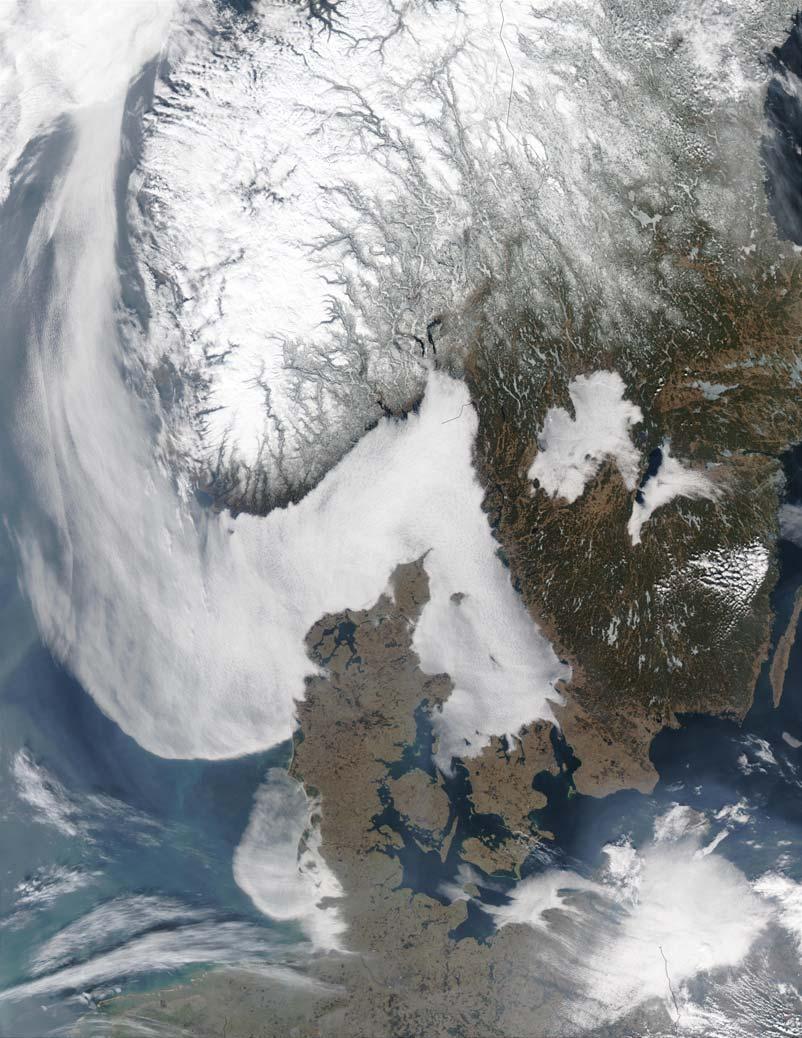
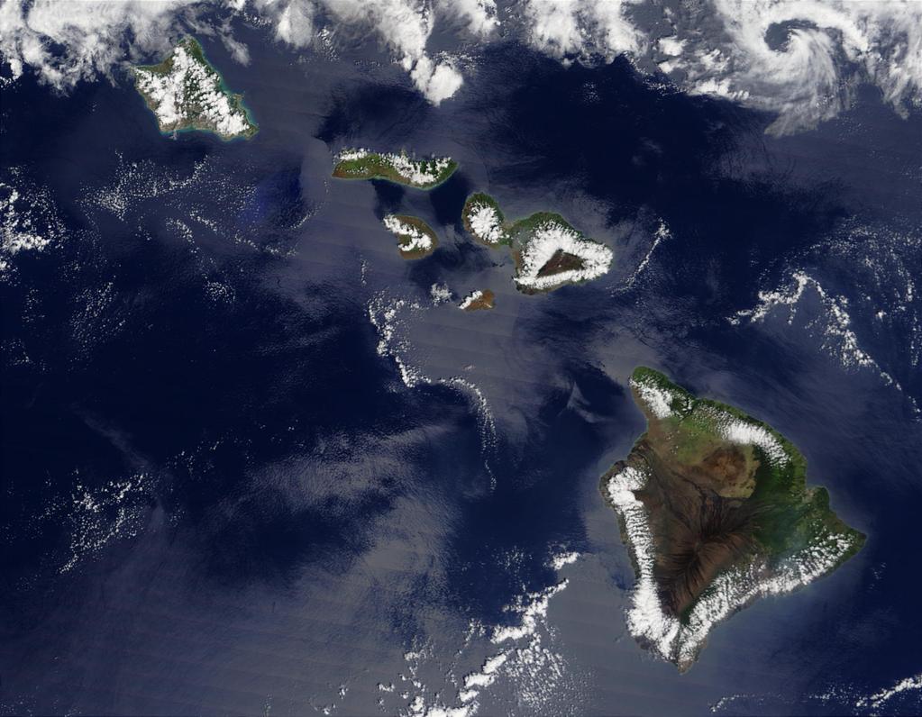
18 Scale Based on Physical Small Scales Mechanism Frequency of gravity waves, ie Brunt-Visalia Frequency, larger than frequency of inertial waves Tendency toward hydrostatic balance with g dominate Large Scales Frequency of inertial wave involving Coriolis larger than gravity wave Balance against inertial acceleration dominates
19 Back to Mesoscale Definitions At middle latitudes (40 N) : 4 1 f 10 s For a disturbance depth of 7 km: cg 20ms Hence Rossby radius is typically: 1 LR 200km
20
21 Meso Scales from 2-20 km Disturbances characterized by Gravity (Buoyancy) Waves (stable) or Deep Convection (unstable). Coriolis effect generally negligible, although local inertial effects can arise to change character of disturbances (i.e. rotating thunderstorms, tornadoes, dust devils, etc)
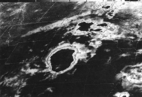
22 Roll convection

23 Open and Closed Cells with Lee Eddies
24 Open and Closed Cells

25 Lake Effect Clouds
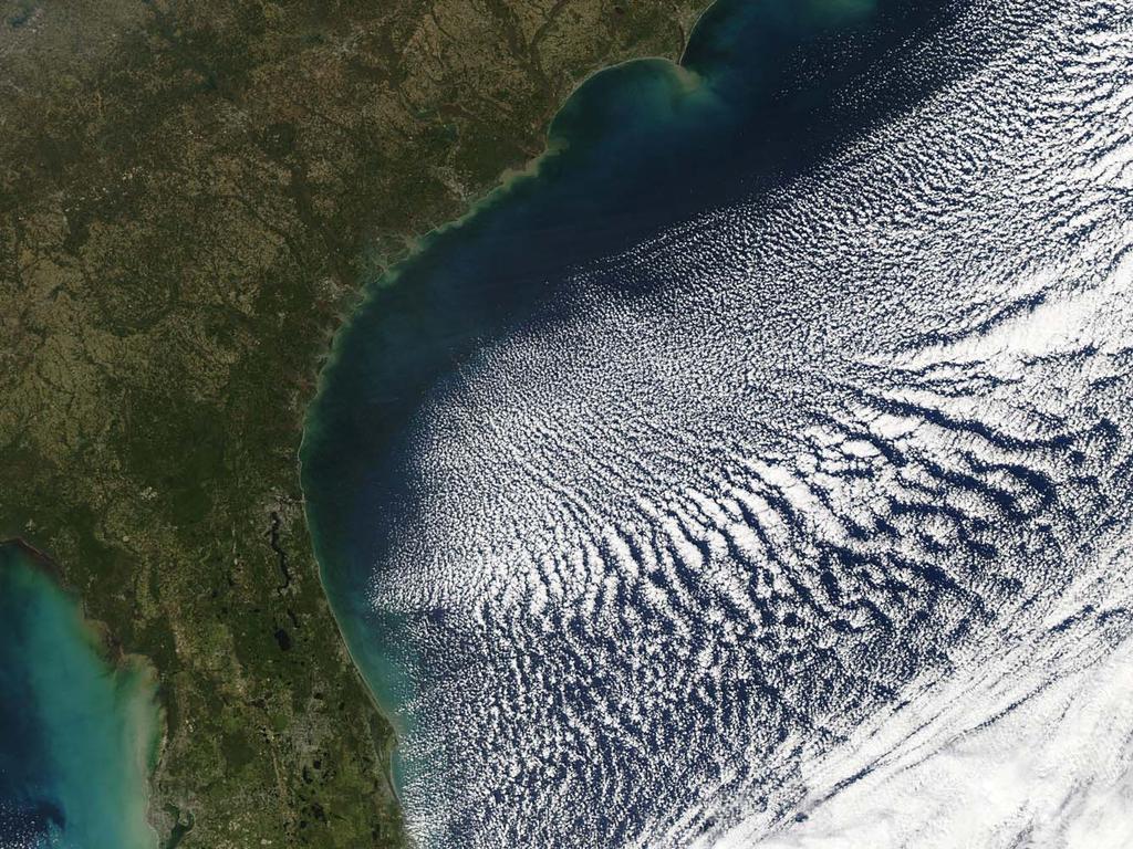
26 Ship Tracks In stratocumulus off Oregon
27 Sea Fog

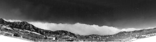
28 Valley Fog

29 Trapped Lee Waves in Ireland

30 Mountain Wave Disturbances
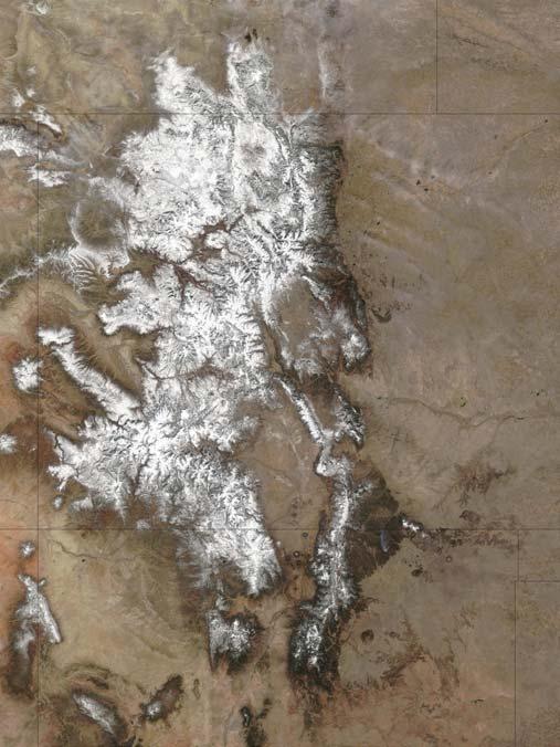
31 Orographic Precipitation
32 Supercells
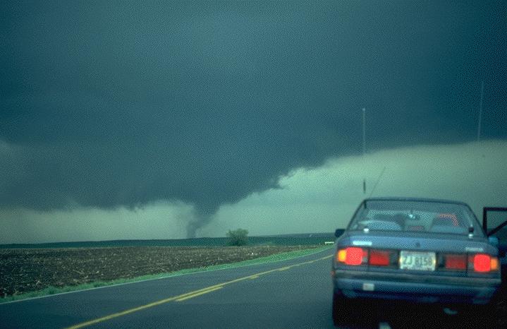
33 Tornado
34 Meso Scales of km Less than but near to Rossby Radius Gravity (Buoyancy) Waves govern system evolution and propagate relative to the wind Inertial oscillation important to wave dynamics, i.e. Gravity-Inertia Waves

35 Shore Parallel Lake Effect Band

36 Actinae Actinae.fli

37 Sea Breeze Convection
38 Seabreeze

39 Meso-beta squall lines
40 Meso- Scales of km Scales greater than but near to Rossby Radius of deformation Characterized by Geostrophic Balance Geostrophic disturbance determines evolution of the system Vertical ageostrophic motions driven by geostrophic disturbance, i.e. quasi-geostrophic dynamics

41 Squall Line
42 MCC

43 MCC

44 ITCZ Cluster

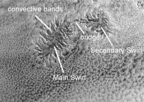
45 Tropical Cyclone
46 Exceptions to these rules These above rules are an approximate description of how the three mesoscales divide typical disturbances. Changes in latitude mean changes in attitude! As we move to lower latitudes Coriolis effect decreases and the Rossby Radius scale increases, going to infinity at the equator! Hence relative to the Earth s inertial effect, all disturbances around the equator are dynamically small and are governed by gravity (buoyancy) waves. Hence, the Kelvin wave, a gravity type wave, is a global scale equatorial disturbance.
47 Deeper disturbances lead to larger gravity wave phase speeds and so have larger Rossby Radius and vise versa for shallow disturbances. Hence, the depth of the disturbance will affect its governing dynamics, the deeper disturbance less likely to be inertially balanced and the shallower disturbances more likely. Some examples: Sea Breeze without deep convection: shallow, likely to achieve significant geostrophic balance Sea Breeze with Deep convection: Deep, not likely to achieve inertial balance Mesoscale Convective Complex: Deep convection parts of the system clearly less than Rossby Radius. Stratiform anvil has large horizontal scale shallow melting layer that may excite inertially balanced disturbance, ie an MCV (mesoscale convective vortex).
48 Rotation induced in the system may locally shrink the Rossby Radius, making the system dynamically large even on meso-beta scales. For example: Mesocyclone or rotating thunderstorm with its forward flanking gust front and rear flanking gust fronts actually become quasi balanced and evolve very similar to a developing quasi-geostrophic baroclinic cyclone with warm and cold fronts respectively. This makes the supercell thunderstorm long lived. The tropical cyclone eye wall becomes inertially stable from the strong storm rotation giving rise to Rossby wave disturbances (relative to cyclone rotation instead of Coriolis) that move around the eye, and play significant roles in horizontal momentum transport through their tilt! Tornadoes survive relatively long periods for their size because of their inertial balance and locally very small Rossby Radius of Deformation.

49 Genesis of Fefa
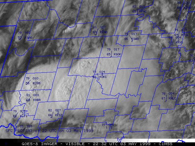
50 Special Observation and Analysis Problems of the Mesoscale Synoptic observation systems have horizontal resolutions of 100 km and 1 hour at the surface and 400 km and 12 hours aloft and are clearly inadequate to capture all but the upper end of the meso-. The dynamics of mesoscale disturbances contain important non-balanced or transient features that propagate rapidly. The systems are highly three-dimensional so that the vertical structure is equally important to the horizontal structure.
51 Mesoscale disturbances are more likely to be a hybrid of several dynamic entities interacting together to maintain the system. Process Interaction is especially significant. Such processes include microphysical and radiative transfer interactions. Scale Interactions and particularly interactions across the Rossby Radius of Deformation are basic to the mesoscale problem
52 How Can we Deal with This? Use observations as clues to the analysis, and do not expect the data to ever be sufficient to reveal the process behind the observations. Attach a strong dynamical model to the observations to fill in the gaps. To the extent that the model reproduces the observations at points where it is coincident with the observations, it gains credibility. Study the model to understand the dynamics. If the model is consistent with the few observations, then the model can be used (always with caution) to reveal the dynamics of the system.
53 What is a Model? Models range from simple to complex. Simple model: Quasi-Geostrophic model: positive vorticity advection results in upward vertical motion. Its so simple we can do it in our heads! But it has many approximations and is likely to miss features that can be represented in more complex models.
54 Primitive Equation Forecast Model: Such as the Eta model, or AVN model or ECMWF model. Must be solved on the computer but much more precise than the simple PVA model. Why would anyone look at a 500mb map predicted by the Eta model and then disagree with its vertical motion pattern because it doesn t obey the mentally tractable PVA model? Some people do!
55 Research Models: More precise physics, too big to execute in real time but able to provide a deeper understanding of specific processes causing an observed event. These models, used in case study or idealized mode provide our basic understanding that we use to construct truncated models that can run in real time.
Chapter 1. Introduction
 Chapter 1. Introduction In this class, we will examine atmospheric phenomena that occurs at the mesoscale, including some boundary layer processes, convective storms, and hurricanes. We will emphasize
Draft Chapter from Mesoscale Dynamic Meteorology By Prof. Yu-lang Lin, North Carolina State University
 Draft Chapter from Mesoscale Dynamic Meteorology By Prof. Yu-lang Lin, North Carolina State University Chapter 1 Overview 1.1 Introduction The so-called mesometeorology or mesoscale meteorology is defined
MODEL TYPE (Adapted from COMET online NWP modules) 1. Introduction
 1. Introduction") MODEL TYPE (Adapted from COMET online NWP modules) 1. Introduction Grid point and spectral models are based on the same set of primitive equations. However, each type formulates and solves the equations
MODEL TYPE (Adapted from COMET online NWP modules) 1. Introduction Grid point and spectral models are based on the same set of primitive equations. However, each type formulates and solves the equations
Goals of this Chapter
 Waves in the Atmosphere and Oceans Restoring Force Conservation of potential temperature in the presence of positive static stability internal gravity waves Conservation of potential vorticity in the presence
Solutions to Comprehensive Final Examination Given on Thursday, 13 December 2001
 Name & Signature Dr. Droegemeier Student ID Meteorology 1004 Introduction to Meteorology Fall, 2001 Solutions to Comprehensive Final Examination Given on Thursday, 13 December 2001 BEFORE YOU BEGIN!! Please
Chapter 14 Thunderstorm Fundamentals
 Chapter overview: Thunderstorm appearance Thunderstorm cells and evolution Thunderstorm types and organization o Single cell thunderstorms o Multicell thunderstorms o Orographic thunderstorms o Severe
Chapter 3 Convective Dynamics 3.4. Bright Bands, Bow Echoes and Mesoscale Convective Complexes
 Chapter 3 Convective Dynamics 3.4. Bright Bands, Bow Echoes and Mesoscale Convective Complexes Photographs Todd Lindley Bright band associated with stratiform precipitation in a squall line system 1 Bright
Hurricanes are intense vortical (rotational) storms that develop over the tropical oceans in regions of very warm surface water.
 storms that develop over the tropical oceans in regions of very warm surface water.") Hurricanes: Observations and Dynamics Houze Section 10.1. Holton Section 9.7. Emanuel, K. A., 1988: Toward a general theory of hurricanes. American Scientist, 76, 371-379 (web link). http://ww2010.atmos.uiuc.edu/(gh)/guides/mtr/hurr/home.rxml
Hurricanes: Observations and Dynamics Houze Section 10.1. Holton Section 9.7. Emanuel, K. A., 1988: Toward a general theory of hurricanes. American Scientist, 76, 371-379 (web link). http://ww2010.atmos.uiuc.edu/(gh)/guides/mtr/hurr/home.rxml
Gravity Waves. Lecture 5: Waves in Atmosphere. Waves in the Atmosphere and Oceans. Internal Gravity (Buoyancy) Waves 2/9/2017
 Waves 2/9/2017") Lecture 5: Waves in Atmosphere Perturbation Method Properties of Wave Shallow Water Model Gravity Waves Rossby Waves Waves in the Atmosphere and Oceans Restoring Force Conservation of potential temperature
Lecture 5: Waves in Atmosphere Perturbation Method Properties of Wave Shallow Water Model Gravity Waves Rossby Waves Waves in the Atmosphere and Oceans Restoring Force Conservation of potential temperature
Module 9 Weather Systems
 Module 9 Weather Systems In this module the theory of atmospheric dynamics is applied to different weather phenomena. The first section deals with extratropical cyclones, low and high pressure areas of
Chapter 8 cont. Clouds and Storms. Spring 2018
 Chapter 8 cont. Clouds and Storms Spring 2018 Clouds and Storms Clouds cover ~ 50% of earth at any time. Clouds are linked to a number of condensation processes. Cloud morphology, cloud types, associated
Tornadoes forecasting, dynamics and genesis. Mteor 417 Iowa State University Week 12 Bill Gallus
 Tornadoes forecasting, dynamics and genesis Mteor 417 Iowa State University Week 12 Bill Gallus Tools to diagnose severe weather risks Definition of tornado: A vortex (rapidly rotating column of air) associated
CHAPTER 11 THUNDERSTORMS AND TORNADOES MULTIPLE CHOICE QUESTIONS
 CHAPTER 11 THUNDERSTORMS AND TORNADOES MULTIPLE CHOICE QUESTIONS 1. A thunderstorm is considered to be a weather system. a. synoptic-scale b. micro-scale c. meso-scale 2. By convention, the mature stage
Tornadoes forecasting, dynamics and genesis. Mteor 417 Iowa State University Week 12 Bill Gallus
 Tornadoes forecasting, dynamics and genesis Mteor 417 Iowa State University Week 12 Bill Gallus Tools to diagnose severe weather risks Definition of tornado: A vortex (rapidly rotating column of air) associated
MET Lecture 26 Tornadoes I
 MET 4300 Lecture 26 Tornadoes I A Large Tornado approaches Lyndon, Kansas, on May 8, 2003 Outline Definition, life cycle Tornado formation within supercells Tornado formation within nonsupercell thunderstorms
Practical Use of the Skew-T, log-p diagram for weather forecasting. Primer on organized convection
 Practical Use of the Skew-T, log-p diagram for weather forecasting Primer on organized convection Outline Rationale and format of the skew-t, log-p diagram Some basic derived diagnostic measures Characterizing
1 of 7 Thunderstorm Notes by Paul Sirvatka College of DuPage Meteorology. Thunderstorms
 1 of 7 Thunderstorm Notes by Paul Sirvatka College of DuPage Meteorology Thunderstorms There are three types of thunderstorms: single-cell (or air mass) multicell (cluster or squall line) supercell Although
Measurement of Rotation. Circulation. Example. Lecture 4: Circulation and Vorticity 1/31/2017
 Lecture 4: Circulation and Vorticity Measurement of Rotation Circulation Bjerknes Circulation Theorem Vorticity Potential Vorticity Conservation of Potential Vorticity Circulation and vorticity are the
Synoptic-Dynamic Meteorology in Midlatitudes
 Synoptic-Dynamic Meteorology in Midlatitudes VOLUME II Observations and Theory of Weather Systems HOWARD B. BLUESTEIN New York Oxford OXFORD UNIVERSITY PRESS 1993 Contents 1. THE BEHAVIOR OF SYNOPTIC-SCALE,
A more detailed and quantitative consideration of organized convection: Part I Cold pool dynamics and the formation of squall lines
 A more detailed and quantitative consideration of organized convection: Part I Cold pool dynamics and the formation of squall lines Note: Lecture notes presented here based on course Daily Weather Laboratory
ESCI 344 Tropical Meteorology Lesson 11 Tropical Cyclones: Formation, Maintenance, and Intensification
 ESCI 344 Tropical Meteorology Lesson 11 Tropical Cyclones: Formation, Maintenance, and Intensification References: A Global View of Tropical Cyclones, Elsberry (ed.) Global Perspectives on Tropical Cylones:
The Atmospheric Boundary Layer. The Surface Energy Balance (9.2)
") The Atmospheric Boundary Layer Turbulence (9.1) The Surface Energy Balance (9.2) Vertical Structure (9.3) Evolution (9.4) Special Effects (9.5) The Boundary Layer in Context (9.6) Fair Weather over Land
The Atmospheric Boundary Layer Turbulence (9.1) The Surface Energy Balance (9.2) Vertical Structure (9.3) Evolution (9.4) Special Effects (9.5) The Boundary Layer in Context (9.6) Fair Weather over Land
SEVERE AND UNUSUAL WEATHER
 SEVERE AND UNUSUAL WEATHER Basic Meteorological Terminology Adiabatic - Referring to a process without the addition or removal of heat. A temperature change may come about as a result of a change in the
Thunderstorms and Severe Weather. (Chapt 15)
") Thunderstorms and Severe Weather (Chapt 15) The Big Picture We ve emphasized horizontal transport of energy to balance the planetary energy budget: Hadley Cell Subtropical divergence Midlatitude cyclones
Thunderstorms and Severe Weather (Chapt 15) The Big Picture We ve emphasized horizontal transport of energy to balance the planetary energy budget: Hadley Cell Subtropical divergence Midlatitude cyclones
Mesoscale meteorological models. Claire L. Vincent, Caroline Draxl and Joakim R. Nielsen
 Mesoscale meteorological models Claire L. Vincent, Caroline Draxl and Joakim R. Nielsen Outline Mesoscale and synoptic scale meteorology Meteorological models Dynamics Parametrizations and interactions
Tornadogenesis in Supercells: The Three Main Ingredients. Ted Funk
 Tornadogenesis in Supercells: The Three Main Ingredients Ted Funk NWS Louisville, KY Spring 2002 Environmental Parameters Supercells occur within environments exhibiting several wellknown characteristics
Chapter 3 Convective Dynamics Part VI. Supercell Storms. Supercell Photos
 Chapter 3 Convective Dynamics Part VI. Supercell Storms Photographs Todd Lindley (This part contains materials taken from UCAR MCS training module) Supercell Photos 1 Introduction A supercel storm is defined
Weather Systems III: Thunderstorms and Twisters
 Weather Systems III: Thunderstorms and Twisters Review 1. Definition of airmasses? Bergeron classification of air masses 2. Surface weather analysis: Station model, wind speed code, present weather 3.
Dynamics and Kinematics
 Geophysics Fluid Dynamics () Syllabus Course Time Lectures: Tu, Th 09:30-10:50 Discussion: 3315 Croul Hall Text Book J. R. Holton, "An introduction to Dynamic Meteorology", Academic Press (Ch. 1, 2, 3,
Convective Dynamics. Jeremy A. Gibbs. March 10, University of Oklahoma
 Convective Dynamics Jeremy A. Gibbs University of Oklahoma gibbz@ou.edu March 10, 2015 1 / 66 Overview Multicellular Storms Intro Lifecycle Thunderstorm Outflow as a Density Current Cell Regeneration 2
Geophysics Fluid Dynamics (ESS228)
") Geophysics Fluid Dynamics (ESS228) Course Time Lectures: Tu, Th 09:30-10:50 Discussion: 3315 Croul Hall Text Book J. R. Holton, "An introduction to Dynamic Meteorology", Academic Press (Ch. 1, 2, 3, 4,
Geophysics Fluid Dynamics (ESS228) Course Time Lectures: Tu, Th 09:30-10:50 Discussion: 3315 Croul Hall Text Book J. R. Holton, "An introduction to Dynamic Meteorology", Academic Press (Ch. 1, 2, 3, 4,
Chapter 3 Convective Dynamics Part V ñ Bright Bands, Bow Echoes and MCCs. Bright band associated with stratiform precipitation in a squall line system
 Chapter 3 Convective Dynamics Part V ñ Bright Bands, Bow Echoes and MCCs Photographs Todd Lindley (This part contains materials taken from UCAR MCS training module) Bright band associated with stratiform
Meteorology. Chapter 10 Worksheet 2
 Chapter 10 Worksheet 2 Meteorology Name: Circle the letter that corresponds to the correct answer 1) Downdrafts totally dominate the in the development of a thunderstorm. a) dissipating stage b) mature
Thunderstorms. Ordinary Cell Thunderstorms. Ordinary Cell Thunderstorms. Ordinary Cell Thunderstorms 5/2/11
 A storm containing lightning and thunder; convective storms Chapter 14 Severe thunderstorms: At least one: large hail wind gusts greater than or equal to 50 kt Tornado 1 2 Ordinary Cell Ordinary Cell AKA
ATMOSPHERIC SCIENCE-ATS (ATS)
") Atmospheric Science-ATS (ATS) 1 ATMOSPHERIC SCIENCE-ATS (ATS) Courses ATS 150 Science of Global Climate Change Credits: 3 (3-0-0) Physical basis of climate change. Energy budget of the earth, the greenhouse
Atmospheric Science-ATS (ATS) 1 ATMOSPHERIC SCIENCE-ATS (ATS) Courses ATS 150 Science of Global Climate Change Credits: 3 (3-0-0) Physical basis of climate change. Energy budget of the earth, the greenhouse
ESCI 344 Tropical Meteorology Lesson 8 Tropical Weather Systems
 ESCI 344 Tropical Meteorology Lesson 8 Tropical Weather Systems References: Tropical Climatology (2 nd Ed.), McGregor and Nieuwolt Climate and Weather in the Tropics, Riehl Climate Dynamics of the Tropics,
Chapter 8 cont. Clouds and Storms
 Chapter 8 cont. Clouds and Storms Spring 2007 Clouds and Storms Clouds cover ~ 50% of earth at any time. Clouds are linked to a number of condensation processes. Cloud morphology, cloud types, associated
NOAA S National Weather Service
 NOAA S National Weather Service Night Spotting Advanced Concepts of Severe Storm Spotting 2012 Rusty Kapela Milwaukee/Sullivan Weather.gov/milwaukee Problems Spotters Encounter Spotters can only see a
Meteorology Lecture 18
 Meteorology Lecture 18 Robert Fovell rfovell@albany.edu 1 Important notes These slides show some figures and videos prepared by Robert G. Fovell (RGF) for his Meteorology course, published by The Great
P1.16 ADIABATIC LAPSE RATES IN TORNADIC ENVIRONMENTS
 P1.16 ADIABATIC LAPSE RATES IN TORNADIC ENVIRONMENTS Matthew D. Parker Convective Storms Group, The Mesoscale Nexus in Atmospheric Sciences North Carolina State University, Raleigh, North Carolina 1. INTRODUCTION
Part-8c Circulation (Cont)
") Part-8c Circulation (Cont) Global Circulation Means of Transfering Heat Easterlies /Westerlies Polar Front Planetary Waves Gravity Waves Mars Circulation Giant Planet Atmospheres Zones and Belts Global
Part-8c Circulation (Cont) Global Circulation Means of Transfering Heat Easterlies /Westerlies Polar Front Planetary Waves Gravity Waves Mars Circulation Giant Planet Atmospheres Zones and Belts Global
Thunderstorms. Stages in the development of a thunderstorm
 Severe Weather Outcomes: S2-4-04 Explain the formation and dynamics of selected severe weather phenomena... S2-4-05 Collect, interpret, and analyze meteorological data related to a severe weather event.
TOPICS: What are Thunderstorms? Ingredients Stages Types Lightning Downburst and Microburst
 THUNDERSTORMS TOPICS: What are Thunderstorms? Ingredients Stages Types Lightning Downburst and Microburst What are Thunderstorms? A storm produced by a cumulonimbus cloud that contains lightning and thunder
Examination #3 Wednesday, 28 November 2001
 Name & Signature Dr. Droegemeier Student ID Meteorology 1004 Introduction to Meteorology Fall, 2001 Examination #3 Wednesday, 28 November 2001 BEFORE YOU BEGIN!! Please be sure to read each question CAREFULLY
Chapter 21. Weather Patterns and Severe Storms
 Chapter 21 Weather Patterns and Severe Storms 20.1 Air Masses Air Masses and Weather Air Masses An air mass is an immense body of air that is characterized by similar temperatures and amounts of moisture
6 Two-layer shallow water theory.
 6 Two-layer shallow water theory. Wewillnowgoontolookatashallowwatersystemthathastwolayersofdifferent density. This is the next level of complexity and a simple starting point for understanding the behaviour
The general circulation: midlatitude storms
 The general circulation: midlatitude storms Motivation for this class Provide understanding basic motions of the atmosphere: Ability to diagnose individual weather systems, and predict how they will change
Test Form: A Key Final Exam: Spring 2011
 Test Form: A Key Final Exam: Spring 2011 Instructions: Write your name (last name and first name) on your bubble sheet. Write your student identification number on the bubble sheet, and carefully and completely
Contents. Parti Fundamentals. 1. Introduction. 2. The Coriolis Force. Preface Preface of the First Edition
 Foreword Preface Preface of the First Edition xiii xv xvii Parti Fundamentals 1. Introduction 1.1 Objective 3 1.2 Importance of Geophysical Fluid Dynamics 4 1.3 Distinguishing Attributes of Geophysical
196 7 atmospheric oscillations:
 196 7 atmospheric oscillations: 7.4 INTERNAL GRAVITY (BUOYANCY) WAVES We now consider the nature of gravity wave propagation in the atmosphere. Atmospheric gravity waves can only exist when the atmosphere
MET 4300/5355 Severe Weather
 MET 4300/5355 Severe Weather Lecture 1 Introduction Course Organization Tu/Th 11:00AM-12:15 PM, AHC5 Rm357 Haiyan Jiang, 305-348-2984, AHC5 Rm371, haiyan.jiang@fiu.edu Office Hours Tu 12:15-1:15 PM, or
Mesoscale Convective Systems. The COMET Program March 2002
 Mesoscale Convective Systems The COMET Program March 2002 Overview! Introduction to MCSs! Squall Lines! Bow Echoes! Mesoscale Convective Complexes Introduction Definition! Mesoscale convective systems
ESCI 110: 2 s.h. Introduction to Earth Sciences Programs ESCI 322: 3 s.h. Environmental Hydrology ESCI 241: 4 s.h. Meteorology (G2, L)
") ESCI 110: 2 s.h. Introduction to Earth Sciences Programs General introduction to each of the earth sciences disciplines and to college life. 2 hrs. lec. Offered in fall. Restricted to earth sciences majors.
ESCI 110: 2 s.h. Introduction to Earth Sciences Programs General introduction to each of the earth sciences disciplines and to college life. 2 hrs. lec. Offered in fall. Restricted to earth sciences majors.
Thunderstorm: a cumulonimbus cloud or collection of cumulonimbus clouds featuring vigorous updrafts, precipitation and lightning
 Thunderstorm: a cumulonimbus cloud or collection of cumulonimbus clouds featuring vigorous updrafts, precipitation and lightning Thunderstorm: a cumulonimbus cloud or collection of cumulonimbus clouds
Graduate Courses Meteorology / Atmospheric Science UNC Charlotte
 Graduate Courses Meteorology / Atmospheric Science UNC Charlotte In order to inform prospective M.S. Earth Science students as to what graduate-level courses are offered across the broad disciplines of
Weather Patterns and Severe Storms
 Weather Patterns and Severe Storms 20.1 Air Masses Air Masses and Weather Air Masses An air mass is an immense body of air that is characterized by similar temperatures and amounts of moisture at any given
2. Baroclinic Instability and Midlatitude Dynamics
 2. Baroclinic Instability and Midlatitude Dynamics Midlatitude Jet Stream Climatology (Atlantic and Pacific) Copyright 26 Emily Shuckburgh, University of Cambridge. Not to be quoted or reproduced without
Transient and Eddy. Transient/Eddy Flux. Flux Components. Lecture 3: Weather/Disturbance. Transient: deviations from time mean Time Mean
 Lecture 3: Weather/Disturbance Transients and Eddies Climate Roles Mid-Latitude Cyclones Tropical Hurricanes Mid-Ocean Eddies Transient and Eddy Transient: deviations from time mean Time Mean Eddy: deviations
The Equations of Motion in a Rotating Coordinate System. Chapter 3
 The Equations of Motion in a Rotating Coordinate System Chapter 3 Since the earth is rotating about its axis and since it is convenient to adopt a frame of reference fixed in the earth, we need to study
THUNDERSTORMS Brett Ewing October, 2003
 THUNDERSTORMS Brett Ewing October, 2003 A natural hazard that occurs often on a daily basis in the lower and mid-latitudes is thunderstorms. Thunderstorms is a weather system that can produce lightning,tornadoes,
Lecture 12. The diurnal cycle and the nocturnal BL
 Lecture 12. The diurnal cycle and the nocturnal BL Over flat land, under clear skies and with weak thermal advection, the atmospheric boundary layer undergoes a pronounced diurnal cycle. A schematic and
12.2 MESOVORTICES FORMED WITHIN BOW ECHOES: THEIR GENESIS AND SENSITIVITY TO THE ENVIRONMENT AND SYSTEM COLD POOL
 12.2 MESOVORTICES FORMED WITHIN BOW ECHOES: THEIR GENESIS AND SENSITIVITY TO THE ENVIRONMENT AND SYSTEM COLD POOL Nolan T. Atkins and Mike St. Laurent Lyndon State College, Lyndonville, Vermont 1. INTRODUCTION
ESCI 344 Tropical Meteorology Lesson 7 Temperature, Clouds, and Rain
 ESCI 344 Tropical Meteorology Lesson 7 Temperature, Clouds, and Rain References: Forecaster s Guide to Tropical Meteorology (updated), Ramage Tropical Climatology, McGregor and Nieuwolt Climate and Weather
- tornadoes. Further Reading: Chapter 08 of the text book. Outline. -tropical storms. -Storm surge
 (1 of 12) Further Reading: Chapter 08 of the text book Outline - tornadoes -tropical storms -Storm surge (2 of 12) Introduction Previously, We talked about fronts and their relationship to air masses Also
Thunderstorm: a cumulonimbus cloud or collection of cumulonimbus clouds featuring vigorous updrafts, precipitation and lightning
 Thunderstorm: a cumulonimbus cloud or collection of cumulonimbus clouds featuring vigorous updrafts, precipitation and lightning Thunderstorms are responsible for most of what we refer to as severe weather,
Quasi-geostrophic ocean models
 Quasi-geostrophic ocean models March 19, 2002 1 Introduction The starting point for theoretical and numerical study of the three dimensional large-scale circulation of the atmosphere and ocean is a vorticity
Large-Eddy Simulations of Tropical Convective Systems, the Boundary Layer, and Upper Ocean Coupling
 DISTRIBUTION STATEMENT A. Approved for public release; distribution is unlimited. Large-Eddy Simulations of Tropical Convective Systems, the Boundary Layer, and Upper Ocean Coupling Eric D. Skyllingstad
Final Examination, MEA 443 Fall 2008, Lackmann
 Place an X here to count it double! Name: Final Examination, MEA 443 Fall 2008, Lackmann If you wish to have the final exam count double and replace your midterm score, place an X in the box above. As
warmest (coldest) temperatures at summer heat dispersed upward by vertical motion Prof. Jin-Yi Yu ESS200A heated by solar radiation at the base
 temperatures at summer heat dispersed upward by vertical motion Prof. Jin-Yi Yu ESS200A heated by solar radiation at the base") Pole Eq Lecture 3: ATMOSPHERE (Outline) JS JP Hadley Cell Ferrel Cell Polar Cell (driven by eddies) L H L H Basic Structures and Dynamics General Circulation in the Troposphere General Circulation in the
Pole Eq Lecture 3: ATMOSPHERE (Outline) JS JP Hadley Cell Ferrel Cell Polar Cell (driven by eddies) L H L H Basic Structures and Dynamics General Circulation in the Troposphere General Circulation in the
The Earth System - Atmosphere III Convection
 The Earth System - Atmosphere III Convection Thunderstorms 1. A thunderstorm is a storm that produces lightning (and therefore thunder) 2. Thunderstorms frequently produce gusty winds, heavy rain, and
Severe weather. Some case studies for medium-range forecasting. T. La Rocca, Department of Synoptic Meteorology, Italian Met. Service, Rome.
 Severe weather. Some case studies for medium-range forecasting T. La Rocca, Department of Synoptic Meteorology, Italian Met. Service, Rome. The Met Alert Messages by the Watch Office of the Public Safety
P10.1 TORNADOGENESIS IN A SIMULATED HP SUPERCELL
 Preprints, 21 st Conference on Severe Local Storms 12-16 August 2002, San Antonio, Texas P10.1 TORNADOGENESIS IN A SIMULATED HP SUPERCELL 1. INTRODUCTION Catherine A. Finley * Department of Earth Sciences
Hurricanes and Tropical Weather Systems:
 Hurricanes and Tropical Weather Systems: An influence on weather in parts of the USA Meteorology 411 Iowa State University Week 2 Bill Gallus Classification/Terminology Tropical Disturbance enhanced convection
Multiscale Analyses of Inland Tropical Cyclone Midlatitude Jet Interactions: Camille (1969) and Danny (1997)
 and Danny (1997)") Multiscale Analyses of Inland Tropical Cyclone Midlatitude Jet Interactions: Camille (1969) and Danny (1997) Matthew Potter, Lance Bosart, and Daniel Keyser Department of Atmospheric and Environmental
Multiscale Analyses of Inland Tropical Cyclone Midlatitude Jet Interactions: Camille (1969) and Danny (1997) Matthew Potter, Lance Bosart, and Daniel Keyser Department of Atmospheric and Environmental
Mesoscale Atmospheric Systems
 Mesoscale Atmospheric Systems Introduction Spring Semester 2018 Heini Wernli Outline of lecture course See also www.iac.ethz.ch/edu/courses/master/modules/mesoscale-atmospheric-systems.html 20 Feb Introduction
1/27/2010. With this method, all filed variables are separated into. from the basic state: Assumptions 1: : the basic state variables must
 Lecture 5: Waves in Atmosphere Perturbation Method With this method, all filed variables are separated into two parts: (a) a basic state part and (b) a deviation from the basic state: Perturbation Method
Science Olympiad Meteorology Quiz #1 Page 1 of 7
 1) What is generally true about the stratosphere: a) Has turbulent updrafts and downdrafts. b) Has either a stable or increasing temperature profile with altitude. c) Where the auroras occur. d) Both a)
HAZARDOUS WEATHER 1. Dr. Julie Laity Geography 266
 HAZARDOUS WEATHER 1 Dr. Julie Laity Geography 266 Violent Weather Thunderstorms Atmospheric turbulence Lightning and thunder Hail Derechos Tornadoes Tornado measurement and science Tropical Cyclones Hurricanes
contact with ground for 1 hour plus, starting 1500 MDT moved N., covered about 37 km width varied m
 Goal for today: Finish Ch. 11 Lightning, Thunder & Tornadoes 16 Nov., 2011 Edmonton tornado 31 July 1987 contact with ground for 1 hour plus, starting 1500 MDT moved N., covered about 37 km width varied
The General Circulation of the Atmosphere: A Numerical Experiment
 The General Circulation of the Atmosphere: A Numerical Experiment Norman A. Phillips (1956) Presentation by Lukas Strebel and Fabian Thüring Goal of the Model Numerically predict the mean state of the
CHAPTER 13 WEATHER ANALYSIS AND FORECASTING MULTIPLE CHOICE QUESTIONS
 CHAPTER 13 WEATHER ANALYSIS AND FORECASTING MULTIPLE CHOICE QUESTIONS 1. The atmosphere is a continuous fluid that envelops the globe, so that weather observation, analysis, and forecasting require international
On the effect of forward shear and reversed shear baroclinic flows for polar low developments. Thor Erik Nordeng Norwegian Meteorological Institute
 On the effect of forward shear and reversed shear baroclinic flows for polar low developments Thor Erik Nordeng Norwegian Meteorological Institute Outline Baroclinic growth a) Normal mode solution b) Initial
Oakfield, WI Tornado of July 18 th, 1996: "Everything in its Right Place"
 Oakfield, WI Tornado of July 18 th, 1996: "Everything in its Right Place" Arian Sarsalari Department of Atmospheric and Oceanic Sciences, University of Wisconsin Madison ABSTRACT This paper will serve
Mid-Latitude Cyclones and Fronts. Lecture 12 AOS 101
 Mid-Latitude Cyclones and Fronts Lecture 12 AOS 101 Homework 4 COLDEST TEMPS GEOSTROPHIC BALANCE Homework 4 FASTEST WINDS L Consider an air parcel rising through the atmosphere The parcel expands as it
The Planetary Circulation System
 12 The Planetary Circulation System Learning Goals After studying this chapter, students should be able to: 1. describe and account for the global patterns of pressure, wind patterns and ocean currents
Practical Atmospheric Analysis
 Chapter 12 Practical Atmospheric Analysis With the ready availability of computer forecast models and statistical forecast data, it is very easy to prepare a forecast without ever looking at actual observations,
ESCI 241 Meteorology Lesson 19 Tropical Cyclones Dr. DeCaria
 ESCI 241 Meteorology Lesson 19 Tropical Cyclones Dr. DeCaria READING: Chapter 16 GENERAL A tropical cyclone is a large, low-pressure system that forms over the tropical oceans. Tropical cyclones are classified
3. Midlatitude Storm Tracks and the North Atlantic Oscillation
 3. Midlatitude Storm Tracks and the North Atlantic Oscillation Copyright 2006 Emily Shuckburgh, University of Cambridge. Not to be quoted or reproduced without permission. EFS 3/1 Review of key results
8/21/08. Modeling the General Circulation of the Atmosphere. Topic 4: Equatorial Wave Dynamics. Moisture and Equatorial Waves
 Modeling the General Circulation of the Atmosphere. Topic 4: Equatorial Wave Dynamics D A R G A N M. W. F R I E R S O N U N I V E R S I T Y O F W A S H I N G T O N, D E P A R T M E N T O F A T M O S P
Lecture #3: Gravity Waves in GCMs. Charles McLandress (Banff Summer School 7-13 May 2005)
") Lecture #3: Gravity Waves in GCMs Charles McLandress (Banff Summer School 7-13 May 2005) 1 Outline of Lecture 1. Role of GWs in the middle atmosphere 2. Background theory 3. Resolved GWs in GCMs 4. Parameterized
Lecture #3: Gravity Waves in GCMs Charles McLandress (Banff Summer School 7-13 May 2005) 1 Outline of Lecture 1. Role of GWs in the middle atmosphere 2. Background theory 3. Resolved GWs in GCMs 4. Parameterized
 http://www.ssec.wisc.edu/data/composites.html Red curve: Incoming solar radiation Blue curve: Outgoing infrared radiation. Three-cell model of general circulation Mid-latitudes: 30 to 60 latitude MID-LATITUDES
Answer each section in a separate booklet.
 DURATION: 3 HOURS TOTAL MARKS: 150 Internal Examiners: Dr S Pillay & Mr J Lutchmiah External Examiner: Dr J Odindi NOTE: This paper consists of 8 pages and an MCQ answer sheet. Please ensure that you have
The Integration of WRF Model Forecasts for Mesoscale Convective Systems Interacting with the Mountains of Western North Carolina
 Proceedings of The National Conference On Undergraduate Research (NCUR) 2006 The University of North Carolina at Asheville Asheville, North Carolina April 6-8, 2006 The Integration of WRF Model Forecasts
Tornadoes. tornado: a violently rotating column of air
 Tornadoes tornado: a violently rotating column of air Tornadoes What is the typical size of a tornado? What are typical wind speeds for a tornado? Five-stage life cycle of a tornado Dust Swirl Stage Tornado
Quasi-Geostrophic ω-equation. 1. The atmosphere is approximately hydrostatic. 2. The atmosphere is approximately geostrophic.
 Quasi-Geostrophic ω-equation For large-scale flow in the atmosphere, we have learned about two very important characteristics:. The atmosphere is approximately hydrostatic.. The atmosphere is approximately
1/25/2010. Circulation and vorticity are the two primary
 Lecture 4: Circulation and Vorticity Measurement of Rotation Circulation Bjerknes Circulation Theorem Vorticity Potential Vorticity Conservation of Potential Vorticity Circulation and vorticity are the
THUNDERSTORMS. Convective heavy rain accompanied by lightning and thunder. Ahrens
 THUNDERSTORMS Convective heavy rain accompanied by lightning and thunder Ahrens Thunderstorms About 1,800 T-storms occur around the world at any instant Where do they occur the most? National Lightning
Final Exam Clicker Questions ATOC 1050 Spring 2011 Chapter 16: Mountain Snowstorms
 Final Exam Clicker Questions ATOC 1050 Spring 2011 Chapter 16: Mountain Snowstorms True or false: Mean annual snowfall in the western United States always increases from south to north. Total precipitation
For the operational forecaster one important precondition for the diagnosis and prediction of
 Initiation of Deep Moist Convection at WV-Boundaries Vienna, Austria For the operational forecaster one important precondition for the diagnosis and prediction of convective activity is the availability
Tropical Cyclone Forecasting Applications of the GOES WMSI
 1. Introduction Tropical Cyclone Forecasting Applications of the GOES WMSI Kenneth L. Pryor Center for Satellite Applications and Research (NOAA/NESDIS) Camp Springs, MD The Geostationary Operational Environmental