The effect of ice fall speed in the structure of surface precipitation
|
|
|
- Caitlin French
- 5 years ago
- Views:
Transcription

1 The effect of ice fall speed in the structure of surface precipitation 10th International SRNWP-Workshop on Non-Hydrostatic Modelling. 14 th May 2013 Jorge Bornemann, Paul Field, Kalli Furtado, Mark Weeks,

2 Contents This presentation covers the following areas Introduction Experiment description Results Conclusions
3 Introduction

4 Sev iri_histo_a11 Motivation Sensitivity tests on ice fallspeed to improve the radiative balance of the model through better representation of ice clouds. Test revealed also a sensitivity in surface precipitation. Seviri channel 9 reconstructions (Courtesy Mark Weeks)
. Model top: 40000 m. 4 Km. 1.5 Km. 4 Km. 1.5 Km. Timestep: 50 sec.")
5 UKV Model formulation 4 Km. 4 Km. 1.5 Km. 4 Km. 4 Km. 4 Km. Nested in Global (25 Km gridlength) LBC update frequency: 1 hr. 70 vertical levels (38 Boundary Layer). Model top: m. 4 Km. 1.5 Km. 4 Km. 1.5 Km. Timestep: 50 sec. Forecast length: 36 hours No convection scheme 4 Km. 4 Km. 1.5 Km. 4 Km. 4 Km. 4 Km.
6 UM Microphysics scheme Multi-phase scheme based on Wilson and Ballard (1999) 4 phases: Liquid, vapour, ice aggregates and rain (recently graupel has been added as a prognostic variable) Rain is advected as it falls through the model levels Ice Particle Size Distribution based on Field et al. (2007) Wilson, D. R., and S. P. Ballard, 1999: A microphysically based precipitation scheme for the UK Meteorological Office Unified Model. Quart. J. Roy. Meteor. Soc., 125, Field, P. R., Heymsfield, A. J., and Bansemer, A. (2007). Snow size distribution parameterization for midlatitude and tropical ice clouds. J. Atmos. Sci., 64,
7 Ice fallspeed parametrization Based on Mitchell (1996) Mass-diameter relationship: m(d)=ai*d Bi Best-Reynolds relationship: Re(X)=Alpha*X Beta Ai and Bi are derived from observations Alpha and Beta are determined empirically The two relationships provide a correspondence between the particle diameter and the terminal velocity. Mitchell, D. L. (1996). Use of mass- and area-dimensional power laws for determining precipitation particle terminal velocities. J. Atmos. Sci., 53,
8 Experiment description
9 Ice fallspeed Ai Bi Alpha Beta Control (PS28) Test 1 (PS29) Test 2 (PS31) Test 3 (exp1) All values are chosen within the range specified in the literature. The control run has fallspeeds near the higher limit and Test-1 and Test-3 near the lower limit
10 Ice fallspeed Control (PS28) Test 1 (PS29) Test 2 (PS31) Test 3 (exp1)
11 Cases Dynamically Driven Summer Convection. 7 th of July Summer frontal system plus convection in post frontal cold air. 12 th of August Winter frontal system. 6 th of December NW cold outbreak. 4 th of February Easterly snow. 11 th of March 2013.


12 Case 07/07/2012. Analysis 00Z 08/07/2012 Start 15Z 07/07/2012 End 03Z 09/07/2012


13 Case 04/02/2013. Start 03Z 04/02/2013 End 12Z 05/02/2013
14 Results


15 Case 1 Control Test 2 Test 1 Test 3

16 Case 1 Control Test 2 Test 1 Test 3
17 Case 1. Whole domain cell statistics
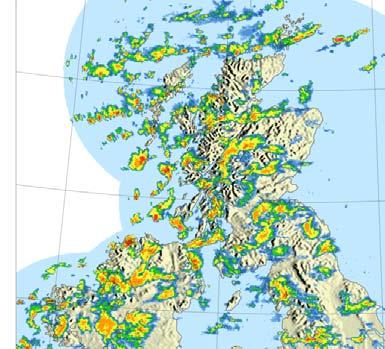
18 Case 1. Radar comparison. S. England
19 Case 1 Peak instant precipitation rates are higher with higher ice fallspeed. Precipitation rates over 16 mm./hr are less frequent with lower ice fallspeed. Cells are smoother with lower ice fallspeed. 6 hr accumulations very similar below the 4mm. Threshold, but Lower Ice fallspeeds don t produce accumulations above 16mm/6hr. Cell size histograms very similar in all experiments up to a rainfall threshold of 4 mm/hr. All configurations have a significantly higher number of cells between 15 km 2 and 1000 km 2 for thresholds above 2 mm/hr compared with the radar.


20 Case 4 Control Test 2 Test 1 Test 3
21 Case 4. Whole domain cell statistics
22 Case 4. Radar comparison, Scotland
23 Case 4 Spin-up from the boundaries visible in the West edge of the model in all experiments. Snow rates significantly lower on tests with lower ice fallspeed, particularly over Scotland. Convection over the sea in the inflow area North of Ireland dies out quickly after spin-up in all 3 tests, particularly noticeable in Test-2 and Test-3. Significant reduction of number of cells of all sizes (up to 1000 km 2 ) for thresholds above 2 mm/hr on the tests with lower ice fallspeeds. Comparison with radar over Scotland points to underforecasting of snowfall in lower ice fallspeeds experiments.
24 Conclusions
25 Conclusions Modifications to ice fallspeed affect noticeably the structure of surface precipitation. Increasing ice fallspeeds produces more intense precipitation and sharper cells. Lower ice fallspeeds reduce peak precipitation rates and accumulations significantly. May impact forecast of severe events. Impact is more clearly seen in snow showers. The UKV model has introduced recently different ice fallspeed parameters for crystals and for aggregates, so improvements to ice cloud are decoupled from surface precipitation.
26 Further work Analysis of upper air fields and experiments without advection of precipitates in order to understand mechanisms. Understand difference in number of cells smaller than 20 km2 between model and radar. More sensitivity studies in order to find best parameters. Assess impact in flooding events.
27 Questions and answers
Operational convective scale NWP in the Met Office
 Operational convective scale NWP in the Met Office WSN09 Symposium. 18 st of May 2011 Jorge Bornemann (presenting the work of several years by many Met Office staff and collaborators) Contents This presentation
Forecasting the "Beast from the East" and Storm Emma
 Forecasting the "Beast from the East" and Storm Emma Ken Mylne and Rob Neal with contributions from several scientists across the Met Office ECMWF UEF Meeting, 5-8 June 2018 Beast started 24 Feb Emma reached
Remote Sensing of Precipitation
 Lecture Notes Prepared by Prof. J. Francis Spring 2003 Remote Sensing of Precipitation Primary reference: Chapter 9 of KVH I. Motivation -- why do we need to measure precipitation with remote sensing instruments?
Nesting and LBCs, Predictability and EPS
 Nesting and LBCs, Predictability and EPS Terry Davies, Dynamics Research, Met Office Nigel Richards, Neill Bowler, Peter Clark, Caroline Jones, Humphrey Lean, Ken Mylne, Changgui Wang copyright Met Office
Precipitation Structure and Processes of Typhoon Nari (2001): A Modeling Propsective
: A Modeling Propsective") Precipitation Structure and Processes of Typhoon Nari (2001): A Modeling Propsective Ming-Jen Yang Institute of Hydrological Sciences, National Central University 1. Introduction Typhoon Nari (2001) struck
Precipitation Structure and Processes of Typhoon Nari (2001): A Modeling Propsective Ming-Jen Yang Institute of Hydrological Sciences, National Central University 1. Introduction Typhoon Nari (2001) struck
Future work on explicit convection
 Future work on explicit convection Humphrey Lean et al MetOffice@Reading, Reading, UK Cascade Downstream meeting, Oct 2014 Thanks to many colleagues Introduction Convection permitting models have provided
Convective-scale NWP for Singapore
 Convective-scale NWP for Singapore Hans Huang and the weather modelling and prediction section MSS, Singapore Dale Barker and the SINGV team Met Office, Exeter, UK ECMWF Symposium on Dynamical Meteorology
The Nowcasting Demonstration Project for London 2012
 The Nowcasting Demonstration Project for London 2012 Susan Ballard, Zhihong Li, David Simonin, Jean-Francois Caron, Brian Golding, Met Office, UK Introduction The success of convective-scale NWP is largely
Predicting rainfall using ensemble forecasts
 Predicting rainfall using ensemble forecasts Nigel Roberts Met Office @ Reading MOGREPS-UK Convection-permitting 2.2 km ensemble now running routinely Embedded within MOGREPS-R ensemble members (18 km)
A New Method for Representing Mixed-phase Particle Fall Speeds in Bulk Microphysics Parameterizations
 November Journal of the 2008 Meteorological Society of Japan, Vol. J. 86A, DUDHIA pp. 33 44, et al. 2008 33 A New Method for Representing Mixed-phase Particle Fall Speeds in Bulk Microphysics Parameterizations
Precipitation AOSC 200 Tim Canty. Cloud Development: Orographic Lifting
 Precipitation AOSC 200 Tim Canty Class Web Site: http://www.atmos.umd.edu/~tcanty/aosc200 Topics for today: Precipitation formation Rain Ice Lecture 14 Oct 11 2018 1 Cloud Development: Orographic Lifting
Mark T. Stoelinga*, Christopher P. Woods, and John D. Locatelli. University of Washington, Seattle, Washington 2. THE MODEL
 P2.51 PREDICTION OF SNOW PARTICLE HABIT TYPES WITHIN A SINGLE-MOMENT BULK MICROPHYSICAL SCHEME Mark T. Stoelinga*, Christopher P. Woods, and John D. Locatelli University of Washington, Seattle, Washington
Snowfall Detection and Rate Retrieval from ATMS
 Snowfall Detection and Rate Retrieval from ATMS Jun Dong 1, Huan Meng 2, Cezar Kongoli 1, Ralph Ferraro 2, Banghua Yan 2, Nai-Yu Wang 1, Bradley Zavodsky 3 1 University of Maryland/ESSIC/Cooperative Institute
A Revised Version of the Cloud Microphysical Parameterization of COSMO-LME
 A Revised Version of the Cloud Microphysical Parameterization of COSMO-LME Axel Seifert DWD, Offenbach -1- Motivation: Well known problems of COSMO-LME regards wintertime precipitation: Overestimation
The WRF Microphysics and a Snow Event in Chicago
 2.49 The WRF Microphysics and a Snow Event in Chicago William Wilson* NOAA/NWS/WFO Chicago 1. Introduction Mesoscale meteorological models are increasingly being used in NWS forecast offices. One important
Convective-scale data assimilation at the UK Met Office
 Convective-scale data assimilation at the UK Met Office DAOS meeting, Exeter 25 April 2016 Rick Rawlins Hd(DAE) Acknowledgments: Bruce Macpherson and team Contents This presentation covers the following
JP1J.9 ASSIMILATION OF RADAR DATA IN THE MET OFFICE MESOSCALE AND CONVECTIVE SCALE FORECAST SYSTEMS
 JP1J.9 ASSIMILATION OF RADAR DATA IN THE MET OFFICE MESOSCALE AND CONVECTIVE SCALE FORECAST SYSTEMS S. Ballard *, M. Dixon, S. Swarbrick,, Z. Li,, O.Stiller, H. Lean, F. Rihan 2 and C.Collier 2 Met Office
1. describe the two methods by which cloud droplets can grow to produce precipitation (pp );
;") 10 Precipitation Learning Goals After studying this chapter, students should be able to: 1. describe the two methods by which cloud droplets can grow to produce precipitation (pp. 232 236); 2. distinguish
10 Precipitation Learning Goals After studying this chapter, students should be able to: 1. describe the two methods by which cloud droplets can grow to produce precipitation (pp. 232 236); 2. distinguish
INVESTIGATION FOR A POSSIBLE INFLUENCE OF IOANNINA AND METSOVO LAKES (EPIRUS, NW GREECE), ON PRECIPITATION, DURING THE WARM PERIOD OF THE YEAR
, ON PRECIPITATION, DURING THE WARM PERIOD OF THE YEAR") Proceedings of the 13 th International Conference of Environmental Science and Technology Athens, Greece, 5-7 September 2013 INVESTIGATION FOR A POSSIBLE INFLUENCE OF IOANNINA AND METSOVO LAKES (EPIRUS,
Proceedings of the 13 th International Conference of Environmental Science and Technology Athens, Greece, 5-7 September 2013 INVESTIGATION FOR A POSSIBLE INFLUENCE OF IOANNINA AND METSOVO LAKES (EPIRUS,
Met Office convective-scale 4DVAR system, tests and improvement
 Met Office convective-scale 4DVAR system, tests and improvement Marco Milan*, Marek Wlasak, Stefano Migliorini, Bruce Macpherson Acknowledgment: Inverarity Gordon, Gareth Dow, Mike Thurlow, Mike Cullen
Incorporation of 3D Shortwave Radiative Effects within the Weather Research and Forecasting Model
 Incorporation of 3D Shortwave Radiative Effects within the Weather Research and Forecasting Model W. O Hirok and P. Ricchiazzi Institute for Computational Earth System Science University of California
CONSTRAIN proposal for grey zone model comparison case. Adrian Hill, Paul Field, Adrian Lock, Thomas Frederikse, Stephan de Roode, Pier Siebesma
 CONSTRAIN proposal for grey zone model comparison case Adrian Hill, Paul Field, Adrian Lock, Thomas Frederikse, Stephan de Roode, Pier Siebesma Contents Introduction CONSTRAIN Overview of UM Limited Area
Extreme precipitation and climate change: the potential impacts on flooding
 Extreme precipitation and climate change: the potential impacts on flooding Conference or Workshop Item Accepted Version Champion, A., Hodges, K. and Bengtsson, L. (2010) Extreme precipitation and climate
PRECIPITATION TYPE AND RAINFALL INTENSITY FROM THE PLUDIX DISDROMETER DURING THE WASSERKUPPE CAMPAIGN
 PRECIPITATION TYPE AND RAINFALL INTENSITY FROM THE PLUDIX DISDROMETER DURING THE WASSERKUPPE CAMPAIGN Clelia Caracciolo1, Franco Prodi1,2, Leo Pio D Adderio2 and Eckhard Lanzinger4 1 University of Ferrara,
Meteorology Lecture 24
 Meteorology Lecture 24 Robert Fovell rfovell@albany.edu 1 Important notes These slides show some figures and videos prepared by Robert G. Fovell (RGF) for his Meteorology course, published by The Great
Scatterometer Wind Assimilation at the Met Office
 Scatterometer Wind Assimilation at the Met Office James Cotton International Ocean Vector Winds Science Team (IOVWST) meeting, Brest, June 2014 Outline Assimilation status Global updates: Metop-B and spatial
Understanding Weather and Climate Risk. Matthew Perry Sharing an Uncertain World Conference The Geological Society, 13 July 2017
 Understanding Weather and Climate Risk Matthew Perry Sharing an Uncertain World Conference The Geological Society, 13 July 2017 What is risk in a weather and climate context? Hazard: something with the
Numerical Study of Precipitation Intensification and Ice Phase Microphysical Processes in Typhoon Spiral Band
 Journal October of 2012 the Meteorological Society of Japan, M. NOMURA Vol. 90, No. and 5, pp. K. TSUBOKI 685 699, 2012 685 DOI: 10.2151/jmsj.2012-508 Numerical Study of Precipitation Intensification and
Kinematic Modelling: How sensitive are aerosol-cloud interactions to microphysical representation
 Kinematic Modelling: How sensitive are aerosol-cloud interactions to microphysical representation Adrian Hill Co-authors: Ben Shipway, Ian Boutle, Ryo Onishi UK Met Office Abstract This work discusses
The Impacts of GPSRO Data Assimilation and Four Ices Microphysics Scheme on Simulation of heavy rainfall Events over Taiwan during June 2012
 The Impacts of GPSRO Data Assimilation and Four Ices Microphysics Scheme on Simulation of heavy rainfall Events over Taiwan during 10-12 June 2012 Pay-Liam LIN, Y.-J. Chen, B.-Y. Lu, C.-K. WANG, C.-S.
SENSITIVITY OF SPACE-BASED PRECIPITATION MEASUREMENTS
 SENSITIVITY OF SPACE-BASED PRECIPITATION MEASUREMENTS JP7.2 TO CHANGES IN MESOSCALE FEATURES Joseph Hoch *, Gregory J. Tripoli, Mark Kulie University of Wisconsin, Madison, Wisconsin 1. INTRODUCTION The
Forecasting Local Weather
 Forecasting Local Weather Sea/Land Breeze Temperature Dew Fog Frost Snow Thunderstorms Tropical Cyclones Temperatures: Radiation Balance Typical Diurnal Variation of Temperature Min soon after dawn Temp
Observations of the depth of ice particle evaporation beneath frontal cloud to improve NWP modelling
 Q. J. R. Meteorol. Soc. (2006), 132, pp. 865 883 doi: 10.1256/qj.04.187 Observations of the depth of ice particle evaporation beneath frontal cloud to improve NWP modelling By RICHARD M. FORBES 1 and ROBIN
An improvement of the SBU-YLIN microphysics scheme in squall line simulation
 1 An improvement of the SBU-YLIN microphysics scheme in squall line simulation Qifeng QIAN* 1, and Yanluan Lin 1 ABSTRACT The default SBU-YLIN scheme in Weather Research and Forecasting Model (WRF) is
IWT Scenario 2 Integrated Warning Team Workshop National Weather Service Albany, NY October 31, 2014
 IWT Scenario 2 Integrated Warning Team Workshop National Weather Service Albany, NY October 31, 2014 09 10 11 12 13 Scenario 2 Timeline December 9-13 Tue Wed Thu Fri Sat Tue, Dec. 9 @ 5 am 2014 2014 2014
SNOWFALL RATE RETRIEVAL USING AMSU/MHS PASSIVE MICROWAVE DATA
 SNOWFALL RATE RETRIEVAL USING AMSU/MHS PASSIVE MICROWAVE DATA Huan Meng 1, Ralph Ferraro 1, Banghua Yan 2 1 NOAA/NESDIS/STAR, 5200 Auth Road Room 701, Camp Spring, MD, USA 20746 2 Perot Systems Government
The prognostic deep convection parametrization for operational forecast in horizontal resolutions of 8, 4 and 2 km
 The prognostic deep convection parametrization for operational forecast in horizontal resolutions of 8, 4 and 2 km Martina Tudor, Stjepan Ivatek-Šahdan and Antonio Stanešić tudor@cirus.dhz.hr Croatian
Diabatic processes and the structure of the warm conveyor belt
 2 nd European Windstorm Workshop Leeds, 3-4 September 2012 Diabatic processes and the structure of the warm conveyor belt Oscar Martínez-Alvarado J. Chagnon, S. Gray, R. Plant, J. Methven Department of
The benefits of the Met Office variable resolution NWP model for forecasting convection
 METEOROLOGICAL APPLICATIONS Meteorol. Appl. 20: 417 426 (2013) Published online 21 February 2012 in Wiley Online Library (wileyonlinelibrary.com) DOI: 10.1002/met.1300 The benefits of the Met Office variable
Comparison of Convection Characteristics at the Tropical Western Pacific Darwin Site Between Observation and Global Climate Models Simulations
 Comparison of Convection Characteristics at the Tropical Western Pacific Darwin Site Between Observation and Global Climate Models Simulations G.J. Zhang Center for Atmospheric Sciences Scripps Institution
NEW SCHEME TO IMPROVE THE DETECTION OF RAINY CLOUDS IN PUERTO RICO
 NEW SCHEME TO IMPROVE THE DETECTION OF RAINY CLOUDS IN PUERTO RICO Joan Manuel Castro Sánchez Advisor Dr. Nazario Ramirez UPRM NOAA CREST PRYSIG 2016 October 7, 2016 Introduction A cloud rainfall event
Observations needed for verification of additional forecast products
 Observations needed for verification of additional forecast products Clive Wilson ( & Marion Mittermaier) 12th Workshop on Meteorological Operational Systems, ECMWF, 2-6 November 2009 Additional forecast
Meteorology 311. General Circulation/Fronts Fall 2017
 Meteorology 311 General Circulation/Fronts Fall 2017 Precipitation Types Rain Snow growth of ice crystals through deposition, accretion, and aggregation. Freezing Rain Rain freezes when it hits the surface.
Data Assimilation Development for the FV3GFSv2
 Data Assimilation Development for the FV3GFSv2 Catherine Thomas 1, 2, Rahul Mahajan 1, 2, Daryl Kleist 2, Emily Liu 3,2, Yanqiu Zhu 1, 2, John Derber 2, Andrew Collard 1, 2, Russ Treadon 2, Jeff Whitaker
InSAR measurements of volcanic deformation at Etna forward modelling of atmospheric errors for interferogram correction
 InSAR measurements of volcanic deformation at Etna forward modelling of atmospheric errors for interferogram correction Rachel Holley, Geoff Wadge, Min Zhu Environmental Systems Science Centre, University
Generating probabilistic forecasts from convectionpermitting. Nigel Roberts
 Generating probabilistic forecasts from convectionpermitting ensembles Nigel Roberts Context for this talk This is the age of the convection-permitting model ensemble Met Office: MOGREPS-UK UK 2.2km /12
The Purdue Lin Microphysics Scheme in WRF. Russ Schumacher AT 730 Final Project 26 April 2006
 The Purdue Lin Microphysics Scheme in WRF Russ Schumacher AT 730 Final Project 26 April 2006 Overview Introduction to microphysics schemes Introduction to the Purdue Lin scheme Tunable coefficients, inputs
MESO-NH cloud forecast verification with satellite observation
 MESO-NH cloud forecast verification with satellite observation Jean-Pierre CHABOUREAU Laboratoire d Aérologie, University of Toulouse and CNRS, France http://mesonh.aero.obs-mip.fr/chaboureau/ DTC Verification
Romanian Contribution in Quantitative Precipitation Forecasts Project
 3 Working Group on Physical Aspects 29 Romanian Contribution in Quantitative Precipitation Forecasts Project Rodica Dumitrache, Victor Pescaru, Liliana Velea, Cosmin Barbu National Meteorological Administration,
ESCI Cloud Physics and Precipitation Processes Lesson 9 - Precipitation Dr. DeCaria
 ESCI 34 - Cloud Physics and Precipitation Processes Lesson 9 - Precipitation Dr. DeCaria References: A Short Course in Cloud Physics, 3rd ed., Rogers and Yau, Ch. 1 Microphysics of Clouds and Precipitation
A closer look at fog, clouds in cold conditions and precipitation in HARMONIE-AROME
 A closer look at fog, clouds in cold conditions and precipitation in HARMONIE-AROME A joint presentation by: Lisa Bengtsson, Karl-Ivar Ivarsson, Daniel Martin, Javier Calvo, Gema Morales, Wim de Rooy,
Met Office physics developments
 Met Office physics developments Ian Boutle, Anke Finnenkoetter, Adrian Hill, Adrian Lock, Jeremy Price and Ben Shipway Presented by Mike Bush 36th EWGLAM and 21 st SRNWP Annual Meeting 2014. 29 th of September
Impact of horizontal diffusion, radiation and cloudiness parametrization on fog forecasting in valleys (Meteorol Atmos Phys, 2010, 108:57-70)
") Impact of horizontal diffusion, radiation and cloudiness parametrization on fog forecasting in valleys (Meteorol Atmos Phys, 2010, 108:57-70) Martina Tudor Research Department Croatian Meteorological and
Impact of horizontal diffusion, radiation and cloudiness parametrization on fog forecasting in valleys (Meteorol Atmos Phys, 2010, 108:57-70) Martina Tudor Research Department Croatian Meteorological and
Improving real time observation and nowcasting RDT. E de Coning, M Gijben, B Maseko and L van Hemert Nowcasting and Very Short Range Forecasting
 Improving real time observation and nowcasting RDT E de Coning, M Gijben, B Maseko and L van Hemert Nowcasting and Very Short Range Forecasting Introduction Satellite Application Facilities (SAFs) are
Current and future configurations of MOGREPS-UK. Susanna Hagelin EWGLAM/SRNWP, Rome, 4 Oct 2016
 Current and future configurations of MOGREPS-UK Susanna Hagelin EWGLAM/SRNWP, Rome, 4 Oct 2016 Contents Current configuration PS38 and package trial results Soil moisture perturbations case study Future
PALM - Cloud Physics. Contents. PALM group. last update: Monday 21 st September, 2015
 PALM - Cloud Physics PALM group Institute of Meteorology and Climatology, Leibniz Universität Hannover last update: Monday 21 st September, 2015 PALM group PALM Seminar 1 / 16 Contents Motivation Approach
Day Microphysics RGB Nephanalysis in daytime. Meteorological Satellite Center, JMA
 Day Microphysics RGB Nephanalysis in daytime Meteorological Satellite Center, JMA What s Day Microphysics RGB? R : B04 (N1 0.86) Range : 0~100 [%] Gamma : 1.0 G : B07(I4 3.9) (Solar component) Range :
REPRESENTING CLOUD AND PRECIPITATION IN NWP MODELS IN CANADA. Environment Canada [RPN], Dorval, Canada
![REPRESENTING CLOUD AND PRECIPITATION IN NWP MODELS IN CANADA. Environment Canada [RPN], Dorval, Canada](/thumbs/82/86396255.jpg "REPRESENTING CLOUD AND PRECIPITATION IN NWP MODELS IN CANADA. Environment Canada [RPN], Dorval, Canada") REPRESENTING CLOUD AND PRECIPITATION IN NWP MODELS IN CANADA. (Peter) M.K. Yau 1 and Jason Milbrandt 2 1 McGill University, Montreal, Canada 2 Environment Canada [RPN], Dorval, Canada Environment Canada's
REPRESENTING CLOUD AND PRECIPITATION IN NWP MODELS IN CANADA. (Peter) M.K. Yau 1 and Jason Milbrandt 2 1 McGill University, Montreal, Canada 2 Environment Canada [RPN], Dorval, Canada Environment Canada's
Validation of MÉRA total precipitation at Stornoway (Scotland) with a 24 GHz micro rain radar: A Preliminary Investigation
 with a 24 GHz micro rain radar: A Preliminary Investigation") Validation of MÉRA total precipitation at Stornoway (Scotland) with a 24 GHz micro rain radar: A Preliminary Investigation Dr. Edward Graham 1 and Dr. Chris Kidd 2 1 University of the Highlands and Islands,
Validation of MÉRA total precipitation at Stornoway (Scotland) with a 24 GHz micro rain radar: A Preliminary Investigation Dr. Edward Graham 1 and Dr. Chris Kidd 2 1 University of the Highlands and Islands,
Future directions for parametrization of cloud and precipitation microphysics
 Future directions for parametrization of cloud and precipitation microphysics Richard Forbes (ECMWF) ECMWF-JCSDA Workshop, 15-17 June 2010 Cloud and Precipitation Microphysics A Complex System! Ice Nucleation
The New Thompson Microphysical Scheme in WRF
 The New Thompson Microphysical Scheme in WRF by W.D. Hall, Roy M. Rasmussen, and Gregory Thompson RAL, National Center for Atmospheric Research Boulder, CO 80307 Work funded by the FAA AWRP program Introduction
Mesoscale modeling of lake effect snow over Lake Engineering Erie sensitivity to convection, microphysics and. water temperature
 Open Sciences Author(s) 2010. This work is distributed under the Creative Commons Attribution 3.0 License. Advances in Science & Research Open Access Proceedings Drinking Water Mesoscale modeling of lake
Characteristics of high resolution versions of the Met Office unified model for forecasting convection over the United Kingdom
 Characteristics of high resolution versions of the Met Office unified model for forecasting convection over the United Kingdom Article Published Version Lean, H. W., Clark, P., Dixon, M., Roberts, N. M.,
Pacific Storm Track at Different Horizontal Resolutions Snap-shot of Column Liquid Water Content
 Color Plates Pacific Storm Track at Different Horizontal Resolutions Snap-shot of Column Liquid Water Content Fig. 2.8 A snapshot of the cyclone frontal-system by a nonhydrostatic model run with two very
Use of AMSU data in the Met Office UK Mesoscale Model
 Use of AMSU data in the Met Office UK Mesoscale Model 1. Introduction Brett Candy, Stephen English, Richard Renshaw & Bruce Macpherson The Met Office, Exeter, United Kingdom In common with other global
Representation of model error in a convective-scale ensemble
 Representation of model error in a convective-scale ensemble Ross Bannister^*, Stefano Migliorini^*, Laura Baker*, Ali Rudd* ^ National Centre for Earth Observation * DIAMET, Dept of Meteorology, University
SERIES A DYNAMIC METEOROLOGY AND OCEANOGRAPHY
 PUBLISHED BY THE INTERNATIONAL METEOROLOGICAL INSTITUTE IN STOCKHOLM SERIES A DYNAMIC METEOROLOGY AND OCEANOGRAPHY Tellus (2011), 63A, 468 496 Printed in Singapore. All rights reserved C 2011 The Met Office
Simulation of heavy precipitation events with the COSMO model
 LM User Seminar, 6 March 2007, Langen Federal Department of Home Affairs FDHA Federal Office of Meteorology and Climatology MeteoSwiss Simulation of heavy precipitation events with the COSMO model Silke
Weather Research and Forecasting Model. Melissa Goering Glen Sampson ATMO 595E November 18, 2004
 Weather Research and Forecasting Model Melissa Goering Glen Sampson ATMO 595E November 18, 2004 Outline What does WRF model do? WRF Standard Initialization WRF Dynamics Conservation Equations Grid staggering
convective parameterization in an
 PANDOWAE (Predictability and Dynamics of Weather Systems in the Atlantic-European Sector) is a research group of the Deutsche Forschungsgemeinschaft. Using the Plant Craig stochastic convective parameterization
Using Microwave Limb Sounder (MLS) Data to Evaluate Model Cloud Ice Fields
 Data to Evaluate Model Cloud Ice Fields") Using Microwave Limb Sounder (MLS) Data to Evaluate Model Cloud Ice Fields Workshop on Parametrization of Clouds in Large-scale Models, ECMWF, Nov 2006 Duane Waliser/JPL Frank Li/JPL MLS Team/J. Jiang/JPL
Using Microwave Limb Sounder (MLS) Data to Evaluate Model Cloud Ice Fields Workshop on Parametrization of Clouds in Large-scale Models, ECMWF, Nov 2006 Duane Waliser/JPL Frank Li/JPL MLS Team/J. Jiang/JPL
HIERARCHY OF MICROPHYSICAL PARAMETERIZATIONS SUITABLE FOR CLOUD AND MESOSCALE MODELS.
 HIERARCHY OF MICROPHYSICAL PARAMETERIZATIONS SUITABLE FOR CLOUD AND MESOSCALE MODELS. William D. Hall, Roy M. Rasmussen, and Gregory Thompson National Center for Atmospheric Research, Boulder, Colorado
B.W.Golding * Met Office, Exeter, UK
 7.35 A NEW APPROACH TO NOWCASTING AT THE MET OFFICE B.W.Golding * Met Office, Exeter, UK 1. BACKGROUND * The Nimrod system was introduced into operational use in the Met Office in 1996 (Golding, 1998).
Direct assimilation of all-sky microwave radiances at ECMWF
 Direct assimilation of all-sky microwave radiances at ECMWF Peter Bauer, Alan Geer, Philippe Lopez, Deborah Salmond European Centre for Medium-Range Weather Forecasts Reading, Berkshire, UK Slide 1 17
Heavy Rainfall Event of June 2013
 Heavy Rainfall Event of 10-11 June 2013 By Richard H. Grumm National Weather Service State College, PA 1. Overview A 500 hpa short-wave moved over the eastern United States (Fig. 1) brought a surge of
Fundamentals of Radar Display. Atmospheric Instrumentation
 Fundamentals of Radar Display Outline Fundamentals of Radar Display Scanning Strategies Basic Geometric Varieties WSR-88D Volume Coverage Patterns Classic Radar Displays and Signatures Precipitation Non-weather
Inter-comparison of CRTM and RTTOV in NCEP Global Model
 Inter-comparison of CRTM and RTTOV in NCEP Global Model Emily H. C. Liu 1, Andrew Collard 2, Ruiyu Sun 2, Yanqiu Zhu 2 Paul van Delst 2, Dave Groff 2, John Derber 3 1 SRG@NOAA/NCEP/EMC 2 IMSG@NOAA/NCEP/EMC
UNIT 1. WEATHER AND CLIMATE. PRIMARY 4/ Social Science Pedro Antonio López Hernández
 UNIT 1. WEATHER AND CLIMATE PRIMARY 4/ Social Science Pedro Antonio López Hernández LAYERS OF THE ATMOSPHERE The atmosphere is a mixture of gases that surround Earth and separate it from the rest of the
LARGE-SCALE WRF-SIMULATED PROXY ATMOSPHERIC PROFILE DATASETS USED TO SUPPORT GOES-R RESEARCH ACTIVITIES
 LARGE-SCALE WRF-SIMULATED PROXY ATMOSPHERIC PROFILE DATASETS USED TO SUPPORT GOES-R RESEARCH ACTIVITIES Jason Otkin, Hung-Lung Huang, Tom Greenwald, Erik Olson, and Justin Sieglaff Cooperative Institute
Understanding and monitoring Arctic weather using Iqaluit Supersite meteorological observations
 Understanding and monitoring Arctic weather using Iqaluit Supersite meteorological observations Gabrielle Gascon 1, Zen Mariani 2, Armin Dehghan 2, Paul Joe 2, William Burrows 2, and Stella Melo 2 1 Meteorological
Lateral Boundary Conditions
 Lateral Boundary Conditions Introduction For any non-global numerical simulation, the simulation domain is finite. Consequently, some means of handling the outermost extent of the simulation domain its
National Meteorological Library and Archive
 National Meteorological Library and Archive Fact sheet No. 4 Climate of the United Kingdom Causes of the weather in the United Kingdom The United Kingdom lies in the latitude of predominately westerly
Convective-Scale Data Assimilation
 Convective-Scale Data Assimilation Dale Barker, with contributions from Met Office colleagues, and: Jelena Bolarova (HIRLAM), Yann Michel (Meteo France), Luc Fillion (Environment Canada), Kazuo Saito (JMA/MRI)
Your Creekside at Bethpage Weather with 2017 Forecasts. By Kevin Walls
 Your Creekside at Bethpage Weather with 2017 Forecasts By Kevin Walls Lets discuss. What are the Weather Extremes? Why are our wind patterns always the same? What are the causes of our weather patterns?
Pacific Decadal Oscillation ( PDO ):
:") Time again for my annual Winter Weather Outlook. Here's just a small part of the items I considered this year and how I think they will play out with our winter of 2015-2016. El Nino / La Nina: When looking
Time again for my annual Winter Weather Outlook. Here's just a small part of the items I considered this year and how I think they will play out with our winter of 2015-2016. El Nino / La Nina: When looking
TAMSAT: LONG-TERM RAINFALL MONITORING ACROSS AFRICA
 TAMSAT: LONG-TERM RAINFALL MONITORING ACROSS AFRICA Ross Maidment, Emily Black, Matthew Young and Dagmawi Asfaw TAMSAT, University of Reading Helen Greatrex IRI, Columbia University 13 th EUMETSAT User
Unified Cloud and Mixing Parameterizations of the Marine Boundary Layer: EDMF and PDF-based cloud approaches
 DISTRIBUTION STATEMENT A. Approved for public release; distribution is unlimited. Unified Cloud and Mixing Parameterizations of the Marine Boundary Layer: EDMF and PDF-based cloud approaches Joao Teixeira
Assimilation of precipitation-related observations into global NWP models
 Assimilation of precipitation-related observations into global NWP models Alan Geer, Katrin Lonitz, Philippe Lopez, Fabrizio Baordo, Niels Bormann, Peter Lean, Stephen English Slide 1 H-SAF workshop 4
Application and verification of ECMWF products 2016
 Application and verification of ECMWF products 2016 RHMS of Serbia 1 Summary of major highlights ECMWF forecast products became the backbone in operational work during last several years. Starting from
Outgoing long wave radiation (OLR) a proxy of convection
 a proxy of convection") Outgoing long wave radiation (OLR) a proxy of convection Vijay Garg M.M.College, Modinagar, Ghaziabad Abstract: Outgoing long wave radiation (OLR) is a proxy indicator of convection. It is measured through
Outgoing long wave radiation (OLR) a proxy of convection Vijay Garg M.M.College, Modinagar, Ghaziabad Abstract: Outgoing long wave radiation (OLR) is a proxy indicator of convection. It is measured through
Utilising Radar and Satellite Based Nowcasting Tools for Aviation Purposes in South Africa. Erik Becker
 Utilising Radar and Satellite Based Nowcasting Tools for Aviation Purposes in South Africa Erik Becker Morné Gijben, Mary-Jane Bopape, Stephanie Landman South African Weather Service: Nowcasting and Very
Improved rainfall and cloud-radiation interaction with Betts-Miller-Janjic cumulus scheme in the tropics
 Improved rainfall and cloud-radiation interaction with Betts-Miller-Janjic cumulus scheme in the tropics Tieh-Yong KOH 1 and Ricardo M. FONSECA 2 1 Singapore University of Social Sciences, Singapore 2
Observation Based Products Technical Report No. 13
 Observation Based Products Technical Report No. 13 Improving precipitation estimates from weather radar using quality control and correction techniques by D L Harrison, S J Driscoll & M Kitchen October
Evaluating Parametrizations using CEOP
 Evaluating Parametrizations using CEOP Paul Earnshaw and Sean Milton Met Office, UK Crown copyright 2005 Page 1 Overview Production and use of CEOP data Results SGP Seasonal & Diurnal cycles Other extratopical
Cloud parameterization and cloud prediction scheme in Eta numerical weather model
 Cloud parameterization and cloud prediction scheme in Eta numerical weather model Belgrade, 10th September, 2018 Ivan Ristić, CEO at Weather2 Ivana Kordić, meteorologist at Weather2 Introduction Models
A brief overview of the scheme is given below, taken from the whole description available in Lopez (2002).
.") Towards an operational implementation of Lopez s prognostic large scale cloud and precipitation scheme in ARPEGE/ALADIN NWP models F.Bouyssel, Y.Bouteloup, P. Marquet Météo-France, CNRM/GMAP, 42 av. G.
Towards an operational implementation of Lopez s prognostic large scale cloud and precipitation scheme in ARPEGE/ALADIN NWP models F.Bouyssel, Y.Bouteloup, P. Marquet Météo-France, CNRM/GMAP, 42 av. G.
Judit Kerényi. OMSZ-Hungarian Meteorological Service P.O.Box 38, H-1525, Budapest Hungary Abstract
 Comparison of the precipitation products of Hydrology SAF with the Convective Rainfall Rate of Nowcasting-SAF and the Multisensor Precipitation Estimate of EUMETSAT Judit Kerényi OMSZ-Hungarian Meteorological
Forecasting Lake-Effect Precipitation in the Great Lakes region using NASA Enhanced Satellite Data
 Forecasting Lake-Effect Precipitation in the Great Lakes region using NASA Enhanced Satellite Data Michelle Cipullo 1, Andrew Molthan 2, Jackie Shafer 2, Gary Jedlovec 2, and Jonathan Case 3 1 North Carolina
Parametrizing Cloud Cover in Large-scale Models
 Parametrizing Cloud Cover in Large-scale Models Stephen A. Klein Lawrence Livermore National Laboratory Ming Zhao Princeton University Robert Pincus Earth System Research Laboratory November 14, 006 European
A MODEL IN SPATIAL AND TEMPORAL DOMAIN TO PREDICT RADAR RAINFALL DATA
 A MODEL IN SPATIAL AND TEMPORAL DOMAIN TO PREDICT RADAR RAINFALL DATA Nazario D. Ramirez-Beltran, Luz Torres Molina, Joan M. Castro, Sandra Cruz-Pol, José G. Colom-Ustáriz and Nathan Hosanna PRYSIG 2014