Imaging the whole Earth every day. Josh Alban VP, Business Development
|
|
|
- Peter Sharp
- 6 years ago
- Views:
Transcription


1 Imaging the whole Earth every day Josh Alban VP, Business Development

2 Planet Labs helps you detect and act on change by imaging the whole Earth everyday.


3 Challenges Limited Coverage Low Revisit Rates Slow Access


4 Traditional Approach Tasking Low coverage Weeks to gain access Expensive Planet Labs Approach Monitoring Global coverage Daily online delivery Affordable

5 Confidential and Proprietary Page 5


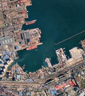
6 NASA LANDSAT8 PLANET LABS DOVE
7 Our Solution Global Coverage Planet s constellation of satellites is always-on, imaging the entire Earth every day Fresh Data Fresh, daily imagery helps you detect anomalies, take action and capitalize on change Easy Access Integrate same-day imagery into your processes with Planet's APIs or online tools
8 The Dove Spacecraft 10cm 30cm 10cm


9 Agile Aerospace BUILD 13 JUN 2015 BUILD 6 APR 2013 BUILD 1 APR Builds in less than 3 years
10 Confidential and Proprietary Page 10


11 End-to-end System 150 Satellites 475km Altitude Sun Synchronous Orbit 30 Ground Stations 10 Sites 370,000 images per day 1000S of virtual machines 11TB Processed daily Image whole Earth everyday <24 Hours online catalog API For data pipeline and platform access

12 160 Unprecedented Launches Q Q Q Q Q Q Q Q Test Orbit Planned Sun Synchronous Orbit Information is Proprietary & Confidential Planned launches are subject to change
13 Industry Satellite Launches ; 19% 22; 15% 95; 78% 4; 3% 37; 24% 93; 61% Commercial Satellites Other Cube Satellites Planet Labs Satellites Source: Prepared by Tauri Group for Satellite Industry association

14 PROPRIETARY AND CONFIDENTIAL. Signal to Noise 80

15 September of 2015 Clifton, Iowa, USA Two 2 stripe NIR Filters

16 Applications, Imagery & Tools Planet 16 Labs Proprietary & Confidential


17 Agriculture Energy & Infrastructure Finance & Business Intelligence Forestry Government Maps & Imagery Social Impact Plus many more.


18 API Immediate access to the data Scenes Explorer Unrectified Scenes Orthorectification Color-Correction 3rd Party Applications Mosaics Mosaicking Mosaic Explorer

19 Scenes Explorer Instant browse and delivery of scene archive Browse scene archive New scenes added as acquired and cleared data pipeline Filter by metadata, AOI & TOI Save workspaces Bulk delivery planet.com/scenes

20 Mosaic Explorer Seamless, timely and frequent mosaics planet.com/mosaics Specify timeframe for mosaics Best Pixel methodology for optimal results See change happen over time Scene traceability Monthly and weekly built

21 External APIs Programmatic access to search and download data api.planet.com planet.com/docs

22 Use Case Examples

23 Soybean Fields Plymouth County Iowa October 12, 2014
24 Soybean Fields Plymouth County Iowa October 15, 2014 (3 days later)

25 Soybean Fields Plymouth County Iowa Harvest: 1136 Acres % of Soybean: 15%

26 Lower Se San 2 Dam Cambodia Tonle Srepok, tributary of the Mekong River Source: USGS Landsat 8 Date: December 22, 2014

27 Lower Se San 2 Dam Cambodia Tonle Srepok, tributary of the Mekong River Source: Planet Labs Date: January 14, 2014

28 Forest Management Oregon, USA Source: Landsat 8 Date: March 23, 2014

29 Forest Management Oregon, USA Source: Planet Labs Date: May 2, 2014


30 Nepal Earthquake Source: Planet Labs Planet Labs imagery was used to identify impacted settlements not represented on aid workers maps.

31 Nepal Earthquake Source: Planet Labs Aid worker maps show limited infrastructure in Nepal BEFORE Planet imagery
32 Nepal Earthquake Source: Planet Labs Aid worker maps show limited infrastructure in Nepal BEFORE Planet imagery This illustrates how the maps appear over Planet Lab s imagery
33 Nepal Earthquake Source: Planet Labs Revised infrastructure updated AFTER Planet imagery

34 Nepal Earthquake Source: Planet Labs Revised infrastructure updated AFTER Planet imagery

35 Earthquake in Nepal After comparing these results with the latest maps from the HOT team, we saw two towns that were outside the areas currently covered by other crisis mapping, but that our classifiers had marked as high priority.

36 Inner Mongolia, China Goldmine Source: Planet Labs Date: Sep 29, 2014

37 Inner Mongolia, China Goldmine Source: Planet Labs Date: Oct 26, 2014

38 Inner Mongolia, China Goldmine Source: Planet Labs Date: Feb 15, 2015

39 Campbell County, WY Energy well pads Source: USDA NAIP Date: 2012 Analysis: visible 108 Pads

40 Campbell County, WY Energy well pads Source: Planet Labs Date: October 2104 Analysis: 189 Pads visible Value ~$3.5M/feature Delta of $283M

41 Brazil Fields Source: Landsat Date: August 8, 2014

42 Brazil Burning Fields Source: Planet Labs Date: August 9, 2014


43 Discover how Planet Labs can help you with: Global Coverage Fresh Data Easy Access planet.com
Orbital Insight Energy: Oil Storage v5.1 Methodologies & Data Documentation
 Orbital Insight Energy: Oil Storage v5.1 Methodologies & Data Documentation Overview and Summary Orbital Insight Global Oil Storage leverages commercial satellite imagery, proprietary computer vision algorithms,
The DEIMOS Earth Observation System and the PanGeo Alliance. Contribution to CSCDA Data WareHouse 2. Fabrizio Pirondini CEO, Elecnor Deimos Imaging
 The DEIMOS Earth Observation System and the PanGeo Alliance Contribution to CSCDA Data WareHouse 2 Fabrizio Pirondini CEO, Elecnor Deimos Imaging Copernicus Space Component Data Access Workshop ESRIN,
UrtheCast s High Resolution Imagery, HD Video and Synthetic Aperture Radar from Space for Smart Earth Observations Dr. Rao S.
 UrtheCast s High Resolution Imagery, HD Video and Synthetic Aperture Radar from Space for Smart Earth Observations Dr. Rao S. Ramayanam Vice President Middle East, Africa and South Asia Geo Smart Asia
Leveraging Sentinel-1 time-series data for mapping agricultural land cover and land use in the tropics
 Leveraging Sentinel-1 time-series data for mapping agricultural land cover and land use in the tropics Caitlin Kontgis caitlin@descarteslabs.com @caitlinkontgis Descartes Labs Overview What is Descartes
Introduction to Satellite Derived Vegetation Indices
 Introduction to the Use of Geospatial Information Technology for Drought Risk Management 13-17 November, 2017 Tonle Bassac II Restaurant, Phnom Penh, Cambodia Introduction to Satellite Derived Vegetation
Interannual variation of MODIS NDVI in Lake Taihu and its relation to climate in submerged macrophyte region
 Yale-NUIST Center on Atmospheric Environment Interannual variation of MODIS NDVI in Lake Taihu and its relation to climate in submerged macrophyte region ZhangZhen 2015.07.10 1 Outline Introduction Data
CLICK HERE TO KNOW MORE
 CLICK HERE TO KNOW MORE UrtheCast Constellations: World s first fully-integrated Optical and SAR constellations Fabrizio Pirondini, CEO Deimos Imaging & GM Earth Observation UrtheCast Geospatial World
Disaster Monitoring with Remote Sensing at CRISP, NUS
 Disaster Monitoring with Remote Sensing at CRISP, NUS KWOH, Leong Keong Director, CRISP The 3rd Sentinel Asia Joint Project Team Meeting (JPTM) Le Meridien Hotel, Singapore 13-15 March 2007 6 metre Antenna
Aerial Photography and Imagery Resources Guide
 Aerial Photography and Imagery Resources Guide Cheyenne and Laramie County Cooperative GIS Created and Maintained by the GIS Coordinator for the Cooperative GIS Program March 2011 CHEYENNE / LARAMIE COUNTY
Using the moon as a calibration source for a fleet of satellites
 Using the moon as a calibration source for a fleet of satellites Arin Jumpasut, Adriana Fukuzato, Ignacio Zuleta Kure Atoll, Hawaii, USA May 12, 2016 Introduction Singapore Strait, Singapore July 29, 2016
Situational Report HOW PLANET MONITORS DEVELOPMENTS IN THE SOUTH CHINA SEA AUGUST 1, 2016 IMAGE ACQUIRED: JULY 22, 2015 PLANET.
 Situational Report IMAGE ACQUIRED: JULY 22, 2015 HOW PLANET MONITORS DEVELOPMENTS IN THE SOUTH CHINA SEA AUGUST 1, 2016 PRESS@PLANET.COM PLANET.COM THE SITUATION An international tribunal in The Hague
Opportunities for advanced Remote Sensing; an outsider s perspective
 Opportunities for advanced Remote Sensing; an outsider s perspective Ramon Hanssen Delft University of Technology 1 Starting questions Can we do more with the data we are already acquire? What s in stock
Yanbo Huang and Guy Fipps, P.E. 2. August 25, 2006
 Landsat Satellite Multi-Spectral Image Classification of Land Cover Change for GIS-Based Urbanization Analysis in Irrigation Districts: Evaluation in Low Rio Grande Valley 1 by Yanbo Huang and Guy Fipps,
CIMA Professional
 CIMA Professional 201819 Birmingham Interactive Timetable Version 3.1 Information last updated 12/10/18 Please note: Information and dates in this timetable are subject to change. A better way of learning
CIMA Professional
 CIMA Professional 201819 Manchester Interactive Timetable Version 3.1 Information last updated 12/10/18 Please note: Information and dates in this timetable are subject to change. A better way of learning
Drought Characterization. Examination of Extreme Precipitation Events
 Drought Characterization Examination of Extreme Precipitation Events Extreme Precipitation Events During the Drought For the drought years (1999-2005) daily precipitation data was analyzed to find extreme
Aerial Photography and Imagery Resources Guide
 Aerial Photography and Imagery Resources Guide Cheyenne and Laramie County Cooperative GIS Created and Maintained by the GIS Coordinator for the Cooperative GIS Program May 2016 CHEYENNE / LARAMIE COUNTY
Sentinel-1 Mission Status
 Sentinel-1 Mission Status Pierre Potin, Sentinel-1 Mission Manager, ESA Luca Martino, Technical Support Engineer, ESA... and the Sentinel-1 operations team PSTG SAR Coordination Working Group 14 December
World Meterological Organization Polar Space Task Group
 World Meterological Organization Polar Space Task Group Jerry L. Mullins Coordinator, USGS Antarctic, Arctic and Canadian Programs Reston, VA, USA 30 September 2011 1. USGS Landsat Program 11/06 7/07 4/08
Appendix B. A proposition for updating the environmental standards using real Earth Albedo and Earth IR Flux for Spacecraft Thermal Analysis
 19 Appendix B A proposition for updating the environmental standards using real Earth Albedo and Earth IR Romain Peyrou-Lauga (ESA/ESTEC, The Netherlands) 31 st European Space Thermal Analysis Workshop
P7.7 A CLIMATOLOGICAL STUDY OF CLOUD TO GROUND LIGHTNING STRIKES IN THE VICINITY OF KENNEDY SPACE CENTER, FLORIDA
 P7.7 A CLIMATOLOGICAL STUDY OF CLOUD TO GROUND LIGHTNING STRIKES IN THE VICINITY OF KENNEDY SPACE CENTER, FLORIDA K. Lee Burns* Raytheon, Huntsville, Alabama Ryan K. Decker NASA, Marshall Space Flight
Working with ArcGIS Online
 Esri International User Conference San Diego, CA Technical Workshops July 12, 2011 Working with ArcGIS Online Bern Szukalski, Deane Kensok Topics for this Session ArcGIS Online Overview ArcGIS Online Content
CIMA Professional 2018
 CIMA Professional 2018 Interactive Timetable Version 16.25 Information last updated 06/08/18 Please note: Information and dates in this timetable are subject to change. A better way of learning that s
Orbit Design Marcelo Suárez. 6th Science Meeting; Seattle, WA, USA July 2010
 Orbit Design Marcelo Suárez Orbit Design Requirements The following Science Requirements provided drivers for Orbit Design: Global Coverage: the entire extent (100%) of the ice-free ocean surface to at
What s New in Topographic Information - USGS National Map
 + What s New in Topographic Information - USGS National Map SARGIS Workshop November 14, 2016 Rob Dollison, 703-648-5724 rdollison@usgs.gov + USGS 2 National Geospatial Program The National Geospatial
CIMA Professional 2018
 CIMA Professional 2018 Newcastle Interactive Timetable Version 10.20 Information last updated 12/06/18 Please note: Information and dates in this timetable are subject to change. A better way of learning
Intelligent City Management
 Intelligent City Management Based on Land Cover Feature Changes Detected by Satellite Imagery Twenty First Century Aerospace Technology (21AT) www.21at.com.cn Geospatial World Forum 2016 Outline 01 Introduction
REDWOOD VALLEY SUBAREA
 Independent Science Review Panel Conceptual Model of Watershed Hydrology, Surface Water and Groundwater Interactions and Stream Ecology for the Russian River Watershed Appendices A-1 APPENDIX A A-2 REDWOOD
Aniekan Eyoh 1* Department of Geoinformatics & Surveying, Faculty of Environmental Studies, University of Uyo, Nigeria
 Available online at http://euroasiapub.org/journals.php, pp. 53~62 Thomson Reuters Researcher ID: L-5236-2015 TEMPORAL APPRAISAL OF LAND SURFACE TEMPERATURE DYNAMICS ACROSS THE NINE STATES OF NIGER DELTA
UK-DMC 2 and Deimos-1, New DMC Sensors for Agricultural Monitoring. Owen Hawkins DMC International Imaging Ltd
 UK-DMC 2 and Deimos-1, New DMC Sensors for Agricultural Monitoring Owen Hawkins DMC International Imaging Ltd Full Spectrum Satellite Solutions Design Manufacture Assembly, Integration & Test Launch Services
DROUGHT IN MAINLAND PORTUGAL
 DROUGHT IN MAINLAND Ministério da Ciência, Tecnologia e Ensino Superior Instituto de Meteorologia, I. P. Rua C Aeroporto de Lisboa Tel.: (351) 21 844 7000 e-mail:informacoes@meteo.pt 1749-077 Lisboa Portugal
HICO Mission Planning and Operations
 HICO Mission Planning and Operations Ellen J. Wagner and Marcos Montes Naval Research Laboratory ellen.wagner@nrl.navy.mil Oregon State Selecting Targets: Part 1 Request through OSU web site Choose coordinates
Remote Sensing of Snow GEOG 454 / 654
 Remote Sensing of Snow GEOG 454 / 654 What crysopheric questions can RS help to answer? 2 o Where is snow lying? (Snow-covered area or extent) o How much is there? o How rapidly is it melting? (Area, depth,
Sentinel-1 Mission Status
 Sentinel-1 Mission Status Pierre Potin, Sentinel-1 Mission Manager 5TH GEOGLAM RAPP Workshop 16-17 May 2017, ESRIN Sentinel-1: Copernicus radar imaging mission for ocean, land, emergency Part of the Copernicus
Challenges for the operational assimilation of satellite image data in agrometeorological models
 Challenges for the operational assimilation of satellite image data in agrometeorological models Mark Danson Centre for Environmental Systems Research, University of Salford, UK 0 Objectives The main objective
Change Detection Analysis using New Nano Satellite Imagery
 Change Detection Analysis using New Nano Satellite Imagery M. Selim Abstract: Mapping Land use /Land cover (LULC), changes studies have become interesting over the past decades through using remote sensing.
Cutting Edge Engineering for Modern Geospatial Systems Rear Admiral Dr. S Kulshrestha, retd
 Cutting Edge Engineering for Modern Geospatial Systems Rear Admiral Dr. S Kulshrestha, retd 11 Jun 2015 GeoIntelligence Asia 2015 The technology would become so pervasive that it becomes a part of you
Urban Tree Canopy Assessment Purcellville, Virginia
 GLOBAL ECOSYSTEM CENTER www.systemecology.org Urban Tree Canopy Assessment Purcellville, Virginia Table of Contents 1. Project Background 2. Project Goal 3. Assessment Procedure 4. Economic Benefits 5.
Modeling of peak inflow dates for a snowmelt dominated basin Evan Heisman. CVEN 6833: Advanced Data Analysis Fall 2012 Prof. Balaji Rajagopalan
 Modeling of peak inflow dates for a snowmelt dominated basin Evan Heisman CVEN 6833: Advanced Data Analysis Fall 2012 Prof. Balaji Rajagopalan The Dworshak reservoir, a project operated by the Army Corps
The NOAA/NESDIS/STAR IASI Near Real-Time Product Processing and Distribution System
 The NOAA/NESDIS/STAR Near Real-Time Product Processing and Distribution System W. Wolf 2, T. King 1, Z. Cheng 1, W. Zhou 1, H. Sun 1, P. Keehn 1, L. Zhou 1, C. Barnet 2, and M. Goldberg 2 1 QSS Group Inc,
WHEN IS IT EVER GOING TO RAIN? Table of Average Annual Rainfall and Rainfall For Selected Arizona Cities
 WHEN IS IT EVER GOING TO RAIN? Table of Average Annual Rainfall and 2001-2002 Rainfall For Selected Arizona Cities Phoenix Tucson Flagstaff Avg. 2001-2002 Avg. 2001-2002 Avg. 2001-2002 October 0.7 0.0
Enhancement of the U.S. Drought Monitor Through the Integration of NASA Vegetation Index Imagery
 Enhancement of the U.S. Drought Monitor Through the Integration of NASA Vegetation Index Imagery Project and Related Activities at USGS/EROS Jim Verdin, Jesslyn Brown, Yingxin Gu, Gail Schmidt, Troy McVay
Twelve Moons Curriculum Overview
 Twelve Moons Twelve Moons Curriculum Overview 1. Instructions The curriculum is arranged by book section, in order. Feel free to teach in any order you wish. The curriculum adheres to three objectives
GPS :: VSAT :: Earth Observation :: Satellites & Communications :: Unmanned Aerial Vehicles :: Aerospace :: Launchers :: Analysis :: Jobs in Space ::
 T R A D E A D V E R T I S I N G 2 0 0 6 D E M O G R A P H I C S : : I N D U S T R Y P O S I T I O N S : : S P O N S O R S H I P R A T E S Reach out to the engineers of space at SpaceDaily.com. G L O B
Agricultural Science Climatology Semester 2, Anne Green / Richard Thompson
 Agricultural Science Climatology Semester 2, 2006 Anne Green / Richard Thompson http://www.physics.usyd.edu.au/ag/agschome.htm Course Coordinator: Mike Wheatland Course Goals Evaluate & interpret information,
Boy Scout Badge Workshop ASTRONOMY
 Boy Scout Badge Workshop ASTRONOMY Welcome to the Schenectady Museum & Suits-Bueche Planetarium! During this workshop, you will explore the museum, see a show in the planetarium, and try out some other
Highlights of the 2006 Water Year in Colorado
 Highlights of the 2006 Water Year in Colorado Nolan Doesken, State Climatologist Atmospheric Science Department Colorado State University http://ccc.atmos.colostate.edu Presented to 61 st Annual Meeting
Wheat Outlook July 24, 2017 Volume 26, Number 44
 Today s Newsletter Market Situation Crop Progress 1 Weather 1 Grain Use 5 Market Situation Crop Progress. The U.S. spring wheat crop condition index this week is down only one point to 277 with 96% of
Louis-François Guerre, Planet Action Coordinator Copenhagen, December Spot Image 2007
 Louis-François Guerre, Planet Action Coordinator Copenhagen, December 2009 1 Spot Image 2007 Spot Image, Earth Observation and geo-information services Satellite operator, imagery distributor SPOT4 SPOT5
An Internet-based Agricultural Land Use Trends Visualization System (AgLuT)
") An Internet-based Agricultural Land Use Trends Visualization System (AgLuT) Second half yearly report 01-01-2001-06-30-2001 Prepared for Missouri Department of Natural Resources Missouri Department of
An Internet-based Agricultural Land Use Trends Visualization System (AgLuT) Second half yearly report 01-01-2001-06-30-2001 Prepared for Missouri Department of Natural Resources Missouri Department of
STATISTICAL FORECASTING and SEASONALITY (M. E. Ippolito; )
") STATISTICAL FORECASTING and SEASONALITY (M. E. Ippolito; 10-6-13) PART I OVERVIEW The following discussion expands upon exponential smoothing and seasonality as presented in Chapter 11, Forecasting, in
STATISTICAL FORECASTING and SEASONALITY (M. E. Ippolito; 10-6-13) PART I OVERVIEW The following discussion expands upon exponential smoothing and seasonality as presented in Chapter 11, Forecasting, in
DAMAGE DETECTION OF THE 2008 SICHUAN, CHINA EARTHQUAKE FROM ALOS OPTICAL IMAGES
 DAMAGE DETECTION OF THE 2008 SICHUAN, CHINA EARTHQUAKE FROM ALOS OPTICAL IMAGES Wen Liu, Fumio Yamazaki Department of Urban Environment Systems, Graduate School of Engineering, Chiba University, 1-33,
PRELIMINARY DRAFT FOR DISCUSSION PURPOSES
 Memorandum To: David Thompson From: John Haapala CC: Dan McDonald Bob Montgomery Date: February 24, 2003 File #: 1003551 Re: Lake Wenatchee Historic Water Levels, Operation Model, and Flood Operation This
NR402 GIS Applications in Natural Resources
 NR402 GIS Applications in Natural Resources Lesson 1 Introduction to GIS Eva Strand, University of Idaho Map of the Pacific Northwest from http://www.or.blm.gov/gis/ Welcome to NR402 GIS Applications in
The Moon. It's Just a Phase It's Going Through...
 The Moon It's Just a Phase It's Going Through... www.thesciencequeen.net Moon Our planet's large natural satellite, the Moon, is the easiest astronomical object to observe. The only "scientific instrument"
Evapo-transpiration Losses Produced by Irrigation in the Snake River Basin, Idaho
 Nov 7, 2007 DRAFT Evapo-transpiration Losses Produced by Irrigation in the Snake River Basin, Idaho Wendell Tangborn and Birbal Rana HyMet Inc. Vashon Island, WA Abstract An estimated 8 MAF (million acre-feet)
ASTRONOMY Merit Badge Requirements
 ASTRONOMY Merit Badge Requirements 1) Do the following: A) Sketch the face of the moon, indicating on it the locations of at least five seas and five craters. B) Within a single week, sketch the position
Global Monitoring for Environment and Security (GMES)
") Global Monitoring for Environment and Security (GMES) Satellite Earth Observation for the Emergency Services Dr Nick Veck Presentation to the G-STEP Launch Univ. of Leicester 19 th June 2009 Contents of
Global Monitoring for Environment and Security (GMES) Satellite Earth Observation for the Emergency Services Dr Nick Veck Presentation to the G-STEP Launch Univ. of Leicester 19 th June 2009 Contents of
Model Implementation Details for the Final Project in EEOS 465/
 Model Implementation Details for the Final Project in EEOS 465/627 2009 Last week, we introduced a conceptual model of estimating DOC loadings from landscape to coastal waters as a model template for the
Why Hydrological Services are Important to Business
 Why Hydrological Services are Important to Business Dr. David Green Program Manager, Disasters Earth Science Division David.s.green@nasa.gov May 8, 2018 2 Communities and Areas of Intensive Risk Socio-Economic
Table 01A. End of Period End of Period End of Period Period Average Period Average Period Average
 SUMMARY EXCHANGE RATE DATA BANK OF ZAMBIA MID-RATES Table 01A Period K/USD K/GBP K/ZAR End of Period End of Period End of Period Period Average Period Average Period Average Monthly January 6.48 6.46 9.82
Chiang Rai Province CC Threat overview AAS1109 Mekong ARCC
 Chiang Rai Province CC Threat overview AAS1109 Mekong ARCC This threat overview relies on projections of future climate change in the Mekong Basin for the period 2045-2069 compared to a baseline of 1980-2005.
Country Presentation-Nepal
 Country Presentation-Nepal Mt.Everest, Shiva Pd. Nepal, DHM South Asia Drought Monitor Workshop Dhaka Bangladesh 2 th April 215 Overview Brief Climatology Climate activities- DHM PPCR (Pilot Program for
The Climate of Bryan County
 The Climate of Bryan County Bryan County is part of the Crosstimbers throughout most of the county. The extreme eastern portions of Bryan County are part of the Cypress Swamp and Forest. Average annual
2015 Fall Conditions Report
 2015 Fall Conditions Report Prepared by: Hydrologic Forecast Centre Date: December 21 st, 2015 Table of Contents Table of Figures... ii EXECUTIVE SUMMARY... 1 BACKGROUND... 2 SUMMER AND FALL PRECIPITATION...
Many of remote sensing techniques are generic in nature and may be applied to a variety of vegetated landscapes, including
 Remote Sensing of Vegetation Many of remote sensing techniques are generic in nature and may be applied to a variety of vegetated landscapes, including 1. Agriculture 2. Forest 3. Rangeland 4. Wetland,
Feasibility of Using Commercial Star Trackers for On-Orbit Resident Space Object Detection
 Feasibility of Using Commercial Star Trackers for On-Orbit Resident Space Object Detection Samuel Clemens York University Regina Lee York University Paul Harrison Magellan Aerospace Warren Soh Magellan
Sources of Imagery and GIS Data Layers (Last updated October 2005)
") Sources of Imagery and GIS Data Layers (Last updated October 2005) The question of where to find data is one often asked by beginners in precision agriculture and other geospatial projects. The following
Sources of Imagery and GIS Data Layers (Last updated October 2005) The question of where to find data is one often asked by beginners in precision agriculture and other geospatial projects. The following
Towards eenvironment Prague, March GMES Space Component. Josef Aschbacher Head, ESA GMES Space Office
 Towards eenvironment Prague, 25-27 March 2009 GMES Space Component Josef Aschbacher Head, ESA GMES Space Office Prague from Space Segment 2 05 Nov 2003 CNES 2003 GISAT 2007 ESA GSELAND GMES is an EU led
Current Status of the ALOS-2 Operation and PALSAR-2 Calibration Activities
 Current Status of the ALOS-2 Operation and PALSAR-2 Calibration Activities Takeshi Motohka, Ryo Natsuaki, Yukihiro Kankaku, Shinichi Suzuki, Masanobu Shimada (JAXA) Osamu Isoguchi (RESTEC) CEOS SAR CALVAL
Ryan K. Decker * NASA Marshall Space Flight Center, Huntsville, Alabama. Lee Burns Raytheon, Huntsville, Alabama
 P.7 THE 006 CAPE CANAVERAL AIR FORCE STATION RANGE REFERENCE ATMOSPHERE MODEL VALIDATION STUDY AND SENSITIVITY ANALYSIS TO THE NATIONAL AERONAUTICS AND SPACE ADMINISTRATION'S SPACE SHUTTLE Ryan K. Decker
VISUALIZATION URBAN SPATIAL GROWTH OF DESERT CITIES FROM SATELLITE IMAGERY: A PRELIMINARY STUDY
 CO-439 VISUALIZATION URBAN SPATIAL GROWTH OF DESERT CITIES FROM SATELLITE IMAGERY: A PRELIMINARY STUDY YANG X. Florida State University, TALLAHASSEE, FLORIDA, UNITED STATES ABSTRACT Desert cities, particularly
When Map Quality Matters
 When Map Quality Matters 50% 25% Powerful geospatial mapping tools for Adobe Creative Cloud and offline map solutions for mobile devices 20% When Map Quality Matters 10% We re focused on creating powerful
Space-Based Disaster Management in Nigeria: The Role of the International Charter Space and Major Disasters.
 Space-Based Disaster Management in Nigeria: The Role of the International Charter Space and Major Disasters. Godstime JAMES, Halilu SHABA, Opeyemi ZUBAIR, Alade TESLIM, Gabriel YUSUF, Alhassan NUHU- Paper
Satellite-Based Precipitation Data Delivery System for Thailand. Infrastructure Development Institute-Japan
 Satellite-Based Precipitation Data Delivery System for Thailand Infrastructure Development Institute-Japan 1 About the Satellite-Based Precipitation Data Delivery System The Satellite-Based Precipitation
ISU GIS CENTER S ARCSDE USER'S GUIDE AND DATA CATALOG
 ISU GIS CENTER S ARCSDE USER'S GUIDE AND DATA CATALOG 2 TABLE OF CONTENTS 1) INTRODUCTION TO ARCSDE............. 3 2) CONNECTING TO ARCSDE.............. 5 3) ARCSDE LAYERS...................... 9 4) LAYER
SIMULATION AND OPTIMISATION OF AN OF OPTICAL REMOTE SENSING SYSTEM FOR MONITORING THE EUROPEAN GAS PIPELINE NETWORK
 SIMULATION AND OPTIMISATION OF AN OF OPTICAL REMOTE SENSING SYSTEM FOR MONITORING THE EUROPEAN GAS PIPELINE NETWORK M. van Persie, A. van der Kamp, T. Algra National Aerospace Laboratory NLR, The Netherlands
Geospatial Big Data. Greg Scott Inter-Regional Advisor Global Geospatial Information Management United Nations Statistics Division. ggim.un.
 Geospatial Big Data Greg Scott Inter-Regional Advisor Global Geospatial Information Management United Nations Statistics Division Positioning geospatial information to address global challenges ggim.un.org
Connecting Communities. Jeff Peters - Esri
 Connecting Communities Jeff Peters - Esri Public Safety and Security Infrastructure Protection Officer Involved Shootings and Violent Crimes DHS Police Foundation Operation Centers Mail Theft Live Incident
Part : General Situation of Surveying and Mapping. The Development of Surveying and Mapping in China. The contents
 The Development of Surveying and Mapping in China Dr. Ping Xiao China.P.R The contents Part : General Situation of Surveying and Mapping 1. The legal systems of surveying and mapping 2. The technologies
Cygnus Loop from the NOAO
 Cygnus Loop from the NOAO Longmont Astronomy Society Newsletter January 2013 Cover Picture: As an end of the year finale, the National Optical Astronomy Observatory (NOAO) and WIYN partners offer this
C O P E R N I C U S F O R G I P R O F E S S I O N A L S
 C O P E R N I C U S F O R G I P R O F E S S I O N A L S Downstream Applications MALTA 2017-06-26 Pascal Lory, EUROGI EU EU EU www.copernicus.eu S c o p e Identifying urban housing density: Stella Ofori-Ampofo,
High Precision Exoplanet Observations with Amateur Telescopes
 High Precision Exoplanet Observations with Amateur Telescopes Dennis M. Conti Chair, AAVSO Exoplanet Section Member, KELT Follow-up Team Member, TESS TFOP Working Group HAL Meeting: October 19, 2017 1
ACCA Interactive Timetable & Fees
 ACCA Interactive Timetable & Fees 2018/19 Professional Version 1.1 Information last updated tember 2018 Please note: Information and dates in this timetable are subject to change. A better way of learning
Improvement of Himawari-8 observation data quality
 Improvement of Himawari-8 observation data quality 3 July 2017 Meteorological Satellite Center Japan Meteorological Agency The Japan Meteorological Agency (JMA) plans to modify its Himawari-8 ground processing
Determine the trend for time series data
 Extra Online Questions Determine the trend for time series data Covers AS 90641 (Statistics and Modelling 3.1) Scholarship Statistics and Modelling Chapter 1 Essent ial exam notes Time series 1. The value
10 emergency observation requests were successfully processed during the period
 ISRO s Inputs for the Sentinel Asia DPN and JPT meeting being held during 13-16, 16, November 2012 November 2012 Sentinel Asia Activity Spectrum - A dedicated Sentinel Asia server established at NRSC,
European Space Agency
 Guidelines - Guidelines how/when to interact during the WebEx session: - Due to the number of attendees, please keep always your webcam and microphone switched-off - You can use anytime the chat to all
Preparation of LULC map from GE images for GIS based Urban Hydrological Modeling
 International Conference on Modeling Tools for Sustainable Water Resources Management Department of Civil Engineering, Indian Institute of Technology Hyderabad: 28-29 December 2014 Abstract Preparation
SciBox, a Proven Automated Planning and Commanding System
 SciBox, a Proven Automated Planning and Commanding System Teck Choo, Edward Russell, Michael Kim February 25, 2014 2014 by The Johns Hopkins University/Applied Physics Laboratory. Published by The Aerospace
State of Passive Microwave Polar Stereographic Products. Walt Meier and polar stereographic product team
 State of Passive Microwave Polar Stereographic Products Walt Meier and polar stereographic product team State of PM PS datasets NRT Tb and sea ice running nominally after many issues (see subsequent slides)
Midwest and Great Plains Climate and Drought Update
 Midwest and Great Plains Climate and Drought Update June 20,2013 Laura Edwards Climate Field Specialist Laura.edwards@sdstate.edu 605-626-2870 2012 Board of Regents, South Dakota State University General
An Update on EUMETSAT Programmes and Plans. Dieter Klaes on behalf of EUMETSAT teams
 An Update on EUMETSAT Programmes and Plans Dieter Klaes on behalf of EUMETSAT teams 1 21 st International TOVS Study Conference (ITSC), Darmstadt, Germany, 29 November 2017 5 December 2017 Current EUMETSAT
ACCA Interactive Timetable & Fees
 ACCA Interactive Timetable & Fees 2018/19 Professional London Version 1.1 Information last updated 3 October 2018 Please note: Information and dates in this timetable are subject to change. A better way
A Review of the 2007 Water Year in Colorado
 A Review of the 2007 Water Year in Colorado Nolan Doesken Colorado Climate Center, CSU Mike Gillespie Snow Survey Division, USDA, NRCS Presented at the 28 th Annual AGU Hydrology Days, March 26, 2008,
USA Space Debris Environment, Operations, and Policy Updates
 USA Space Debris Environment, Operations, and Policy Updates Presentation to the 48 th Session of the Scientific and Technical Subcommittee Committee on the Peaceful Uses of Outer Space United Nations
ACCA Interactive Timetable & Fees
 ACCA Interactive Timetable & Fees 2018/19 Professional Version 1.1 Information last updated tember 2018 Please note: Information and dates in this timetable are subject to change. A better way of learning
Simulated Radiances for OMI
 Simulated Radiances for OMI document: KNMI-OMI-2000-004 version: 1.0 date: 11 February 2000 author: J.P. Veefkind approved: G.H.J. van den Oord checked: J. de Haan Index 0. Abstract 1. Introduction 2.
Japanese Programs on Space and Water Applications
 Japanese Programs on Space and Water Applications Tamotsu IGARASHI Remote Sensing Technology Center of Japan June 2006 COPUOS 2006 Vienna International Centre Water-related hazards/disasters may occur
ACCA Interactive Timetable & Fees
 ACCA Interactive Timetable & Fees 2018/19 Professional Version 2.1 Information last updated uary 2019 Please note: Information and dates in this timetable are subject to change. A better way of learning