STREAM GAUGING TECHNIQUES
|
|
|
- Anis Hoover
- 5 years ago
- Views:
Transcription


, Volume II Chapter 2, with")


1 World Meteorological Organization -- Working together in weather, climate and water STREAM GAUGING TECHNIQUES Presentation based on the WMO Manual on streamgauging (2010), Volume II Chapter 2, with additional material provided by Alexandre HAUET (EDF DTG Grenoble, France) IAHR WMO IAHS Training Course on Stream Gauging Lyon -- September 2-4,

: Use of a rating curve : Measurement of the water stage at a station, continuously and in real time Establishment of a")
2 STREAM GAUGING WHAT FOR?? Different needs : Knowing the discharge of a river at a given place and a given time: Check environmental regulation (ecological instream flow) / Punctual studies Discharge measurement by field hydrologist Knowing the discharge of a river continuously (and in real-time): Use of a rating curve : Measurement of the water stage at a station, continuously and in real time Establishment of a stage-discharge relationship (rating curve), based on gaugings Computation of the discharge from the measured stage 2


3 RIVERS ARE COMPLEX Complexity at the spatial scale: Upstream Downstream Complexity at the time scale 17m 3


4 RIVERS ARE COMPLEX Interaction with the environment: How the Mississippi has changed course No instrument for measuring directly the discharge continuously rating curve Not a unique gauging methods : Different methods / Field hydrologist toolbox 4
5 LET SPEAK THE SAME LANGUAGE Hydraulic description of a river cross-section: 5
6 LET SPEAK THE SAME LANGUAGE Hydraulic description of a river cross-section: Geometric characteristics River width Wetted area Water depth Bathymetry 6
7 LET SPEAK THE SAME LANGUAGE Hydraulic description of a river: Geometric characteristics Cinematic characteristics River width Flow velocity Wetted area Water depth Bathymetry 7
8 LET SPEAK THE SAME LANGUAGE Hydraulic description of a river: Geometric characteristics Cinematic characteristics Discharge : Q = wetted area * mean velocity [m 3 /s] [m 2 ] [m/s] Volume per unit time River width Flow velocity Wetted area Water depth Bathymetry 8


9 LET SPEAK THE SAME LANGUAGE Discharge is : a characteristic quantity of the state of the river and the basin a characteristic quantity for water resource management drinking water irrigation hydroelectricity / cooling of power plants quantifying flood risk Rivers.. It s not only a matter if discharge Sediment transport, biology, ecology, pollution, fishing But it is out of the scope of this course! Desman of Pyrénées Jiang Zi Gjiang Mékong 9
 Other ways for measuring stream discharge : Non-intrusive methods (course of Ichiro Fujita)")
 WMO reference documents : WMO Manual on Streamgauging (2010) WMO Guide to Hydrological Practices,")
10 STREAM GAUGING METHODS 3 classical methods for stream gauging: Volumetric method Tracer dilution method (slug and constant-rate injections) Velocity-area method (current meter and ADCP) Other ways for measuring stream discharge : Non-intrusive methods (course of Ichiro Fujita) Index-velocity method (course of Jérôme Le Coz) Precalibrated measuring structures (course of Roberto Ranzi) Indirect determination of flood peak (course of Jérôme Le Coz) WMO reference documents : WMO Manual on Streamgauging (2010) WMO Guide to Hydrological Practices, Volume I 10


11 PRELIMINARY OPERATIONS BEFORE GAUGING Prior site visits, especially for new sites Make sure that the whole stream discharge is measured Secondary branch during flood, for example Find the right gauging site Not necessary at the exact location of the stage gauge, but not too far! Depending on the gauging method used Depending on the river morphology / vegetation Allowing to work safely!! Find the right gauging method To make the best discharge measurement safely Keep a constant discharge during the measurement Adapt the gauging method to the dynamics of the flow Avoid more than 10% of discharge variation during the gauging Monitor the stage variation during the gauging Computation of mean gauge height H H = σ t h t q t Q Have equipment well maintained and in working order Course Assessment of the performance of flow measurement instruments on Wednesday And trained staff knowing how to use it!! 11

12 VOLUMETRIC METHOD Q = Volume per unit time Measuring the time (t) to fill of a container of known capacity (Vol) Q = V / t Equipment required calibrated container and stop-watch Only applicable to small discharges Q < 10 L/s..but it is the most accurate method of measuring such flows! 12
 fluorescence Requirements for the tracer : dissolves readily in the stream s water at ordinary temperatures; absent in the water of the")

13 TRACER DILUTION METHOD Based on the mass conservation Determining the degree of dilution by the flowing water of an added tracer solution Tracers used : salt conductivity or Fluorescent tracers (Uranine, Rhodamine) fluorescence Requirements for the tracer : dissolves readily in the stream s water at ordinary temperatures; absent in the water of the stream (or present only in negligible quantities); not decomposed in the stream s water and not retained or absorbed by sediment, plants or organisms; concentration can be measured accurately by simple methods; harmless to humans, animals and vegetation in the concentration it assumes in the stream. 2 injections methods : Slug injection and Constant rate injection 13
 t C 0 )dt M = Q t C M = V C M C C 14 IAHR / WMO / IAHS 0 International")
14 TRACER DILUTION METHOD Principle of the slug injection method Injection of a known mass M of tracer Tracer is dilute onto a cloud Mass conservation M = Volume of the cloud V mean Concentration of the cloud C When mixing length is reached, V = stream discharge Q duration of the cloud t M M = V C = Q t C Q = M t C = C ) t C 0 )dt M = Q t C M = V C M C C 14 IAHR / WMO / IAHS 0 International Streamgauging course t
.")
15 TRACER DILUTION METHOD Principle of the constant rate injection method Injection of a tracer of concentration c 1 at a constant discharge of q during a long time Container equipped with a Marriott vessel Tracer is dilute onto the river discharge Q When mixing length is reached, concentration is homogeneous on the cross-section C 2 Mass conservation c 1 q = C 2 (Q + q). As q Q, Q = q c 1 C 2 C 2 C 15 t
 If")

16 TRACER DILUTION METHOD Recommendations / limitations Adequate mixing of the tracer with the stream water in a short length of channel Adapted for turbulent streams Mountainous streams, bends or abrupt constrictions Supercritical flows Flood flow (if not too much suspended sediments) If cross-sectional area cannot be accurately measured or is changing during the measurement. Fish passage Slug injection : fast method Adapted for unsteady flow measurement Not adapted for : Fluvial flow with long mixing length High sediment concentration flows Adsorption and masking Avoid large dead-water zones 16

17 TRACER DILUTION METHOD Prehistoric first dilution gauging 17
18 VELOCITY-AREA METHOD USING CURRENT METERS Q = Cross sectional area X Average velocity Measure cross sectional area Streambed bathymetry Sufficient sampling to catch the shape of the wetted area River width Flow velocity Wetted area Water depth Bathymetry 18
19 VELOCITY-AREA METHOD USING CURRENT METERS Q = Cross sectional area X Average velocity Measure cross sectional area Streambed bathymetry Sufficient bathymetric sampling to catch the shape of the wetted area Determine average velocity over the cross-section Stream velocity varies through the stream profile Sufficient sampling to determine the average velocity Velocity contour : Low vel. High vel. highest velocity at the top and the middle energy lost due to friction along the stream channel lowest velocity close to the bottom and the banks 19
20 VELOCITY-AREA METHOD USING CURRENT METERS Selection of the gauging cross-section A stream reach as simple as possible subcritical flow uniform reach upstream and downstream / No singularity (bridge, weir, dam, gorges ) A cross section perpendicular to the flow General recommendations: velocities at all points are parallel to one another and at right angles to the cross-section curves of distribution of velocity in the section are regular in the vertical and horizontal planes; velocities greater than m/s; depth of flow greater than 0.3 m; regular and stable streambed; no aquatic growth, minimal formation of slush or frazil ice 20
")
21 VELOCITY-AREA METHOD USING CURRENT METERS Selection of the gauging cross-section Small modifications of the cross section are possible Small dikes to concentrate the flow Removing stones from the bed Stream modification must be limited and reversible Not disturbing the fishes (spawning areas) 21


22 EQUIPMENT Different supports depending on the accessibility of the river Wading rod : Section fully accessible by foot, distance across the section measured with a tape Gauging truck Retractable arm mounted on a truck sounding weights Cableways Carrier cable permanently stretched across a section Equipped with a sounding weight or a cable car 22

 Contact to generate an electric pulse for indicating the revolutions of the rotor")


23 MECHANICAL CURRENT METERS Velocity by counting revolutions of rotor during a short-time period V flow = f V rotor current meter calibration Two types of current meter rotors cup type with a vertical shaft (Price AA) propeller type with a horizontal shaft (Ott C2) Contact to generate an electric pulse for indicating the revolutions of the rotor Can measure from 0.05 to 5 m/s, depending on the rotor type Mind measuring the component of velocity normal to the cross-section Larger section Lower velocity component Same discharge Advantages : Mechanical : one can see when it is not working properly or not Drawbacks : Need care and periodic verification of the moving parts Susceptible to vegetation 23


24 ELECTROMAGNETIC CURRENT METERS Principle : Water (conductor) moving through a magnetic field produce an electric current (Faraday principle) Velocity of the water is proportional to the electric current produced Velocity range : 0 to 6 m/s; accuracy of 2% +/- 2cm/s Advantages : Can measure low velocities No moving part less maintenance Can measure with vegetation Drawbacks : Susceptible to electrical interference 24


 and backward flow Can measure very low velocities (2 cm/s) Drawback :")
25 ACOUSTIC CURRENT METERS Principle Transmit acoustic signals into a water column with a frequency f Signal is backscattered by particles moving in the water Doppler effect change of frequency of the backscatter signals f Computation of radial velocity on each beam f f V cos α = f Computation of flow velocity Velocity range -0,2 m/s à 2,4 m/s; accuracy : 1% ± 0.25 cm/s Advantages : No moving part less maintenance Measurement of 2D or 3D velocity components (Vx, Vy, Vz) and backward flow Can measure very low velocities (2 cm/s) Drawback : Susceptible to vegetation 25
26 VELOCITY-AREA METHOD USING CURRENT METERS Measurement protocol Temporal sampling of the velocity Streams : turbulent flow average turbulent velocities Exposure time of at least 30s to get average velocity And at least 100 rotations for a mechanical current meter Optimal exposure time should be evaluated for each measurement (increase exposure time when velocity decrease) Standard Iso748 : 26

27 VELOCITY-AREA METHOD USING CURRENT METERS Measurement protocol : measuring the stream bathymetry Spatial sampling of the cross section bathymetry at n verticals depth of each vertical d i Spatial sampling of the cross section velocity distribution at the n verticals Velocity distribution method Reduced point method Integration method depth-averaged velocity of each vertcal Vi 27

28 VELOCITY-AREA METHOD USING CURRENT METERS Measurement protocol : computing depth-averaged velocity at vertical i Velocity distribution method Important number of velocity measurement along each vertical between surface and bed 28


29 VELOCITY-AREA METHOD USING CURRENT METERS Measurement protocol : computing depth-averaged velocity at vertical i Velocity distribution method Important number of velocity measurement along each vertical between surface and bed Interpolation between measured velocity Extrapolation to the bed and the surface (log- or power-law) V i = d i 0 V measured d i number and spacing of the points are chosen as to define accurately the velocity distribution in each vertical with a difference in readings between two adjacent points of not more than 20 % with respect to the higher value 29

 6 pts method : V i = 0.1 (V surface + 2 V 0.2di + 2 V 0.4di + 2 V 0.6di + 2 V 0.8di + V bed ) Surface velocity method : V i = 0.")
30 VELOCITY-AREA METHOD USING CURRENT METERS Measurement protocol : computing depth-averaged velocity at vertical i Reduced point method 1 to 6 velocity measurements per vertical At a relative depth below the free surface Computation of V i with algebraic formula 1 pt method : V i = V 0.6di 2 pts method : V i = 0.5 (V 0.2di + V 0.8di ) 3 pts method : V i = 0.25 (V 0.2di + 2 V 0.6di + V 0.8di ) 5 pts method : V i = 0.1 (V surface + 3 V 0.2di + 3 V 0.6di + 2 V 0.8di + V bed ) 6 pts method : V i = 0.1 (V surface + 2 V 0.2di + 2 V 0.4di + 2 V 0.6di + 2 V 0.8di + V bed ) Surface velocity method : V i = 0.85 V surface Example with 2 pts method : 30

31 VELOCITY-AREA METHOD USING CURRENT METERS Measurement protocol : computing depth-averaged velocity at vertical i Integration method using mechanical current meters current meter is lowered and raised through the entire depth at each vertical at a uniform rate. average number of revolutions per second is determined depth-averaged velocity the speed at which the meter is lowered < 5% of the flow velocity and between 0.04 and 0.10 m/s two complete cycles are made in each vertical if the results differ by more than 10 per cent, the measurement is repeated. restriction of use : depth > 1 m velocities > 1 m/s the integration method should not be used with a vertical axis current meter 31

32 COMPUTATION OF DISCHARGE WITH CURRENT METERS Mid-section method A cross-section with n verticals i of known depth d i and depth-averaged velocity V i 32

33 COMPUTATION OF DISCHARGE WITH CURRENT METERS Mid-section method A cross-section with n verticals i of known depth d i and depth-averaged velocity V i The relative location of each vertical b i is measured 33
/2; a depth of d i, a mean velocity of V i The discharge q i of the subsection centered on i is q i = W i d i V")
34 COMPUTATION OF DISCHARGE WITH CURRENT METERS Mid-section method A cross-section with n verticals i of known depth d i and depth-averaged velocity V i The relative location of each vertical b i is measured For vertical i, a subsection is defined with : A width W i of (b i+1 -b i-1 )/2; a depth of d i, a mean velocity of V i The discharge q i of the subsection centered on i is q i = W i d i V i 34
/2; a depth of d i, a mean velocity of V i The discharge q i of the subsection centered on i is q i = W i d i V i")
35 COMPUTATION OF DISCHARGE WITH CURRENT METERS Mid-section method A cross-section with n verticals i of known depth d i and depth-averaged velocity V i The relative location of each vertical b i is measured For vertical i, a subsection is defined with : A width W i of (b i+1 -b i-1 )/2; a depth of d i, a mean velocity of V i The discharge q i of the subsection centered on i is q i = W i d i V i Total discharge is the sum of the q i : Q = σ q i With an interpolation of the velocity between the banks and the first and last verticals 35
36 COMPUTATION OF DISCHARGE WITH CURRENT METERS About the sampling Enough verticals to have a good sampling of the bed bathymetry Enough verticals and points per vertical to have a good sampling of the velocity but not too long to be in a steady flow.. find a compromise between sampling and duration Some Rules of thumb : No general rules! Try to detail areas with strong gradients of bathymetry or velocity, especially if they contribute significantly to the total flow The interval between any two verticals should not be greater than 1/20 of the total width The discharge of any subsection should not be more than 10% of the total discharge. 36


37 STREAM GAUGING WITH AN ADCP ADCP : Acoustic Doppler Current Profiler Ultrasonic measurement (300 à 3000 khz) Sonar principle to measure the river bathymetry wetted area Doppler shift to measure flow velocity Q Profiler : ADCP mounted on a float, generally pointing down Sending an ultrasonic acoustic wave in the water Backscatter by particles in suspension in the water Analyze of the Doppler shift between the transmitted and the backscatter signals 37


38 HOW AN ADCP MEASURES THE WATER DEPTH Sonar principle : Peak of retuned intensity when the echo hit the river bed 38
39 HOW AN ADCP MEASURES THE WATER VELOCITY Let postulate that the ADCP is not moving ADCP transmits an ultrasonic pulse in the water Pulse is backscattered by particles in the water ADCP received backscattered echo Analysis of Doppler shift between transmitted and backscattered pulses velocity of the particles Basic hypothesis: particles are advected by the water velocity of the particle = velocity of the water 39


40 BACKSCATTERED PARTICLES Maximum backscatter for d=0,4mm if F=1200kHz d=0,2mm if F=2400kHz zooplankton and small particles 40
41 HOW AN ADCP MEASURES THE WATER VELOCITY Doppler shift radial velocity Component of velocity in the beam axis V cos α = C f / f 0 with f = f 1 f 0 f 0 : frequency of the transmitted pulse f 1 : frequency of the backscattered pulse C : speed of the sound. C depends on the water temperature it is crucial to measure accurately the water temperature ADCP transducer 41


42 HOW AN ADCP MEASURES THE WATER VELOCITY Doppler shift radial velocity Component of velocity in the beam axis V cos α = C f / f 0 with f = f 1 f 0 f 0 : frequency of the transmitted pulse f 1 : frequency of the backscattered pulse C : speed of the sound. C depends on the water temperature de l eau it is crutial to measure accurately the water temperature ADCP transducer 42

43 HOW AN ADCP MEASURES THE WATER VELOCITY Doppler shift radial velocity Component of velocity in the beam axis How measuring 3D velocity components (North / East / Vertical components) Geometric configuration : 2, 3, 4 divergent beams Measurement of radial velocity on each beam trigonometric calculation to obtain 3D velocity under the assumption that the velocity is homogeneous on the 3 beams 43
44 HOW AN ADCP MEASURES THE WATER VELOCITY Geometric configuration : Stationary ADCP Measurement of the radial velocity on each beam 44
45 HOW AN ADCP MEASURES THE WATER VELOCITY Geometric configuration : Stationary ADCP Measurement of the radial velocity on each beam 45
46 HOW AN ADCP MEASURES THE WATER VELOCITY Geometric configuration : Stationary ADCP Measurement of the radial velocity on each beam Beam A Beam B 46
47 HOW AN ADCP MEASURES THE WATER VELOCITY Geometric configuration : Stationary ADCP Plan view : in the plan of the beams
48 HOW AN ADCP MEASURES THE WATER VELOCITY Geometric configuration : Stationary ADCP Plan view : in the plan of the beams 3-4 Beam 4 Beam 3 V water V water 48
49 HOW AN ADCP MEASURES THE WATER VELOCITY Geometric configuration : Stationary ADCP Plan view : in the plan of the beams 3-4 V water = V Vz Beam 4 Beam 3 Vz Vz V 3-4 V
50 HOW AN ADCP MEASURES THE WATER VELOCITY Geometric configuration : Stationary ADCP Plan view : in the plan of the beams 3-4 Beam 4 Beam 3 V water = V Vz On Beam 3: V3 = V 3-4 *sin + Vz*cos Vz Vz V 3-4 V
51 HOW AN ADCP MEASURES THE WATER VELOCITY Geometric configuration : Stationary ADCP Plan view : in the plan of the beams 3-4 Beam 4 Beam 3 V water = V Vz On Beam 3: V3 = V 3-4 *sin + Vz*cos On Beam 4 : V4 = -V 3-4 *sin + Vz*cos Vz Vz V 3-4 V
52 HOW AN ADCP MEASURES THE WATER VELOCITY Geometric configuration : Stationary ADCP Plan view : in the plan of the beams 3-4 Beam 4 Beam 3 V water = V Vz On Beam 3: V3 = V 3-4 *sin + Vz*cos On Beam 4 : V4 = -V 3-4 *sin + Vz*cos V 3-4 = (V3-V4)/(2*sin ) Vz=(V3+V4)/(2*cos ) Vz Vz V 3-4 V
53 HOW AN ADCP MEASURES THE WATER VELOCITY Geometric configuration : Stationary ADCP Plan view : in the plan of the beams y 53
54 HOW AN ADCP MEASURES THE WATER VELOCITY Geometric configuration : Stationary ADCP Plan view : in the plan of the beams 1-2 Beam 1 Beam 2 V water = V Vz On Beam 1: V1 = V 1-2 *sin + Vz*cos On Beam 2 : V2 = -V 1-2 *sin + Vz*cos V 1-2 = (V1-V2)/(2*sin ) Vz=(V1+V2)/(2*cos ) Vz Vz V 1-2 V
55 HOW AN ADCP MEASURES THE WATER VELOCITY Geometric configuration : Stationary ADCP Plan view: With Beams 1 and 2, one can compute V 1-2 and Vz With Beams 3 and 4, one can compute V 3-4 and Vz One can compute 3 components of V water 2 measurements of Vz Difference between those measurements «error velocity» If strong error velocity, no homogeneity invalidated measurement
56 HOW AN ADCP MEASURES THE WATER VELOCITY ADCP = Profiler : Ability to measure a profile of the water currents throughout the water column range-gating the backscattered signal in time : ADCP assigns discrete sections of the echo record to distinct sections of the water column depth cells or bins ADCP assigns separate measurements of the three components of water currents to different depth cells and generates a water-current profile 56


57 UNMEASURED AREAS ADCP measurement range: when frequency : TRDI StreamPro 2400 khz : 6m maxi TRDI RioGrande 600 khz : 60m maxi when sediment load Close to the ADCP: Transducer depth Distance (time) the emitted sound travels while internal electronics prepare for data reception and the transducers stop vibrating from the transmission and become quiescent enough to accurately record the backscattered acoustic energy Flow disturbance: Hydraulic of the flow around the ADCP 57
58 UNMEASURED AREAS Close to the river bed «side-lobes» hit the river bed before the main lobe Shortest distance 58
59 UNMEASURED AREAS Close to the river bed «side-lobes» hit the river bed before the main lobe α Side-lobe blanking d = P (1 cos ) 6% for = 20 14% for = 30 59


60 UNMEASURED AREAS Close to the river bed «side-lobes» hit the river bed before the main lobe Side-lobe blanking d = P (1 cos ) 6% for = 20 14% for = 30 Mesured, but filtered 60

61 UNMEASURED AREAS Bad bins / bad ensembles error velocity > threshold correlation < threshold 61
 Discharge (m 3 /s) It measures the velocity distribution (m/s) The displacement of the ADCP must be")
62 MEASUREMENT OF THE ADCP DISPLACEMENT The ADCP moves across the river cross-section V water/bed = V water/adcp + V adcp/bed It measures the section area (m²) Discharge (m 3 /s) It measures the velocity distribution (m/s) The displacement of the ADCP must be measured 62


63 MEASUREMENT OF THE ADCP DISPLACEMENT Bottom Tracking: Based on the Doppler-shift Measures the Doppler shift of the acoustic pulses reflected from the streambed Assuming the streambed is not moving, the measured Doppler shift is directly related to the velocity of the boat GPS: Bottom-tracking pulses are sent before the water measurement pulses Supplementary equipment 63
64 DISCHARGE COMPUTATION To compute the discharge : only the angle between the water-velocity and the boat velocity vectors is needed. where T is the total time for which data were collected; D is the total depth; V f is the mean water-velocity vector; V b is the mean boat-velocity vector; θ is the angle between the water-velocity vector and the boat-tracking vector; dz is the vertical differential depth; and dt is differential time. 64
65 DISCHARGE COMPUTATION With Bottom Tracking, the ADCP : measures the water velocity in the beams reference system Measures it s displacement in the beams reference system Same reference system: direct computation Compass of the ADCP not used for the discharge computation 65

66 DISCHARGE COMPUTATION With GPS, the ADCP Measures the water velocity in the beams reference system Measures it s displacement in a geographical reference system (North / East) Need to link the 2 coordinates systems: Compass of ADCP used to orient the beams on the magnetic North Magnetic declination to find the True North Prefer Bottom Tracking positioning except : If the quality of the BT is bad (aquatic vegetation, for example) If the bed of the river moves (bed load) we'll discuss it again later 66
67 UNMEASURED DISCHARGE Areas without measured velocity Top and bottom blankings Close to the banks Missing cells or ensembles Estimation of the unmeasured areas Unmeasured areas must be as small as possible Importance of the choice of the measurement section! 67
68 UNMEASURED DISCHARGE Invalid cells: interpolation from neighboring cells Invalid ensembles: interpolation from neighboring ensembles 68
69 UNMEASURED DISCHARGE Top and bottom blankings Extrapolation of vertical velocity profiles At the top: Fitted Power law Linear slope Constant Fond : Fitted Power law «No slip» power law Power Linear slope Constant ADCP measurements Power Power No slip 69

70 UNMEASURED DISCHARGE Select the best extrapolation: Fitted on the measured velocities Software «Qrev» of the USGS Measure carefully the transducer depth Depends on the instrument, the float, etc 70
71 UNMEASURED DISCHARGE Extrapolation of the discharge close to the banks Q bank = C. V m. L. d m C bank coefficient (triangle : 0,35, rectangle : 0,91) V m closest measured velocity (average on n shore ensembles) d m closest measured velocity depth L distance to the bank River bed River bed 71

72 UNMEASURED DISCHARGE Give it some attention or not! Depends on the relative weight of each components of computed discharge Key point for uncertainty estimation Q measured / Q total > 80% uncertainty 5-10% Q measured / Q total > 60% uncertainty 10-15%; give attention to the computed discharge Q measured / Q total < 50% find an other measurement site (if possible) ADCP is well adapted for subcritical, quite deep (> 0.6 m) flows 72

73 MOVING BED PROBLEM Bottom-tracking assumes that the bed is not moving If bedload, the bed moves: The moving bed bias introduces an apparent upstream boat velocity, which reduces the calculated downstream water velocity and the corresponding discharge will be biased low. Moving bed error Solution: integration of a GPS to measure the velocity of the ADCP : 73
 Keep the ADCP at a fixed location during 5 minute minimum Moving bed BT course goes upstream, travelling an upstream distance D Moving bed velocity = D /")
74 MOVING BED PROBLEM If you don t have a GPS you can correct the moving bed error! Stationary moving bed analysis (SMBA) Keep the ADCP at a fixed location during 5 minute minimum Moving bed BT course goes upstream, travelling an upstream distance D Moving bed velocity = D / duration of the test Repeat the analysis for different location across the section Computation of the averaged moving bed velocity over the cross section D 74


75 MOVING BED PROBLEM If you don t have a GPS you can correct the moving bed error! Loop analysis: Round trip across the section Departure and arrival exactly at the same location Moving bed BT course distorted upstream Distance D between departure and arrival Moving bed velocity = D / duration of the test Averaged moving bed over the cross-section The compass must be well calibrated! Moving bed corrections are included in the ADCP softwares 75


76 MOST USED INSTRUMENTS 76
77 MOST USED INSTRUMENTS TRDI StreamPro 2400 khz / maximum depth: 6 m For shallow and slow flows TRDI RioPro 1200kHz for the 4 velocity beams 600kHz for the vertical bathymetric beam Maximul depth : 25m Automatic adaptation of the cells size SonTek S5 and M9 1 vertical bathymetric beam at 0.5 Mhz 4 velocity beams at 3.0Mhz 4 velocity beams at 1.0Mhz Automatic adaptation of the cells size and of the frequency 77


78 ADCP: EXAMPLES OF DEPLOYMENT Floats Remote controlled boats Attached to a holder 78
79 ADCP: RULES OF THUMB 1. Before the measurement: Choose the right measurement section ADCP system tests and compass calibration Put the ADCP in the river (check the measured temperature) 2. Evaluation of the cross-section: round trip without recording Is the section OK for and ADCP gauging? 3. Measurement of the moving bed: Stationary or Loop analysis No Moving Bed use BT Moving Bed use GPS / correct moving bed using SMBA or Loop if no GPS 4. Gauging (finally!) Go slow and smooth, over a straight transect Do not get too close to the banks: keep at least two valid cells Repeat at least 4 transects (WMO) France : at least 6 reciprocal transects USGS : at least 2 reciprocal transects and a combined duration of all transects of at least 720 s 79
80 ADCP: SOFTWARES TRDI : WinRiver II For collecting and postprocessing data SonTek : RiverSurveyor Live For collecting and postprocessing data USGS s Qrev For quality analysis and postprocessing 80
81 ADCP: SOFTWARES USGS s Qrev Quality Analysis / Quality Control Green OK / Yellow take care / Red problem 81
82 ADCP: SOFTWARES USGS s Qrev Quality Analysis / Quality Control Green OK / Yellow take care / Red problem Estimation of the uncertainty 82
83 STREAM GAUGING METHODS What should you remember? No single solution: a toolbox of methods for the field hydrologist Volumetric method very small discharges (< 10L/s) Dilution method supercritical, very turbulent flows Velocity-area using current meters subcritical shallow flows Velocity-area using ADCP subcritical deeper flows Choice of the method to use depends on : River hydraulic The site configuration Hazardousness, accessibility of the gauging site Material available: Different prices : mechanical current meter = ; ADCP = 30 k 83
84 STREAM GAUGING METHODS What should you remember? No single solution: a toolbox of methods for the field hydrologist Volumetric method very small discharges (< 10L/s) Dilution method supercritical, very turbulent flows Velocity-area using current meters subcritical shallow flows Velocity-area using ADCP subcritical deeper flows Choice of the method to use depends on : River hydraulic The site configuration Hazardousness, accessibility of the gauging site Material available: Different prices : mechanical current meter = ; ADCP = 30 k 84
Stream flow measurements are fundamental in water management and. Different streams and rivers require
 Stream Flow Measurements Introduction Stream flow measurements are fundamental in water management and projects Different streams and rivers require appropriate flow measurement methods Weirs and Flumes
Discharge. Discharge (Streamflow) is: Q = Velocity (L T -1 ) x Area (L 2 ) Units: L 3 T -1 e.g., m 3 s -1. Velocity. Area
 is: Q = Velocity (L T -1 ) x Area (L 2 ) Units: L 3 T -1 e.g., m 3 s -1. Velocity. Area") Discharge Discharge (Streamflow) is: Q = Velocity (L T -1 ) x Area (L 2 ) Units: L 3 T -1 e.g., m 3 s -1 Velocity Area Where is the average velocity?? 3 Source: Brooks et al., Hydrology and the Management
Discharge Discharge (Streamflow) is: Q = Velocity (L T -1 ) x Area (L 2 ) Units: L 3 T -1 e.g., m 3 s -1 Velocity Area Where is the average velocity?? 3 Source: Brooks et al., Hydrology and the Management
 http://water.usgs.gov/waterwatch/ Stream Flow Measurement: Velocity-Area method Stream discharge = Q = U * A Q = volumetric flow rate in [L 3 T -1 ] U= average stream velocity [L 2 T -1 ] A = cross sectional
Ultrasonic Measuring System for Deposition of Sediments in Reservoirs
 MECAHITECH 11, vol. 3, year: 011 Ultrasonic Measuring System for Deposition of Sediments in Reservoirs M. Mărgăritescu* 1, A. Moldovanu * 1, P. Boeriu *, A.M.E. Rolea* 1 * 1 National Institute of Research
Discharge Measurements at Niger River and its Tributaries Sota, Tinkisso and Niandan
 Discharge Measurements at Niger River and its Tributaries Sota, Tinkisso and Niandan Hannover, June 2012 Author: Torsten Krekeler Commissioned by: Project: Federal Ministry for Economic Cooperation and
Varying Bathymetric Data Collection Methods and their Impact on Impoundment Volume and Sediment Load Calculations I.A. Kiraly 1, T.
 Varying Bathymetric Data Collection Methods and their Impact on Impoundment Volume and Sediment Load Calculations I.A. Kiraly 1, T. Sullivan 2 1 Gomez and Sullivan Engineers, D.P.C., 41 Liberty Hill Road,
MODELING OF LOCAL SCOUR AROUND AL-KUFA BRIDGE PIERS Saleh I. Khassaf, Saja Sadeq Shakir
 ISSN 2320-9100 11 International Journal of Advance Research, IJOAR.org Volume 1, Issue 8,August 2013, Online: ISSN 2320-9100 MODELING OF LOCAL SCOUR AROUND AL-KUFA BRIDGE PIERS Saleh I. Khassaf, Saja Sadeq
Signature 55 Long Range Current Profiler Data from a Short Deployment Lee Gordon Doppler Ltd. January 7, 2015 This report presents
 Signature 55 Long Range Current Profiler Data from a Short Deployment Lee Gordon Doppler Ltd. lee@dopplerltd.com January 7, 215 This report presents and evaluates data collected by a Nortek Signature 55
Uncertainty analysis of Acoustic-Doppler Current Profilers (ADCP) gaugings
 gaugings") Uncertainty analysis of Acoustic-Doppler Current Profilers (ADCP) gaugings The 4 th WMO/IAHR/IAHS Stream Gauging Training Course, Lyon, France September 4, 208 Marian Muste IIHR-Hydroscience & Engineering
Uncertainty analysis of Acoustic-Doppler Current Profilers (ADCP) gaugings The 4 th WMO/IAHR/IAHS Stream Gauging Training Course, Lyon, France September 4, 208 Marian Muste IIHR-Hydroscience & Engineering
Study about Velocity Index in Actual River during Flooding
 Study about Velocity Index in Actual River during Flooding Atsuhiro Yorozuya 1, Kazuhiko Fukami 1 1 International Centre for Water Hazard and Risk Management (ICHARM) under the auspices of UNESCO, Public
The investigation of sediment processes in rivers by means of the Acoustic Doppler Profiler
 368 Evolving Water Resources Systems: Understanding, Predicting and Managing Water Society Interactions Proceedings of ICWRS014, Bologna, Italy, June 014 (IAHS Publ. 364, 014). The investigation of sediment
Laboratory experiences on open channel flow (in collaboration with Dr. Ing. Luca Milanesi)
") Classwork 8 Laboratory experiences on open channel flow (in collaboration with Dr. Ing. Luca Milanesi) Why a practical lesson on open channel flow? In the first part of the course we studied open channel
Classwork 8 Laboratory experiences on open channel flow (in collaboration with Dr. Ing. Luca Milanesi) Why a practical lesson on open channel flow? In the first part of the course we studied open channel
Standard Practices for Air Speed Calibration Testing
 Standard Practices for Air Speed Calibration Testing Rachael V. Coquilla Bryza Wind Lab, Fairfield, California Air speed calibration is a test process where the output from a wind measuring instrument
Complete Velocity Distribution in River Cross-sections Measured by Acoustic Instruments
 Complete Velocity Distribution in River Cross-sections Measured by Acoustic Instruments Ralph T. Cheng and Jeffrey W. Gartner U. S. Geological Survey Menlo Park, California (650) 329-4500 rtcheng@usgs.gov
Geomorphology Geology 450/750 Spring Fluvial Processes Project Analysis of Redwood Creek Field Data Due Wednesday, May 26
 Geomorphology Geology 450/750 Spring 2004 Fluvial Processes Project Analysis of Redwood Creek Field Data Due Wednesday, May 26 This exercise is intended to give you experience using field data you collected
Innovative Technologies and Methodologies to Help Solve Complex Problems in Spatial River Studies
 Innovative Technologies and Methodologies to Help Solve Complex Problems in Spatial River Studies John V. Sloat Chief Technical officer WaterCube, LLC Overview Water depth, water-velocity, and water-surface
Summary Results from Horizontal ADCP tests in the Indiana Harbor Canal and the White River
 Summary Results from Horizontal ADCP tests in the Indiana Harbor Canal and the White River This report summarizes results of tests of horizontally deployed ADCPs in the Indiana Harbor Canal and the White
Application of an ultrasonic velocity profile monitor in a hydraulic laboratory
 Application of an ultrasonic velocity profile monitor in a hydraulic laboratory Abstract Helmut Knoblauch 1, Roman Klasinc 1, Thomas Geisler 1 Velocity profile measurement using the ultrasound-pulse-doppler
Canal Velocity Indexing at Colorado River Indian Tribes (CRIT) Irrigation Project in Parker, Arizona using the SonTek Argonaut SL
 Irrigation Project in Parker, Arizona using the SonTek Argonaut SL") Canal Velocity Indexing at Colorado River Indian Tribes (CRIT) Irrigation Project in Parker, Arizona using the SonTek Argonaut SL Authors: Dr. Stuart Styles P.E., Mark Niblack, Beau Freeman Abstract An
Canal Velocity Indexing at Colorado River Indian Tribes (CRIT) Irrigation Project in Parker, Arizona using the SonTek Argonaut SL Authors: Dr. Stuart Styles P.E., Mark Niblack, Beau Freeman Abstract An
Study on river-discharge measurements with a bottom-mounted ADCP
 Study on river-discharge measurements with a bottom-mounted ADCP Y. Nihei & T. Sakai Tokyo University of Science, Dept. of Civil Engineering, Chiba, Japan ABSTRACT: To examine the accuracy of discharge
Performance of the Nortek Aquadopp Z-Cell Profiler on a NOAA Surface Buoy
 Performance of the Nortek Aquadopp Z-Cell Profiler on a NOAA Surface Buoy Eric Siegel NortekUSA Annapolis, USA Rodney Riley & Karen Grissom NOAA National Data Buoy Center Stennis Space Center, USA Abstract-Observations
Flood River Discharge Measurement Method in Japan
 Flood River Discharge Measurement Method in Japan Hydrologic Engineering Research Team Hydraulic Engineering Research Group Public Work Research Institute (PWRI) Contents 1. Overview of River Discharge
Temporal variability of partially-contaminated sediments in a strongly regulated reservoir of the upper Rhine River
 Temporal variability of partially-contaminated sediments in a strongly regulated reservoir of the upper Rhine River Germain Antoine 1,2,, Thomas Pretet 1,3,, Matthieu Secher 3,, and Anne Clutier 3, 1 Laboratoire
Within-event spatially distributed bedload: linking fluvial sediment transport to morphological change
 Within-event spatially distributed bedload: linking fluvial sediment transport to morphological change C.D. Rennie 1, R. Williams 2, J. Brasington 3, D. Vericat 4, and M. Hicks 5 1 Department of Civil
Repeated surveys by acoustic Doppler current profiler for flow and sediment dynamics in a tidal river
 Journal of Hydrology 314 (2005) 1 21 www.elsevier.com/locate/jhydrol Repeated surveys by acoustic Doppler current profiler for flow and sediment dynamics in a tidal river R.L. Dinehart*, J.R. Burau US
Field intercomparison tests: The empirical assessment of uncertainty
 Field intercomparison tests: The empirical assessment of uncertainty Application to different streamgauging techniques Pour mieux affirmer ses missions, le Cemagref devient Irstea First meeting of the
SEDIMENT TRANSPORT IN RIVER MOUTH ESTUARY
 SEDIMENT TRANSPORT IN RIVER MOUTH ESTUARY Katsuhide YOKOYAMA, Dr.Eng. dredge Assistant Professor Department of Civil Engineering Tokyo Metropolitan University 1-1 Minami-Osawa Osawa, Hachioji,, Tokyo,
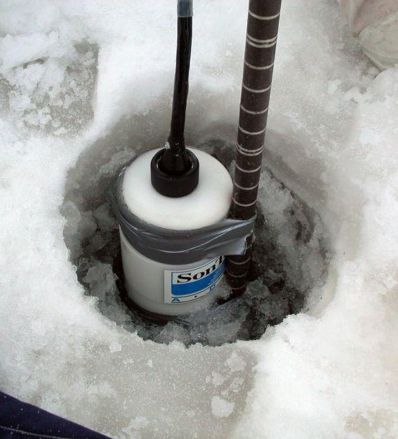
IMPROVEMENT OF DISCHARGE OBSERVATION ACCURACY IN ICE-COVERED RIVERS FOR RIVER MANAGEMENT
 in the Environment: Proceedings of the 16th IAHR International Symposium on Dunedin, New Zealand, 2nd 6th December 2002 International Association of Hydraulic Engineering and Research IMPROVEMENT OF DISCHARGE
B-1. Attachment B-1. Evaluation of AdH Model Simplifications in Conowingo Reservoir Sediment Transport Modeling
 Attachment B-1 Evaluation of AdH Model Simplifications in Conowingo Reservoir Sediment Transport Modeling 1 October 2012 Lower Susquehanna River Watershed Assessment Evaluation of AdH Model Simplifications
Experimental Evaluation of the Q-Liner Measurement Performance
 Experimental Evaluation of the Q-Liner Measurement Performance by Andrew Craig and Marian Muste to: Nalley, G.M., McVay, J., and Goodrich, R.D. Iowa Water Science Center U.S. Geological Survey 400 S. Clinton
Closed duct flows are full of fluid, have no free surface within, and are driven by a pressure gradient along the duct axis.
 OPEN CHANNEL FLOW Open channel flow is a flow of liquid, basically water in a conduit with a free surface. The open channel flows are driven by gravity alone, and the pressure gradient at the atmospheric
State Water Survey Division SURFACE WATER SECTION
 State Water Survey Division SURFACE WATER SECTION AT THE UNIVERSITY OF ILLINOIS Illinois Department of Energy and Natural Resources SWS Miscellaneous Publication 88 SEDIMENTATION OF POOL 19 ON THE MISSISSIPPI
Tom Glass, B.S. Whitman College Sarah Wasssmund, B.S. Humboldt State University Edgar Verdin, B.S. Portland State University Kelsi Lakey, B.S.
 Tom Glass, B.S. Whitman College Sarah Wasssmund, B.S. Humboldt State University Edgar Verdin, B.S. Portland State University Kelsi Lakey, B.S. Washington State University Overview 1. Background 2. History
Title: Flow of fluids
 Title: Flow of fluids Topics: Flow, continuity equation, mass flow rate Time: 90 Minutes Age: 12-15 hydrology, geography Differentiation: Guidelines, ICT support etc.: Use the applet. Use the maps geography.
8. Hydrometry - measurement and analysis
 130 8. Hydrometry - measurement and analysis 8.1 Definitions In English, the traditional word used to describe the measurement of water levels and flow volumes is Hydrography. That is ambiguous, for that
Physics and Physical Oceanography Data Report Analysis of Physical Oceanographic Data from Funk Island Bank, August 2004
 Physics and Physical Oceanography Data Report 2004-2 Analysis of Physical Oceanographic Data from Funk Island Bank, August 2004 Nicholas Record, Brad de Young, and Jack Foley 2004 Department of Physics
Development and application of demonstration MIKE 21C morphological model for a bend in Mekong River
 Development and application of demonstration MIKE 21C morphological model for a bend in Mekong River September 2015 0 Table of Contents 1. Introduction... 2 2. Data collection... 3 2.1 Additional data...
Fluid Mechanics Prof. S.K. Som Department of Mechanical Engineering Indian Institute of Technology, Kharagpur
 Fluid Mechanics Prof. S.K. Som Department of Mechanical Engineering Indian Institute of Technology, Kharagpur Lecture - 42 Flows with a Free Surface Part II Good morning. I welcome you to this session
Flowing Streams. Adapted from: Field Exercise: Stream Flow Dynamics & Sedimentation by Daniel J. Bisaccio and Donald L. Woodrow.
 Flowing Streams Stream Flow & Sedimentation Adapted from: Field Exercise: Stream Flow Dynamics & Sedimentation by Daniel J. Bisaccio and Donald L. Woodrow. http://www.beliot.edu Grade Level: Advanced Duration:
Remaining Capacity in Great Lakes Reservoirs
 US Army Corps of Engineers Detroit District Remaining Capacity in Great Lakes Reservoirs Storage Capacity Behind Great Lakes Dams Field Data and Modeling Motivation for project Project overview Data and
ES 105 Surface Processes I. Hydrologic cycle A. Distribution % in oceans 2. >3% surface water a. +99% surface water in glaciers b.
 ES 105 Surface Processes I. Hydrologic cycle A. Distribution 1. +97% in oceans 2. >3% surface water a. +99% surface water in glaciers b. >1/3% liquid, fresh water in streams and lakes~1/10,000 of water
Review of Anemometer Calibration Standards
 Review of Anemometer Calibration Standards Rachael V. Coquilla rvcoquilla@otechwind.com Otech Engineering, Inc., Davis, CA Anemometer calibration defines a relationship between the measured signals from
Engineering Hydrology (ECIV 4323) CHAPTER FOUR. Stream flow measurement. Instructors: Dr. Yunes Mogheir Dr. Ramadan Al Khatib
 CHAPTER FOUR. Stream flow measurement. Instructors: Dr. Yunes Mogheir Dr. Ramadan Al Khatib") Engineering Hydrology (ECIV 4323) CHAPTER FOUR Stream flow measurement Instructors: Dr. Yunes Mogheir Dr. Ramadan Al Khatib -١ 4.1 Introduction - Surface water hydrology deals with the movement of water
Engineering Hydrology (ECIV 4323) CHAPTER FOUR Stream flow measurement Instructors: Dr. Yunes Mogheir Dr. Ramadan Al Khatib -١ 4.1 Introduction - Surface water hydrology deals with the movement of water
Estimation of Bed Load Transport in River Omi, South Western Nigeria using Grain Size Distribution Data
 International Journal of Engineering and Technology Volume 2 No. 9, September, 2012 Estimation of Bed Load Transport in River Omi, South Western Nigeria using Grain Size Distribution Data A.A. Adegbola
Investigation of Flow Profile in Open Channels using CFD
 Investigation of Flow Profile in Open Channels using CFD B. K. Gandhi 1, H.K. Verma 2 and Boby Abraham 3 Abstract Accuracy of the efficiency measurement of a hydro-electric generating unit depends on the
MODERN TECHNOLOGIES IN HYDRO-METEOROLOGICAL INFORMATION SYSTEMS
 MODERN TECHNOLOGIES IN HYDRO-METEOROLOGICAL INFORMATION SYSTEMS MARK HEGGLI, INNOVATIVE HYDROLOGY CONSULTING METEOROLOGIST/HYDROLOGIST TO THE WORLD BANK AREAS OF TECHNOLOGY ADVANCEMENT RECENT TECHNOLOGY
This file is part of the following reference: Access to this file is available from:
 This file is part of the following reference: Page, Geoff () Mass Transport Evaluation using consolidated VHF Radar and Acoustic Doppler Current Profiler data. Masters (Research) thesis, James Cook University.
Appendix O. Sediment Transport Modelling Technical Memorandum
 Appendix O Sediment Transport Modelling Technical Memorandum w w w. b a i r d. c o m Baird o c e a n s engineering l a k e s design r i v e r s science w a t e r s h e d s construction Final Report Don
An Essential Requirement in CV Based Industrial Appliances.
 Measurement of Flow P M V Subbarao Professor Mechanical Engineering Department An Essential Requirement in CV Based Industrial Appliances. Mathematics of Flow Rate The Scalar Product of two vectors, namely
HIGH RESOLUTION SEDIMENT DYNAMICS IN SALT-WEDGE ESTUARIES
 HIGH RESOLUTION SEDIMENT DYNAMICS IN SALT-WEDGE ESTUARIES Philip Orton, Dept. of Environmental Science and Engineering, Oregon Graduate Institute Douglas Wilson, Dept. of Environmental Science and Engineering,
Rock Sizing for Waterway & Gully Chutes
 Rock Sizing for Waterway & Gully Chutes WATERWAY MANAGEMENT PRACTICES Photo 1 Rock-lined waterway chute Photo 2 Rock-lined gully chute 1. Introduction A waterway chute is a stabilised section of channel
By-Pass. This voltage is proportional to the liquid level (threewire potentiometer circuit). The resistance reading can
. The resistance reading can") " " ' " ' / The magnetic field which is in the ball or cylindrical floats actuates very small reed contacts through the wall of a guide tube and these pick up an uninterrupted measuring-circuit voltage
" " ' " ' / The magnetic field which is in the ball or cylindrical floats actuates very small reed contacts through the wall of a guide tube and these pick up an uninterrupted measuring-circuit voltage
Strategies for managing sediment in dams. Iwona Conlan Consultant to IKMP, MRCS
 Strategies for managing sediment in dams Iwona Conlan Consultant to IKMP, MRCS 1 Sediment trapping by dams Active storage capacity Dead storage coarse material (bed load) Fine materials (suspension) Francis
SonTek IQ - Principles of Operation
 SonTek IQ - Principles of Operation SonTek IQ - Principles of Operation This doument introduces the operating principles of the SonTek IQ acoustic Doppler current meter. It does not attempt to provide
Examination of Direct Discharge Measurement Data and Historic Daily Data for Selected Gages on the Middle Mississippi River,
 Examination of Direct Discharge Measurement Data and Historic Daily Data for Selected Gages on the Middle Mississippi River, 1861-2008 - Richard J. Huizinga, P.E. U.S. Geological Survey Missouri Water
ADDRESSING GEOMORPHIC AND HYDRAULIC CONTROLS IN OFF-CHANNEL HABITAT DESIGN
 ADDRESSING GEOMORPHIC AND HYDRAULIC CONTROLS IN OFF-CHANNEL HABITAT DESIGN Conor Shea - Hydrologist U.S. Fish and Wildlife Service Conservation Partnerships Program Arcata, CA Learning Objectives Examine
Contents. 1. Fieldsketching. 2. List of possible hypothesis. 3. Discharge. 4. Hydraulic Radius. 5. Valley Transect. 6. Sinuosity
 Contents 1. Fieldsketching 2. List of possible hypothesis 3. Discharge 4. Hydraulic Radius 5. Valley Transect 6. Sinuosity 7. Grain size of bedload Draw a field sketch using this grid River Discharge Task
Hydrodynamic model of St. Clair River with Telemac-2D Phase 2 report
 Hydrodynamic model of St. Clair River with Telemac-2D Phase 2 report Controlled Technical Report CHC-CTR-084 revision 1 March 2009 NRC-CHC has prepared this report for the International Joint Commission
Doppler echocardiography & Magnetic Resonance Imaging. Doppler echocardiography. History: - Langevin developed sonar.
 1 Doppler echocardiography & Magnetic Resonance Imaging History: - Langevin developed sonar. - 1940s development of pulse-echo. - 1950s development of mode A and B. - 1957 development of continuous wave
PART 2:! FLUVIAL HYDRAULICS" HYDROEUROPE
 PART 2:! FLUVIAL HYDRAULICS" HYDROEUROPE 2009 1 HYDROEUROPE 2009 2 About shear stress!! Extremely complex concept, can not be measured directly!! Computation is based on very primitive hypotheses that
FLOW MEASUREMENT. INC 102 Fundamental of Instrumentation and Process Control 2/2560
 FLOW MEASUREMENT INC 102 Fundamental of Instrumentation and Process Control 2/2560 TABLE OF CONTENTS A. INTRODUCTION B. LOCAL FLOW MEASUREMENT B.1 Particle Image Velocimetry (PIV) B.2 Laser doppler anemometry
The distortion observed in the bottom channel of Figure 1 can be predicted from the full transport equation, C t + u C. y D C. z, (1) x D C.
 x D C.") 1 8. Shear Dispersion. The transport models and concentration field solutions developed in previous sections assume that currents are spatially uniform, i.e. u f(,y,). However, spatial gradients of velocity,
1 8. Shear Dispersion. The transport models and concentration field solutions developed in previous sections assume that currents are spatially uniform, i.e. u f(,y,). However, spatial gradients of velocity,
Closed duct flows are full of fluid, have no free surface within, and are driven by a pressure gradient along the duct axis.
 OPEN CHANNEL FLOW Open channel flow is a flow of liquid, basically water in a conduit with a free surface. The open channel flows are driven by gravity alone, and the pressure gradient at the atmospheric
MaxDepth Aquatics, Inc.
 MaxDepth Aquatics, Inc. Bathymetry of Mirror Pond From Newport Bridge to Galveston Bridge Prepared for the City of Bend By Joseph Eilers & Benn Eilers MaxDepth Aquatics, Inc. Bend, OR June 2005 INTRODUCTION
Links to Syllabus. Core Unit 3 Skills Geographical Investigation Core Unit Fluvial processes 1.6 Fluvial adjustment
 River Study Links to Syllabus Core Unit 3 Skills Geographical Investigation Core Unit 2 1.5 Fluvial processes 1.6 Fluvial adjustment Mapping Photographs Sketching Statistical analysis Data collection Report
Tarbela Dam in Pakistan. Case study of reservoir sedimentation
 Tarbela Dam in Pakistan. HR Wallingford, Wallingford, UK Published in the proceedings of River Flow 2012, 5-7 September 2012 Abstract Reservoir sedimentation is a main concern in the Tarbela reservoir
Tanjung Priok GFPPEP. Presentation and discussion, 22 October 2009 PT. PLN (Persero) Jasa Enjiniring Office Jl. KS Tubun I/2 Petamburan, Jakarta
 Jasa Enjiniring Office Jl. KS Tubun I/2 Petamburan, Jakarta") Tanjung Priok GFPPEP Presentation and discussion, 22 October 2009 PT. PLN (Persero) Jasa Enjiniring Office Jl. KS Tubun I/2 Petamburan, Jakarta prepared by Department of Civil and Environmental Engineering
Tanjung Priok GFPPEP Presentation and discussion, 22 October 2009 PT. PLN (Persero) Jasa Enjiniring Office Jl. KS Tubun I/2 Petamburan, Jakarta prepared by Department of Civil and Environmental Engineering
Stream Restoration and Environmental River Mechanics. Objectives. Pierre Y. Julien. 1. Peligre Dam in Haiti (deforestation)
") Stream Restoration and Environmental River Mechanics Pierre Y. Julien Malaysia 2004 Objectives Brief overview of environmental river mechanics and stream restoration: 1. Typical problems in environmental
Stream Restoration and Environmental River Mechanics Pierre Y. Julien Malaysia 2004 Objectives Brief overview of environmental river mechanics and stream restoration: 1. Typical problems in environmental
SCOPE OF PRESENTATION STREAM DYNAMICS, CHANNEL RESTORATION PLANS, & SEDIMENT TRANSPORT ANALYSES IN RELATION TO RESTORATION PLANS
 DESIGN METHODS B: SEDIMENT TRANSPORT PROCESSES FOR STREAM RESTORATION DESIGN PETER KLINGEMAN OREGON STATE UNIVERSITY CIVIL ENGINEERING DEPT., CORVALLIS 2 ND ANNUAL NORTHWEST STREAM RESTORATION DESIGN SYMPOSIUM
Technical Review of Pak Beng Hydropower Project (1) Hydrology & Hydraulics and (2) Sediment Transport & River Morphology
 Hydrology & Hydraulics and (2) Sediment Transport & River Morphology") Technical Review of Pak Beng Hydropower Project (1) Hydrology & Hydraulics and (2) Sediment Transport & River Morphology The 2 nd Regional Stakeholder Forum The Pak Beng Hydropower Project 5 th May 2017
Technical Review of Pak Beng Hydropower Project (1) Hydrology & Hydraulics and (2) Sediment Transport & River Morphology The 2 nd Regional Stakeholder Forum The Pak Beng Hydropower Project 5 th May 2017
Appendix G.19 Hatch Report Pacific NorthWest LNG Lelu Island LNG Maintenance Dredging at the Materials Offloading Facility
 Appendix G.19 Hatch Report Pacific NorthWest LNG Lelu Island LNG Maintenance Dredging at the Materials Offloading Facility Project Memo H345670 To: Capt. David Kyle From: O. Sayao/L. Absalonsen December
7. Basics of Turbulent Flow Figure 1.
 1 7. Basics of Turbulent Flow Whether a flow is laminar or turbulent depends of the relative importance of fluid friction (viscosity) and flow inertia. The ratio of inertial to viscous forces is the Reynolds
THE EFFECT OF THICKNESS OF PILLAR IN THE CHANNEL BEND TO CHANGES THE COEFFICIENT OF SUPERELEVATION
 Journal Engineering Science and Technology Vol. 11, No. 5 (2016) 745-754 School Engineering, Taylor s University THE EFFECT OF THICKNESS OF PILLAR IN THE CHANNEL BEND TO CHANGES THE COEFFICIENT OF SUPERELEVATION
Regional Flash Flood Guidance and Early Warning System
 WMO Training for Trainers Workshop on Integrated approach to flash flood and flood risk management 24-28 October 2010 Kathmandu, Nepal Regional Flash Flood Guidance and Early Warning System Dr. W. E. Grabs
MS4 Flow and Precipitation Monitoring Project Progress Report
 MS4 Flow and Precipitation Monitoring Project Progress Report February 6, 2018 Dave Braun (Stone) and Joe Bartlett (FEA) 1 Stormwater-impaired streams in Chittenden and Franklin Counties Stream Allen Brook
Rock Sizing for Small Dam Spillways
 Rock Sizing for Small Dam Spillways STORMWATER MANAGEMENT PRACTICES Photo 1 Rock-lined spillway on a construction site sediment basin Photo 2 Rock-lined spillway on a small farm dam 1. Introduction A chute
Flow Field Investigation in a Rectangular Shallow Reservoir using UVP, LSPIV and numerical model
 Flow Field Investigation in a Rectangular Shallow Reservoir using UVP, LSPIV and numerical model S AMEH KANTOUSH, ERIK BOLLAERT, GIOVANNI DE CESARE, JEAN-LOUIS BOILLAT and ANTON SCHLEISS Ecole Polytechnique
1.061 / 1.61 Transport Processes in the Environment
 MIT OpenCourseWare http://ocw.mit.edu 1.061 / 1.61 Transport Processes in the Environment Fall 2008 For information about citing these materials or our Terms of Use, visit: http://ocw.mit.edu/terms. 6.
What is Relative Motion
 RELATIVE MOTION What is Relative Motion Strictly speaking all motion is relative to something. Usually that something is a reference point that is assumed to be at rest (i.e. the earth). Motion can be
Surface Water Short Study Guide
 Name: Class: Date: Surface Water Short Study Guide Multiple Choice Identify the letter of the choice that best completes the statement or answers the question. 1. The three ways in which a stream carries
By Richard L. Kiesling. Open-File Report 2016-XXX
 By Richard L. Kiesling Open-File Report 216-XXX U.S. Department of the Interior SALLY JEWELL, Secretary U.S. Geological Survey Suzette M. Kimball, Director U.S. Geological Survey, Reston, Virginia: 21X
Morphological Changes of Reach Two of the Nile River
 ICHE 2014, Hamburg - Lehfeldt & Kopmann (eds) - 2014 Bundesanstalt für Wasserbau ISBN 978-3-939230-32-8 Morphological Changes of Reach Two of the Nile River E. Said Egyptian Environmental Affairs Agency,
Surface Water and Stream Development
 Surface Water and Stream Development Surface Water The moment a raindrop falls to earth it begins its return to the sea. Once water reaches Earth s surface it may evaporate back into the atmosphere, soak
6. Continuous Release - Point Source
 1 6. Continuous Release - Point Source A scalar released continuously into a moving fluid and from a discrete point will form a plume that grows in the lateral dimension through diffusion and extends downstream
UC Berkeley Technical Completion Reports
 UC Berkeley Technical Completion Reports Title Hydrodynamics of shallow water habitats in the Sacramento-San Joaquin Delta Permalink https://escholarship.org/uc/item/3j77h7t6 Author Stacey, Mark T Publication
Erosion Surface Water. moving, transporting, and depositing sediment.
 + Erosion Surface Water moving, transporting, and depositing sediment. + Surface Water 2 Water from rainfall can hit Earth s surface and do a number of things: Slowly soak into the ground: Infiltration
Quantification of Bed-Load Transport on the Upper Mississippi River Using Multibeam Survey Data and Traditional Methods
 Quantification of Bed-Load Transport on the Upper Mississippi River Using Multibeam Survey Data and Traditional Methods by David D. Abraham and Thad Pratt PURPOSE: This Coastal and Hydraulics Engineering
Hydroacoustic survey and bathymetric map creation for Brant Lake, New York
 Hydroacoustic survey and bathymetric map creation for Brant Lake, New York Holly A. Waterfield CLM 1 INTRODUCTION Brant Lake is located in Warren County, New York, within the bounds of the Adirondack Park.
The River Restoration Centre therrc.co.uk. Understanding Fluvial Processes: supporting River Restoration. Dr Jenny Mant
 The River Restoration Centre therrc.co.uk Understanding Fluvial Processes: supporting River Restoration Dr Jenny Mant Jenny@therrc.co.uk Understanding your catchment Hydrology Energy associated with the
NATURAL RIVER. Karima Attia Nile Research Institute
 NATURAL RIVER CHARACTERISTICS Karima Attia Nile Research Institute NATURAL RIVER DEFINITION NATURAL RIVER DEFINITION Is natural stream of water that flows in channels with ih more or less defined banks.
GLG598 Surface Processes and Landform Evolution K. Whipple VERDE RIVER: FLOW MECHANICS, ROUGHNESS, AND SHEAR STRESS
 VERDE RIVER: FLOW MECHANICS, ROUGHNESS, AND SHEAR STRESS This lab will introduce you to some common field techniques and some general understanding of the geomorphic processes operating in a stream. The
Dan Miller + Kelly Burnett, Kelly Christiansen, Sharon Clarke, Lee Benda. GOAL Predict Channel Characteristics in Space and Time
 Broad-Scale Models Dan Miller + Kelly Burnett, Kelly Christiansen, Sharon Clarke, Lee Benda GOAL Predict Channel Characteristics in Space and Time Assess Potential for Fish Use and Productivity Assess
Physical modeling to guide river restoration projects: An Overview
 Physical modeling to guide river restoration projects: An Overview Scott Dusterhoff¹, Leonard Sklar², William Dietrich³, Frank Ligon¹, Yantao Cui¹, and Peter Downs¹ ¹Stillwater Sciences, 2855 Telegraph
Turbulence is a ubiquitous phenomenon in environmental fluid mechanics that dramatically affects flow structure and mixing.
 Turbulence is a ubiquitous phenomenon in environmental fluid mechanics that dramatically affects flow structure and mixing. Thus, it is very important to form both a conceptual understanding and a quantitative
Rock Sizing for Batter Chutes
 Rock Sizing for Batter Chutes STORMWATER MANAGEMENT PRACTICES Photo 1 Rock-lined batter chute Photo 2 Rock-lined batter chute 1. Introduction In the stormwater industry a chute is a steep drainage channel,
Lab #4 Similitude: The Kármán Vortex Street CEE 331 Fall 2004
 CEE 331 Lab 4 Page 1 of 6 Lab #4 Similitude: The Kármán Vortex Street CEE 331 Fall 2004 Safety The major safety hazard in this laboratory is a shock hazard. Given that you will be working with water and
River Current Resource Assessment and Characterization Considering Ice Conditions
 River Current Resource Assessment and Characterization Considering Ice Conditions 1 Gilles Boesch, Eng, M.Eng Marie-Hélène Briand, Eng, PhD Vadim Belotserkovsky International Conference on Ocean Energy,
Q = Flow of water in the River (cubic metres per second) y o = depth (metres) and is a function of. y o Q
 y o = depth (metres) and is a function of. y o Q") Peace River Ice and Joint Task Force September 2008 Martin Jasek River Ice Processes Open Water Hydraulics Q = Flow of water in the River (cubic metres per second) y o = depth (metres) and is a function
Peace River Ice and Joint Task Force September 2008 Martin Jasek River Ice Processes Open Water Hydraulics Q = Flow of water in the River (cubic metres per second) y o = depth (metres) and is a function
Running Water Earth - Chapter 16 Stan Hatfield Southwestern Illinois College
 Running Water Earth - Chapter 16 Stan Hatfield Southwestern Illinois College Hydrologic Cycle The hydrologic cycle is a summary of the circulation of Earth s water supply. Processes involved in the hydrologic
Hydraulics of bendway weirs
 River Basin Management IV 389 Hydraulics of bendway weirs C. Thornton 1, S. Abt 1, D. Baird 2 & R. Padilla 3 1 Colorado State University, Fort Collins, CO, USA 2 U.S. Bureau of Reclamation, Denver, CO,