Visit activities.carsondellosa.comsa.com for FREE activities!
|
|
|
- Gilbert Jones
- 5 years ago
- Views:
Transcription


1 5 8 Go to Visit activities.carsondellosa.comsa.com for FREE activities!
2 Table of Contents Table of Contents Introduction to the Teacher... 1 The Continents Close-Up... 2 Knowledge Check... 4 Map Follow-Up... 5 Explore... 6 The Continent of Antarctica Close-Up... 7 Outline Map of Antarctica... 8 Knowledge Check... 9 Map Follow-Up Map Follow-Up Explore Antarctica s Climate Close-Up Knowledge Check Antarctica s Ice Close-Up Knowledge Check Map Follow-Up Explore Antarctica s Plant and Animal Life Close-Up Knowledge Check Explore Early Exploration of Antarctica Close-Up Knowledge Check Explore The Race to the South Pole Close-Up Knowledge Check Ernest Shackleton Close-Up Knowledge Check Explore Later Exploration of Antarctica Close-Up Knowledge Check Explore Antarctica s Conservation Close-Up Knowledge Check Explore Scientific Research Close-Up Knowledge Check Governing Antarctica Close-Up Knowledge Check Map of National Claims to Antarctica Glossary Answer Keys Bibliography Photo Credits...C3 ii
3 Introduction to the Teacher Introduction to the Teacher Exploring Antarctica is one of the seven books in Mark Twain Media s Continents of the World Geography Series. The books are a valuable resource for any classroom. The series can be used to supplement the middle-school geography and social studies curriculum. The books support the goal of the National Geography Standards to prepare students for life in a global community by strengthening geographical literacy. The intent of the Continents of the World Geography Series is to help students better understand the world around them through the study of geography. Each book focuses on one continent. Information and facts are presented in an easy-to-read and easy-to-understand format that does not overwhelm the learner. The text presents only the most important information in small, organized bites to make it easier for students to comprehend. Vocabulary words are boldfaced in the text. For quick reference, these words are listed in a glossary at the back of the book. The series is specifically designed to facilitate planning for the diverse learning styles and skill levels of middle-school students. Each book is divided into several units. Each unit provides the teacher with alternative methods of instruction. Unit Features Close-Up introduces facts and information as a reading exercise. Knowledge Check assesses student understanding of the reading exercise using selected response and constructed response questioning strategies. Map Follow-Up provides opportunities for students to report information from a spatial perspective. Explore allows students to expand learning by participating in high-interest, hands-on activities. Glossary lists the boldfaced words with definitions. Online Resources Reluctant Reader Text: A modified version of the reading exercise pages can be downloaded from In the Search box, enter the produce code CD When you reach the Exploring Antarctica product page, click the icon for the Reluctant Reader Text download. The readability level of the text has been modified to facilitate struggling readers. The Flesch-Kincaid Readability formula, which is built into Microsoft Word, was used to determine the readability level. The formula calculates the number of words, sentences, and paragraphs in each selection to produce a reading level. Additional Resources Classroom Decoratives: The Seven Continents of the World and World Landmarks and Locales Topper bulletin board sets are available through Mark Twain Media/Carson- Dellosa Publishing LLC. These classroom decoratives visually reinforce geography lessons found in the Continents of the World Geography Series in an interesting and attention-grabbing way. 1
. More than 65 percent of the land area is in the Northern Hemisphere.")
4 The Continents: Close-Up The Continents: Close-Up A continent is a large landmass completely or mostly surrounded by water. The continents make up just over 29 percent of the earth s surface. They occupy about 57,100,000 square miles (148,000,000 sq. km). More than 65 percent of the land area is in the Northern Hemisphere. Landmasses Continents: Geographers list North America, South America, Europe, Asia, Africa, Australia, and Antarctica as continents. Subcontinents: Greenland and the India-Pakistan area are sometimes referred to as subcontinents. Microcontinents: Madagascar and the Seychelles Islands are often called microcontinents. Oceania: The island groups in the Pacific Ocean are called Oceania, but they are not considered a continent. How Were the Continents Formed? For many years, Europeans believed the continents were formed by a catastrophe or series of catastrophes, such as floods, earthquakes, and volcanoes. In 1596, a Dutch mapmaker, Abraham Ortelius, noted that the Americas eastern coasts and the western coasts of Europe and Africa looked as if they fit together. He proposed that once they had been joined but later were torn apart. Wegener s theoretical continent, Pangaea, during the Permian Age (white outlines indicate current continents) North America South America Europe Africa Antarctica The Continents Today Asia Australia Many years later, a German named Alfred Lothar Wegener published a book in which he explained his theory of the Continental Drift. Wegener, like Ortelius, believed that the earth originally had one supercontinent. He named it Pangaea from the Greek word meaning all lands. He believed that the large landmass was a lighter rock that floated on a heavier rock, like ice floats on water. Wegener s theory stated that the landmasses were still moving at a rate of about one yard each century. Wegener believed that Pangaea existed in the Permian Age. Then Pangaea slowly divided into two continents, 2
5 The Continents: Close-Up the upper part, Laurasia, and the lower, Gondwanaland, during the Triassic Age. By the Jurassic Age, the landmasses had moved into what we could recognize as the seven continents, although they were still located near each other. Eventually, the continents drifted to their present locations. Most scientists had been in agreement on the continental drift theory until researchers in the 1960s discovered several Landmasses during the Jurassic Age major mountain ranges on the ocean floor. These mountains suggested that the earth s crust consists of about 20 slabs or plates. These discoveries led to a new theory, Tectonics, which has become more popular. This theory suggests that these plates move a few inches each year. In some places the plates are moving apart, while in others, the plates are colliding or scraping against each other. Scientists also discovered that most volcanoes and earthquakes occur along the boundaries of the various plates. Recent earthquakes near Indonesia and Japan along the boundaries of the Indo-Australian, Eurasian, Philippine, and Pacific s have triggered devastating tsunamis that killed hundreds of thousands of people. Scientists hope that further study will help them increase their understanding of Earth s story. North American Eurasian Cocos Pacific Nazca Caribbean South American Arabian African Philippine Indo-Australian Pacific Scotia Antarctic The earth s crust consists of about 20 plates. tectonics suggest that these plates move a few inches each year. 3

6 Name: Date: Knowledge Check The Continents: Knowledge Check 1. Tectonics a. lower part of Pangaea 2. Laurasia b. Greek word meaning all lands 3. continent c. theory suggesting that plates move a few inches each 4. Gondwanaland year 5. Pangaea d. upper part of Pangaea e. a large landmass completely or mostly surrounded by water 6. He explained his theory of the Continental Drift. a. Abraham Ortelius b. Alfred Lothar Wegener c. Pangaea d. Laurasia Did You Know? Earth is thought to be the only planet in our solar system that has plate tectonics. 7. The earth s crust consists of plates. a. about 20 b. about 10 c. about 5 d. about 50 Explain how the movement of the earth s plates formed the seven continents. Use two details from the selection to support your answer. 4

7 The Continents: Map Follow-Up Exploring Antarctica Name: Date: Map Follow-Up Directions: There are seven continents and four oceans. Match the numbers on the map with the names of the continents and oceans. Pacific Ocean Arctic Ocean Atlantic Ocean Indian Ocean Africa Antarctica Asia Australia Europe North America South America Continents and Oceans


8 Name: Date: Explore: Antarctica Tortilla Map The Continents: Explore Materials blue construction paper (9 X 12 ) pencil tortilla 8 size black and red markers (fine point) scissors flour outline map of Antarctica glue salt water atlas mixing bowl white chalk plastic baggie Directions Day 1 Step 1: Mix 1 2 cup flour with 1 4 cup salt and 1 4 cup of water in mixing bowl to form a modeling dough. Step 2: Place dough in plastic baggie and set aside. Step 3: Cut Antarctica from outline map. Step 4: Trace and cut the outline from the tortilla. Do not discard the scraps, they can be used for other landforms. Step 5: Use the scraps to cut rough shapes of the southernmost parts of South America, South Africa, Australia, and New Zealand. Then cut out islands for Madagascar, Tasmania, and the Falkland Islands. Step 6: Place the cutouts on the blue construction paper. Refer to a map from the atlas to position the landforms correctly. Step 7: Glue the cutouts on the construction paper. Step 8: Mold the dough on the tortilla cutouts to create mountain ranges for the Transantarctic Mountains, Ellsworth Range, and Andes in South America. Let dry overnight. Day 2 Step 1: Color in the ice shelf with white chalk. Step 2: Label landforms, major oceans and seas, and mountain ranges with black marker. Step 3: Draw in the Antarctic Circle with the red marker and label it 66 South. 6


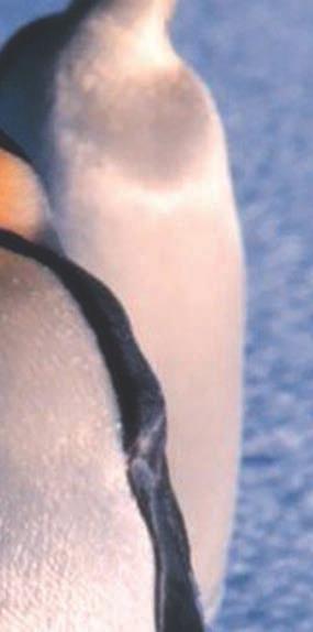
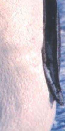
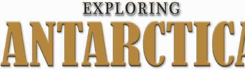
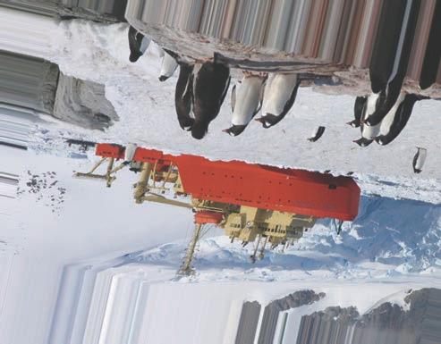
9 The Continent of Antarctica: Close-Up The Continent of Antarctica: Close-Up Antarctica is the world s southernmost continent. It surrounds the South Pole, which is the earth s most southern point. Its name means opposite the Arctic. The Arctic is the earth s northernmost region. Antarctica is approximately 600 miles (1,000 km) from South America, 2,500 miles (4,000 km) from Africa, and 1,600 miles (2,500 km) from Australia. Antarctica is the fifth-largest continent. It is larger than Australia or Europe. It is slightly less than one and one-half the size of the United States. The Transantarctic Mountains divide the continent into two regions, West Antarctica and East Antarctica. Because of Antarctica s severe weather, it is the only continent that does not have any permanent residents. Twenty-nine nations send scientists to several research stations located on the continent. The population of the research stations varies from about 5,000 in the summer to 1,000 in the winter. In recent years, tourists have begun to visit the continent. It is bitterly cold and almost completely covered by a huge sheet of ice. The ice is often two miles thick near the center of the continent; it then thins out toward the coastline. This sheet contains about 90 percent of the world s ice. Below the ice, the land area of Antarctica is about the size of Australia. Just over two percent of its area is exposed land. Much of the land that is exposed is mountaintops. As snow falls in the central region, it forces the ice sheet to move very slowly toward the coastlines. Often, when the ice reaches the water s edge, it floats, creating an ice shelf. Antarctica has several ice shelves. The two largest are the Ross Ice Shelf and the Ronne Ice Shelf. The Ross Ice Shelf is about 4,000 feet (1,219 m) thick in places. Often, pieces break off the ice shelves and form icebergs. Antarctica is surrounded by water, including the southern parts of the Atlantic, Pacific, and Indian Oceans. Sometimes, the waters off Antarctica s coast are referred to as the Antarctic Ocean or the Southern Ocean. Also along its coasts are the Amundsen, Ross, and Weddell Seas. Antarctica is the world s highest continent. Its average elevation is over 6,500 feet (2,000 m) above sea level. Its highest point is Vinson Massif, which is 16,864 feet (5,140 m) high; its lowest point is on the Southern Ocean at zero feet (sea level). Ice covering Lake Fryxell in the Transantarctic Mountains comes from the melting of the Canada Glacier. 7
10 Name: The Continent of Antarctica: Outline Map of Antarctica Date: Outline Map of Antarctica Western Hemisphere Eastern Hemisphere Black outlines indicate coastline covered by ice shelves. 8

11 Name: Date: The Continent of Antarctica: Knowledge Check Knowledge Check 1. Antarctica a. ice reaching the water s edge and floating 2. ice shelf creates this 3. Transantarctic Mountains b. the waters off Antarctica s coast are sometimes 4. Southern Ocean called this 5. Vinson Massif c. opposite the Arctic d. Antarctica s highest point e. divides Antarctica into two regions 6. Which continent is closest to Antarctica? a. North America b. South America c. Africa d. Australia 7. What is the population of Antarctica in the summer? a. about 10,000 b. about 50 c. about 5,000 d. about 100 Did You Know? Scientists recorded the world s coldest temperature, degrees below zero (Fahrenheit), in Antarctica. Explain the difference between an ice shelf and an iceberg. Use details from the selection to support your answer. 9
12 Name: Date: The Continent of Antarctica: Map Follow-Up Map Follow-Up Directions: Match the names below with the numbers on the map. Draw the mountain symbol on the map to indicate the location of the Transantarctic Mountains. Label the mountains. Antarctic Peninsula Eastern Antarctica Western Antarctica Ronne Ice Shelf Ross Ice Shelf South Pole Features of Antarctica Western Hemisphere Eastern Hemisphere 4 10

13 Name: Date: The Continent of Antarctica: Map Follow-Up Map Follow-Up Directions: Match the names below with the numbers on the map. Weddle Sea Southern Ocean Atlantic Ocean Bellingshausen Sea Amundsen Sea Pacific Ocean Ross Sea Antarctica s Oceans and Seas Western Hemisphere Eastern Hemisphere 4 11
14 Answer Keys Answer Keys The Continents Knowledge Check (p. 4) 1. c 2. d 3. e 4. a 5. b 6. b 7. a The earth s crust consists of 20 plates. tectonics suggest that these plates move a few inches each year. Over time the plates have moved to their present positions. Map Follow Up (p. 5) 1. North America 2. South America 3. Europe 4. Africa 5. Antarctica 6. Asia 7. Australia 8. Arctic Ocean 9. Atlantic Ocean 10. Indian Ocean 11. Pacific Ocean The Continent of Antarctica Knowledge Check (p. 9) 1. c 2. a 3. e 4. b 5. d 6. b 7. c An iceberg is smaller than an ice shelf. An iceberg is a floating piece of ice that is not connected to anything else. An ice shelf is still attached to land. Actually, the ice that breaks off the ice shelf is considered an iceberg. Map Follow Up (p. 10) 1. Antarctic Peninsula 2. Western Antarctica 3. South Pole 4. Eastern Antarctica 5. Ross Ice Shelf 6. Ronne Ice Shelf Map Follow (p. 11) 1. Weddle Sea 2. Amundsen Sea 3. Ross Sea 4. Southern Ocean 5. Bellingshausen Sea 6. Atlantic Ocean 7. Pacific Ocean Antarctica s Climate Knowledge Check (p. 14) 1. a 2. e 3. d 4. b 5. c 6. a 7. d The ozone layer protects the earth from harmful ultraviolet radiation. Scientists fear that the additional radiation will change Antarctica s ecological system and may affect the food chain of the continent s fish and other marine life. Antarctica s Ice Knowledge Check (p. 16) 1. c 2. e 3. a 4. b 5. d 6. b 7. c The Lambert Glacier is the largest glacier. It is 248 miles long. The Shirase is the fastest-moving glacier. It travels just over one mile per year. Map Follow Up (p. 17) 1. Antarctic Peninsula 2. Larsen Ice Shelf 3. Ronne-Filchner Ice Shelf 4. Ross Ice Shelf 5. West Ice Shelf 6. Amery Ice Shelf Antarctica s Plant and Animal Life Knowledge Check (p. 20) 1. d 2. e 3. b 4. a 5. c 6. b 7. c Krill is important in the diet of the rest of the animal life in the region. Antarctica s fish, birds, seals, and whales all feed on krill. It is often considered to be Antarctica s major resource to the rest of the world. Early Exploration of Antarctica Knowledge Check (p. 23) 1. d 2. c 3. a 4. e 5. b 6. d 7. b Aristotle and Ptolemy both believed that there was a huge unknown land in the Southern Hemisphere. Aristotle named it Antarktikos, and Ptolemy named it Terra Australis Incognita. The Race to the South Pole Knowledge Check (p. 26) 1. e 2. c 3. a 4. b 5. d 6. a 7. a Answers will vary. More than likely, Amunden wished him the best of luck based on the letter he left for him. 44
Exploring North America
 Exploring North America Continents of the World Geography Series Author: Michael Kramme, Ph.D. Consultants: Schyrlet Cameron and Carolyn Craig Editors: Mary Dieterich and Sarah M. Anderson COPYRIGHT 2012
Exploring Europe. Continents of the World Geography Series
 Exploring Europe Continents of the World Geography Series Author: Michael Kramme, Ph.D. Consultants: Schyrlet Cameron and Carolyn Craig Editors: Mary Dieterich and Sarah M. Anderson COPYRIGHT 2012 Mark
Visit activities.carsondellosa.com for FREE activities!
 Grades 5 8 CD-404170 Go to carsondellosa.com for a lower-level version of every reading passage. Visit activities.carsondellosa.com for FREE activities! Table of Contents Table of Contents Introduction
Visit activities.carsondellosa.com for FREE activities!
 5 8 Go to Visit activities.carsondellosa.com for FREE activities! Table of Contents Table of Contents Introduction to the Teacher... 1 The Continents Close-Up... 2 Knowledge Check... 4 Map Follow-Up...
Pangaea to the Present Lesson #2
 Pangaea to the Present Lesson #2 The Earth is a dynamic or constantly changing planet. The thin, fragile plates slide very slowly on the mantle's upper layer. This sliding of the plates is caused by the
The Continental Drift Hypothesis
 Lesson 1 The Continental Drift Hypothesis Scan Lesson 1. Then write three questions that you have about continental drift in your Science Journal. Try to answer your questions as you read. Pangaea Define
Sample file. Teacher Guide ... Before You Teach. Our resource has been created for ease of use by both TEACHERS and STUDENTS alike.
 8 7 9 10 12 13 14 11 Introduction T his resource provides ready-to-use information and activities for remedial students in grades five to eight. Written to grade and using simplified language and vocabulary,
Chapter 1 Section 2. Land, Water, and Climate
 Chapter 1 Section 2 Land, Water, and Climate Vocabulary 1. Landforms- natural features of the Earth s land surface 2. Elevation- height above sea level 3. Relief- changes in height 4. Core- most inner
The shape and geology of the continents suggests that they were once joined together.
 Drifting Continents Section 17.1 Drifting Continents The shape and geology of the continents suggests that they were once joined together. Review Vocabulary hypothesis: testable explanation of a situation
Drifting Continents. Key Concepts
 Plate Tectonics Section Summary Key Concepts What was Alfred Wegener s hypothesis about the continents? What evidence supported Wegener s hypothesis? Why was Alfred Wegener s theory rejected by most scientists
In the space provided, write the letter of the definition that best matches the term or phrase.
 Skills Worksheet Directed Reading Section: The Changing Continents 1. What is the result of slow movements of tectonic plates? RESHAPING EARTH S CRUST In the space provided, write the letter of the definition
2 Earth s Changing Continents
 CHAPTER 9 SECTION The History of Life on Earth 2 Earth s Changing Continents California Science Standards 7.4.a, 7.4.e, 7.4.f BEFORE YOU READ After you read this section, you should be able to answer these
Visit us at...
 Thanks for your purchase. We hope you are pleased. We think you might like the website that we are working on. You will find websites that go along with your unit and word wall cards. We hope you enjoy.
Plate Tectonics. These icons indicate that teacher s notes or useful web addresses are available in the Notes Page.
 Plate Tectonics These icons indicate that teacher s notes or useful web addresses are available in the Notes Page. This icon indicates the slide contains activities created in Flash. These activities are
The Continental Drift Hypothesis
 CHAPTER 7 Plate Tectonics LESSON 1 The Continental Drift Hypothesis What do you think? Read the two statements below and decide whether you agree or disagree with them. Place an A in the Before column
12. The diagram below shows the collision of an oceanic plate and a continental plate.
 Review 1. Base your answer to the following question on the cross section below, which shows the boundary between two lithospheric plates. Point X is a location in the continental lithosphere. The depth
THE EARTH S RELIEF SOCIAL SCIENCES 1º ESO
 THE EARTH S RELIEF SOCIAL SCIENCES 1º ESO 1. THE STRUCTURE OF THE EARTH The Earth is divided into layers: The crust is the surface layer. It is a thin, solid layer made of rock. The Earth s crust has a
Name Class Date. In the space provided, write the letter of the definition that best matches the term or phrase.
 Skills Worksheet Directed Reading Section: The Changing Continents 1. What is the result of slow movements of tectonic plates? RESHAPING EARTH S CRUST In the space provided, write the letter of the definition
The structure of the Earth and how its motion creates the seasons. The landforms of the earth and the forces that shape the land.
 The structure of the Earth and how its motion creates the seasons. The landforms of the earth and the forces that shape the land. The role of wind and water in creating climate. The different climate and
Plate Tectonics CHAPTER 17
 Plate Tectonics CHAPTER 17 Layers of the Earth A. Crust- solid, 5-70 km thick Moho Two Types of Crust: Oceanic- ocean floor, more dense then because of more iron Continental-dry land (mostly silicates
Plate Tectonics Introduction
 Name Block Plate Tectonics Introduction Go to the following site: http://www.learner.org/interactives/dynamicearth/index.html On the top of the screen are different tabs, click on each section as listed
Module 7: Plate Tectonics and Earth's Structure Topic 2 Content: Plates of the World Presentation Notes
 There are several large plates and several smaller plates that comprise the Earth s crust. How do these plates interact with the bordering plates? Review each of the world s plates and the landforms that
The continent of Antarctica Resource N1
 The continent of Antarctica Resource N1 Prepared by Gillian Bunting Mapping and Geographic Information Centre, British Antarctic Survey February 1999 Equal area projection map of the world Resource N2
September 2, Aims: Agenda. SWBAT explain Alfred Wegener s hypothesis of Continental Drift.
 September 2, 2016 Aims: SWBAT explain Alfred Wegener s hypothesis of Continental Drift. Agenda 1. Do Now 2. Class Notes 3. Guided Practice 4. Independent Practice 5. Practicing our AIMS: Homework: EI.6
Science in the News - Plate Tectonics 1. Story
 Science in the News - Plate Tectonics 1. Story Scientists who study the Earth tell us the continents and ocean floors are always moving. This movement sometimes can be violent, causing death and destruction.
What is PLATE TECTONICS?
 What is PLATE TECTONICS? It s the theory that states: The surface of the Earth is not fixed and eternal, but it is in constant everchanging motion. If you look at a map of the world, you may notice that
Evidence for Continental Drift and The Theory of Plate Tectonics
 Evidence for Continental Drift and The Theory of Plate Tectonics Did you know that the coal that is mined in Pennsylvania was actually formed from tropical plant life near the Equator? How did it travel
TO GO TO ANY OF THE PAGES LISTED BELOW, CLICK ON ITS TITLE
 TO GO TO ANY OF THE PAGES LISTED BELOW, CLICK ON ITS TITLE CHAPTER 6 Plate Tectonics 1 6-1 What is continental drift? 2 6-2 Why is the seafloor spreading? 3 6-3 What evidence supports seafloor spreading?
Module 7: Plate Tectonics and Earth's Structure Topic 2 Content: Major Events in the History of Plate Tectonics Theory Notes
 Introduction Like most scientific theories, the Theory of Plate Tectonics did not come about overnight, or even over one decade. It was a discovery many centuries in the making. In this interactivity,
Module 7, Lesson 1 Water world
 Module 7, Lesson 1 Water world Imagine that the year is 2100. Scientists have determined that the rapidly warming climate of the earth will cause the ice sheets of Antarctica to break apart and melt at
Plate Tectonics. And Plate Boundaries HORRAH!!!
 Plate Tectonics And Plate Boundaries HORRAH!!! History of Plate Tectonics and Alfred Wegener In the 1500 s, a Dutch mapmaker, Abraham Ortelius noticed the continents across the Atlantic Ocean fit like
I. Earth s Layers a. Crust: Earth s outside layer. Made of mostly rock. i. Continental: er; made of mostly granite, forms the continents and shallow
 I. Earth s Layers a. Crust: Earth s outside layer. Made of mostly rock. i. Continental: er; made of mostly granite, forms the continents and shallow sea beds, floats! ii. Oceanic: er; dense rock such as
Crustal Activity. Plate Tectonics - Plates - Lithosphere - Asthenosphere - Earth s surface consists of a major plates and some minor ones
 Name: Date: Period: Tectonics The Physical Setting: Earth Science CLASS NOTES Tectonics - s - Lithosphere - Asthenosphere - Earth s surface consists of a major plates and some minor ones The plates are
From VOA Learning English, this is SCIENCE IN THE NEWS, in Special English. I m Kelly Jean Kelly.
 From VOA Learning English, this is SCIENCE IN THE NEWS, in Special English. I m Kelly Jean Kelly. And I m Christopher Cruise. Scientists who study the Earth tell us the continents and ocean floors are
Module 7, Lesson 1 Water world
 Module 7, Lesson 1 Water world Imagine that the year is 2100. Scientists have determined that the rapidly warming climate of the earth will cause the ice sheets of Antarctica to break apart and melt at
Earth Movement and Resultant Landforms
 Earth Movement and Resultant Landforms Structure of the Earth Lithosphere : earth s crust Asthenosphere : upper mantle zone where material is near its melting point & acts almost like liquid (appprox.
UNIT SIX: Earth s Structure. Chapter 18 Earth s History and Rocks Chapter 19 Changing Earth Chapter 20 Earthquakes and Volcanoes
 UNIT SIX: Earth s Structure Chapter 18 Earth s History and Rocks Chapter 19 Changing Earth Chapter 20 Earthquakes and Volcanoes Chapter Nineteen: Changing Earth 19.1 Inside Earth 19.2 Plate Tectonics
SCIENCE IN THE NEWS Plate Tectonics
 SCIENCE IN THE NEWS Plate Tectonics From VOA Learning English, this is Science in the News. I m Anna Matteo. And I m Christopher Cruise. Scientists who study the Earth tell us the continents and ocean
Sample Pages from. Leveled Texts for Science: Earth and Space Science
 Sample Pages from Leveled Texts for Science: Earth and Space Science The following sample pages are included in this download: Table of Contents Readability Chart Sample Passage For correlations to Common
Exploring Geography. Chapter 1
 Exploring Geography Chapter 1 The Study of Geography Geography is the study of where people, places, and things are located and how they relate to each other. Greek meaning writing about or describing
Chapter 2 Planet Earth
 Chapter 2 Planet Earth Section Notes Earth and the Sun s Energy Water on Earth The Land Close-up The Water Cycle World Almanac Major Eruptions in the Ring of Fire Quick Facts Chapter 2 Visual Summary Video
Define plate tectonics. Explain what the word tectonic means as part of your definition.
 Lesson 3 The Theory of Tectonics LA.7.2.2.3, MA.6.A.3.6, SC.7.E.6.4, SC.7.E.6.5, SC.7.E.6.7, SC.7.N.1.1, SC.7.N.1.5, SC.7.N.1.6 Skim or scan the heading, boldfaced words, and pictures in the lesson. Identify
Earth s Interior. Use Target Reading Skills. Exploring Inside Earth
 Plate Tectonics Name Date Class Earth s Interior This section explains how scientists learn about Earth s interior. The section also describes the layers that make up Earth and explains why Earth acts
Modern scientific theory relies on the collection of supporting data that is observable, measurable and repeatable.
 Modern scientific theory relies on the collection of supporting data that is observable, measurable and repeatable. Primary data is data collected by the observer. In the picture, the rock in the geologist
Earth s Changing Continents
 2 What You Will Learn Earth s continents have moved around Earth s surface throughout Earth s history and have only recently arrived at their current locations. Rocks and fossils provide evidence of continental
The Moving Story of Plate Tectonics
 08 January 2012 MP3 at voaspecialenglish.com The Moving Story of Plate Tectonics AP Smoke and ash from Italy's Mount Etna volcano last week FAITH LAPIDUS: This is SCIENCE IN THE NEWS in VOA Special English.
Do Now: Vocabulary: Objectives. Vocabulary: 1/5/2016. Wegener? (Can they move?) the idea that continents have moved over time?
 the idea that continents have moved over time?") Do Now: 1. Who was Alfred Wegener? 2. What was Pangaea? 3. Are continents fixed? (Can they move?) 4. What evidence supports the idea that continents have moved over time? Objectives What evidence suggests
Do Now: 1. Who was Alfred Wegener? 2. What was Pangaea? 3. Are continents fixed? (Can they move?) 4. What evidence supports the idea that continents have moved over time? Objectives What evidence suggests
Chapter 2 Earth s Interlocking Systems pg The Earth and Its Forces pg
 Chapter 2 Earth s Interlocking Systems pg. 24 55 2 1 The Earth and Its Forces pg. 27 33 Connecting to Your World and Internal Forces Shaping the Earth The Earth is unique in the solar system because it
Social Studies. Chapter 2 Canada s Physical Landscape
 Social Studies Chapter 2 Canada s Physical Landscape Introduction Canada s geography its landforms and climate - has a great impact on Canadians sense of identity. Planet Earth The earth is divided into
Chapter 1: The Geography of the Western Hemisphere
 Chapter 1: The Geography of the Western Hemisphere Chapter 1, Lesson 1: The Changing Earth Objectives: - You will be able to identify the major natural events that cause the earth to change. - You will
NASA Images of Antarctica and the Arctic covered in both land and sea ice
 ICE SHELVES ACTIVITY 1: DECODING THE ROLE OF ANTARCTIC ICE IN GLOBAL CLIMATE Ice Shelves play a critical role in Antarctica, serving as a buffer between the ocean and the continental ice sheet covering
Plate Tectonics Investigation
 Plate Tectonics Investigation Exploration A Look at a watch or clock with a second hand in the classroom. 1. What evidence of movement do you see on the clock face? 2. What other movement do you know takes
Chapter 2, Section 1 Planet Earth
 Chapter 2, Section 1 Planet Earth (Pages 33 36) Setting a Purpose for Reading Think about these questions as you read: Where is Earth located in our solar system? How is Earth shaped? What is Earth s structure?
What type of land feature is located at Point A? A Cliff B Delta C Mountain D Valley
 1 What type of land feature is located at Point A? A Cliff B Delta C Mountain D Valley Alfred Wegener s theory of continental drift was 2 not accepted by scientists when the theory was first proposed.
The Crust How does the crust move?
 Lesson Plan 3 The Crust Introduction Discuss with the aid of a world map Have the Earth s land areas always looked the same? Can you show any evidence if you think the position of continents has changed?
Concept Map #1. Proposed by. Broke up to form. Evidence includes. Young Rx in center
 Name Date Concept Map #1 Combines theory of Proposed by Started as crust is Broke up to form at at Evidence includes Evidence includes which creates deep Continental Drift Continents Created Destroyed
PLATE TECTONICS. SECTION 17.1 Drifting Continents
 Date Period Name PLATE TECTONICS SECTION.1 Drifting Continents In your textbook, read about continental drift. Circle the letter of the choice that best completes each statement. 1. Early mapmakers thought
Map Skills Lesson 1. Materials: maps, pencils, Lesson 1 Worksheet, strips of paper, grid paper
 Map Skills Lesson 1 Use cardinal directions, map grids, scales, and titles to locate places on a map. Interpret a map using information from its title, compass rose, scale, and legend. Vocabulary: map,
Unit 3 Target 1. I can explain the evidence for continental drift.
 Unit 3 Target 1 I can explain the evidence for continental drift. Question? Look at the map below, do you see any puzzle pieces, if so where would they fit? Copyright 2010 Ryan P. Murphy Possible Answers!
Plate Tectonic Theory
 Have you ever looked at a world map and noticed the shapes of the continents? Have you ever noticed how some continents appear to fit together like the pieces of a jigsaw puzzle? Why do you think this
WHAT IS THE EARTH MADE OF? LITHOSPHERE AND HYDROSPHERE
 UNIT 8 WHAT IS THE EARTH MADE OF? LITHOSPHERE AND HYDROSPHERE TABLE OF CONTENTS 1 THE STRUCTURE OF THE EARTH... 2 2 THE FORMATION OF THE RELIEF: INTERNAL AND EXTERNAL FORCES.... 2 2.1 Internal forces:
Name Date Class. Plate Tectonics
 Chapter Review Plate Tectonics Part A. Vocabulary Review Directions: Write the term that matches each description below in the spaces provided. Then unscramble the letters in the boxes to reveal the mystery
Plate Tectonics. The Theory of Plate Tectonics. The Plate Tectonics Theory. 62 Plate Tectonics Reading Essentials
 CHAPTER 4 LESSON 3 Tectonics The Theory of Tectonics Key Concepts What is the theory of plate tectonics? What are the three types of plate boundaries? Why do tectonic plates move? What do you think? Read
Directed Reading. Section: The Theory of Plate Tectonics. to the development of plate tectonics, developed? HOW CONTINENTS MOVE
 Skills Worksheet Directed Reading Section: The Theory of Plate Tectonics 1. The theory that explains why and how continents move is called. 2. By what time period was evidence supporting continental drift,
Understanding Projections
 GEOGRAPHY SKILLS 1 Understanding Projections The earth is a sphere and is best shown as a globe. For books and posters, though, the earth has to be represented as a flat object. To do this, mapmakers create
Plate Tectonics Practice Test
 Plate Tectonics Practice Test 1. What is the main idea Alfred Wegner proposed in the Theory of Continental Drift that he published in 1915? a. The continents float on a liquid layer that allows them to
Chapter Nineteen: Changing Earth
 Chapter Nineteen: Changing Earth 19.1 Inside Earth 19.2 Plate Tectonics 19.3 Plate Boundaries 19.4 Metamorphic Rocks 19.2 Learning Goals Discuss hypotheses which ultimately led to plate tectonics theory.
Unit 4 Lesson 2 Plate Tectonics. Copyright Houghton Mifflin Harcourt Publishing Company
 Puzzling Evidence What evidence suggests that continents move? In the late 1800s, Alfred Wegener proposed his hypothesis of continental drift. According to this hypothesis, the continents once formed a
Chapter 12. Thermal Energy Transfer Drives Plate tectonics
 Chapter 12 Thermal Energy Transfer Drives Plate tectonics What is thermal energy Thermal energy with respect to plate tectonics is energy of molten rock that is constantly moving below your feet. Below
Continental Drift and Plate Tectonics
 Continental Drift and Plate Tectonics As you work through the following slides of information, make sure you use the information to complete the tasks on your worksheet. By the end of the PDF, you should
Ch 9.1 Notes. Objective: Be able to explain the theory of plate tectonics and be able to explain evidence that supports it.
 Ch 9.1 Notes Objective: Be able to explain the theory of plate tectonics and be able to explain evidence that supports it. Pangaea Alfred Wegener proposed that land on Earth formed a single, huge landmass.
The Puzzling Plates Part I. Follow the steps below while taking notes in your science notebook.
 Procedure Follow the steps below while taking notes in your science notebook. 1. On the table is a pile of cardboard puzzle pieces. Work with your team to assemble the puzzle. The edges of the completed
The Indian Ocean. Copyright 2010 LessonSnips
 The Indian Ocean One of the five major geographic divisions of the world s ocean, the Indian Ocean is located in the Eastern Hemisphere. The Indian Ocean is bounded by three continents: Africa to the west,
Plate Tectonic Vocabulary Chapter 10 Pages
 Name: Period: Plate Tectonic Vocabulary Chapter 10 Pages 239-260 Vocabulary Word What is this? What are some examples? What does it look like? (draw a picture or diagram) Continental drift Mid-ocean ridge
Section 1: Continental Drift
 Plate Tectonics Section 1 Section 1: Continental Drift Preview Key Ideas Wegener s Hypothesis Sea-Floor Spreading Paleomagnetism Wegener Redeemed Continental Drift (Pangaea) Plate Tectonics Section 1 Key
Week: 4 5 Dates: 9/8 9/12 Unit: Plate Tectonics
 clementaged.weebly.com Name: ODD Period: Week: 4 5 Dates: 9/8 9/12 Unit: Plate Tectonics Monday Tuesday Wednesday Thursday Friday 7 No School 8 E 9 O *Vocabulary *Frayer Vocab *Continental Drift Notes
Unit: 4 Plate Tectonics LT 4.1 Earth s Interior: I can draw and interpret models of the interior of the earth.
 Unit: 4 Plate Tectonics LT 4.1 Earth s Interior: I can draw and interpret models of the interior of the earth. 1. Can you draw the 3-layer model and the 5-layer model of the Earth? #1 Yes I can: 2. Can
Earth s Plates, Part 1: What Are They, Where Are They and What Do They Do?
 Earth s Plates, Part 1: What Are They, Where Are They and What Do They Do? A scientist named Alfred Wegener believed that, at one time, all of the continents were one landmass. Although he had no real
Mr. Petersen EARTH SCIENCE LESSON th Grade
 Teacher Prep Materials and stuff needed: Cutout Glue Sticks or Rice Glue PowerPoint Plate Tectonics Set up the students for taking notes. Model for the students using the camera projector. Use the Prentice
Seafloor spreading is a geologic process in which tectonic plates large slabs of Earth's lithosphere split apart from each other.
 This website would like to remind you: Your browser (Apple Safari 4) is out of date. Update your browser for more security, comfort and the best experience on this site. Encyclopedic Entry seafloor spreading
Directed Reading. Section: Continental Drift. years ago? WEGENER S HYPOTHESIS
 Skills Worksheet Directed Reading Section: Continental Drift 1. Who obtained new information about the continents and their coastlines 400 years ago? 2. What did people notice when they studied new world
Ch 17 Plate Tectonics Big Idea: Most geologic activity occurs at the boundaries between plates.
 Ch 17 Plate Tectonics Big Idea: Most geologic activity occurs at the boundaries between plates. 17.1 Drifting Continents 17.2 Seafloor Spreading 17.3 Plate Boundaries 17.4 Causes of Plate Motions Learning
THE DISCOVERY OF A NEW CONTINENT ON PLANET EARTH: Zealandia
 THE DISCOVERY OF A NEW CONTINENT ON PLANET EARTH: Zealandia By Vashaanth Gowri-Kriszyk, Science Editor February 2017 Recently, in February 2017, scientists have discovered a new continent called Zealandia,
* If occurs, fossils that formed in shallow water may be found in water. Subsidence mean the crust is.
 Name Notes: Topic 5B Topic 5B: The Dynamic Crust A. What evidence exists that proves the Earth s Crust is and has moved? Earth Science 1. Tilted, folded or faulted strata Strata is a term that refers to.
On the Move: Continental Drift and Plate Tectonic
 On the Move: Continental Drift and Plate Tectonic By Jim Cornish (1) Have you noticed that South America and Africa look like they could fit together like pieces in a jigsaw puzzle? If you have, you are
Antarctica s Climate Secrets Poster 5. Decoding Antarctica s Climate History
 Decoding Antarctica s Climate History Decoding Antarctica s Climate History Scientists are working to uncover and decode Antarctica s climate secrets. In order to piece together a complete story, they
Student Packet session # 11 Name: Date:
 Student Packet session # 11 Name: Date: Student Exploration: Building Pangaea Big Idea 6: Earth Structures Benchmark: SC.7.E.6.4 Explain and give examples of how physical evidence supports scientific theories
Plate Tectonics. 8 th grade
 Plate Tectonics 8 th grade Not in notes- look at picture If you look at a map of Earth s surface, you can see that the edges of some continents look as though they could fit together like a puzzle Wegener
Major Domain of the Earth
 Major Domain of the Earth The surface of the earth is a complex zone in which three main components of the environment meet, overlap and interact. The solid portion of the earth on which we live is called
The surface of the ocean floor is as varied as the land. The five major oceans, from largest to smallest, are
 11.1 Ocean Basins The surface of the ocean floor is as varied as the land. The five major oceans, from largest to smallest, are w the Pacific w the Atlantic w the Indian w the Southern w the Arctic The
Module 2 Educator s Guide Overview
 Module 2 Educator s Guide Overview Water, water almost everywhere? Module Overview The presence of water in solid, liquid, and gaseous forms is one of the primary factors that distinguishes Earth from
Earth s Tectonic Plates
 Earth s Tectonic Plates Lesson 3 The Earth is known as the blue planet because two-thirds of its surface lies beneath the ocean. Before the 19 th century most people thought the ocean floors were flat
On Earth, the land is broken into large pieces. These pieces are separated by large bodies of water called oceans. We call some of these pieces of
 The 7 Continents On Earth, the land is broken into large pieces. These pieces are separated by large bodies of water called oceans. We call some of these pieces of land continents. A continent is an area
The Theory of Plate Tectonics Name
 The Theory of Plate Tectonics Name Intermediate Version Block CHAPTER 1 INTRODUCTION 1. The scientific theory that describes the movement of Earth s outer layer is called. CHAPTER 2 CONTINENTAL DRIFT:
Energy and Seasons A B1. 9. Which graph best represents the general relationship between latitude and average surface temperature?
 Energy and Seasons A B1 1. Which type of surface absorbs the greatest amount of electromagnetic energy from the Sun? (1) smooth, shiny, and light colored (2) smooth, shiny, and dark colored (3) rough,
Discusssion / Activity 1 Suggested Answers. INSPECTION COPY for schools only
 Earth Structure Discusssion / Activity 1 Suggested Answers 1. Clearly label the diagram to show the main layers of the Earth. 2. What is the lithosphere? The lithosphere is the crust, plus a thin part
History of Plate Tectonics
 History of Plate Tectonics Continental Drift The hypothesis of how the continents were all once together and then split apart and drifted to their current location. classroomatsea.net Early Thoughts Elie
Assembly Instructions:
 Assembly Instructions: Materials: - One 12 x 18 pieces of construction paper - Scissors and Glue 1. Fold Paper in Half 2. Cut in half & fold into fourths 3. Attach or draw a cover page on the front part
Laboratory #7: Plate Tectonics
 Materials Needed: 1. Pencil 2. Colored Pencils 3. Metric/Standard Ruler 4. Calculator 5. Tracing Paper Laboratory #7: Plate Tectonics Plate Tectonics The Earth is composed of layers. At the center is a
Tuesday, September 05, 2017 Planet Earth
 Tuesday, September 05, 2017 Planet Earth Objective: Describe the solar system and Earth s location in it. Identify Earth s shape. Discuss Earth s structure. List Earth s landforms Do Now: What is a compass