Visit us at...
|
|
|
- Annis Blankenship
- 5 years ago
- Views:
Transcription

1 Thanks for your purchase. We hope you are pleased. We think you might like the website that we are working on. You will find websites that go along with your unit and word wall cards. We hope you enjoy. Once you go to website click on second grade, social studies, and then SOL 2.5. Visit us at...
 Locating the equator, the seven continents, and the five oceans on maps")
2 The student will develop map skills by Virginia Standard Soc. St. SOL 2.5a a) Locating the equator, the seven continents, and the five oceans on maps and globes
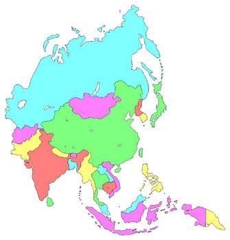
3 Name: Interactive Notes Continents and s This is your world, Earth. It is one of a kind, the only one that we know of to have life on it. It is made of 75 % water. The rest is made of large pieces of land called continents. There are seven continents and five oceans. In the middle of Earth, there is an imaginary line called the equator. The equator separates the world into two parts a Northern and a Southern hemisphere. The closer you live to the equator the warmer your climate is. The farther you are away from the equator the colder your climate is. The world is an amazing place. Can you find the continent you live on? Map of our World Let's label our map together!

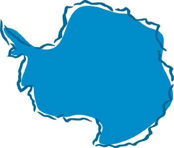
4 Name: Label the continents and oceans. Pacific Atlantic Southern Arctic Indian Africa North America Australia South America Asia Antarctica Europe

5 Name: Label the oceans. Pacific Atlantic Southern Arctic Indian
6 Name: All about the oceans Cut the stars out and place them where they belong. Atlantic Southern Pacific Arctic Indian
7 Name: Label the continents. Write the continent names on the arrows. Africa North America Australia South America Asia Antarctica Europe
8 Name: Our World Arctic North America Europe Asia Pacific Equator Atlantic Africa Pacific South America Indian Australia Southern Antarctica Follow these directions. 1. Color Australia yellow. 2. Color Africa red. How many oceans are in the world? 3. Color Europe green. 4. Color North America brown. 5. Color Asia orange. 6. Color Antarctica purple. 7. Color South America pink. How many continents are in the world? 8. Color all oceans blue. 9. Draw a star on the continent we live on. 10. Color the equator black.


9 Name: Global World Word Box Africa Australia North America South America Europe Asia Which continent do you live on? Antarctica Equator


10 Name: Geography Puzzler Across 6. How many continents are there? 7. west of Africa. 8. Largest continent. 11. Coldest continent. Down 1. A model of the Earth. 2. A large body of land. 3. A flat document that helps people locate places. 4. Planet we live on. 5. A large body of water. 6. north of Antarctica. 9. Imaginary line that divides the earth into two hemispheres. 10. How many oceans are there?


11 Name: Interactive notes s Earth is a very unique planet because it contains water. It is the only planet in our solar system that we know of that has free flowing water. Water has become one of the main ingredients of life. Humans, animals and plants need it to survive. Our world is made up of mostly water. An ocean is a large body of salt water. On Earth, we have five oceans that surround the continents: the Atlantic, Arctic, Southern, Pacific, and the Indian. They provide food for humans and create habitats for many animals. Take a look at these plants and animals; can you spot the animals that live in the oceans? Circle and label the ocean animals.

12 Name: Find these Earthly Words Antarctica equator ocean continent Africa Asia Australia North America, South America Europe Indian Pacific Southern Atlantic Arctic hemispheres N C C A H A C S L X A G P W H P O S T N E I E U N N T A N N Z I R W E A T L T M R K C W H A A T T F K C A A Z E L I H E E F Q R H L R P K R H T F F M C N I Z B C A G L Y T M I G I V C A S T N H C K B U S C I S A T C I M A I R Z S O O U A P H S C A D T M R S O S U J A H J A R R N N F E Q U A T O R E M S T A P S I E R D P H N J R C J L M B R Z C E I J U Y U E L T G T O C E A N D C F L Z S A K T N E N I T N O C A T G R E P O R U E C Q V J F I Z I H


13 Equator In the middle of Earth, there is an imaginary line called the equator. The equator separates the world into two parts a Northern and a Southern hemisphere. You cannot see the equator, but scientists know it exists because of clear habitat and weather patterns. The closer you live to the equator, the warmer your climate is. The farther away you are from the equator, the colder your climate is. The world is an amazing place. These two pictures show the equator dividing the Earth into two hemispheres. Try this... Color the equators in the pictures red. Draw a compass rose. Label the northern hemisphere. Label the southern hemisphere. Answer these questions. 1. Which continents are in the northern hemisphere? 2. Which continents are in the southern hemisphere? 3. Which hemisphere do you live in?
14 Name: Think about the oceans and continents. Which continents are in the Southern Hemisphere? Which ones are in the Northern Hemisphere? Use the map below to help you. List the continents in the Northern Hemisphere here List the continents in the Southern Hemisphere here Which hemisphere is the southern ocean located in? Which hemisphere is the arctic ocean located in? Which hemisphere do you live in? Which hemisphere is Antarctica in?


15 Name: Which Continent is it? Europe Africa Asia North America South America Australia Antarctica
16 Thank You for your purchase. Visit for free resources that go along with this unit. Click 2nd Click Social Studies. Click SOL 2.5
GEOGRAPHY. Map Skills. Mrs. Pere ~ 2013
 GEOGRAPHY Map Skills Mrs. Pere ~ 2013 WHAT IS A GLOBE? A globe is a model of the Earth. North Pole Equator South Pole WHAT IS A MAP? A map is a flat drawing of a place. THE IMPORTANT PARTS OF A MAP 1.
Map Skills: Continents and Oceans. Map Skills: Continents and Oceans
 Map Skills: Continents and Oceans Our Earth is made up of continents and oceans. A continent is an enormous mass of land. There are seven continents on our planet. The continents include North America,
Maps and Globes. By Kennedy s Korner
 Maps and Globes By Kennedy s Korner Map Key or Symbols Maps use symbols to show places and things on Earth. Symbols are drawings that stand for something real. A map key tells you what each symbol stands
Unit 1: Geography and Social Studies Skills
 Unit 1: Geography and Social Studies Skills Standard(s) of Learning: WHI.1 The student will improve skills in historical research and geographical analysis by a) Identifying, analyzing, and interpreting
Cardinal and Intermediate Directions:
 Name Period Parent Signature Due Date: (TBA) Geography/Map Skills Study Guide Continents and Oceans of the World: Label the continents (7) and oceans (4) on the lines below the map. 1 11 3 5 4 8 2 9 10
 Name Period Parent Signature Geography/Map Skills Study Guide *For extra practice with these skills, check out Mr. Kath s website: http://rkath.weebly.com/activities--links.html Continents and Oceans of
DOWNLOAD OR READ : OER OCEANS AND CONTINENTS WITH THE SETTING SUN PDF EBOOK EPUB MOBI
 DOWNLOAD OR READ : OER OCEANS AND CONTINENTS WITH THE SETTING SUN PDF EBOOK EPUB MOBI Page 1 Page 2 oer oceans and continents with the setting sun oer oceans and continents pdf oer oceans and continents
Map Skills Lesson 1. Materials: maps, pencils, Lesson 1 Worksheet, strips of paper, grid paper
 Map Skills Lesson 1 Use cardinal directions, map grids, scales, and titles to locate places on a map. Interpret a map using information from its title, compass rose, scale, and legend. Vocabulary: map,
The World of Geography Pre-Test/Study Guide Chapter 1 Test
 Read each statement or question. On the lines below write the letter of the best answer. 1. Geographers look at the Earth 5. What are the two specific A. by studying cities first. measurements of Earth
World Geography. Test Pack
 World Geography Test Pack WALCH PUBLISHING Table of Contents To the Teacher......... v Testing Students Who Do Not Test Well....... vi Test-Taking Strategies for Power Basics........ vii Pretest.......
2011, 1998, 1987 Copyright by Remedia Publications, Inc. All Rights Reserved. Printed in the U.S.A.
 See the world REM 129A A Teaching Resource From 2011, 1998, 1987 Copyright by Remedia Publications, Inc. All Rights Reserved. Printed in the U.S.A. The purchase of this product entitles the individual
Map Skills Scavenger Hunt
 Map Skills Scavenger Hunt Introduction to: Continents Cardinal Directions Relative Location Equator and Prime Meridian Hemispheres Reading a Political Map Reading a Physical Map Idea: This product includes
Understanding Projections
 GEOGRAPHY SKILLS 1 Understanding Projections The earth is a sphere and is best shown as a globe. For books and posters, though, the earth has to be represented as a flat object. To do this, mapmakers create
Continents. and. Oceans
 Continents and Oceans Continents and Oceans Africa Africa Antarctica Antarctica Asia Asia Australia Australia Europe Europe North America North America South America South America World Map World Map Continents
... Asia. Based on Bloom s Taxonomy. Human & Movement. Location Place. Regions. Environment. Interactions
 ... Asia Location Place Human & Environment Interactions Movement Regions LEVEL 1 Knowledge Match Show or Label List Information Recall Details (5Ws + H) Find Information LEVEL 2 Comprehension LEVEL 3
Introduction to Geography
 Introduction to Geography ropic of Cancer 3½ N Arctic Circle 90 N Prime Meridian 0 Arctic Ocean Mississippi R. Appalachian Mts. Europe Rocky Mountains N. America Atlantic Gulf of Ocean Mexico Caribbean
Essential Questions What are the major physical components of the world, and how are they represented on a map? 3.4
 Third Grade Social Studies Unit One Six Weeks GEOGRAPHY Originally compiled by Russellville In order for students to understand that geography influences the development of a region as well as the interactions
 Name Period Parent Signature Foundational Skills Study Guide *For extra practice with these skills, check out Mr. Kath s website: http://rkath.weebly.com/activities--links.html Continents and Oceans of
Pre-AP World Geography Summer Assignment
 Pre-AP World Geography 2018-2019 Summer Assignment This is the summer assignment for students who intend on being accepted and enrolled in Pre-AP World Geography. Successful performance on this assignment
Unit 1: Geography. For additional information, refer to this website: 1 G e o g r a p h y
 Unit 1: Geography For additional information, refer to this website: http://mryoungtms.weebly.com/ 1 G e o g r a p h y Continents and Oceans SOL USI. 2a Essential Understanding: Continents are large land
Unit 1: Basics of Geography Test Review
 Name Date Period Unit 1: Basics of Geography Test Review Directions: Reading the following sections and complete the questions, charts, and diagrams. Types of Maps Maps that have a particular theme are
Sample file. Teacher Guide ... Before You Teach. Our resource has been created for ease of use by both TEACHERS and STUDENTS alike.
 8 7 9 10 12 13 14 11 Introduction T his resource provides ready-to-use information and activities for remedial students in grades five to eight. Written to grade and using simplified language and vocabulary,
Social Studies Tools (Maps & Sources) Test Study Guide
 Test Study Guide") Social Studies Tools (Maps & Sources) Test Study Guide Name: ANSWER KEY Date: Period: Directions: Complete this study guide as a way to prepare for your test on our Social Studies Tools unit about maps
Social Studies Tools (Maps & Sources) Test Study Guide Name: ANSWER KEY Date: Period: Directions: Complete this study guide as a way to prepare for your test on our Social Studies Tools unit about maps
MR. GOFF S WORLD HISTORY UNIT ONE: GEOGRAPHY 5 THEMES OF GEOGRAPHY
 MR. GOFF S WORLD HISTORY UNIT ONE: GEOGRAPHY 5 THEMES OF GEOGRAPHY BYOD BRING YOUR OWN DEVICE IN SMALL GROUPS (3-4), USE YOUR ELECTRONIC DEVICE(S) AND DEFINE THE FOLLOWING VOCAB. WORDS 1. GEOGRAPHY 2.
Chapter 1 Section 2. Land, Water, and Climate
 Chapter 1 Section 2 Land, Water, and Climate Vocabulary 1. Landforms- natural features of the Earth s land surface 2. Elevation- height above sea level 3. Relief- changes in height 4. Core- most inner
N.B Write everything on the paper provided, and the use of good English is recommended.
 St. Francis School, Sliema Specimen Paper Geography Form 1 Time : 1 hour N.B Write everything on the paper provided, and the use of good English is recommended. Name: Class: A. Study about the Continents
Exploring The Planets: Earth
 Exploring The Planets: Earth By Encyclopaedia Britannica, adapted by Newsela staff on 08.24.17 Word Count 632 Level MAX An image of Earth, created by the Suomi NFP Satellite. This photo is created from
1 What Is Climate? TAKE A LOOK 2. Explain Why do areas near the equator tend to have high temperatures?
 CHAPTER 17 1 What Is Climate? SECTION Climate BEFORE YOU READ After you read this section, you should be able to answer these questions: What is climate? What factors affect climate? How do climates differ
... Europe. Based on Bloom s Taxonomy. Environment Interactions Movement. Human & Location. Regions. Place
 ... Europe Location Place Human & Environment Interactions Movement Regions LEVEL 1 Knowledge Match Show or Label List Information Recall Details (5Ws + H) Find Information LEVEL 2 Comprehension Describe
Smyth County Schools Curriculum Map. 1st 6 Weeks 2nd 6 Weeks 3rd 6 Weeks 3.5 a, b, & e, , 3.10 a,b, &c, 3.11, , 3.2, 3.4, 3.
 Standards Grade: 3rd Subject: 1st 6 Weeks 2nd 6 Weeks 3rd 6 Weeks 3.5 a, b, & e, 3.6 3.6, 3.10 a,b, &c, 3.11, 312 3.1, 3.2, 3.4, 3.6 all Content STANDARD 3.5 The student will develop map skills by a) positioning
DOWNLOAD OR READ : WHITE CONTINENT PDF EBOOK EPUB MOBI
 DOWNLOAD OR READ : WHITE CONTINENT PDF EBOOK EPUB MOBI Page 1 Page 2 white continent white continent pdf white continent 2020 WHITE CONTINENT 50k, MARATHON AND ½ MARATHON January 25 â February 2, 2020
About places and/or important events Landmarks Maps How the land is, hills or flat or mountain range Connected to maps World Different countries
 What do you think you know about geography? About places and/or important events Landmarks Maps How the land is, hills or flat or mountain range Connected to maps World Different countries What do you
Pangaea to the Present Lesson #2
 Pangaea to the Present Lesson #2 The Earth is a dynamic or constantly changing planet. The thin, fragile plates slide very slowly on the mantle's upper layer. This sliding of the plates is caused by the
Map Skills Unit. Note taking unit
 Map Skills Unit Note taking unit Introduction To learn about the Earth, we are going to learn about two geographic tools you can use.globes and maps. Globe A globe is a round model of the planet Earth
2nd Grade. Earth's Water. Slide 1 / 111 Slide 2 / 111. Slide 3 / 111. Slide 4 / 111. Slide 5 (Answer) / 111. Slide 5 / 111. Role of Water on Earth
 / 111. Slide 5 / 111. Role of Water on Earth") Slide 1 / 111 Slide 2 / 111 2nd Grade Role of Water on Earth 2015-11-20 www.njctl.org Slide 3 / 111 Slide 4 / 111 Table of Contents: The Role of Water on Earth Earth's Water The Use of Maps Click on the
Slide 1 / 111 Slide 2 / 111 2nd Grade Role of Water on Earth 2015-11-20 www.njctl.org Slide 3 / 111 Slide 4 / 111 Table of Contents: The Role of Water on Earth Earth's Water The Use of Maps Click on the
Simple Solutions Social Studies Level 2. Level 2. Social Studies. Help Pages
 Level 2 Social Studies 147 148 adobe houses with bricks made of clay and straw ancestor a family member who lived before us appoint choose; leaders can appoint others barter trading one thing for another
V Q \ = 5a?WZTL 156 Unit 6
 156 Unit 6 It is large and almost round. The colors are blue and brown. There are also swirls of white. It even glows at night. What a wonderful sight! What is it? I will learn to talk about physical features
Earth s Oceans. Divisions of the Global Ocean
 Earth s Oceans 1 Key Concept The characteristics of ocean water, such as temperature and salinity, affect the circulation of the ocean. What You Will Learn Earth is unique in our solar system because 71%
NATURAL SCIENCES & TECHNOLOGY RESOURCE PACK GRADE 4 TERM 4
 NATURAL SCIENCES & TECHNOLOGY RESOURCE PACK GRADE 4 TERM 4 GRADE: 4 TERM: 4 STRAND: PLANET EARTH AND BEYOND RESOURCE 1 https://commons.wikimedia.org/wiki/file:earth_-_africa,_middle_east_and_europe_(16728031541).jpg
Downloaded from
 SOCIAL STUDIESCLASS - V LESSON-1 GLOBE ANSWER THE FOLLOWING: 1. Name the continents and oceans on the earth. Ans. The seven continents are: a) Australia b) Europe c) Antarctica d) South America e) North
LET S GO ON A ROAD TRIP
 Partner School News June 2016 In this issue: Education Children Around the World www.opportunityeducation.org Road Trip Start Writing Right Now Teaching Tip of the Month Focus on Schools LET S GO ON A
SECOND GRADE 1 WEEK LESSON PLANS AND ACTIVITIES
 SECOND GRADE 1 WEEK LESSON PLANS AND ACTIVITIES UNIVERSE CYCLE OVERVIEW OF SECOND GRADE UNIVERSE WEEK 1. PRE: Discovering stars. LAB: Analyzing the geometric pattern of constellations. POST: Exploring
1. Match the words in the first column to the meaning in the second column. [5]
![1. Match the words in the first column to the meaning in the second column. [5]](/thumbs/96/126839765.jpg "1. Match the words in the first column to the meaning in the second column. [5]") Exercise 1: [40 POINTS] 1. Match the words in the first column to the meaning in the second column. [5] Equator Around earth between the Equator and the Poles. Greenwich meridian Half of earth. Longitude
Exercise 1: [40 POINTS] 1. Match the words in the first column to the meaning in the second column. [5] Equator Around earth between the Equator and the Poles. Greenwich meridian Half of earth. Longitude
Social Studies: The World Post Test Study Guide
 Name: Period: Social Studies: The World Post Test Study Guide Map and Globe Skills: Label the continents and oceans on the lines below the map. 1 11 3 4 5 8 2 9 10 8 6 7 1. 8. 2. 9. 3. 10. 4. 11. 5. 6.
Sample. Contents SECTION 1: PLACE NAMES 6 SECTION 2: CONNECTING TO PLACES 21 SECTION 3: SPACES: NEAR AND FAR 53
 Contents Teachers' Notes 4 National Curriculum Links 5 SECTION 1: PLACE NAMES 6 Teachers' Notes 7-8 Activities Names Of Places 9 Place Names Are Important 1 10 Place Names Are Important 2 11 The Meanings
Chapter 1: The World of Geography
 Chapter 1: The World of Geography Chapter 1: What is Geography? *It is the study of our earth; our home. OR *Anything that can be mapped! *Geography mixes up the physical and human aspects of our world
FIRST GRADE 1 WEEK LESSON PLANS AND ACTIVITIES
 FIRST GRADE 1 WEEK LESSON PLANS AND ACTIVITIES UNIVERSE CYCLE OVERVIEW OF FIRST GRADE UNIVERSE WEEK 1. PRE: Describing the Universe. LAB: Comparing and contrasting bodies that reflect light. POST: Exploring
Student Handout. Write the map s title in the northwest corner of the map. How many picnic areas does the park have? Write the answer near the legend.
 Student Handout 1F Cards Write the map s title in the northwest corner of the map. How many picnic areas does the park have? Write the answer near the legend. 1 2 Draw a compass rose near the west edge
Activity #2 - Major Ocean Surface Currents
 Activity #2 - Major Ocean Surface Currents Concepts # 3 & 6 # 3 Atmospheric cells and ocean gyres redistribute heat from low to high latitudes, which influences climate, weather, and ocean temperature.
AP Human Geography World Atlas Project
 AP Human Geography World Atlas Project - 2018 Welcome to Robert E. Lee High School and Advanced Placement Human Geography! You are going to thoroughly enjoy this class. It will be a lot of work, but the
Introducing Planet Earth
 Introducing Planet Earth Reading A Z Level L Levelled Book Word Count: 511 LEVELLED BOOK L Introducing Planet Earth Visit www.readinga-z.com for thousands of books and materials. Written by Celeste Fraser
Phase 1 Cards. Phase 1. Phase 1. How many picnic areas does the park have? Write the answer near the legend.
 S T U D E N T H A N D O U T F Cards Write the map s title in the northwest corner above the map. How many picnic areas does the park have? Write the answer near the legend. 1 2 Draw a compass rose near
Module 2 Educator s Guide Overview
 Module 2 Educator s Guide Overview Water, water almost everywhere? Module Overview The presence of water in solid, liquid, and gaseous forms is one of the primary factors that distinguishes Earth from
The Northwest Passage Grades 6-8
 The Northwest Passage Grades 6-8 Introduction European and North American governments and merchants expended a tremendous amount of effort during the 16 th through 19 th centuries in the quest to find
The Ocean Floor THE VAST WORLD OCEAN
 OCEANOGRAPHY Name Color all water LIGHT BLUE. Color all land LIGHT GREEN. Label the 5 Oceans: Pacific, Atlantic, Indian, Arctic, Antarctic. Label the 7 Continents: N.America, S.America, Europe, Asia, Africa,
Name: Climate Date: EI Niño Conditions
 Name: Date: Base your answers to questions 1 and 2 on the maps and the passage below. The maps show differences in trade wind strength, ocean current direction, and water temperature associated with air-pressure
Word Cards. 2 map. 1 geographic representation. a description or portrayal of the Earth or parts of the Earth. a visual representation of an area
 Name: Date: Hour: Word Cards 1 geographic representation a description or portrayal of the Earth or parts of the Earth Example: A map is a representation of an actual location or place. 2 map a visual
World Geography. Teacher s Guide
 World Geography Teacher s Guide WALCH PUBLISHING Table of Contents To the Teacher.......................................................... vi Classroom Management.................................................
Sample. Contents SECTION 5: GLOBAL LINKS 33 SECTION 1: LABELLING OUR GLOBE 6 SECTION 6: PLACES 37 SECTION 2: NAMES OF PLACES 13
 Contents Teachers' Notes 4 Curriculum Links 5 SECTION 1: LABELLING OUR GLOBE 6 All About Continents 7 Continents 1 8 Continents 2 9 Labelling The Globe 10 Our Globe 1 11 Our Globe 2 12 SECTION 2: NAMES
Ocean Boundary Currents Guiding Question: How do western boundary currents influence climate and ocean productivity?
 Name: Date: TEACHER VERSION: Suggested Student Responses Included Ocean Boundary Currents Guiding Question: How do western boundary currents influence climate and ocean productivity? Introduction The circulation
Knowledge and understanding Geographical skills. Sample pages. features people processes world places events environments characteristics
 1.1 What is geography? Knowledge and understanding Geographical skills verbal linguistic visual spatial 1 Give two reasons why it is important to study geography. 2 Use words from the box below to complete
Energy and Seasons A B1. 9. Which graph best represents the general relationship between latitude and average surface temperature?
 Energy and Seasons A B1 1. Which type of surface absorbs the greatest amount of electromagnetic energy from the Sun? (1) smooth, shiny, and light colored (2) smooth, shiny, and dark colored (3) rough,
Map Skills Test. 1. What do we call a person who makes maps? a. mapographer b. cartographer c. geologist d. archaeologist
 Map Skills Test 1. What do we call a person who makes maps? a. mapographer b. cartographer c. geologist d. archaeologist 2. What is the name of the 0 latitude line? a. Equator b. Arctic Circle c. First
What Is a Globe? Hemispheres. Main Idea Globes and maps provide different ways of showing features of the earth. Terms to Know
 r Main Idea Globes and maps provide different ways of showing features of the earth. Terms to Know hemisphere latitude longitude scale bar scale relief elevation contour line What Is a Globe? A globe is
1 What Is Climate? TAKE A LOOK 2. Explain Why do areas near the equator tend to have high temperatures?
 CHAPTER 17 1 What Is Climate? SECTION Climate BEFORE YOU READ After you read this section, you should be able to answer these questions: What is climate? What factors affect climate? How do climates differ
Maps. All Kinds of Maps 104 words. How to Draw a Map 105 words. The Difference Between Maps and Globes 108 words. Learn About Maps 96 words
 ARTICLE-A-DAY Maps 8 Articles Check articles you have read: All Kinds of Maps 104 words How to Draw a Map 105 words The Difference Between Maps and Globes 108 words Learn About Maps 96 words Seven Large
Your web browser (Safari 7) is out of date. For more security, comfort and the best experience on this site: Update your browser Ignore
 is out of date. For more security, comfort and the best experience on this site: Update your browser Ignore") Your web browser (Safari 7) is out of date. For more security, comfort and the best experience on this site: Update your browser Ignore Activityengage O NE O CEAN How many oceans are there on Earth? OVERVIEW
Your web browser (Safari 7) is out of date. For more security, comfort and the best experience on this site: Update your browser Ignore Activityengage O NE O CEAN How many oceans are there on Earth? OVERVIEW
World Geography. BY MARK STANGE and REBECCA LARATTA
 BY MARK STANGE and REBECCA LARATTA COPYRIGHT 2002 Mark Twain Media, Inc. ISBN 1-58037-205-8 Printing No. CD-1551 Mark Twain Media, Inc., Publishers Distributed by Carson-Dellosa Publishing Company, Inc.
Dr. M.K.K. Arya Model School Class-V, Social Science Assignment Ch-1, Globe The Model of the Earth Answer the following:- Q.1.
 Class-V, Social Science Assignment Ch-1, Globe The Model of the Earth - Q.1. What are the disadvantages/demerits of a globe? Ans. Some disadvantages of globe are: a) It is difficult to carry. b) It cannot
This image cannot currently be displayed. Course Catalog. History and Geography Glynlyon, Inc.
 This image cannot currently be displayed. Course Catalog History and Geography 2016 Glynlyon, Inc. History and Geography Table of Contents COURSE OVERVIEW... 1 UNIT 1: OUR EARTH... 1 UNIT 2: SEAPORT CITIES...
Markville. CGC 1DL/PL Geography. Geography of Canada. Natural Environment Unit Test
 Markville CGC 1DL/PL Geography Geography of Canada Natural Environment Unit Test Name: Thinking /10 Knowledge /10 Application /10 Communication /10 Part A: Blanks (1 mark each) Thinking Choose the correct
Pool Canvas. Add. Creation Settings. Chapter 1--Objectives and Tools of World Regional Geography. Description Instructions.
 1 of 6 TEST BANK > CONTROL PANEL > POOL MANAGER > POOL CANVAS Pool Canvas Add, modify, and remove questions. Select a question type from the Add Question drop-down list and click Go to add questions. Use
TEACHER MATERIALS BIG HISTORY PROJECT / LESSON 4.1 ACTIVITY BIOGRAPHY OF A CONTINENT. Purpose
 TEACHER MATERIALS Purpose The early Earth was an inhospitable place. It wasn t until the start of the Archaean eon, almost 700 million years after the Earth was created, that rocks formed, which made possible
History EC LE UE MS. Knows the names and order of the Seasons of the Year and science behind it
 History EC LE UE MS Time and Timelines : awareness of how the universe and life came to be and his/her place on the continuum. The child discovers interests, makes connections and draws inferences about
Witchampton CofE First School Geography Curriculum Map
 2016-2017 Autumn People and : 30-50 Show interest in the lives of people who are familiar to them. Shows interest in different occupations. Remembers and talks significant events in their own experience.
locate the world s countries, using maps to focus on Europe (including the location of
 Year 3 and 4 Geography study- Autumn 2 2017 National curriculum: Locational knowledge locate the world s countries, using maps to focus on Europe (including the location of Russia) and North and South
Cranford Park CE Primary School. Subject Overview for Geography. Autumn 1 Autumn 2 Spring 1 Spring 2 Summer 1 Summer 2 Title of unit.
 Autumn 1 Autumn 2 Spring 1 Spring 2 Summer 1 Summer 2 Main Objectives /Skills Main Objectives /Skills Main Objectives /Skills Main Objectives /Skills Main Objectives /Skills Main Objectives /Skills Foundation
Social Studies: The World (End of the Year TEST)
") Name: Period: TEST A Social Studies: The World (End of the Year TEST) Map and Globe Skills: Label the continents and oceans on the lines below the map. 1 11 3 4 5 8 2 9 10 8 6 7 1. 8. 2. 9. 3. 10. 4. 11.
Name: Period: TEST A Social Studies: The World (End of the Year TEST) Map and Globe Skills: Label the continents and oceans on the lines below the map. 1 11 3 4 5 8 2 9 10 8 6 7 1. 8. 2. 9. 3. 10. 4. 11.
What is the name of the continent that is labeled #1 on the map?
 What is the name of the continent that is labeled #1 on the map? North America What is the name of the continent that is labeled #2 on the map? South America What is the name of the continent that is labeled
Teachers Curriculum Institute Map Skills Toolkit 411
 Map kills Toolkit To the Teacher tudents encounter maps every day inside and outside their classes in books and on handheld devices, computers, or television screens. Whether they re navigating cities
Unit 1 Continents And Geo Skills Lesson 1 Getting To
 We have made it easy for you to find a PDF Ebooks without any digging. And by having access to our ebooks online or by storing it on your computer, you have convenient answers with unit 1 continents and
Utah Core Standards Science Grade: 2 - Adopted: 2010
 Main Criteria: Utah Core Standards Secondary Criteria: Subjects: Science, Social Studies Grade: 2 Correlation Options: Show Correlated UT.2. Utah Core Standards Science Grade: 2 - Adopted: 2010 Earth and
Nebraska s Place in the World
 Geographic Educators of Nebraska Advocating geographic education for all Nebraskans Nebraska s Place in the World Students will use lines of latitude and longitude to locate cities within the state and
What is Geography? *Mixes up the physical and human aspects of our world into one field of study.
 World Geography What is Geography? *It is the study of the earth *Mixes up the physical and human aspects of our world into one field of study. *Shows the relationship between people and the environment.
Section. 1 Our Planet, Earth. Prepare to Read
 1 Section Step-by-Step Instruction Objectives Social Studies 1. Learn about Earth s movement in relation to the sun. 2. Explore seasons and latitude. Reading/Language Arts Use context clues from surrounding
Major Domain of the Earth
 Major Domain of the Earth The surface of the earth is a complex zone in which three main components of the environment meet, overlap and interact. The solid portion of the earth on which we live is called
Exploring North America
 Exploring North America Continents of the World Geography Series Author: Michael Kramme, Ph.D. Consultants: Schyrlet Cameron and Carolyn Craig Editors: Mary Dieterich and Sarah M. Anderson COPYRIGHT 2012
Exploring Europe. Continents of the World Geography Series
 Exploring Europe Continents of the World Geography Series Author: Michael Kramme, Ph.D. Consultants: Schyrlet Cameron and Carolyn Craig Editors: Mary Dieterich and Sarah M. Anderson COPYRIGHT 2012 Mark
Downloaded from
 I II III IV V VI Define the following terms:- a) Orbitb) Meteoroids c) Celestial bodies GEOGRAPHY ASSIGNMENTS The Earth In The Solar System d) Satellite e) Comets Give one word answers:- a) Blue planet
Geography. Programmes of study for Key Stages 1-3
 Geography Programmes of study for Key Stages 1-3 February 2013 Contents Purpose of study 3 Aims 3 Attainment targets 3 Subject content 4 Key Stage 1 4 Key Stage 2 5 Key Stage 3 6 2 Purpose of study A high-quality
Year 1 name and locate the four countries and capital cities of the United Kingdom and its surrounding seas
 Long Term Objective Organisation for Geography Please note that only statutory requirements should be included in this document; any supplementary guidance and information should be retained by Subject
Alleghany County Schools Curriculum Guide GRADE/COURSE: World Geography
 GRADE/COURSE: World 2013-14 GRADING PERIOD: 1 st Six Weeks Time Frame Unit/SOLs SOL # Strand Resource Assessment 8 days* The student will use maps, globes, satellite images, photographs, or diagrams to
Evidence for Continental Drift and The Theory of Plate Tectonics
 Evidence for Continental Drift and The Theory of Plate Tectonics Did you know that the coal that is mined in Pennsylvania was actually formed from tropical plant life near the Equator? How did it travel
Why VOCABULARY? clues
 It s GHSGT Time! Why VOCABULARY? Social Studies is all about MAKING CONNECTIONS Key Terms provide relational clues to guide you in answering test questions! The more WORDS you know, the smarter you are
Geography Progression
 Geography Progression This document aims to track expectations for History within George Grenville Academy. What the National Curriculum says: KS1: Locational Knowledge: Name and locate the world s 7 continents
US History, Ms. Brown Need Help? or Call
 Name Course: US History/Ms. Brown Homeroom: 7th Grade US History Standard #7H102; 7H103 Do Now Day #6 Aims: SWBAT define and use essential geographic vocabulary such as hemisphere, equator, longitude,
page - 1 Laboratory Exercise #1 - Introduction to Latitude and Longitude Northern Hemisphere Southern Hemisphere
 page - 1 Laboratory Exercise #1 - Introduction to Latitude and Longitude A. Introduction There are many methods that can be used to locate ones position on the surface of the earth. A common method for
2 Earth s Changing Continents
 CHAPTER 9 SECTION The History of Life on Earth 2 Earth s Changing Continents California Science Standards 7.4.a, 7.4.e, 7.4.f BEFORE YOU READ After you read this section, you should be able to answer these
Ocean Temperatures. Key Words: No new key words.
 Key Words: No new key words. Ocean Temperatures Getting Started: 1. In this activity, you will simulate the work of climatologists who sample ocean surface temperatures and compile that data to investigate
Climate versus Weather
 Climate versus Weather What is climate? Climate is the average weather usually taken over a 30-year time period for a particular region and time period. Climate is not the same as weather, but rather,