What is the name of the continent that is labeled #1 on the map?
|
|
|
- Cameron Marsh
- 5 years ago
- Views:
Transcription


1
2 What is the name of the continent that is labeled #1 on the map?
3 North America
4 What is the name of the continent that is labeled #2 on the map?
5 South America
6 What is the name of the continent that is labeled #3 on the map?
7 Europe
8 What is the name of the continent that is labeled #4 on the map?
9 Africa
10 What is the name of the continent that is labeled #5 on the map?
11 Asia
12 What is the name of the continent that is labeled #6 on the map?
13 Australia
14 What is the name of the continent that is labeled #7 on the map?
15 Antarctica
16 What is the name of the ocean that is labeled #8 on the map?
17 Pacific Ocean
18 What is the name of the ocean that is labeled #9 on the map?
19 Atlantic Ocean
20 What is the name of the ocean that is labeled #10 on the map?
21 Indian Ocean

22 What is the name of the ocean that is labeled #11 on the map?
23 Arctic Ocean

24 What is the name of the ocean that is labeled #12 on the map?
25 Southern Ocean

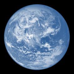
26 What planet do you live on?
27 Earth

28 What continent do you live on?

29 North America

30 What country do you live in?
31 United States of America


32 What state do you live in?
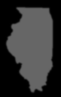
33 Illinois
34 What direction does #16 on the compass rose represent?
35 north
36 What direction does #17 on the compass rose represent?
37 northeast
38 What direction does #18 on the compass rose represent?
39 east
40 What direction does #19 on the compass rose represent?
41 southeast

42 What direction does #20 on the compass rose represent?
43 south
44 What direction does #21 on the compass rose represent?
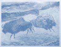
45 southwest
46 What direction does #22 on the compass rose represent?
47 west
48 What direction does #23 on the compass rose represent?
49 northwest
50 How many years are represented on the parallel time lines?
51 30,000 years (take the number all the way to left of the timeline and subtract the number all the way to the right of the timeline)
52 When were the cave paintings in Lascaux, France produced?
53 Old Stone Age
54 How many years ago did the Old Stone Age end?
55 about 10,000 years ago
56 How many years ago did the New Stone Age end?
57 about 5,000 years ago

58 What are the imaginary lines that extend east and west on a map called? (also known as parallels)
59 Lines of latitude or parallels

60 What are the imaginary lines that extend north and south on a map called? (also known as meridians or great circles )
61 Lines of longitude or meridians

62 What type of map is shown?
63 Political map

64 What type of map is shown?
65 Physical map
66 What type of map is shown?
67 Time Zone map
68 What time zone is Illinois located in?
69 Central time zone
70 If it is 1:00 a.m. where you live, what time is it in the Eastern time zone?
71 2:00 a.m.
72 If it is 1:00 a.m. where you live, what time is it in the Mountain time zone?
73 12:00 a.m.
74 What do the bars on the climograph represent?
75 temperature
76 What do the lines on the climograph represent?
77 precipitation
78 During which month does Beijing have the greatest average temperature?
79 July (78 F)
80 During which month does Beijing have the lowest average temperature?
81 January (22 F)
82 During which month does Hong Kong receive the least precipitation?
83 December (0.5 inches)
84 During which month does Hong Kong receive the most precipitation?
85 June (15 inches)
86 Which city has the smaller temperature range?
87 Hong Kong (take the largest number smallest number = range) (82 F 58 F = 24 F temperature range)
88 Which city has the larger temperature range?
89 Beijing (take the largest number smallest number = range) (78 F 22 F = 56 F temperature range)


90 What is an archaeologist?
91 An archaeologist is one who carefully uncovers evidence from the past.

92 How do archaeologists draw conclusions about ancient civilizations?
93 Archaeologists study artifacts, such as tools, weapons, jewelry, and pottery. They analyze them to draw conclusions about the ancient peoples daily lives.

94 What is the study of the relationship between physical features, climate, and people?
95 geography

96 Why was farming a challenge in Mesopotamia?
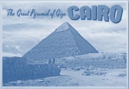
97 Farming was a challenge in Mesopotamia because there was little rainfall.

98 How did Mesopotamians overcome the problem of low rainfall?
99 Mesopotamians overcame the problem of low rainfall by irrigating their crops with water from the rivers.


100 What does monotheism mean?
101 Monotheism is the worship of only one god.

102 What does polytheism mean?
103 Polytheism is the worship of many gods.

104 What is the longest river in the world?
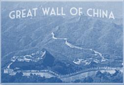
105 Nile River


106 What country is the Nile River located in?
107 Egypt

108 How were Egyptian pharaohs bodies prepared for the afterlife?
109 All organs except for the heart were removed, oils and perfumes were rubbed over the body, the body was wrapped in bandages, and it was placed in a coffin inside a tomb.

110 Why were Egyptian pharaohs bodies mummified?
111 Egyptians believed the pharaoh would need a well-preserved body for the afterlife.


112 Why is China s culture so different from its neighbors to the west?
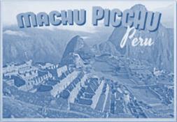
113 Centuries-old written records reveal a longlasting civilization in China with a culture that has remained mostly unified from its earliest recorded history to the present.
114 Where is Mesoamerica located?
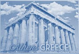
115 Mesoamerica extends from the middle of present-day Mexico to the central part of Central America.
116 What is a theocracy?
117 A theocracy is a form of government in which the leader or ruling classes are believed to represent the will of the gods.

118 What empire in Mexico was conquered by the Spanish explorer, Hernándo Cortés?
119 Aztec

120 What is one geographical world record that South America currently holds?
121 The Andes Mountains are the longest mountain chain in the world. The Amazon Rainforest is the world s largest rainforest. Angel Falls is the world s highest waterfall. The Atacama Desert is one of the driest regions on Earth. The Pantanal is the world s largest tropical wetland.

122 How did the physical geography of ancient Greece cause it to separate into independent communities?
123 Mountains, deep valleys, and rugged terrain separated Greece into different regions, making it difficult to unite the regions under one government. In time, these small communities grew into cities and each had its own way of doing things.


124 What form of government is ruled by the people, for the people?
125 democracy

126 How was democracy in ancient Athens different from the democracy in the United States?
127 Women, slaves, and men born outside Athens were not eligible to participate in the government. Most people in Athens did not have the right to vote, own property, or testify in court. Today in the U.S., all citizens over the age of 18 have these rights.


128
Social Studies: The World Post Test Study Guide
 Name: Period: Social Studies: The World Post Test Study Guide Map and Globe Skills: Label the continents and oceans on the lines below the map. 1 11 3 4 5 8 2 9 10 8 6 7 1. 8. 2. 9. 3. 10. 4. 11. 5. 6.
Social Studies: The World (End of the Year TEST)
") Name: Period: TEST A Social Studies: The World (End of the Year TEST) Map and Globe Skills: Label the continents and oceans on the lines below the map. 1 11 3 4 5 8 2 9 10 8 6 7 1. 8. 2. 9. 3. 10. 4. 11.
Name: Period: TEST A Social Studies: The World (End of the Year TEST) Map and Globe Skills: Label the continents and oceans on the lines below the map. 1 11 3 4 5 8 2 9 10 8 6 7 1. 8. 2. 9. 3. 10. 4. 11.
Cardinal and Intermediate Directions:
 Name Period Parent Signature Due Date: (TBA) Geography/Map Skills Study Guide Continents and Oceans of the World: Label the continents (7) and oceans (4) on the lines below the map. 1 11 3 5 4 8 2 9 10
 Name Period Parent Signature Foundational Skills Study Guide *For extra practice with these skills, check out Mr. Kath s website: http://rkath.weebly.com/activities--links.html Continents and Oceans of
 Name Period Parent Signature Geography/Map Skills Study Guide *For extra practice with these skills, check out Mr. Kath s website: http://rkath.weebly.com/activities--links.html Continents and Oceans of
GEOGRAPHY. Map Skills. Mrs. Pere ~ 2013
 GEOGRAPHY Map Skills Mrs. Pere ~ 2013 WHAT IS A GLOBE? A globe is a model of the Earth. North Pole Equator South Pole WHAT IS A MAP? A map is a flat drawing of a place. THE IMPORTANT PARTS OF A MAP 1.
The World of Geography Pre-Test/Study Guide Chapter 1 Test
 Read each statement or question. On the lines below write the letter of the best answer. 1. Geographers look at the Earth 5. What are the two specific A. by studying cities first. measurements of Earth
Learning Target : Describe the purposes and uses of different types of maps.
 Learning Target : Describe the purposes and uses of different types of maps. Directions: 1. Below, place a where you think you are located. 2. In which continent are you located? 3. In which country are
Unit 1: Basics of Geography Test Review
 Name Date Period Unit 1: Basics of Geography Test Review Directions: Reading the following sections and complete the questions, charts, and diagrams. Types of Maps Maps that have a particular theme are
Map Skills: Continents and Oceans. Map Skills: Continents and Oceans
 Map Skills: Continents and Oceans Our Earth is made up of continents and oceans. A continent is an enormous mass of land. There are seven continents on our planet. The continents include North America,
Unit 1: Geography and Social Studies Skills
 Unit 1: Geography and Social Studies Skills Standard(s) of Learning: WHI.1 The student will improve skills in historical research and geographical analysis by a) Identifying, analyzing, and interpreting
LEARNING OUTCOMES SST (G1-G12)
") LEARNING OUTCOMES SST (G1-G12) Grade 1 Learning Outcomes Students will be expected to: - demonstrate an understanding of the importance of interactions between people - demonstrate an understanding of
LEARNING OUTCOMES SST (G1-G12) Grade 1 Learning Outcomes Students will be expected to: - demonstrate an understanding of the importance of interactions between people - demonstrate an understanding of
September 14, 2013 Objective: How does geography impact history? What important features exist that have shaped societies?
 Lowenhaupt 1 September 14, 2013 Objective: How does geography impact history? What important features exist that have shaped societies? Warm-Up: In your binder, answer the following question: Imagine you
... Asia. Based on Bloom s Taxonomy. Human & Movement. Location Place. Regions. Environment. Interactions
 ... Asia Location Place Human & Environment Interactions Movement Regions LEVEL 1 Knowledge Match Show or Label List Information Recall Details (5Ws + H) Find Information LEVEL 2 Comprehension LEVEL 3
Map Skills Unit. Note taking unit
 Map Skills Unit Note taking unit Introduction To learn about the Earth, we are going to learn about two geographic tools you can use.globes and maps. Globe A globe is a round model of the planet Earth
Central Valley School District Social Studies Curriculum Map Grade 7. August - September
 August - September Geographical/Historical Skills Identify and analyze timelines. Construct and use cause and effect charts. Differentiate between fact and opinion. Use of word webs, flip charts, outlines
KIPP: Inspire Academy Social Studies Benchmark 1 PART I. Use the map of Missouri to answer questions 7-9.
 PART I 1) A physical map key shows: A. Climate B. Cities and borders C. Elevation and water depth D. Geographic features Use the map of Missouri to answer questions 7-9. 2) Lines of latitude: A. Are parallel
4th Grade US Regional Geography First Nine Weeks
 4th Grade US Regional Geography First Nine Weeks 2014-2015 Identify the choice that best completes the statement or answers the question. 1 The line identified as 0 runs west and east on the globe and
Map Skills Test. 1. What do we call a person who makes maps? a. mapographer b. cartographer c. geologist d. archaeologist
 Map Skills Test 1. What do we call a person who makes maps? a. mapographer b. cartographer c. geologist d. archaeologist 2. What is the name of the 0 latitude line? a. Equator b. Arctic Circle c. First
1. Match the words in the first column to the meaning in the second column. [5]
![1. Match the words in the first column to the meaning in the second column. [5]](/thumbs/96/126839765.jpg "1. Match the words in the first column to the meaning in the second column. [5]") Exercise 1: [40 POINTS] 1. Match the words in the first column to the meaning in the second column. [5] Equator Around earth between the Equator and the Poles. Greenwich meridian Half of earth. Longitude
Exercise 1: [40 POINTS] 1. Match the words in the first column to the meaning in the second column. [5] Equator Around earth between the Equator and the Poles. Greenwich meridian Half of earth. Longitude
Smyth County Schools Curriculum Map. 1st 6 Weeks 2nd 6 Weeks 3rd 6 Weeks 3.5 a, b, & e, , 3.10 a,b, &c, 3.11, , 3.2, 3.4, 3.
 Standards Grade: 3rd Subject: 1st 6 Weeks 2nd 6 Weeks 3rd 6 Weeks 3.5 a, b, & e, 3.6 3.6, 3.10 a,b, &c, 3.11, 312 3.1, 3.2, 3.4, 3.6 all Content STANDARD 3.5 The student will develop map skills by a) positioning
Unit 1: Geography. For additional information, refer to this website: 1 G e o g r a p h y
 Unit 1: Geography For additional information, refer to this website: http://mryoungtms.weebly.com/ 1 G e o g r a p h y Continents and Oceans SOL USI. 2a Essential Understanding: Continents are large land
Understanding Projections
 GEOGRAPHY SKILLS 1 Understanding Projections The earth is a sphere and is best shown as a globe. For books and posters, though, the earth has to be represented as a flat object. To do this, mapmakers create
What Is a Globe? Hemispheres. Main Idea Globes and maps provide different ways of showing features of the earth. Terms to Know
 r Main Idea Globes and maps provide different ways of showing features of the earth. Terms to Know hemisphere latitude longitude scale bar scale relief elevation contour line What Is a Globe? A globe is
Simple Solutions Social Studies Level 2. Level 2. Social Studies. Help Pages
 Level 2 Social Studies 147 148 adobe houses with bricks made of clay and straw ancestor a family member who lived before us appoint choose; leaders can appoint others barter trading one thing for another
Visit us at...
 Thanks for your purchase. We hope you are pleased. We think you might like the website that we are working on. You will find websites that go along with your unit and word wall cards. We hope you enjoy.
Pre-AP World Geography Summer Assignment
 Pre-AP World Geography 2018-2019 Summer Assignment This is the summer assignment for students who intend on being accepted and enrolled in Pre-AP World Geography. Successful performance on this assignment
Introduction to Geography
 Introduction to Geography ropic of Cancer 3½ N Arctic Circle 90 N Prime Meridian 0 Arctic Ocean Mississippi R. Appalachian Mts. Europe Rocky Mountains N. America Atlantic Gulf of Ocean Mexico Caribbean
Phase 1 Cards. Phase 1. Phase 1. How many picnic areas does the park have? Write the answer near the legend.
 S T U D E N T H A N D O U T F Cards Write the map s title in the northwest corner above the map. How many picnic areas does the park have? Write the answer near the legend. 1 2 Draw a compass rose near
Maps and Globes. By Kennedy s Korner
 Maps and Globes By Kennedy s Korner Map Key or Symbols Maps use symbols to show places and things on Earth. Symbols are drawings that stand for something real. A map key tells you what each symbol stands
SOCIAL STUDIES MID-TERM EXAM REVIEW. Please use the review notes on my website as a basis for the answer.
 SOCIAL STUDIES MID-TERM EXAM REVIEW FORMAT: There will be 5 sections on the mid-term: 1) multiple choice 2) Geography knowledge and skills 3) Vocabulary terms 4) short answer 5) long answer/essay 6) primary
Why VOCABULARY? clues
 It s GHSGT Time! Why VOCABULARY? Social Studies is all about MAKING CONNECTIONS Key Terms provide relational clues to guide you in answering test questions! The more WORDS you know, the smarter you are
Chapter 21 Southwest Asia: Harsh & Arid Lands
 Name Hour Chapter 21 Southwest Asia: Harsh & Arid Lands Essential Question: How has the physical geography of Asia influenced the development of these regions (i.e. history, population distribution, &
Grade 3. Introduction to History and Social Science: Focus on Ancient World Cultures
 Grade 3 Introduction to History and Social Science: Focus on Ancient World Cultures The standards for third-grade students include an introduction to the heritage and contributions of the peoples of ancient
Unit 9.2 Introduction to Geography
 Unit 9.2 Introduction to Geography Name: Period: This activity has been modified from the Stanford History Education Group from the original found here. 1 What does it mean to think like a geographer?
MR. JOHNSON S. Geography OHIO COUNTY MIDDLE SCHOOL
 MR. JOHNSON S Geography OHIO COUNTY MIDDLE SCHOOL CHAPTER 1 Geography The science of geography is likely the oldest of all sciences. Geography is the answer to the question that the earliest humans asked,
This image cannot currently be displayed. Course Catalog. History and Geography Glynlyon, Inc.
 This image cannot currently be displayed. Course Catalog History and Geography 2016 Glynlyon, Inc. History and Geography Table of Contents COURSE OVERVIEW... 1 UNIT 1: OUR EARTH... 1 UNIT 2: SEAPORT CITIES...
Student Handout. Write the map s title in the northwest corner of the map. How many picnic areas does the park have? Write the answer near the legend.
 Student Handout 1F Cards Write the map s title in the northwest corner of the map. How many picnic areas does the park have? Write the answer near the legend. 1 2 Draw a compass rose near the west edge
World Geography. Test Pack
 World Geography Test Pack WALCH PUBLISHING Table of Contents To the Teacher......... v Testing Students Who Do Not Test Well....... vi Test-Taking Strategies for Power Basics........ vii Pretest.......
... Europe. Based on Bloom s Taxonomy. Environment Interactions Movement. Human & Location. Regions. Place
 ... Europe Location Place Human & Environment Interactions Movement Regions LEVEL 1 Knowledge Match Show or Label List Information Recall Details (5Ws + H) Find Information LEVEL 2 Comprehension Describe
CHAPTER 1. Geo Challenges 1A to 1D. & World Map Activity
 CHAPTER 1 Geo Challenges 1A to 1D & World Map Activity SELECT YOUR CHALLENGE World Map Activity Challenge 1A Challenge 1B Challenge 1C Challenge 1D Challenge 1A WS PG. 2 STEP #1 Label the largest continent
New York State Learning Standards and Core Curriculum Science Grade: 5 - Adopted: Matter and Energy in Organisms and Ecosystems
 Main Criteria: New York State Learning Standards and Core Curriculum Secondary Criteria: Subjects: Science, Social Studies Grade: 5 Correlation Options: Show Correlated New York State Learning Standards
MR. GOFF S WORLD HISTORY UNIT ONE: GEOGRAPHY 5 THEMES OF GEOGRAPHY
 MR. GOFF S WORLD HISTORY UNIT ONE: GEOGRAPHY 5 THEMES OF GEOGRAPHY BYOD BRING YOUR OWN DEVICE IN SMALL GROUPS (3-4), USE YOUR ELECTRONIC DEVICE(S) AND DEFINE THE FOLLOWING VOCAB. WORDS 1. GEOGRAPHY 2.
A Correlation of. Eastern Hemisphere. Ohio s Learning Standards Social Studies: K-12 Grade 6
 A Correlation of Eastern Hemisphere To Grade 6 to,, Grade 6 Introduction This document demonstrates how, Eastern Hemisphere, Ohio Edition, meets : K-12 Social Studies for Grade 6. Correlation page references
Physical Geography. Ariel view of the Amazon Rainforest. A Look at the Seven Continents
 Physical Geography In this unit you will learn about general physical geography. The study of the Earth s surface features provides the setting for the human-environmental interactions and for the human
Our Lady Immaculate Catholic Primary School History and Geography Curriculum Map Would the Bog Baby survive in Liverpool?
 Year 1 and 2 - *Year 1 and 2 work on a two year cycle due to mixed classes Autumn 1 National Curriculum link: Human and physical geography - identify seasonal and daily weather patterns in the United Kingdom
On Earth, the land is broken into large pieces. These pieces are separated by large bodies of water called oceans. We call some of these pieces of
 The 7 Continents On Earth, the land is broken into large pieces. These pieces are separated by large bodies of water called oceans. We call some of these pieces of land continents. A continent is an area
Unit 1: Geography CLASS WEBSITE: QUIZLET GAMES: ONLINE RESOURCES
 Unit 1: Geography ONLINE RESOURCES CLASS WEBSITE: HTTPS://MRYOUNGTMS.WEEBLY.COM/GEOGRAPHY.HTML QUIZLET GAMES: HTTPS://QUIZLET.COM/JOIN/MSFYY94T5 1 G e o g r a p h y Continents and Oceans The Seven Continents
Geography of the Americas
 STATION ACTIVITY Geography of the Americas NAME: Directions: Using each station s text and maps, complete this graphic organizer. Olmec Mayans Aztecs Incas Where was this people group located? (include
Parts of a Map. Map Skills. The Title. There are 4 main parts of a map: The Title The Compass Rose The Map Key The Scale
 Map Skills Parts of a Map There are 4 main parts of a map: The Title The Compass Rose The Map Key The Scale The Title The title of the map is usually at the top and describes the topic of the map Example:
SOCIAL STUDIES GRADE 6. I Can Checklist REGIONS AND PEOPLE OF THE EASTERN HEMISPHERE. Office of Teaching and Learning Curriculum Division
 SOCIAL STUDIES REGIONS AND PEOPLE OF THE EASTERN HEMISPHERE GRADE 6 I Can Checklist 2018-2019 Aligned with Ohio s Learning Standards for Social Studies Office of Teaching and Learning Curriculum Division
New City Primary School Curriculum 2017/18. Year 5- History Medium Term Plans
 New City Primary School Curriculum 2017/18 Year 5- History Medium Term Plans Subject Week 1 Week 2 Week 3 Week 4 Week 5 Week 6 Week 7 History Au 1 Ancient Egypt Written and recorded tasks To identify Egypt
Norwich City Schools Social Studies 6
 Social Studies 6 Topic: Maps and Globes and Graphs and Time Transferable Concepts: change 3: Geography Geography Geographers use maps, globes, and graphs to study the Earth and everything on it. Types
Sec$on 1: Geography and Early China. How does China s geography affect the culture?
 Sec$on 1: Geography and Early China How does China s geography affect the culture? Con$nents of the World Label the continents. Where is China located? Where is China located? In your groups, begin filling
Unit 2 Study Guide: The World in Spatial Terms
 Name Date Hour Unit 2 Study Guide: The World in Spatial Terms TEST is WEDNESDAY, DECEMBER 19 TH This study guide contains all the concepts that will be on your test. Vocabulary words and concepts will
Teachers Curriculum Institute Map Skills Toolkit 411
 Map kills Toolkit To the Teacher tudents encounter maps every day inside and outside their classes in books and on handheld devices, computers, or television screens. Whether they re navigating cities
1 st Term Test 2014 Maris Stella College - Negombo. Geography
 Grade 9 1 st Term Test 2014 Maris Stella College - Negombo Geography 2 Hour Name(. Class ( No ( Use MCQ paper to answer Part 1. 1) What is the Blue Planet? i. Neptune iii. Uranus ii. Earth iv. Merury 2)
Witchampton CofE First School Geography Curriculum Map
 2016-2017 Autumn People and : 30-50 Show interest in the lives of people who are familiar to them. Shows interest in different occupations. Remembers and talks significant events in their own experience.
Year 1 name and locate the four countries and capital cities of the United Kingdom and its surrounding seas
 Long Term Objective Organisation for Geography Please note that only statutory requirements should be included in this document; any supplementary guidance and information should be retained by Subject
Map Skills and Geographic Tools
 Name: Period: Map Skills and Geographic Tools TEKS: 8.9C interpret topographic maps and satellite views to identify land and erosional features and predict how these features may be reshaped by weathering
Holy Trinity 3-16 School. Geography Overview (Primary)
") Holy Trinity 3-16 School Key Stage 1 Geography Overview (Primary) Year Autumn 1 Autumn 2 Spring1 Spring 2 Summer 1 Summer 2 Y1 Dear Zoo Castles Gadgets and Gizmos (UK) Name, locate and identify characteristics
Holy Trinity 3-16 School Key Stage 1 Geography Overview (Primary) Year Autumn 1 Autumn 2 Spring1 Spring 2 Summer 1 Summer 2 Y1 Dear Zoo Castles Gadgets and Gizmos (UK) Name, locate and identify characteristics
Social Studies Tools (Maps & Sources) Test Study Guide
 Test Study Guide") Social Studies Tools (Maps & Sources) Test Study Guide Name: ANSWER KEY Date: Period: Directions: Complete this study guide as a way to prepare for your test on our Social Studies Tools unit about maps
Social Studies Tools (Maps & Sources) Test Study Guide Name: ANSWER KEY Date: Period: Directions: Complete this study guide as a way to prepare for your test on our Social Studies Tools unit about maps
About places and/or important events Landmarks Maps How the land is, hills or flat or mountain range Connected to maps World Different countries
 What do you think you know about geography? About places and/or important events Landmarks Maps How the land is, hills or flat or mountain range Connected to maps World Different countries What do you
We are learning to describe how geography affected the growth of Mesopotamia.
 Name Team/Rotation Middle East, Past and Present Learning Targets and Success Criteria We are learning to describe how geography affected the growth of Mesopotamia. We are looking for the reasons why rivers
AP Human Geography World Atlas Project
 AP Human Geography World Atlas Project - 2018 Welcome to Robert E. Lee High School and Advanced Placement Human Geography! You are going to thoroughly enjoy this class. It will be a lot of work, but the
Ganado Unified School District (Social Studies/1 st Grade)
") Ganado Unified School District (/1 st Grade) PACING Guide SY 2016-17 1 st Quarter (11 Performance Objectives) Strand 1: American History, Strand 2: World History, Strand 3: Civics/Government, Strand 4:
Ganado Unified School District (/1 st Grade) PACING Guide SY 2016-17 1 st Quarter (11 Performance Objectives) Strand 1: American History, Strand 2: World History, Strand 3: Civics/Government, Strand 4:
Chapter 1 Section 2. Land, Water, and Climate
 Chapter 1 Section 2 Land, Water, and Climate Vocabulary 1. Landforms- natural features of the Earth s land surface 2. Elevation- height above sea level 3. Relief- changes in height 4. Core- most inner
Map Skills Scavenger Hunt
 Map Skills Scavenger Hunt Introduction to: Continents Cardinal Directions Relative Location Equator and Prime Meridian Hemispheres Reading a Political Map Reading a Physical Map Idea: This product includes
Reading for Information Grade 2 Correlations to Idaho Content Standards
 Science Life Science Physical Science Grade 2 Leveled Plants Live and Grow Plants: Alive and Growing Plants: Living and Growing It Takes Force Making Things Move Facts about Force Grade 2 Correlations
Grade 7 History Mr. Norton
 Grade 7 History Mr. Norton Section 1: Thinking Geographically Section 2: Land and Climates of the United States Section 3: The Tools of History Section 4: Economics and Other Social Sciences Grade 7 History
Some of these parallels are very important. In the Northern Hemisphere, there is the Tropic of Cancer and the Arctic Circle.
 PDF 2 Geographic coordinates 1 The geographic coordinates system is network of imaginary horizontal and vertical lines that are drawn on globes or maps. These lines are called parallels (lines of latitude)
Continents. and. Oceans
 Continents and Oceans Continents and Oceans Africa Africa Antarctica Antarctica Asia Asia Australia Australia Europe Europe North America North America South America South America World Map World Map Continents
2 Georgia: Its Heritage and Its Promise
 TERMS region, erosion, fault, elevation, Fall Line, aquifer, marsh, climate, weather, precipitation, drought, tornado, hurricane, wetland, estuary, barrier island, swamp PLACES Appalachian Mountains, Appalachian
Essential Questions What are the major physical components of the world, and how are they represented on a map? 3.4
 Third Grade Social Studies Unit One Six Weeks GEOGRAPHY Originally compiled by Russellville In order for students to understand that geography influences the development of a region as well as the interactions
Exploring the Geography of West Asia
 Unit 3 - Lesson 1 Content Expectations 7 G1.1.1: Explain and use a variety of maps, globes, and web based geography technology to study the world, including global, interregional, regional, and local scales.
Word Cards. 2 map. 1 geographic representation. a description or portrayal of the Earth or parts of the Earth. a visual representation of an area
 Name: Date: Hour: Word Cards 1 geographic representation a description or portrayal of the Earth or parts of the Earth Example: A map is a representation of an actual location or place. 2 map a visual
Geography Long Term Plan. Autumn Spring Summer
 Geography Long Term Plan Autumn Spring Summer Year 1 Working Scientifically covered throughout the year Location Geography of UK Name, locate and identify characteristics of the four countries and capital
6 th Grade: Regions and People of the World ESC Suggested Pacing Guide
 Norton City Schools Standards-Based Social Studies Course of Study 2005 6 th Grade: Regions and People of the World ESC Suggested Pacing Guide 2005-06 The sixth grade year focuses on the study of world
Knowledge and understanding Geographical skills. Sample pages. features people processes world places events environments characteristics
 1.1 What is geography? Knowledge and understanding Geographical skills verbal linguistic visual spatial 1 Give two reasons why it is important to study geography. 2 Use words from the box below to complete
3 rd Grade Social Studies
 3 rd Grade Social Studies UNITED STATES HISTORY Year 1: American Indian Cultures through Colonization In third grade, students begin a three-year study of United States history in which all four strands
Third Grade United States History
 Third Grade United States History Year 1: American Indian Cultures through Colonization In third grade, students begin a three-year study of United States history in which all four strands (history, geography,
Geography Long Term Plan 2018
 Geography Long Term Plan 2018 Geography Co-ordinator: Megan Frost A high-quality geography education should inspire in pupils a curiosity and fascination about the world and its people that will remain
Geography Test Unit 1 Study Guide. democracy profit citizenship Bill of Rights consumers federal government political process values
 Geography Test Unit 1 Study Guide Skills Identify Longitude and Latitude Identify Continents of the World Identify Time Zones Equator Prime Meridian Hemispheres Map Requirements Oceans Compare US/Mexico/Canada
Grade Level Expectations for the Sunshine State Standards
 for the Sunshine State Standards FLORIDA DEPARTMENT OF EDUCATION http://www.myfloridaeducation.com/ The sixth grade student: Time, Continuity, and Change [History] understands that historical events are
NEWHAM BRIDGE PRIMARY SCHOOL FOUNDATION SUBJECTS CURRICULUM AND ASSESSMENT DOCUMENT GEOGRAPHY
 NEWHAM BRIDGE PRIMARY SCHOOL FOUNDATION SUBJECTS CURRICULUM AND ASSESSMENT DOCUMENT GEOGRAPHY Y1 Geography Curriculum Y1 Geography A.R.E Locational language: hills, beach, forest, town, country, address,
EGYPTIAN RELIGION. Section 3
 EGYPTIAN RELIGION Section 3 Religion was an important part of daily life in ancient Egypt. Egyptians believed their gods and goddesses controlled the workings of nature. They built temples to honor their
Chapter 1 Test on Geography Skills
 Name Score Chapter 1 Test on Geography Skills Part 1 Matching (14 pts.) Match each term in Column B with its correct definition in Column A by clearly writing the number in the blank space provided. Two
2017LearnedLessons. Mapping Skills
 Mapping Skills Geography Mapsà Flat representation of the earth Globeà round representation of the earth, truer representation Types of Maps & Uses General Purpose Mapsà show a wide range of information
First 9 Weeks 3rd Grade
 First 9 Weeks 3rd Grade Common Core Standard Student Friendly (I Can statement) Week 1-4 Geography Standards 3.1 Process and report information identifying, locating, comparing, and contrasting the major
Grade 7 Social Studies
 Standard 1: History Students will examine the major movements, events, and figures that contributed to the development of nations in modern Africa, Asia, and the Southwest Pacific from acient civilizations
Iceland. 1. Warm up. A. Talk about the picture and read the essay. B. Discuss the questions about the essay.
 1. Warm up A. Talk about the picture and read the essay. Iceland My country, Iceland, is one of the most beautiful countries on Earth. It is an island country. It is located in Europe, in the North Atlantic
Dr. M.K.K. Arya Model School Class-V, Social Science Assignment Ch-1, Globe The Model of the Earth Answer the following:- Q.1.
 Class-V, Social Science Assignment Ch-1, Globe The Model of the Earth - Q.1. What are the disadvantages/demerits of a globe? Ans. Some disadvantages of globe are: a) It is difficult to carry. b) It cannot
Why Geography Matters
 Why Geography Matters Vocabulary words geography relative location absolute location physical feature human feature region modify adapt cause effect geography: The study of the Earth s physical and human
Different types of maps and how to read them.
 Different types of maps and how to read them. A map is a picture or representation of the Earth's surface, showing how things are related to each other by distance, direction, and size. Maps have been
SAMPLE. Succeeding in Social Studies 3 4 TH IN A SERIES OF 7. Years 3 4. Written by Valerie Marett. CORONEOS PUBLICATIONS Item No 506
 AUSTRALIAN HOMESCHOOLING SERIES Succeeding in Social Studies 3 4 TH IN A SERIES OF 7 Years 3 4 Written by Valerie Marett CORONEOS PUBLICATIONS Item No 506 Contents Notes to Parents......2 Maps...... 3
Downloaded from
 SOCIAL STUDIESCLASS - V LESSON-1 GLOBE ANSWER THE FOLLOWING: 1. Name the continents and oceans on the earth. Ans. The seven continents are: a) Australia b) Europe c) Antarctica d) South America e) North
ESSENTIALS of GEOGRAPHY. Physical Geography (Geog. 300) Prof. Hugh Howard American River College
 Prof. Hugh Howard American River College") ESSENTIALS of GEOGRAPHY Physical Geography (Geog. 300) Prof. Hugh Howard American River College GEOGRAPHY GEOGRAPHY Earth description, or study of Earth Describes the natural environment and human interaction
ESSENTIALS of GEOGRAPHY Physical Geography (Geog. 300) Prof. Hugh Howard American River College GEOGRAPHY GEOGRAPHY Earth description, or study of Earth Describes the natural environment and human interaction
Reading for Information Grade 2 Correlations to Alabama State Curriculum
 Grade 2 Correlations to Alabama State Curriculum Science Strand Life Science Earth Science Physical Science Grade 2 Leveled Plants Live and Grow Plants: Alive and Growing Plants: Living and Growing All
What is Geography? *Mixes up the physical and human aspects of our world into one field of study.
 World Geography What is Geography? *It is the study of the earth *Mixes up the physical and human aspects of our world into one field of study. *Shows the relationship between people and the environment.
1. Study the following Vocabulary Words to be defined: Prehistory, History, Geography, 5 Themes of Geography, Legacy
 Social Studies Mr. Poirier Introduction Test - Study Guide Study Guide given in class on Monday September 18, 2017 Introduction Unit Test - Thursday September 21, 2017 1. Study the following Vocabulary