Multi-cultural Aspects of Spatial Knowledge
|
|
|
- Priscilla Phelps
- 5 years ago
- Views:
Transcription
1 Multi-cultural Aspects of Spatial Knowledge Andrew U. Frank Geoinformation TU Vienna Andrew Frank 1
2 Overview 1. What is culture? 2. Cultural influences in GIS review of previous research 3. Culture as a particular aspect of context Andrew Frank 2
3 Goal of talk: Cultural differences are obvious: Language Social structure Customs How do they influence GIScience and GIS? Practical question: can one GIS software serve the world? Contribute to a better understanding and a differentiation of cultural and context.
4 Difficult topic: multiple meaning of culture High cultures, e.g. Maya Popular culture Art and literature

5 Tulum
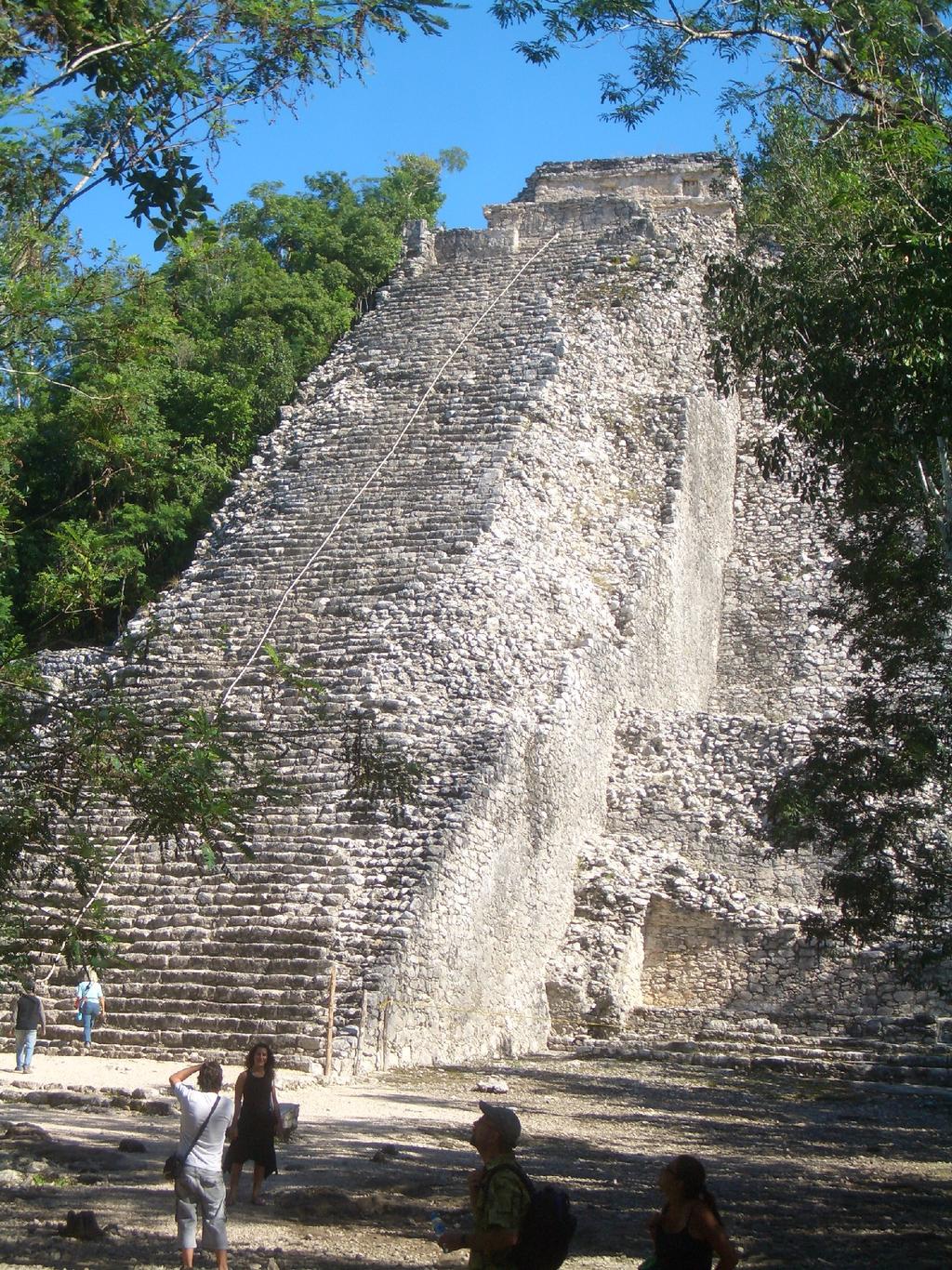
6 Coba

7 The landscape

8 Chichen Itza
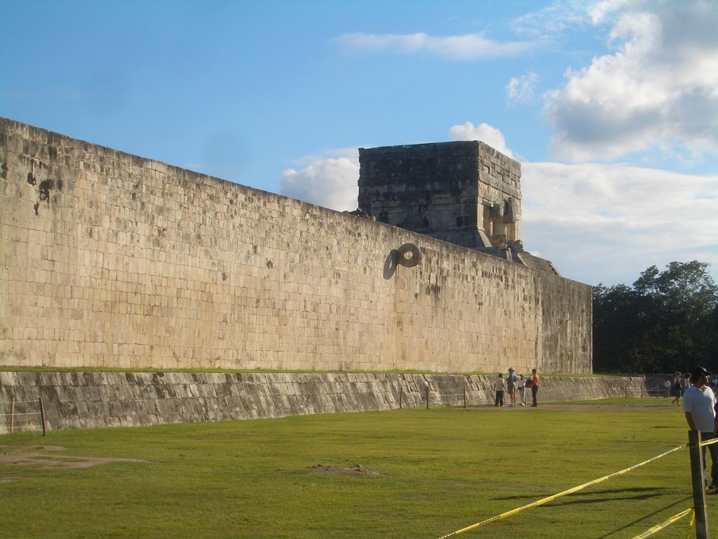
9 Ball game
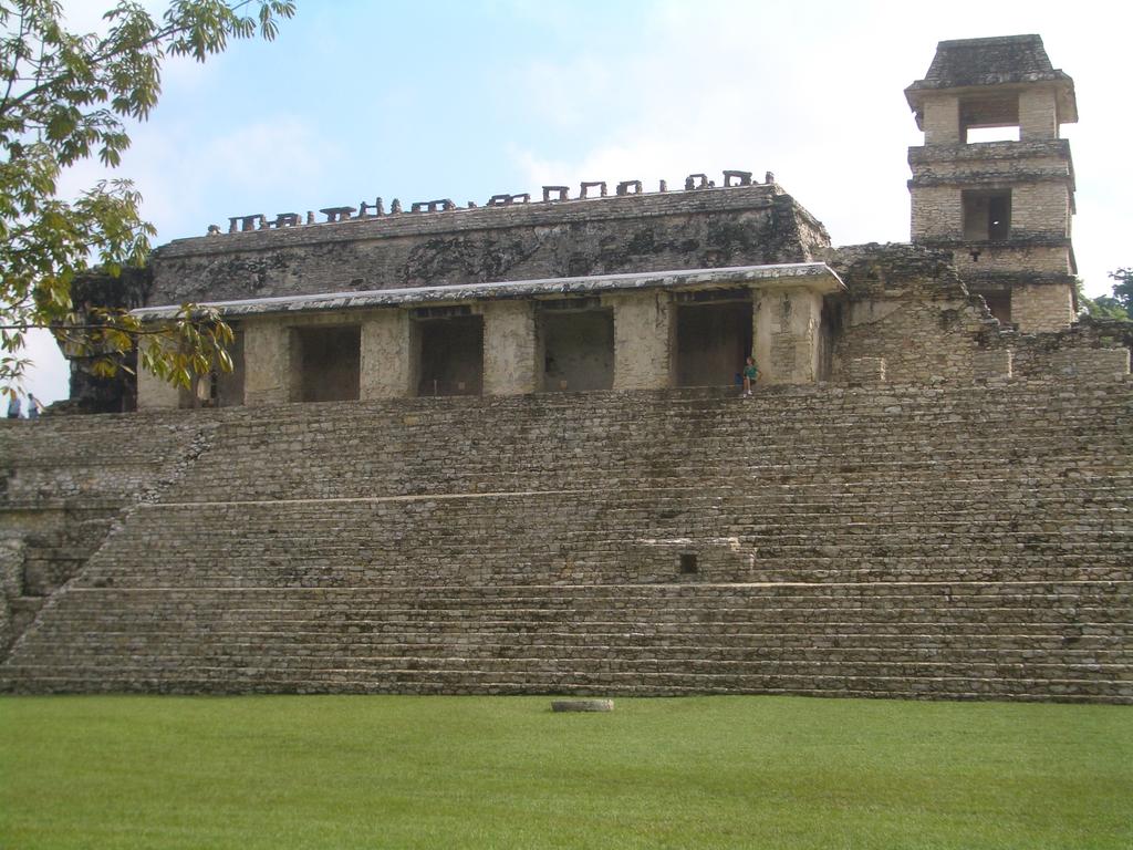
10 Palenque

11 San Cristobal de las Casas

12 Written culture

13 Culture alive
14 Potential influence of cultural differences: Cultural assumptions built into GIS software: 1. Spatial cognition 2. Verbal expression of spatial relation 3. Naming of GIS operations 4. Different physical situation 5. Identification of landmarks 6. Toponyms
15 Cultural differences in spatial cognition (Montello): Spatial cognition is universal, i.e. the same for all human beings. No evidence to the contrary has been found, despite efforts. However, people over- or underestimate distance depending on situation. No influence of regular environment on spatial conceptualization found (Freundschuh)
16 Naming of geometric situation (Egenhofer, Mark): Human subject testing for a sketched situation of a road and a park. Comparing different language groups does not show significant differences.
17 Regular failures in spatial reasoning Hierarchical grouping let people overestimate distances between groups compared to inter-group distances. Observed, at least, in as diverse groups as American and Chinese.
18 Naming of GIS operations may be confusing: The names given to GIS operations are typically metaphorical applications of everyday words. Implications in the source language may conflict with implications in the target language and thus confuse GIS users.
19 A detailed case study: English term: cover, coverage Italian translation: copertura The Italian connotations imply hiding what is underneath, thus not suggesting the idea of connecting the coverages. Did not become a major obstacle as GIS experts are specially trained and lay people use prepared applications.
20 GIS were constructed initially with a specific application in mind: The application worked on initially at the Harvard Graphics Lab were planning for new suburban developments in the mid-west of the USA. It focuses on a 2D projection of the city, with uniform (nearly isotropic) terrain, and exclusive assignments of land use.

21 How to use it for re-planning cities like this?
22 Automatic Identification of Landmarks Landmarks are crucial for proper wayfinding instructions. Research to identify landmarks automatically is important. Can it result in universally usable software?
23 Toponyms and descriptions of land forms Terms like Lake, Pond etc. appear often in toponyms and are important for querying GIS. How to translate? Lake ~ lac ~ laguna? Pond etang ~ laguna?
24 Simple translation does not work (Mark):
25 Stages of past research: Naive
26 Whorfian
27 Summary of past research No fundamental differences in spatial cognition identified. Yet another example of the Whorfian hypothesis failing.
28 Strong dependencies on cultural aspects in the context of GIS use: Language not likely automatically translatable without consideration of context. Toponyms and land form terms: dependent on natural and cultural context.
29 A suggestion for a systematic approach Consider the semantic triangle, from the object perceived to the materialized expression:
30 Context redefined: Define context such that it influences all the mappings that occur from object perceived to the expression.
31 Structure the mappings in a sequence (hypothesis): human body physical environment Subject physical situation social environment concepts communication goals Language expression
32 Hypothesis of mappings: A collection of data or the formulation of a query in a GIS are expressions
33 Human body The properties of the human body influence what is perceived: The human senses Humans perceive only a specific window from the spatial and temporal spectrum.
34 Physical environment The presence of stimuli as produced by: climate, habitat, technology, economy, etc. determine what we see as objects and the operations possible with them.
35 The subject's situation: What are the current goals? What actions contribute to achieve them? Which objects permit these actions?
36 The social interpretation of the situation: X counts as Y in context Z (Searle). What is the social context which gives sense to the objects? What are the socially constructed operations that help me achieve my goals?
37 Communication goals What is the message I want to communicate? Factual information + Emotional stanza
38 Expression in a language Language as a system of symbols and their combination. Social agreements on what they communicate.
39 Culture influences some mappings: Depending on the definition of culture: Environment Technology Cosmology Political system Language These are interdependent...
40 Conclusion Culture and cultural influences is not well defined. Replace with a sequence of mappings from real world to concepts to expressions (symbols). To communicate subject situation the context determining the mapping must be fixed this is (mostly) culture.
Spatial Intelligence. Angela Schwering
 Spatial Intelligence Angela Schwering What I do What I do intelligent representation and processing of spatial information From the Cognitive Perspective How do humans perceive spatial information? How
Cognitive Engineering for Geographic Information Science
 Cognitive Engineering for Geographic Information Science Martin Raubal Department of Geography, UCSB raubal@geog.ucsb.edu 21 Jan 2009 ThinkSpatial, UCSB 1 GIScience Motivation systematic study of all aspects
Mappings For Cognitive Semantic Interoperability
 Mappings For Cognitive Semantic Interoperability Martin Raubal Institute for Geoinformatics University of Münster, Germany raubal@uni-muenster.de SUMMARY Semantic interoperability for geographic information
World Geography Unit Curriculum Document
 Unit Number and Title: Unit 9-Review (including a comparison to North America) Curriculum Concepts: Globalization Culture Democracy Diversity Migration Enduring Understandings (Big Ideas): Time Frame:
Why Is Cartographic Generalization So Hard?
 1 Why Is Cartographic Generalization So Hard? Andrew U. Frank Department for Geoinformation and Cartography Gusshausstrasse 27-29/E-127-1 A-1040 Vienna, Austria frank@geoinfo.tuwien.ac.at 1 Introduction
COURSES OUTSIDE THE JOURNALISM SCHOOL
 COURSES OUTSIDE THE JOURNALISM SCHOOL Students are not limited to the science courses on this list and may select classes from additional specialties. In accordance with University policy, 400-level courses
Fourth Grade Social Studies Crosswalk
 Fourth Grade Social Studies Crosswalk This crosswalk document compares the 2010 K-12 Social Studies Essential Standards and the 2006 North Carolina Social Studies Standard Course of Study (SCOS) and provides
Chapter 1: Basic Concepts
 Chapter 1: Basic Concepts The Cultural Landscape: An Introduction to Human Geography Defining Geography Word coined by Eratosthenes Geo = Earth Graphia = writing Geography thus means earth writing Contemporary
Multi-cultural Aspects of Spatial Knowledge
 Multi-cultural Aspects of Spatial Knowledge Andrew U. Frank Geoiformation TU Wien, Gusshausstrasse 27-29/E127 frank@geoinfo.tuwien.ac.at It is trivial to observe differences between cultures: people use
Mutah university faculty of Social Sciences The Study plan of the department of Geography 2006/2007
 Mutah university faculty of Social Sciences The Study plan of the department of Geography 2006/2007 Requirements university compulsory 22 Credit hours Course No Credit hours Prerequisite Requirements Faculty
Level 1 Geography PROGRAMME OVERVIEW 2014
 Ruawai College Social Sciences Department Level 1 Geography PROGRAMME OVERVIEW 2014 Topic/Theme EXTREME NATURAL EVENTS: TSUNAMIS Case Study: 2004 Indian Ocean Tsunami/Boxin g Day Tsunami, Indian Ocean
Geo-identification and pedestrian navigation with geo-mobile applications: how do users proceed?
 TU Vienna presentation 17 th July 2008 Geo-identification and pedestrian navigation with geo-mobile applications: how do users proceed? Ioannis Delikostidis Corné van Elzakker INTERNATIONAL INSTITUTE FOR
DIATHEMATIKON PROGRAMMA CROSS-THEMATIC CURRICULUM FRAMEWORK
 DIATHEMATIKON PROGRAMMA CROSS-THEMATIC CURRICULUM FRAMEWORK FOR STUDIES OF THE ENVIRONMENT The nature of Studies of the Environment Studies of the Environment is an interdisciplinary subject dealing with
Intelligent GIS: Automatic generation of qualitative spatial information
 Intelligent GIS: Automatic generation of qualitative spatial information Jimmy A. Lee 1 and Jane Brennan 1 1 University of Technology, Sydney, FIT, P.O. Box 123, Broadway NSW 2007, Australia janeb@it.uts.edu.au
What is Human Geography? HUMAN GEOGRAPHY. Human Geography. Human Geography 5/18/2015. Example of Differences: Hurricane Katrina
 What is Human Geography? Geography is the science of place and space. Geographers ask: Where are things located? Why things are located where they are? How places differ from one another? How people interact
Why Geography Matters
 Why Geography Matters Vocabulary words geography relative location absolute location physical feature human feature region modify adapt cause effect geography: The study of the Earth s physical and human
Generic Success Criteria
 Generic Success Criteria Significance I can identify a short term and long term impact that a development/event/issue has/had locally/globally. I can discuss (verbally, graphically, etc.) how a development/event/issue
GEOGRAPHY (GE) Courses of Instruction
 Courses of Instruction") GEOGRAPHY (GE) GE 102. (3) World Regional Geography. The geographic method of inquiry is used to examine, describe, explain, and analyze the human and physical environments of the major regions of the
GEOGRAPHY (GE) GE 102. (3) World Regional Geography. The geographic method of inquiry is used to examine, describe, explain, and analyze the human and physical environments of the major regions of the
Geography (GEOG) Courses
 Courses") Geography (GEOG) 1 Geography (GEOG) Courses GEOG 100. Introduction to Human Geography. 4 (GE=D4) Introduction to the global patterns and dynamics of such human activities as population growth and movements,
Geography (GEOG) 1 Geography (GEOG) Courses GEOG 100. Introduction to Human Geography. 4 (GE=D4) Introduction to the global patterns and dynamics of such human activities as population growth and movements,
Research on Object-Oriented Geographical Data Model in GIS
 Research on Object-Oriented Geographical Data Model in GIS Wang Qingshan, Wang Jiayao, Zhou Haiyan, Li Bin Institute of Information Engineering University 66 Longhai Road, ZhengZhou 450052, P.R.China Abstract
WS/FCS Unit Planning Organizer
 WS/FCS Unit Planning Organizer Subject(s) Social Studies Conceptual Lenses Grade/Course 3rd Place Unit of Study Five Themes of Geography Location Unit Title Pacing Geo Explorers 20-22 days Human environment
Modeling Discrete Processes Over Multiple Levels Of Detail Using Partial Function Application
 Modeling Discrete Processes Over Multiple Levels Of Detail Using Partial Function Application Paul WEISER a and Andrew U. FRANK a a Technical University of Vienna Institute for Geoinformation and Cartography,
Research Group Cartography
 Research Group Cartography Research Group Cartography Towards supporting wayfinding LBS components 1. Mobile devices 2. Communication Network 3. Positioning Component 4. Service and Application Provider
Extracting and Analyzing Semantic Relatedness between Cities Using News Articles
 Extracting and Analyzing Semantic Relatedness between Cities Using News Articles Yingjie Hu 1, Xinyue Ye 2, and Shih-Lung Shaw 1 1 Department of Geography, University of Tennessee, Knoxville 2 Department
AP Human Geography Syllabus
 AP Human Geography Syllabus Textbook The Cultural Landscape: An Introduction to Human Geography. Rubenstein, James M. 10 th Edition. Upper Saddle River, N.J.: Prentice Hall 2010 Course Objectives This
Course Introduction II
 CULTURE GEOG 247 Cultural Geography Course Introduction II Prof. Anthony Grande Hunter College-CUNY AFG 2015 Culture is the essence of human geography because it influences all aspects of life on earth.
Stage 2 Geography. Assessment Type 1: Fieldwork. Student Response
 Stage 2 Geography Assessment Type 1: Fieldwork Student Response Page 1 of 21 Page 2 of 21 Page 3 of 21 Image removed due to copyright. Page 4 of 21 Image removed due to copyright. Figure 5: A cause of
Aileen Buckley, Ph.D. and Charlie Frye
 An Information Model for Maps: Towards Production from GIS Databases Aileen Buckley, Ph.D. and Charlie Frye Researchers, ESRI GIS vs. cart GIS Outline of the presentation Introduction Differences between
Grade 6 Social Studies
 Grade 6 Social Studies Social Studies Grade(s) 6th Course Overview This course focuses on the five Wisconsin Model Academic standards for Social Studies: Geography, History, Political Science and Citizenship,
Belfairs Academy GEOGRAPHY Fundamentals Map
 YEAR 12 Fundamentals Unit 1 Contemporary Urban Places Urbanisation Urbanisation and its importance in human affairs. Global patterns of urbanisation since 1945. Urbanisation, suburbanisation, counter-urbanisation,
HIERARCHICAL STREET NETWORKS AS A CONCEPTUAL MODEL FOR EFFICIENT WAY FINDING
 HIERARCHICAL STREET NETWORKS AS A CONCEPTUAL MODEL FOR EFFICIENT WAY FINDING Adrijana Car and Andrew U. Frank Department of Geoinformation, Technical University Vienna Gußhausstraße 27-29, A-1040 Vienna,
Alleghany County Schools Curriculum Guide GRADE/COURSE: World Geography
 GRADE/COURSE: World 2013-14 GRADING PERIOD: 1 st Six Weeks Time Frame Unit/SOLs SOL # Strand Resource Assessment 8 days* The student will use maps, globes, satellite images, photographs, or diagrams to
Texas Geography. Understanding the physical and human characteristics of our state
 Texas Geography Understanding the physical and human characteristics of our state To understand Texas you must first learn about its Geography. Geography- The study of the world, its people, and the interaction
OAKLYN PUBLIC SCHOOL MATHEMATICS CURRICULUM MAP EIGHTH GRADE
 OAKLYN PUBLIC SCHOOL MATHEMATICS CURRICULUM MAP EIGHTH GRADE STANDARD 8.NS THE NUMBER SYSTEM Big Idea: Numeric reasoning involves fluency and facility with numbers. Learning Targets: Students will know
Information Cartography
 Information Cartography The use of Geographic Information Systems (GIS) to visualize nongeographic data Utilizes Geographic Information Science to develop models and organize information--not an art form
Curriculum Unit. Instructional Unit #1
 Curriculum Unit Name of Course: AP Human Geography Grade Level(s): 9-12 Brief Description (Course Catalog): The purpose of the AP Human Geography course is to introduce students to the systematic study
A General Framework for Conflation
 A General Framework for Conflation Benjamin Adams, Linna Li, Martin Raubal, Michael F. Goodchild University of California, Santa Barbara, CA, USA Email: badams@cs.ucsb.edu, linna@geog.ucsb.edu, raubal@geog.ucsb.edu,
Kai-Florian Richter Stephan Winter. Landmarks. GIScience for Intelligent Services
 Landmarks Kai-Florian Richter Stephan Winter Landmarks GIScience for Intelligent Services 123 Kai-Florian Richter Department of Geography University of Zurich Zurich, Switzerland Stephan Winter Department
Cognitive OpenLS Extending XML for location services by a high-level cognitive framework
 Cognitive OpenLS Extending XML for location services by a high-level cognitive framework Diplomarbeit Fachbereich Informatik, Universität Bremen April 10, 2006 Stefan Hansen Betreuer: Dr. Alexander Klippel
Basics of GIS reviewed
 Basics of GIS reviewed Martin Breunig Karlsruhe Institute of Technology martin.breunig@kit.edu GEODETIC INSTITUTE, DEPARTMENT OF CIVIL ENGINEERING, GEO AND ENVIRONMENTAL SCIENCES, CHAIR IN GEOINFORMATICS
Geographic Information Systems (GIS) in Environmental Studies ENVS Winter 2003 Session III
 in Environmental Studies ENVS Winter 2003 Session III") Geographic Information Systems (GIS) in Environmental Studies ENVS 6189 3.0 Winter 2003 Session III John Sorrell York University sorrell@yorku.ca Session Purpose: To discuss the various concepts of space,
Geographic Information Systems (GIS) in Environmental Studies ENVS 6189 3.0 Winter 2003 Session III John Sorrell York University sorrell@yorku.ca Session Purpose: To discuss the various concepts of space,
GIS Solutions in Natural Resource Management: Balancing the Technical- Political Equation
 GIS Solutions in Natural Resource Management: Balancing the Technical- Political Equation Stan Morain, Editor SUB Gdttlngen 7 208 520 309 98 A14447 0NW0RD PRESS V? % \
Spatializing time in a history text corpus
 Zurich Open Repository and Archive University of Zurich Main Library Strickhofstrasse 39 CH-8057 Zurich www.zora.uzh.ch Year: 2014 Spatializing time in a history text corpus Bruggmann, André; Fabrikant,
AP Human Geography Chapter 1: Thinking Geographically Key Issue 1: How do Geographers describe where things are?
 AP Human Geography Chapter 1: Thinking Geographically Key Issue 1: How do Geographers describe where things are? Studying Human Geography Physical Geography Physical geography deals with Earth s natural
GIS-based Smart Campus System using 3D Modeling
 GIS-based Smart Campus System using 3D Modeling Smita Sengupta GISE Advance Research Lab. IIT Bombay, Powai Mumbai 400 076, India smitas@cse.iitb.ac.in Concept of Smart Campus System Overview of IITB Campus
Place Syntax Tool (PST)
") Place Syntax Tool (PST) Alexander Ståhle To cite this report: Alexander Ståhle (2012) Place Syntax Tool (PST), in Angela Hull, Cecília Silva and Luca Bertolini (Eds.) Accessibility Instruments for Planning
Place Syntax Tool (PST) Alexander Ståhle To cite this report: Alexander Ståhle (2012) Place Syntax Tool (PST), in Angela Hull, Cecília Silva and Luca Bertolini (Eds.) Accessibility Instruments for Planning
DM-Group Meeting. Subhodip Biswas 10/16/2014
 DM-Group Meeting Subhodip Biswas 10/16/2014 Papers to be discussed 1. Crowdsourcing Land Use Maps via Twitter Vanessa Frias-Martinez and Enrique Frias-Martinez in KDD 2014 2. Tracking Climate Change Opinions
Variation of geospatial thinking in answering geography questions based on topographic maps
 Variation of geospatial thinking in answering geography questions based on topographic maps Yoshiki Wakabayashi*, Yuri Matsui** * Tokyo Metropolitan University ** Itabashi-ku, Tokyo Abstract. This study
Chapter 1: Basic Concepts
 Chapter 1: Basic Concepts The Cultural Landscape: An Introduction to Human Geography Defining Geography Word coined by Eratosthenes Geo = Earth Graphia = writing Geography thus means earth writing Contemporary
Chapter 1: Introduction to Safety and Ethics
 Core Curriculum Standards Met by Each Chapter On the Right Trail meets Utah s Social Studies Core Curriculum Standards for grades 3-7. Each chapter has specific standard objectives, which are met by the
Geography for Life. Course Overview
 Geography for Life Description In Geography for Life students will explore the world around them. Using the six essential elements established by the National Geographic Society students will be able to
THE TOURIST AND THE CITY.
 THE TOURIST AND THE CITY. ON ORIENTATION IN UNKNOWN URBAN SPACE Anna Agata Kantarek D.Sc. Ph.D. Arch. Faculty of Architecture Cracow University of Technology 6TH CONFERENCE OF THE INTERNATIONAL FORUM ON
GIScience & Mobility. Prof. Dr. Martin Raubal. Institute of Cartography and Geoinformation SAGEO 2013 Brest, France
 GIScience & Mobility Prof. Dr. Martin Raubal Institute of Cartography and Geoinformation mraubal@ethz.ch SAGEO 2013 Brest, France 25.09.2013 1 www.woodsbagot.com 25.09.2013 2 GIScience & Mobility Modeling
Curriculum and Assessment in Geography at KS3
 Curriculum and Assessment in Geography at KS3 Curriculum Statement: Geography The world as we know it is not given and it can and it will change. - Lambert et al. Powerful Knowledge in Geography Geography
Canadian Geo Course Introduction
 Canadian Geo 1202 Course Introduction Course Overview Unit 1 Natural and Human Systems (SCO 1.0 and SCO 2.0) - What happens when systems interact? In this unit students are challenged to reflect on the
Warmup. geography compass rose culture longitude
 Warmup geography compass rose culture longitude ecosystem latitude 1. study of the special physical and human characteristics of a place or region 2. learned system of shared beliefs, traits, and values
Yahoo! Labs Nov. 1 st, Liangjie Hong, Ph.D. Candidate Dept. of Computer Science and Engineering Lehigh University
 Yahoo! Labs Nov. 1 st, 2012 Liangjie Hong, Ph.D. Candidate Dept. of Computer Science and Engineering Lehigh University Motivation Modeling Social Streams Future work Motivation Modeling Social Streams
1. Pass GE1101E Geographical Journeys: Exploring World Environments. This will be counted towards the Faculty Core or UE requirements.
 H Geography At the Department of Geography, students are encouraged to develop a deeper and more critical understanding of both physical and human environments. Students will acquire knowledge, skills
MIDLAND ISD ADVANCED PLACEMENT CURRICULUM STANDARDS. ALGEBRA l
 (1) Foundations for functions. The student understands that a function represents a dependence of one quantity on another and can be described in a variety of ways. The (A) describe independent and dependent
Riocan Centre Study Area Frontenac Mall Study Area Kingston Centre Study Area
 OVERVIEW the biggest challenge of the next century (Dunham Jones, 2011). New books are continually adding methods and case studies to a growing body of literature focused on tackling this massive task.
Discovering Geographical Topics in Twitter
 Discovering Geographical Topics in Twitter Liangjie Hong, Lehigh University Amr Ahmed, Yahoo! Research Alexander J. Smola, Yahoo! Research Siva Gurumurthy, Twitter Kostas Tsioutsiouliklis, Twitter Overview
GEOGRAPHICAL NAMES AS PART OF THE GLOBAL, REGIONAL AND NATIONAL SPATIAL DATA INFRASTRUCTURES
 GEOGRAPHICAL NAMES AS PART OF THE GLOBAL, REGIONAL AND NATIONAL SPATIAL DATA INFRASTRUCTURES Željko HEĆIMOVIĆ, Željka JAKIR, Zvonko ŠTEFAN, Danijela KUKIĆ zeljko.hecimovic@cgi.hr, zeljka.jakir@cgi.hr,
STAAR Vocabulary Words extracted directly from the standard and/or associated with the instruction of the content within the standard.
 STAAR Vocabulary Words extracted directly from the standard and/or associated with the instruction of the content within the standard. READINESS STANDARDS - World Geography (WG.1) History. The student
A qualitative evaluation of a proposed new metro map for Melbourne. William Cartwright
 A qualitative evaluation of a proposed new metro map for Melbourne William Cartwright presentation presentation presentation presentation presentation presentation presentation Melbourne s rail system
INTRODUCTION. In March 1998, the tender for project CT.98.EP.04 was awarded to the Department of Medicines Management, Keele University, UK.
 INTRODUCTION In many areas of Europe patterns of drug use are changing. The mechanisms of diffusion are diverse: introduction of new practices by new users, tourism and migration, cross-border contact,
Expanding Canada s Rail Network to Meet the Challenges of the Future
 Expanding Canada s Rail Network to Meet the Challenges of the Future Lesson Overview Rail may become a more popular mode of transportation in the future due to increased population, higher energy costs,
A semantic and language-based model of landscape scenes
 A semantic and language-based model of landscape scenes Jean-Marie Le Yaouanc, Éric Saux, Christophe Claramunt Naval Academy Research Institute, BP 600, 29240, Brest Naval, France {leyaouanc, saux, claramunt}@ecole-navale.fr
Introduction to GIS I
 Introduction to GIS Introduction How to answer geographical questions such as follows: What is the population of a particular city? What are the characteristics of the soils in a particular land parcel?
Grade 3 Social Studies
 Grade 3 Social Studies Social Studies Grade(s) 3rd Course Overview Students will learn about a variety of communities. Students will learn about the geography and resources of communities. Students will
USING THE MILITARY LENSATIC COMPASS
 USING THE MILITARY LENSATIC COMPASS WARNING This presentation is intended as a quick summary, and not a comprehensive resource. If you want to learn Land Navigation in detail, either buy a book; or get
State and National Standard Correlations NGS, NCGIA, ESRI, MCHE
 GEOGRAPHIC INFORMATION SYSTEMS (GIS) COURSE DESCRIPTION SS000044 (1 st or 2 nd Sem.) GEOGRAPHIC INFORMATION SYSTEMS (11, 12) ½ Unit Prerequisite: None This course is an introduction to Geographic Information
Advanced Placement Human Geography
 Advanced Placement Human Geography Introduction to AP Human Geography The Advanced Placement course in Human Geography is designed to introduce students to the systematic study of the processes that have
Welcome to GST 101: Introduction to Geospatial Technology. This course will introduce you to Geographic Information Systems (GIS), cartography,
, cartography,") Welcome to GST 101: Introduction to Geospatial Technology. This course will introduce you to Geographic Information Systems (GIS), cartography, remote sensing, and spatial analysis through a series of
Welcome to GST 101: Introduction to Geospatial Technology. This course will introduce you to Geographic Information Systems (GIS), cartography, remote sensing, and spatial analysis through a series of
Urban Spatial Scenario Design Modelling (USSDM) in Dar es Salaam: Background Information
 in Dar es Salaam: Background Information") Urban Spatial Scenario Design Modelling (USSDM) in Dar es Salaam: Background Information Modelling urban settlement dynamics in Dar es Salaam Revision: 2 (July 2013) Prepared by: Katja Buchta TUM team
Urban Spatial Scenario Design Modelling (USSDM) in Dar es Salaam: Background Information Modelling urban settlement dynamics in Dar es Salaam Revision: 2 (July 2013) Prepared by: Katja Buchta TUM team
North Carolina Essential Standards Kindergarten Social Studies
 North Carolina s Kindergarten Social Studies Kindergarten through second grade students are introduced to an integrative approach of Social Studies by exploring aspects of self, others, families and communities
Social Studies Continuum
 Historical Skills chronological thinking understand that we can learn about the past from different sorts of evidence begin to use historical resources apply research skills by investigating a topic in
About places and/or important events Landmarks Maps How the land is, hills or flat or mountain range Connected to maps World Different countries
 What do you think you know about geography? About places and/or important events Landmarks Maps How the land is, hills or flat or mountain range Connected to maps World Different countries What do you
Semantic Granularity in Ontology-Driven Geographic Information Systems
 Semantic Granularity in Ontology-Driven Geographic Information Systems Frederico Fonseca a Max Egenhofer b Clodoveu Davis c Gilberto Câmara d a School of Information Sciences and Technology Pennsylvania
Spatial Knowledge Acquisition from Addresses
 Spatial Knowledge Acquisition from Addresses Farid Karimipour 1, Negar Alinaghi 1,3, Paul Weiser 2, and Andrew U. Frank 3 1 Faculty of Surveying and Geospatial Engineering, University of Tehran, Iran {fkarimipr,
How Irrigation Affected the Geography of Northeast Oregon
 Delia Wallis How Irrigation Affected the Geography of Northeast Oregon Grade Levels: 4 (with ability to move up or down) Time: two x 45-minute sessions Overview: Students are going to study topographical
WS/FCS Unit Planning Organizer
 WS/FCS Unit Planning Organizer Subject(s) Social Studies Conceptual Lenses Grade/Course 6 th Geography Unit of Study Unit 1: Human Geography Civilization Unit Title Social Studies 101 Culture Pacing 12
Advanced Placement Human Geography
 Advanced Placement Human Geography I. Overview of the Course The purpose of the Advanced Placement (AP) Human Geography course is to introduce students to the systematic study of patterns and processes
HPISD CURRICULUM (SOCIAL STUDIES, WORLD GEOGRAPHY)
") HPISD CURRICULUM (SOCIAL STUDIES, WORLD GEOGRAPHY) EST. NUMBER OF DAYS: 14 UNIT NAME Unit Overview UNIT 7 SOUTH WEST ASIA/NORTH AFRICA SWANA s geography has led to economic and cultural differences. Students
HPISD CURRICULUM (SOCIAL STUDIES, WORLD GEOGRAPHY) EST. NUMBER OF DAYS: 14 UNIT NAME Unit Overview UNIT 7 SOUTH WEST ASIA/NORTH AFRICA SWANA s geography has led to economic and cultural differences. Students
Exploring the boundaries of your built and natural world. Geomatics
 Exploring the boundaries of your built and natural world Geomatics Before the Luxor brought magic to the Las Vegas strip and before the South LRT extension in Edmonton gave residents a new route to travel,
AP HUG REVIEW WELCOME TO 2 ND SEMESTER! Annette Parkhurst, M.Ed. January, 2015
 AP HUG REVIEW WELCOME TO 2 ND SEMESTER! Annette Parkhurst, M.Ed. January, 2015 Movement Globalization Latitude & Elevation Levels of Economic Activities CONNECTIONS Human Geography Human is the geography
Alexander Klippel and Chris Weaver. GeoVISTA Center, Department of Geography The Pennsylvania State University, PA, USA
 Analyzing Behavioral Similarity Measures in Linguistic and Non-linguistic Conceptualization of Spatial Information and the Question of Individual Differences Alexander Klippel and Chris Weaver GeoVISTA
MORPHOLOGICAL STUDY OF A SMALL TOWN BARKUR IN COASTAL KARNATAKA, INDIA 2 METHODOLOGY
 2 METHODOLOGY The understanding of form as a process with underlying structure, distinguishing it from the physical characteristics of town form itself by which the potentials of the town structure are
GENERALIZATION IN THE NEW GENERATION OF GIS. Dan Lee ESRI, Inc. 380 New York Street Redlands, CA USA Fax:
 GENERALIZATION IN THE NEW GENERATION OF GIS Dan Lee ESRI, Inc. 380 New York Street Redlands, CA 92373 USA dlee@esri.com Fax: 909-793-5953 Abstract In the research and development of automated map generalization,
LOUISIANA STUDENT STANDARDS FOR SOCIAL STUDIES THAT CORRELATE WITH A FIELD TRIP TO DESTREHAN PLANTATION KINDERGARTEN
 LOUISIANA STUDENT STANDARDS FOR SOCIAL STUDIES THAT CORRELATE WITH A FIELD TRIP TO DESTREHAN PLANTATION KINDERGARTEN Standard 2 Historical Thinking Skills Students distinguish between events, people, and
Nevada Academic Content Standards Science Grade: 6 - Adopted: 2014
 Main Criteria: Nevada Academic Content Standards Secondary Criteria: Subjects: Science, Social Studies Grade: 6 Correlation Options: Show Correlated Nevada Academic Content Standards Science Grade: 6 -
Fundamentals of Geographic Information System PROF. DR. YUJI MURAYAMA RONALD C. ESTOQUE JUNE 28, 2010
 Fundamentals of Geographic Information System 1 PROF. DR. YUJI MURAYAMA RONALD C. ESTOQUE JUNE 28, 2010 CONTENTS OF THIS LECTURE PRESENTATION Basic concept of GIS Basic elements of GIS Types of GIS data
Highland Park Physics I Curriculum Semester I Weeks 1-4
 NAME OF UNIT: Kinematics Components Unit Name Introduction Short Descriptive Overview Concepts Weeks 1-4 Survival Physics Describing Motion Mathematical Model of Motion In Physics, students conduct field
Characteristic features of toponym objects and their dynamics
 23 May 2002 English only Eighth United Nations Conference on the Standardization of Geographical Names Berlin, 27 August-5 September 2002 Item 12 (c) of the provisional agenda* Toponymic data files: toponymic
LEARNING OUTCOMES SST (G1-G12)
") LEARNING OUTCOMES SST (G1-G12) Grade 1 Learning Outcomes Students will be expected to: - demonstrate an understanding of the importance of interactions between people - demonstrate an understanding of
LEARNING OUTCOMES SST (G1-G12) Grade 1 Learning Outcomes Students will be expected to: - demonstrate an understanding of the importance of interactions between people - demonstrate an understanding of
GIS = Geographic Information Systems;
 What is GIS GIS = Geographic Information Systems; What Information are we talking about? Information about anything that has a place (e.g. locations of features, address of people) on Earth s surface,
Alaska Content and Performance Standards Science Grade: 7 - Adopted: Concepts of Life Science (SC1, SC2, SC3)
") Main Criteria: Alaska Content and Performance Standards Secondary Criteria: Subjects: Science, Social Studies Grade: 7 Correlation Options: Show Correlated AK.C1. Alaska Content and Performance Standards
Main Criteria: Alaska Content and Performance Standards Secondary Criteria: Subjects: Science, Social Studies Grade: 7 Correlation Options: Show Correlated AK.C1. Alaska Content and Performance Standards
Interactive Visualization Tool (InViTo)
") Interactive Visualization Tool (InViTo) Stefano Pensa To cite this report: Stefano Pensa (2012) Interactive Visualization Tool (InViTo), in Angela Hull, Cecília Silva and Luca Bertolini (Eds.) Accessibility
Interactive Visualization Tool (InViTo) Stefano Pensa To cite this report: Stefano Pensa (2012) Interactive Visualization Tool (InViTo), in Angela Hull, Cecília Silva and Luca Bertolini (Eds.) Accessibility
Climate Change: How it impacts Canadians and what we can do to slow it down.
 Climate Change: How it impacts Canadians and what we can do to slow it down. Lesson Overview This lesson takes stock of how climate change has already affected Canadians in geographic, economic, and cultural
Linear Referencing in Boulder County, CO. Getting Started
 Linear Referencing in Boulder County, CO Getting Started 1 Authors Janie Pierre GIS Technician, Boulder County Road centerline and storm sewer geodatabases & maps John Mosher GIS Specialist, Boulder County
5 Themes of Geography Review Video Notes What is Geography?
 Name PG # 5 Themes of Geography Review Video Notes What is Geography? The study of, their, and their Main Idea or Topic Continents Notes about Main Idea or Topic There are 7 Continents or in the world: