Outline Introduction Objectives Study Area Methodology Result Discussion Conclusion
|
|
|
- Ralf Melton
- 5 years ago
- Views:
Transcription

1 Land Cover, Land Use of two bioluminescent bays in Puerto Rico Undergraduate Research By: Yadira Soto Viruet Advisor: Fernando Gilbes Santaella, Ph.D
2 Outline Introduction Objectives Study Area Methodology Result Discussion Conclusion
3 Introduction Land around Puerto Mosquito Bay in Vieques and La Parguera Bioluminescence Bay in Lajas, Puerto Rico are used to produce Land Use/ Land Cover maps. Land use is defined as the use of land by humans. Land cover is designates (natural or man made). only the vegetation
4 Examples: urban structures, forest, agriculture, water resources, vegetations index and others. The Land Use/Land Cover maps have the capacity to illustrate the interaction between human and the surroundings. In Puerto Rico, general maps of Land Uses/Land Cover were produced in 1999 for La Parguera and Vieques Island.


5 Land Use/ Land Cover Maps, 1999 Linda Velez,1999
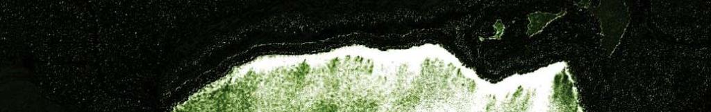
6 The Bioluminescence is the emission of light by living organism (Pyrodinium bahamense). Conditions aiding the accumulation of these organisms oga sae are: shallow basin with low tidal and narrow mouth, surrounded by mangroves. La Parguera Bioluminescent Bay has shown a decrease in its bioluminescence by approximately 80% during recent years compared with Puerto Mosquito Bay.
7 Objectives The main objective of this research was produce and compare Land Use and Land Cover, specific maps for the two bioluminescence bays; using Remote Sensing and GIS tools.


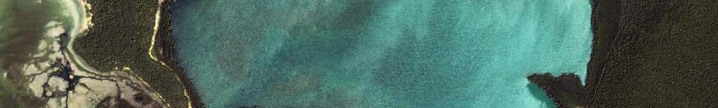
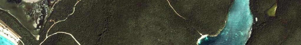
8 Study Area Adapted from Walker, 1997 IKONOS 1m


9 La Parguera Bioluminescence Bay The geomorphology of the area is the result of deformation of Limestone in early Cretaceous (Glynn, 1973). The bottom sediments are composed by fine mud, marine plants and mangrove leaves. Scale 1,2000 (Volckmann, 1984)
10 Puerto Mosquito Bay Scale 1,2000 (USGS Maps,2001) The geology of Vieques consists in intrusive rocks with carbonate sediments, the bottom sediments are composed by clay. QTu Sedimentary deposits undivided Marine limestone.
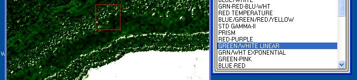
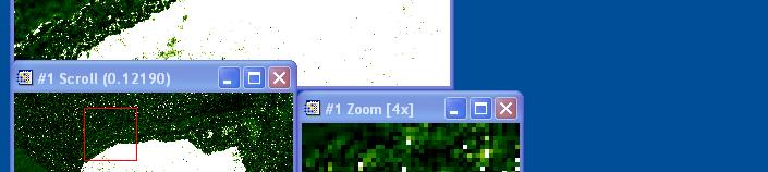
11 Methodology Environment for Visualizing Images (ENVI) Geographic Information System (GIS) IKONOS sensor provides spatial resolution at 1 meter and in multispectral mode, it provides imagery at 4 m spatial in four spectral bands. The images was displayed using all available bands; red, green, blue (RGB) and infrared band (IR).
12 IKONOS, 1m


13 IKONOS, 1m
14 (Campbell, 2002)
15 (Campbell, 2002)

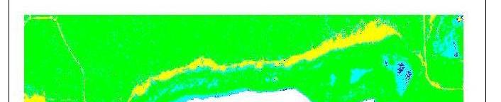
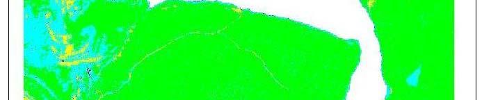
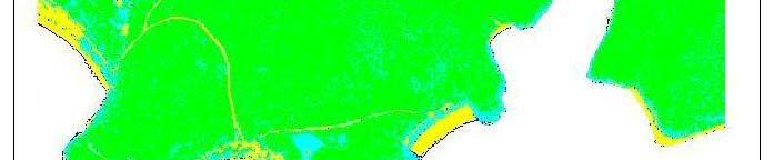
16 Supervised classification Parallelepiped Minimum Distance Mahalanobis Distance Maximum Likelihood Confusion Matrix method using ground truth image and ROI s. Hydrology information,, USGS publication files

")


17 Regions of Interest (ROI s) The process of using known pixels identity to classify unknown pixel identity.


18 Index of Vegetation (NDVI) NDVI= Infrared (IR)-Red (R) / Infrared (IR)+ Red (R)
19 Results


20 Maximum Likehood Assumes that the statistics for each class in each band are normally distributed and calculates the probability that a given pixel belongs to a specific class. (Campbell, 2002)


21 Minimum Distance Uses the mean vectors of each ROI s and calculates the Euclidean distance from each unknown pixel to the mean vector for each class. (Campbell, 2002)


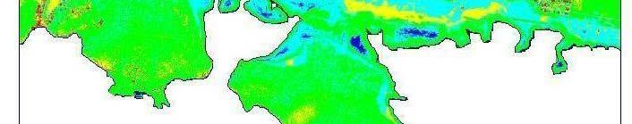
22 Parallelepiped classification Ranges of values within training data to define regions within a multidimensional data space. (Campbell, 2002)


23 Mahalanobis Distance Mahalanobis Distance classification is a direction sensitive distance classifier that uses statistics for each class.
24 Minimum Distance
25 Mahalanobis Distance
26 Maximum Likehood


27 Distribution of Classes Distribution of Classes % La Parguera Bioluminescence i Bay 1% 12%, Distribution of Classes % Puerto Mosquito Bay 5% 11% 9% 55% 23% 27% 57%


28


29
30 Index of Vegetation Darker green color represent more density of vegetation


31
32 Validation process Accuracy is calculated by the sum of the number of pixels classified correctly divided by the sum of all the pixels in the entire ground truth classes. Confusion matrix for La Parguera Bioluminescence Bay Ground Truth ROI s, was 99% Kappa coefficient was The Kappa coefficient is a measure of the proportional improvement by the 36 classifier over a purely random assignment of classes. Puerto Mosquito Bay Ground Truth ROI s 90% Kappa Coefficient was 0.5 The confusion matrix, using Ground Truth Image, was 100% and the kappa coefficient was 1 for both bays.
33 Discussion Supervised classification, the analyst has control of the selected classes depending of the purpose of the research. All supervised classifications, were tested to determine the best spectral response for each image and classification method. For La Parguera Bioluminescence Bay the percentage distribution were similar in the two bays, except for urban or built up.
34 In La Parguera Bioluminescence Bay has more interaction with anthropogenic activities than Puerto Mosquito Bay. It is visible iibl to recognize that t La Parguera Bioluminescence Bay has less density of vegetation than Puerto Mosquito Bay. The geological characteristic take an important role for the distribution and impute of sediments that effect into the bay.
35 Conclusion The capacity to recognize and updates these land use and land cover areas are important tools development of priorities iti for the management and for future research. The fact that the presence of the urban or anthropogenic activities affects the bioluminescent bays, also contribute to reduce the bioluminescent. Human activities have a substantial impact on the hydrology characteristic of the bay, also the sediment impute to the bay has been variable due to human activities.
36 The destruction of vegetation and the transit of boats can also affect the bay. For future research, is suggested used older images and make supervised classification to determine changes in time and vegetation. The IKONOS sensor is a great tool to obtain images with high h quality, classification and index of vegetation was possible using the spectral information available in the images. Webpage: p
37 Acknowledgments I want to thank Dr. Fernando Gilbes Santaella for support and help in working on this research. Thanks William Hernández to provide the USGS information and support me. This project was funded by University of Puerto Rico, Sea Grant College Program.
38 References Bawiec, J. W., 2001, Geology, geochemistry, geophysics, Mineral Occurrences and Mineral Resource Assessment for Commonwealth of Puerto Rico. U.S. Geological Survey Open- File Report p Campbell, J.A, 2000, Introduction to Remote Sensing, The Guilford Press. p Connelly, X. M. 1993, Batimetría de la Bahía Puerto Mosquito. Vieques, Puerto Rico. In: Walker, L.A., 1997, Populations Dynamics of Dinoflagellates in Two Bioluminescent bays: Bahía Fosforecente and Puerto Mosquito, Vieques. M.S. thesis, University of Puerto Rico, Mayagüez. p.51. Foddy, G. and Curran P. 1994, Environmental Remote Sensing from Global to Regional Scales. p. 238 Glynn, P.W Ecology of a Caribbean Coral Reef. The Porites Reef-Flat Biotope:Part 1. Meterology and Hydrography. Marine Biology.20: p Green E., Alasdair E., Clark C. and J. Mumby,2000. Remote Sensing Handbook for Tropical Coastal Management. Unesco Publishing. Coastal management source books 3 Margalef, R., Hidrografía y fitoplancton de un área marina de la costa meridional de Puerto Rico. Investigación Pesquera. 18:p Seixas Guerrero, C.E., 1988, Patrones de distribución especial y sucesión temporal en poblaciones de dinoflagelados de la Bahía Fosforescente, Puerto Rico. Ph.D tesis, Universidad de Puerto Rico, Mayagüez.88. Volckmann, R. P., 1984, Geologic Map of the Cabo Rojo and La Parguera Bioluminesce Bay Quadrangles, Southwest of Puerto Rico: U.S.G.S. Miscellanous Geologic Invest. Map I , scale 1:20, Walker, L.A., 1997, Population dynamics of Dinoflagellates in two bioluminescent bays: Bahia Fosforescente, La Parguera Bioluminescence Bay and Puerto Mosquito Bay Vieques. V1. p. 51
Contaminant and Erosion Control Baseline Database for the Puerto Mosquito Watershed, Vieques, PR
 Sea Grant University of Puerto Rico at Mayaguez Mayaguez, Puerto Rico Contaminant and Erosion Control Baseline Database for the Puerto Mosquito Watershed, Vieques, PR Progress Report Submitted by: Fernando
GEOGRAPHIC INFORMATION SYSTEMS (GIS) AT GERS LAB
 AT GERS LAB") GEOGRAPHIC INFORMATION SYSTEMS (GIS) AT GERS LAB Fernando Gilbes Santaella GERS Lab-Department of Geology University of Puerto Rico at Mayaguez fernando.gilbes@upr.edu Geological and Environmental Remote
GEOGRAPHIC INFORMATION SYSTEMS (GIS) AT GERS LAB Fernando Gilbes Santaella GERS Lab-Department of Geology University of Puerto Rico at Mayaguez fernando.gilbes@upr.edu Geological and Environmental Remote
GERSVIEW: A New Database for Web Mapping
 GERSVIEW: A New Database for Web Mapping William J. Hernández, M.S. Graduate Student Department of Marine Sciences-UPRM Fernando Gilbes, Ph.D. Associate Professor Department of Geology-UPRM Overview Introduction
Seek of Specific Soils in Puerto Rico using IKONOS
 Geological Aplication of Remote Sensing Copyright 2004 Department of Geology University of Puerto Rico, Mayagüez Seek of Specific Soils in Puerto Rico using IKONOS D. HERNÁNDEZ University of Puerto Rico
Dr.N.Chandrasekar Professor and Head Centre for GeoTechnology Manonmaniam Sundaranar University Tirunelveli
 Classification and Segmentation of Coastal Landforms in the South Tamilnadu Coast Dr.N.Chandrasekar Professor and Head Centre for GeoTechnology Manonmaniam Sundaranar University Tirunelveli E-mail: profncsekar@gmail.com
SATELLITE DATA COLLECTION BY THE UPRM-TCESS SPACE INFORMATION LABORATORY
 SATELLITE DATA COLLECTION BY THE UPRM-TCESS SPACE INFORMATION LABORATORY Visita a la Estación De Satélites De UPRM En el CID 16 sep. 4:30 pm Nos reuniremos al frente del CID. CID L-BAND ANTENNA Orbview
Using IKONOS Images to Evaluate Coral Reefs in Low versus High Sedimentation Environments
 Using IKONOS Images to Evaluate Coral Reefs in Low versus High Sedimentation Environments David N. Cuevas Miranda Department of Marine Sciences, University of Puerto Rico at Mayagüez P.O. Box 908 Lajas,
Landsat TM processing in the investigation of active fault zones, South Lajas Valley Fault Zone and Cerro Goden Fault Zone as an example
 Landsat TM processing in the investigation of active fault zones, South Lajas Valley Fault Zone and Cerro Goden Fault Zone as an example ANTONIO E. CAMERON-GONZÁLEZ 1 1 Department of Geology, University
Undergraduate Research Final Report: Estimation of suspended sediments using MODIS 250 m bands in Mayagüez Bay, Puerto Rico
 Undergraduate Research Final Report: Estimation of suspended sediments using MODIS 250 m bands in Mayagüez Bay, Puerto Rico Abstract: José F. Martínez Colón Undergraduate Research 2007 802-03-4097 Advisor:
Usage of remote sensing data for the identification of Shoreline evolution of the Holderness, UK
 Usage of remote sensing data for the identification of Shoreline evolution of the Holderness, UK STEPHANIE D. MONTALVO DELGADO Geology Department, University of Puerto Rico, Mayagüez Campus P.O. Box 9017
Developing a protocol to use remote sensing as a cost effective tool to monitor contamination of mangrove wetlands
 Developing a protocol to use remote sensing as a cost effective tool to monitor contamination of mangrove wetlands Johannes H. Schellekens, Fernando Gilbes-Santaella, Augustine Rodriguez-Roman, and Belyneth
Study of the Effects of Land Use and Land Cover in Laguna Grande Bioluminescent Bay
 Study of the Effects of Land Use and Land Cover in Laguna Grande Bioluminescent Bay Maribel Torres Velázquez 1, Denyse Colón Lugo 2, José A. Algarín Ballesteros 3 1. Department of Electrical Engineering,
Using Remote Sensing to Map the Evolution of Marsh Vegetation in the South Bay of San Francisco
 Using Remote Sensing to Map the Evolution of Marsh Vegetation in the South Bay of San Francisco Brian Fulfrost Design, Community and Environment (DC&E) 6 th Annual Bay-Delta Science Conference PROJECT
The Positional and Thematic Accuracy for Analysis of Multi-Temporal Satellite Images on Mangrove Areas
 The Positional and Thematic Accuracy for Analysis of Multi-Temporal Satellite Images on Mangrove Areas Paulo Rodrigo Zanin¹, Carlos Antonio O. Vieira² ¹Universidade Federal de Santa Catarina, Campus Universitário
HEAVY MINERALS INVESTIGATION USING GEOSPATIAL TECHNOLOGY
 HEAVY MINERALS INVESTIGATION USING GEOSPATIAL TECHNOLOGY *Muthiah.M.S, **Colins Johnny.J, *PG student: Department of Civil Engineering, Anna University Regional Campus Tirunelveli, India **Assistant Professor:
Comparison between Land Surface Temperature Retrieval Using Classification Based Emissivity and NDVI Based Emissivity
 Comparison between Land Surface Temperature Retrieval Using Classification Based Emissivity and NDVI Based Emissivity Isabel C. Perez Hoyos NOAA Crest, City College of New York, CUNY, 160 Convent Avenue,
KNOWLEDGE-BASED CLASSIFICATION OF LAND COVER FOR THE QUALITY ASSESSEMENT OF GIS DATABASE. Israel -
 KNOWLEDGE-BASED CLASSIFICATION OF LAND COVER FOR THE QUALITY ASSESSEMENT OF GIS DATABASE Ammatzia Peled a,*, Michael Gilichinsky b a University of Haifa, Department of Geography and Environmental Studies,
1. Introduction. Chaithanya, V.V. 1, Binoy, B.V. 2, Vinod, T.R. 2. Publication Date: 8 April DOI: https://doi.org/ /cloud.ijarsg.
 Cloud Publications International Journal of Advanced Remote Sensing and GIS 2017, Volume 6, Issue 1, pp. 2088-2096 ISSN 2320 0243, Crossref: 10.23953/cloud.ijarsg.112 Research Article Open Access Estimation
Remote Sensing of Episodic Rainfall Events Affecting Coral Reefs in Southwestern Puerto Rico
 Remote Sensing of Episodic Rainfall Events Affecting Coral Reefs in Southwestern Puerto Rico Y. Detrés, R. Armstrong, E. Otero and R. García yasmin@cacique.uprm.edu University of Puerto Rico, Mayaguez
Ramos-Scharron et al-gsa Southeastern Section Meeting, San Juan, March 2013
 Interdisciplinary approaches to assess the hydrogeomorphological effects of land use change on marine ecosystems of Puerto Rico and the U.S. Virgin Islands C.E. Ramos-Scharrón J Amador (Greg L. Morris
High-resolution bottom albedo images and benthic habitat classification to develop baseline management tools in Natural Reserves
 High-resolution bottom albedo images and benthic habitat classification to develop baseline management tools in Natural Reserves William J. Hernandez, Ph.D. and Roy A. Arsmtrong, Ph.D. Post-Doctoral Researcher
International Journal of Scientific & Engineering Research, Volume 6, Issue 7, July ISSN
 International Journal of Scientific & Engineering Research, Volume 6, Issue 7, July-2015 1428 Accuracy Assessment of Land Cover /Land Use Mapping Using Medium Resolution Satellite Imagery Paliwal M.C &.
Soil Erosion Calculation using Remote Sensing and GIS in Río Grande de Arecibo Watershed, Puerto Rico
 Soil Erosion Calculation using Remote Sensing and GIS in Río Grande de Arecibo Watershed, Puerto Rico Alejandra M. Rojas González Department of Civil Engineering University of Puerto Rico at Mayaguez.
Suspended Sediments around Puerto Rico as measured with AVIRIS and MODIS
 UNDERGRADUATE RESEARCH PROYECT Submitted to: Department of Geology By: Eidalia González Tosado Department of Geology, University of Puerto Rico, Mayaguez, Puerto Rico Suspended Sediments around Puerto
Mapping the Frequency and Distribution of the Rio Grande de Añasco plume using MERIS
 UNDERGRADUATE RESEARCH GEOL 4055 University of Puerto Rico Mayaguez Campus Faculty of Arts and Sciences Department of Geology Mapping the Frequency and Distribution of the Rio Grande de Añasco plume using
OSTRACODES AS PROXIES FOR PALEOSALINITY IN BAYS OF VIEQUES, PUERTO RICO
 OSTRACODES AS PROXIES FOR PALEOSALINITY IN BAYS OF VIEQUES, PUERTO RICO LAURA R. ROBERTSON The College of William and Mary Dr. Heather Macdonald and Dr. Neil Tibert INTRODUCTION The 2006 Keck Geology Consortium
University of Puerto Rico Mayagüez Campus Department of Geology
 University of Puerto Rico Mayagüez Campus Department of Geology Undergraduate Research Final Report: Development of a site-specific algorithm to estimate suspended sediments using MODIS José F. Martínez
SEAWIFS VALIDATION AT THE CARIBBEAN TIME SERIES STATION (CATS)
") SEAWIFS VALIDATION AT THE CARIBBEAN TIME SERIES STATION (CATS) Jesús Lee-Borges* and Roy Armstrong Department of Marine Science, University of Puerto Rico at Mayagüez, Mayagüez, Puerto Rico 00708 Fernando
SEAWIFS VALIDATION AT THE CARIBBEAN TIME SERIES STATION (CATS) Jesús Lee-Borges* and Roy Armstrong Department of Marine Science, University of Puerto Rico at Mayagüez, Mayagüez, Puerto Rico 00708 Fernando
LAND USE MAPPING FOR CONSTRUCTION SITES
 LAND USE MAPPING FOR CONSTRUCTION SITES STATEMENT OF THE PROBLEM Monitoring of existing construction sites within the limits of the City of Columbia is a requirement of the city government for: 1) Control
Preparation of LULC map from GE images for GIS based Urban Hydrological Modeling
 International Conference on Modeling Tools for Sustainable Water Resources Management Department of Civil Engineering, Indian Institute of Technology Hyderabad: 28-29 December 2014 Abstract Preparation
Display data in a map-like format so that geographic patterns and interrelationships are visible
 Vilmaliz Rodríguez Guzmán M.S. Student, Department of Geology University of Puerto Rico at Mayagüez Remote Sensing and Geographic Information Systems (GIS) Reference: James B. Campbell. Introduction to
Digital Change Detection Using Remotely Sensed Data for Monitoring Green Space Destruction in Tabriz
 Int. J. Environ. Res. 1 (1): 35-41, Winter 2007 ISSN:1735-6865 Graduate Faculty of Environment University of Tehran Digital Change Detection Using Remotely Sensed Data for Monitoring Green Space Destruction
Investigation of the Effect of Transportation Network on Urban Growth by Using Satellite Images and Geographic Information Systems
 Presented at the FIG Congress 2018, May 6-11, 2018 in Istanbul, Turkey Investigation of the Effect of Transportation Network on Urban Growth by Using Satellite Images and Geographic Information Systems
1. Introduction. S.S. Patil 1, Sachidananda 1, U.B. Angadi 2, and D.K. Prabhuraj 3
 Cloud Publications International Journal of Advanced Remote Sensing and GIS 2014, Volume 3, Issue 1, pp. 525-531, Article ID Tech-249 ISSN 2320-0243 Research Article Open Access Machine Learning Technique
URBAN LAND COVER AND LAND USE CLASSIFICATION USING HIGH SPATIAL RESOLUTION IMAGES AND SPATIAL METRICS
 URBAN LAND COVER AND LAND USE CLASSIFICATION USING HIGH SPATIAL RESOLUTION IMAGES AND SPATIAL METRICS Ivan Lizarazo Universidad Distrital, Department of Cadastral Engineering, Bogota, Colombia; ilizarazo@udistrital.edu.co
Vegetation Change Detection of Central part of Nepal using Landsat TM
 Vegetation Change Detection of Central part of Nepal using Landsat TM Kalpana G. Bastakoti Department of Geography, University of Calgary, kalpanagb@gmail.com Abstract This paper presents a study of detecting
International Journal of Intellectual Advancements and Research in Engineering Computations
 ISSN:2348-2079 Volume-5 Issue-2 International Journal of Intellectual Advancements and Research in Engineering Computations Agricultural land investigation and change detection in Coimbatore district by
MULTI-SOURCE IMAGE CLASSIFICATION
 MULTI-SOURCE IMAGE CLASSIFICATION Hillary Tribby, James Kroll, Daniel Unger, I-Kuai Hung, Hans Williams Corresponding Author: Daniel Unger (unger@sfasu.edu Arthur Temple College of Forestry and Agriculture
The Effects of Haze on the Accuracy of. Satellite Land Cover Classification
 Applied Mathematical Sciences, Vol. 9, 215, no. 49, 2433-2443 HIKARI Ltd, www.m-hikari.com http://dx.doi.org/1.12988/ams.215.52157 The Effects of Haze on the Accuracy of Satellite Land Cover ification
Detection of Land Use and Land Cover Change around Eti-Osa Coastal Zone, Lagos State, Nigeria using Remote Sensing and GIS
 International Research Journal of Environment Sciences E-ISSN 2319 1414 Detection of Land Use and Land Cover Change around Eti-Osa Coastal Zone, Lagos State, Nigeria using Remote Sensing and GIS Abstract
Geospatial technology for land cover analysis
 Home Articles Application Environment & Climate Conservation & monitoring Published in : Middle East & Africa Geospatial Digest November 2013 Lemenkova Polina Charles University in Prague, Faculty of Science,
Remote Sensing, Computers, and Land Use Planning
 Purdue University Purdue e-pubs LARS Technical Reports Laboratory for Applications of Remote Sensing 1-1-1973 Remote Sensing, Computers, and Land Use Planning Harry C. Hitchcock Follow this and additional
Earth and Environmental Science (EES)
") Earth and Environmental Science (EES) 1 Earth and Environmental Science (EES) Courses EES 5011. Remote Sensing and GIS. 4 Credit Hours. The focus of this class is on remote sensing technologies and geographic
Earth and Environmental Science (EES) 1 Earth and Environmental Science (EES) Courses EES 5011. Remote Sensing and GIS. 4 Credit Hours. The focus of this class is on remote sensing technologies and geographic
Sedimentary Environments Chapter 8
 Sedimentary Environments Chapter 8 Does not contain complete lecture notes. To be used to help organize lecture notes and home/test studies. What is a sedimentary rock? Sedimentary rocks are products of
Habitat Mapping using Remote Sensing for Green Infrastructure Planning in Anguilla
 Habitat Mapping using Remote Sensing for Green Infrastructure Planning in Anguilla Dr Katie Medcalf Cenv MIEEM www.envsys.co.uk Context Introduction to Anguilla Habitat mapping using Earth Observation
Spatial Accuracy Assessment for Coral Reef Classifications. Supawan Wongprayoon 1 Carlos Antonio Oliveira Vieira 2 Joseph Henry John Leach 3
 Spatial Accuracy Assessment for Coral Reef Classifications Supawan Wongprayoon 1 Carlos Antonio Oliveira Vieira 2 Joseph Henry John Leach 3 1, 3 Department of Geomatics, The University of Melbourne, Parkville,
High-resolution bottom albedo images and benthic habitat classification to develop baseline management tools in Natural Reserves
 High-resolution bottom albedo images and benthic habitat classification to develop baseline management tools in Natural Reserves *William J. Hernandez, Ph.D. and Roy A. Armstrong, Ph.D. *Post-Doctoral
Accuracy Assessment of Land Cover Classification in Jodhpur City Using Remote Sensing and GIS
 Accuracy Assessment of Land Cover Classification in Jodhpur City Using Remote Sensing and GIS S.L. Borana 1, S.K.Yadav 1 Scientist, RSG, DL, Jodhpur, Rajasthan, India 1 Abstract: A This study examines
Remote Sensing and Geographic Information System (GIS) Based Analysis of Historic Resources
 Based Analysis of Historic Resources") World War II Additional Material Remote Sensing and Geographic Information System (GIS) Based Analysis of Historic Resources By Nicole Vernon and Patrick O Day, GANDA Remote Sensing and Geographic Information
World War II Additional Material Remote Sensing and Geographic Information System (GIS) Based Analysis of Historic Resources By Nicole Vernon and Patrick O Day, GANDA Remote Sensing and Geographic Information
MAPPING THE FREQUENCY AND DISTRIBUTION OF THE RIO GRANDE DE AÑASCO PLUME USING MERIS
 MAPPING THE FREQUENCY AND DISTRIBUTION OF THE RIO GRANDE DE AÑASCO PLUME USING MERIS AS PART OF THE SEA GRANT PROJECT: APPLICATION OF THE SOIL AND WATER ASSESSMENT TOOL MODEL (SWAT) TO ESTIMATE DISCHARGE
Seasonal variability in the vertical attenuation coefficient at 490 nm (K490) in waters around Puerto Rico and US Virgin Islands.
 in waters around Puerto Rico and US Virgin Islands.") Seasonal variability in the vertical attenuation coefficient at 490 nm (K490) in waters around Puerto Rico and US Virgin Islands. William J. Hernandez 1 and Fernando Gilbes 2 1 Department of Marine Science,
Seasonal variability in the vertical attenuation coefficient at 490 nm (K490) in waters around Puerto Rico and US Virgin Islands. William J. Hernandez 1 and Fernando Gilbes 2 1 Department of Marine Science,
Combination of Microwave and Optical Remote Sensing in Land Cover Mapping
 Combination of Microwave and Optical Remote Sensing in Land Cover Mapping Key words: microwave and optical remote sensing; land cover; mapping. SUMMARY Land cover map mapping of various types use conventional
Current and Future Technology Applications for Coastal Zone Management. Bruce K. Carlisle, Acting Director Office of Coastal Zone Management
 Current and Future Technology Applications for Coastal Zone Management Bruce K. Carlisle, Acting Director Office of Coastal Zone Management The Massachusetts Coastal Zone Management Program Approved in
NOAA s OCM: Services, tools and collaboration opportunities & Puerto Rico s NE Marine Corridor as a case study
 NOAA s OCM: Services, tools and collaboration opportunities & Puerto Rico s NE Marine Corridor as a case study Dr. Antares Ramos Álvarez NOAA s Office of Coastal Management September 15 th, 2016 Conservation
Monitoring Vegetation Growth of Spectrally Landsat Satellite Imagery ETM+ 7 & TM 5 for Western Region of Iraq by Using Remote Sensing Techniques.
 Monitoring Vegetation Growth of Spectrally Landsat Satellite Imagery ETM+ 7 & TM 5 for Western Region of Iraq by Using Remote Sensing Techniques. Fouad K. Mashee, Ahmed A. Zaeen & Gheidaa S. Hadi Remote
SATELLITE REMOTE SENSING
 SATELLITE REMOTE SENSING of NATURAL RESOURCES David L. Verbyla LEWIS PUBLISHERS Boca Raton New York London Tokyo Contents CHAPTER 1. SATELLITE IMAGES 1 Raster Image Data 2 Remote Sensing Detectors 2 Analog
M.C.PALIWAL. Department of Civil Engineering NATIONAL INSTITUTE OF TECHNICAL TEACHERS TRAINING & RESEARCH, BHOPAL (M.P.), INDIA
, INDIA") INVESTIGATIONS ON THE ACCURACY ASPECTS IN THE LAND USE/LAND COVER MAPPING USING REMOTE SENSING SATELLITE IMAGERY By M.C.PALIWAL Department of Civil Engineering NATIONAL INSTITUTE OF TECHNICAL TEACHERS
INVESTIGATIONS ON THE ACCURACY ASPECTS IN THE LAND USE/LAND COVER MAPPING USING REMOTE SENSING SATELLITE IMAGERY By M.C.PALIWAL Department of Civil Engineering NATIONAL INSTITUTE OF TECHNICAL TEACHERS
The Geological Potential of Central America and the Caribbean: A USGS Report
 The Geological Potential of Central America and the Caribbean: A USGS Report World Bank Workshop Recent Developments in Mining and Sustainable Development in Latin America March 5, 2014 Jane Hammarstrom
Comparative Analysis of Supervised and
 Applied Mathematical Sciences, Vol.,, no., 68-69 HIKARI Ltd, www.m-hikari.com http://dx.doi.org/.988/ams.. Comparative Analysis of Supervised and Unsupervised Classification on Multispectral Data Asmala
Lecture Outline Wednesday - Friday February 14-16, 2018
 Lecture Outline Wednesday - Friday February 14-16, 2018 Quiz 2 scheduled for Friday Feb 23 (Interlude B, Chapters 6,7) Questions? Chapter 6 Pages of the Past: Sedimentary Rocks Key Points for today Be
HYPERSPECTRAL IMAGING
 1 HYPERSPECTRAL IMAGING Lecture 9 Multispectral Vs. Hyperspectral 2 The term hyperspectral usually refers to an instrument whose spectral bands are constrained to the region of solar illumination, i.e.,
Remote Sensing and GIS Techniques for Monitoring Industrial Wastes for Baghdad City
 The 1 st Regional Conference of Eng. Sci. NUCEJ Spatial ISSUE vol.11,no.3, 2008 pp 357-365 Remote Sensing and GIS Techniques for Monitoring Industrial Wastes for Baghdad City Mohammad Ali Al-Hashimi University
LAND COVER CATEGORY DEFINITION BY IMAGE INVARIANTS FOR AUTOMATED CLASSIFICATION
 LAND COVER CATEGORY DEFINITION BY IMAGE INVARIANTS FOR AUTOMATED CLASSIFICATION Nguyen Dinh Duong Environmental Remote Sensing Laboratory Institute of Geography Hoang Quoc Viet Rd., Cau Giay, Hanoi, Vietnam
A Baseline Mapping of Aquaculture and Coastal Habitats in Myanmar
 Aquaculture and Coastal Habitats Report No. 3 A Baseline Mapping of Aquaculture and Coastal Habitats in Myanmar J. Ronald Eastman, James Toledano, Stefano Crema Clark Labs, Clark University Introduction
Land Cover Classification Over Penang Island, Malaysia Using SPOT Data
 Land Cover Classification Over Penang Island, Malaysia Using SPOT Data School of Physics, Universiti Sains Malaysia, 11800 Penang, Malaysia. Tel: +604-6533663, Fax: +604-6579150 E-mail: hslim@usm.my, mjafri@usm.my,
Delineation of Groundwater Potential Zone on Brantas Groundwater Basin
 Delineation of Groundwater Potential Zone on Brantas Groundwater Basin Andi Rachman Putra 1, Ali Masduqi 2 1,2 Departement of Environmental Engineering, Sepuluh Nopember Institute of Technology, Indonesia
THE CONCENTRATION AND DISTRIBUTION OF BIOLUMINESCENT DINOFLAGELLATES IN VIEQUES, PUERTO RICO
 THE CONCENTRATION AND DISTRIBUTION OF BIOLUMINESCENT DINOFLAGELLATES IN VIEQUES, PUERTO RICO SARA GASPARICH Whitman College Research Advisor: Patrick Spencer INTRODUCTION The dinoflagellate Pyrodinium
Landuse and Landcover change analysis in Selaiyur village, Tambaram taluk, Chennai
 Landuse and Landcover change analysis in Selaiyur village, Tambaram taluk, Chennai K. Ilayaraja Department of Civil Engineering BIST, Bharath University Selaiyur, Chennai 73 ABSTRACT The synoptic picture
Applying Remote Sensing to Paleontology Studies in the State of Arizona, USA. Alberto Jiménez 1
 Applying Remote Sensing to Paleontology Studies in the State of Arizona, USA. Alberto Jiménez 1 1 Geology Department, UPR Mayagüez, P.O. Box 9017 Mayagüez, Puerto Rico, 00681 9017 ABSTRACT. Advances of
Chapter 9 : Rocks and Minerals
 Table of Contents Chapter 9 : Rocks and Minerals Section 2: Igneous and Sedimentary Rocks Section 3: Metamorphic Rocks and the Rock Cycle Section 2 and 3: Rocks and the Rock Cycle There are 3 different
REFERENCE: The Blue Planet An Introduction to Earth System Science. Brian J. Skinner and Barbara W. Murck (2011) Third Edition. John Wiley and Sons
 Third Edition. John Wiley and Sons") REFERENCE: The Blue Planet An Introduction to Earth System Science. Brian J. Skinner and Barbara W. Murck (2011) Third Edition. John Wiley and Sons Inc. Most life on Earth lives within a zone no wider
REFERENCE: The Blue Planet An Introduction to Earth System Science. Brian J. Skinner and Barbara W. Murck (2011) Third Edition. John Wiley and Sons Inc. Most life on Earth lives within a zone no wider
Developing a GIS of the Bioluminescent Bays on Vieques, Puerto Rico
 NGA PA 04-201 Developing a GIS of the Bioluminescent Bays on Vieques, Puerto Rico Page 1 of 10 Developing a GIS of the Bioluminescent Bays on Vieques, Puerto Rico ABSTRACT Lee E. Mitchell The Puerto Rico
Satellite Remote Sensing for Ocean
 Satellite Remote Sensing for Ocean August 17, 2017 Masatoshi Kamei RESTEC All rights reserved RESTEC 2015 Contents 1. About RESTEC and Remote Sensing 2. Example of Remote Sensing Technology 3. Remote Sensing
AUTOMATED BUILDING DETECTION FROM HIGH-RESOLUTION SATELLITE IMAGE FOR UPDATING GIS BUILDING INVENTORY DATA
 13th World Conference on Earthquake Engineering Vancouver, B.C., Canada August 1-6, 2004 Paper No. 678 AUTOMATED BUILDING DETECTION FROM HIGH-RESOLUTION SATELLITE IMAGE FOR UPDATING GIS BUILDING INVENTORY
STUDY OF NORMALIZED DIFFERENCE BUILT-UP (NDBI) INDEX IN AUTOMATICALLY MAPPING URBAN AREAS FROM LANDSAT TM IMAGERY
 INDEX IN AUTOMATICALLY MAPPING URBAN AREAS FROM LANDSAT TM IMAGERY") STUDY OF NORMALIZED DIFFERENCE BUILT-UP (NDBI) INDEX IN AUTOMATICALLY MAPPING URBAN AREAS FROM LANDSAT TM IMAGERY Dr. Hari Krishna Karanam Professor, Civil Engineering, Dadi Institute of Engineering &
STUDY OF NORMALIZED DIFFERENCE BUILT-UP (NDBI) INDEX IN AUTOMATICALLY MAPPING URBAN AREAS FROM LANDSAT TM IMAGERY Dr. Hari Krishna Karanam Professor, Civil Engineering, Dadi Institute of Engineering &
Soil erosion susceptibility and coastal evolution: examples in southern New Caledonia
 Pacific Island Countries GIS /RS User Conference Soil erosion susceptibility and coastal evolution: examples in southern New Caledonia Pascal DUMAS et Olivier COHEN University of New-Caledonia (EA 4242/
Dr. S.SURIYA. Assistant professor. Department of Civil Engineering. B. S. Abdur Rahman University. Chennai
 Hydrograph simulation for a rural watershed using SCS curve number and Geographic Information System Dr. S.SURIYA Assistant professor Department of Civil Engineering B. S. Abdur Rahman University Chennai
CHAPTER-7 INTERFEROMETRIC ANALYSIS OF SPACEBORNE ENVISAT-ASAR DATA FOR VEGETATION CLASSIFICATION
 147 CHAPTER-7 INTERFEROMETRIC ANALYSIS OF SPACEBORNE ENVISAT-ASAR DATA FOR VEGETATION CLASSIFICATION 7.1 INTRODUCTION: Interferometric synthetic aperture radar (InSAR) is a rapidly evolving SAR remote
University of Puerto Rico Mayagüez Campus Faculty of Arts and Sciences Department of Geology. Plume analysis in six rivers of Puerto Rico using MERIS
 University of Puerto Rico Mayagüez Campus Faculty of Arts and Sciences Department of Geology Plume analysis in six rivers of Puerto Rico using MERIS Kateleen Vargas Serrano 802-09-9068 Undergraduate Research
Anjana Dewanji, Anindita Chatterjee & Achyut Kumar Banerjee. Agricultural & Ecological Research Unit Indian Statistical Institute Kolkata, India
 Anjana Dewanji, Anindita Chatterjee & Achyut Kumar Banerjee Agricultural & Ecological Research Unit Indian Statistical Institute Kolkata, India World wide distribution Distribution in India Present scenario
Application of Remote Sensing and GIS in Seismic Surveys in KG Basin
 P-318 Summary Application of Remote Sensing and GIS in Seismic Surveys in KG Basin M.Murali, K.Ramakrishna, U.K.Saha, G.Sarvesam ONGC Chennai Remote Sensing provides digital images of the Earth at specific
USING NORMALIZED DIFFERENCE VEGETATION INDEX (NDVI) TO ASSESS VEGETATION COVER CHANGE IN MINING AREAS OF TUBAY, AGUSAN DEL NORTE
 TO ASSESS VEGETATION COVER CHANGE IN MINING AREAS OF TUBAY, AGUSAN DEL NORTE") USING NORMALIZED DIFFERENCE VEGETATION INDEX (NDVI) TO ASSESS VEGETATION COVER CHANGE IN MINING AREAS OF TUBAY, AGUSAN DEL NORTE Kendel P. Bolanio 1,2*, Meriam M. Santillan 1,2, Jojene R. Santillan 2,
USING NORMALIZED DIFFERENCE VEGETATION INDEX (NDVI) TO ASSESS VEGETATION COVER CHANGE IN MINING AREAS OF TUBAY, AGUSAN DEL NORTE Kendel P. Bolanio 1,2*, Meriam M. Santillan 1,2, Jojene R. Santillan 2,
A Method to Improve the Accuracy of Remote Sensing Data Classification by Exploiting the Multi-Scale Properties in the Scene
 Proceedings of the 8th International Symposium on Spatial Accuracy Assessment in Natural Resources and Environmental Sciences Shanghai, P. R. China, June 25-27, 2008, pp. 183-188 A Method to Improve the
The Nature of Sedimentary Rocks
 The Nature of Sedimentary Rocks Sedimentary rocks are composed of: Fragments of other rocks Chemical precipitates Organic matter or biochemically produced materials The Nature of Sedimentary Rocks Sedimentary
USING GIS CARTOGRAPHIC MODELING TO ANALYSIS SPATIAL DISTRIBUTION OF LANDSLIDE SENSITIVE AREAS IN YANGMINGSHAN NATIONAL PARK, TAIWAN
 CO-145 USING GIS CARTOGRAPHIC MODELING TO ANALYSIS SPATIAL DISTRIBUTION OF LANDSLIDE SENSITIVE AREAS IN YANGMINGSHAN NATIONAL PARK, TAIWAN DING Y.C. Chinese Culture University., TAIPEI, TAIWAN, PROVINCE
MONITORING COASTAL ZONE LAND USE AND LAND COVER CHANGES OF ABU DHABI USING REMOTE SENSING
 Photonirvachak Journal of the Indian Society of Remote Sensing, Vol. 34, No. 1, 2006 MONITORING COASTAL ZONE LAND USE AND LAND COVER CHANGES OF ABU DHABI USING REMOTE SENSING M.M. YAGOUB *@ AND GIRIDHAR
USING LANDSAT IN A GIS WORLD
 USING LANDSAT IN A GIS WORLD RACHEL MK HEADLEY; PHD, PMP STEM LIAISON, ACADEMIC AFFAIRS BLACK HILLS STATE UNIVERSITY This material is based upon work supported by the National Science Foundation under
GLG Chapter 7 Sedimentary Environments & Rocks
 GLG 101 - Chapter 7 Sedimentary Environments & Rocks Name Note, Oct 11: I ll be writing this study sheet over the next few days. Each day I will add questions until the entire chapter is done, hopefully
2013 Esri Europe, Middle East and Africa User Conference October 23-25, 2013 Munich, Germany
 2013 Esri Europe, Middle East and Africa User Conference October 23-25, 2013 Munich, Germany Environmental and Disaster Management System in the Valles Altos Region in Carabobo / NW-Venezuela Prof.Dr.habil.Barbara
Monitoring Urban Space Expansion Using Remote Sensing Data in Ha Long City, Quang Ninh Province in Vietnam
 Monitoring Urban Space Expansion Using Remote Sensing Data in Ha Long City, Quang Ninh Province in Vietnam MY Vo Chi, LAN Pham Thi, SON Tong Si, Viet Key words: VSW index, urban expansion, supervised classification.
Lab 7: Sedimentary Structures
 Name: Lab 7: Sedimentary Structures Sedimentary rocks account for a negligibly small fraction of Earth s mass, yet they are commonly encountered because the processes that form them are ubiquitous in the
An analysis on the relationship between land subsidence and floods at the Kujukuri Plain in Chiba Prefecture, Japan
 doi:10.5194/piahs-372-163-2015 Author(s) 2015. CC Attribution 3.0 License. An analysis on the relationship between land subsidence and floods at the Kujukuri Plain in Chiba Prefecture, Japan Y. Ito 1,
AN INVESTIGATION OF AUTOMATIC CHANGE DETECTION FOR TOPOGRAPHIC MAP UPDATING
 AN INVESTIGATION OF AUTOMATIC CHANGE DETECTION FOR TOPOGRAPHIC MAP UPDATING Patricia Duncan 1 & Julian Smit 2 1 The Chief Directorate: National Geospatial Information, Department of Rural Development and
Remote Sensing and GIS Application in Change Detection Study Using Multi Temporal Satellite
 Cloud Publications International Journal of Advanced Remote Sensing and GIS 2013, Volume 2, Issue 1, pp. 374-378, Article ID Tech-181 ISSN 2320-0243 Case Study Open Access Remote Sensing and GIS Application
This is trial version
 Journal of Rangeland Science, 2012, Vol. 2, No. 2 J. Barkhordari and T. Vardanian/ 459 Contents available at ISC and SID Journal homepage: www.rangeland.ir Full Paper Article: Using Post-Classification
The Ocean Floor Chapter 14. Essentials of Geology, 8e. Stan Hatfield and Ken Pinzke Southwestern Illinois College
 The Ocean Floor Chapter 14 Essentials of Geology, 8e Stan Hatfield and Ken Pinzke Southwestern Illinois College The vast world ocean Earth is often referred to as the water planet 71% of Earth s surface
GEOCHEMISTRY UNIFORM SYLLABUS
 GEOCHEMISTRY UNIFORM SYLLABUS The Association of Professional Engineers and Geoscientists of the Province of British Columbia Note: 1. This Syllabus May Be Subject To Change 2. These Courses Are Required
1. Introduction. Jai Kumar, Paras Talwar and Krishna A.P. Department of Remote Sensing, Birla Institute of Technology, Ranchi, Jharkhand, India
 Cloud Publications International Journal of Advanced Remote Sensing and GIS 2015, Volume 4, Issue 1, pp. 1026-1032, Article ID Tech-393 ISSN 2320-0243 Research Article Open Access Forest Canopy Density
Research Article A Quantitative Assessment of Surface Urban Heat Islands Using Satellite Multitemporal Data over Abeokuta, Nigeria
 International Atmospheric Sciences Volume 2016, Article ID 3170789, 6 pages http://dx.doi.org/10.1155/2016/3170789 Research Article A Quantitative Assessment of Surface Urban Heat Islands Using Satellite
GEOG 4110/5100 Advanced Remote Sensing Lecture 12. Classification (Supervised and Unsupervised) Richards: 6.1, ,
 Richards: 6.1, ,") GEOG 4110/5100 Advanced Remote Sensing Lecture 12 Classification (Supervised and Unsupervised) Richards: 6.1, 8.1-8.8.2, 9.1-9.34 GEOG 4110/5100 1 Fourier Transforms Transformations in the Frequency Domain
GEOG 4110/5100 Advanced Remote Sensing Lecture 12 Classification (Supervised and Unsupervised) Richards: 6.1, 8.1-8.8.2, 9.1-9.34 GEOG 4110/5100 1 Fourier Transforms Transformations in the Frequency Domain