GTK GeoKernel and Data Management. Material from Niina Ahtonen, Esa Kauniskangas and Tero Rönkkö
|
|
|
- Jared Watson
- 5 years ago
- Views:
Transcription


1 GTK GeoKernel and Data Management Esa Kauniskangas Material from Niina Ahtonen, Esa Kauniskangas and Tero Rönkkö 1
2 GTK s operational areas Northern Finland Office Rovaniemi Western Finland Office Kokkola Kuopio Eastern Finland Office Outokumpu Loppi Espoo Southern Finland Office 2
3 GTK / Eastern Finland Office, Information Services Projects Geodata systems development, GeoKernel Geological data digitizing and prosessing (Internal) Services GIS Services, graphical Services and map production Geological image processing Scientific library 3
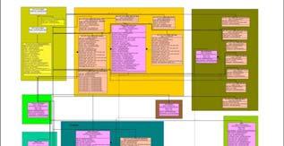
4 The subsystems of GeoKernel (Geotietoydin)
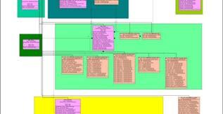
5 GeoKernel in Data Menu (ArcView) 5
6 Advantages and requirements of GeoKernel information system Common information system architecture for all data capture processes Secure and centralized databases Data in its s real geometry map databases All data processes under the same information system architecture, workflows should be well described before system engineering starts Coherent architecture good opportunities for developers Data delivery and geoprocessing services Re-usable application framework professional environment for software developers Requirement analysis is very important (and very difficult) Component based software engineering leads to results Finding of essential features for implementation Training courses for each end-user group are needed for successful mobilisation GIS development challenges: metadata, new coordinate system implementation (Euref-FIN), geophysical data (ground geophysics), geochemical data, harmonization at o of web map services 6


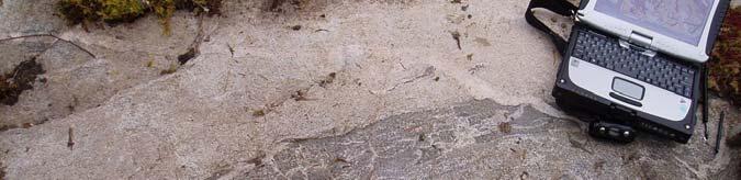
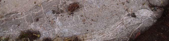
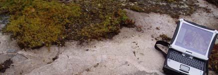
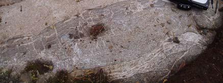
7 Field data capture with tablet PC - geological mapping 7
8 Challenges Data migration from old systems to new one Requirements management processes specifications Complicated data models several layers and tables one feature can have dozens of attributes database tables have many relationships Resources human time 8
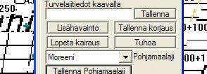
9 Case Mire In the office: planning of investigations lines with ArcMap and custom tools In the field pocket PC or tablet PC and GPS ArcPad shape and dbf files derived from central ArcSDE-geodatabase correct data structures forms and all functionality maintaining data integrity are custom made by GTK In the office: peat amount and energy content calculations peat profiles 9


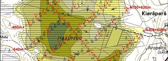
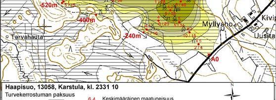
10 Case Mire 10
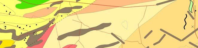
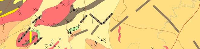
11 Case Bedrock Rugged tablet PC:s (Panasonic) All base maps, geophysical maps, previously made observations etc. are in digital format and are fully usable use in the GIS-software during fieldwork Bedrock observations are stored using standard ArcMap geometry tools and custom editors programmed in GTK Editors use the database structure, which is extracted from the central ArcSDEgeodatabase Data model for bedrock observation covers all the sub processes belonging to bedrock mapping such as basic bedrock mapping, exploration of metallic ores, natural stone investigations and detailed mapping needed for infrastructure projects 11
12 12


13 Case Bedrock 13
14 Case Bedrock 14
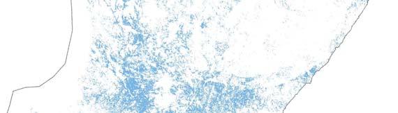
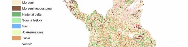
15 GTK Metadata system architecture Geological Survey of Finland, Rönkkö Tero, Ahtonen Niina, Kuronen Eija, Pietilä Raija 15
16 Screenshot: Resource identification Geological Survey of Finland, Rönkkö Tero, Ahtonen Niina, Kuronen Eija, Pietilä Raija 16
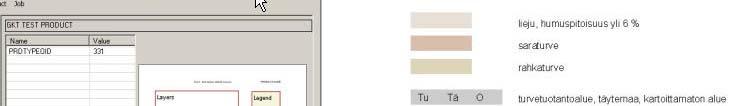
17 Geological Map Production System Layout defining (wysiwyg) 17


18 Geological Map Production System Cartographic editing (wysiwyg) Transparent masking 18
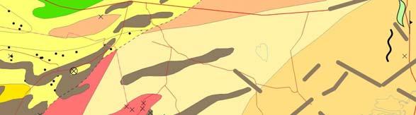
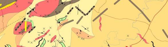
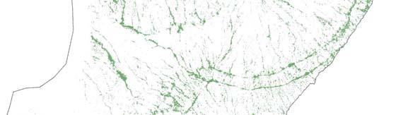
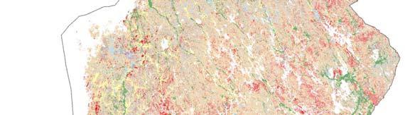
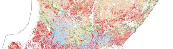
19 Bedrock Map 1:
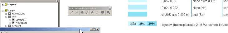
20 Finnish Stratigraphic Units Database 20
21 21

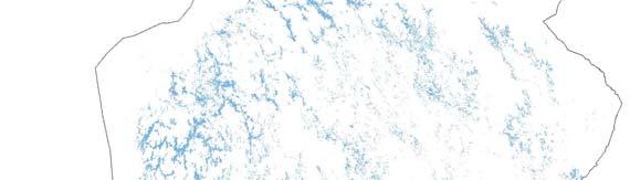
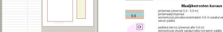
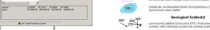
22 Quaternary Deposits Map Gravel and Sand Areas Clay Areas 22


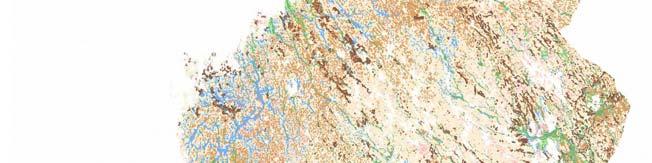

23 Old Quaternary Map (1000K) New Quaternary Map 1: (DigiMP 200) 23
24 GTK s Web Portal (g geo.fi ) GTK s service model is based on ArcGIS Server 9.x for vector data (Advanced Enterprise version) ErMapper Image Web Server (IWS) for raster/matrix data Service and data can be used with web browser (basic users) with GIS software (advanced users) on OGC (Open Geospatial Consortium) interfaces (WMS, WFS) Geological spatial data comes from GTK s GeoKernel central database Airborne geophysical data, height models and other raster-themes come from IWS-servers Metadata from xml-files (stored in Oracle database) Basemaps are uploaded to services via WMS-interface from Finnish National Land Survey / Logica Reports and other documents are readable or downloadable in Adobe.pdf format Data downloads in different formats AutoCAD, Mapinfo, ESRI shapefiles, etc. Data Interoperability Extension (ESRI DIE) build in the system Ordering services available for printed documents and maps (on paper or GIS files) Mineral deposit databases and other data have been published also through Google Earth 24
25 WMS = Web Map Services WFS = Web Feature Services 25
26 Bedrock Map, WMS-interface OneGeology, OneGeologyEurope, INSPIRE, ProMine 26
UNIT 4: USING ArcGIS. Instructor: Emmanuel K. Appiah-Adjei (PhD) Department of Geological Engineering KNUST, Kumasi
 Department of Geological Engineering KNUST, Kumasi") UNIT 4: USING ArcGIS Instructor: Emmanuel K. Appiah-Adjei (PhD) Department of Geological Engineering KNUST, Kumasi Getting to Know ArcGIS ArcGIS is an integrated collection of GIS software products ArcGIS
UNIT 4: USING ArcGIS Instructor: Emmanuel K. Appiah-Adjei (PhD) Department of Geological Engineering KNUST, Kumasi Getting to Know ArcGIS ArcGIS is an integrated collection of GIS software products ArcGIS
3D modelling at the Geological Survey of Finland (GTK)
") 3D modelling at the Geological Survey of Finland (GTK) E Laine, A Pasanen & 3D team at GTK 28.7.2016 1 Contents 1. GTK Geological Survey of Finland 2. GTK s 3D geological model storage 3. Examples 4. Future:
3D modelling at the Geological Survey of Finland (GTK) E Laine, A Pasanen & 3D team at GTK 28.7.2016 1 Contents 1. GTK Geological Survey of Finland 2. GTK s 3D geological model storage 3. Examples 4. Future:
ISO Series Standards in a Model Driven Architecture for Landmanagement. Jürgen Ebbinghaus, AED-SICAD
 ISO 19100 Series Standards in a Model Driven Architecture for Landmanagement Jürgen Ebbinghaus, AED-SICAD 29.10.2003 The Company 100% SIEMENS PTD SIEMENS Business Services Shareholder & Strategic Business
How does ArcGIS Server integrate into an Enterprise Environment? Willy Lynch Mining Industry Specialist ESRI, Denver, Colorado USA
 How does ArcGIS Server integrate into an Enterprise Environment? Willy Lynch Mining Industry Specialist ESRI, Denver, Colorado USA wlynch@esri.com ArcGIS Server Technology Transfer 1 Agenda Who is ESRI?
ESRI Survey Summit August Clint Brown Director of ESRI Software Products
 ESRI Survey Summit August 2006 Clint Brown Director of ESRI Software Products Cadastral Fabric How does Cadastral fit with Survey? Surveyors process raw field observations Survey measurements define high-order
Bentley Map Advancing GIS for the World s Infrastructure
 Bentley Map Advancing GIS for the World s Infrastructure Presentation Overview Why would you need Bentley Map? What is Bentley Map? Where is Bentley Map Used? Why would you need Bentley Map? Because your
Leveraging the OGC Capabilities of ArcGIS Server
 Leveraging the OGC Capabilities of ArcGIS Server Satish Sankaran Interoperability and Standards Team Yingqi Tang Server Team Jessica Parteno Geodatabase Team ArcGIS Server is Open & Interoperable Using
Innovation. The Push and Pull at ESRI. September Kevin Daugherty Cadastral/Land Records Industry Solutions Manager
 Innovation The Push and Pull at ESRI September 2004 Kevin Daugherty Cadastral/Land Records Industry Solutions Manager The Push and The Pull The Push is the information technology that drives research and
Implementing INSPIRE Geoportal in Turkey
 Implementing INSPIRE Geoportal in Turkey Gencay SERTER City and Regional Planner 1 Presentation Plan Introduction INSPIRE and Turkey Importance of al Spatial Planning Portal Logical&Legal Hierarchy GeoPortal
Introduction to the 176A labs and ArcGIS Purpose of the labs
 Introduction to the 176A labs and ArcGIS Purpose of the labs Acknowledgement: Slides by David Maidment, U Texas-Austin and Francisco Olivera (TAMU) Hands-on experience with a leading software package Introduction
ArcGIS. for Server. Understanding our World
 ArcGIS for Server Understanding our World ArcGIS for Server Create, Distribute, and Manage GIS Services You can use ArcGIS for Server to create services from your mapping and geographic information system
Using OGC standards to improve the common
 Using OGC standards to improve the common operational picture Abstract A "Common Operational Picture", or a, is a single identical display of relevant operational information shared by many users. The
Introduction to ArcGIS Server - Creating and Using GIS Services. Mark Ho Instructor Washington, DC
 Introduction to ArcGIS Server - Creating and Using GIS Services Mark Ho Instructor Washington, DC Technical Workshop Road Map Product overview Building server applications GIS services Developer Help resources
MPM Online Tool ArcSDM 5 Final Seminar May 4 th 2018, Rovaniemi
 http://gtkdata.gtk.fi/mpm/ ArcSDM 5 Final Seminar May 4 th 2018, Rovaniemi Funding 2 Vesa Nykänen/ArcSDM5 Seminar 4.5. 2018 http://gtkdata.gtk.fi/mpm/ 3 Vesa Nykänen/ArcSDM5 Seminar 4.5. 2018 http://gtkdata.gtk.fi/mpm/
How to Pick a GIS. GIS Software Chapter 8 in Longley, Goodchild, Maguire, and Rhind,, 2001
 How to Pick a GIS GIS Software Chapter 8 in Longley, Goodchild, Maguire, and Rhind,, 2001 How to Pick a GIS Evolution of GIS software Architecture of GIS software Types of software Example products The
These modules are covered with a brief information and practical in ArcGIS Software and open source software also like QGIS, ILWIS.
 Online GIS Training and training modules covered are: 1. ArcGIS, Analysis, Fundamentals and Implementation 2. ArcGIS Web Data Sharing 3. ArcGIS for Desktop 4. ArcGIS for Server These modules are covered
From Geographics Stella to Bentley Map Stella Map. Kimmo Soukki, Account Manager Bentley Finland
 From Geographics Stella to Bentley Map Stella Map Kimmo Soukki, Account Manager Bentley Finland This presentation Stella? Why migrate? New Bentley Stella Map - How it is done? Data migration Bonuses? What
Spatial Data Infrastructure Concepts and Components. Douglas Nebert U.S. Federal Geographic Data Committee Secretariat
 Spatial Data Infrastructure Concepts and Components Douglas Nebert U.S. Federal Geographic Data Committee Secretariat August 2009 What is a Spatial Data Infrastructure (SDI)? The SDI provides a basis for
Lecture 11. Data Standards and Quality & New Developments in GIS
 Lecture 11 Data Standards and Quality & New Developments in GIS Lecture 11: Outline I. Data Standards and Quality 1. Types of Spatial Data Standards 2. Data Accuracy II. New Developments/The Future of
INSPIRE Shared Service
 INSPIRE Shared Service Creation and operation out of the box Petra Fritz (HZD), Michael Voigtländer (Esri Deutschland GmbH) INSPIRE Shared Service Agenda HZD backbone for a geodata infrastructure Implementing
This Week is All About GIS, Geography and Sharing Our Knowledge
 Stockholm 2007 1 This Week is All About GIS, Geography and Sharing Our Knowledge Technology Methods Organization Data Processes Standards Projects Visualization And About You Applications Mapping Data
ArcGIS 10.1 An Overview of the System
 ArcGIS 10.1 An Overview of the System ArcGIS 10.1 An Overview of the System Damian Spangrud Director of Solutions, Esri Redlands, CA USA ArcGIS 10.1 Web Cloud Online Mobile Enterprise Desktop ArcGIS 10.1
Reducing Complex Spatial Data Management Needs in and Upstream Oil and Gas Operations Team. Jason Wilson GIS Business Analyst SM Energy
 Reducing Complex Spatial Data Management Needs in and Upstream Oil and Gas Operations Team Jason Wilson GIS Business Analyst SM Energy Agenda About Myself and SM Energy The Challenge The Goal Solution
GEOGRAPHIC INFORMATION SYSTEMS AND IT SOLUTIONS FOR THE ENVIRONMENT
 GEOGRAPHIC INFORMATION SYSTEMS AND IT SOLUTIONS FOR THE ENVIRONMENT Mission We focus on Solutions is a worldwide operating business offering Geographic Information Systems and IT solutions to assist environmental
Discovery and Access of Geospatial Resources using the Geoportal Extension. Marten Hogeweg Geoportal Extension Product Manager
 Discovery and Access of Geospatial Resources using the Geoportal Extension Marten Hogeweg Geoportal Extension Product Manager DISCOVERY AND ACCESS USING THE GEOPORTAL EXTENSION Geospatial Data Is Very
Paper UC1351. Conference: User Conference Date: 08/10/2006 Time: 8:30am-9:45am Room: Room 23-B (SDCC)
") Conference: User Conference Date: 08/10/2006 Time: 8:30am-9:45am Room: Room 23-B (SDCC) Title of Paper: Increasing the Use of GIS in the Federal Government Author Name: Miss Abstract This presentation
Conference: User Conference Date: 08/10/2006 Time: 8:30am-9:45am Room: Room 23-B (SDCC) Title of Paper: Increasing the Use of GIS in the Federal Government Author Name: Miss Abstract This presentation
Exelis and Esri Technologies for Defense and National Security. Cherie Muleh
 Exelis and Esri Technologies for Defense and National Security Cherie Muleh Cherie.Muleh@exelisinc.com ENVI IMAGERY AND DATA BECOME KNOWLEDGE > Add information from imagery to your GIS > Automated workflows
Why GIS & Why Internet GIS?
 Why GIS & Why Internet GIS? The Internet bandwagon Internet mapping (e.g., MapQuest) Location-based services Real-time navigation (e.g., traffic) Real-time service dispatch Business Intelligence Spatial
DP Project Development Pvt. Ltd.
 Dear Sir/Madam, Greetings!!! Thanks for contacting DP Project Development for your training requirement. DP Project Development is leading professional training provider in GIS technologies and GIS application
Introduction to the 176A labs and ArcGIS
 Introduction to the 176A labs and ArcGIS Acknowledgement: Slides by David Maidment, U Texas-Austin and Francisco Olivera (TAMU) Purpose of the labs Hands-on experience with one software pakage Introduction
Data Aggregation with InfraWorks and ArcGIS for Visualization, Analysis, and Planning
 Data Aggregation with InfraWorks and ArcGIS for Visualization, Analysis, and Planning Stephen Brockwell President, Brockwell IT Consulting, Inc. Join the conversation #AU2017 KEYWORD Class Summary Silos
Technical Specifications. Form of the standard
 Used by popular acceptance Voluntary Implementation Mandatory Legally enforced Technical Specifications Conventions Guidelines Form of the standard Restrictive Information System Structures Contents Values
Lecture 2. Introduction to ESRI s ArcGIS Desktop and ArcMap
 Lecture 2 Introduction to ESRI s ArcGIS Desktop and ArcMap Outline ESRI What is ArcGIS? ArcGIS Desktop ArcMap Overview Views Layers Attribute Tables Help! Scale Tips and Tricks ESRI Environmental Systems
Enabling ENVI. ArcGIS for Server
 Enabling ENVI throughh ArcGIS for Server 1 Imagery: A Unique and Valuable Source of Data Imagery is not just a base map, but a layer of rich information that can address problems faced by GIS users. >
Environmental Systems Research Institute
 Introduction to ArcGIS ESRI Environmental Systems Research Institute Redlands, California 2 ESRI GIS Development Arc/Info (coverage model) Versions 1-7 from 1980 1999 Arc Macro Language (AML) ArcView (shapefile
Among various open-source GIS programs, QGIS can be the best suitable option which can be used across partners for reasons outlined below.
 Comparison of Geographic Information Systems (GIS) software As of January 2018, WHO has reached an agreement with ESRI (an international supplier of GIS software) for an unlimited use of ArcGIS Desktop
Mineral Resources Branch. Natural Resources
 Mineral Resources Branch Natural Resources ! Brian Fisher - Geologist / GIS Specialist - supervisor! Jeff Poole - Geologist / GIS Specialist - IMS specialist! John MacNeil - Geologist / GIS Specialist
Geospatial Products V8i (SELECTseries 1)
") Geospatial Products V8i (SELECTseries 1) Keith Raymond Product Manager Geospatial Desktop Products Presentation Overview What are the various products? Why would you need them? Demonstrations 2 WWW.BENTLEY.COM
Geospatial Products V8i (SELECTseries 1) Keith Raymond Product Manager Geospatial Desktop Products Presentation Overview What are the various products? Why would you need them? Demonstrations 2 WWW.BENTLEY.COM
Innovation in Land Management: Integrated Solutions For National Cadastre Projects
 Success With GIS Innovation in Land Management: Integrated Solutions For National Cadastre Projects XXIII International FIG Congress Munich These documents are only complete, when used in connection with
Bentley Map Advancing GIS for the World s Infrastructure
 Bentley Map Advancing GIS for the World s Infrastructure Presentation Overview Why would you need Bentley Map? What is Bentley Map? Where is Bentley Map Used? Red text signifies new things in Bentley Map
Overview. Everywhere. Over everything.
 Cadenza Desktop Cadenza Web Cadenza Mobile Cadenza Overview. Everywhere. Over everything. The ultimate GIS and reporting suite. Provide, analyze and report data efficiently. For desktop, web and mobile.
One platform for desktop, web and mobile
 One platform for desktop, web and mobile Search and filter Get access to all data thematically filter data in context factually and spatially as well as display it dynamically. Export a selection or send
GeoSUR SRTM 30-m / TPS
 GeoSUR SRTM 30-m / TPS Wm Matthew Cushing (USGS) 16 May 2013 U.S. Department of the Interior U.S. Geological Survey SRTM Mission Shuttle Radar Topography Mission (SRTM) Space Shuttle Endeavour during the
NR402 GIS Applications in Natural Resources
 NR402 GIS Applications in Natural Resources Lesson 1 Introduction to GIS Eva Strand, University of Idaho Map of the Pacific Northwest from http://www.or.blm.gov/gis/ Welcome to NR402 GIS Applications in
ArcGIS Tools for Professional Cartography
 ArcGIS Tools for Professional Cartography By Makram Murad-al-shaikh M.S. Cartography Senior instructor ESRI Educational Services ICC - A Coruña - Spain, 9-16 July, 2005 Overview Overview of the ArcGIS
SDI Standards at work
 SDI Standards at work Jan Juul Jensen Senior Technology Strategist Informi GIS Denmark Informi GIS Private held Limited Company Specialized in GIS 100+ employees HQ in Charlottenlund, Copenhagen Regional
SUSTAINABLE GROWTH FROM GEOLOGY. gtk.fi
 SUSTAINABLE GROWTH FROM GEOLOGY gtk.fi Geological Survey of Finland The Geological Survey of Finland (GTK) is a leading European competence centre for the assessment and sustainable use of geological resources.
GIS Software. Evolution of GIS Software
 GIS Software The geoprocessing engines of GIS Major functions Collect, store, mange, query, analyze and present Key terms Program collections of instructions to manipulate data Package integrated collection
A decade of geoinformation sharing at ETH Zurich
 A decade of geoinformation sharing at ETH Zurich Ionuț Iosifescu-Enescu, Cristina Iosifescu-Enescu, Nadia H. Panchaud, Angeliki Tsorlini, Lorenz Hurni {iosifescu,ciosifescu,nadia.panchaud,atsorlini,lhurni}@ethz.ch
ArcGIS for INSPIRE. Paul Hardy. ArcGIS. ArcGIS for INSPIRE Enables Esri ArcGIS users to implement and comply with INSPIRE. INSPIRE Data Themes
 Enables Esri ArcGIS users to implement and comply with INSPIRE Paul Hardy phardy@esri.com EuroGeographics INSPIRE KEN (Schema Transformation) 8/9 October 2013, Marne la Vallée INSPIRE Data Themes Annex
PaikkaOppi - a Virtual Learning Environment on Geographic Information for Upper Secondary School
 PaikkaOppi - a Virtual Learning Environment on Geographic Information for Upper Secondary School Jaakko Kähkönen*, Lassi Lehto*, Juha Riihelä** * Finnish Geodetic Institute, PO Box 15, FI-02431 Masala,
Portals: Standards in Action
 Portals: Standards in Action David Danko ISO TC 211 Metadata Project Leader GIS Standards Consultant-ESRI. Metadata Portals Portal gateway, place of entry Producers Advertise, expose products Share information
Outline Brief Overview MapPlace Website Data Delivery & Map Themes Digital Geology
 BRITISH COLUMBIA GEOLOGICAL SURVEY Kirk Hancock Pat Desjardins Nick Massey BRITISH COLUMBIA Ministry of Energy and Mines Ward Kilby acknowledged developer of MapPlace Outline Brief Overview MapPlace Website
The Emerging Role of Enterprise GIS in State Forest Agencies
 The Emerging Role of Enterprise GIS in State Forest Agencies Geographic Information System (GIS) A geographic information system (GIS) is a computer software system designed to capture, store, manipulate,
A Geographer s role in a Google Maps World. Jeremy Bartley ESRI
 A Geographer s role in a Google Maps World Jeremy Bartley ESRI 1 It is a good time to be a Geographer. 2 Microsoft, Google, Yahoo, and others are pushing geographic awareness to the general public Providing
Esri Production Mapping: Map Automation & Advanced Cartography MADHURA PHATERPEKAR JOE SHEFFIELD
 Esri Production Mapping: Map Automation & Advanced Cartography MADHURA PHATERPEKAR JOE SHEFFIELD Traditional Cartography What you really want Cartographic Workflow Output Cartographic Data Symbology Layout
Geospatial Standards Support - An Overview. Marten Hogeweg & Satish Sankaran
 Geospatial Standards Support - An Overview Marten Hogeweg & Satish Sankaran Agenda Interoperability and Standards ArcGIS Open, Interoperable and Standards Compliant Esri Open initiatives Understanding
On the Road from Simple Mapping to Spatial Analysis
 On the Road from Simple Mapping to Spatial Analysis Brief History How to make disadvantages work for you Building GIS Knowledge Internally Tested GIS Initiatives Current Initiatives Next Steps BHP Billiton
Lecture 12. Data Standards and Quality & New Developments in GIS
 Lecture 12 Data Standards and Quality & New Developments in GIS Lecture 12: Outline I. Data Standards and Quality 1. Types of Spatial Data Standards 2. Data Accuracy 3. III. Documenting Spatial Data Accuracy
GENERALIZATION IN THE NEW GENERATION OF GIS. Dan Lee ESRI, Inc. 380 New York Street Redlands, CA USA Fax:
 GENERALIZATION IN THE NEW GENERATION OF GIS Dan Lee ESRI, Inc. 380 New York Street Redlands, CA 92373 USA dlee@esri.com Fax: 909-793-5953 Abstract In the research and development of automated map generalization,
Safe to Save? Archive Options for Geodatabases. Jeff Essic North Carolina State University Libraries
 Safe to Save? Archive Options for Geodatabases Jeff Essic North Carolina State University Libraries 2011 ESRI International Users Conference July 13, 2011 GeoMAPP Geospatial Multistate Archive and Preservation
Advancing Geoscientific Capability. Geological Survey of Finland
 Advancing Geoscientific Capability Geological Survey of Finland GTK in brief The Geological Survey of Finland (GTK) is one of the largest European centres of excellence in assessment, research and the
GIS at UCAR. The evolution of NCAR s GIS Initiative. Olga Wilhelmi ESIG-NCAR Unidata Workshop 24 June, 2003
 GIS at UCAR The evolution of NCAR s GIS Initiative Olga Wilhelmi ESIG-NCAR Unidata Workshop 24 June, 2003 Why GIS? z z z z More questions about various climatological, meteorological, hydrological and
When Map Quality Matters
 When Map Quality Matters 50% 25% Powerful geospatial mapping tools for Adobe Creative Cloud and offline map solutions for mobile devices 20% When Map Quality Matters 10% We re focused on creating powerful
Incorporating ArcGIS Pro in your Curriculum
 AAG, Boston 2017 April 5, 2017 Incorporating ArcGIS Pro in your Curriculum Geri Miller Agenda Concerns Acknowledged Learning curve ArcGIS Pro does not have all the tools (perception) Licensing and offline
Land Board, NW Services and SDI Tambet Tiits, FRICS
 Land Board, NW Services and SDI Tambet Tiits, FRICS 07.09.2016 200th anniversary of the Struve Geodetic Arc Friedrich Georg Wilhelm Struve and Carl Friedrich Tenner Struve Geodetic Arc The Struve Geodetic
NOKIS - Information Infrastructure for the North and Baltic Sea
 NOKIS - Information Infrastructure for the North and Baltic Sea Carsten Heidmann 1 and Jörn Kohlus 2 Abstract 1. General The initial motivation for the project NOKIS (German title: Nord- und Ostsee-Küsteninformationssystem)
Experiences and Directions in National Portals"
 FIG Seminar on e-land Administration Innsbruck/Austria 2-4 June 2004 "ESRI's Experiences and Directions in National Portals" Kevin Daugherty Cadastral/Land Records Manager ESRI Topic Points Technology
RIDOT GIS Activities RIGIS User Group Meeting Stephen Kut RIDOT
 RIDOT GIS Activities RIGIS User Group Meeting Stephen Kut RIDOT Presentation Topics Pictometry Imagery Project Update GIS Historic Review Project GIS / CAD Integration Pictometry Project Details Digital
October 2011 ArcGIS 10 for Server Functionality Matrix
 October 2011 ArcGIS 10 for Server Functionality Matrix Esri, 380 New York St., Redlands, CA 92373-8100 USA TEL 909-793-2853 FAX 909-793-5953 E-MAIL info@esri.com WEB www.esri.com Copyright 2011 Esri All
Hosted by Esri Official Distributor
 Hosted by Esri Official Distributor Esri European User Conference October 15-17, 2012 Oslo, Norway Hosted by Esri Official Distributor Interoperability and Standards Support in ArcGIS 10.1 Roberto Lucchi
Imagery and the Location-enabled Platform in State and Local Government
 Imagery and the Location-enabled Platform in State and Local Government Fred Limp, Director, CAST Jim Farley, Vice President, Leica Geosystems Oracle Spatial Users Group Denver, March 10, 2005 TM TM Discussion
Esri Training by Microcenter Prepare to Innovate. Microcenter Course Catalog
 Esri Training by Microcenter Prepare to Innovate 2015 Instructor-Led Courses Microcenter Course Catalog ArcGIS Foundational Courses Designed to meet the learning needs of professionals whose GIS experience
Geog 469 GIS Workshop. Managing Enterprise GIS Geodatabases
 Geog 469 GIS Workshop Managing Enterprise GIS Geodatabases Outline 1. Why is a geodatabase important for GIS? 2. What is the architecture of a geodatabase? 3. How can we compare and contrast three types
Features and Benefits
 Autodesk LandXplorer Features and Benefits Use the Autodesk LandXplorer software family to help improve decision making, lower costs, view and share changes, and avoid the expense of creating physical
Innovative GIS solutions
 Dušan Cibulka GIS Consultant / Analyst 5. - 6. June 2014 8 th Forum of Young Geoinformaticians 2014 Contents Our Vision and Philosophy Technologies we use Selected solutions implemented in projects: Renovation
Gridded Traffic Density Estimates for Southern
 Gridded Traffic Density Estimates for Southern California, 1995-2014 User Notes authored by Beau, 11/28/2017 METADATA: Each raster file contains Traffic Density data for one year (1995, 2000, 2005, 2010,
Overview of Geospatial Open Source Software which is Robust, Feature Rich and Standards Compliant
 Overview of Geospatial Open Source Software which is Robust, Feature Rich and Standards Compliant Cameron SHORTER, Australia Key words: Open Source Geospatial Foundation, OSGeo, Open Standards, Open Geospatial
HertfordshireCC GIS Standards (draft) Contents
 Contents") Standards for Geographic Information Systems Contents Requirements for the procurement of systems with mapping/gis functionality...2 Background...2 System Requirements...2 HCC Corporate Standard for Spatial
Standards for Geographic Information Systems Contents Requirements for the procurement of systems with mapping/gis functionality...2 Background...2 System Requirements...2 HCC Corporate Standard for Spatial
Enabling Web GIS. Dal Hunter Jeff Shaner
 Enabling Web GIS Dal Hunter Jeff Shaner Enabling Web GIS In Your Infrastructure Agenda Quick Overview Web GIS Deployment Server GIS Deployment Security and Identity Management Web GIS Operations Web GIS
Esri UC2013. Technical Workshop.
 Esri International User Conference San Diego, California Technical Workshops July 9, 2013 CAD: Introduction to using CAD Data in ArcGIS Jeff Reinhart & Phil Sanchez Agenda Overview of ArcGIS CAD Support
Geologi for samfunnet
 Implementing Inspire Download Services using Open Source and FME Software at Geological Survey of Norway Bjørn Ove Grøtan - NGU FMEDagarna 11-12th October 2010 Geologi for samfunnet About Geological survey
Global Geospatial Information Management Country Report Finland. Submitted by Director General Jarmo Ratia, National Land Survey
 Global Geospatial Information Management Country Report Finland Submitted by Director General Jarmo Ratia, National Land Survey Global Geospatial Information Management Country Report Finland Background
Geodatabase 101 Why, What, & How
 Geodatabase 101 Why, What, & How Beau Dealy Dealy Geomatics, LC beau@dealygeo.com Curt Moore InfiniTec, Inc. cmoore@infinitec.net ... first, a brief explanation. Geodata traditionally stored as two components
Solving the European Data Puzzle Simplifying INSPIRE Challenges and Usage. con terra GmbH Dipl.-Ing. Mark Döring
 Solving the European Data Puzzle Simplifying INSPIRE Challenges and Usage con terra GmbH Dipl.-Ing. Mark Döring INSPIRE Reference Projects GeoBAK 2.0 Project // INSPIRE Data & Services The Project Evolution
Modular Web Framework for the BRANDENBURGVIEWER
 Modular Web Framework for the BRANDENBURGVIEWER Geoinformation System (GIS) 2 GIS = geo + information + system + + Survey of data Organization of data Processing and Analysis Presentation geodata infrastructure
WEB MAP SERVICE (WMS) FOR GEOLOGICAL DATA GEORGE TUDOR
 FOR GEOLOGICAL DATA GEORGE TUDOR") WEB MAP SERVICE (WMS) FOR GEOLOGICAL DATA GEORGE TUDOR WEB MAP SERVICE (WMS) - GENERALITIES Projects with data from different sources Geological data are in different GIS software format Large amount of
WEB MAP SERVICE (WMS) FOR GEOLOGICAL DATA GEORGE TUDOR WEB MAP SERVICE (WMS) - GENERALITIES Projects with data from different sources Geological data are in different GIS software format Large amount of
Office of Technology Partnerships GIS Collaboration
 Office of Technology Partnerships GIS Collaboration State GIS Update April 21, 2017 Mark Holmes, GISP Outline MGF Upgrade Project Census Programs Imagery Update LiDAR Update Open Discussion 2 MGF Background
Bentley Geospatial update
 Bentley Geospatial update Tallinna, 01.11.2007 Timo Tuukkanen, Bentley Systems Issues today Bentley Map available now detailed introduction to Bentley Map Bentley Geo Web Publisher Bentley Web GIS update,
ArcGIS for INSPIRE. Marten Hogeweg
 ArcGIS for INSPIRE Marten Hogeweg Please Take Our Survey on the App Download the Esri Events app and find your event Select the session you attended Scroll down to find the feedback section Complete answers
Strategies for Integrating CAD and BIM in ArcGIS. Don Kuehne Esri 3D Product Manager: CAD/BIM/AEC
 Strategies for Integrating CAD and BIM in ArcGIS Don Kuehne Esri 3D Product Manager: CAD/BIM/AEC CAD Digital Drawing CAD in ArcGIS Desktop CAD in Desktop CAD as Data CAD as a Map EXPORT TO CAD Create and
Thales Canada, System Division. BattleView: Integrating ArcGIS Into Canadian Army s Command And Control Application
 BattleView: Integrating ArcGIS Into Canadian Army s Command And Control Application BattleView Overview Canadian Army s command and control (C2) application Deployed in army headquarters unit and above
Welcome to NR502 GIS Applications in Natural Resources. You can take this course for 1 or 2 credits. There is also an option for 3 credits.
 Welcome to NR502 GIS Applications in Natural Resources. You can take this course for 1 or 2 credits. There is also an option for 3 credits. The 1st credit consists of a series of readings, demonstration,
Key Points Sharing fosters participation and collaboration Metadata has a big role in sharing Sharing is not always easy
 Sharing Resources Geoff Mortson esri, Inc. SDI Solutions Team Key Points Sharing fosters participation and collaboration Metadata has a big role in sharing Sharing is not always easy Data Sharing is Good
Introduction to ArcGIS Server Development
 Introduction to ArcGIS Server Development Kevin Deege,, Rob Burke, Kelly Hutchins, and Sathya Prasad ESRI Developer Summit 2008 1 Schedule Introduction to ArcGIS Server Rob and Kevin Questions Break 2:15
Evaluating Sustainability of the Georesources Observation System
 Evaluating Sustainability of the Georesources Observation System Michael Mente Federal Institute for Geosciences and Natural Resources Germany, Hannover GEOSS-CBC Meeting Athens April 27th 28th, 2009 GEOSS-CBC
IMPLEMENTING GOVERNMENT-WIDE ENTERPRISE GIS; THE FEDERATED MODEL
 IMPLEMENTING GOVERNMENT-WIDE ENTERPRISE GIS; THE FEDERATED MODEL James E. Mitchell, Ph. D. IT GIS Manager Louisiana Department of Transportation and Development presented at the ESRI International Users
Demystifying ArcGIS Online. Karen Lizcano Esri
 Demystifying ArcGIS Online Karen Lizcano Esri An Integrated Web GIS Platform Desktop Web Device Powered by Services Managed via Portal Access from any Device Portal Server Online Content and Services ArcGIS
Arcgis Enterprise Performance And Scalability Best Practices
 Arcgis Enterprise Performance And Scalability Best Practices We have made it easy for you to find a PDF Ebooks without any digging. And by having access to our ebooks online or by storing it on your computer,
ArcMap - EXPLORING THE DATABASE Part I. SPATIAL DATA FORMATS Part II
 Week 5 ArcMap - EXPLORING THE DATABASE Part I SPATIAL DATA FORMATS Part II topics of the week Exploring the Database More on the Table of Contents Exploration tools Identify, Find, Measure, Map tips, Hyperlink,