Introduction to the Training Course
|
|
|
- Kerry Bell
- 6 years ago
- Views:
Transcription
 methodologies (risk assessment and")
1 Introduction to the Training Course Trainer Khaled Mashfiq 14 / Nov / 2017 Training Module A1 Session 1 Introduction to the Use of Geospatial Information Technology for Drought Risk Management Phnom Penh, Cambodia November, 2017 In partnership with Learning Objectives The aim of the course is to provide participants with GIS and Remote Sensing (RS) methodologies (risk assessment and satellite based mapping) related drought management in Cambodia At the end of the course students should be able to: Define basic concepts and terminologies related to geospatial technology; Apply basic methods and functionalities for GIS and Remote Sensing analysis and mapping; Identify, access, search, collect, organize and analyse geospatial data from web and field relevant to drought risk monitoring/management; Apply relevant GIS methodologies and tools for drought risk monitoring/management Explain the advantages and limitations of using geospatial information technology for drought risk management.
2 Course Outline Week 1 Mod A1 14 November Tuesday Mod A2 15 November Wednesday Mod A3 16 November Thursday Mod A4 17 November Friday S1 9:00-10:15 S2 10:30-12:00 OPENING: Introduction to Training Programme + ESCAP Drought Mechanism (MOWRAM & ESCAP) [PPT] Introduction to Geographic Information Systems (UNOSAT) [PPT+IA] Interactive Introduction to Remote Sensing (UNOSAT) [PPT] Intro to Remote Sensing (UNOSAT) [LAB_EX] Remote Sensing Indices for Drought Monitoring (NDVI, VCI, SAVI) (ESCAP) [PPT] Remote Sensing Indices for Drought Monitoring (NDVI, VCI, SAVI) (GISTDA) [PPT] ASEAN Drought Study (CIAT) [PPT] ASEAN Drought Study (CIAT)** [Stakeholder EX] 12:00-13:30 LUNCH LUNCH LUNCH LUNCH S3 13:30-15:00 S4 15:15-16:30 16:30-17:00 Introduction to Geographic Information Systems (UNOSAT) [PPT+IA] Discussion on available data for DroughtWatch (RADI) [DISS] Wrap-up & Self-Study Gathering EO Data from We (UNOSAT) [PPT+IA] Gathering EO Data from Web (UNOSAT) [PPT+IA] Wrap-up & Self-Study Field Data Collection Using Smartphones (UNOSAT & GISTDA) [Field-EX] Opensource Software for Geospatial Technology (QGIS) (UNOSAT) [IA] Wrap-up & Self-Study Quiz (30 minutes) Evaluation, Certificate Distribution & Closing ( hrs.) Close Flexible & Modular Not limit the discussion to contents only Fully Interactive Introduce Technology Innovations [PPT]: Power Point Presentation [LAB_EX]: GIS Lab Exercise [PPT-IA]: Power Point Presentation with Interactive exercise 3 Expectations? 4


3 UNITAR s Operational Satellite Applications Programme - UNOSAT What is UNITAR? The United Nations Institute for Training and Research (UNITAR) is a principal training arm of the United Nations, working in every region of the world to empower individuals, governments and organizations through knowledge and learning to effectively overcome contemporary global challenges. Mission To develop capacities to enhance global decision-making and to support translation of those decisions into action at country level 6


4 What is UNITAR? 7 About UNITAR The Institute Core Functions Design and deliver innovative training Facilitate knowledge- and experiencesharing Conduct research on and pilot innovative learning strategies Advise and support governments, UN and other partners with technology-based knowledge-related services


5 About UNOSAT An operational programme of UNITAR serving UN, international organizations and governments Fully dedicated to satellite imagery analysis, applications of geospatial information technologies, training and capacity development Operational since 2001 Currently 30 employees Presence: Geneva (hosted at CERN), Bangkok, Nairobi, N Djamena UNOSAT s Main Activities MAPPING Analysis, Research and Innovation TRAINING AND CAPACITY DEVELOPMENT Hands on, National and Regional level, Technical Backstopping Knowledge Transfer


")


6 UNOSAT Humanitarian Rapid Mapping Service UNOSAT s Humanitarian Rapid Mapping Service UNOSAT provides Satellite Imagery Analysis during Humanitarian Emergencies Natural Disasters and Conflict-Situations (Maps, GIS-ready data, statistics and reports) As of today approximately 25% of humanitarian activations benefit from data delivered through the International Space Charter (Only for Major Natural Disasters). For the rest of activations UNOSAT relies on in-kind contributions as well as from imagery funds from donors and UN sister agencies.

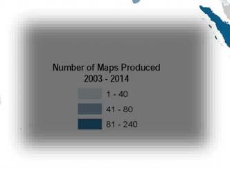
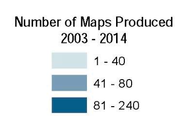
7 Maps produced Covering Asia and Africa( ) UNOSAT Rapid Mapping


")

")


8 Satellite Derived Analysis Wide range of satellite imagery from commercial and scientific sensors (no military data) Imagery from very high resolution (32 cm), to low resolution (1km) Optical and Radar data Relevant GIS data from UN, partners, commercial, public sources and crowdsourcing Since 2003: maps produced Mapping Activities 16 Source: NASA Earth Observatory


9 Flood Analysis Pakistan 2015 Floods Earthquakes Cyclones Land Slides Refugees and Internally Displaced ed Persons Mapping Cultural Heritage Sites Conflict Damage Assessments And so on.. 17 Earthquake Damage Assessment Nepal 2015 Floods Earthquakes Cyclones Land Slides Refugees and Internally Displaced Persons Mapping Cultural Heritage Sites Conflict Damage Assessments And so on.. 18


10 Cyclones Philippines 2014 Floods Earthquakes Cyclones Land Slides Refugees and Internally Displaced Persons Mapping Cultural Heritage Sites Conflict Damage Assessments And so on.. 19 Landslide Myanmar 2015 Floods Earthquakes Storms/Cyclones Land Slides Refugees and Internally Displaced Persons Mapping Cultural Heritage Sites Conflict Damage Assessments And so on.. 20


11 Refugee Camp Iraq 2013 Floods Earthquakes Storms/Cyclones Land Slides Refugees and Internally Displaced Persons Mapping Cultural Heritage Sites Conflict Damage Assessment 21 Cultural Heritage Damage Assessment Syria 2015 Floods Earthquakes Storms/Cyclones Land Slides Refugees and Internally Displaced Persons Mapping Cultural Heritage Sites Conflict Damage Assessment Temple of Bel destruction Palmyra, Syria 22


12 Damage Assessment Syria 2015 Floods Earthquakes Storms/Cyclones Land Slides Refugees and Internally Displaced Persons Mapping Cultural Heritage Sites Conflict Damage Assessment 23 Recent Reports Four years of Human Suffering in the Syrian Conflict Large scale destruction and damage to cultural heritage sites in Syria Impact of the 2014 Conflict in the Gaza Strip Global Report on Maritime Piracy


13 Flood-FINDER A modelling and forecasting tool to enhance global flood resilience and humanitarian response Tool for decision makers - International and National organizations Can be customized to meet specific needs Serve as an Early Warning System at country level Partners: CERN, CIMA, USGS Comparison between modelled and satellite detected flood waters 25 Training and Capacity Development
 within different applications Disaster Risk Management Water Management Territorial Planning Face to Face Training Interactivity,")


14 Overview More than a decade of experience in the development and delivery of knowledge sharing Remarkable experience of training design and delivery on the use of Geospatial Information Technology (GIT) within different applications Disaster Risk Management Water Management Territorial Planning Face to Face Training Interactivity, active participation with practical case studies Portfolio of Activities Master level courses Master level courses on the use of satellite imagery for emergency response mapping Basic and advanced Courses Capacity development programmes Workshops and information sharing Basic and advanced courses in the use of satellite imagery for human security, emergency response mapping and strategic territorial planning Capacity development programmes to strengthen local and national capacities in the use of satellite imagery for disaster risk management and territorial planning Awareness raising workshops and information sharing sessions on the use of geospatial information technology for decision makers.
 (Horn of")
 Government of Chad Target Audience")


15 Capacity Development Activities UNOSAT is partnering with Intergovernmental Authority on Development (IGAD) (Horn of Africa) the Asian Disaster Preparedness Centre (ADPC) (South East Asia) Government of Chad Target Audience Decision makers and professionals from national and international organizations Capacity Development South East Asia The collaboration between ADPC and UNOSAT combines training held annually in Bangkok Training of 180 disaster management professionals working in SE Asia In-country technical assistance and training programmes implemented each year in different South East Asian countries: Vietnam 2011 Myanmar 2012 Bangladesh 2013 Cambodia 2014 Bangladesh 2015 Myanmar 2016


16 Beneficiary Outreach Beneficiaries by Region 1 Europe 23% S. America 7% M. East 1% Asia 36% Africa 33% 781 Training Participants in 70% 30% 52 Countries Worldwide Major Training Areas Disaster Risk Management Water Management Territorial Planning Beneficiaries by Organisational Affiliation 49% Government / National Authorities 28% Academic 9% UN System & International Organisations 8% Regional Organisations 6% NGOs Our Training Partners

17 United Nations Institute for Training and Research Institut des Nations Unies pour la Formation et la Recherche Instituto de las Naciones Unidas para Formación Profesional e Investigaciones Учебньıй и научно-исследовательский институт Организации Объединенньıх Наций معھد الا مم المتحدة للتدریب والبحث UNITAR International Environment House Chemin des Anémones 11-13, CH-1219 Châtelaine, Geneva - Switzerland T F Introduction to the Use of Geospatial Information Technology for Drought Risk Management Phnom Penh, Cambodia November, 2017 In partnership with This presentation should not be copied or disseminated in any manner without the express permission of UNOSAT.
Application of UAV in Emergency Response
 Application of UAV in Emergency Response Trainer Khaled MASHFIQ Khaled.MASHFIQ@unitar.org 23 Aug 2017 International Training Course on Building Efficiency of UAV Image Processing for ASEAN Countries GISTDA
Introduction to Geographic Information System
 Introduction to Geographic Information System Trainer Khaled Mashfiq 14 / Nov / 2017 Training Module A1 Session 2 Introduction to the Use of Geospatial Information Technology for Drought Risk Management
RESAP Progress Report
 RESAP Progress Report December 2016 to October 2017 Presentation to the Twenty-first session of the Intergovernmental Consultative Committee on the Regional Space Applications Programme for Sustainable
Space Applications for Disaster Risk Reduction and Sustainable Development
 Space Applications for Disaster Risk Reduction and Sustainable Development Space Applications Section (SAS) ICT and Disaster Risk Reduction Division (IDD) UNESCAP Contents I. RESAP Activities 2016-2017
Preliminary Flood Analysis along Niger and Benue Rivers in Nigeria
 Preliminary Flood Analysis along Niger and Benue Rivers in Nigeria 28 September 2018 SUMMARY UNITAR-UNOSAT has produced an estimation of the potential affected and population exposed to riverine flooding
Preliminary Rapid Flood Assessment Lao People s Democratic Republic Update 1
 Preliminary Rapid Flood Assessment Lao People s Democratic Republic Update 1 2 August 2017 Situation Overview- SAR data over the area- Latest Acquisition SAR Image from 30 July 2017 covering the provinces
Geospatial Information and Services for Disasters (GIS4D)
") Geospatial Information and Services for Disasters (GIS4D) 31 July 2017 Tae Hyung KIM ICT and Disaster Risk Reduction Division (IDD) UNESCAP 1 About ESCAP Who is ESCAP? United Nations Economic and Social
Geospatial Information and Services for Disasters (GIS4D) 31 July 2017 Tae Hyung KIM ICT and Disaster Risk Reduction Division (IDD) UNESCAP 1 About ESCAP Who is ESCAP? United Nations Economic and Social
Recap: Geospatial Information Technology for Drought Risk Management
 Recap: Geospatial Information Technology for Drought Risk Management Trainer Khaled Mashfiq 2 / April / 2018 Training Module A1 Session 1 Advanced Application of Geospatial Information technology for Decision
Geographic Information Infrastructure and Policy Framework for Sustainable Mountain Development in the Hindu Kush-Himalayas
 Geo SMART ASIA 2017 22-24 August, Kualalampur Geographic Information Infrastructure and Policy Framework for Sustainable Mountain Development in the Hindu Kush-Himalayas Basanta Shrestha, Director Strategic
Thematic Session: IT Innovations Geospatial Approaches to Damage Assessment: The Example of Haiti Earthquake
 Thematic Session: IT Innovations Geospatial Approaches to Damage Assessment: The Example of Haiti Earthquake Date: 10/05/2011 Location: Geneva, Switzerland Name: Luca Dell Oro Title: Research Associate
Mapping Secondary Cities for Resiliency and Emergency Preparedness
 Mapping Secondary Cities for Resiliency and Emergency Preparedness Secondary Cities Geospatial Training Workshop Pilot Project: Cusco, Peru June 29 July 3 2015 WHO ARE WE? Office of the Geographer (GGI)
Journey of supporting CSNs to establish Geo-DRM
 Regional Workshop on Geo-referenced Information Systems for Disaster Risk Management (Geo-DRM) 26-27 June 2014 Bangkok, Thailand Journey of supporting CSNs to establish Geo-DRM Keran Wang Chief, Space
UNESCO World Heritage Centre - Arab States Unit
 UNESCO World Heritage Centre - Arab States Unit Post-Conflict Reconstruction in the Middle East Context and in the Old City of Aleppo in Particular UNESCO Headquarter, 18-19 June 2015 ACTION PLAN resulting
Building Institutional Capacity for Multi-Hazard Early Warning in Asia and the Pacific Subtitle
 Building Institutional Capacity for Multi-Hazard Early Warning in Asia and the Pacific Subtitle Title Keran Wang Chief, Space Applications Section ICT and Disaster Risk Reduction Division 22 May 2018 Pillar
Table ronde 5 : Cartographie d'urgence Emergency Mapping.
 Table ronde 5 : Cartographie d'urgence Emergency Mapping MapAction is an international NGO that provides maps and other information services to help humanitarian relief organisations in the field MapAction
Overview of Technical Advisory Missions
 Expert Group Meeting (EGM) on Georeferenced Information Systems for Disaster Risk Management (Geo-DRM) and sustaining the Community of Practice (COP) 23-25 April 2014 Bangkok Overview of Technical Advisory
INDONESIA IMPACT BASED FORECAST PROGRAM
 INDONESIA IMPACT BASED FORECAST PROGRAM Seoul, 19-21 November 2018 The 2nd Regional Workshop on Impact-based Forecasts in Asia Indonesia Agency for Meteorology Climatology and Geophysics (BMKG) A. Fachri
Implementing the Sustainable Development Goals: The Role of Geospatial Technology and Innovation
 Fifth High Level Forum on UN Global Geospatial Information Management Implementing the Sustainable Development Goals: The Role of Geospatial Technology and Innovation 28-30 November 2017 Sheraton Maria
Working Group on Geospatial Information
 GEO-XIV Plenary Summary Working Group on Geospatial Information 4 th Meeting Lawrence Friedl Argyro Kavvada Group on Earth Observations NASA Earth Science Dec. 6-8, 2017 An intergovernmental organization
Bistandsprosjekter i Sørøst-Asia
 Bistandsprosjekter i Sørøst-Asia -Sikre liv og verdier Lars R. Hole, Hanneke Luijting, Tor Ivar Mathisen og Kristine Gjesdal September 2017 Norwegian Meteorological Institute Background Ministry of Foreign
Copernicus Overview and Emergency Management Service
 Copernicus Overview and Emergency Management Service Frédéric BASTIDE European Commission Open informal session of the United Nations Inter-Agency Meeting on Outer Space Activities 12 March 2013, Geneva
Global Monitoring for Environment and Security (GMES)
") Global Monitoring for Environment and Security (GMES) Satellite Earth Observation for the Emergency Services Dr Nick Veck Presentation to the G-STEP Launch Univ. of Leicester 19 th June 2009 Contents of
Global Monitoring for Environment and Security (GMES) Satellite Earth Observation for the Emergency Services Dr Nick Veck Presentation to the G-STEP Launch Univ. of Leicester 19 th June 2009 Contents of
Urban Climate Resilience
 Urban Climate Resilience in Southeast Asia Partnership Project Introduction Planning for climate change is a daunting challenge for governments in the Mekong Region. Limited capacity at the municipal level,
Weather Climate Science to Service Partnership South Africa
 PROJECTS UNDERWAY Title of the Weather Climate Science to Service Partnership South Africa Together, building on an existing strong partnership, South African Weather Service and the Met Office will build
Space Application in Support of Land Management for SDG Implementation
 Space Application in Support of Land Management for SDG Implementation Regional Expert Workshop on Land Accounting for SDG Monitoring and Reporting 26 September 2017 Space Application Section Information
Geohazards and disaster risk reduction
 Geohazards and disaster risk reduction Susanne Sargeant 8 November 2017 Overview University and my PhD Seismology at BGS Learning other skills Working at the interface between science and resilience building
ACTION PLAN FOR WORLD HERITAGE IN LATIN AMERICA AND THE CARIBBEAN ( )
") Annex ACTION PLAN FOR WORLD HERITAGE IN LATIN AMERICA AND THE CARIBBEAN (2014-2024) The current Regional Action Plan for Latin America and the Caribbean for 2014-2024 has been elaborated by the State Parties
Annex ACTION PLAN FOR WORLD HERITAGE IN LATIN AMERICA AND THE CARIBBEAN (2014-2024) The current Regional Action Plan for Latin America and the Caribbean for 2014-2024 has been elaborated by the State Parties
Economic and Social Council
 United Nations Economic and Social Council Distr.: General 18 July 2016 Original: English Committee of Experts on Global Geospatial Information Management Sixth session New York, 3-5 August 2016 Item 2
LandScan Global Population Database
 LandScan Global Population Database The World s Finest Population Distribution Data Uncommon information. Extraordinary places. LandScan Global Population Database East View Cartographic is now offering
Capacity Building on Geoportals. Geoinformatics Centre, AIT, Thailand
 Capacity Building on Geoportals in PIC Geoinformatics Centre, AIT, Thailand Content 1. About Geoinformatics Centre, AIT, Thailand 2. Introduction to Project and Our Contribution 3. Web Maps and Geonode
GENERAL RECOMMENDATIONS. Session 7. Breakout discussion. discuss on regional and interregional. proposals 1. COLLABORATION BETWEEN PROGRAMMES
 Session 7 24 July 2016, 9.00-11.00 Breakout discussion on regional and interregional joint project proposals Mr Shahbaz Khan summarized the two days of presentations and exchanges and requested the participants
Capacity Building in Applications of Remote Sensing and GIS for Disaster Management
 Capacity Building in Applications of Remote Sensing and GIS for Disaster Management M.K. Hazarika, L. Samarakoon, N. Senevirathne, J.S.M. Fowze and R. de Silva Project Researcher GeoInformatics Center
Space Assets for Demining Assistance (SADA) Feasibility Studies
 Feasibility Studies") Space Assets for Demining Assistance (SADA) Feasibility Studies Perspective of the Geneva Centre for Humanitarian Demining Dr. d.eriksson@gichd.org World Geospatial Forum 2012 - Earth Observation Systems
Space Assets for Demining Assistance (SADA) Feasibility Studies Perspective of the Geneva Centre for Humanitarian Demining Dr. d.eriksson@gichd.org World Geospatial Forum 2012 - Earth Observation Systems
Geo-information and Disaster Risk Reduction in the Hindu Kush-Himalayan region
 Geo-information and Disaster Risk Reduction in the Hindu Kush-Himalayan region Basanta Shrestha, Division Head MENRIS, International Centre for Integrated Mountain Development Kathmandu, Nepal The International
JOINT BRIEFING TO THE MEMBERS. El Niño 2018/19 Likelihood and potential impact
 JOINT BRIEFING TO THE MEMBERS El Niño 2018/19 Likelihood and potential impact CURRENT EL NIÑO OUTLOOK (SEPTEMBER 2018) CPC/IRI ENSO Forecast from September. Red bars denote probability of an El Nino developing
National Remote Sensing Center of China. Space Technology for Sustainable Development in China Status, Achievements and Futures.
 National Remote Sensing Center of China Space Technology for Sustainable Development in China Status, Achievements and Futures Jing Li National Remote Sensing Center of China Ministry of Science and Technology,
Capacity Building Activities at CRECTEALC. Ing. Jerjes Molina Blancas Professor and Developer.
 Capacity Building Activities at CRECTEALC Ing. Jerjes Molina Blancas Professor and Developer. Centro Regional de Enseñanza de Ciencia y Tecnología del Espacio para América Latina y el Caribe (CRECTEALC)
Applied Geoscience and Technology Division SOPAC. Joy Papao, Risk Information Systems Officer
 Joy Papao, Risk Information Systems Officer Secretariat of the Pacific Community SPC 22 Pacific Island States Head office in Noumea, New Caledonia 2 Regional offices (Pohnpei and Honiara) 600 staff 9 Technical
Earth Observations as a Tool To Achieve Sustainable Development Goals
 The image part with relationship ID rid3 was not found in the file. 16/10/2017 Earth Observations as a Tool To Achieve Sustainable Development Goals LI Jing, China GEO On behalf of the Group on Earth Observations
!I!L. Imagery Analysis from 31 August Flooding. 31 August Imagery Extent UNITAR / UNOSAT. Palais des Nations,
 Disaster coverage by the International Charter 'Space and Major Disasters'. For more information on the Charter, which is about assisting the disaster relief organizations with multi-satellite data and
Building Institutional Capacity for Multi-Hazard Early Warning in Pacific Countries Subtitle
 Building Institutional Capacity for Multi-Hazard Early Warning in Pacific Countries Subtitle Title Keran Wang Chief, Space Applications Section ICT and Disaster Risk Reduction Division 30 March 2018 Slide
FIG Asia Pacific Capacity Development Network
 FIG Asia Pacific Capacity Development Network Report to the 41th General Assembly FIG Congress 2018, Istanbul - Turkey Rob Sarib Chair FIG Asia Pacific Capacity Development Network (AP CDN) Story of the
Economic and Social Council
 United Nation E/C.20/2012/4/Add.1 Economic and Social Council Distr.: General 2 July 2012 Original: English Committee of Experts on Global Geospatial Information Management Second session New York, 13-15
Report on the Actions Taken on Resolutions of the Eighteenth United Nations Regional Cartographic Conference for Asia and the Pacific
 UNITED NATIONS E/CONF.102/7 ECONOMIC AND SOCIAL COUNCIL Nineteenth United Nations Regional Cartographic Conference for Asia and the Pacific Bangkok, 29 October 1 November 2012 Item 4 of the provisional
Georeferencing and Satellite Image Support: Lessons learned, Challenges and Opportunities
 Georeferencing and Satellite Image Support: Lessons learned, Challenges and Opportunities Shirish Ravan shirish.ravan@unoosa.org UN-SPIDER United Nations Office for Outer Space Affairs (UNOOSA) UN-SPIDER
Brainstorming Session on Meteorological Services for Improved Humanitarian Emergency Contingency Planning and Response
 Brainstorming Session on Meteorological Services for Improved Humanitarian Emergency Contingency Planning and Response WMO Headquarters (Geneva, Switzerland) 17 April 2009 19 June, 2009 Table of Contents
Civil Unrest & Arson. Damage Analysis Based on QuickBird02 Satellite Imagery Recorded on 18 June :35 UTC - Version 1.0 CE KGZ
 Civil Unrest & Arson 4 22 June 2010 17:35 UTC - Version 1.0 CE-2010-000113-KGZ Damage Analysis Based on QuickBird02 Satellite Imagery Recorded on 18 June 2010 Ma p over vie w of dama ges in Bazar- Kur
Geospatial Information for Disaster Risk Management in Asia-Pacific Region
 Geospatial Information for Disaster Risk Management in Asia-Pacific Region Ram S. Tiwaree, Dr.Eng. Space Applications Section Information and Communications Technology and Disaster Risk Reduction Division
Regional EGM on Community of Practice of Georeferenced Information System. for Disaster Risk Management (Geo-DRM) April 2014, Bangkok, Thailand
 April 2014, Bangkok, Thailand") Regional EGM on Community of Practice of Georeferenced Information System for Disaster Risk Management (Geo-DRM) 23-25 April 2014, Bangkok, Thailand Presented By Mukesh Kumar Keshari Ministry of Home Affairs
Regional EGM on Community of Practice of Georeferenced Information System for Disaster Risk Management (Geo-DRM) 23-25 April 2014, Bangkok, Thailand Presented By Mukesh Kumar Keshari Ministry of Home Affairs
Cooperation is the key, FIG can facilitate
 Cooperation is the key, FIG can facilitate Mikael Lilje Vice President 2017-2020 Head, Geodetic infrastructure, Swedish mapping, cadastral and land registration authority Presented at the GIS/RS Conference
Development of a Regional Land Cover Monitoring System In the Lower Mekong Region a Joint Effort Between SERVIR-Mekong and Partners -
 Mekong Development of a Regional Land Cover Monitoring System In the Lower Mekong Region a Joint Effort Between SERVIR-Mekong and Partners - Aekkapol Aekakkararungroj SERVIR-Mekong Asian Disaster Preparedness
A/AC.105/C.1/2012/CRP.10
 A/AC.105/C.1/2012/CRP.10 1 February 2012 English only Committee on the Peaceful Uses of Outer Space Scientific and Technical Subcommittee Forty-ninth session Vienna, 6-17 February 2012 Item 6 of the provisional
Future Proofing the Provision of Geoinformation: Emerging Technologies
 Future Proofing the Provision of Geoinformation: Emerging Technologies An Exchange Forum with the Geospatial Industry William Cartwright Chair JBGIS Second High Level Forum on Global Geospatial Information
Humanitarian- TT ECMWF experience with WFP
 Humanitarian- TT ECMWF experience with WFP Geneva, July 2013 Dr. Anna Ghelli Thanks to WFP and ECMWF colleagues Slide 1 Humanitarian TT, Geneva July 2013 ECMWF ECMWF WFP: Dmeline Establishing needs Support
AAG Partnerships for. Sustainable Development in Africa: Geospatial Science & Technology for. Partnerships and Applications
 AAG Partnerships for Sustainable Development in Africa Geospatial Science & Technology for Sustainable Development in Africa: Partnerships and Applications Harvard University John F. Kennedy School of
Joint RA II/V Workshop on WIGOS for DRR - The Jakarta Declaration - (12-14 October, Jakarta, Indonesia) NMSC/KMA
 NMSC/KMA") Joint RA II/V Workshop on WIGOS for DRR - The Jakarta Declaration - (12-14 October, Jakarta, Indonesia) /KMA dolong@korea.kr Background Enhancement of Member s capabilities for weather forecasts and warnings
Joint RA II/V Workshop on WIGOS for DRR - The Jakarta Declaration - (12-14 October, Jakarta, Indonesia) /KMA dolong@korea.kr Background Enhancement of Member s capabilities for weather forecasts and warnings
Disaster Risk Reduction UNESCO s contribution to a global challenge
 Educational, Scientific Cultural Organization Disaster Risk Reduction UNESCO s contribution to a global challenge aming gas crater known as the Door to Hell in Darvaza, Turkmenistan. Shutterstock / Lockenes
2018/1 The integration of statistical and geospatial information. The Regional Committee of UN-GGIM: Americas:
 The following are the conclusions and recommendations of the Regional Committee of the United Nations on Global Geospatial Information Management for the Americas, during its Fifth Session, Thursday 8
ACTION PLAN FOR WORLD HERITAGE IN LATIN AMERICA AND THE CARIBBEAN
 Final version-to send to the ACTION PLAN FOR WORLD HERITAGE IN LATIN AMERICA AND THE CARIBBEAN 2014-2024 The current Regional Action Plan for Latin America and the Caribbean has been elaborated by the
Effective Utilization of Synthetic Aperture Radar (SAR) Imagery in Rapid Damage Assessment
 Imagery in Rapid Damage Assessment") Effective Utilization of Synthetic Aperture Radar (SAR) Imagery in Rapid Damage Assessment Case Study Pakistan Floods SUPARCO M. Maisam Raza, Ahmad H. Rabbani SEQUENCE Flood Monitoring using Satellite
Effective Utilization of Synthetic Aperture Radar (SAR) Imagery in Rapid Damage Assessment Case Study Pakistan Floods SUPARCO M. Maisam Raza, Ahmad H. Rabbani SEQUENCE Flood Monitoring using Satellite
Background. The agreement s initial duration was six years.
 Evaluation and Renewal of the International Centre on Space Technologies for Natural and Cultural Heritage (HIST) under the auspices of UNESCO, Beijing, China Background The International Centre on Space
GEO-VIII November Geohazard Supersites and Natural Laboratories Progress Report. Document 9
 GEO-VIII 16-17 November 2011 Geohazard Supersites and Natural Laboratories Progress Report Document 9 This document is submitted to GEO-VIII for information. Geohazard Supersites and Natural Laboratories
Commercialisation. Lessons learned from Dutch weather market
 Commercialisation Lessons learned from Dutch weather market Where information comes together weather traffic public transport Weather, traffic and public transport. Daily actual information that influences
SDG s and the role of Earth Observation
 SDG s and the role of Earth Observation Christian Heipke IPI - Institute for Photogrammetry and GeoInformation Leibniz Universität Hannover Germany Secretary General, ISPRS 1. No Poverty 2. Zero Hunger
Areas Beyond National Jurisdiction (ABNJ) 2016 Regional Leaders Program. March 22 to April 1, 2016 United Nations, New York
 2016 Regional Leaders Program. March 22 to April 1, 2016 United Nations, New York") Areas Beyond National Jurisdiction (ABNJ) 2016 Regional Leaders Program March 22 to April 1, 2016 United Nations, New York Welcome and Introductions Biliana Cicin-Sain President, Global Ocean Forum Vladimir
Areas Beyond National Jurisdiction (ABNJ) 2016 Regional Leaders Program March 22 to April 1, 2016 United Nations, New York Welcome and Introductions Biliana Cicin-Sain President, Global Ocean Forum Vladimir
Global Map: A Tool for Disaster Mitigation for the Asia and Pacific Region
 Global Map: A Tool for Disaster Mitigation for the Asia and Pacific Region D. R. Fraser Taylor Chair, International Steering Committee for Global Mapping (ISCGM) fraser_taylor@carleton.ca www. 18 th United
Sub-regional Training on development of Geo-referenced Disaster Risk Management Information Systems for SAARC countries
 Sub-regional Training on development of Geo-referenced Disaster Risk Management Information Systems for SAARC countries Jointly organized by Economic and Social Commission for Asia and the Pacific and
GEONETCast Future Plans at CIMH
 GEONETCast Future Plans at CIMH Operations, Training, Climate Monitoring and Disaster Preparedness WORLD METEOROLOGICAL ORGANIZATION COORDINATION GROUP ON SATELLITE DATA REQUIREMENTS FOR REGION III AND
ESCAP Promotes Geo-referenced Information System for Disaster Risk Management in Asia and the Pacific
 Third High Level Forum on UNGGIM 22-24 October 2014 Beijing, China ESCAP Promotes Geo-referenced Information System for Disaster Risk Management in Asia and the Pacific Keran Wang Space Applications Section,
Copernicus Overview. Major Emergency Management Conference Athlone 2017
 Copernicus Overview Major Emergency Management Conference Athlone 2017 Copernicus is a European programme implemented by the European Commission. The services address six thematic areas: land, marine,
Use of geo-referenced data for DRM in Central Asia, problems and prospective
 Use of geo-referenced data for DRM in Central Asia, problems and prospective Dr. Akylbek Chymyrov Director, Kyrgyz Center of Geoinformation Systems Member of the Public Supervisory Board MES KR KSUCTA,
- facilitate the preparation of landslide inventory and landslide hazard zonation maps for the city, - development of precipitation thresholds,
 Date of Submission 29.03.2012 IPL Project Proposal Form 2012 (MAXIMUM: 3 PAGES IN LENGTH) 1. Project Title: (2 lines maximum)-introducing Community-based Early Warning System for Landslide Hazard Management
Sentinel Asia Tsunami Working Group
 Sentinel Asia Tsunami Working Group Co-Chairman: Prof. Shunichi Koshimura Abdul Muhari, PhD 4 th Joint Project Team Meeting (JPTM 2017): Sentinel Asia STEP 3 Abdul MUHARI, PhD Ministry of Marine Affairs
Briefing. H.E. Mr. Gyan Chandra Acharya
 Briefing by H.E. Mr. Gyan Chandra Acharya Under-Secretary-General and High Representative for the Least Developed Countries, Landlocked Developing Countries and Small Island Developing States Briefing
GEO Geohazards Community of Practice
 GEO Geohazards Community of Practice 1) Co-Chair of GHCP With input from: Stuart Marsh, GHCP Co-Chair Francesco Gaetani, GEO Secretariat and many GHCP contributors 1) Nevada Bureau of Mines and Geology
NOMAD Workshop Linking Humanitarian Organizations with Mobile Data Collection Tool Providers, 15 th -17 th May, Paris!
 NOMAD Workshop Linking Humanitarian Organizations with Mobile Data Collection Tool Providers, 15 th -17 th May, Paris! Their Work is Contributing to build a Better World... IAEA UNODC Public Health Global
Open Cities Project. The World Bank, South Asia Region. Background
 Open Cities Project The World Bank, South Asia Region Opencitiesproject.com Background The World Bank s South Asia Region (SAR) is proud to announce its new Open Cities Project. The goal of this project
Space-based technology and applications and space science for humanitarian affairs, environment and security
 Space-based technology and applications and space science for humanitarian affairs, environment and security LUC ST-PIERRE United Nations Office for Outer Space Affairs United Nations Office at Vienna
Strategic Framework on Geospatial Information and Services for Disasters
 Strategic Framework on Geospatial Information and Services for Disasters Case Studies for the Caribbean and the Philippines --- Kunming Forum on United Nations Global Geospatial Information Management
Supporting GPSC Cities with Satellite Earth Observation for Sustainable Urban Development
 Supporting GPSC Cities with Satellite Earth Observation for Sustainable Urban Development Global Platform for Sustainable Cities African Regional Workshop 14 May 2018 AfDB Headquarters Abidjan, Côte d'ivoire
The International Charter Space and Major Disasters is further strengthening its contribution to disaster management worldwide.
 28 September 2012 Issue 3 The International Charter Space and Major Disasters is further strengthening its contribution to disaster management worldwide. Building on a decade of success in making satellite
Crisis Management and Natural Disasters Overview of JRC operational or pre-operational activities A. Annunziato, D. Al-Khudhairy
 Papagayo, Costarica 3-4 November 2009 Security Science and The Americas 1 Joint Research Centre (JRC) Crisis Management and Natural Disasters Overview of JRC operational or pre-operational activities A.
Spatially Enabled Society
 International Seminar on Land Administration Trends and Issues in Asia and the Pacific Region Spatially Enabled Society Abbas Rajabifard Vice Chair PCGIAP-WG3 Vice-President (President Elect), GSDI Association
Geospatial application in Kiribati
 Geospatial application in Kiribati ICC-21 ST RESAP (9 TH TO 13 TH OCTOBER, 2017) BANGKOK, THAILAND Outline Kiribati Profile Natural disasters in Kiribati Achievements Challenges/Issues Ways forward 1 Kiribati
ECONOMIC AND SOCIAL COUNCIL
 UNITED NATIONS E/CONF.102/3 ECONOMIC AND SOCIAL COUNCIL Nineteenth United Nations Regional Cartographic Conference for Asia and the Pacific Bangkok, 29 October 1 November 2012 Item 4 of the provisional
WMO Public Weather Services: Enhanced Communication Skills for Improved Service Delivery. by S.W. Muchemi (WMO)
") WMO Public Weather Services: Enhanced Communication Skills for Improved Service Delivery by S.W. Muchemi (WMO) Functions of the Public Weather Services (PWS) programme of WMO To strengthen the capabilities
WMO Public Weather Services: Enhanced Communication Skills for Improved Service Delivery by S.W. Muchemi (WMO) Functions of the Public Weather Services (PWS) programme of WMO To strengthen the capabilities
Challenges and Successes in Sharing Geospatial Data in Africa
 Challenges and Successes in Sharing Geospatial Data in Africa 2018 GeoNode Summit Torino, Italy March 26-28, 2018 Bernard Justus Muhwezi Manager, Geo-Information Services Uganda Bureau of Statistics, Kampala,
DIPLOMA IN DISASTER MANAGEMENT. (Non-Semester) (With effect from the academic year )
 (With effect from the academic year )") DIPLOMA IN DISASTER MANAGEMENT (Non-Semester) (With effect from the academic year 2013-14) Eligibility for the Course Candidate should have passed the Higher Secondary Examination conducted by the Board
DIPLOMA IN DISASTER MANAGEMENT (Non-Semester) (With effect from the academic year 2013-14) Eligibility for the Course Candidate should have passed the Higher Secondary Examination conducted by the Board
Application of remote sensing for agricultural disasters
 Application of remote sensing for agricultural disasters Bingfang Wu, Sheng Chang Institute of Remote Sensing and Digital Earth (RADI) Chinese Academy of Sciences (CAS) wubf@radi.ac.cn, changsheng@radi.ac.cn
Egypt-NOAA Cooperation: Advancing our Environmental Science, Technology, and Education
 Egypt-NOAA Cooperation: Advancing our Environmental Science, Technology, and Education T. G. Onsager NOAA Space Weather Prediction Center and NWS International Activities Office (one-year detail) Terry.Onsager@noaa.gov
EARLY WARNING IN SOUTHERN AFRICA:
 EARLY WARNING IN SOUTHERN AFRICA: Enhancing the Meteorological Early Warning System Eugene Poolman South African Weather Service OUTLINE OF PRESENTATION Impact of Climate Change Meteorological Early Warning
Arctic Spatial Data Infrastructure Enabling Access to Arctic Location-Based Information
 Arctic Spatial Data Infrastructure Enabling Access to Arctic Location-Based Information Arctic SDI Side Event Co-Chairs: Arvo Kokkonen Arctic SDI Board Chair & Director General, National Land Survey of
World Meteorological Organization
 World Meteorological Organization Opportunities and Challenges for Development of Weather-based Insurance and Derivatives Markets in Developing Countries By Maryam Golnaraghi, Ph.D. Head of WMO Disaster
"Outcomes of the storm surge and waves workshop in Dominican Republic and the questionnaire"
 "Outcomes of the storm surge and waves workshop in Dominican Republic and the questionnaire" Strengthening Regional Cooperation to Support Forecasting with Multi Hazard Approach in RA IV Ritz Carlton Grand
From PCGIAP to UN GGIM AP: A Regional Perspective on GGIM
 Regional Committee of United Nations Global Geospatial Information Management for Asia and the Pacific (UN-GGIM-AP) Established by a United Nations Resolution From PCGIAP to UN GGIM AP: A Regional Perspective
Strategic Planning and Management of MMD
 Fifth Technical Conference on Management of Meteorological & Hydrological Services In Regional V (South-West Pacific) Strategic Capacity Development of NMHS s in RAV Malaysia Meteorological Department
National workshop on Eco-efficient Water Infrastructure for Sustainable Urban Development in Nepal objectives. expected outcomes & schedule
 GEO-REF Information Sharing Eco-Efficient water Infrastructure, National workshop on Eco-efficient Water Infrastructure for Sustainable Urban Development in Nepal objectives. expected outcomes & schedule
Land use and landslides in Azad Kashmir and Jammu, Pakistan: A multidisciplinary approach to disaster risk reduction
 Land use and landslides in Azad Kashmir and Jammu, Pakistan: A multidisciplinary approach to disaster risk reduction Sudmeier-Rieux, K., A. Breguet, J. Dubois, M. Jaboyedoff, R. Jaubert, P. Peduzzi, R.
UNITED NATIONS GEOGRAPHIC INFORMATION WORKING GROUP
 UNGIWG UNITED NATIONS GEOGRAPHIC INFORMATION WORKING GROUP New York, May 2014 UNSPACE & UNGIWG 14 INTRO. The United Nations Geographic Information Working Group (UNGIWG) is a voluntary network of UN professionals
Flood impact assessment using remote sensing
 Aerial view of the 2013 Jan flood in Limpopo river, near Xaixai, Mozambique Flood impact assessment using remote sensing 3rd Workshop on Global Flood Risk 4-6 March, 2013, University of Maryland Alanna