Portuguese Task Group for the Extension of the Continental Shelf (EMEPC)
|
|
|
- Cleopatra Bathsheba Lloyd
- 5 years ago
- Views:
Transcription
 Teresa Rafael November 13 th")
1 Portuguese Task Group for the Extension of the Continental Shelf (EMEPC) Teresa Rafael November 13 th 2017 DGRM

2 Agenda 1. EMEPC competences 2. Initial Assessment Report - Extended continental shelf 3. SNIMar project
3 1.EMEPC competences

4 Cronology 2005 EMEPC was created to prepare and deliver the extended continental shelf submission to the UN and to interact with CLCS, during its consideration the knowledge on the morphology and the geological and hydrographic characteristics of the seabed in order to collect data and information to present the Portuguese submission to the Commission of Limits of the Continental Shelf (CLCS)


5 What is the continental shelf? Art.76º The continental shelf comprises the sea-bed and subsoil of the submarine areas that extend beyond its territorial sea throughout the natural prolongation of its land territory to the outer edge of the continental margin Before After


6 Cronology From 2005 to 2009 Acquire technical and scientific data to establish the outer limit of the continental shelf contained in the Portuguese submission; Start to develop complementary projects: project - marine biodiversity georeferenced information system Informar project - database structure with the collect information from scientific cruises Kit do mar project non-formal educational project for the young generation

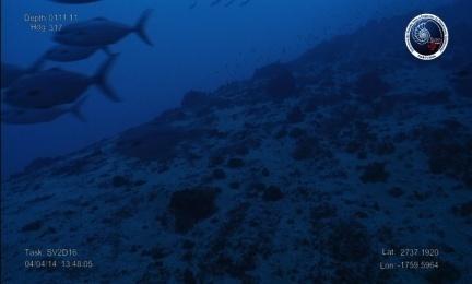
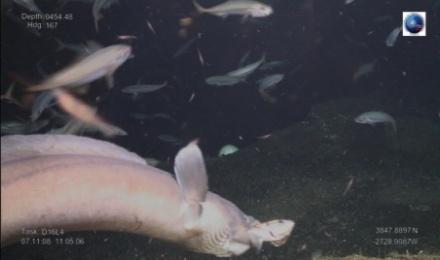
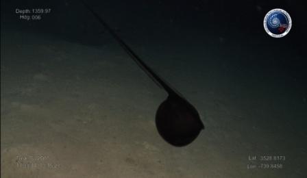
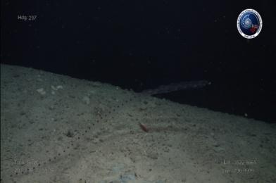
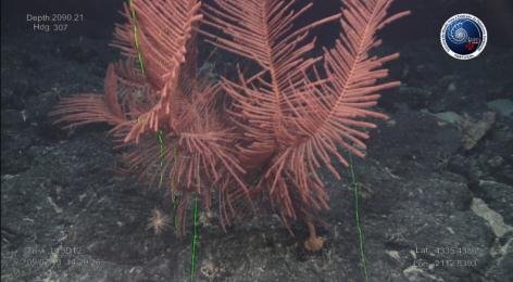
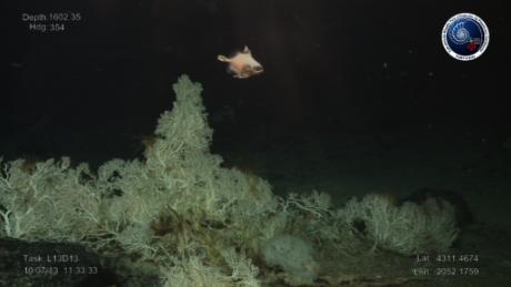
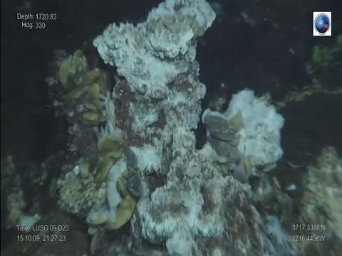
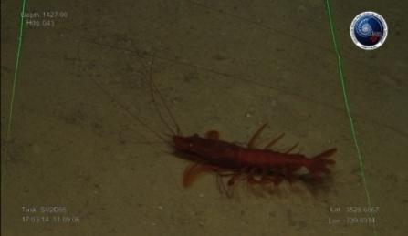
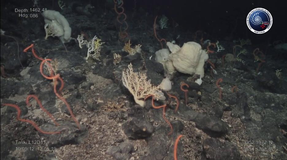
7 Cronology 2008 ROV LUSO Remotely Operated Vehicle capable of diving to depths of 6,000 m

8 Cronology

9 Cronology May 11 th 2009 Portuguese submission concerning the outer limit of the continental shelf beyond 200 nautical miles


10 Cronology From Continue to acquire technical and scientific data to defend and strengthen the establishment of the outer limit of the continental shelf contained in the Portuguese submission Continue to develop and coordinate several complementary projects: Kit do Mar and SNIMar Develop of the national capacity for the intervention in the deep sea LUSO

11 Present and future August An addendum was submitted to CLCS GEBCO 0.5 x0.5
12 2. Initial Assessment Report - Extended continental shelf

13 Marine Strategies Initial assessment report- Extended continental shelf Sub-region level:» Bay of Biscay and the Iberian Coast» Macaronesian biogeographic region» Continental sub-division» Madeira sub-division» Açores sub-division» Extended continental shelf subdivision
14 Initial assessment report- Extended continental shelf Main characteristics: Area Extended continental shelf Km2 Other sub-divisions Continental: Km2 Madeira: Km2 Azores: Km2 Maritime Zones Soil and subsoil Soil, subsoil and water Knowledge Low scientific knowledge Some scientific knowledge Pressures Potencial Areas almost without human presence High potencial in nature conservation and preservation specialy in MPA Areas with human impacts High potencial in nature conservation and preservation specialy in MPA
15 The approach: Initial assessment report- Extended continental shelf Some considerations: Potencial in nature conservation and preservation - encourage research contributing to biodiversity conservation and sustainable use and to designate new MPAs Rainbow hydrothermal vent field first MPA designated in Extension of Continental Shelf area under the OSPAR Convention Evaluation areas = MPAs under OSPAR Covention First Member State to consider this area under MSFD

16 Initial assessment report- Extended continental shelf
17 D2, D5, D6, D7, D10, D11 Initial assessment report- Extended continental shelf Determination of good environmental status (art.9º) D1, D3, D4, D8, D9 without enough scientific information Evaluation areas Environmental status Confidence degree Josephine Good environmental status achieved Low Rainbow Good environmental status achieved Low Altair Good environmental status achieved Low MARNA Good environmental status achieved Low Antialtair Good environmental status achieved Low
18 Initial assessment report- Extended continental shelf Establishment of environmental targets (art. 10º) Relevant existing environmental targets Nº1 Article 10º MSFD - Member States shall take into account the continuing application of relevant existing environmental targets laid down at national, Community or international level in respect of the same waters Operational targets» UNCLOS- relate to the extension of the continental shelf and to the exploration and explotaion of natural resources» OSPAR Convention against polluition and establishment of MPA
19 Initial assessment report- Extended continental shelf Establishment of environmental targets (art. 10º) Targets from MSFD Operational targets» Devepoment of management plans for MPAs» Development of national law to access to genetic resources according to the Nagoia Protocol related to scientific research, bio prospection and exploration» Continue to acquire technical and scientific data for the assessment of the environmental status ex: EMEPC scientific cruises
20 3. SNIMar project

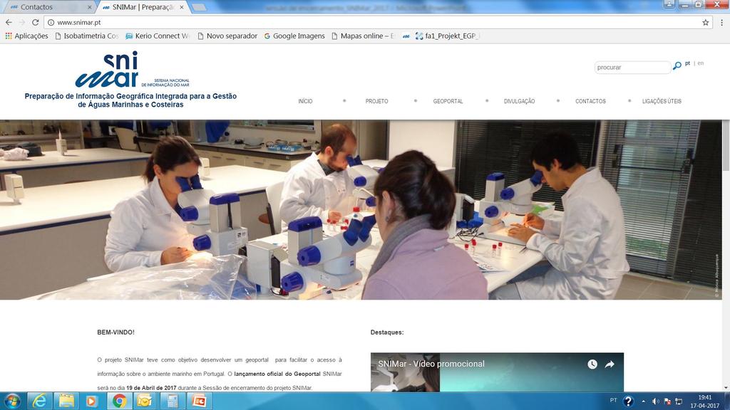
 & MSFD Directive (2008) Project schedule: 35 months Start: June 2014")
21 The project EEA Grants Pre-defined project: Preparation of integrated geographic information for marine and coastal water management ( Included in the program: Integrated management for marine and coastal water Framework: INSPIRE Directive (2007) & MSFD Directive (2008) Project schedule: 35 months Start: June 2014 End: April 2017 Budget: 2.35 M 2.00 M 0.35 M


22 The project A join venture of renowned entities
23 The project The problem: What data on the marine environment exist? Where are those data? How can we acess those data?


24 The project The solution: a marine geoportal to increase the capacity of assessing and predicting environmental status in marine waters share search access marine information
25 The project MISSION: 1. Increasing availability of services provided on-line 2. Significant reduction of waiting time for obtaining high quality thematic information 3. Establishing connections between SNIMar geoportal and other geoportals 4. Ensuring that system will work in a near future with license free


26 The project First: Three steps Second: Third:? To identify existing information To catalogue and prepare information To display and facilitate access to online information Local nodes Local nodes and central node

27 The project How to do it? Kit SNIMar: + + one scholarship one laptop one server with firewal In each local node workpackages coordination entities choose what information they want to share and in which format engagement with all partners With all local nodes

28 SNIMar metadata Profile Data Policy GEOPORTAL public access LOCAL CATALOGUES The project entities access Metadata creation sea thesaurus
29 1 geoportal for public acess 9 local catalogues on line 1861 keywords displayed in Collaborative Keywords application Results SNIMar numbers 16 scholarships 100%: 58 employees from 13 entities: 8 entities with Kit SNIMar Geoportal marine information metadata 283 services 4 products > 5000 historical records
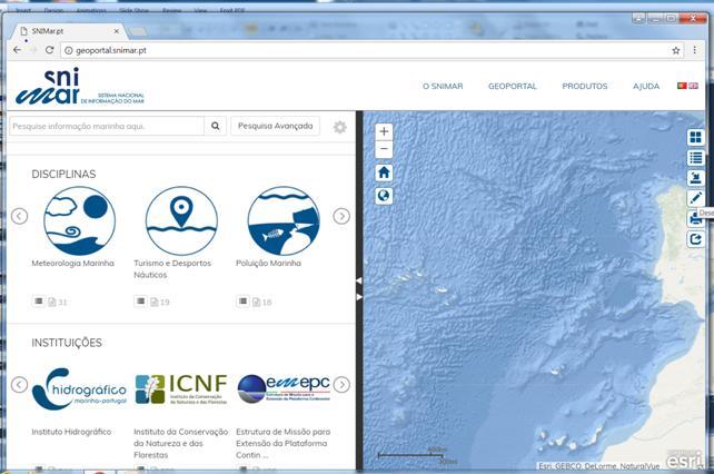
30 SNIMar Geoportal


31 Spatial Data Sets Natural reserve spatial planning SNIMar Geoportal

32 SNIMar Geoportal Web Map Service - Forecast air temperature every three-hour for the next two days (AROME RUN12)
33 Web Map Service - Tsunamis in Portugal SNIMar Geoportal

34 Web Map Service - Bathing waters in Portugal Geoportal SNIMar
35 Web Map Service - Bathymetric data Geoportal SNIMar

36 Geoportal SNIMar Web Map Service - Limits from Special Areas of Conservation

37 Geoportal SNIMar Web Map Service - Tursiops truncatus geographic distribution resident population from Sado estuary

38 Geoportal SNIMar Web Map Service - Nautical sports inside the network of protected areas

")
39 Geoportal SNIMar Web Feature Services Report Natura 2000 Art.17/Distribution ( ) - Balaenoptera physalus

40 Challenges: Sustainability of the geoportal & all the applications Oportunities: 1. Promote marine information sharing 2. Increase visibility of their institutions and data 3. Create opportunities for new partnerships in diferent thematic areas
41 SNIMar: A geoportal to share, search and access marine data Thank you!
MARITIME PLANNING IN PORTUGAL
 MARITIME PLANNING IN PORTUGAL Marta Chantal Ribeiro 2 May 2007 In Portugal there is currently no strategic planning system in force for the maritime area as a whole The maritime area under Portuguese jurisdiction
EXECUTIVE SUMMARY A SUBMISSION OF DATA AND INFORMATION ON THE OUTER LIMITS OF THE CONTINENTAL SHELF OF THE REPUBLIC OF NIGERIA PURSUANT TO
 EXECUTIVE SUMMARY A SUBMISSION OF DATA AND INFORMATION ON THE OUTER LIMITS OF THE CONTINENTAL SHELF OF THE REPUBLIC OF NIGERIA PURSUANT TO PART VI OF AND ANNEX II TO THE UNITED NATIONS CONVENTION ON THE
OUTER CONTINENTAL SHELF CLAIMS IN THE ARCTIC. Presentation given by Dr. Kamrul Hossain ASA University Bangladesh 15 March 2010
 OUTER CONTINENTAL SHELF CLAIMS IN THE ARCTIC Presentation given by Dr. Kamrul Hossain ASA University Bangladesh 15 March 2010 Contents Historical background of the continental shelf Concept of continental
Seabed knowledge In support of UN SDGs
 Seabed knowledge In support of UN SDGs Evert Flier Fiskerifaglig forum 2. november 2017 Hydrography & small scale fishing Hydrography in Transition Serving the Maritime Community Hydrography in Transition
National Perspectives - Portugal. Margarida Almodovar
 National Perspectives - Portugal Margarida Almodovar margarida.almodovar@mam.gov.pt from base line to the external limit of the continental shelf behind 200 miles and according to UNCLOS definitions Economic
Pacific Islands Regional Maritime Boundaries Project
 Pacific Islands Regional Maritime Boundaries Project 31 st Star Conference, Nadi, FIJI 6-8 June 2016 Jens Kruger Head of Ocean & Coastal Geoscience Sector Andrick Lal Project Officer (Surveying) Emily
The IHPT Marine Spatial Data infrastructure and its contribution to the INSPIRE Directive
 The IHPT Marine Spatial Data infrastructure and its contribution to the INSPIRE Directive INSPIRE - GWF 2015 - Coastal & Marine session Lisbon Congress Center, Portugal - Thursday, 28 May 2015 Summary
CONFERENCE OF PARLIAMENTARIANS OF THE ARCTIC REGION. UN LOS Convention and the extended continental shelf in the Arctic
 CONFERENCE OF PARLIAMENTARIANS OF THE ARCTIC REGION UN LOS Convention and the extended continental shelf in the Arctic Presentation given by Dr. Kamrul Hossain Finnish Parliament 18 November 2009 Contents
UNCLOS Article 76- Formulae and constraint lines
 UNCLOS Article 76- Formulae and constraint lines Dr Lindsay Parson (UNCLOS Group, National Oceanography Centre, UK) ABLOS TUTORIAL SESSION - Article 76 of UNCLOS 10th October 2005 IHO/IAG/IOC Advisory
Preliminary Information Indicative of the Outer Limits of the Continental Shelf Beyond 200 Nautical Miles of the People s Republic of China
 (Translation) Preliminary Information Indicative of the Outer Limits of the Continental Shelf Beyond 200 Nautical Miles of the People s Republic of China 1. The People s Republic of China ratified the
JOINT SUBMISSION TO THE COMMISSION ON THE LIMITS OF THE CONTINENTAL SHELF BY TUVALU, THE REPUBLIC OF FRANCE AND NEW ZEALAND (TOKELAU)
") JOINT SUBMISSION TO THE COMMISSION ON THE LIMITS OF THE CONTINENTAL SHELF BY TUVALU, THE REPUBLIC OF FRANCE AND NEW ZEALAND (TOKELAU) TABLE OF CONTENTS i. PREFACE... iii ii. LIST OF FIGURES... iv iii.
JOINT SUBMISSION TO THE COMMISSION ON THE LIMITS OF THE CONTINENTAL SHELF BY TUVALU, THE REPUBLIC OF FRANCE AND NEW ZEALAND (TOKELAU) TABLE OF CONTENTS i. PREFACE... iii ii. LIST OF FIGURES... iv iii.
Article 76, variations in annotation and implementation seen in submission documents for the claim of Extended Continental Shelf
 Article 76, variations in annotation and implementation seen in submission documents for the claim of Extended Continental Shelf Mr. Shin Tani Chairman, IHO/IAG Advisory Board on the Law of the Sea (ABLOS)
The french national programme for claiming continental shelf beyond 200 Miles
 The french national programme for claiming continental shelf beyond 200 Miles Using global bathymetric models in the context of an Extended Continental Shelf submission EXTRAPLAC Using Global Bathymetric
INSPIRE and Land Use Planning System in Portugal
 INSPIRE and Land Use Planning System in Portugal Rui Amaro Alves Director General Directorate General for Territorial Development ruialves@dgterritorio.pt Carlos Simões Senior Technician Directorate General
Realizing benefits of Spatial Data Infrastructure A user s perspective from Environment Agency - Abu Dhabi
 Realizing benefits of Spatial Data Infrastructure A user s perspective from Environment Agency - Abu Dhabi Anil Kumar Director, Environment Information Management 26 April 2012 Geospatial World Forum,
IRELAND. PART I Executive Summary
 IRELAND Submission to the Commission on the Limits of the Continental Shelf pursuant to Article 76, paragraph 8 of the United Nations Convention on the Law of the Sea 1982 in respect of the area abutting
PartiSEApate Conference
 Baltic Maritime Spatial Planning Forum PartiSEApate Conference C r e a t i n g c o m m o n u n d e r s t a n d i n g B a l t i c M a r i t i m e S p a t i a l P l a n n i n g F o r u m B a l t i c M a
MARINE PLANNING IN PORTUGAL ( 1 )
") MARINE PLANNING IN PORTUGAL ( 1 ) MARTA CHANTAL RIBEIRO ( 2 ) I couldn t start my presentation without expressing my gratitude to Professor Gerd Winter for the opportunity to participate in this workshop.
MARINE PLANNING IN PORTUGAL ( 1 ) MARTA CHANTAL RIBEIRO ( 2 ) I couldn t start my presentation without expressing my gratitude to Professor Gerd Winter for the opportunity to participate in this workshop.
Arctic Spatial Data Infrastructure Enabling Access to Arctic Location-Based Information
 Arctic Spatial Data Infrastructure Enabling Access to Arctic Location-Based Information Arctic SDI Side Event Co-Chairs: Arvo Kokkonen Arctic SDI Board Chair & Director General, National Land Survey of
Outline of presentation
 - lessons learnt from precedent cases of establishing the s Outline of presentation Extending Ireland s continental shelf jurisdiction to the outer s in the Porcupine Abyssal Plain: progress, issues and
CONTINENTAL SHELF SUBMISSION OF ANGOLA - EXECUTIVE SUMMARY -
 CONTINENTAL SHELF SUBMISSION OF ANGOLA - EXECUTIVE SUMMARY - INDEX List of Figures 2 List of Tables 3 1 Introduction 5 2 Provisions of Article 76 7 3 Angolan Institutions responsible for the Submission
Natura 2000 in the marine environment: state of implementation and next steps
 Life on the blue planet: biodiversity research and the new European marine policies EPBRS European Platform on Biodiversity Research Strategy Porto, Portugal 7-9 November 2007 Natura 2000 in the marine
Law of the Sea Symposium, February, 2016, TOKYO International Law for the Resources of the Sea
 Law of the Sea Symposium, 16-17 February, 2016, TOKYO International Law for the Resources of the Sea Segment 2 Governance of Resources of the Continental Shelf (including extended continental shelf) Introduction
xxv PART I THE DIVIDED OCEANS: INTERNATIONAL LAW GOVERNING JURISDICTIONAL ZONES 1
 Contents Preface page xv List of Figures xvii List of Tables xviii List of Abbreviations xix Table of Cases xxi Table of Treaties and Instruments xxv PART I THE DIVIDED OCEANS: INTERNATIONAL LAW GOVERNING
GEBCO 2013 TSCOM. EMODNET Hydrography status report
 www.emodnet-hydrography.eu GEBCO 2013 TSCOM EMODNET Hydrography status report Eric Moussat, Ifremer on behalf of the Emodnet consortium 1 Background and objectives EU proposed to take steps in 2008 towards
2018/1 The integration of statistical and geospatial information. The Regional Committee of UN-GGIM: Americas:
 The following are the conclusions and recommendations of the Regional Committee of the United Nations on Global Geospatial Information Management for the Americas, during its Fifth Session, Thursday 8
Geological Survey of Canada Lands and Minerals Sector Natural Resources Canada OneGeology, June 2018
 Geological Survey of Canada Lands and Minerals Sector Natural Resources Canada OneGeology, June 2018 Geological Survey of Canada Mission The Geological Survey of Canada provides public geoscience knowledge
Collaborative Systems for the Creation of Marine Services
 Collaborative Systems for the Creation of Marine Services INSPIRE 2016 Nuno Almeida Nuno Catarino Barcelona, 28 th September 2016 Elecnor Deimos is a trademark which encompasses Elecnor Group companies
A trans-atlantic assessment and deep-water ecosystem-based spatial management plan for Europe
 A trans-atlantic assessment and deep-water ecosystem-based spatial management plan for Europe This project has received funding from the European Union s Horizon 2020 research and innovation programme
Faatasi Malologa (PGSC Chair) Director Department of Lands & Survey, Tuvalu
 Director Department of Lands & Survey, Tuvalu") Seventh Session of the United Nations Committee of Experts on Global Geospatial Information Management (UN-GGIM) - 31 July -4 August 2017 Faatasi Malologa (PGSC Chair) Director Department of Lands & Survey,
Seventh Session of the United Nations Committee of Experts on Global Geospatial Information Management (UN-GGIM) - 31 July -4 August 2017 Faatasi Malologa (PGSC Chair) Director Department of Lands & Survey,
Legal Interpretation of Submarine Ridges & Submarine Elevations
 Legal Interpretation of Ridges & Article 76, paragraph 6 New Knowledge and Changing Circumstances in the Law of the Sea Reykjavik, Iceland June 28, 2018 Kevin Baumert U.S. Department of State U.S. ECS
a national geological survey perspective François ROBIDA BRGM (French Geological Survey)
") a national geological survey perspective François ROBIDA BRGM (French Geological Survey) Pre-Conference Seminar on Socio-Economic Value of Geospatial for National and Regional Development 21 August 2017,
a national geological survey perspective François ROBIDA BRGM (French Geological Survey) Pre-Conference Seminar on Socio-Economic Value of Geospatial for National and Regional Development 21 August 2017,
Providing Marine Data. The German Marine Data Infrastructure (MDI-DE) as an example for best practice
 as an example for best practice") Providing Marine Data The German Marine Data Infrastructure (MDI-DE) as an example for best practice Data Originators 18 Agencies and Institutions in the EEZ and 12 Mile Zone Federal Government BSH Schleswig-Holstein
Providing Marine Data The German Marine Data Infrastructure (MDI-DE) as an example for best practice Data Originators 18 Agencies and Institutions in the EEZ and 12 Mile Zone Federal Government BSH Schleswig-Holstein
IMA s ROLE IN COASTAL AND OCEAN GOVERNANCE IN TRINIDAD AND TOBAGO
 IMA s ROLE IN COASTAL AND OCEAN GOVERNANCE IN TRINIDAD AND TOBAGO Presented by Rahanna Juman, Deputy Director (Ag.) About the Institute of Marine Affairs Institute of Marine Affairs (IMA) was established,
Law No. 41 of 1 June 1979 concerning the Territorial Sea, the Economic Zone and the Continental Shelf. I The territorial sea
 Page 1 Law No. 41 of 1 June 1979 concerning the Territorial Sea, the Economic Zone and the Continental Shelf I The territorial sea Article 1. The territorial sea of Iceland shall be delimited by a line
Pacific Islands Regional Maritime Boundaries Project the latest Update. Malakai Vakautawale (Mr) Maritime Boundaries Adviser
 Maritime Boundaries Adviser") Pacific Islands Regional Maritime Boundaries Project the latest Update Malakai Vakautawale (Mr) Maritime Boundaries Adviser Consortium Partners 2 What we do? Provide technical advice and support on MB
Pacific Islands Regional Maritime Boundaries Project the latest Update Malakai Vakautawale (Mr) Maritime Boundaries Adviser Consortium Partners 2 What we do? Provide technical advice and support on MB
Proposal for a DIRECTIVE OF THE EUROPEAN PARLIAMENT AND OF THE COUNCIL. establishing an infrastructure for spatial information in the Community
 Proposal for a DIRECTIVE OF THE EUROPEAN PARLIAMENT AND OF THE COUNCIL establishing an infrastructure for spatial information in the Community INSPIRE http://inspire.jrc.it/ Alessandro Annoni 1 EU Commission
Clive Schofield * and David Freestone **
 Holding Back the Waves: Options to Secure Maritime Jurisdictional Claims in the Face of Sea Level Rise Clive Schofield * and David Freestone ** *Australian National Centre for Ocean Resources and Security
Ministry of Health and Long-Term Care Geographic Information System (GIS) Strategy An Overview of the Strategy Implementation Plan November 2009
 Strategy An Overview of the Strategy Implementation Plan November 2009") Ministry of Health and Long-Term Care Geographic Information System (GIS) Strategy An Overview of the Strategy Implementation Plan November 2009 John Hill, Health Analytics Branch Health System Information
Ministry of Health and Long-Term Care Geographic Information System (GIS) Strategy An Overview of the Strategy Implementation Plan November 2009 John Hill, Health Analytics Branch Health System Information
P r o d u c t p o r t f o l i o a n d d a t a a c c e s s
 P r o d u c t p o r t f o l i o a n d d a t a a c c e s s Copernicus Environment Service Copernicus EU Copernicus EU Copernicus EU www.copernicus.eu I N T R O D U C T I O N O F U S E C A S E User Uptake
HELCOM-VASAB Maritime Spatial Planning Working Group Twelfth Meeting Gdansk, Poland, February 2016
 HELCOM-VASAB Maritime Spatial Planning Working Group Twelfth Meeting Gdansk, Poland, 24-25 February 2016 Document title HELCOM database for the coastal and marine Baltic Sea protected areas (HELCOM MPAs).
Outer Continental Shelf
 The Delimitation of the Outer Continental Shelf Presentation by Stephen Fietta Monaco, 17 October 2008 Latham & Watkins is the business name of Latham & Watkins (London) LLP, a registered limited liability
EXECUTIVE SUMMARY A PARTIAL SUBMISSION OF DATA AND INFORMATION ON THE OUTER LIMITS OF THE CONTINENTAL SHELF OF THE KINGDOM OF TONGA PURSUANT TO
 EXECUTIVE SUMMARY A PARTIAL SUBMISSION OF DATA AND INFORMATION ON THE OUTER LIMITS OF THE CONTINENTAL SHELF OF THE KINGDOM OF TONGA PURSUANT TO PART VI OF AND ANNEX II TO THE UNITED NATIONS CONVENTION
HOW HAS INSPIRE PROMOTED THE EMERGENCE OF A SPATIAL DATA INFRASTRUCTURE FOR THE MARINE COMMUNITY IN THE SOUTH WEST OF THE INDIAN OCEAN?
 HOW HAS INSPIRE PROMOTED THE EMERGENCE OF A SPATIAL DATA INFRASTRUCTURE FOR THE MARINE COMMUNITY IN THE SOUTH WEST OF THE INDIAN OCEAN? Erwann Quimbert, Michel Ropert, Catherine Satra Le Bris, Julien Meillon,
Statutory framework of the world network of biosphere reserves UNESCO General Conference 1996
 Statutory framework of the world network of biosphere reserves UNESCO General Conference 1996 Keywords: conservation, protected areas, biosphere reserves, policies, strategies. For the Mountain Forum's
Briefing document of the status of maritime boundaries in Pacific island countries
 Secretariat of the Pacific Community Seventh Heads of Fisheries Meeting (28 Feb. 4 March 2011, Noumea, New Caledonia) Working Paper 5 Original: English Briefing document of the status of maritime boundaries
Swedish Spatial Data Infrastructure and the National Geodata Strategy
 Submitted to the United Nations Committee of Experts on Global Geospatial Information Management Seventh Session New York, August 2018 Registration number 519-2018/4327 Country Report, Sweden Swedish Spatial
Geological information for Europe : Towards a pan-european Geological Data Infrastructure
 Geological information for Europe : Towards a pan-european Geological Data Infrastructure Integrating geoscientific information for EU competitiveness Co-funded by the European Union European societal
COMPLICATIONS IN DELIMITING THE OUTER CONTINENTAL SHELF. Ron Macnab Geological Survey of Canada (Retired)
") COMPLICATIONS IN DELIMITING THE OUTER CONTINENTAL SHELF Ron Macnab Geological Survey of Canada (Retired) DISCLAIMER The contents of this presentation are the author s personal views only, and do not represent
COMPLICATIONS IN DELIMITING THE OUTER CONTINENTAL SHELF Ron Macnab Geological Survey of Canada (Retired) DISCLAIMER The contents of this presentation are the author s personal views only, and do not represent
INDONESIA S S UPDATE: GEOSPATIAL INFORMATION FOR SUSTAINABLE DEVELOPMENT RELATED TO INA SDI Dr. Asep Karsidi, M.Sc
 INDONESIA S S UPDATE: GEOSPATIAL INFORMATION FOR SUSTAINABLE DEVELOPMENT RELATED TO INA SDI Dr. Asep Karsidi, M.Sc GEOSPATIAL INFORMATION AGENCY 08 August, 2012 OUTLINE 1. Transformation Bakosurtanal into
INSPIRE - A Legal framework for environmental and land administration data in Europe
 INSPIRE - A Legal framework for environmental and land administration data in Europe Dr. Markus Seifert Bavarian Administration for Surveying and Cadastre Head of the SDI Office Bavaria Delegate of Germany
NOAA Nautical Charts and Coastal and Marine Spatial Planning. Meredith Westington Chief Geographer NOAA/NOS/Office of Coast Survey
 NOAA Nautical Charts and Coastal and Marine Spatial Planning Meredith Westington Chief Geographer NOAA/NOS/Office of Coast Survey Ocean Policy Task Force What is CMSP? A comprehensive, adaptive, integrated,
1982 United Nations Convention on the Law of the Sea
 1982 United Nations Convention on the Law of the Sea Article 16, 47, 75, 76 and 84 Article 16, 47, 75, 76 and 84 require Coastal States to deposit geographic information pertaining to their maritime limits
Introduction to EMODnet
 Introduction to EMODnet Antonio Novellino Torino, 14-15 Ottobre 2015 What is EMODnet? Initiated by the European Commission in response to the EU Future Maritime Policy and Blue Growth, launched in June
IHO STAKEHOLDERS FORUM. Hydrographic data and its role in MSDI. Thursday 27 September Jens Peter Hartmann KMS
 IHO STAKEHOLDERS FORUM Hydrographic data and its role in MSDI Thursday 27 September Jens Peter Hartmann KMS Agenda Traditional approach to hydrographic data Expectations within the marine / maritime field
EuroGEOSS Protected Areas Pilot
 EuroGEOSS Protected Areas Pilot Max Craglia European Commission Joint Research Centre Part 1: the present MyNatura2000 Mobile app. Awareness raising & volunteered data collection. Natura2000 covers 18%
8 th Arctic Regional Hydrographic Commission Meeting September 2018, Longyearbyen, Svalbard Norway
 8 th Arctic Regional Hydrographic Commission Meeting 11-13 September 2018, Longyearbyen, Svalbard Norway Status Report of the Arctic Regional Marine Spatial Data Infrastructures Working Group (ARMSDIWG)
Integration for Informed Decision Making
 Geospatial and Statistics Policy Intervention: Integration for Informed Decision Making Greg Scott Global Geospatial Information Management United Nations Statistics Division Department of Economic and
Geospatial Decision Support Tools for Planning of Marine Protected Areas in California
 Geospatial Decision Support Tools for Planning of Marine Protected Areas in California WILL MCCLINTOCK (UNIVERSITY OF CALIFORNIA SANTA BARBARA), MATT MERRIFIELD (THE NATURE CONSERVANCY), SOPHIE DE BEUKELAER
MAPS AND COORDINATES...
 Table of Contents 1 INTRODUCTION... 2 2 MAPS AND COORDINATES... 3 3 ADVISORY ASSISTANCE FROM COMMISSION MEMBERS... 3 4 PROVISIONS OF ARTICLE 76 INVOKED... 3 5 OUTSTANDING MARITIME DELIMITATIONS... 4 6
Motivations, principles and development of a pan-european approach to describe MPA network coherence in Europe s seas
 Motivations, principles and development of a pan-european approach to describe MPA network coherence in Europe s seas G. Mo 1, S. Agnesi 1, J. Reker 2 1 ISPRA (Rome, Italy) & European Topic Center on Inland
GeomaticsWorld. Issue No 3 : Volume 21. Helping to unravel Easter Island s mysterious statues. DGI 2013: maritime security highlighted
 GeomaticsWorld MARCH APRIL 2013 Issue No 3 : Volume 21 BIM: repeat the message even if you lose the will to live Helping to unravel Easter Island s mysterious statues DGI 2013: maritime security highlighted
Maritime Spatial Planning Framework Directive Supported by INSPIRE
 Maritime Spatial Planning Framework Directive Supported by INSPIRE Andrej Abramić, Vanda Nunes de Lima, Paul Smits, Emanuele Bigagli, Chris Schubert European Commission Joint Research Centre Institute
GMES Service for Geospatial Reference Data Access (RDA) Covering Areas Outside Europe
 Covering Areas Outside Europe") INSPIRE Conference 2011 Edinburgh 27 June - 1 July GMES Service for Geospatial Reference Data Access (RDA) Covering Areas Outside Europe Andrea Ajmar, Simone Balbo, Piero Boccardo, Simone Dalmasso, Anna
INSPIRE Conference 2011 Edinburgh 27 June - 1 July GMES Service for Geospatial Reference Data Access (RDA) Covering Areas Outside Europe Andrea Ajmar, Simone Balbo, Piero Boccardo, Simone Dalmasso, Anna
Seabed 2030: A Call to Action
 Seabed 2030: A Call to Action Rear Adm. Shepard Smith NOAA Office of Coast Survey shep.smith@noaa.gov Introduction Many people like me start speeches about mapping the ocean with we know more about the
Pan American Institute of Geography and History. 12th MACHC 5-9 December 2011
 Pan American Institute of Geography and History 12th MACHC 5-9 December 2011 1 PAIGH Mission and Objectives To encourage, coordinate, and publicize cartographical, geographical, geophysical and historical
Country Fiche Lithuania
 Country Fiche Lithuania Updated June 2018 1. General information The Lithuanian maritime space is delimited by the Decree of the Government of the Republic of Lithuania of 6 December, 2004, No. 1597 and
Cross-border Maritime Spatial Plan for the Black sea - Romania and Bulgaria project
 Cross-border Maritime Spatial Plan for the Black sea - Romania and Bulgaria project in Romania and Bulgaria Plan Presentation A first step in the management of the marine areas of Romania and Bulgaria
PAN AMERICAN INSTITUTE OF GEOGRAPHY AND HISTORY Specialized Organization of the OAS
 PAN AMERICAN INSTITUTE OF GEOGRAPHY AND HISTORY Specialized Organization of the OAS 10 th UNRCC Americas United Nations, New York, 20 August 2013 PAIGH, SIRGAS, PC-IDEA and GeoSUR 2013-2015 Joint Action
SITMUN: Cooperating to Build Local SDIs in the Barcelona Region
 SITMUN: Cooperating to Build Local SDIs in the Barcelona Region Diputació de Barcelona Territory and Sustainability Area Territorial Information Systems Department INSPIRE CONFERENCE Barcelona, September
Management Planning & Implementation of Communication Measures for Terrestrial Natura 2000 Sites in the Maltese Islands Epsilon-Adi Consortium
 Management Planning & Implementation of Communication Measures for Terrestrial Natura 2000 Sites in the Maltese Islands Epsilon-Adi Consortium Briefing Meetings, February 2013 CT3101/2011, MEPA, Malta
SIXTH REGULAR SESSION, 2017 C.B. NO A BILL FOR AN ACT
 NINETEENTH CONGRESS OF THE FEDERATED STATES OF MICRONESIA SIXTH REGULAR SESSION, 0 C.B. NO. - A BILL FOR AN ACT To amend title of the code of the Federated States of Micronesia by amending existing sections
Marine/Maritime Spatial Planning Andrej Abramić
 Marine/Maritime Spatial Planning Andrej Abramić EcoAqua SUMMER SCHOOL: Ecosystem approach to aquaculture 26-29th of October 2015 Research and Technology to enhance excellence in Aquaculture development
Mapping and Assessment of Ecosystems and their Services
 Mapping and Assessment of Ecosystems and their Services ALTER-Net Conference 2013: Science underpinning the EU 2020 Biodiversity Strategy. April 2013 Gent Joachim MAES 1 This presentation is based on the
Country Fiche Sweden.
 Country Fiche Sweden 1. General information the territorial sea (12- nm zone) 70,000 km2 the Exclusive Economic Zone 60,000 km2 the EEZ is limited to the central line between adjacent states because the
THE PORTUGUESE INSTITUTE FOR THE OCEAN AND ATMOSPHERE. Pedro Viterbo
 THE PORTUGUESE INSTITUTE FOR THE OCEAN AND ATMOSPHERE Pedro Viterbo pedro.viterbo@ipma.pt 2012 IPMA CREATION Before Now IM INRB/IPIMAR LNEG IPMA SOME NUMBERS: 506 Staff: Personnel 426 Budget 2014 11% 26%
Bathymetry. EMODnet Stakeholder Conference & Sea-basin Workshops February Bathymetry
 EMODnet Stakeholder Conference & Sea-basin Workshops 14-15 February 2017 Arctic checkpoint Belinda Kater On behalf of all Checkpoints http://www.emodnet.eu 1 ? is the study of the "beds" or "floors" of
INSPIRE Monitoring and Reporting Implementing Rule Draft v2.1
 INSPIRE Infrastructure for Spatial Information in Europe INSPIRE Monitoring and Reporting Implementing Rule Draft v2.1 Title INSPIRE Monitoring and Reporting Implementing Rule v2.1 Creator DT Monitoring
Linking Global and Regional Levels in the Management of Marine Areas Beyond National Jurisdiction
 Linking Global and Regional Levels in the Management of Marine Areas Beyond National Jurisdiction South Atlantic Region Session 4: «Experiences, Priorities and Opportunities in the South Atlantic and Indian
Marine Spatial Planning: A Tool for Implementing Ecosystem-Based Management
 Marine Spatial Planning: A Tool for Implementing Ecosystem-Based Management Steven Murawski, Ph.D., Ecosystem Goal Team Lead National Oceanic and Atmospheric Administration NOAA November 16, 2009 1 To
THE SEVILLE STRATEGY ON BIOSPHERE RESERVES
 THE SEVILLE STRATEGY ON BIOSPHERE RESERVES 1 VISION FOR BIOSPHERE RESERVES IN THE 21 ST CENTURY The international Seville Conference on Biosphere Reserves, organised by UNESCO, adopted a two-pronged approach,
Coastal Mapping Follow on? Bruno Frachon Corine Lochet Gaël Morvan
 Coastal Mapping Follow on? Bruno Frachon Corine Lochet Gaël Morvan Shared objectives; IHO DG MARE CPMR Development of a Joint European Coastal Mapping Programme (JECMaP) within the IHO EU network with
IPSENTINEL. The Collaborative Infrastructure for Sentinel Data in Portugal. IPSentinel
 IPSENTINEL The Collaborative Infrastructure for Sentinel Data in Portugal 1 MISSION The Directorate-General for the Territory Development (DGT) and the Portuguese Institute for the Sea and the Atmosphere
Reprint of article that appeared in Hydro INTERNATIONAL November 2006 Volume 10 Issue 9
 Reprint of article that appeared in Hydro INTERNATIONAL November 2006 Volume 10 Issue 9 While Google Earth is the best known 3D web-mapping viewer currently in the public domain, there are alternative
Ocean Governance and the Japanese Basic Act on Ocean Policy
 Ocean Governance and the Japanese Basic Act on Ocean Policy Hiroshi Terashima Executive Director Ocean Policy Research Foundation 14 April 2009 The United Nations Nippon Foundation Fellowship Programme
Strengthening the Southwestern indian ocean islands network
 Strengthening the Southwestern indian ocean islands network By Said Ahamada Assistant in charge of environment and fisheries said.ahamada@coi-ioc.org ICRI 29 th General Meeting in OKINAWA, October 2014
Delineation of the MSFD Article 4 marine regions and subregions Version 2.0 Date: 04/10/2017
 Delineation of the MSFD Article 4 marine regions and subregions Version 2.0 Date: 04/10/2017 Prepared by: Hans Mose Jensen & Periklis Panagiotidis (ICES) Johnny Reker EEA; (contact person) Contents 1 Marine
DEPARTMENT OF GEOLOGY AND MINERAL INDUSTRIES WAYS & MEANS SUBCOMMITTEE ON NATURAL RESOURCES MARCH 2, 2017
 DEPARTMENT OF GEOLOGY AND MINERAL INDUSTRIES WAYS & MEANS SUBCOMMITTEE ON NATURAL RESOURCES MARCH 2, 2017 1 ABOUT DOGAMI AGENCY MISSION, VISION & GOALS 2 Lidar image of a stream network along the Umpqua
PROGRAM OF THE RUSSIAN FEDERATION CHAIRMANSHIP OF THE ARCTIC COUNCIL IN
 PROGRAM OF THE RUSSIAN FEDERATION CHAIRMANSHIP OF THE ARCTIC COUNCIL IN 2004-2006 The Arctic Council is a unique forum for interaction between the governments of the Arctic States, the Permanent Participants
INSPIRE in Sweden.
 INSPIRE in Sweden Swedish National Data Service Established 2008. SND is a service organisation for Swedish research within the Humanities, Social Sciences and Medicine. SND is the Swedish node in an international
ITLOS s approach to the delimitation of the continental shelf beyond 200 M in Bangladesh/Myanmar: Theoretical and practical difficulties
 ITLOS s approach to the delimitation of the continental shelf beyond 200 M in Bangladesh/Myanmar: Theoretical and practical difficulties London International Boundary Conference 18-19 April 2013 Panel
State Practice on the Establishment of Multiple Maritime Boundaries: Assessing the Challenges of Separating Seabed and Water Column Boundaries
 State Practice on the Establishment of Multiple Maritime Boundaries: Assessing the Challenges of Separating Seabed and Water Column Boundaries Professor Clive Schofield The Australian National Centre for
Integration Activities in Indonesia: The Integration of Land and Marine Spatial Data Sets as Part of Indonesian SDI Development
 Integration Activities in Indonesia: The Integration of Land and Marine Spatial Data Sets as Part of Indonesian SDI Development M. Arief Syafi i National Coordination Agency for Surveys and Mapping (B
PORTUGAL NATIONAL REPORT
 PORTUGAL NATIONAL REPORT 14 TH MEETING OF THE EASTERN ATLANTIC HYDROGRAPHIC COMMISSION Cadiz, Spain 18 th 20 th October 2016 INSTITUTO HIDROGRÁFICO Miguel Arenga IHPT Head of the Hydrography Division 2016-10-18
IHO Perspective on a Marine Spatial Data Infrastructure
 IHO Perspective on a Marine Spatial Data Infrastructure Anthony Pharaoh (International Hydrographic Bureau) Definitions of Hydrography on the Web: The study of the surface waters of the Earth. www.geographic.org/glossary.html
What s the problem? A Modern Odyssey in Search of Relevance. The search for relevance. Some current drivers for new services. Some Major Applications
 A Modern Odyssey in Search of Relevance FIG Working Week, Athens, 24 May 2004 Paul Kelly ANZLIC Executive Director The search for relevance 1. New expectations for spatial services 2. Are we ready to meet
Empowered lives. Resilient nations. Data for People and Planet. powered by
 Empowered lives. Resilient nations. Data for People and Planet powered by Overview As we enter the fourth industrial revolution, technology is revolutionizing our ability to map nature. Satellite data
World Oceans Day 2010 Our oceans: opportunities and challenges
 World Oceans Day 2010 Our oceans: opportunities and challenges Roundtable discussion on the United Nations Convention on the Law of the Sea fifteen years after its entry into force HOW EFFECTIVELY IS UNCLOS
Country Report on SDI Activities in Singapore *
 UNITED NATIONS E/CONF.100/CRP.9 ECONOMIC AND SOCIAL COUNCIL Eighteenth United Nations Regional Cartographic Conference for Asia and the Pacific Bangkok, 26-29 October 2009 Item 7(a) of the provisional
2012 INTERIM STATUS REPORT ON THE OSPAR NETWORK OF MARINE PROTECTED AREAS Note by the Executive Secretary
 CBD Distr. GENERAL UNEP/CBD/COP/11/INF/42 26 September 2012 ORIGINAL: ENGLISH CONFERENCE OF THE PARTIES TO THE CONVENTION ON BIOLOGICAL DIVERSITY Eleventh meeting Hyderabad, India, 8-19 October 2012 Items