Stream Restoration Asset Mapping
|
|
|
- Emery Higgins
- 5 years ago
- Views:
Transcription


1 Stream Restoration Asset Mapping John Dean Amy Bergbreiter March 27, 2014 Georgia Association of Floodplain Management Conference Hyatt Regency, Atlanta, GA

2
3


4 Sediment comes mostly from stream banks, not impervious surface. As a reaction to this, we have tried to stabilize our stream banks.


5 Watershed Improvement Projects We will end up with a lot more!


6 We want to track our expenditures and the value of our work. This is called asset management.


7 Stream restoration is a big part of this. Sapelo Trail Stream Restoration Site

8


9 Stream Work-Grading
10 In some cases, we create a new channel. Stream bank protection Structures Relocated Channel
11 This presents data-model problem #1. Streams continuously change their design characteristics along length. How do we negotiate this?
12 Realization: We didn t need to capture how the design varies. We store the cost holistically. Doesn t really matter how the design ebbs and flows. Don t need to treat changes as discrete assets. The whole thing is (debatably) an asset. Therefore: You don t need linear referencing. lessons learned were that we did not want to bother with linear referencing (theoretically elegant, but not practical). Guiding Principle: Need assets, not design.

13 We do want to inventory individual structures because they are discrete assets.


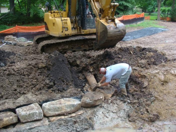
14 Stream Work-Structure Installation

15 Bank protection is captured by tracing the stream centerline Can use symbology to offset line to show left vs. right bank
16 Categorization is a necessary evil of geographic databases. In cartography, it is called simplification.
17 This presents data-model problem #2. How do you sort a spectrum of customized solutions into boxes?
18 Realization: You can broaden your categories with subfields. Example: Step pools We built enough flexibility into our cross vane category that we could capture step pools as a series of cross-vane types. Example: Amphitheater We had a loosely qualified category bench that could accommodate our amphitheater. Solution: Make your bins big and flexible so as to cast a wide net. Guiding Principle: When in doubt, put a feature in a category with other features that have similar replacement costs or require similar types of equipment. Think asset not hydrology.

19 Instead of only these categories of vanes, the categories can be further qualified with additional characteristics.

20 Instead of just a bridge or a retaining wall, a plethora of other qualification are available to further qualify these structures to accommodate customizations.


21 Solution: We installed a series of boulders to create an amphitheater at McDaniel Farm represented it with a series of benches

22 Next consideration: Most organizations have regular feature classes for their conventional inventory.
23 This presents data-model problem #3. Some of your restoration structure resembles conventional inventory. Bioretention outlets Stream restoration reaches
24 First realization: We do not want to duplicate data. Example: Bioretention outlets We decided to use the conventional yard inlet inventory for holding these features. Second realization: We are going to have to duplicate some data. Example: Stream restoration reaches We have non-conduits in our inventory, but we couldn t use them. We fell back on a duplicated GIS layer. Solution: Use as much of your existing data model as possible, but if you have to, make your own. Conflate the duplicated layers so both are as accurate as possible. Tip: When mapping a stream restoration project, expect considerable mapping in your conventional stormwater inventory, too.

25 It s actually a customized solution, but we call it a conventional yard inlet. Tip: You don t want to proliferate on your feature classes.
26 SUMMARY Time spent planning, sometimes changing plans. Building the data model. Populating your database. Technology Capital: Little new cost. We already had it. Human Capital: Expect to use your talent. Expect to use your people. Budget for ample hours. We recommend assigning the task to a small team. A field person An engineer A GIS database person Tip: You will want to prearrange for surveyors to provide as-built drawings. You will want these in CAD format as well as.pdf.
27 BENEFITS Together with all your other layers IMMEASURABLE. Linked to an asset management/work order database EVEN MORE POWERFUL. You can track where you re spending your money and assign work orders. You should do this! There is no substitute for having GIS and asset management layer. Plans, CAD files, and maps are no substitute. GIS is a unifying technology, works best by combining and overlaying. Potentially more valuable as structures age, institutional knowledge fades, and you get more GIS layers. Put it on your publicly facing web maps!

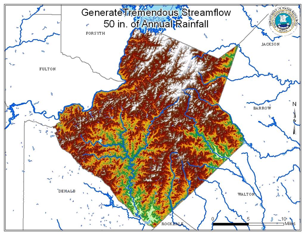
28 Using a digital elevation model (DEM),we can map the area contributing to any pour point.


29 This allows us to map the catchments and impervious contributions for any tributary.
30 FUTURE RESEARCH Quantify the return on investment (ROI). Is linear referencing practical or impractical? Take what we have done and adapt it to your situation! John Dean Amy Bergbreiter Gwinnett County Department of Water Resources Stormwater Management Division Lawrenceville, Georgia USA.


31 Questions? John Dean, GISP Amy Bergbreiter, P.E. Gwinnett County Department of Water Resources
32 THE END Slides after are available, if needed;

33 Representations offer us a stable, flexible platform to store our cartography. You can personally draw and modify these renderings and make them very artistic, morphological and intuitive. They travel with the database and make the data more valuable.

34 We store our symbols as Cartographic Representations. This means they do not have to be in any style file. Arcmap 10.x -values in a knows how draw these symbols directly from geodatabase.


35 Pictures During a Rain Event

36 Cross vanes, a diversion structure, a foot bridge, and a conventional conduit.

37 Using a DEM from LIDAR data we map the catchments that flow into pour points.

38 ArcMap and ArcTools calculate how the stream concentrates...

39 ... but it is important to precondition the DEM.

40

41

42

43


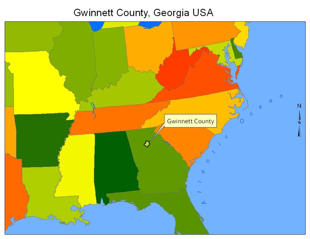
44 Gwinnett County, GA A spacious, suburban county of about 800,000 people located in the southeast U.S. 40 miles northeast of Atlanta, GA.
45
LRS Task Force June 13, REVISION HISTORY
 North Carolina Department of Transportation Geographic Information Systems (GIS) Unit LINEAR REFERENCING SYSTEM (LRS) PROJECT DEFINITION Version 1.0 REVISION HISTORY Date Document Manager Revision Purpose
Enabling Success in Enterprise Asset Management: Case Study for Developing and Integrating GIS with CMMS for a Large WWTP
 Enabling Success in Enterprise Asset Management: Case Study for Developing and Integrating GIS with CMMS for a Large WWTP Allison Blake, P.E. 1*, Matthew Jalbert, P.E. 2, Julia J. Hunt, P.E. 2, Mazen Kawasmi,
Introducing GIS analysis
 1 Introducing GIS analysis GIS analysis lets you see patterns and relationships in your geographic data. The results of your analysis will give you insight into a place, help you focus your actions, or
GIS-T 2010 Building a Successful Geospatial Data Sharing Framework: A Ohio DOT Success Story
 GIS-T 2010 Building a Successful Geospatial Data Sharing Framework: A Ohio DOT Success Story ODOT District 2 GIS John Puente District 1 GIS Coordinator\ Planning Administrator 2 Interoperability 3 District
Why Stabilizing the Stream As-Is is Not Enough
 Why Stabilizing the Stream As-Is is Not Enough Several examples of alternatives to the County s design approach have been suggested. A common theme of these proposals is a less comprehensive effort focusing
MODERNIZATION OF THE MUNICIPAL MAPPING USING HIGH END GNSS SYSTEM AND GIS SOFTWARE
 MODERNIZATION OF THE MUNICIPAL MAPPING USING HIGH END GNSS SYSTEM AND GIS SOFTWARE Mr. R. A. R. Khan Assistant Engineer, Sewerage Utility Management Centre (SUMC) Municipal Corporation Of Greater Mumbai
NR402 GIS Applications in Natural Resources
 NR402 GIS Applications in Natural Resources Lesson 1 Introduction to GIS Eva Strand, University of Idaho Map of the Pacific Northwest from http://www.or.blm.gov/gis/ Welcome to NR402 GIS Applications in
The Dance Hall Goes in What School District?
 The Dance Hall Goes in What School District? Vern C. Svatos Jarrod S. Doucette Abstract This paper presents the results of a GIS mapping effort created for the Delaware State Department of Education using
Oakland County Parks and Recreation GIS Implementation Plan
 Oakland County Parks and Recreation GIS Implementation Plan TABLE OF CONTENTS 1.0 Introduction... 3 1.1 What is GIS? 1.2 Purpose 1.3 Background 2.0 Software... 4 2.1 ArcGIS Desktop 2.2 ArcGIS Explorer
Linear Referencing in Boulder County, CO. Getting Started
 Linear Referencing in Boulder County, CO Getting Started 1 Authors Janie Pierre GIS Technician, Boulder County Road centerline and storm sewer geodatabases & maps John Mosher GIS Specialist, Boulder County
Natural and Human Influences on Flood Zones in Wake County. Georgia Ditmore
 Natural and Human Influences on Flood Zones in Wake County Georgia Ditmore Prepared for GEOG 591 December 5, 2014 2 Table of Contents Introduction.3 Objectives...5 Methods...6 Conclusion.11 References
Welcome to NR502 GIS Applications in Natural Resources. You can take this course for 1 or 2 credits. There is also an option for 3 credits.
 Welcome to NR502 GIS Applications in Natural Resources. You can take this course for 1 or 2 credits. There is also an option for 3 credits. The 1st credit consists of a series of readings, demonstration,
GIS Quick Facts. CIVL 1101 GIS Quick Facts 1/5.
 CIVL 1101 1/5 What is GIS? Geographic Information Systems (GIS) provide a platform for displaying and analyzing spatial data. GIS systems allow you to view multiple layers of data simultaneously. GIS is
Office of Enterprise Technology
 Office of Enterprise Technology Transforming the Maricopa Department of Transportation (MCDOT) GIS-based Transportation Asset Inventory System January 21, 2016 Presented By Steve Hossack, GIS Database
Welcome to NetMap Portal Tutorial
 Welcome to NetMap Portal Tutorial Potential Applications What Can you do with the Portal? At least 25 things! 1) Locate the best potential fish habitats. 2) Identify biological hotspots. 3) Map floodplain
MS4: MAPPING CHALLENGES. Mike Towle Associate Planner, WestCOG
 MS4: MAPPING CHALLENGES Mike Towle Associate Planner, WestCOG mtowle@westcog.org Please contact or attribute author before using any images or data from this presentation Overview I. Theory and background
DP Project Development Pvt. Ltd.
 Dear Sir/Madam, Greetings!!! Thanks for contacting DP Project Development for your training requirement. DP Project Development is leading professional training provider in GIS technologies and GIS application
A Help Guide for Using gssurgo to Find Potential Wetland Soil Landscapes
 A Help Guide for Using gssurgo to Find Potential Wetland Soil Landscapes Wetland Mapping Consortium Webinar September 17, 2014 Dr. John M. Galbraith Crop & Soil Environmental Sciences Virginia Tech Wetland
Applying GIS to Hydraulic Analysis
 Texas A&M University Department of Civil Engineering CVEN689 Applications of GIS to Civil Engineering Instructor: Francisco Olivera, Ph.D., P.E. Applying GIS to Hydraulic Analysis Lim, Chae Kwan April
Exploring the boundaries of your built and natural world. Geomatics
 Exploring the boundaries of your built and natural world Geomatics Before the Luxor brought magic to the Las Vegas strip and before the South LRT extension in Edmonton gave residents a new route to travel,
Section 4: Model Development and Application
 Section 4: Model Development and Application The hydrologic model for the Wissahickon Act 167 study was built using GIS layers of land use, hydrologic soil groups, terrain and orthophotography. Within
Building a GIS with Limited Resources
 Building a GIS with Limited Resources VILLAGE OF LOMBARD Daniel Price, GIS Technician David Dratnol, Village Engineer About Lombard... 22 Miles from downtown Chicago 43,251 Residents (28th among 272 NIPC
SCHOOL OF ENGINEERING AND TECHNOLOGY COMPUTER LAB
 PHASE 1_6 TH SESSION ARCGIS TRAINING AT KU GIS LABS: INTRODUCTION TO GIS: EXPLORING ARCCATALOG AND ARCGIS TOOLS 6 TH SESSION REPORT: 3 RD -5 TH SEPTEMBER 2014 SCHOOL OF ENGINEERING AND TECHNOLOGY COMPUTER
GIS and Web Technologies to Improve Irrigation Districts
 GIS and Web Technologies to Improve Irrigation Districts Presented To: Montana Association of Dam and Canal Systems Workshop Presented By: Brian Fischer, CFM GIS Manager October 07, 2010 What you won t
3/29/11. Why bother with tools? Incorporating Decision Support Tools into Climate Adaptation Planning. A Simplified Planning Process
 Incorporating Decision Support Tools into Climate Adaptation Planning Why bother with tools? Tools don t eliminate complexity but they can help deal with it" Tools can:"! Help incorporate science into
Road to GIS, PSE s past, present and future
 Road to GIS, PSE s past, present and future PSE Gas Mapping History 1840 Early 1900 s Gas piping was captured in Field Books which were than converted onto Mylar maps using Pen and Ink. 1955 Washington
Cartography: Modeling GIS data for Mapmaking. Aileen Buckley, Ph.D. Senior Cartographic Researcher, ESRI. Barbara Buttenfield, Ph.D.
 Slide 1 Cartography: Modeling GIS data for Mapmaking Aileen Buckley, Ph.D. Senior Cartographic Researcher, ESRI Barbara Buttenfield, Ph.D. Professor, University of Colorado-Boulder Thank you coming to
Inlets to Outlets: You May Be Surprised at What You Find
 Inlets to Outlets: You May Be Surprised at What You Find TFMA Annual Conference March 10, 2016 Presented by Mike Keenum, PE, CFM Jennifer Davidson, PE Steven Nelson, PE, CFM Erin Atkinson, PE, CFM, GISP
Using ArcGIS for Hydrology and Watershed Analysis:
 Using ArcGIS 10.2.2 for Hydrology and Watershed Analysis: A guide for running hydrologic analysis using elevation and a suite of ArcGIS tools Anna Nakae Feb. 10, 2015 Introduction Hydrology and watershed
software, just as word processors or databases are. GIS was originally developed and cartographic capabilities have been augmented by analysis tools.
 1. INTRODUCTION 1.1Background A GIS is a Geographic Information System, a software package for creating, viewing, and analyzing geographic information or spatial data. GIS is a class of software, just
Hydrology and Watershed Analysis
 Hydrology and Watershed Analysis Manual By: Elyse Maurer Reference Map Figure 1. This map provides context to the area of Washington State that is being focused on. The red outline indicates the boundary
Trail Flow: Analysis of Drainage Patterns Affecting a Mountain Bike Trail
 Andy Belcher BAE 590 Professor Huffman 12.9.11 Location Trail Flow: Analysis of Drainage Patterns Affecting a Mountain Bike Trail The location of the project area rests in the Cary area of Wake County,
CAUSES FOR CHANGE IN STREAM-CHANNEL MORPHOLOGY
 CAUSES FOR CHANGE IN STREAM-CHANNEL MORPHOLOGY Chad A. Whaley, Department of Earth Sciences, University of South Alabama, MobileAL, 36688. E-MAIL: caw408@jaguar1.usouthal.edu The ultimate goal of this
Steve Pietersen Office Telephone No
 Steve Pietersen Steve.Pieterson@durban.gov.za Office Telephone No. 031 311 8655 Overview Why geography matters The power of GIS EWS GIS water stats EWS GIS sanitation stats How to build a GIS system EWS
Building GIS for Fairfax County Wastewater Management. Gilbert Osei-Kwadwo
 Abstract: Building GIS for Fairfax County Wastewater Management Gilbert Osei-Kwadwo Wastewater Management Agency (WWM) of Fairfax County in Virginia has put a lot of efforts into building an effective
The production and use of a hydrographic flow-direction network of surface waters. Rickard HALLENGREN, Håkan OLSSON and Erik SISELL, Sweden
 The production and use of a hydrographic flow-direction network of surface waters Rickard HALLENGREN, Håkan OLSSON and Erik SISELL, Sweden Key words: hydrographic, flow-direction network, surface waters
Transforming the Maricopa County Department of Transportation (MCDOT) GIS-based Transportation Asset Inventory System June 30, 2016
 GIS-based Transportation Asset Inventory System June 30, 2016") Transforming the Maricopa County Department of Transportation (MCDOT) GIS-based Transportation Asset Inventory System June 30, 2016 Presented By Steve Hossack, GIS Database Administrator 2016 Esri User
Transforming the Maricopa County Department of Transportation (MCDOT) GIS-based Transportation Asset Inventory System June 30, 2016 Presented By Steve Hossack, GIS Database Administrator 2016 Esri User
file://q:\report1\greenatlasfinalreportindex.html
 Page 1 of 8 Quick Links WATER MANAGEMENT INTERNSHIP USDA HIS GRANT FUNDED FINAL PROJECT REPORT SUBMITTED BY MELISSA QUINTANA 11/07/07-03/24/08 Summary Provided is an assessment of my accomplishments for
Teaching GIS for Land Surveying
 Teaching GIS for Land Surveying Zhanjing (John) Yu Evergreen Valley College, San Jose, California James Crossfield California State University at Fresno, Fresno California 7/13/2006 1 Outline of the Presentation
A Review: Geographic Information Systems & ArcGIS Basics
 A Review: Geographic Information Systems & ArcGIS Basics Geographic Information Systems Geographic Information Science Why is GIS important and what drives it? Applications of GIS ESRI s ArcGIS: A Review
Automatic Watershed Delineation using ArcSWAT/Arc GIS
 Automatic Watershed Delineation using ArcSWAT/Arc GIS By: - Endager G. and Yalelet.F 1. Watershed Delineation This tool allows the user to delineate sub watersheds based on an automatic procedure using
Geo-spatial Analysis for Prediction of River Floods
 Geo-spatial Analysis for Prediction of River Floods Abstract. Due to the serious climate change, severe weather conditions constantly change the environment s phenomena. Floods turned out to be one of
BSEN 6220 GIS LAB #5
 BSEN 6220 GIS LAB #5 Dustin Till 10/29/2014 INTRODUCTION: ArcGIS is a geographic information system for working with maps and geographic information. It is used for creating and using maps, compiling geographic
Fluvial Erosion Impacts on Infrastructure Along Indiana Rivers and Streams
 Fluvial Erosion Impacts on Infrastructure Along Indiana Rivers and Streams Siavash Beik, Robert Barr, Brian Meunier 2017 Purdue Road School March 6-9, 2017 In June 2008, flooding damaged or destroyed
Developing a Campus-wide Base Map for Planning, Design and Construction. June 21, 2007
 Developing a Campus-wide Base Map for Planning, Design and Construction June 21, 2007 Presenters Berent Pippert UCR Project Manager Capital and Physical Planning Academic Planning and Budget 951-827-2431
Overview of using SPSS for the Work Environment Evaluation Survey
 Overview of using SPSS for the Work Environment Evaluation Survey From Statistical Consulting Group March 08 (University of Iowa) SPSS and surveys March 08 / Sections kôr LLC Design Group Goals of the
Neighborhood Locations and Amenities
 University of Maryland School of Architecture, Planning and Preservation Fall, 2014 Neighborhood Locations and Amenities Authors: Cole Greene Jacob Johnson Maha Tariq Under the Supervision of: Dr. Chao
Tips and Tricks for Using ArcGIS for Fire Pre-Incident Planning Version II By: Chris Rogers Firefighter Kirkland Fire Department Kirkland Washington
 Tips and Tricks for Using ArcGIS for Fire Pre-Incident Planning Version II By: Chris Rogers Firefighter Kirkland Fire Department Kirkland Washington Abstract: The Kirkland Fire Department has been using
IMPERIAL COUNTY PLANNING AND DEVELOPMENT
 IMPERIAL COUNTY PLANNING AND DEVELOPMENT GEODATABASE USER MANUAL FOR COUNTY BUSINESS DEVELOPMENT GIS June 2010 Prepared for: Prepared by: County of Imperial Planning and Development 801 Main Street El
USING GIS IN WATER SUPPLY AND SEWER MODELLING AND MANAGEMENT
 USING GIS IN WATER SUPPLY AND SEWER MODELLING AND MANAGEMENT HENRIETTE TAMAŠAUSKAS*, L.C. LARSEN, O. MARK DHI Water and Environment, Agern Allé 5 2970 Hørsholm, Denmark *Corresponding author, e-mail: htt@dhigroup.com
Office of Geographic Information Systems
 Winter 2007 Department Spotlight SWCD GIS by Dave Holmen, Dakota County Soil and Water Conservation District The Dakota County Soil and Water Conservation District (SWCD) has collaborated with the Dakota
Introduction-Overview. Why use a GIS? What can a GIS do? Spatial (coordinate) data model Relational (tabular) data model
 data model Relational (tabular) data model") Introduction-Overview Why use a GIS? What can a GIS do? How does a GIS work? GIS definitions Spatial (coordinate) data model Relational (tabular) data model intro_gis.ppt 1 Why use a GIS? An extension
Introduction-Overview Why use a GIS? What can a GIS do? How does a GIS work? GIS definitions Spatial (coordinate) data model Relational (tabular) data model intro_gis.ppt 1 Why use a GIS? An extension
Data Structures & Database Queries in GIS
 Data Structures & Database Queries in GIS Objective In this lab we will show you how to use ArcGIS for analysis of digital elevation models (DEM s), in relationship to Rocky Mountain bighorn sheep (Ovis
Designing GIS Databases to Support Mapping and Map Production Charlie Frye, ESRI Redlands Aileen Buckley, ESRI Redlands
 Designing GIS Databases to Support Mapping and Map Production Charlie Frye, ESRI Redlands Aileen Buckley, ESRI Redlands 1 Designing GIS Databases to Support Mapping and Map Production Charlie Frye, ESRI
Lesson 5: Solving Linear Systems Problem Solving Assignment solutions
 Write inequalities to represent the following problem, and then solve to answer the question. 1. The Rent-A-Lemon Car Rental Company charges $60 a day to rent a car and an additional $0.40 per mile. Alex
Semester Project Final Report. Logan River Flood Plain Analysis Using ArcGIS, HEC-GeoRAS, and HEC-RAS
 Semester Project Final Report Logan River Flood Plain Analysis Using ArcGIS, HEC-GeoRAS, and HEC-RAS Kedric Curtis, Josh Hogge, Jordan Jarrett, Jared Justensen May 6, 2016 CEE 6190 GIS for Civil Engineers
WSDOT Upgrading Basemap Data The path to GIS maps, A Modern LRS System, and Local Roads Data
 WSDOT Upgrading Basemap Data The path to GIS maps, A Modern LRS System, and Local Roads Data Shawn Blaesing Thompson Washington State Department of Transportation GIS T T Nashville, TN March 27, 2007 Moving
Hydrologic Engineering Applications of Geographic Information Systems
 Hydrologic Engineering Applications of Geographic Information Systems Davis, California Objectives: The participant will acquire practical knowledge and skills in the application of GIS technologies for
PHASE 1_7 TH SESSION ARCGIS TRAINING AT KU GIS LABS: INTRODUCTION TO GIS: EXPLORING ARCCATALOG AND ARCGIS TOOLS
 PHASE 1_7 TH SESSION ARCGIS TRAINING AT KU GIS LABS: INTRODUCTION TO GIS: EXPLORING ARCCATALOG AND ARCGIS TOOLS 7 TH SESSION REPORT: 10 TH - 12 TH SEPTEMBER 2014 SCHOOL OF ENGINEERING AND TECHNOLOGY COMPUTER
Urban Mapping and Providing Partner Services Utilizing GIS Presenter: Josh Garver. GISP, Assistant Director;
 Urban Mapping and Providing Partner Services Utilizing GIS Presenter: Josh Garver. GISP, Assistant Director; jgarver@franklinswcd.org What I d Like You to do: Think Spatially Look for Shapes Look for Patterns
GIS Changing the World GIS Day November 15, 2017
 + GIS Changing the World GIS Day November 15, 2017 + Growing Up On The Farm 3 Geographic Information in DNR A 75 year history of mapping and GIS. Forest type map from 1944. State of Washington - Division
GIS TECHNICIAN I GIS TECHNICIAN II
 GIS TECHNICIAN I GIS TECHNICIAN II CITY OF ROSEVILLE DEFINITION To perform a variety of technical office and field work duties related to the creation and maintenance of maps, tables, graphs and other
Learning Objectives: I can identify and interpret river flows and directions.
 Learning Objectives: I can identify and interpret river flows and directions. Bellringer Review: Check for Understanding Questions: 1 2 What Are The Key Parts Of A River s Anatomy? In your data notebooks
Getting On the Same Page and Parcel
 Getting On the Same Page and Parcel Local flair is a valued and cherished quality of small Vermont towns and cities. The Agency of Natural Resources works daily with town officials and local committee
STREAM RESTORATION AWRA Summer Specialty Conference, GIS and Water Resources IX
 STREAM RESTORATION 2016 AWRA Summer Specialty Conference, GIS and Water Resources IX Innovative Use of 2D Hydraulic Modeling in Stream Restoration Design Presented by: Li Gao, PE and Robert Scrafford,
Please bring the task to your first physics lesson and hand it to the teacher.
 Pre-enrolment task for 2014 entry Physics Why do I need to complete a pre-enrolment task? This bridging pack serves a number of purposes. It gives you practice in some of the important skills you will
The Use of Geographic Information Systems (GIS) by Local Governments. Giving municipal decision-makers the power to make better decisions
 by Local Governments. Giving municipal decision-makers the power to make better decisions") The Use of Geographic Information Systems (GIS) by Local Governments Giving municipal decision-makers the power to make better decisions Case Study: Examples of GIS Usage by Local Governments in North
The Use of Geographic Information Systems (GIS) by Local Governments Giving municipal decision-makers the power to make better decisions Case Study: Examples of GIS Usage by Local Governments in North
STORMWATER ASSET MANAGEMENT:
 STORMWATER ASSET MANAGEMENT: THE ROLE OF GIS IN ASSET MANAGEMENT Janice Lerg, Hubbell, Roth & Clark, Inc. Brian McElroy, Hubbell, Roth & Clark, Inc. Kevin Fowler, Hubbell, Roth & Clark, Inc. IMAGIN CONFERENCE
ARCGIS TRAINING AT KU GIS LABS: INTRODUCTION TO GIS: EXPLORING ARCCATALOG AND ARCGIS TOOLS
 PHASE 1_3 rd SESSION ARCGIS TRAINING AT KU GIS LABS: INTRODUCTION TO GIS: EXPLORING ARCCATALOG AND ARCGIS TOOLS 3 rd SESSION REPORT: 25 TH -27 TH JUNE 2014 SCHOOL OF ENVIRONMENTAL STUDIES COMPUTER LAB
Geodatabase An Overview
 Federal GIS Conference February 9 10, 2015 Washington, DC Geodatabase An Overview Ralph Denkenberger - esri Session Path The Geodatabase - What is it? - Why use it? - What types are there? Inside the Geodatabase
Robert D. Borchert GIS Technician
 QA/QC: AM/FM: A Checklist Confirmed for fit Quality Methods and Control Actions Robert D. Borchert GIS Technician This just goes to show that QA/QC is important. Robert D. Borchert GIS Technician Did you
EnvSci 360 Computer and Analytical Cartography
 EnvSci 360 Computer and Analytical Cartography Lecture 7 Mapping Images, Surfaces, and 3-D Data Brief Overview of Imagery What is Imagery? A spatial data model that defines space as an array of equally
Oklahoma GIS for GeoCIP
 GeoCIP Program Partners Oklahoma GIS for GeoCIP A Center for Spatial Analysis Report to Oklahoma GI Council 6 November 2009 The CSA team Kathy Hines Tran Trung Semiha Caliskan Peter Camili Scott March
ARCGIS PRO COURSE, APPLIED TO ENVIROMENTAL MANAGEMENT GIS. Course. Training. .com
 ARC PRO COURSE, APPLIED TO ENVIROMENTAL MANAGEMENT TYC Training Course.com TRAINING OVERVIEW This Arc Pro online course will provide a great deal of information about the link between earth s ecosystems
Regional GIS Presentation for Small and Large Jurisdictions. Michelle E. Fults GIS Manager January 8, 2009
 Regional GIS Presentation for Small and Large Jurisdictions Michelle E. Fults GIS Manager January 8, 2009 Presentation Contributions from Juston Manville Henrico County Kevin Nelson Hanover County Mark
A Comprehensive Inventory of the Number of Modified Stream Channels in the State of Minnesota. Data, Information and Knowledge Management.
 A Comprehensive Inventory of the Number of Modified Stream Channels in the State of Minnesota Data, Information and Knowledge Management Glenn Skuta Environmental Analysis and Outcomes Division Minnesota
CASE STUDIES. Introduction
 Introduction The City of Winston-Salem faces the challenge of maintaining public infrastructure (e.g., water and sewer lines, storm drains, roads, culverts and bridges) while minimizing the potential impacts
3.11 Floodplains Existing Conditions
 Other stormwater control practices may be needed to mitigate water quality impacts. In addition to detention facilities, other practices such as vegetated basins/buffers, infiltration basins, and bioswales
Geographic Information Systems. Introduction to Data and Data Sources
 Geographic Information Systems Introduction to Data and Data Sources Presented by John Showler, NJDA-SSCC NJ SCD GIS Training Session December 10, 209 The Objectives of this session are 3-fold: 1. Introduce
D2D SALES WITH SURVEY123, OP DASHBOARD, AND MICROSOFT SSAS
 D2D SALES WITH SURVEY123, OP DASHBOARD, AND MICROSOFT SSAS EDWARD GAUSE, GISP DIRECTOR OF INFORMATION SERVICES (ENGINEERING APPS) HTC (HORRY TELEPHONE COOP.) EDWARD GAUSE, GISP DIRECTOR OF INFORMATION
USING GIS CARTOGRAPHIC MODELING TO ANALYSIS SPATIAL DISTRIBUTION OF LANDSLIDE SENSITIVE AREAS IN YANGMINGSHAN NATIONAL PARK, TAIWAN
 CO-145 USING GIS CARTOGRAPHIC MODELING TO ANALYSIS SPATIAL DISTRIBUTION OF LANDSLIDE SENSITIVE AREAS IN YANGMINGSHAN NATIONAL PARK, TAIWAN DING Y.C. Chinese Culture University., TAIPEI, TAIWAN, PROVINCE
Landmark LRM. MM and RefPts can be same or different
 1 2 This project began in the fall of 2005. At the time CDOT had three different business units maintaining different LRS s. That is, the beginning and ending reference points and the measured length of
Delineation of Watersheds
 Delineation of Watersheds Adirondack Park, New York by Introduction Problem Watershed boundaries are increasingly being used in land and water management, separating the direction of water flow such that
GIS Workshop Data Collection Techniques
 GIS Workshop Data Collection Techniques NOFNEC Conference 2016 Presented by: Matawa First Nations Management Jennifer Duncan and Charlene Wagenaar, Geomatics Technicians, Four Rivers Department QA #: FRG
Problems and Challenges
 2018 Esri Petroleum GIS Conference Problems and Challenges May 9 10, 2018 Houston, Texas George R. Brown Convention Center Disunity of drawing standards and format Large amount of work in Cartography,
DATA SOURCES AND INPUT IN GIS. By Prof. A. Balasubramanian Centre for Advanced Studies in Earth Science, University of Mysore, Mysore
 DATA SOURCES AND INPUT IN GIS By Prof. A. Balasubramanian Centre for Advanced Studies in Earth Science, University of Mysore, Mysore 1 1. GIS stands for 'Geographic Information System'. It is a computer-based
Data Aggregation with InfraWorks and ArcGIS for Visualization, Analysis, and Planning
 Data Aggregation with InfraWorks and ArcGIS for Visualization, Analysis, and Planning Stephen Brockwell President, Brockwell IT Consulting, Inc. Join the conversation #AU2017 KEYWORD Class Summary Silos
Unit 1, Lesson 2. What is geographic inquiry?
 What is geographic inquiry? Unit 1, Lesson 2 Understanding the way in which social scientists investigate problems will help you conduct your own investigations about problems or issues facing your community
Flood Event Analysis to Estimate the Avoided Damages Due to Flood Improvement Projects & Voluntary Buyout Program
 Flood Event Analysis to Estimate the Avoided Damages Due to Flood Improvement Projects & Voluntary Buyout Program Ataul Hannan, P.E., CFM Planning Division Director Harris County Flood Control District
An Information Model for Maps: Towards Cartographic Production from GIS Databases
 An Information Model for s: Towards Cartographic Production from GIS Databases Aileen Buckley, Ph.D. and Charlie Frye Senior Cartographic Researchers, ESRI Barbara Buttenfield, Ph.D. Professor, University
Base Level Engineering FEMA Region 6
 Base Level Engineering Over the past five years, has been evaluating its investment approach and data preparation work flow to establish an efficient and effective change in operation, generating an approach
That s Why We Did That! A MicroStation to ArcGIS Conversion Story
 GIS- April 2016 That s Why We Did That! A MicroStation to ArcGIS Conversion Story Michael Herrmann (mherrmann1@ncdot.gov) NC : County Road and Bridge Maps 3 Lenoir County Bridge Map Back In the Old Days.
Urban Tree Canopy Assessment Purcellville, Virginia
 GLOBAL ECOSYSTEM CENTER www.systemecology.org Urban Tree Canopy Assessment Purcellville, Virginia Table of Contents 1. Project Background 2. Project Goal 3. Assessment Procedure 4. Economic Benefits 5.
Geodatabase An Introduction
 Federal GIS Conference 2014 February 10 11, 2014 Washington DC Geodatabase An Introduction Ralph Denkenberger esri Session Path The Geodatabase - What is it? - Why use it? - What types are there? Inside
Thinking Outside the Box (Culvert) Making difficult decisions for Fish Passage. Dave Stewart Oregon Department of Fish and Wildlife
 Making difficult decisions for Fish Passage. Dave Stewart Oregon Department of Fish and Wildlife") Thinking Outside the Box (Culvert) Making difficult decisions for Fish Passage Dave Stewart Oregon Department of Fish and Wildlife Overview Fish Passage History Fast Version Where are we at Now Approval
Thinking Outside the Box (Culvert) Making difficult decisions for Fish Passage Dave Stewart Oregon Department of Fish and Wildlife Overview Fish Passage History Fast Version Where are we at Now Approval
GIS Boot Camp for Education June th, 2011 Day 1. Instructor: Sabah Jabbouri Phone: (253) x 4854 Office: TC 136
 x 4854 Office: TC 136") GIS Boot Camp for Education June 27-30 th, 2011 Day 1 Instructor: Sabah Jabbouri Phone: (253) 833-9111 x 4854 Office: TC 136 Email: sjabbouri@greenriver.edu http://www.instruction.greenriver.edu/gis/ Summer
GIS Boot Camp for Education June 27-30 th, 2011 Day 1 Instructor: Sabah Jabbouri Phone: (253) 833-9111 x 4854 Office: TC 136 Email: sjabbouri@greenriver.edu http://www.instruction.greenriver.edu/gis/ Summer
Outline. Chapter 1. A history of products. What is ArcGIS? What is GIS? Some GIS applications Introducing the ArcGIS products How does GIS work?
 Outline Chapter 1 Introducing ArcGIS What is GIS? Some GIS applications Introducing the ArcGIS products How does GIS work? Basic data formats The ArcCatalog interface 1-1 1-2 A history of products Arc/Info
Watershed Delineation
 Watershed Delineation Jessica L. Watkins, University of Georgia 2 April 2009 Updated by KC Love February 25, 2011 PURPOSE For this project, I delineated watersheds for the Coweeta synoptic sampling area
ARMSTRONG COUNTY, PA
 ARMSTRONG COUNTY, PA Revised Preliminary DFIRM Mapping March 31, 2013 Kevin Donnelly, P.E., CFM GG3, Greenhorne & O Mara, Inc. Presentation Agenda Armstrong County DFIRM Overview - June 25, 2010 DFIRM
ARCGIS COURSE, ADVANCED LEVEL ONLINE TRAINING
 ARC COURSE, ADVANCED LEVEL ONLINE TRAINING Training Course.com TYC TRAINING OVERVIEW This course will qualify students in Arc Desktop 10.x and in particular in the usage of ArcMap, ArcCatalog and ArcTool