DEKDIV: A Linked-Data-Driven Web Portal for Learning Analytics Data Enrichment, Interactive Visualization, and Knowledge Discovery
|
|
|
- Clinton Welch
- 5 years ago
- Views:
Transcription
1 DEKDIV: A Linked-Data-Driven Web Portal for Learning Analytics Data Enrichment, Interactive Visualization, and Knowledge Discovery Yingjie Hu, Grant McKenzie, Jiue-An Yang, Song Gao, Amin Abdalla, and Krzysztof Janowicz The STKO Lab Department of Geography University of California Santa Barbara Mar. 25, 2014
2 Outline 1 Motivation 2 DEKDIV: A Quick Flyby 3 Concepts and Methods behind the Scene 4 Architecture and Design Principles 5 Demo
3 Outline 1 Motivation 2 DEKDIV: A Quick Flyby 3 Concepts and Methods behind the Scene 4 Architecture and Design Principles 5 Demo

4 Motivation The LAK dataset provides a rich amount of information about researchers, papers, and conferences in the field of learning analytics. This dataset has already been structured in a machine readable format (RDF).
5 Motivation Question: How can we design effective tools to gain more insights from the LAK dataset?
6 Outline 1 Motivation 2 DEKDIV: A Quick Flyby 3 Concepts and Methods behind the Scene 4 Architecture and Design Principles 5 Demo

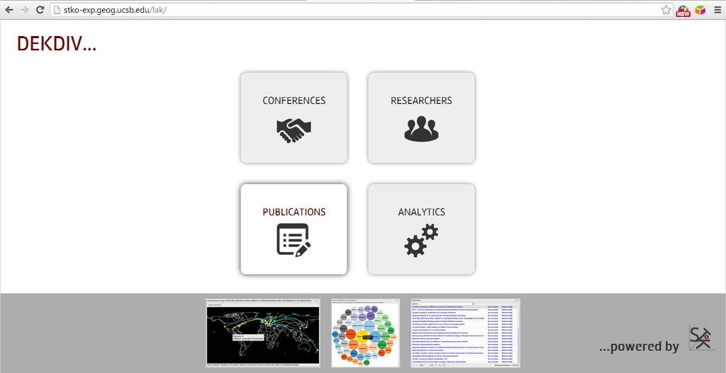
7 DEKDIV: A Quick Flyby DEKDIV is a unified Web portal consists of a number of functional modules for interactive visualization and knowledge discovery.


8 DEKDIV: A Quick Flyby Dataset: LAK dataset in RDF Concepts and topics extracted from papers full text Geospatial locations for research institutes and conferences External citation data from Microsoft Academic Search as well as expertise information from ArnetMiner

9 DEKDIV: A Quick Flyby Interactive Visualization: Where do the conference participants come from? What are the major concepts in a paper? Who are the collaborators of a researcher? Which researchers and institutes are citing your papers?...

10 DEKDIV: A Quick Flyby Knowledge Discovery: Who are the most active scholars in a conference? How similar are two scholars in their research topic space? Who can be suitable reviewers for a newly submitted paper? Who can be your potential collaborators?...
11 Outline 1 Motivation 2 DEKDIV: A Quick Flyby 3 Concepts and Methods behind the Scene 4 Architecture and Design Principles 5 Demo
12 Scientometrics and Spatiotemporal Scientometrics Scientometrics refers to the science of analyzing and measuring a discipline s research topics, authors, publications and so forth. In previous works, we have proposed a framework for spatiotemporal scientometrics which focuses on discovering the spatiotemporal patterns of a research discipline (Hu etc., ISWC 2013; Gao etc., ACMGIS 2013). DEKDIV is an Online scientometrics workbench for the LAK community.
13 Latent Dirichlet allocation (LDA) LDA is an unsupervised, generative probabilistic model used to infer topics from a textual corpus. LDA represents each topic using a mixture of keywords. Each paper is described as a number of topics with associated probability values. LDA has also been applied to describe the interested topics for each researcher.

14 Multidimensional Scaling (MDS) MDS is a method to visualize the similarity among individual cases in a dataset. MDS can take multiple attributes of individual cases, and put these cases into N-dimensional space so that the between-object distances can represent the corresponding similarity. In this work, MDS has been used to represent the similarity between researchers based on their research topics extracted using LDA.
15 Graph and Shortest Path Distance An academic graph can be constructed by considering researchers as nodes and co-authorships as edges. From each node in the graph, we calculate its shortest path distance to other nodes (researchers) using Dijkstra s Algorithm. The shortest path distance has been used to represent how far (or how close) that two researchers are connected. Application: finding potential collaborators for researchers. potential = sim(a 1, a 2 ) (1 1/d)
16 Outline 1 Motivation 2 DEKDIV: A Quick Flyby 3 Concepts and Methods behind the Scene 4 Architecture and Design Principles 5 Demo

17 A Self-contained Modular Design Paradigm The Web portal is designed as a general framework, and each function is implemented as a self-contained module.

18 Functional Scalability Users can plug or unplug functional modules by adding or removing the import statement of the corresponding JavaScript files.


19 Data Scalability A customized script can be designed to synchronize data and ensure the data in the triple store is up to date. This strategy has already been used in the Linked Data portal of the Semantic Web Journal (

20 Usability Design Simple and intuitive user interface: Four access points (conferences, researchers, papers, and analytics); follow your nose data exploration. Configurable layout of modules: Each module is displayed in a separate window whose position can be configured based on users preference. Rich help document: Each module is accompanied with a help description, and a Youtube tutorial video has also been provided to facilitate the understanding of the system.
21 Technology Stack Client side: JQuery, ExtJS, HTML5, CSS, D3, Leaflet,... Server side: Java Servlet, Jena API, SPARQL queries, Jena Fuseki,... Client-server interaction: AJAX requests and responses Data models/formats: RDF, GeoJSON/TopoJSON,... Performance strategies: dynamic information caching for frequently requested authors and papers,...
22 Outline 1 Motivation 2 DEKDIV: A Quick Flyby 3 Concepts and Methods behind the Scene 4 Architecture and Design Principles 5 Demo
23 Demo
From Research Objects to Research Networks: Combining Spatial and Semantic Search
 From Research Objects to Research Networks: Combining Spatial and Semantic Search Sara Lafia 1 and Lisa Staehli 2 1 Department of Geography, UCSB, Santa Barbara, CA, USA 2 Institute of Cartography and
Data Aggregation with InfraWorks and ArcGIS for Visualization, Analysis, and Planning
 CI125230 Data Aggregation with InfraWorks and ArcGIS for Visualization, Analysis, and Planning Stephen Brockwell Brockwell IT Consulting Inc. Sean Kinahan Brockwell IT Consulting Inc. Learning Objectives
Discovery and Access of Geospatial Resources using the Geoportal Extension. Marten Hogeweg Geoportal Extension Product Manager
 Discovery and Access of Geospatial Resources using the Geoportal Extension Marten Hogeweg Geoportal Extension Product Manager DISCOVERY AND ACCESS USING THE GEOPORTAL EXTENSION Geospatial Data Is Very
FINNISH LINKED DATA PILOTS
 FINNISH LINKED DATA PILOTS Kai Koistinen Data Linking by Indirect Reference Systems -workshop 5.9.2018 1 NLS FINLAND National Land Survey of Finland National mapping and cadastral agency Geodetic research
ArcGIS Enterprise: What s New. Philip Heede Shannon Kalisky Melanie Summers Sam Williamson
 ArcGIS Enterprise: What s New Philip Heede Shannon Kalisky Melanie Summers Sam Williamson ArcGIS Enterprise is the new name for ArcGIS for Server What is ArcGIS Enterprise ArcGIS Enterprise is powerful
Introduction to Portal for ArcGIS
 Introduction to Portal for ArcGIS Derek Law Product Management March 10 th, 2015 Esri Developer Summit 2015 Agenda Web GIS pattern Product overview Installation and deployment Security and groups Configuration
A Prototype of a Web Mapping System Architecture for the Arctic Region
 A Prototype of a Web Mapping System Architecture for the Arctic Region Han-Fang Tsai 1, Chih-Yuan Huang 2, and Steve Liang 3 GeoSensorWeb Laboratory, Department of Geomatics Engineering, University of
OFWIM 2017 Annual Conference What Does Web GIS Really Mean for Fish and Wildlife Agencies?
 Content Open Mapping OFWIM 2017 Annual Conference What Does Web GIS Really Mean for Fish and Wildlife Agencies? Imagery Spatial Analysis Mike Bialousz, Esri 3D Data Exploration Real-Time Apps Visualization
Towards Geographic Information Observatories
 Towards Geographic Information Observatories Krzysztof Janowicz 1, Benjamin Adams 2, Grant McKenzie 1, and Tomi Kauppinen 3,4 1 University of California, Santa Barbara, USA 2 The University of Auckland,
The Geo Web: Enabling GIS on the Internet IT4GIS Keith T. Weber, GISP GIS Director ISU GIS Training and Research Center.
 The Geo Web: Enabling GIS on the Internet IT4GIS Keith T. Weber, GISP GIS Director ISU GIS Training and Research Center In the Beginning GIS was independent The GIS analyst or manager was typically a oneperson
An Ontology-based Framework for Modeling Movement on a Smart Campus
 An Ontology-based Framework for Modeling Movement on a Smart Campus Junchuan Fan 1, Kathleen Stewart 1 1 Department of Geographical and Sustainability Sciences, University of Iowa, Iowa City, IA, 52242,
Collaborative Topic Modeling for Recommending Scientific Articles
 Collaborative Topic Modeling for Recommending Scientific Articles Chong Wang and David M. Blei Best student paper award at KDD 2011 Computer Science Department, Princeton University Presented by Tian Cao
Design and implementation of a new meteorology geographic information system
 Design and implementation of a new meteorology geographic information system WeiJiang Zheng, Bing. Luo, Zhengguang. Hu, Zhongliang. Lv National Meteorological Center, China Meteorological Administration,
Migrating Defense Workflows from ArcMap to ArcGIS Pro. Renee Bernstein and Jared Sellers
 Migrating Defense Workflows from ArcMap to ArcGIS Pro Renee Bernstein and Jared Sellers ArcGIS Desktop Desktop Web Device ArcMap ArcCatalog ArcScene ArcGlobe ArcGIS Pro portal Server Online Content and
ArcGIS Enterprise: What s New. Philip Heede Shannon Kalisky Melanie Summers Shreyas Shinde
 ArcGIS Enterprise: What s New Philip Heede Shannon Kalisky Melanie Summers Shreyas Shinde ArcGIS Enterprise is the new name for ArcGIS for Server ArcGIS Enterprise Software Components ArcGIS Server Portal
Introduction to Portal for ArcGIS. Hao LEE November 12, 2015
 Introduction to Portal for ArcGIS Hao LEE November 12, 2015 Agenda Web GIS pattern Product overview Installation and deployment Security and groups Configuration options Portal for ArcGIS + ArcGIS for
Yingjie Hu. Research Interests Geographic Information Science, Geospatial Semantics, Information Value, Data Mining, Spatial Data infrastructures
 Assistant Professor Department of Geography University of Tennessee, Knoxville Yingjie Hu Office: 206A Burchfiel Geography Bldg. Tel: (865) 974-5343 Email: yhu21@utk.edu Research Interests Geographic Information
Leveraging ArcGIS Online Elevation and Hydrology Services. Steve Kopp, Jian Lange
 Leveraging ArcGIS Online Elevation and Hydrology Services Steve Kopp, Jian Lange Topics An overview of ArcGIS Online Elevation Analysis Using Elevation Analysis Services in ArcGIS for Desktop Using Elevation
Detecting Origin-Destination Mobility Flows From Geotagged Tweets in Greater Los Angeles Area
 Detecting Origin-Destination Mobility Flows From Geotagged Tweets in Greater Los Angeles Area Song Gao 1, Jiue-An Yang 1,2, Bo Yan 1, Yingjie Hu 1, Krzysztof Janowicz 1, Grant McKenzie 1 1 STKO Lab, Department
Topic Models and Applications to Short Documents
 Topic Models and Applications to Short Documents Dieu-Thu Le Email: dieuthu.le@unitn.it Trento University April 6, 2011 1 / 43 Outline Introduction Latent Dirichlet Allocation Gibbs Sampling Short Text
ArcGIS. for Server. Understanding our World
 ArcGIS for Server Understanding our World ArcGIS for Server Create, Distribute, and Manage GIS Services You can use ArcGIS for Server to create services from your mapping and geographic information system
ArcGIS is Advancing. Both Contributing and Integrating many new Innovations. IoT. Smart Mapping. Smart Devices Advanced Analytics
 ArcGIS is Advancing IoT Smart Devices Advanced Analytics Smart Mapping Real-Time Faster Computing Web Services Crowdsourcing Sensor Networks Both Contributing and Integrating many new Innovations ArcGIS
ArcGIS GeoAnalytics Server: An Introduction. Sarah Ambrose and Ravi Narayanan
 ArcGIS GeoAnalytics Server: An Introduction Sarah Ambrose and Ravi Narayanan Overview Introduction Demos Analysis Concepts using GeoAnalytics Server GeoAnalytics Data Sources GeoAnalytics Server Administration
Geospatial Fire Behavior Modeling App to Manage Wildfire Risk Online. Kenyatta BaRaKa Jackson US Forest Service - Consultant
 Geospatial Fire Behavior Modeling App to Manage Wildfire Risk Online Kenyatta BaRaKa Jackson US Forest Service - Consultant Fire Behavior Modeling and Forest Fuel Management Modeling Fire Behavior is an
Portal for ArcGIS: An Introduction
 Portal for ArcGIS: An Introduction Derek Law Esri Product Management Esri UC 2014 Technical Workshop Agenda Web GIS pattern Product overview Installation and deployment Security and groups Configuration
Lecture 2. Introduction to ESRI s ArcGIS Desktop and ArcMap
 Lecture 2 Introduction to ESRI s ArcGIS Desktop and ArcMap Outline ESRI What is ArcGIS? ArcGIS Desktop ArcMap Overview Views Layers Attribute Tables Help! Scale Tips and Tricks ESRI Environmental Systems
Geog 469 GIS Workshop. Managing Enterprise GIS Geodatabases
 Geog 469 GIS Workshop Managing Enterprise GIS Geodatabases Outline 1. Why is a geodatabase important for GIS? 2. What is the architecture of a geodatabase? 3. How can we compare and contrast three types
Computational Biology, University of Maryland, College Park, MD, USA
 1 Data Sharing in Ecology and Evolution: Why Not? Cynthia S. Parr 1 and Michael P. Cummings 2 1 Institute for Advanced Computer Studies, 2 Center for Bioinformatics and Computational Biology, University
From the Venice Lagoon Atlas towards a collaborative federated system
 From the Venice Lagoon Atlas towards a collaborative federated system City of Venice Alessandro Mulazzani CORILA Consortium for Coordination of Research Activities Concerning the Venice Lagoon System ISMAR-CNR
Portal for ArcGIS: An Introduction. Catherine Hynes and Derek Law
 Portal for ArcGIS: An Introduction Catherine Hynes and Derek Law Agenda Web GIS pattern Product overview Installation and deployment Configuration options Security options and groups Portal for ArcGIS
GENERALIZATION IN THE NEW GENERATION OF GIS. Dan Lee ESRI, Inc. 380 New York Street Redlands, CA USA Fax:
 GENERALIZATION IN THE NEW GENERATION OF GIS Dan Lee ESRI, Inc. 380 New York Street Redlands, CA 92373 USA dlee@esri.com Fax: 909-793-5953 Abstract In the research and development of automated map generalization,
Introduction to IsoMAP Isoscapes Modeling, Analysis, and Prediction
 Introduction to IsoMAP Isoscapes Modeling, Analysis, and Prediction What is IsoMAP To the user, and online workspace for: Accessing, manipulating, and analyzing, and modeling environmental isotope data
LandEx A GeoWeb-based Tool for Exploration of Patterns in Raster Maps
 LandEx A GeoWeb-based Tool for Exploration of Patterns in Raster Maps T. F. Stepinski 1, P. Netzel 1,2, J. Jasiewicz 3, J. Niesterowicz 1 1 Department of Geography, University of Cincinnati, Cincinnati,
Leveraging Web GIS: An Introduction to the ArcGIS portal
 Leveraging Web GIS: An Introduction to the ArcGIS portal Derek Law Product Management DLaw@esri.com Agenda Web GIS pattern Product overview Installation and deployment Configuration options Security options
Ontologies and Spatial Decision Support
 Ontologies and Spatial Decision Support Naicong Li, Philip Murphy, The Redlands Institute, University of Redlands Krzysztof Janowicz, University of California, Santa Barbara Earth Science-Ontolog mini
file://q:\report1\greenatlasfinalreportindex.html
 Page 1 of 8 Quick Links WATER MANAGEMENT INTERNSHIP USDA HIS GRANT FUNDED FINAL PROJECT REPORT SUBMITTED BY MELISSA QUINTANA 11/07/07-03/24/08 Summary Provided is an assessment of my accomplishments for
Chemistry Informatics in Academic Laboratories: Lessons Learned
 Chemistry Informatics in Academic Laboratories: Lessons Learned Michael Hudock Center for Biophysics & Computational Biology University of Illinois at Urbana-Champaign My Background Ph.D. candidate, Biophysics
DATA SCIENCE SIMPLIFIED USING ARCGIS API FOR PYTHON
 DATA SCIENCE SIMPLIFIED USING ARCGIS API FOR PYTHON LEAD CONSULTANT, INFOSYS LIMITED SEZ Survey No. 41 (pt) 50 (pt), Singapore Township PO, Ghatkesar Mandal, Hyderabad, Telengana 500088 Word Limit of the
Getting Started with Community Maps
 Esri International User Conference San Diego, California Technical Workshops July 24, 2012 Getting Started with Community Maps Shane Matthews and Tamara Yoder Topics for this Session ArcGIS is a complete
Crime Analyst Extension. Christine Charles
 Crime Analyst Extension Christine Charles ccharles@esricanada.com Agenda Why use Crime Analyst? Overview Tools Demo Interoperability With our old software it could take a police officer up to forty minutes
ArcGIS Pro Q&A Session. NWGIS Conference, October 11, 2017 With John Sharrard, Esri GIS Solutions Engineer
 ArcGIS Pro Q&A Session NWGIS Conference, October 11, 2017 With John Sharrard, Esri GIS Solutions Engineer jsharrard@esri.com ArcGIS Desktop The applications ArcGIS Pro ArcMap ArcCatalog ArcScene ArcGlobe
Web GIS Administration: Tips and Tricks
 EdUC 2017 July 8 th, 2017 Web GIS Administration: Tips and Tricks Geri Miller Agenda Concerns Acknowledged User Management Content Management Monitoring Licensing and logins Sophistication of IT support
Harvard Center for Geographic Analysis Geospatial on the MOC
 2017 Massachusetts Open Cloud Workshop Boston University Harvard Center for Geographic Analysis Geospatial on the MOC Ben Lewis Harvard Center for Geographic Analysis Aaron Williams MapD Small Team Supporting
Enabling Web GIS. Dal Hunter Jeff Shaner
 Enabling Web GIS Dal Hunter Jeff Shaner Enabling Web GIS In Your Infrastructure Agenda Quick Overview Web GIS Deployment Server GIS Deployment Security and Identity Management Web GIS Operations Web GIS
ArcGIS 10.1 An Overview of the System
 ArcGIS 10.1 An Overview of the System ArcGIS 10.1 An Overview of the System Damian Spangrud Director of Solutions, Esri Redlands, CA USA ArcGIS 10.1 Web Cloud Online Mobile Enterprise Desktop ArcGIS 10.1
Web-based Exploration of and Interaction with Large and Deeply Structured Semantic 3D City Models using HTML5 and WebGL
 Web-based Exploration of and Interaction with Large and Deeply Structured Semantic 3D City Models using HTML5 and WebGL KANISHK CHATURVEDI 1, ZHIHANG YAO 2 & THOMAS H. KOLBE 1 Abstract: The aim of the
Using spatial-temporal signatures to infer human activities from personal trajectories on location-enabled mobile devices
 Using spatial-temporal signatures to infer human activities from personal trajectories on location-enabled mobile devices Yingjie Hu 1, Wenwen Li 2, Krzysztof Janowicz 1, Kathleen Deutsch 1, Grant McKenzie
Enabling ENVI. ArcGIS for Server
 Enabling ENVI throughh ArcGIS for Server 1 Imagery: A Unique and Valuable Source of Data Imagery is not just a base map, but a layer of rich information that can address problems faced by GIS users. >
GIS CONCEPTS Part I. GIS ON THE WEB Part II
 Week 2 GIS CONCEPTS Part I GIS ON THE WEB Part II topics of the week part I GIS functions and GIS data Spatial relationships Organizing convention for spatial data Store Information by thematic layers
Topic Models. Advanced Machine Learning for NLP Jordan Boyd-Graber OVERVIEW. Advanced Machine Learning for NLP Boyd-Graber Topic Models 1 of 1
 Topic Models Advanced Machine Learning for NLP Jordan Boyd-Graber OVERVIEW Advanced Machine Learning for NLP Boyd-Graber Topic Models 1 of 1 Low-Dimensional Space for Documents Last time: embedding space
INTERACTING WITH 17 TH CENTURY FORTRESSES ON DARDANELLES THROUGH WEB-BASED GEO-VISUALIZATION
 Geoinformatics 2004 Proc. 12th Int. Conf. on Geoinformatics Geospatial Information Research: Bridging the Pacific and Atlantic University of Gävle, Sweden, 7-9 June 2004 INTERACTING WITH 17 TH CENTURY
Web GIS Deployment for Administrators. Vanessa Ramirez Solution Engineer, Natural Resources, Esri
 Web GIS Deployment for Administrators Vanessa Ramirez Solution Engineer, Natural Resources, Esri Agenda Web GIS Concepts Web GIS Deployment Patterns Components of an On-Premises Web GIS Federation of Server
GIS Supports to Economic and Social Development
 GIS Supports to Economic and Social Development Dang Van Duc and Le Quoc Hung Institute of Information Technology 18, Hoang Quoc Viet Rd., Cau Giay Dist., Hanoi, Vietnam Email: dvduc@ioit.ncst.ac.vn; lqhung@ioit.ncst.ac.vn
GIS Visualization Support to the C4.5 Classification Algorithm of KDD
 GIS Visualization Support to the C4.5 Classification Algorithm of KDD Gennady L. Andrienko and Natalia V. Andrienko GMD - German National Research Center for Information Technology Schloss Birlinghoven,
Data Aggregation with InfraWorks and ArcGIS for Visualization, Analysis, and Planning
 Data Aggregation with InfraWorks and ArcGIS for Visualization, Analysis, and Planning Stephen Brockwell President, Brockwell IT Consulting, Inc. Join the conversation #AU2017 KEYWORD Class Summary Silos
Visualizing The Semantic Similarity of Geographic Features
 Visualizing The Semantic Similarity of Geographic Features Gengchen Mai STKO Lab, UCSB, CA, USA gengchen mai@geog.ucsb.edu Sathya Prasad Esri Inc, Redlands, CA, USA sprasad@esri.com Krzysztof Janowicz
These modules are covered with a brief information and practical in ArcGIS Software and open source software also like QGIS, ILWIS.
 Online GIS Training and training modules covered are: 1. ArcGIS, Analysis, Fundamentals and Implementation 2. ArcGIS Web Data Sharing 3. ArcGIS for Desktop 4. ArcGIS for Server These modules are covered
Northrop Grumman Concept Paper
 Northrop Grumman Concept Paper A Comprehensive Geospatial Web-based Solution for NWS Impact-based Decision Support Services Glenn Higgins April 10, 2014 Northrop Grumman Corporation Information Systems
No. of Days. ArcGIS 3: Performing Analysis ,431. Building 3D cities Using Esri City Engine ,859
 What s New? Creating Story Maps with ArcGIS Field Data Collection and Management Using ArcGIS Get Started with Insights for ArcGIS Introduction to GIS Using ArcGIS & ArcGIS Pro: Essential Workflow Migrating
No. of Days. ArcGIS Pro for GIS Professionals ,431. Building 3D cities Using Esri City Engine ,859
 What s New? Creating Story Maps with ArcGIS Field Data Collection and Management Using ArcGIS Get Started with Insights for ArcGIS Introduction to GIS Using ArcGIS & ArcGIS Pro: Essential Workflow Migrating
Collaborative topic models: motivations cont
 Collaborative topic models: motivations cont Two topics: machine learning social network analysis Two people: " boy Two articles: article A! girl article B Preferences: The boy likes A and B --- no problem.
Overview of ArcGIS Enterprise August 24, Dan Haag ESRI
 Overview of ArcGIS Enterprise August 24, 2017 Dan Haag ESRI Sharing to a portal ArcGIS 10.3 portal Central destination for all of your geospatial assets in Web GIS - ArcGIS Online organization and/or Portal
SCAUG Community Maps Building a Living Atlas of the World
 SCAUG Community Maps Building a Living Atlas of the World Mark Stewart Topics: SCAUG ArcGIS Online Overview Community Maps Overview Community Maps Workflow Update Process Utilizing Your Contribution Community
Contextualizing Historical Places in a Gazetteer by Using Historical Maps and Linked Data
 Contextualizing Historical Places in a Gazetteer by Using Historical Maps and Linked Data Esko Ikkala, Jouni Tuominen, and Eero Hyvönen Semantic Computing Research Group (SeCo), Aalto University http://www.seco.tkk.fi/,
Developing 3D Geoportal for Wilayah Persekutuan Iskandar
 Developing 3D Geoportal for Wilayah Persekutuan Iskandar Dionnald Beh BoonHeng and Alias Abdul Rahman Department of Geoinformatics, Faculty of Geoinformation Engineering and Sciences, Universiti Teknologi
Conceptual study of Web-based PPGIS for Designing Built Environment: Identifying Housing Location Preferences in Littleborough
 Conceptual study of Web-based PPGIS for Designing Built Environment: Identifying Housing Location Preferences in Littleborough Shrabanti Hira *1, S M Labib 1 1 SEED, University of Manchester March 31,
Enabling Geospatial Killer Apps Interfaces, Visualizations and APIs Imaging the World
 International Open Government Data Conference Enabling Geospatial Killer Apps Interfaces, Visualizations and APIs Imaging the World Jim Barrett, Data.gov Geospatial Architect Pat Cummens, Government Strategist,
ArcGIS Online Routing and Network Analysis. Deelesh Mandloi Matt Crowder
 ArcGIS Online Routing and Network Analysis Deelesh Mandloi Matt Crowder Introductions Who are we? - Members of the Network Analyst development team Who are you? - Network Analyst users? - ArcGIS Online
ELF products in the ArcGIS platform
 ELF products in the ArcGIS platform Presentation to: Author: Date: NMO Summit 2016, Dublin, Ireland Clemens Portele 18 May 2016 The Building Blocks 18 May, 2016 More ELF users through affiliated platforms
Joint MISTRAL/CESI lunch workshop 15 th November 2017
 MISTRAL@Newcastle Joint MISTRAL/CESI lunch workshop 15 th November 2017 ITRC at Newcastle ITRC at Newcastle MISTRAL at Newcastle New approach to infrastructure data management to open-up analytics, modelling
Hybrid Models for Text and Graphs. 10/23/2012 Analysis of Social Media
 Hybrid Models for Text and Graphs 10/23/2012 Analysis of Social Media Newswire Text Formal Primary purpose: Inform typical reader about recent events Broad audience: Explicitly establish shared context
Esri UC2013. Technical Workshop.
 Esri International User Conference San Diego, California Technical Workshops July 9, 2013 CAD: Introduction to using CAD Data in ArcGIS Jeff Reinhart & Phil Sanchez Agenda Overview of ArcGIS CAD Support
Animating Maps: Visual Analytics meets Geoweb 2.0
 Animating Maps: Visual Analytics meets Geoweb 2.0 Piyush Yadav 1, Shailesh Deshpande 1, Raja Sengupta 2 1 Tata Research Development and Design Centre, Pune (India) Email: {piyush.yadav1, shailesh.deshpande}@tcs.com
Arcgis Tutorial Manual READ ONLINE
 Arcgis Tutorial Manual READ ONLINE ArcGIS Desktop 10 Trial Help - Note: The Quick Start Guide contains instructions that do not pertain to the trial edition. Many tutorials are found in the ArcGIS Desktop
NOACA s DART: Web GIS Tools for Transportation Planning. Chad Harris, NOACA Bryan Baker, Tierra Plan LLC Kevin Knapp, Tierra Plan LLC
 NOACA s DART: Web GIS Tools for Transportation Planning Chad Harris, NOACA Bryan Baker, Tierra Plan LLC Kevin Knapp, Tierra Plan LLC NOACA DART: Data Analysis and Reporting Tool NOACA: Northeast Ohio Areawide
DEVELOPMENT AND IMPLEMENTATION OF A NEW WEB MAPPING SYSTEM ARCHITECTURE FOR ARCTIC REGION
 GEOIDE SSII#109 DEVELOPMENT AND IMPLEMENTATION OF A NEW WEB MAPPING SYSTEM ARCHITECTURE FOR ARCTIC REGION Presenter: Fanny Tsai hftsai@ucalgary.ca Supervisor: Dr. Steve Liang steve.liang@ucalgary.ca Date:
Effective Visualization Tool for Job Searching
 Effective Visualization Tool for Job Searching Yilin Gu Andries H. Smith,1 Jong Kwan Lee Xinyue Ye Soo K. Kim Dept. of Comp. Science School of Earth, Env. & Society Dept. of Comp. Info. Science Bowling
GeomRDF : A Geodata Converter with a Fine-Grained Structured Representation of Geometry in the Web
 GeomRDF : A Geodata Converter with a Fine-Grained Structured Representation of Geometry in the Web Fayçal Hamdi 1 Nathalie Abadie 2 Bénédicte Bucher 2 Abdelfettah Feliachi 2 1 ISID TEAM, CEDRIC Lab Conservatoire
RaRE: Social Rank Regulated Large-scale Network Embedding
 RaRE: Social Rank Regulated Large-scale Network Embedding Authors: Yupeng Gu 1, Yizhou Sun 1, Yanen Li 2, Yang Yang 3 04/26/2018 The Web Conference, 2018 1 University of California, Los Angeles 2 Snapchat
Rick Ebert & Joseph Mazzarella For the NED Team. Big Data Task Force NASA, Ames Research Center 2016 September 28-30
 NED Mission: Provide a comprehensive, reliable and easy-to-use synthesis of multi-wavelength data from NASA missions, published catalogs, and the refereed literature, to enhance and enable astrophysical
An Open Source Tool for the Visualization, Analysis and Reporting of Regional and Statewide Transit Networks
 An Open Source Tool for the Visualization, Analysis and Reporting of Regional and Statewide Transit Networks Saeed Ghanbartehrani Department of Industrial and Systems Engineering, Ohio University J. David
Applying the Semantic Web to Computational Chemistry
 Applying the Semantic Web to Computational Chemistry Neil S. Ostlund, Mirek Sopek Chemical Semantics Inc., Gainesville, Florida, USA {ostlund, sopek}@chemicalsemantics.com Abstract. Chemical Semantics
The Europeana Linked Open Data Server
 The Europeana Linked Open Data Server Nicola Aloia, Cesare Concordia, Carlo Meghini Istituto di Scienza e Tecnologie dell Informazione CNR Pisa 2/20/2014 LOD 2014 - Roma 1 Europeana Started in 2007 Cluster
Finding geodata that otherwise would have been forgotten GeoXchange a portal for free geodata
 Finding geodata that otherwise would have been forgotten GeoXchange a portal for free geodata Sven Tschirner and Alexander Zipf University of Applied Sciences FH Mainz Department of Geoinformatics and
Ákos Tarcsay CHEMAXON SOLUTIONS
 Ákos Tarcsay CHEMAXON SOLUTIONS FINDING NOVEL COMPOUNDS WITH IMPROVED OVERALL PROPERTY PROFILES Two faces of one world Structure Footprint Linked Data Reactions Analytical Batch Phys-Chem Assay Project
An intelligent client application for on-line astronomical information
 An intelligent client application for on-line astronomical information Chenzhou CUI Chinese Virtual Observatory Project National Astronomical Observatory of China VO concept Virtual Observatory (VO) is
ONLINE DECISION SUPPORT TOOL FOR AVALANCHE RISK MANAGEMENT. Patrick Nairz* Avalanche Warning Center Tyrol, Austria
 ONLINE DECISION SUPPORT TOOL FOR AVALANCHE RISK MANAGEMENT Patrick Nairz* Avalanche Warning Center Tyrol, Austria Karel Kriz and Michaela Kinberger Department of Geography and Regional Research, University
Spatial Analysis in CyberGIS
 Spatial Analysis in CyberGIS towards a spatial econometrics workbench Luc Anselin, Sergio Rey and Myunghwa Hwang GeoDa Center School of Geographical Sciences and Urban Planning Arizona State University
Abstract. Interoperable Framework for Mobile Dynamic Surveying based on open source components
 Interoperable Framework for Mobile Dynamic Surveying based on open source components Sergiusz Pawlowicz, Didier Leibovici, Richard Saull±, Mike Jackson, Chaoyu Ye, Wenchao Jiang, Natalie Adams 1, Suchith
Reaxys Medicinal Chemistry Fact Sheet
 R&D SOLUTIONS FOR PHARMA & LIFE SCIENCES Reaxys Medicinal Chemistry Fact Sheet Essential data for lead identification and optimization Reaxys Medicinal Chemistry empowers early discovery in drug development
GIS for Crime Analysis. Building Better Analysis Capabilities with the ArcGIS Platform
 GIS for Crime Analysis Building Better Analysis Capabilities with the ArcGIS Platform Crime Analysis The Current State One of the foundations of criminological theory is that three things are needed for
DataShine Automated Thematic Mapping of 2011 Census Quick Statistics
 DataShine Automated Thematic Mapping of 2011 Census Quick Statistics Oliver O Brien, James Cheshire Department of Geography University College London UKDS Census Applications Conference, July 2015 Contents
DP Project Development Pvt. Ltd.
 Dear Sir/Madam, Greetings!!! Thanks for contacting DP Project Development for your training requirement. DP Project Development is leading professional training provider in GIS technologies and GIS application
Understanding Comments Submitted to FCC on Net Neutrality. Kevin (Junhui) Mao, Jing Xia, Dennis (Woncheol) Jeong December 12, 2014
 Mao, Jing Xia, Dennis (Woncheol) Jeong December 12, 2014") Understanding Comments Submitted to FCC on Net Neutrality Kevin (Junhui) Mao, Jing Xia, Dennis (Woncheol) Jeong December 12, 2014 Abstract We aim to understand and summarize themes in the 1.65 million
Understanding Comments Submitted to FCC on Net Neutrality Kevin (Junhui) Mao, Jing Xia, Dennis (Woncheol) Jeong December 12, 2014 Abstract We aim to understand and summarize themes in the 1.65 million
Probabilistic Latent Semantic Analysis
 Probabilistic Latent Semantic Analysis Yuriy Sverchkov Intelligent Systems Program University of Pittsburgh October 6, 2011 Outline Latent Semantic Analysis (LSA) A quick review Probabilistic LSA (plsa)
Welcome to NR502 GIS Applications in Natural Resources. You can take this course for 1 or 2 credits. There is also an option for 3 credits.
 Welcome to NR502 GIS Applications in Natural Resources. You can take this course for 1 or 2 credits. There is also an option for 3 credits. The 1st credit consists of a series of readings, demonstration,
DARIAH Geo-Browser. Service for spa-o- temporal visualisa-on. Stefan E. Funk, Ubbo Veentjer, Stefan Schmunk State and University Library (SUB)
") DARIAH Geo-Browser Service for spa-o- temporal visualisa-on Stefan E. Funk, Ubbo Veentjer, Stefan Schmunk Gö@ngen State and University Library (SUB) de.dariah.eu DARIAH Geo- Browser Overview 30.07.2014
DARIAH Geo-Browser Service for spa-o- temporal visualisa-on Stefan E. Funk, Ubbo Veentjer, Stefan Schmunk Gö@ngen State and University Library (SUB) de.dariah.eu DARIAH Geo- Browser Overview 30.07.2014
UC Berkeley International Conference on GIScience Short Paper Proceedings
 UC Berkeley International Conference on GIScience Title Deriving Locational Reference through Implicit Information Retrieval Permalink https://escholarship.org/uc/item/0tn5s4v9 Journal International Conference
Evaluating Physical, Chemical, and Biological Impacts from the Savannah Harbor Expansion Project Cooperative Agreement Number W912HZ
 Evaluating Physical, Chemical, and Biological Impacts from the Savannah Harbor Expansion Project Cooperative Agreement Number W912HZ-13-2-0013 Annual Report FY 2018 Submitted by Sergio Bernardes and Marguerite
Canadian Historical GIS Partnership Development: Taking Steps for Historical Mapping in Canada
 Canadian Historical GIS Partnership Development: Taking Steps for Historical Mapping in Canada Byron Moldofsky Manager, GIS and Cartography Office Department of Geography and Planning University of Toronto