Week 3 : (3HL) Coverage : Typical geotechnical problems and usual application of SI methods
|
|
|
- Dennis Briggs
- 6 years ago
- Views:
Transcription
1 LEARNING OUTCOMES Week 3 : (3HL) Coverage : Typical geotechnical problems and usual application of SI methods Learning Outcomes : At the end of this lecture/week, the students will be able to : 1. Discuss SI for different geotechnical problems 2. Propose procedures of doing the appropriate SI


2 CONVENTIONAL APPROACH TO SI OUTLINE of PRESENTATION 3.0 Planning Scope of Site Investigation 4.0 Procedures of SI 5.0 SI Common Methods
3 THE PURPOSE OF SITE INVESTIGATION The purpose of all site investigation is the identification of the geotechnical and geoenvironmental characteristics of the ground at a site to provide the basis for the design of efficient, economic and safe projects. Comprehensive accumulation of information on the ground and its characteristics will be used in an appropriate foundation design for the structures and pavement design and enables a practical, safe and economic construction process to be planned.
4 THE QUALITY INDICATORS OF A GOOD SITE INVESTIGATION Critical Success Factors: Identification of Ground Hazards. Provision for better management of ground risk Provision of better value for clients and users Efficient processes which continuously improve Provision of relevant, reliable information and effective supply chain management Key Performance Indicators: Preparation Desk Study and reconnaissance survey Design Procurement Management project, risk and quality Supervision Reporting factual, interpretative and ground model Outcome client satisfaction, project review and user feedback


5 SI PRACTITIONERS The planning of SI works should be carried out by Qualified Geotechnical Engineers SI works should be executed by Qualified SI contractor registered with CIDB. SI works should be directed, monitored, supervised and Reported by Qualified Geotechnical Engineers registered with the BEM
6 SELECTING AN SI CONTRACTOR

7 OBJECTIVES OF SITE INVESTIGATION To assess the general suitability of the site and neighbour - hood for the proposed works, from a geological and geotechnical point of view. To provide suitable geotechnical data for all aspects of an economic, safe and reliable design of foundations, earthworks and temporary works, including assessment of the effects of any previous uses of the site. To assess the problems and constraints associated with the construction of the works arising from the soil or groundwater conditions and to plan the best method of construction.
8 OBJECTIVES OF SITE INVESTIGATION To assess the quantity, quality and ease of extraction of construction materials suitable for the works. To determine the changes in the stability, drainage and other geotechnical aspects of the site and the surrounding ground and buildings, which might be initiated by the construction works. To make comparison on the construction works by alternative methods or at alternative sites.
9 DESK STUDIES Desk Studies provide an opportunity to gather valuable information for negligible cost. They are carried out at the start of the Site Investigation, and involve reading existing information about the site. This existing information could include; Topographical Maps Geological Maps Aerial Photographs Satellite Images Existing SI records Geotechnical Journals, etc Information obtained during the Desk Study will be taken into account when planning the SI.
10 TYPES OF INFORMATION USEFUL FOR DESK STUDIES Aspect of Investigation Type of Information Source Site Topography Geology Geotechnical parameters / geotechnical problems Topographic Maps Stereo Aerial photographs Satelite Image Maps Geological Maps Geological Publications Aerial photogrphs Soil Survey Maps Geotechnical / geological journals Previous geotechnical or SI reports. JUPEM MACRES (Ikonos, QB) Google EARTH? JMG (Mineral and Geoscience Department) Warta Geologi (GSM) Local Authorities Groundwater conditions Hydrological Maps JPS (Department Irrigation and Drainage) Meteorological conditions Existing construction and services Previous land use Meteorological records Percipitation Construction as-built drawings. Drawings from Utilities companies Topographical Maps, Aerial Photographs Previous topographical and geological maps. Old Aerial photographs, etc Meteorological Dept. JPS Local Authorities, Contractors or Eng. Consultants, Utility Companies. JUPEM, MACRES
11 SITE RECONNAISSANCE SURVEY The Site Reconnaissance Survey or the Walk-Over Survey is an important and necessary supplement to Desk Study and should cover the whole site area and the immediate vicinity. To compare & confirm desk study & obtain additional information Physically examine ground conditions, geotechnical hazards, exposed cut/geology, outcrop, weathering depth, previous slip, adjacent structures, etc. Give due consideration to environment & ecological impact. Execute brief geological mapping Questioning local individuals: flood & tide levels, etc.
12 Example Checklist form for Site Reconnaissance
13 MAIN SUBSURFACE EXPLORATION Developing a Site Investigation Program For many projects and for many site conditions, the most difficult and crucial part of the planning phase involves the decisions regarding sampling/investigation method, boring locations, number of samples, number and types of laboratory tests, and the number of confirmatory samples. At this stage, the types of potential sampling/investigation methods should have been identified and assessed.
14 HOW MANY BOREHOLES? Example : A proposed site for multi-storey complex Borehole point Not enough boreholes, soil profile and properties not well defined
15 HOW MANY BOREHOLES? Example : A proposed site for multi-storey complex Borehole point Too many boreholes and will blow the budget
16 HOW MANY BOREHOLES? Example : A proposed site for multi-storey complex Borehole point Trial pit About right Here, we strike a good balance. Trial pits are quite cheap, and they certianly have a place in site investigation.
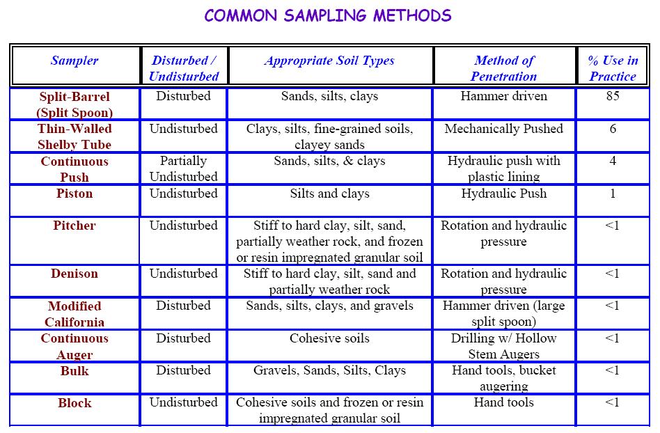
17 CONVENTIONAL APPROACH TO SI 5.0 Common SI Methods. 5.1 JKR/Mackintosh Probes 5.2 Hand Augering (HA) 5.3 Deep Boring (DB) 5.4 Deep Sound (DS) -100/200 kn Capacity 5.5 Test Pits, Bulk & Block Samples 5.6 Motorised Hand Boring (MHB) 5.7 Geophysical Survey
18 CONVENTIONAL APPROACH TO SI 5.1 JKR/Mackintosh Probe Can be used to determine the thickness of unsuitable material to be removed and also for preliminary design of embankments Limited to about 15 m Record no. of blows/ft. then correlate to established chart to determine bearing capacity of soil
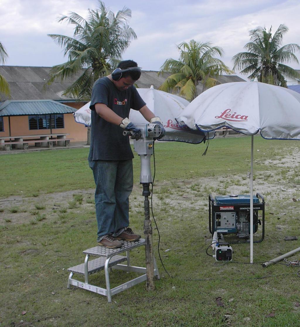
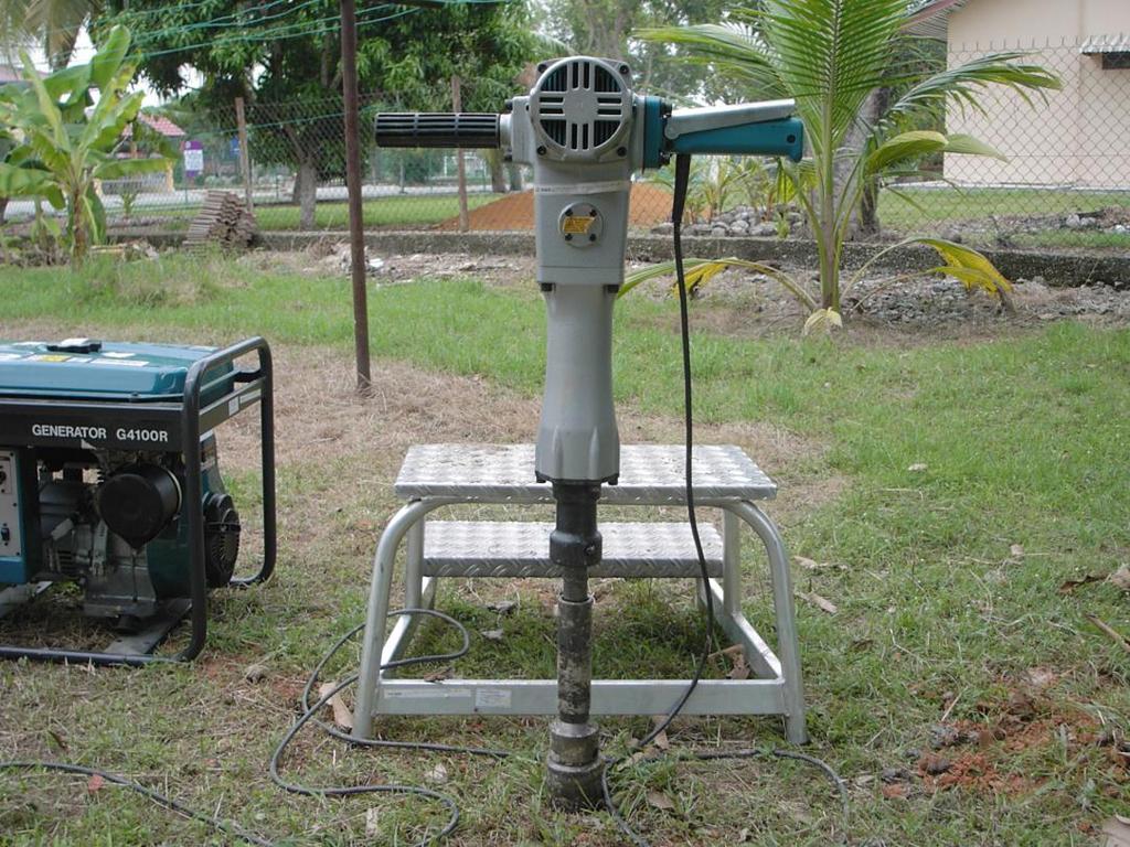
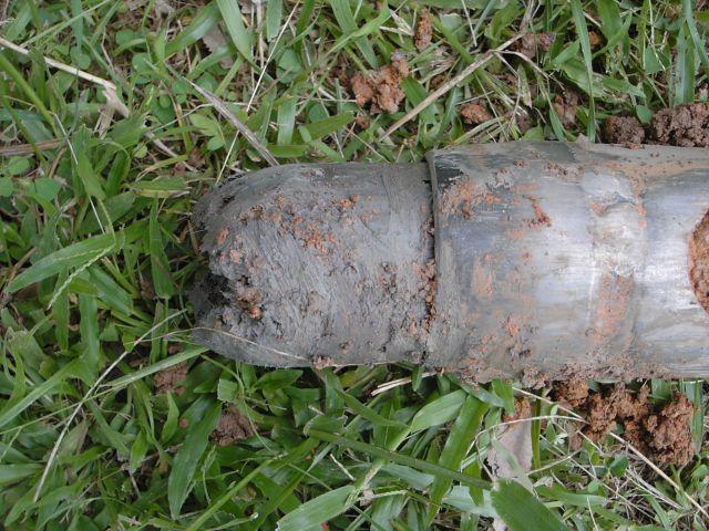
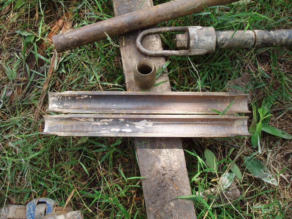
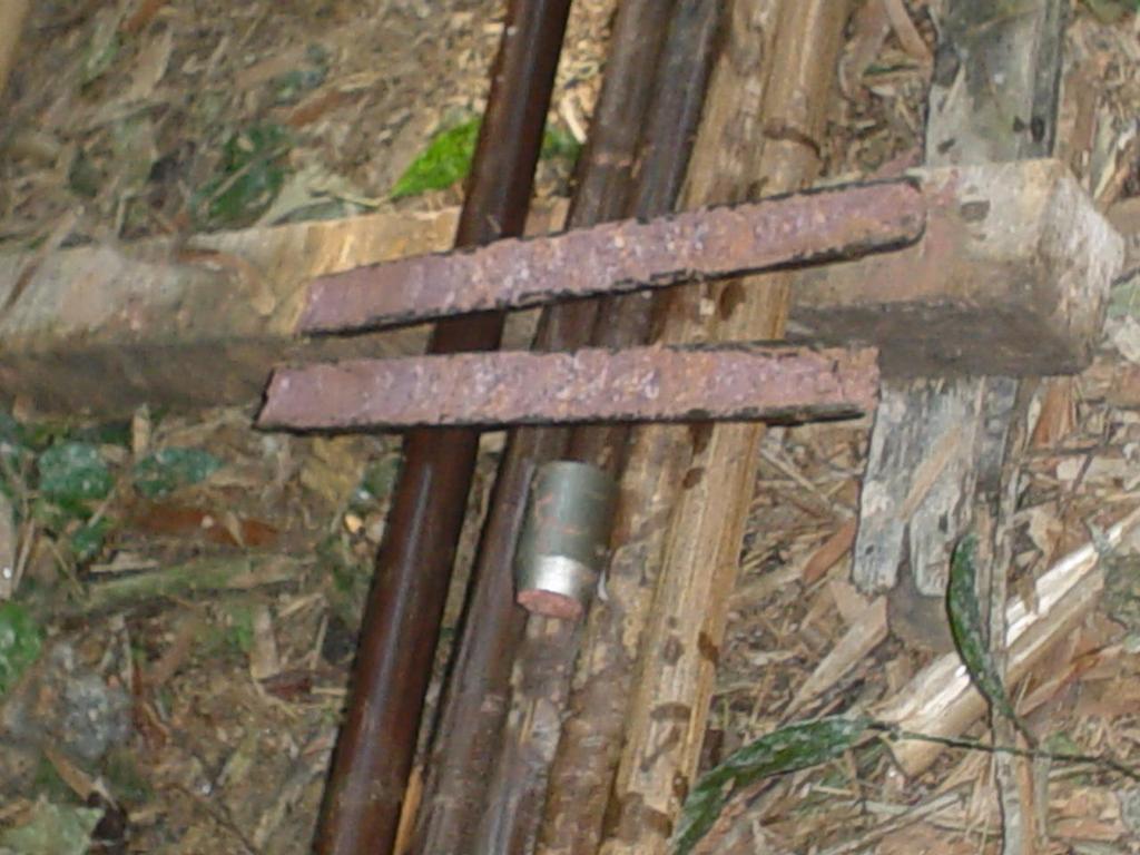
19 CONVENTIONAL APPROACH TO SI 5.2 Hand Augering (HA) Used in soft to stiff cohesive soils or sandy soils above water tables Maximum depth about 5 m

20 HAND AUGERING (HA) Used in soft to stiff cohesive soils or sandy soils above water table. Maximum depth up to 5 m. Can be used to obtained open tube samples of mm diameter COMMON TYPES OF HAND AUGER TECHNIQUE FOR RECORDING A REPRESENTATIVE SOIL PROFILE USING A HAND AUGER


21 CONVENTIONAL APPROACH TO SI 5.2 Hand Augering (HA)
22 CONVENTIONAL APPROACH TO SI Percussion Drilling

23 CONVENTIONAL APPROACH TO SI
24 CONVENTIONAL APPROACH TO SI 5.3 Deep Boring (DB) Advanced by power rotary drilling Open hole rotary drilling or casing advancement drilling method Flushing medium.. Clear water, mud water, etc Bentonite/mud water for coarse sand/fine gravel
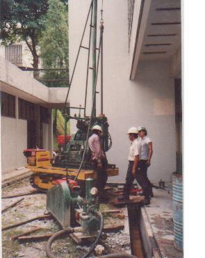
25 CONVENTIONAL APPROACH TO SI 5.3 Deep Boring (DB)
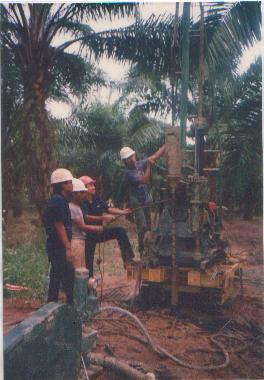
26 METHODS OF ADVANCING BOREHOLES Rig with hydraulic feed Rig rod Water pump Water pump casing casing Drill bit WASH / ROTARY BORING WATER JETTING

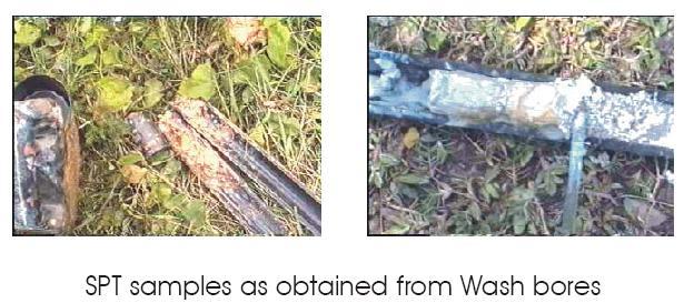
27 WATER JETTING Water under very high pressure Casing Hole advanced by brute jetting action of water and rotating and surging of casing Return water outside of casing, making all related observations useless Huge volume of soil below is disturbed, water ingress is very high and test volume is no longer intact. All tests / samples are bad Hole advanced by jetting of high pressure water downwards into the soil below and surging and rotating action of casing. Hole advanced mainly by destructive forces of water under high pressure. Return water Outside of casing Cheap adapted machine. Very fast and cost less. Test volume disturbed and altered. Samples and tests not representative or bad. NO skil is required. NOT in compliance with specification requiring sampling and testing or code of practice.
28 WASH BORING Water under pressure Drill rod Return water inside of casing, making related observations possible Casing Hole advanced rotating and surging of bit attached to drill string Cutting bit Most flushing water discharged downwards, some water enters soils below. With care, only some tests samples are possible. Hole advanced by rotating and surging action of cutting bit attached to drill rod inside casing. Water discharged sideways and downwards into soils below Return water Inside of casing Machine various including manual. More suited for drilling water wells and boring for disturbed samples. Test volume disturbed and altered. Samples and tests not representative or reliable. Require some skill Doubtful compliance with specification requiring sampling and testing or code of practice.
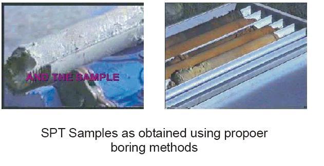
29 ROTARY BORING Water under pressure Compatible drill rod Hole advanced by cutting action of rotating bit attached to drill rod and hydraulic thrust Return water inside of casing making related observations possible Compatible casing Cutting bit Almost all flushing water discharged sideways, very little ingress into soil below. Very little disturbance to soil volume below. Good tests and samples are possible Hole advanced by cutting bit attached to the bottom of drill rod and hydraulic thrust. Soil cuttings transported upward by drilling water. Use compatible casings, rods, drag and cutting bits. Cutting bits varying with soil types. Almost all water discharged sideways. Return water inside of casing Machine suited for quality sampling and testing. High degree of observations possible e.g. return water, water losses, penetration rates, etc. Rig very costly Test volume intact, samples acceptable, reliable. Skill essential In compliance with specification requiring sampling and testing and code of practice.

30 ROTARY DRILLING MACHINE

31 ROTARY WASH DRILLING SYSTEM
32
33
34

35 STRATIGRAPHY IDENTIFICATION AND BOREHOLE LOG/RECORD The subsurface conditions observed in the soil samples and drilling cuts or perceived through the performance of the drilling should be described by the driller. In addition to the description of individual samples, the boring log should also describe various strata

36 COMMON FIELD TESTS

37 STANDARD PENETRATION TEST (SPT)


38 STANDARD PENETRATION TEST (SPT) Drop hammer 50 mm 76 mm Drive head borehole Extension rod 457 mm Split tube Split spoon sampler 76 mm Drive shoe SPT test in borehole Split-spoon sampler

39 SEQUENCE OF DRIVING SPLIT BARREL SAMPLER DURING THE STANDARD PENETRATION TEST (SPT)
40
41
42 CONVENTIONAL APPROACH TO SI 5.4 Deep Sound (DS) Static Dutch Cone Penetrometer Used to supplement Deep Boring (DB) results in filling areas which are fluvial or soft formation Not suitable for gravel abundant subsoil


43 FIELD RESULTS & ANALYSIS I Cone Penetration Equipment

44 FIELD RESULTS & ANALYSIS I CONE PENETRATION TEST
45 CONVENTIONAL APPROACH TO SI 5.5 Test Pit, Bulk & Block Samples Usually to access suitability of soil as filling material Up to 2 m or more (with excavator) Visual inspection in Test Pit Bulk samples for Laboratory Tests Undisturbed block for Strength Test
 JKR / Mackintosh Probes Deep Sounding (DS) BOREHOLE 75 mm dia 10-30 m")
46 METHODS OF EXPLORATION back hoe Boring rig CLAY TRIAL PIT 1-2 m width 2-4 m depth Other exploration methods : Hand Augering (HA) JKR / Mackintosh Probes Deep Sounding (DS) BOREHOLE 75 mm dia m depth


47 TRIAL PIT An engineer supervising and marking samples from trial pit Trial pit showing soil Profiles

48 TRIAL PIT Enables visual inspection, locating strata boundaries, and access for undisturbed block samples. A Very Large Trial Pit

49 CONVENTIONAL APPROACH TO SI 5.5 Test Pit, Bulk & Block Samples
50 CONVENTIONAL APPROACH TO SI 5.7 Geophysical Survey Used to supplement borehole results covering large areas Include seismic refraction method & electrical resistivity method Can be used to predict corrosivity of soil & geological features and cavities


51 CONVENTIONAL APPROACH TO SI 5.7 Geophysical Survey Seismic Refraction Method Electrical Resistivity Method
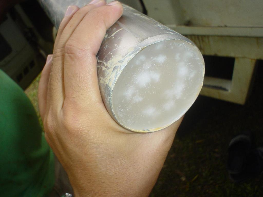
52 SOIL AND ROCK SAMPLING Soil samples obtained for engineering testing and analysis, in general, are of two main categories: Disturbed Samples Disturbed samples are those obtained using equipment that destroy the macro structure of the soil but do not alter its mineralogical composition. Specimens from these samples can be used for determining the general lithology of soil deposits, for identification of soil components and for general classification purposes (grain size distribution, Atterberg limits) and compaction characteristics of soils. Undisturbed Samples Undisturbed samples are obtained in clay soil strata for use in laboratory testing to determine the engineering properties of those soils. Undisturbed samples of granular soils can be obtained, but often specialized procedures are required such as freezing or resin impregnation and block or core type sampling. Undisturbed samples are obtained with specialized equipment designed to minimize the disturbance to the in-situ structure and moisture content of the soils. Specimens obtained by undisturbed sampling methods are used to determine the strength, stratification, permeability, density and compressibility properties
53

54 DISTURBED SAMPLES OBTAINED FROM SPT
55
56
57


 A R 2")

58 UNDISTURBED CLAY SAMPLES Required for triaxial, consolidation tests in the lab. Good quality samples necessary. A R <10% 2 O. D. I. D. 2 I. D. soil 100 (%) A R 2 sampling tube area ratio The thicker the wall, the greater the disturbance. Take good care in transport and handling.
59
60
61
62
63
64

65 ROCK CORING
66
67
68
69


70 CONVENTIONAL APPROACH TO SI
Chapter 12 Subsurface Exploration
 Page 12 1 Chapter 12 Subsurface Exploration 1. The process of identifying the layers of deposits that underlie a proposed structure and their physical characteristics is generally referred to as (a) subsurface
ENCE 3610 Soil Mechanics. Site Exploration and Characterisation Field Exploration Methods
 ENCE 3610 Soil Mechanics Site Exploration and Characterisation Field Exploration Methods Geotechnical Involvement in Project Phases Planning Design Alternatives Preparation of Detailed Plans Final Design
SITE INVESTIGATION 1
 SITE INVESTIGATION 1 Definition The process of determining the layers of natural soil deposits that will underlie a proposed structure and their physical properties is generally referred to as site investigation.
Boreholes. Implementation. Boring. Boreholes may be excavated by one of these methods: 1. Auger Boring 2. Wash Boring 3.
 Implementation Boreholes 1. Auger Boring 2. Wash Boring 3. Rotary Drilling Boring Boreholes may be excavated by one of these methods: 4. Percussion Drilling The right choice of method depends on: Ground
GEOTECHNICAL ENGINEERING II. Subject Code : 06CV64 Internal Assessment Marks : 25 PART A UNIT 1
 GEOTECHNICAL ENGINEERING II Subject Code : 06CV64 Internal Assessment Marks : 25 PART A UNIT 1 1. SUBSURFACE EXPLORATION 1.1 Importance, Exploration Program 1.2 Methods of exploration, Boring, Sounding
Gotechnical Investigations and Sampling
 Gotechnical Investigations and Sampling Amit Prashant Indian Institute of Technology Gandhinagar Short Course on Geotechnical Investigations for Structural Engineering 12 14 October, 2017 1 Purpose of
SCOPE OF INVESTIGATION Simple visual examination of soil at the surface or from shallow test pits. Detailed study of soil and groundwater to a
 Lecture-5 Soil Exploration Dr. Attaullah Shah 1 Today s Lecture Purpose of Soil Exploration Different methods 1. Test trenches and Pits 2. Auger and Wash Boring 3. Rotary Drilling 4. Geophysical Methods
SI Planning & Laboratory Testing for Hill-Site Development
 SI Planning & Laboratory Testing for Hill-Site Development 21 April 2009 IEM Penang Ir. Tan Yean Chin G&P Geotechnics Sdn Bhd Cameron Highlands, 1961 Genting Highland Tower 1993 Bukit Antarabangsa, 1999
KDOT Geotechnical Manual Edition. Table of Contents
 KDOT Geotechnical Manual 2007 Edition The KDOT Geotechnical Manual is available two volumes. Both volumes are very large electronic (pdf) files which may take several minutes to download. The table of
Manual on Subsurface Investigations National Highway Institute Publication No. FHWA NHI Federal Highway Administration Washington, DC
 Manual on Subsurface Investigations National Highway Institute Publication No. FHWA NHI-01-031 Federal Highway Administration Washington, DC Geotechnical Site Characterization July 2001 by Paul W. Mayne,
The process of determining the layers of natural soil deposits that will underlie a proposed structure and their physical properties is generally
 The process of determining the layers of natural soil deposits that will underlie a proposed structure and their physical properties is generally referred to as sub surface investigation 2 1 For proper
An Introduction to Field Explorations for Foundations
 An Introduction to Field Explorations for Foundations J. Paul Guyer, P.E., R.A. Paul Guyer is a registered mechanical engineer, civil engineer, fire protection engineer and architect with over 35 years
Rotary Drilling Rotary Drilling Bits
 GE 343 SUBSURFACE EXPLORATION CH 8 Rock Drilling, Testing, and Sampling Text Ch. 7. Dr. Norbert H. Maerz Missouri University of Science and Technology (573) 341-6714 norbert@mst.edu Instructional Objectives
Geotechnical Geotechnical Assessment
 Site Investigation Site Investigation Pile Probing Pile Probing Geotechnical Logging Geotechnical and Sampling Logging and Sampling Streetworks and Utilities Streetworks Avoidance and Utilities Avoidance
Module 1 : Site Exploration and Geotechnical Investigation
 Objectives In this section you will learn the following Displacement borings Wash boring Auger boring Rotary drilling Percussion drilling Continuous sampling Boring methods of exploration The boring methods
The attitude he maintains in his relation to the engineer is very well stated in his own words:
 Su bsurface Soil Exploration, 53: 139 Foundation Engineering Geotechnical companies that have a history of experience in a given region usually have extensive boring logs and maps telling where the borings
Instructional Objectives
 GE 343 SUBSURFACE EXPLORATION CH 8 Rock Drilling, Testing, and Sampling Text Ch. 7. Dr. Norbert H. Maerz Missouri University of Science and Technology (573) 341-6714 norbert@mst.edu Instructional Objectives
GEOTECHNICAL INVESTIGATION REPORT INFRASTRUCTURE PVT LTD
 GEOTECHNICAL INVESTIGATION REPORT Client : TAEIN CONSTRUCTION & INFRASTRUCTURE PVT LTD Office address : Flat No.104, A -Wing,1st floor,gloria Park, Paranjape Scheme, Bavdhan Khurd, Chandni Chowk, Pune
GEOTECHNICAL INVESTIGATION REPORT
 GEOTECHNICAL INVESTIGATION REPORT SOIL INVESTIGATION REPORT FOR STATIC TEST FACILITY FOR PROPELLANTS AT BDL, IBRAHIMPATNAM. Graphics Designers, M/s Architecture & Engineering 859, Banjara Avenue, Consultancy
10. GEOTECHNICAL EXPLORATION PROGRAM
 Geotechnical site investigations should be conducted in multiple phases to obtain data for use during the planning and design of the tunnel system. Geotechnical investigations typically are performed in
Underground Risk Management Course Marina Del Rey, California November, Geotechnical Data Reports. Greg Raines, PE
 Underground Risk Management Course Marina Del Rey, California November, 2018 Geotechnical Data Reports Greg Raines, PE Gregory.Raines@Stantec.com Introduction What is a Geotechnical Data Report? The GDR
 UNIT I SITE INVESTIGATION AND SELECTION OF FOUNDATION Types of boring 1.Displacement borings It is combined method of sampling & boring operation. Closed bottom sampler, slit cup, or piston type is forced
Appendix J. Geological Investigation
 Appendix J Geological Investigation Appendix J Geological Environment Table of Contents Page 1 INTRODUCTION...J-1 1.1 Purpose of the Investigation...J-1 1.2 Scope of the Investigation...J-1 2 METHODO OF
CONTENTS. 1. GeneralsG Field Investigation WorkG Laboratory Testing Work Surface Soil Description-- 7.
 CONTENTS Page 1. GeneralsG 4 2. Field Investigation WorkG 4 3. Laboratory Testing Work--- 5 4. Surface Soil Description-- 7 Appendix A Borehole Location Plan 11 Soil Profile-- 15 Bore Logs--=---- 18 Appendix
B-1 BORE LOCATION PLAN. EXHIBIT Drawn By: 115G BROOKS VETERINARY CLINIC CITY BASE LANDING AND GOLIAD ROAD SAN ANTONIO, TEXAS.
 N B-1 SYMBOLS: Exploratory Boring Location Project Mngr: BORE LOCATION PLAN Project No. GK EXHIBIT Drawn By: 115G1063.02 GK Scale: Checked By: 1045 Central Parkway North, Suite 103 San Antonio, Texas 78232
Role of the Geotechnical Consultant in Design Build Projects a General Contractors Geotechnical Engineer s Perspective
 Role of the Geotechnical Consultant in Design Build Projects a General Contractors Geotechnical Engineer s Perspective Steven R. Saye Kiewit Engineering Group, Inc. Design Build Geotechnical Goal All parties
NHBRA SOIL LABORATORY SECTION INTERIM REVISED TEST RATES FOR THE MATERIALS LABORATORY
 NHBRA SOIL LABORATORY SECTION INTERIM REVISED TEST RATES FOR THE MATERIALS LABORATORY DATE OF REVISION: ) 10th October 2010 S/N TEST DESCRIPTION UNIT RATE REMARKS 1 Sieve Analysis (wet and dry methods
IAEA SAFETY STANDARDS Geotechnical Aspects of Site Evaluation and Foundations in NPPs, NS-G-3.6
 IAEA SAFETY STANDARDS Geotechnical Aspects of Site Evaluation and Foundations in NPPs, NS-G-3.6 Regional Workshop on Volcanic, Seismic, and Tsunami Hazard Assessment Related to NPP Siting Activities and
Guidelines for Site-Specific Seismic Hazard Reports for Essential and Hazardous Facilities and Major and Special-Occupancy Structures in Oregon
 Guidelines for Site-Specific Seismic Hazard Reports for Essential and Hazardous Facilities and Major and Special-Occupancy Structures in Oregon By the Oregon Board of Geologist Examiners and the Oregon
Chapter 3 SUBSOIL EXPLORATION. Omitted parts: Sections & 3.24, 3.25 Examples 3.3, 3.4,3.5
 Chapter 3 SUBSOIL EXPLORATION Omitted parts: Sections 3.2-3.10 & 3.24, 3.25 Examples 3.3, 3.4,3.5 GENERAL OBSERVATION Soil does not posses a unique or linear stress-strain relationship. Soil behavior depends
ATTACHMENT A PRELIMINARY GEOTECHNICAL SUMMARY
 ATTACHMENT A PRELIMINARY GEOTECHNICAL SUMMARY Kevin M. Martin, P.E. KMM Geotechnical Consultants, LLC 7 Marshall Road Hampstead, NH 0384 603-489-6 (p)/ 603-489-8 (f)/78-78-4084(m) kevinmartinpe@aol.com
Pierce County Department of Planning and Land Services Development Engineering Section
 Page 1 of 7 Pierce County Department of Planning and Land Services Development Engineering Section PROJECT NAME: DATE: APPLICATION NO.: PCDE NO.: LANDSLIDE HAZARD AREA (LHA) GEOLOGICAL ASSESSMENT REPORT
Advanced Foundation Engineering
 2013 Advanced Foundation Engineering Prof.T.G. Sitharam Indian Institute of Science, Bangalore CHAPTER 1: Soil Exploration 1.1 Introduction 1.2 Boring of Holes 1.2.1 Auger Method 1.2.1.1 Hand Operated
East Land Quality Forum Drilling Techniques; Old and New
 East Land Quality Forum Drilling Techniques; Old and New 1 Introduction Different Drilling Methods Rota-sonic drilling What is it and how does it work? Different types of Rota-Sonic/Sonic Drilling Rigs
REPORT OF SUBSURFACE EXPLORATION
 REPORT OF SUBSURFACE EXPLORATION GRAND RIVER DAM AUTHORITY HULBERT 69 KV SWITCHING STATION S. 440 Road Hulbert, Cherokee County, Oklahoma ENERCON PROJECT NO. GRDA006 MARCH 7, 2012 PREPARED FOR: C/O ENERCON
Geotechnical Engineering Report
 Geotechnical Engineering Report Turner Turnpike Widening Bridge D Bridge Crossing: South 209 th West Avenue Creek County, Oklahoma June 1, 2016 Terracon Project No. 04155197 Prepared for: Garver, LLC Tulsa,
IN SITU SPECIFIC GRAVITY VS GRAIN SIZE: A BETTER METHOD TO ESTIMATE NEW WORK DREDGING PRODUCTION
 IN SITU SPECIFIC GRAVITY VS GRAIN SIZE: A BETTER METHOD TO ESTIMATE NEW WORK DREDGING PRODUCTION Nancy Case O Bourke, PE 1, Gregory L. Hartman, PE 2 and Paul Fuglevand, PE 3 ABSTRACT In-situ specific gravity
Geotechnical Data Report
 Geotechnical Data Report Downtown Greenville Future Conveyance Study December 1, 2015 Terracon Project No. 86155032 Prepared for: Prepared by: Terracon Consultants, Inc. December 1, 2015 561 Mauldin Road
CE 240 Soil Mechanics & Foundations Lecture 5.2. Permeability III (Das, Ch. 6) Summary Soil Index Properties (Das, Ch. 2-6)
 Summary Soil Index Properties (Das, Ch. 2-6)") CE 40 Soil Mechanics & Foundations Lecture 5. Permeability III (Das, Ch. 6) Summary Soil Index Properties (Das, Ch. -6) Outline of this Lecture 1. Getting the in situ hydraulic conductivity 1.1 pumping
CE 40 Soil Mechanics & Foundations Lecture 5. Permeability III (Das, Ch. 6) Summary Soil Index Properties (Das, Ch. -6) Outline of this Lecture 1. Getting the in situ hydraulic conductivity 1.1 pumping
Site investigation in rock
 Site investigation in rock masses Geotechnical Core Drilling & Logging Core Orientation Borehole Surveying Logging g Core Borehole Log Face Mapping Scanline Data Analysis Influence of Joints Orientation
MUDLOGGING, CORING, AND CASED HOLE LOGGING BASICS COPYRIGHT. Coring Operations Basics. By the end of this lesson, you will be able to:
 LEARNING OBJECTIVES MUDLOGGING, CORING, AND CASED HOLE LOGGING BASICS Coring Operations Basics By the end of this lesson, you will be able to: Understand why cores are justified and who needs core data
APPENDIX F CORRELATION EQUATIONS. F 1 In-Situ Tests
 APPENDIX F 1 APPENDIX F CORRELATION EQUATIONS F 1 In-Situ Tests 1. SPT (1) Sand (Hatanaka and Uchida, 1996), = effective vertical stress = effective friction angle = atmosphere pressure (Shmertmann, 1975)
How to Interpret Mining Company Drill Reports & Announcements
 How to Interpret Mining Company Drill Reports & Announcements A Simple Guide amscot Stockbroking Pty Ltd A division of State One Stockbroking Ltd (AFSL 247 100) Disclaimer: All information in this document
June 9, R. D. Cook, P.Eng. Soils Engineer Special Services Western Region PUBLIC WORKS CANADA WESTERN REGION REPORT ON
 PUBLIC WORKS CANADA WESTERN REGION REPORT ON GEOTECHNICAL INVESTIGATION PROPOSED MARTIN RIVER BRIDGE MILE 306.7 MACKENZIE HIGHWAY Submitted by : R. D. Cook, P.Eng. Soils Engineer Special Services Western
EVALUATION OF STRENGTH OF SOILS AGAINST LIQUEFACTION USING PIEZO DRIVE CONE
 4 th International Conference on Earthquake Geotechnical Engineering June 25-28, 2007 Paper No. 1146 EVALUATION OF STRENGTH OF SOILS AGAINST LIQUEFACTION USING PIEZO DRIVE CONE Shun-ichi Sawada 1 ABSTRACT
Geotechnical Investigation Juneau Seawalk - Taku Fisheries to Miner s Wharf Juneau, Alaska DM&A Job No
 Duane Miller & Associates 5821 Arctic Boulevard, Suite A Anchorage, AK 99518-1654 (907) 644-3200 Fax 644-0507 Arctic & Geotechnical Engineering May 4, 2006 Tetra Tech/KCM, Inc. 1971 First Avenue Seattle,
BELFAST SEWERS PROJECT
 BELFAST SEWERS PROJECT Adam Green - Atkins Tunnelling Scheme Overview New stormwater interceptor Tunnel Scheme within Belfast City Centre to alleviate flooding and divert storm water flows from existing
Geotechnical Engineering Report
 Geotechnical Engineering Report Turner Turnpike Widening Bridge B Bridge Crossing: South 257 th West Avenue Creek County, Oklahoma June 1, 2016 Terracon Project No. 04155197 Prepared for: Garver, LLC Tulsa,
Engineer. Engineering. Engineering. (in-ja-neer ) A person trained and skilled in any of the various branches of engineering: a civil engineer
 A person trained and skilled in any of the various branches of engineering: a civil engineer") Engineer (in-ja-neer ) A person trained and skilled in any of the various branches of engineering: a civil engineer (Random House Webster s College Dictionary, 1991) CE100 Introduction to Civil Geotechnical
Engineer (in-ja-neer ) A person trained and skilled in any of the various branches of engineering: a civil engineer (Random House Webster s College Dictionary, 1991) CE100 Introduction to Civil Geotechnical
Soils. Technical English - I 10 th week
 Technical English - I 10 th week Soils Soil Mechanics is defined as the branch of engineering science which enables an engineer to know theoretically or experimentally the behavior of soil under the action
This document downloaded from vulcanhammer.net vulcanhammer.info Chet Aero Marine
 This document downloaded from vulcanhammer.net vulcanhammer.info Chet Aero Marine Don t forget to visit our companion site http://www.vulcanhammer.org Use subject to the terms and conditions of the respective
Soil Mechanics Brief Review. Presented by: Gary L. Seider, P.E.
 Soil Mechanics Brief Review Presented by: Gary L. Seider, P.E. 1 BASIC ROCK TYPES Igneous Rock (e.g. granite, basalt) Rock formed in place by cooling from magma Generally very stiff/strong and often abrasive
SOIL MECHANICS AND APPLIED FOUNDATION ENGINEERING FUNDAMENTAL FACTS OF SOIL BEHAVIOR
 SOIL MECHANICS AND APPLIED FOUNDATION ENGINEERING The Subsurface is Unknown to many and Blind Guesswork cannot be used to Determine the Character and Behavior of the Underlying Soil Conditions. FUNDAMENTAL
Site Investigations and Geotechnical Risk For Underground Construction Greg Raines, PE
 August 14, 2017 Site Investigations and Geotechnical Risk For Underground Construction Greg Raines, PE Gregory.Raines@Stantec.com Develop Preliminary Geologic / Geotech Conceptual Model for the Project
Geotechnical Engineering and Dams
 Geotechnical Engineering and Dams Solving Geotechnical Challenges for Hydropower and Water Resources Projects Geological and geotechnical challenges are often very demanding when planning hydraulic structures.
GEOTECHNICAL SUBSOIL PROPERTIES FOR WASIT GOVERNORATE
 ; www.jead.org Vol. 20, No.02, March 2016 ISSN 1813-7822 EVALUATION OF GEOTECHNICAL SUBSOIL PROPERTIES FOR WASIT GOVERNORATE *Hadeel Majid Hussein Assist Lecturer, Civil Engineering Department, Al-Esra'a
Table of Contents 8.1 GENERAL Overview Subsurface Exploration Methods Responsibilities... 8.
 Table of Contents Section Page 8.1 GENERAL... 8.1-1 8.1.1 Overview... 8.1-1 8.1.2 Subsurface Exploration Methods... 8.1-2 8.1.3 Responsibilities... 8.1-3 8.1.3.1 Geotechnical Section... 8.1-3 8.1.3.2 District
patersongroup Design for Earthquakes Consulting Engineers May 19, 2016 File: PG3733-LET.01
 patersongroup May 19, 2016 File: PG3733-LET.01 Hydro Ottawa Limited c/o Cresa Toronto 170 University Avenue, Suite 1 Toronto, Ontario M5H 3B3 Attention: Ms. Barbara Wright Consulting Engineers 154 Colonnade
ENGINEERING ASSOCIATES
 July 16, 211 Vista Design, Inc. 11634 Worcester Highway Showell, Maryland 21862 Attention: Reference: Dear Mr. Polk: Mr. Richard F. Polk, P.E. Geotechnical Engineering Report Charles County RFP No. 11-9
(C) Global Journal of Engineering Science and Research Management
 Global Journal of Engineering Science and Research Management") GEOTECHNCIAL ASSESSMENT OF PART OF PORT HARCOURT, NIGER DELTA FOR STRUCTURAL ANALYSIS Warmate Tamunonengiyeofori Geostrat International Services Limited, www.geostratinternational.com. *Correspondence
GEOTECHNCIAL ASSESSMENT OF PART OF PORT HARCOURT, NIGER DELTA FOR STRUCTURAL ANALYSIS Warmate Tamunonengiyeofori Geostrat International Services Limited, www.geostratinternational.com. *Correspondence
GUIDELINE FOR HAND HELD SHEAR VANE TEST
 GUIDELINE FOR HAND HELD SHEAR VANE TEST NZ GEOTECHNICAL SOCIETY INC August 2001 CONTENTS Page 1.0 Introduction 2 2.0 Background 2 3.0 Recommended Practice 3 4.0 Undrained Shear Strength 3 5.0 Particular
PRELIMINARY GEOTECHNICAL ENGINEERING REPORT. Proposed Re-Development 44 Old Worcester Road Charlton, Massachusetts. Prepared For:
 PRELIMINARY GEOTECHNICAL ENGINEERING REPORT Proposed Re-Development 44 Old Worcester Road Charlton, Massachusetts Prepared For: Meridian Associates, Inc. 500 Cummings Center, Suite 5950 Beverly, Massachusetts
Preliminary Investigation to Eliminate Soft Spots + (Remediation of Soft Subgrade)
") Preliminary Investigation to Eliminate Soft Spots + (Remediation of Soft Subgrade) By Jim Coffin, P.G. Chief Engineering Geologist Wyoming Department of Transportation WYDOT Geology Crew: 24 Total- 1 Admin.
Preliminary Investigation to Eliminate Soft Spots + (Remediation of Soft Subgrade) By Jim Coffin, P.G. Chief Engineering Geologist Wyoming Department of Transportation WYDOT Geology Crew: 24 Total- 1 Admin.
Geotechnical Subsoil Investigation for the Design of Water Tank Foundation
 International Journal of Scientific and Research Publications, Volume 4, Issue 3, March 2014 1 Geotechnical Subsoil Investigation for the Design of Water Tank Foundation * Ngerebara Owajiokiche Dago, **
Preliminary Geotechnical and Environmental Report
 ` Preliminary Geotechnical and Environmental Report (Volume 2) December 2011 THIS PAGE INTENTIONALLY LEFT BLANK VOLUME 2 Summary As part of PE phase, the following investigations were performed: Geotechnical
Conventional Field Testing & Issues (SPT, CPT, DCPT, Geophysical methods)
") Conventional Field Testing & Issues (SPT, CPT, DCPT, Geophysical methods) Ajanta Sachan Assistant Professor Civil Engineering IIT Gandhinagar Conventional Field Testing 1 Field Test: In-situ shear strength
Conventional Field Testing & Issues (SPT, CPT, DCPT, Geophysical methods) Ajanta Sachan Assistant Professor Civil Engineering IIT Gandhinagar Conventional Field Testing 1 Field Test: In-situ shear strength
GEOTECHNICAL POLICIES AND PROCEDURES MANUAL CHAPTER 5 GEOTECHNICAL INVESTIGATION PLANNING GUIDELINES
 GEOTECHNICAL POLICIES AND PROCEDURES MANUAL CHAPTER 5 GEOTECHNICAL INVESTIGATION PLANNING GUIDELINES GEOTECHNICAL INVESTIGATION PLANNING GUIDELINES 5-i TABLE OF CONTENTS 1. PURPOSE... 1 2. INTRODUCTION...
Geotechnical Indications Of Eastern Bypass Area In Port Harcourt, Niger Delta
 Geotechnical Indications Of Eastern Bypass Area In Port Harcourt, Niger Delta Warmate Tamunonengiyeofori Geostrat International Services Limited, Rivers State, Nigeria www.geostratinternational.com info@geostratinternational.com,
VMS-GeoMil. Background
 Background When using a drilling rig for cone penetration testing, a mechanical clamp can be mounted to the drilling head (by means of a special transition piece). The depth than can be achieved depends
Cyclic Behavior of Sand and Cyclic Triaxial Tests. Hsin-yu Shan Dept. of Civil Engineering National Chiao Tung University
 Cyclic Behavior of Sand and Cyclic Triaxial Tests Hsin-yu Shan Dept. of Civil Engineering National Chiao Tung University Causes of Pore Pressure Buildup due to Cyclic Stress Application Stress are due
REPORT OF GEOTECHNICAL INVESTIGATION FOR CONSTRUCTION OF AIIMS AT GUNTUR, ANDHRA PRADESH
 REPORT OF GEOTECHNICAL INVESTIGATION FOR CONSTRUCTION OF AIIMS AT GUNTUR, ANDHRA PRADESH REPORT NO : GT 1764 CLIENT: DEPUTY GENERAL MANAGER (CIVIL) HSCC (INDIA) LTD. (A Govt. Of India Enterprise) (CONSULTANTS
Civil Engineering, Surveying and Environmental Consulting WASP0059.ltr.JLS.Mich Ave Bridge Geotech.docx
 2365 Haggerty Road South * Canton, Michigan 48188 P: 734-397-3100 * F: 734-397-3131 * www.manniksmithgroup.com August 29, 2012 Mr. Richard Kent Washtenaw County Parks and Recreation Commission 2330 Platt
Geophysical Site Investigation (Seismic methods) Amit Prashant Indian Institute of Technology Gandhinagar
 Amit Prashant Indian Institute of Technology Gandhinagar") Geophysical Site Investigation (Seismic methods) Amit Prashant Indian Institute of Technology Gandhinagar Short Course on Geotechnical Aspects of Earthquake Engineering 04 08 March, 2013 Seismic Waves
Geophysical Site Investigation (Seismic methods) Amit Prashant Indian Institute of Technology Gandhinagar Short Course on Geotechnical Aspects of Earthquake Engineering 04 08 March, 2013 Seismic Waves
REQUEST FOR QUOTATION FOR ONSHORE GEOTECHNICAL INVESTIGATION
 MLT-II JETTY AT KAMARAJAR PORT REQUEST FOR QUOTATION FOR ONSHORE GEOTECHNICAL INVESTIGATION Consultant DEPARTMENT OF OCEAN ENGINEERING INDIAN INSTITUTE OF TECHNOLOGY MADRAS CHENNAI 600 036 Client Hindustan
Predicting Settlement and Stability of Wet Coal Ash Impoundments using Dilatometer Tests
 Predicting Settlement and Stability of Wet Coal Ash Impoundments using Dilatometer Tests Chris Hardin, P.E. CH2M Hill, Charlotte, North Carolina, E-mail: Chris.Hardin@ch2m.com Roger Failmezger, P.E., F.
NEW DOWN-HOLE PENETROMETER (DHP-CIGMAT) FOR CONSTRUCTION APPLICATIONS
 FOR CONSTRUCTION APPLICATIONS") NEW DOWN-HOLE PENETROMETER (DHP-CIGMAT) FOR CONSTRUCTION APPLICATIONS 1 2 C. Vipulanandan 1, Ph.D., M. ASCE and Omer F. Usluogullari 2 Chairman, Professor, Director of Center for Innovative Grouting Materials
NEW DOWN-HOLE PENETROMETER (DHP-CIGMAT) FOR CONSTRUCTION APPLICATIONS 1 2 C. Vipulanandan 1, Ph.D., M. ASCE and Omer F. Usluogullari 2 Chairman, Professor, Director of Center for Innovative Grouting Materials
Highway Subsurface Exploration
 Highway Subsurface Exploration D. G. S hurig, Research A ssistant E. J. Yoder, Research E ngineer Joint Highway Research Project Purdue University Introduction This paper pertains to the operation and
CHAPTER 3.0 DRILLING AND SAMPLING OF SOIL AND ROCK
 HAPTER 3.0 DRILLING AND SAMPLING OF SOIL AND ROK This chapter describes the equipment and procedures commonly used for the drilling and sampling of soil and rock. The methods addressed in this chapter
THE INSTITUTE OF COST ACCOUNTANTS OF INDIA (ICAI)
") THE INSTITUTE OF COST ACCOUNTANTS OF INDIA (ICAI) GEOTECHNICAL INVESTIGATION REPORT FOR PROPOSED PROJECT INSTITUTIONAL BUILDING FOR ICAI AT CBD BELAPUR, NAVI MUMBAI OCTOBER 2012 1281-2012-073 BY THANE
THE INSTITUTE OF COST ACCOUNTANTS OF INDIA (ICAI) GEOTECHNICAL INVESTIGATION REPORT FOR PROPOSED PROJECT INSTITUTIONAL BUILDING FOR ICAI AT CBD BELAPUR, NAVI MUMBAI OCTOBER 2012 1281-2012-073 BY THANE
Limited Geotechnical Engineering Evaluation Classroom Additions Albany County Campus Laramie, Wyoming
 Limited Geotechnical Engineering Evaluation Classroom Additions Albany County Campus 2300 Missile Drive, Cheyenne, Wyoming 82001 Phone 307-635-0222 www.stratageotech.com Limited Geotechnical Engineering
DATA REPORT GEOTECHNICAL INVESTIGATION GALVESTON CRUISE TERMINAL 2 GALVESTON, TEXAS
 DATA REPORT GEOTECHNICAL INVESTIGATION GALVESTON CRUISE TERMINAL 2 GALVESTON, TEXAS SUBMITTED TO PORT OF GALVESTON 123 ROSENBERG AVENUE, 8TH FLOOR GALVESTON, TEXAS 77553 BY HVJ ASSOCIATES, INC. HOUSTON,
Instructional Objectives
 GE 6477 DISCONTINUOUS ROCK 8. Fracture Detection Dr. Norbert H. Maerz Missouri University of Science and Technology (573) 341-6714 norbert@mst.edu Instructional Objectives 1. List the advantages and disadvantages
UNDP HARARE HOSPITAL PROPOSED NATPHARM WAREHOUSE
 UNDP HARARE HOSPITAL PROPOSED NATPHARM WAREHOUSE January 17 2016 TO CARRY OUT IN-SITU SOIL SURVEY, LABORATORY TESTS AND GEOTECHNICAL REPORTING. GEOTECHNICAL INVESTIGATIONS REPORT 1 2 Re: GEOTECHNICAL INVESTIGATIONS
GEOTECHNICAL INVESTIGATION OF RAILWAYS
 GEOTECHNICAL INVESTIGATION OF RAILWAYS Prof. Hannes Gräbe University of Pretoria Transnet Chair in Railway Engineering May 2011 Contents Cost considerations Objectives Phased approach to site investigation
Introduction to Soil Mechanics Geotechnical Engineering
 Introduction to Soil Mechanics Geotechnical Engineering Dr. Attaullah Shah ground SIVA 1 Soil Mechanics= Soil+Mechanics Branch of Science dealing with the structure, Engineering properties and reactions
MICRO TO MACRO ARE UK LINEAR INFRASTRUCTURE GI S SUITABLE FOR INVESTIGATING MASS SOIL PROPERTY CHARACTERISTICS?
 MICRO TO MACRO ARE UK LINEAR INFRASTRUCTURE GI S SUITABLE FOR INVESTIGATING MASS SOIL PROPERTY CHARACTERISTICS? Ben Gilson - Arup 1 OUTLINE 1. Context why linear infrastructure? 2. Geotechnical challenges
OVERVIEW OF ER DRILLING IN EARTH EMBANKMENT DAMS AND
 OVERVIEW OF ER 1110-1-1807 DRILLING IN EARTH EMBANKMENT DAMS AND 255 255 255 237 237 237 0 0 0 217 217 217 LEVEES 163 163 163 200 200 200 131 132 122 239 65 53 80 119 27 110 135 120 Requirements and Processes
GEOTECHNICAL SITE CHARACTERIZATION
 GEOTECHNICAL SITE CHARACTERIZATION Neil Anderson, Ph.D. Professor of Geology and Geophysics Richard W. Stephenson, P.E., Ph.D. Professor of Civil, Architectural and Environmental Engineering University
Geotechnical Engineering Report
 Geotechnical Engineering Report Turner Turnpike Widening Polecat Creek Bridge (Bridge A) June 1, 2016 Terracon Project No. 04155197 Prepared for: Garver, LLC Prepared by: Terracon Consultants, Inc. TABLE
 Photo 1 - Southerly view across 2700 parking lot toward existing building. Multi-residential building borders western side of property in upper right of view. Photo 2 - Southerly view across 2750 parking
CHAPTER 3 PLANNING A SUBSURFACE INVESTIGATION AND LABORATORY TESTING PROGRAM
 CHAPTER 3 PLANNING A SUBSURFACE INVESTIGATION AND LABORATORY TESTING PROGRAM 3.1 INTRODUCTION To evaluate soil and rock properties required for geotechnical design related to transportation projects, subsurface
Ardaman & Associates, Inc. Geotechnical, Environmental and Materials Consultants
 SUBSURFACE SOIL EXPLORATION 42-INCH FORCE MAIN REPLACEMENT CHIQUITA BOULEVARD S AND SW 34 TH STREET CAPE CORAL, LEE COUNTY, FLORIDA Ardaman & Associates, Inc. Geotechnical, Environmental and Materials
3.0 SUMMARY OF FINDINGS
 AECOM 500 W Jefferson St. Suite 1600 Louisville, KY 40202 www.aecom.com 502-569-2301 tel 502-569-2304 fax October 17, 2018 Big Rivers Electric Corporation Sebree Generating Station 9000 Highway 2096 Robards,
SLOPE STABILITY ASSESSMENT PROPOSED RESIDENTIAL SUBDIVISION 161 LAKESHORE ROAD EAST TOWN OF THE BLUE MOUNTAINS, ONTARIO
 SLOPE STABILITY ASSESSMENT PROPOSED RESIDENTIAL SUBDIVISION 161 LAKESHORE ROAD EAST TOWN OF THE BLUE MOUNTAINS, ONTARIO PETO MacCALLUM LTD. 19 CHURCHILL DRIVE BARRIE, ONTARIO L4N 8Z5 PHONE: (705) 734-3900
SASKATCHEWAN STRATIGRAPHY GLACIAL EXAMPLE BOULDERS IN GLACIAL DEPOSITS
 SASKATCHEWAN STRATIGRAPHY GLACIAL EXAMPLE BOULDERS IN GLACIAL DEPOSITS 51 SASKATCHEWAN STRATIGRAPHY GLACIAL SURFICIAL STRATIFIED DEPOSITS 52 SASKATCHEWAN STRATIGRAPHY GLACIAL EXAMPLE OF SEDIMENT DEPOSITION
SOIL CHARACTERIZATION OF JABALPUR CITY USING BORE LOGS
 ISSN 77-685 IJESR/June 16/ Vol-6/Issue-6/131-135 Mrinal Singh et. al., / International Journal of Engineering & Science Research SOIL CHARACTERIZATION OF JABALPUR TY USING BORE LOGS ABSTRACT Mrinal Singh*
Minnesota Department of Transportation Geotechnical Section Cone Penetration Test Index Sheet 1.0 (CPT 1.0)
") This Cone Penetration Test (CPT) Sounding follows ASTM D 5778 and was made by ordinary and conventional methods and with care deemed adequate for the Department's design purposes. Since this sounding was
This Cone Penetration Test (CPT) Sounding follows ASTM D 5778 and was made by ordinary and conventional methods and with care deemed adequate for the Department's design purposes. Since this sounding was
Northern Colorado Geotech
 PRELIMINARY GEOTECHNICAL ENGINEERING REPORT PROPOSED CECIL FARMS DEVELOPMENT WELD COUNTY ROAD 7, BETWEEN ROADS 7 AND 7 SEVERANCE, COLORADO NORTHERN COLORADO GEOTECH PROJECT NO. 0-6 APRIL 0, 06 Prepared
6.2 Geotechnical Investigation and Construction Material Survey
 6.2 Geotechnical Investigation and Construction Material Survey Geological surveys and investigations were conducted to obtain information on the subsurface geological condition required for the preliminary
Geotechnical Testing Methods I
 Geotechnical Testing Methods I Ajanta Sachan Assistant Professor Civil Engineering IIT Gandhinagar Hiding World of Geotechnical Engg!! Foundations Shoring Tunneling Soil Exploration Geotechnical Engg Structures