ESCAP Promotes Geo-referenced Information System for Disaster Risk Management in Asia and the Pacific
|
|
|
- Michael Horton
- 6 years ago
- Views:
Transcription
1 Third High Level Forum on UNGGIM October 2014 Beijing, China ESCAP Promotes Geo-referenced Information System for Disaster Risk Management in Asia and the Pacific Keran Wang Space Applications Section, Information and Communications Technology and Disaster Risk Reduction Division (IDD)

2 Why ESCAP has put in place space applications and GIS to realize its vision? Established in 1947 with its headquarters in Bangkok, Thailand. Regional development arm of the United Nations for the Asia-Pacific region. Made up of 53 Member States and 9 Associate Members, the region is home to 4.1 billion people, or two thirds of the world s population. Geographical scope stretches from Turkey in the west to Kiribati in the east, and from the Russian Federation in the north to New Zealand in the south.


3 Achieving Sustainable Development in Asia Pacific Eradicating poverty and narrowing inequality Pursuing sustained and inclusive economic growth Gender Equality and Empowerment Building resilience to economic crisis, climate change and disasters Responding to population dynamics and urbanization Enhancing resource efficiency and natural resource management Deepening regional integration and connectivity Financing Science, Technology and Innovation Trade Capacity Building Partnership Governance
4 Key developments and challenges in disaster risk reduction In , Asia and the Pacific continued to be the region most affected by natural disasters 9 of the top 10 world s deadliest disasters struck the region - Typhoon Haiyan (Philippines, Viet Nam and China), flash floods (India and Nepal). Disasters in the region affected more than 85 million people and caused over $62 billion in damages. New developments in space technologies and GIS have brought much potential; these technologies have become more affordable than ever before Lack of awareness and capacity hinder effective application of space technology and GIS. Growing needs-member States request ESCAP to do more. Our work deals with pressing development challenges of today: Building Resilience, and Promoting Connectivity


 Institutionalization of RESAP: ESCAP acts as")


5 Fostering strong political commitment, ownership and support 69/11: Implementation of the Asia-Pacific Plan of Action for Applications of Space Technology and Geographic Information Systems for Disaster Risk Reduction and Sustainable Development, (2013) 68/5: Asia-Pacific Years of Action for Applications of Space Technology and the Geographic Information System for Disaster Risk Reduction and Sustainable Development, (2012) Regional Space Applications for Sustainable Development in Asia and the Pacific (RESAP) Institutionalization of RESAP: ESCAP acts as the secretariat of RESAP 2 nd Space Ministerial Conference New Delhi (1999) Capacity Building 1 st Space Ministerial Conference Regional Cooperative Mechanism for Drought Monitoring and Early Warning was launched Beijing (1994) RESAP: Education and Training Networks (China, India and Indonesia) + Regional /South- South Cooperation Inception of RESAP: Intergovernmental Consultative Committee, Thematic Regional Working Groups


6 Asia and Pacific is the world s most disaster-prone region a.the loss of life is decreasing from hydro-meteorological hazards, while the economic losses are alarmingly on the rise. b.spatial land use plans, resilient critical infrastructure help in reducing economic losses.


7 Asia-Pacific Leaders Convene to Discuss Strategies to Build Resilience to Natural Disaster and Economic Crises in the Region Space technologies and georeferenced information can be used to enhance resilience, economic, social, environment development, build critical infrastructure and strengthen supply chains.
8 Why Geo-DRM is important to developing countries in Asia and the Pacific? Asia-Pacific is the most disaster-prone region of the world. Huge loss caused by severe disasters rolls back the development gains made by CSNs. Utilization of space technology and GIS is now more accessible and affordable than ever. Comprehensive hazard and risk assessments, disaster response, relief and impact assessments. Space technology and GIS applications continue to be underutilized in CSNs. Primarily because of the lack of capacity in developing countries in terms of human, scientific, technological, organizational and institutional resources.
9 What are the goals of ESCAP s project? LDCs, LLDCs and SIDS in Asia-Pacific region have the capacity to establish and use a geo-referenced information platform for disaster risk reduction and management. Geo-DRM provides a highly effective tool in support of evidence-based decision making for preparedness, rapid analysis and impact assessment of disasters. Through South-South cooperation as well as triangular cooperation. Community of Practices (COP) is developed among stakeholders and link it to a regional-level support network of DRR and DRM.

10 Provide right information to the right people at the right time for the right decision
11 What is our approach? Survey of regional persistent gaps and challenges in CSNs. Low capacity in space and GIS applications. Lack of geo-referenced information systems in the region. Pilot country selection upon request. Least developed countries: Nepal, Bangladesh, Afghanistan Land lock developing countries: Mongolia, Kyrgyzstan Small Island developing States: Cook Islands, Fiji Country level needs and gap assessment. Increase awareness of policymakers on Geo-DRM and the capacity of the users in key ministries.
12 What are our key deliveries? Developed standardized prototype Geo-DRM portal based on open source software for disaster risk management and shared it with member States, in particular, with LDCs, LLDC and SIDS. Developed a series of knowledge products 2013 Installation of Geo-DRM portal, users manuals and video guidance, etc. Supported member States to enhance their capacity building Supported Bangladesh, the Cook Islands, Fiji, Kyrgyzstan, Mongolia and Nepal in establishing Geo-DRM and provided the specialized training to configure, operate and manage the Geo-DRM. Strengthened regional partnerships UNISDR, UNDP, UNITAR/UNOSAT, UNOCHA, UNGGIM, SAARC, SOPAC, CSSTEAP and AIT.
13 What is the current status of Geo-DRM? The Geo-DRM which integrating geospatial data and critical socio-economic information has been initially operational in pilot countries. Bangladesh, Cook Islands, Fiji, Kyrgyzstan, Mongolia, Nepal More countries such as Afghanistan, Bhutan, Cambodia, Lao PDR, Kiribati, and Maldives have requested the technical support on establishment and use of Geo-DRMs. In the advent of a disaster, the Geo-DRM aims to provide the right information, to the right people, at the right time to enable sound, evidence-based decision making. The online Community of Practice (COP) has been established. A regional network of more than 100 key stakeholders, has been established and will assist in sharing information, knowledge and resources for disaster management.
14 Good practices in pilot countries: Mainstreamed using innovative technology, such as space and GIS, into their sectoral or national disaster prevention plan. Bangladesh, Cook Islands, Kyrgyzstan, Mongolia and Nepal have initially exchanged the data and provide support among related ministries. Network of Networks: Network of policy makers, officials, researchers and project managers from different ministries and academic fields has been setup. Effective linkage with professional UN agencies, such as UNITAR/UNOSAT, UNGGIM, UNGGIM-AP and GEO, has been further strengthened. An experienced technical team at AIT will continue to provide technical assistance to all user of Geo-DRM. Continued support: from existing and potential donors, such as Korea, Japan, China and India, are committed to provide financial and technical support to ESCAP in GIS applications for disaster risk reduction.


15 What should be proud of?
16 Mongolia


17 Usage of Geo-portal in NEMA, Mongolia Geo-portal was installed in our server. Server room technical specification: Dell power edge T410 CPU: Intel Xeon 2.40Ghz (16CPUs) RAM: 4096mb OS: Windows server 2008 Geo-portal server 17


18 Map of fodder resources Map of groundwater 18


19 Executing FERN Mapping System Cook Islands

20 Kyrgyzstan


21 Geodata downloaded into the Data Platform Some examples of geo-loaded into the data platform

22 Fiji

23 GIS Status in Fiji

24 Nepal Geo-Portal 24
25 Future plan 1. Effective use of space and GIS for disaster risk reduction and sustainable development. Urban planning for building resilient cities; Utilizing Earth observation tools agricultural and land management. Enhance geospatial information management in developing countries for sustainable development 2. Climate change and disaster risk management. Strengthening Climate Risk Knowledge for Pacific Small Island Developing States (SIDS) 3. Establishing regional standards for disaster related statistics 4. Collaboration with UNGGIM


26 Many urban risk hot spots in Asia- Pacific
27 4 Collaboration with UNGGIM 1) Regional arm in Asia-Pacific 2) Conduce joint research: standard, methodology, etc. 3) Sharing the good practices in Asia and the Pacific; 4) Joint capacity building for developing countries.

28 Thank you for your kind attention.
Journey of supporting CSNs to establish Geo-DRM
 Regional Workshop on Geo-referenced Information Systems for Disaster Risk Management (Geo-DRM) 26-27 June 2014 Bangkok, Thailand Journey of supporting CSNs to establish Geo-DRM Keran Wang Chief, Space
Overview of Technical Advisory Missions
 Expert Group Meeting (EGM) on Georeferenced Information Systems for Disaster Risk Management (Geo-DRM) and sustaining the Community of Practice (COP) 23-25 April 2014 Bangkok Overview of Technical Advisory
RESAP Progress Report
 RESAP Progress Report December 2016 to October 2017 Presentation to the Twenty-first session of the Intergovernmental Consultative Committee on the Regional Space Applications Programme for Sustainable
Geospatial Information for Disaster Risk Management in Asia-Pacific Region
 Geospatial Information for Disaster Risk Management in Asia-Pacific Region Ram S. Tiwaree, Dr.Eng. Space Applications Section Information and Communications Technology and Disaster Risk Reduction Division
Geospatial Information and Services for Disasters (GIS4D)
") Geospatial Information and Services for Disasters (GIS4D) 31 July 2017 Tae Hyung KIM ICT and Disaster Risk Reduction Division (IDD) UNESCAP 1 About ESCAP Who is ESCAP? United Nations Economic and Social
Geospatial Information and Services for Disasters (GIS4D) 31 July 2017 Tae Hyung KIM ICT and Disaster Risk Reduction Division (IDD) UNESCAP 1 About ESCAP Who is ESCAP? United Nations Economic and Social
Project Evaluation Report Improving disaster risk preparedness in the Economic and Social Commission for Asia and the Pacific region
 Project Evaluation Report Improving disaster risk preparedness in the Economic and Social Commission for Asia and the Pacific region September 2014 Evaluator Mihir R. Bhatt Page 1 of 72 ACKNOWLEDGEMENTS
Space Applications for Disaster Risk Reduction and Sustainable Development
 Space Applications for Disaster Risk Reduction and Sustainable Development Space Applications Section (SAS) ICT and Disaster Risk Reduction Division (IDD) UNESCAP Contents I. RESAP Activities 2016-2017
Building Institutional Capacity for Multi-Hazard Early Warning in Asia and the Pacific Subtitle
 Building Institutional Capacity for Multi-Hazard Early Warning in Asia and the Pacific Subtitle Title Keran Wang Chief, Space Applications Section ICT and Disaster Risk Reduction Division 22 May 2018 Pillar
Geospatial Technologies for Resources Planning & Management
 Geospatial Technologies for Resources Planning & Management Lal Samarakoon, PhD Director, Geoinformatics Center Asian Institute of Technology, Thailand Content Geoinformatics for SDG Information Integration
Report of the Working Group 2 Data Sharing and Integration for Disaster Management *
 UNITED NATIONS E/CONF.104/6 ECONOMIC AND SOCIAL COUNCIL Twentieth United Nations Regional Cartographic Conference for Asia and the Pacific Jeju, 6-9 October 2015 Item 5 of the provisional agenda Report
National workshop on Eco-efficient Water Infrastructure for Sustainable Urban Development in Nepal objectives. expected outcomes & schedule
 GEO-REF Information Sharing Eco-Efficient water Infrastructure, National workshop on Eco-efficient Water Infrastructure for Sustainable Urban Development in Nepal objectives. expected outcomes & schedule
National workshop on sustainable urban and industry development in Mongolia objective, expected outcomes and schedule
 GEO-REF Information Eco-Efficient Urban Infrastructure, and Platform Green for & Disaster Livable Management Cities National workshop on sustainable urban and industry development in Mongolia objective,
Space Application in Support of Land Management for SDG Implementation
 Space Application in Support of Land Management for SDG Implementation Regional Expert Workshop on Land Accounting for SDG Monitoring and Reporting 26 September 2017 Space Application Section Information
Building Institutional Capacity for Multi-Hazard Early Warning in Pacific Countries Subtitle
 Building Institutional Capacity for Multi-Hazard Early Warning in Pacific Countries Subtitle Title Keran Wang Chief, Space Applications Section ICT and Disaster Risk Reduction Division 30 March 2018 Slide
ESCAP Technical Paper Information and Communications Technology and Disaster Risk Reduction Division
 ESCAP Technical Paper Information and Communications Technology and Disaster Risk Reduction Division Using Space-based Applications and Information Available through the ESCAP-established Regional Cooperation
Sub-regional Training on development of Geo-referenced Disaster Risk Management Information Systems for SAARC countries
 Sub-regional Training on development of Geo-referenced Disaster Risk Management Information Systems for SAARC countries Jointly organized by Economic and Social Commission for Asia and the Pacific and
ECONOMIC AND SOCIAL COUNCIL
 UNITED NATIONS E/CONF.102/3 ECONOMIC AND SOCIAL COUNCIL Nineteenth United Nations Regional Cartographic Conference for Asia and the Pacific Bangkok, 29 October 1 November 2012 Item 4 of the provisional
Disaster Management & Recovery Framework: The Surveyors Response
 Disaster Management & Recovery Framework: The Surveyors Response Greg Scott Inter-Regional Advisor Global Geospatial Information Management United Nations Statistics Division Department of Economic and
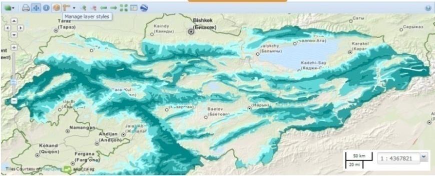
Use of geo-referenced data for DRM in Central Asia, problems and prospective
 Use of geo-referenced data for DRM in Central Asia, problems and prospective Dr. Akylbek Chymyrov Director, Kyrgyz Center of Geoinformation Systems Member of the Public Supervisory Board MES KR KSUCTA,
Economic and Social Council
 United Nation E/C.20/2012/4/Add.1 Economic and Social Council Distr.: General 2 July 2012 Original: English Committee of Experts on Global Geospatial Information Management Second session New York, 13-15
From PCGIAP to UN GGIM AP: A Regional Perspective on GGIM
 Regional Committee of United Nations Global Geospatial Information Management for Asia and the Pacific (UN-GGIM-AP) Established by a United Nations Resolution From PCGIAP to UN GGIM AP: A Regional Perspective
Geographic Information Infrastructure and Policy Framework for Sustainable Mountain Development in the Hindu Kush-Himalayas
 Geo SMART ASIA 2017 22-24 August, Kualalampur Geographic Information Infrastructure and Policy Framework for Sustainable Mountain Development in the Hindu Kush-Himalayas Basanta Shrestha, Director Strategic
Urban Climate Resilience
 Urban Climate Resilience in Southeast Asia Partnership Project Introduction Planning for climate change is a daunting challenge for governments in the Mekong Region. Limited capacity at the municipal level,
Space Technology for Implementation of SDGs in the Pacific Region
 Space Technology for Implementation of SDGs in the Pacific Region 13 15 September 2016, Nadi, Fiji Tae Hyung KIM ICT and Disaster Risk Reduction Division (IDD) UNESCAP 1 Contents 1. What are SDGs? How
UN-GGIM: Strengthening Geospatial Capability
 Fifth Plenary Meeting of UN-GGIM: Europe Brussels, 6-7 June 2018 UN-GGIM: Strengthening Geospatial Capability Walking the talk to leave no one behind Greg Scott, UN-GGIM Secretariat Environmental Statistics
ENHANCING THE SHARE OF LLDCs IN. (Priority 3 of APoA) Dr Mia Mikic Chief, Trade Policy and Analysis Section Trade and Investment Division
 Dr Mia Mikic Chief, Trade Policy and Analysis Section Trade and Investment Division") ESCAP/OHRLLS/ECE/Government of Lao PDR Final Regional Review of the AlmatyProgrammeof of Action 5 7 March 2013, Vientiane, Lao PDR ENHANCING THE SHARE OF LLDCs IN GLOBAL TRADE FLOWS AND TRADE FACILITATION
ESCAP/OHRLLS/ECE/Government of Lao PDR Final Regional Review of the AlmatyProgrammeof of Action 5 7 March 2013, Vientiane, Lao PDR ENHANCING THE SHARE OF LLDCs IN GLOBAL TRADE FLOWS AND TRADE FACILITATION
Regional EGM on Community of Practice of Georeferenced Information System. for Disaster Risk Management (Geo-DRM) April 2014, Bangkok, Thailand
 April 2014, Bangkok, Thailand") Regional EGM on Community of Practice of Georeferenced Information System for Disaster Risk Management (Geo-DRM) 23-25 April 2014, Bangkok, Thailand Presented By Mukesh Kumar Keshari Ministry of Home Affairs
Regional EGM on Community of Practice of Georeferenced Information System for Disaster Risk Management (Geo-DRM) 23-25 April 2014, Bangkok, Thailand Presented By Mukesh Kumar Keshari Ministry of Home Affairs
KUNMING FORUM ON UNITED NATIONS GLOBAL GEOSPATIAL INFORMATION MANAGEMENT CITIES OF THE FUTURE: SMART, RESILIENT
 KUNMING FORUM ON UNITED NATIONS GLOBAL GEOSPATIAL INFORMATION MANAGEMENT CITIES OF THE FUTURE: SMART, RESILIENT and SUSTAINABLE Yunnan Zhenzhuang Guest House, Kunming, China 10 12 May 2017 BACKGROUND CONCEPT
GENERAL RECOMMENDATIONS. Session 7. Breakout discussion. discuss on regional and interregional. proposals 1. COLLABORATION BETWEEN PROGRAMMES
 Session 7 24 July 2016, 9.00-11.00 Breakout discussion on regional and interregional joint project proposals Mr Shahbaz Khan summarized the two days of presentations and exchanges and requested the participants
THE SALB PROJECT: STATE OF PROGRESS IN ASIA AND THE PACIFIC SINCE THE 8 th SEASC
 THE SALB PROJECT: STATE OF PROGRESS IN ASIA AND THE PACIFIC SINCE THE 8 th SEASC Chandima Subasinghe 1, Yaniss Guigoz 2, Lal Samarakoon 1, Steeve Ebener 2 1 Geoinformatics Center, Asian Institute of Technology
Report of the Regional Committee of UN-GGIM for Asia and the Pacific (UN-GGIM-AP)
") Report of the Regional Committee of UN-GGIM for Asia and the Pacific (UN-GGIM-AP) At the Eighth Session of UN-GGIM UN Headquarters, New York, 1 3 August 2018 About UN-GGIM-AP One of the five regional committees
Report of the Regional Committee of UN-GGIM for Asia and the Pacific (UN-GGIM-AP) At the Eighth Session of UN-GGIM UN Headquarters, New York, 1 3 August 2018 About UN-GGIM-AP One of the five regional committees
UN GGIM and National SDI Strategy
 MSDI Open Forum on 26 th January 2016 Contributing to the successful delivery of MSDI UN GGIM and National SDI Strategy Hiroshi Murakami Deputy Administrator Geospatial Information Authority of Japan Geospatial
The Regional Integrated Multi-Hazard Early Warning System for Africa and Asia CAP in RIMES
 The Regional Integrated Multi-Hazard Early Warning System for Africa and Asia CAP in RIMES 2018 CAP Implementation Workshop OUTLINE 1. RIMES Overview 2. DSS tools developed in RIMES 3. CAP Integration
Pacific Geospatial and Surveying Council (PGSC) Geospatial and GNSS CORS Infrastructure Forum. Kuala Lumpur October
 Geospatial and GNSS CORS Infrastructure Forum. Kuala Lumpur October") Pacific Geospatial and Surveying Council (PGSC) Geospatial and GNSS CORS Infrastructure Forum. Kuala Lumpur 16-17 October Beginning and Progress Members PGSC Charter PGSC Strategy 2017-2027 Meetings Geodetic
Pacific Geospatial and Surveying Council (PGSC) Geospatial and GNSS CORS Infrastructure Forum. Kuala Lumpur 16-17 October Beginning and Progress Members PGSC Charter PGSC Strategy 2017-2027 Meetings Geodetic
Natural Disasters in Member Countries (2002 Summary)
") 4.2 Member Countries and their Disaster Characteristics: Table 5: Natural Disasters in Member Countries (2002 Summary) (Country/Disaster Type/Disaster Characteristics) Data Country DisType Count of TotAff
4.2 Member Countries and their Disaster Characteristics: Table 5: Natural Disasters in Member Countries (2002 Summary) (Country/Disaster Type/Disaster Characteristics) Data Country DisType Count of TotAff
Economic and Social Council
 United Nations Economic and Social Council Distr.: General 2 July 2012 E/C.20/2012/10/Add.1 Original: English Committee of Experts on Global Geospatial Information Management Second session New York, 13-15
National Remote Sensing Center of China. Space Technology for Sustainable Development in China Status, Achievements and Futures.
 National Remote Sensing Center of China Space Technology for Sustainable Development in China Status, Achievements and Futures Jing Li National Remote Sensing Center of China Ministry of Science and Technology,
Country Report Vanuatu
 Country Report Vanuatu Ministry Infrastructure and Public Utilities. Application of Space Technology and the Geographic information system for DRR and Sustainable Development 18 th 22 nd December 2012
Georeferencing and Satellite Image Support: Lessons learned, Challenges and Opportunities
 Georeferencing and Satellite Image Support: Lessons learned, Challenges and Opportunities Shirish Ravan shirish.ravan@unoosa.org UN-SPIDER United Nations Office for Outer Space Affairs (UNOOSA) UN-SPIDER
Background Document: Report of the Regional Committee of United Nations Global Geospatial Information Management for Asia and the Pacific
 Background Document: Report of the Regional Committee of United Nations Global Geospatial Information Management for Asia and the Pacific 1. Summary 1. This report highlights the activities carried out
Capacity Building in Applications of Remote Sensing and GIS for Disaster Management
 Capacity Building in Applications of Remote Sensing and GIS for Disaster Management M.K. Hazarika, L. Samarakoon, N. Senevirathne, J.S.M. Fowze and R. de Silva Project Researcher GeoInformatics Center
WMO s Severe Weather Forecasting Demonstration Project (SWFDP)
") 5 th Meeting of the RA II WIGOS Project on Satellites Coordination Group, 21 Oct 2017 WMO s Severe Weather Forecasting Demonstration Project (SWFDP) Abdoulaye Harou Chief DPFS Division/WDS WMO Secretariat
5 th Meeting of the RA II WIGOS Project on Satellites Coordination Group, 21 Oct 2017 WMO s Severe Weather Forecasting Demonstration Project (SWFDP) Abdoulaye Harou Chief DPFS Division/WDS WMO Secretariat
Global Map: A Tool for Disaster Mitigation for the Asia and Pacific Region
 Global Map: A Tool for Disaster Mitigation for the Asia and Pacific Region D. R. Fraser Taylor Chair, International Steering Committee for Global Mapping (ISCGM) fraser_taylor@carleton.ca www. 18 th United
Concept note. High-Level Seminar: Accelerating Sustainable Energy for All in Landlocked Developing Countries through Innovative Partnerships
 Concept note High-Level Seminar: Accelerating Sustainable Energy for All in Landlocked Developing Countries through Innovative Partnerships Date: 24 and 25 October 2016 Venue: Conference Room C3, Vienna
Implementing the Sustainable Development Goals: The Role of Geospatial Technology and Innovation
 Fifth High Level Forum on UN Global Geospatial Information Management Implementing the Sustainable Development Goals: The Role of Geospatial Technology and Innovation 28-30 November 2017 Sheraton Maria
Maria Hurtola, Head of International Affairs, FMI Harri Pietarila, Head of Expert Services, FMI
 MEETING ON THE IMPLEMENTATION COORDINATION OF THE GFCS 29 September to 1 October 2014 WMO, Geneva Contribution by Finland to the GFCS Ongoing and planned projects Maria Hurtola, Head of International Affairs,
Measuring Disaster Risk for Urban areas in Asia-Pacific
 Measuring Disaster Risk for Urban areas in Asia-Pacific Acknowledgement: Trevor Clifford, Intl Consultant 1 SDG 11 Make cities and human settlements inclusive, safe, resilient and sustainable 11.1: By
Challenges and Potentials of Place Based Information Management in Nepal"
 Nineteenth United Nations Regional Cartographic Conference for Asia and the Pacific, Bangkok, Thailand, 29 October 1 November 2012 Challenges and Potentials of Place Based Information Management in Nepal"
Spatial Data Infrastructure in the Pacific
 Spatial Data Infrastructure in the Pacific. Sachindra Singh Senior Geospatial Systems Architect ICT for Development, Geoscience Division Pacific Community (SPC) OrganisationalBackground SPC - The Pacific
Space-based technology and applications and space science for humanitarian affairs, environment and security
 Space-based technology and applications and space science for humanitarian affairs, environment and security LUC ST-PIERRE United Nations Office for Outer Space Affairs United Nations Office at Vienna
WMO Priorities and Perspectives on IPWG
 WMO Priorities and Perspectives on IPWG Stephan Bojinski WMO Space Programme IPWG-6, São José dos Campos, Brazil, 15-19 October 2012 1. Introduction to WMO Extended Abstract The World Meteorological Organization
SEISMIC RISK ASSESSMENT IN ARMENIA
 SEISMIC RISK ASSESSMENT IN ARMENIA Hovhannes Khangeldyan Head of National Crisis Management Center Rescue Service Ministry of Emergency Situations of the Republic of Armenia Tokyo, 2016 ARMENIA: GEOGRAPHICAL
Introduction of the Asia-Oceania Global Earth Observation System of Systems (AOGEOSS) GEO Initiative(GI-22 )
 GEO Initiative(GI-22 )") Introduction of the Asia-Oceania Global Earth Observation System of Systems (AOGEOSS) GEO Initiative(GI-22 ) Prof. Xiang ZHOU Institute of Remote Sensing and Digital Earth, CAS 11 May 2017 Kunming, China
Introduction of the Asia-Oceania Global Earth Observation System of Systems (AOGEOSS) GEO Initiative(GI-22 ) Prof. Xiang ZHOU Institute of Remote Sensing and Digital Earth, CAS 11 May 2017 Kunming, China
Nineteenth SPREP Meeting
 Page 1 SECRETARIAT OF THE PACIFIC REGIONAL ENVIRONMENT PROGRAMME Nineteenth SPREP Meeting Pohnpei, Federated States of Micronesia 04 12 September 2008 Agenda Item 9.2.5: Regional Meteorological Services
Governance and Urban Nexus: Closing the gaps
 Governance and Urban Nexus: Closing the gaps Donovan Storey Chief, Sustainable Urban Development, Environment & Development Division National Dialogue on Urban Nexus in Thailand Bangkok, UNCC, 19 March
2018/1 The integration of statistical and geospatial information. The Regional Committee of UN-GGIM: Americas:
 The following are the conclusions and recommendations of the Regional Committee of the United Nations on Global Geospatial Information Management for the Americas, during its Fifth Session, Thursday 8
CapacityAssessmentofNational MeteorologicalandHydrological ServicesinSupportof DisasterRiskReduction
 CapacityAssessmentofNational MeteorologicalandHydrological ServicesinSupportof DisasterRiskReduction Analysisofthe2006WMO DisasterRiskReduction Country-levelSurvey Capacity Assessment of National Meteorological
Geo-information and Disaster Risk Reduction in the Hindu Kush-Himalayan region
 Geo-information and Disaster Risk Reduction in the Hindu Kush-Himalayan region Basanta Shrestha, Division Head MENRIS, International Centre for Integrated Mountain Development Kathmandu, Nepal The International
Regional Integration and Cooperation (Priority 4)
") Regional Integration and Cooperation (Priority 4) Andrzej Bolesta Economic Affairs Officer Macroeconomic Policy and Financing for Development Division United Nations Economic and Social Commission for
Regional Integration and Cooperation (Priority 4) Andrzej Bolesta Economic Affairs Officer Macroeconomic Policy and Financing for Development Division United Nations Economic and Social Commission for
Earth Observations as a Tool To Achieve Sustainable Development Goals
 The image part with relationship ID rid3 was not found in the file. 16/10/2017 Earth Observations as a Tool To Achieve Sustainable Development Goals LI Jing, China GEO On behalf of the Group on Earth Observations
NUKU ALOFA MINISTERIAL DECLARATION For SUSTAINABLE WEATHER AND CLIMATE SERVICES FOR A RESILIENT PACIFIC. 24th July 2015, Nuku alofa, Tonga
 NUKU ALOFA MINISTERIAL DECLARATION For SUSTAINABLE WEATHER AND CLIMATE SERVICES FOR A RESILIENT PACIFIC 24th July 2015, Nuku alofa, Tonga The First Pacific Ministerial Meeting on Meteorology was held on
TRANSPORT CHALLENGES AND OPPORTUNITIES FOR LANDLOCKED COUNTRIES FOR ACHIEVING SUSTAINABLE DEVELOPMENT GOALS
 TRANSPORT CHALLENGES AND OPPORTUNITIES FOR LANDLOCKED COUNTRIES FOR ACHIEVING SUSTAINABLE DEVELOPMENT GOALS Robert Earley, consultant 11 th Intergovernmental Regional Environmentally Sustainable Transport
Presentation by Thangavel Palanivel Senior Strategic Advisor and Chief Economist UNDP Regional Bureau for Asia-Pacific
 Presentation by Thangavel Palanivel Senior Strategic Advisor and Chief Economist UNDP Regional Bureau for Asia-Pacific The High-Level Euro-Asia Regional Meeting on Improving Cooperation on Transit, Trade
South and South-West Asia LLDCs
 International support measures to South and South-West Asia LLDCs Nagesh Kumar Director, ESCAP South and South West Asia Office And ESCAP Chief Economist ESCAP/OHRLLS/ECE/Government / / of Lao PDR Final
Impact of Cyclone Nargis
 Lessons Learnt from Nargis Recovery for the Next Disaster International Recovery Forum (2011) 12, JAN 2011, Kobe, Japan Home for over 100 national races. Profile of Myanmar The 2 nd largest country in
INDONESIA S S UPDATE: GEOSPATIAL INFORMATION FOR SUSTAINABLE DEVELOPMENT RELATED TO INA SDI Dr. Asep Karsidi, M.Sc
 INDONESIA S S UPDATE: GEOSPATIAL INFORMATION FOR SUSTAINABLE DEVELOPMENT RELATED TO INA SDI Dr. Asep Karsidi, M.Sc GEOSPATIAL INFORMATION AGENCY 08 August, 2012 OUTLINE 1. Transformation Bakosurtanal into
Country Report Nepal Geospatial Data Sharing Initiatives of Survey Department Supporting Disaster Management
 Third JPTM Step 2 for Sentinel Asia 6-8 July, 2010 Manila, The Philippines Country Report Nepal Geospatial Data Sharing Initiatives of Survey Department Supporting Disaster Management Durgendra M Kayastha
ISSUES BRIEF Plenary A Risk-informed Approach to Sustainable Development and Resilience for Countries in Special Situations
 ISSUES BRIEF Plenary A Risk-informed Approach to Sustainable Development and Resilience for Countries in Special Situations Rationale All recent international agreements, including the Sendai Framework
1) United Nations Committee of Experts on Global Geospatial Information Management (UN-GGIM)
 United Nations Committee of Experts on Global Geospatial Information Management (UN-GGIM)") International Workshop on Legal and Policy Frameworks for Geospatial Information Management Licensing of Geospatial Information 7 9 November 2017 Tianjin Zhengxie Club Hotel Tianjin, China Outline of presentation
International Workshop on Legal and Policy Frameworks for Geospatial Information Management Licensing of Geospatial Information 7 9 November 2017 Tianjin Zhengxie Club Hotel Tianjin, China Outline of presentation
Realizing benefits of Spatial Data Infrastructure A user s perspective from Environment Agency - Abu Dhabi
 Realizing benefits of Spatial Data Infrastructure A user s perspective from Environment Agency - Abu Dhabi Anil Kumar Director, Environment Information Management 26 April 2012 Geospatial World Forum,
Geospatial Information Management in the Americas: Lessons for the Post-2015 development agenda
 Geospatial Information Management in the Americas: Lessons for the Post-2015 development agenda Rolando Ocampo President, UN-GGIM: Americas October 2014 The integration of statistical and geographical
SDG s and the role of Earth Observation
 SDG s and the role of Earth Observation Christian Heipke IPI - Institute for Photogrammetry and GeoInformation Leibniz Universität Hannover Germany Secretary General, ISPRS 1. No Poverty 2. Zero Hunger
UN-OHRLLS. Opening Statement for. Ms. Fekitamoeloa Katoa Utoikamanu. High Representative and Under-Secretary-General
 Please check against delivery UN-OHRLLS Opening Statement for Ms. Fekitamoeloa Katoa Utoikamanu High Representative and Under-Secretary-General Least Developed Countries, Landlocked Developing Countries
Geospatial framework for monitoring SDGs/Sendai targets By Shimonti Paul Sr. Assistant Editor Geospatial Media & Communications
 Geospatial framework for monitoring SDGs/Sendai targets By Shimonti Paul Sr. Assistant Editor Geospatial Media & Communications Outline 1. Introduction to Geospatial Media and Communications 2. Geospatial
Public Disclosure Copy
 Public Disclosure Authorized EAST ASIA AND PACIFIC Vanuatu Social, Urban, Rural and Resilience Global Practice Global Practice Recipient Executed Activities Technical Assistance Loan FY 2013 Seq No: 7
THE ROLE OF GEOSPATIAL AT THE WORLD BANK
 THE ROLE OF GEOSPATIAL AT THE WORLD BANK INSPIRE Conference Barcelona, Spain September 26, 2016 Kathrine Kelm Senior Land Administration Specialist Global Land and Geospatial Unit The World Bank Group
Voices from Private Sector: Insights for Future NSDI Development in Indonesia
 Voices from Private Sector: Insights for Future NSDI Development in Indonesia Ta n d a n g Yu l i a d i D w i P u t ra, Ryosuke S h i b a s a k i I n st i t u t e o f I n d u st r i a l S c i e n c e,
Disaster Management in Mongolia
 The Third UN-GGIM-AP Plenary Meeting Disaster Management in Mongolia ~Coordination among NGIA & Other Related Organizations and Recommendations~ Bali Indonesia 10 November 2014 Khurelshagai Ayurzana, Director
Disaster RISK Management : Bhutanese Scenario
 Disaster RISK Management : Bhutanese Scenario Expert Group Meeting (EGM) on Geo-referenced Information Systems for Disaster Risk Management (Geo-DRM) and sustaining the Community of Practice (COP), Bangkok,
Progress on the Development of the Strategic Framework on Geospatial Information and Services for Disasters
 Progress on the Development of the Strategic Framework on Geospatial Information and Services for Disasters Dr. Peter N. Tiangco Administrator, NAMRIA, Philippines Co-chair, Working Group on Geospatial
Weather Climate Science to Service Partnership South Africa
 PROJECTS UNDERWAY Title of the Weather Climate Science to Service Partnership South Africa Together, building on an existing strong partnership, South African Weather Service and the Met Office will build
Creating synergies between Statistical and Geospatial information for better policy outputs: The case of Mexico
 Creating synergies between Statistical and Geospatial information for better policy outputs: The case of Mexico Geospatial & Statistics Integration for Informed Decision Making Geospatial World Forum 2017
Session 6: Means of Implementation
 Session 6: Means of Implementation Expert Group Meeting on the Midterm Review of Vienna Programme of Action for Landlocked Developing Countries for the Decade 2014-2024 Almaty, Kazakhstan 18-19 September
Strategic Framework on Geospatial Information and Services for Disasters
 Strategic Framework on Geospatial Information and Services for Disasters Case Studies for the Caribbean and the Philippines --- Kunming Forum on United Nations Global Geospatial Information Management
Report of PCGIAP to the 18 th United Nations Regional Cartographic Conference for Asia and the Pacific (UNRCC-AP) for the period
 for the period") Permanent Committee on GIS Infrastructure for Asia and the Pacific (PCGIAP) Established in 1995 by a United Nations Resolution Report of PCGIAP to the 18 th United Nations Regional Cartographic Conference
Permanent Committee on GIS Infrastructure for Asia and the Pacific (PCGIAP) Established in 1995 by a United Nations Resolution Report of PCGIAP to the 18 th United Nations Regional Cartographic Conference
Report on the Actions Taken on Resolutions of the Eighteenth United Nations Regional Cartographic Conference for Asia and the Pacific
 UNITED NATIONS E/CONF.102/7 ECONOMIC AND SOCIAL COUNCIL Nineteenth United Nations Regional Cartographic Conference for Asia and the Pacific Bangkok, 29 October 1 November 2012 Item 4 of the provisional
The Third UN-GGIM-AP Plenary Meeting. Use of Geospatial Information in Disaster and Coordination among NDMA and Relevant Organizations/Stakeholders
 The Third UN-GGIM-AP Plenary Meeting Use of Geospatial Information in Disaster and Coordination among NDMA and Relevant Organizations/Stakeholders Bali Indonesia 10 November 2014 Bernardus Wisnu Widjaja
UN-GGIM: An Overview Stefan Schweinfest, Director (UNSD) Bangkok, 27 March 2015
 Bangkok, 27 March 2015") UN-GGIM: An Overview Stefan Schweinfest, Director (UNSD) Bangkok, 27 March 2015 ggim.un.org UN-GGIM: A global initiative Formal inter-governmental UN Committee of Experts to: Discuss, enhance and coordinate
UN-GGIM: An Overview Stefan Schweinfest, Director (UNSD) Bangkok, 27 March 2015 ggim.un.org UN-GGIM: A global initiative Formal inter-governmental UN Committee of Experts to: Discuss, enhance and coordinate
Mr. Chairman, Hon ble Ministers, Excellencies, Distinguished participants, Ladies and Gentlemen.
 Ministerial Level Exchange of Views on National Experiences on improving transport connectivity and trade facilitation for the achievement of the SDGs: BHUTAN Mr. Chairman, Hon ble Ministers, Excellencies,
Inventory of United Nations Resolutions on Cartography Coordination, Geographic Information and SDI 1
 Inventory of United Nations Resolutions on Cartography Coordination, Geographic Information and SDI I. Resolutions on Cartography Coordination and Establishment of United Nations Regional Cartographic
What is the PCGIAP? Overview on PCGIAP Activities and the Asia/Pacific Region. Membership. Background. Aims. Asia-Pacific SDI
 3rd FIG Regional Conference for Asia and the Pacific Jakarta, Indonesia, 3-7th October 2004 Overview on PCGIAP Activities and the Asia/Pacific Region What is the PCGIAP? Haji Matusin Matasan Surveyor General,
FIG Asia Pacific Capacity Development Network
 FIG Asia Pacific Capacity Development Network Report to the 41th General Assembly FIG Congress 2018, Istanbul - Turkey Rob Sarib Chair FIG Asia Pacific Capacity Development Network (AP CDN) Story of the
Briefing. H.E. Mr. Gyan Chandra Acharya
 Briefing by H.E. Mr. Gyan Chandra Acharya Under-Secretary-General and High Representative for the Least Developed Countries, Landlocked Developing Countries and Small Island Developing States Briefing
Cooperation is the key, FIG can facilitate
 Cooperation is the key, FIG can facilitate Mikael Lilje Vice President 2017-2020 Head, Geodetic infrastructure, Swedish mapping, cadastral and land registration authority Presented at the GIS/RS Conference
MIDTERM REVIEW OF THE IMPLEMENTATION OF THE VIENNA PROGRAMME OF ACTION FOR LLDCs FOR THE DECADE IN THE EURO ASIAN REGION
 MIDTERM REVIEW OF THE IMPLEMENTATION OF THE VIENNA PROGRAMME OF ACTION FOR LLDCs FOR THE DECADE 2014 2024 IN THE EURO ASIAN REGION 11 12 February 2019, Bangkok, Thailand Ashish Narayan, ITU Regional Office
LANDSLIDE MITIGATION IN CCOP
 "International Workshop on Landslide Risk Assessment and Management for ASEAN Member States 1-2 June 2017 Bangkok, Thailand LANDSLIDE MITIGATION IN CCOP Dr. Adichat Surinkum Director Email: adichat_s@ccop.or.th,
SDC s Global Programme Climate Change
 SDC s Global Programme Climate Change SDC activities and strategies in the KHK region Indus Forum Workshop Switzerland 13 October 2016 ABOUT SDC IN INDIA BACKGROUND A technical cooperation partner of India
GI Technology for Disaster Management
 GI Technology for Disaster Management 17 th ICC on the Regional Space Applications Programme for Sustainable Development (RESAP) 26 th Nov 2013 Bangkok Thailand Period and time of seasonal in thailand
Roles of NGII in successful disaster management
 The Second UN-GGIM-AP Plenary Meeting Roles of NGII in successful disaster management Republic of Korea Teheran Iran 28 October 2013 Sanghoon Lee, Ph.D. NGII Outline Type of Disasters Occur in Korea Practical
Capacity Building on Geoportals. Geoinformatics Centre, AIT, Thailand
 Capacity Building on Geoportals in PIC Geoinformatics Centre, AIT, Thailand Content 1. About Geoinformatics Centre, AIT, Thailand 2. Introduction to Project and Our Contribution 3. Web Maps and Geonode