The Wedding of the Rails
|
|
|
- Brooke Hopkins
- 6 years ago
- Views:
Transcription
1 The Wedding of the Rails Anne Burkhalter Gilbert Elementary School Overview Students will learn about the Transcontinental Railroad its importance in settling the west, as well as its impact on immigration and Native Americans. Connection to the Curriculum Social studies, ELA, and technology South Carolina Social Studies Academic Standards Interpret thematic maps of South Carolina places and regions that show how and where people live, work, and use land and transportation Summarize how railroads affected development of the West, including their ease and inexpensiveness for travelers and their impact on trade and the natural environment. Social Studies Literacy Elements F. Ask geographic questions: where is it located? Why is it there? What is significant about its location? How is its location related to that of other people, places, and environments. H. Use maps to observe and interpret geographic information and relationships. L. Interpret calendars, time lines, maps, charts, tables, graphs, flow charts, diagrams, photographs, paintings, cartoons, architectural drawings, documents, letters, censuses, and other artifacts. Grade Range This activity is most suitable for grade 5, but includes some literacy elements for grade 3. Time 50 minutes, not counting the extension lesson, which is begun on the same day. This lesson is one of the last from a 10-day unit on the American Industrial Revolution. Materials Needed Transparency map of S. C. railroads (1860) from S. C.: An Atlas Transparency map of S. C. railroads (1925) from S. C.: An Atlas U. S. atlases or textbooks on the U. S. Transparency map of U. S. transcontinental railroad Blank maps of U. S. with state lines for students Questions from the United Streaming video clip Colored pencils
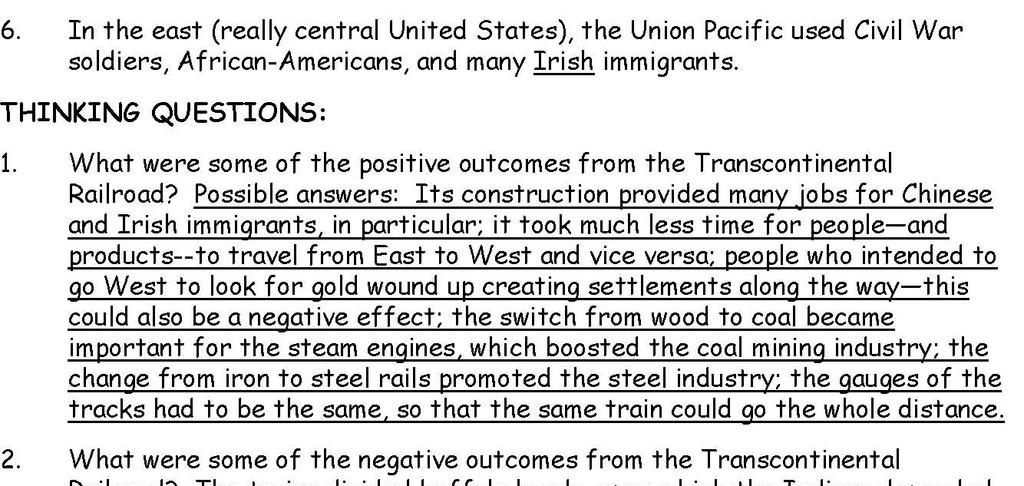
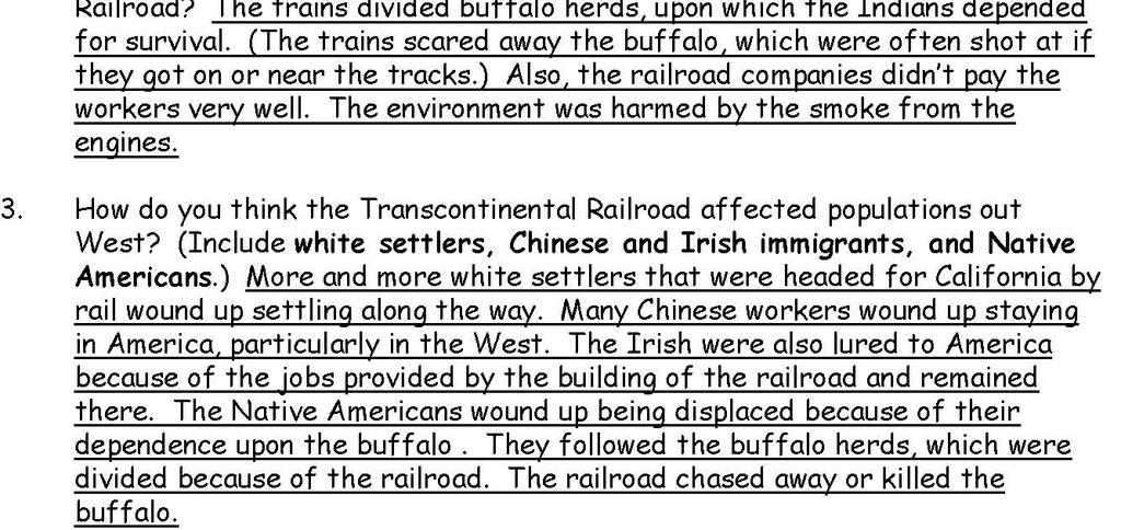
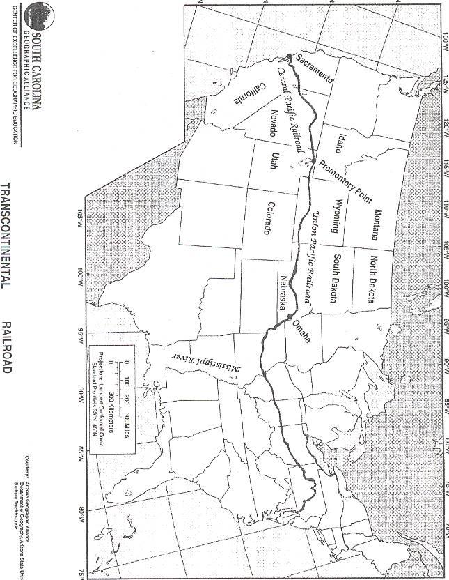
2 Objectives Students will be able (1) to plot the path of the Transcontinental Railroad, labeling key cities and railroad lines; and (2) explain its effect on populations of Native Americans, immigrants, and white settlers moving west. Suggested Procedures Introduce the lesson with the song, I ve Been Working on the Railroad, playing from The words to the music are displayed. Encourage the students to sing along. Explain to the class that they re going to learn about the Transcontinental Railroad, providing the meaning for trans (across)--in this case, a railroad that goes across the North American continent in America. Ask, Is it possible to have more than one transcontinental railroad? (Yes, a railroad that goes across any continent would be a transcontinental railroad.) Display the transparency of the map of S. C. railroads in 1860, a time shortly before the completion of America s Transcontinental Railroad. (Point this out.) Then, show the transparency of the map of S. C. railroads in 1925 to show the students how the rails spread out from the original tracks. Ask, What effect do you think the growth of the railroads had in S. C.? (Cities popped up along the rail routes.) Ask, Do you think that the railroads in the eastern United States grew the same way extensions from the old rail lines? (They may assume that these railroads just gradually extended toward the west, but that is not the case.) Show the transparency of the Transcontinental Railroad, pointing out that before 1865, settlement of non-native Americans stopped at the Mississippi River, except for in California. Ask, What event originally caused people to travel all the way to California to settle there, rather than settle along the way? (California Gold Rush of 1849) Remind them that a trek from Chicago, Illinois, to Sacramento, California, (or to Oregon), before the Transcontinental Railroad, took six months! Ask, Why do you think railroads were the most important business in 1860? (They could transport raw materials like iron-ore to steel-making plants or timber to furniture and papermaking manufactures as well as food and other finished products (products ready to sell to the public) so much more quickly. The faster industries could get products from one place to another, the faster they could make money.) Explain that the Transcontinental Railroad was actually two railroads that met in the middle, so that there would be railroad connections from the east coast to the west coast of the U. S. Ask, How is this action like a wedding? (The two rails joined to become one railway.) Pass out a handout of questions to each student. Tell students they are to answer the questions from a United Streaming clip on railroads: American Industrial Revolution, Railroads. (Ask your media specialist for a login and password. Although this clip is less than 3 minutes long, it can take much longer than that to download to play; therefore, it is suggested that this clip be downloaded and saved on your desktopprior to the lesson.) Play the clip more than once if necessary. Have students work in pairs or groups to compare answers on the first six questions and to complete the Thinking Questions.
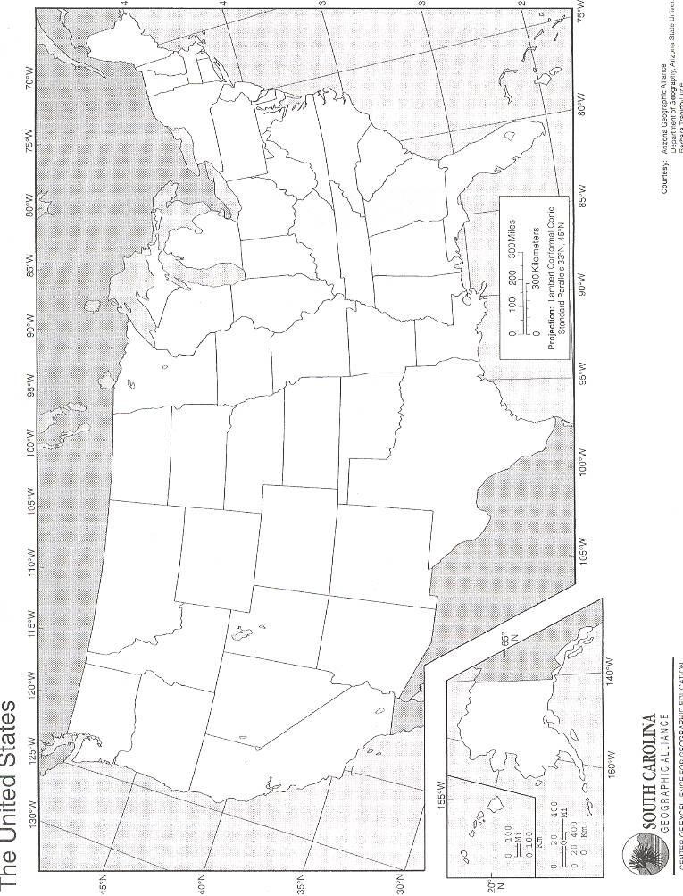
3 Review and/discuss the questions. (See key.) Describe how the workers from each railroad competed to see which group would get to Promontory first and that there was a special ceremony with a golden spike hammered in to attach the two rails. Display the transparency of the map of the Transcontinental Railroad again. Hand out outline maps of the United States to the students. Remind them that in 1854, there were no railroads west of the Mississippi River. Show them this river on the transparency and ask them to draw it in blue on their maps and label it. (They may prefer to use their text books or an atlas as a reference.) Tell them that nine new states across the heartland of America became a part of the Union after the completion of this railroad in 1869, but by Then ask, What do you think those states were? (Nebraska, North Dakota, South Dakota, Montana, Wyoming, Colorado, Idaho, Nevada, and Utah.) List these on the board. Ask them to use an atlas or their textbooks to locate and label these states and to color them yellow. Ask them to color California orange since it was already a state at the time this railroad was completed. Then, use the transparency to indicate the locations of Sacramento, California; Omaha, Nebraska; and Promontory, Utah. Ask them to put a dot for each and label them. Next, indicate the pre-existing Union Pacific line(s) in the East and ask them to draw it in pencil (railroad tracks as a symbol?). Show them the new Union Pacific rail and the Central Pacific line that joins it, and ask that they draw both. Ask them to label both new Central Pacific and Union Pacific Railroads and go over their tracks, each railroad company line in a different color. Remind them to make sure their map has a title, author, key/legend, and compass rose and that the key matches the map. Observe each group closely, making suggestions for corrections and/or additions until each map is accurate. Those that finish early should guide other students in completing their maps. As a summary and in preparation for the extension project, read aloud pages 4-13, From Sea to Shining Sea, from Oil, Steel, and Railroads. Tell the students that each pair or group is going to use the internet the following day to research a related topic. (See Extension Activity. ) Lesson Extensions 1. Have students search the internet for related topics and make a brochure or poster based upon their research to be presented and displayed after completion. The following are suggestions: train songs, Harvey Houses, railroad gauge, Irish or Chinese immigrants in the late 1860 s, Pullman cars, dining cars. Be flexible in considering other related topics. 2. Students could use an atlas to make a physical map of the West to discuss why the Transcontinental Railroad was located where it was. Suggested Evaluation This lesson will be assessed by observation with questions from their notes/study guide included in a unit test on the Industrial Revolution. With teacher guidance, students will devise a rubric for the pamphlets/brochure extension.
4 Materials Provided United States map with state boundaries (for students) U. S. map of Transcontinental Railroad (for transparency) Questions from the United Streaming video clip Resources South Carolina: An Atlas, Charles F. Kovacik and Theodore R. Steinke, ed., South Carolina Geographic Alliance, (ISBN: ) or (Words and music to I ve Been Working on the Railroad) American Industrial Revolution, Railroads video clip. (Get login and password from your media specialist.) Oil, Steel, and Railroads: America s Big Businesses in the Later 1800s, Jesse Janow, The Rosen Publishing Group, Inc., (ISBN: ) USA Studies Weekly, Series B, Vol. 4, Issue 1, First Quarter, Week 5 ( Industrial Revolution )
5
6
7
8
An Introduction to the South Carolina Atlas
 An Introduction to the South Carolina Atlas Daniel E. Stone Pinewood Preparatory School dstone@pinewoodprep.com Overview This lesson is designed to serve as an introduction to the new South Carolina Atlas.
From the Coastal Zone to the Piedmont on the Underground Railroad
 From the Coastal Zone to the Piedmont on the Underground Railroad Chyrl Curtis Kingsbury Elementary Sumter, SC curtisc@sumter17.k12.sc.us Overview This lesson is a part of a larger unit on the Underground
North American Geography. Lesson 2: My Country tis of Thee
 North American Geography Lesson 2: My Country tis of Thee Unit Overview: As students work through the activities in this unit they will be introduced to the United States in general, different regions
DRAWING YOUR CONTINENT
 CONTINENT PROJECT PART I On the attached sheet, you will draw your own continent. Use your creativity to create a continent that is uniquely your own. Give the continent a name. When you are finished with
Nebraska s Place in the World
 Geographic Educators of Nebraska Advocating geographic education for all Nebraskans Nebraska s Place in the World Students will use lines of latitude and longitude to locate cities within the state and
Standard Indicator That s the Latitude! Students will use latitude and longitude to locate places in Indiana and other parts of the world.
 Standard Indicator 4.3.1 That s the Latitude! Purpose Students will use latitude and longitude to locate places in Indiana and other parts of the world. Materials For the teacher: graph paper, globe showing
Saskatchewan s Early Trade Routes: The Impact of Geography on Trade
 Saskatchewan s Early Trade Routes: The Impact of Geography on Trade Lesson Overview In this lesson, students will compare and contrast prehistoric First Nations trade routes and trade goods with the routes
Many Ways to Name a Place
 Your web browser (Safari 7) is out of date. For more security, comfort and Activityapply the best experience on this site: Update your browser Ignore Many Ways to Name a Place What are the names for the
Following the Civil War, many Americans and Europeans continued to move into the WEST
 1860-1900 Following the Civil War, many Americans and Europeans continued to move into the WEST as far as the eye can see millions of acres of treeless grassland. Between the Mississippi River and the
Expanding Canada s Rail Network to Meet the Challenges of the Future
 Expanding Canada s Rail Network to Meet the Challenges of the Future Lesson Overview Rail may become a more popular mode of transportation in the future due to increased population, higher energy costs,
Your web browser (Safari 7) is out of date. For more security, comfort and the best experience on this site: Update your browser Ignore
 is out of date. For more security, comfort and the best experience on this site: Update your browser Ignore") Your web browser (Safari 7) is out of date. For more security, comfort and the best experience on this site: Update your browser Ignore Educator Version TRACKING GRO W TH IN THE U.S. Late 19th century
Your web browser (Safari 7) is out of date. For more security, comfort and the best experience on this site: Update your browser Ignore Educator Version TRACKING GRO W TH IN THE U.S. Late 19th century
South Carolina Trails and Tales of the American Revolution
 South Carolina Trails and Tales of the American Revolution Christopher Bailey West Ashley Middle School Cbailey359@aol.com Overview This lesson is designed to help students gain a better understanding
Crossing the Atlantic: Then and Now
 Your web browser (Safari 7) is out of date. For more security, comfort and Activitydevelop the best experience on this site: Update your browser Ignore Crossing the Atlantic: Then and Now How has the amount
How Irrigation Affected the Geography of Northeast Oregon
 Delia Wallis How Irrigation Affected the Geography of Northeast Oregon Grade Levels: 4 (with ability to move up or down) Time: two x 45-minute sessions Overview: Students are going to study topographical
Your web browser (Safari 7) is out of date. For more security, comfort and. the best experience on this site: Update your browser Ignore
 is out of date. For more security, comfort and. the best experience on this site: Update your browser Ignore") Your web browser (Safari 7) is out of date. For more security, comfort and Activityengage the best experience on this site: Update your browser Ignore Comparing Historical Maps How can historical maps
Your web browser (Safari 7) is out of date. For more security, comfort and Activityengage the best experience on this site: Update your browser Ignore Comparing Historical Maps How can historical maps
Essential Questions What are the major physical components of the world, and how are they represented on a map? 3.4
 Third Grade Social Studies Unit One Six Weeks GEOGRAPHY Originally compiled by Russellville In order for students to understand that geography influences the development of a region as well as the interactions
The Santee Project: A Detour to Success
 The Santee Project: A Detour to Success Overview Students will be introduced to the Old Santee Canal and the Santee Cooper Project. They will become familiar with the two topics, map specific locations,
THE YELLOW ROSE OF TEXAS
 THE YELLOW ROSE OF TEXAS Kirstin Schulz Eunice Smith 2400 N Henry Alton IL 62002 Promoting Geographic Knowledge Through Literature Workshop July 7-19, 2002 Preview of Main Ideas Texas is a world unto itself.
2275 Speedway, Mail Code C9000 Austin, TX (512) Weather and Climate
 Weather and Climate") Lesson Plan for Grades: Middle School Length of Lesson: 90 minutes Authored by: UT Environmental Science Institute Date created: 05/10/2017 Subject area/course: Mathematics Materials: Fun size bags of
Lesson Plan for Grades: Middle School Length of Lesson: 90 minutes Authored by: UT Environmental Science Institute Date created: 05/10/2017 Subject area/course: Mathematics Materials: Fun size bags of
A. Geography Students know the location of places, geographic features, and patterns of the environment.
 Learning Targets Elementary Social Studies Grade 5 2014-2015 A. Geography Students know the location of places, geographic features, and patterns of the environment. A.5.1. A.5.2. A.5.3. A.5.4. Label North
Class 4J Autumn Term St. Lucia Adapted from QCA Geography Unit 10 incorporating some elements of Unit 25
 Class 4J Autumn Term 2002 Geography St. Lucia Geography Unit 10 incorporating some elements of Unit 25 ABOUT THE UNIT In this unit children develop ideas about a less economically developed country. When
Map Skills Lesson 1. Materials: maps, pencils, Lesson 1 Worksheet, strips of paper, grid paper
 Map Skills Lesson 1 Use cardinal directions, map grids, scales, and titles to locate places on a map. Interpret a map using information from its title, compass rose, scale, and legend. Vocabulary: map,
European Migration to Tilting, Newfoundland
 European Migration to Tilting, Newfoundland Lesson Overview In this lesson, students will learn about historical connections between Tilting, Newfoundland and Labrador, and Ireland. Using the Canadian
Touring Around the Islands of Atlantic Canada
 Lesson Overview Touring Around the Islands of Atlantic Canada In this lesson, students will examine the history and heritage of the islands of Atlantic Canada and examine their similarities and differences.
Maryland Council on Economic Education 1
 How to Make an Apple Pie and See the World by Marjorie Priceman (Dragonfly Books, New York, 1994) ISBN 0-679-88083-6 Literature Annotation: This beautifully illustrated story is about a girl baker who
Ganado Unified School District (Social Studies/1 st Grade)
") Ganado Unified School District (/1 st Grade) PACING Guide SY 2016-17 1 st Quarter (11 Performance Objectives) Strand 1: American History, Strand 2: World History, Strand 3: Civics/Government, Strand 4:
Ganado Unified School District (/1 st Grade) PACING Guide SY 2016-17 1 st Quarter (11 Performance Objectives) Strand 1: American History, Strand 2: World History, Strand 3: Civics/Government, Strand 4:
LOUISIANA STUDENT STANDARDS FOR SOCIAL STUDIES THAT CORRELATE WITH A FIELD TRIP TO DESTREHAN PLANTATION KINDERGARTEN
 LOUISIANA STUDENT STANDARDS FOR SOCIAL STUDIES THAT CORRELATE WITH A FIELD TRIP TO DESTREHAN PLANTATION KINDERGARTEN Standard 2 Historical Thinking Skills Students distinguish between events, people, and
Why Do We Live Here? : A Historical Geographical Study of La Tabatiere, Quebec North Shore
 Why Do We Live Here? : A Historical Geographical Study of La Tabatiere, Quebec North Shore Lesson Overview Many communities and their occupants have historical connections to exploration routes and traditional
name and locate the world s seven continents and five oceans
 Subject: Geography Activities National Curriculum Objectives One Progression of Skills Name the 7 continents and 5 oceans 3D Jigsaw task to locate continents and seas name and locate the world s seven
Subject: Geography Scheme of Work: B1 to B6 Mastery tiles. Term: Autumn/Spring/Summer
 Subject: Geography Scheme of Work: B1 to B6 Mastery tiles Term: Autumn/Spring/Summer Topic / Unit(s) Overview / Context Introduction to geography. An introduction to geography including basic map skills
Geography Curriculum Overview
 Geography Curriculum Overview 2016-2017 Suggest one topic a year for each year group based on another city/country or possible local. Suggested ideas for some year groups have been put in as they will
Science Grade 01 Unit 07 Exemplar Lesson 02: Investigating the Moon, the Stars, and the Sky
 Grade 1 Unit: 07 Lesson: 02 Suggested Duration: 5 days Grade 01 Unit 07 Exemplar Lesson 02: Investigating the Moon, the Stars, and the Sky This lesson is one approach to teaching the State Standards associated
Grade 7 Mathematics Test Booklet
 Student Name P Grade Test Booklet Practice Test TEST BOOKLET SECURITY BARCODE Unit 1 Unit 1 Directions: Today, you will take Unit 1 of the Grade Practice Test. Unit 1 has two sections. In the first section,
World Geography. Teacher s Guide
 World Geography Teacher s Guide WALCH PUBLISHING Table of Contents To the Teacher.......................................................... vi Classroom Management.................................................
MEADOWS PRIMARY SCHOOL and NURSERY GEOGRAPHY POLICY
 MEADOWS PRIMARY SCHOOL and NURSERY GEOGRAPHY POLICY Purpose of study The teaching of Geography at Meadows is done by following the 2014 National Curriculum. The planning and teaching of the subject aims
Mapping Data 1: Constructing a Choropleth Map
 Mapping Data 1: Constructing a Choropleth Map OVERVIEW & OBJECTIVES Students will become acquainted with mapping data and understanding the importance of recognizing patterns by constructing a choropleth
Willmar Public Schools Curriculum Map
 Subject Area Grade First Grade Date June 2005, reviewed June 2009 Unit Content Standards Addressed Skills/Benchmarks Essential Questions Assessments Unit 1 Here We Are and Our Class Our School Our Families
About places and/or important events Landmarks Maps How the land is, hills or flat or mountain range Connected to maps World Different countries
 What do you think you know about geography? About places and/or important events Landmarks Maps How the land is, hills or flat or mountain range Connected to maps World Different countries What do you
Using Geography to Plan Civil War Campsites
 Jake Gordon Civil War Campsite Mapping Lesson Plan pg1 Using Geography to Plan Civil War Campsites Overview: This lesson is designed for an 8 th grade social studies class during the Civil War unit. Students
Year 34 B2 Geography - Continents and Oceans 2018 Key Skills to be covered: Taken from Level 3 Taken from Level 4
 Key Skills to be covered: Taken from Level 3 Taken from Level 4 Geographical Enquiry: I ask, Which PHYSICAL features does this place have? I ask, Which HUMAN features does this place have? I give reasons
UNIT PLAN. Big Idea/Theme: In the seventeenth and eighteenth centuries, European expansion impacted societies worldwide.
 UNIT PLAN Grade Level: Unit # 1 Unit Name: Colonial Expansion 7 th Big Idea/Theme: In the seventeenth and eighteenth centuries, European expansion impacted societies worldwide. Culminating Assessment:
Atoms. Grade Level: 4 6. Teacher Guidelines pages 1 2 Instructional Pages pages 3 5 Activity Pages pages 6 7 Homework Page page 8 Answer Key page 9
 Atoms Grade Level: 4 6 Teacher Guidelines pages 1 2 Instructional Pages pages 3 5 Activity Pages pages 6 7 Homework Page page 8 Answer Key page 9 Classroom Procedure: 1. Display the different items collected
Digging into the Past Pre-Visit Materials
 Digging into the Past Pre-Visit Materials Pre-Visit Activities Howard B. Owens Science Center Digging into the Past Pre-Visit The Pre-visit activities are linked to the pre-requisite skills and knowledge
Too Close for Comfort
 Too Close for Comfort Overview South Carolina consists of urban, suburban, and rural communities. Students will utilize maps to label and describe the different land use classifications. Connection to
The Physical Geographical Change of the Great Plains during the Dust Bowl (1930 s)
") The Physical Geographical Change of the Great Plains during the Dust Bowl (1930 s) Overview: This lesson shows how the Dust Bowl climate changed the physical geography of the Great Plains and forced the
The Physical Geographical Change of the Great Plains during the Dust Bowl (1930 s) Overview: This lesson shows how the Dust Bowl climate changed the physical geography of the Great Plains and forced the
Preview: Making a Mental Map of the Region
 Preview: Making a Mental Map of the Region Draw an outline map of Canada and the United States on the next page or on a separate sheet of paper. Add a compass rose to your map, showing where north, south,
Sample Pages. Free Newsletter Sign up Today! Learn Through Experience
 Learn Through Experience Sample Pages Sample pages from this product are provided for evaluation purposes. The entire product is available for purchase at www.socialstudies.com or www.teachinteract.com
Giant Traveling Map Lesson
 Giant Traveling Map Lesson TITLE / AUTHOR: Idahoans on the Move / Rebecca Theobald IDAHO ACADEMIC STANDARDS / SUITABLE DISCIPLINES: OBJECTIVES: Students will: Learn about major cities in Idaho during three
Chapter 9: Equations and Inequalities
 Chapter 9: Equations and Inequalities Lesson Objectives Class Periods Tetbook & Workbook Teacher's Guide Page Additional Materials Needed Determine whether a given number makes an equation true. TB: 28
Elementary Social Studies Content Area Assessment Task. Winter 2010 EDUC 203
 1 Elementary Social Studies Content Area Assessment Task Winter 2010 EDUC 203 Students: Fourth grade class in Watsonville, CA. Approximately 90% Latino, primarily of Mexicandescent. About 80% participate
Molecules and Matter. Grade Level: 4 6
 Molecules and Matter Grade Level: 4 6 Teacher Guidelines pages 1 2 Instructional Pages pages 3 4 Partner Project page 5 Crossword Puzzle page 6 Answer Key page 7 Classroom Procedure 1. Without introduction,
Rock Study and Identification in the Field Study
 Lauren Collins Rock Study and Identification in the Field Study Overview: In this lesson students will use previous knowledge of different kinds of rocks and will travel to an outdoor environment where
Name: Date: Period: #: Chapter 1: Outline Notes What Does a Historian Do?
 Name: Date: Period: #: Chapter 1: Outline Notes What Does a Historian Do? Lesson 1.1 What is History? I. Why Study History? A. History is the study of the of the past. History considers both the way things
Environmental Systems (b) Introduction.
 Introduction.") Dinh 1 Evolution/Extinction Name(s): Dahlia Dinh Title of lesson: Evolution/Extinction Date of lesson: Spring 2010 Length of lesson: 50-90 minutes Description of the class: Name of course: Biology Grade
Dinh 1 Evolution/Extinction Name(s): Dahlia Dinh Title of lesson: Evolution/Extinction Date of lesson: Spring 2010 Length of lesson: 50-90 minutes Description of the class: Name of course: Biology Grade
Critical Thinking. about. GeoGRAPHY. United States, Canada, and Greenland. Jayne Freeman
 Critical Thinking about GeoGRAPHY United States, Canada, and Greenland Jayne Freeman WALCH EDUCATION Contents Introduction............................................................... v National Geography
ST AMBROSE CATHOLIC PRIMARY SCHOOL Geography Policy
 ST AMBROSE CATHOLIC PRIMARY SCHOOL Geography Policy 2017-2018 Our school policy is developed in accordance with the National Curriculum for Geography and Foundation Stage Curriculum for Understanding of
Houghton Mifflin Harcourt People We Know Minnesota Academic Standards in Social Studies, Grade 2
 Houghton Mifflin Harcourt People We Know 2012 correlated to the Minnesota Academic in Social Studies, Grade 2 Grade 2 2.1 Citizenship and Government 2.1.1 Civic Skills 2.1.1.1 Democratic government depends
Your web browser (Safari 7) is out of date. For more security, comfort and. the best experience on this site: Update your browser Ignore
 is out of date. For more security, comfort and. the best experience on this site: Update your browser Ignore") Your web browser (Safari 7) is out of date. For more security, comfort and lesson the best experience on this site: Update your browser Ignore Political Borders Why are the borders of countries located
Your web browser (Safari 7) is out of date. For more security, comfort and lesson the best experience on this site: Update your browser Ignore Political Borders Why are the borders of countries located
Sample file. Teacher Guide ... Before You Teach. Our resource has been created for ease of use by both TEACHERS and STUDENTS alike.
 8 7 9 10 12 13 14 11 Introduction T his resource provides ready-to-use information and activities for remedial students in grades five to eight. Written to grade and using simplified language and vocabulary,
ATheme. Capital Connections. Claudia Crump, Workshop Consultant Indiana University, Southeast
 CAPITAL CONNECTIONS Capital Connections ATheme Claudia Crump, Workshop Consultant Indiana University, Southeast PURPOSE To review basic geographic understandings and skills on location and terminology;
Unit 1: Geography. For additional information, refer to this website: 1 G e o g r a p h y
 Unit 1: Geography For additional information, refer to this website: http://mryoungtms.weebly.com/ 1 G e o g r a p h y Continents and Oceans SOL USI. 2a Essential Understanding: Continents are large land
x On record with the USOE.
 Textbook Alignment to the Utah Core 3 rd Grade Social Studies This alignment has been completed using an Independent Alignment Vendor from the USOE approved list (www.schools.utah.gov/curr/imc/indvendor.html.)
Mapping Diversity in Old and New Netherland
 Your web browser (Safari 7) is out of date. For more security, comfort and Activityengage the best experience on this site: Update your browser Ignore Mapping Diversity in Old and New Netherland How did
Progression of skills in Geography
 New Curriculum Holy Trinity CE Primary Academy 2013-14 Subject: Geography Skills: Progression of skills in Geography Geographical enquiry Teacher led enquiries, to ask and respond to simple closed questions.
In this activity, students will make a classroom weather report chart and record data for four weeks.
 Weather Report Chart s Overview: In this activity, students will make a classroom weather report chart and record data for four weeks. Objectives: The student will: measure temperature, precipitation,
2011, 1998, 1987 Copyright by Remedia Publications, Inc. All Rights Reserved. Printed in the U.S.A.
 See the world REM 129A A Teaching Resource From 2011, 1998, 1987 Copyright by Remedia Publications, Inc. All Rights Reserved. Printed in the U.S.A. The purchase of this product entitles the individual
Introduction to Contour Maps
 Your web browser (Safari 7) is out of date. For more security, comfort and Activityengage the best experience on this site: Update your browser Ignore Introduction to Contour Maps What information does
Large-scale Human Developments and Affects on the Ocean
 Large-scale Human Developments and Affects on the Ocean Lesson Overview: The lesson investigates the impact of man-made structures such as theme parks, aquatic parks, urban areas and their resulting affects
Measuring Keepers S E S S I O N 1. 5 A
 S E S S I O N 1. 5 A Measuring Keepers Math Focus Points Naming, notating, and telling time to the hour on a digital and an analog clock Understanding the meaning of at least in the context of linear measurement
Lesson 8: Representing Proportional Relationships with Equations
 Lesson 8: Representing Proportional Relationships with Equations Student Outcomes Students use the constant of proportionality to represent proportional relationships by equations in real world contexts
Augusta Canal National Heritage Area 8 Grade Lesson Plans. Stage 1 Desired Results
 Title: Falling into Place Stage 1 Desired Results Subject/Course: Grade: 8th Instructional Time: 10 hrs. Big Ideas: Geographic Regions, The Fall Line and Early Settlements, Rivers and Water Power, The
Grade Four Content Overview
 Grade Four Content Overview Physical features Regions Contributions of the states Our Country: Geography and Regions Coastal and inland communities Famous landmarks Physical and human characteristics Local,
My Map Activity MINNESOTA SOCIAL STUDIES STANDARDS & BENCHMARKS
 My Map Activity OVERVIEW & OBJECTIVES Students will learn the basics of Google Maps while using geospatial data to create their neighborhood map with the places they spend time. They will also collect
MARS AREA SCHOOL DISTRICT CURRICULUM GRADE: Grade 4
 MARS AREA SCHOOL DISTRICT CURRICULUM GRADE: Grade 4 Course Title: Social Studies Brief Description Overview: Students will explore the history, geography, government, and economy of the United States with
locate the world s countries, using maps to focus on Europe (including the location of
 Year 3 and 4 Geography study- Autumn 2 2017 National curriculum: Locational knowledge locate the world s countries, using maps to focus on Europe (including the location of Russia) and North and South
Your web browser (Safari 7) is out of date. For more security, comfort and the best experience on this site: Update your browser Ignore
 is out of date. For more security, comfort and the best experience on this site: Update your browser Ignore") Your web browser (Safari 7) is out of date. For more security, comfort and the best experience on this site: Update your browser Ignore Activitydevelop TRADE IN THE 1600S What did Native Americans and
Your web browser (Safari 7) is out of date. For more security, comfort and the best experience on this site: Update your browser Ignore Activitydevelop TRADE IN THE 1600S What did Native Americans and
Discovering Math Concepts in Advanced Algebra Teacher s Guide
 Discovering Math Concepts in Advanced Algebra Teacher s Guide Grade Level: 10 12 Curriculum Focus: Mathematics Lesson Duration: Three class periods Program Description Concepts in Advanced Algebra Calculate
Grade 3 Social Studies
 Grade 3 Social Studies Social Studies Grade(s) 3rd Course Overview Students will learn about a variety of communities. Students will learn about the geography and resources of communities. Students will
Your web browser (Safari 7) is out of date. For more security, comfort and. the best experience on this site: Update your browser Ignore
 is out of date. For more security, comfort and. the best experience on this site: Update your browser Ignore") Your web browser (Safari 7) is out of date. For more security, comfort and Activitydevelop the best experience on this site: Update your browser Ignore Places in the Park Why do we use symbols? Overview
Your web browser (Safari 7) is out of date. For more security, comfort and Activitydevelop the best experience on this site: Update your browser Ignore Places in the Park Why do we use symbols? Overview
Grade 4-Social Studies Sparta Area School District
 1 Grade 4-Social Studies Sparta Area School District A.4.1 Use reference points, latitude and longitude, direction, size, shape, and scale to locate positions on various representations of the Earth s
Canadian Explorers. Learning object La Vérendyre map
 Canadian Explorers Learning object La Vérendyre map Lesson overview Students will be inspired by La Vérendyre to become explorers themselves. Students will embark on a research expedition to discover the
A Correlation of. Pearson myworld Social Studies We Are Connected to the
 A Correlation of Pearson myworld Social Studies We Are Connected 2013 Standard 2-1: The student will demonstrate an understanding of the local community as well as the fact that geography influences not
Simple Solutions Social Studies Level 2. Level 2. Social Studies. Help Pages
 Level 2 Social Studies 147 148 adobe houses with bricks made of clay and straw ancestor a family member who lived before us appoint choose; leaders can appoint others barter trading one thing for another
Lesson Title: Then and Now: How Society Alters Topography and Vegetation
 Lesson Title: Then and Now: How Society Alters Topography and Vegetation Lesson Author: Rodney Collins (rwcollins@lf.k12.de.us) Lesson Description: This lesson is a comparative study in which students
Investigating Similar Triangles and Understanding Proportionality: Lesson Plan
 Investigating Similar Triangles and Understanding Proportionality: Lesson Plan Purpose of the lesson: This lesson is designed to help students to discover the properties of similar triangles. They will
a division of Teacher Created Materials
 Sample Pages from a division of Teacher Created Materials Thanks for checking us out. Please call us at 877-777-3450 with questions or feedback, or to order this product. You can also order this product
North America ATLANTIC OCEAN PACIFIC OCEAN. The First Americans. Labrador Sea. Caribbean Sea. USI_ISN_U01_01.eps. Second Proof TCI19 65.
 G e o g r a p h y C h a l l e n g e North America 70 N 180 N 60 170 W 30 W 160 W 40 W Labrador Sea 150 W 50 N 50 W Hud s on B ay 140 W 40 N 60 W ATLANTIC OCEAN 30 N PACIFIC OCEAN Gulf of Mexico 20 N 130
Mapping Earth. How are Earth s surface features measured and modeled?
 Name Mapping Earth How are Earth s surface features measured and modeled? Before You Read Before you read the chapter, think about what you know about maps Record your thoughts in the first column Pair
Stillwater Area Schools Curriculum Guide for Elementary Social Studies
 Stillwater Area Schools Curriculum Guide for Elementary Social Studies Grade Four Draft March 21, 2006 Minnesota and the St. Croix Valley I. Historical Skills A. The student will acquire skills of chronological
Lesson 3 Mixtures and Solutions
 Lesson 3 Mixtures and Solutions Who This lesson is designed for fifth graders ranging in age from nine to eleven. What This lesson is part of the Physical Science Unit of Instruction and based on California
Geography and the Early Settlement of China
 Geography and the Early Settlement of I N T E R A C T I V E S T U D E N T N O T E B O O K How did geography affect life in ancient? P R E V I E W Physical Features 1. Circle the physical features that
Social Studies (4) Social Science
 Social Science") Scope And Sequence Timeframe Unit Instructional Topics 8 Day(s) Course Overview Students will learn about the regions of the United States with emphasis on local and state history, geography, government,
Scope And Sequence Timeframe Unit Instructional Topics 8 Day(s) Course Overview Students will learn about the regions of the United States with emphasis on local and state history, geography, government,
1-2. Level. Author JoBea Holt. Ph.D.
 1-2 Level Author JoBea Holt. Ph.D. Table of Contents Introduction Research and Introduction....... 4 Overview of Google Earth........ 6 How to Use This Book........... 8 Google Earth Reference Window..
GEOGRAPHY POLICY STATEMENT. The study of geography helps our pupils to make sense of the world around them.
 GEOGRAPHY POLICY STATEMENT We believe that the study of geography is concerned with people, place, space and the environment and explores the relationships between the earth and its peoples. The study
Grade 5 Lesson 3. Lesson Plan Page 2. Page 6. Student Activity Handout 1 Map Practice. Student Activity Handout 2 Marlins Park Maps.
 Grade 5 Lesson 3 Item Page Lesson Plan Page 2 Student Activity Handout 1 Map Practice Page 6 Student Activity Handout 2 Marlins Park Maps Page 10 DETERMINING METHODS VISION-SETTING Marlins Think Tank:
Lesson title: Scavenger Hunt for Lengths. Grade level: 6-8. Subject area: Mathematics. Duration: Two class periods
 Lesson title: Scavenger Hunt for Lengths Grade level: 6-8 Subject area: Mathematics Duration: Two class periods Objectives: Students will understand how to measure and estimate lengths; understand the
Historical Fisheries off the Grand Banks (Wet and Dry Fisheries)
") Lesson Overview Historical Fisheries off the Grand Banks (Wet and Dry Fisheries) The French conducted the earliest trans-atlantic fishery with the Portuguese fishermen, soon joined by Basques, who took
Lesson Overview Historical Fisheries off the Grand Banks (Wet and Dry Fisheries) The French conducted the earliest trans-atlantic fishery with the Portuguese fishermen, soon joined by Basques, who took
Underground Railroad Grades 6-8. Time Frame: 1-3 class periods, depending on the extent of outside research
 Underground Railroad Grades 6-8 Introduction This activity is intended for students who have already learned about slavery and are currently studying the Underground Railroad. They ll compare a map of
Anoka Hennepin K 12 Curriculum Unit Plan
 Anoka Hennepin K 12 Curriculum Unit Plan Department: Social Studies Grade Level: 4 Unit Title: Geographic Investigations Trimester: 2 and 3 (16) 55 minute lessons (can be (32) 25 minute lessons) Unit Summary:
THE SUN, THE MOON AND OUR SOLAR SYSTEM TEACHER NOTES TO SHARE WITH STUDENTS
 THE SUN, THE MOON AND OUR SOLAR SYSTEM TEACHER NOTES TO SHARE WITH STUDENTS The Sun is the biggest feature in our solar system. It is the largest object and contains approximately 98% of the total solar