Update on INSPIRE; interoperable framework for natural hazards
|
|
|
- Phebe Preston
- 5 years ago
- Views:
Transcription


1 Update on INSPIRE; interoperable framework for natural hazards Robert Tomas EC-DG Joint Research Centre 16 th Meeting of Working Group F on Floods 2014, Rome Serving society Stimulating innovation Supporting legislation
2 Update on INSPIRE Development of the INSPIRE legal/technical framework (Implementing Rules / Technical Guidelines) finished end of 2013 The real MS implementation (Annex II and III data themes) of INSPIRE requirements in full speed (till 2020 ). INSPIRE Maintenance and Implementation Framework established and the working programme endorsed INSPIRE Interim policy evaluation public consultation, the Joint EEA-JRC evaluation report (soon to be published - Nov. 2014) + DG ENV Communication/report to the European Parliament (beginning of 2015) INSPIRE evolution/use in environmental thematic domains (also non env.) interoperability thematic pilots


3 Why Europe needs spatial data infrastructure? 2014 Taranaki Regional Council 2014 College of Architecture, Texas A&M University U.S. Department of the Interior U.S. Geological Survey 2014 Die Welt natural disasters no country borders!!

4 Status 10 years ago Important obstacles related to use of geospatial data* Spatial data is often missing or incomplete The description of available spatial data is often incomplete Spatial datasets can often not be combined with other spatial datasets The system to find, access and use spatial data often function in isolation only and are not compatible which each other. Cultural, institutional, financial and legal barriers prevent or delay the sharing and re-use of existing data. *Agreement of 97 % of participants public consultation % of all fresh water bodies in Europe are part of a trans-boundary river basin!!

5 And the current situation is: Have the initial problems evolved? Joint EEA&JRC INSPIRE midterm evaluation report

6 And the current situation is: Are the initial INSPIRE objectives relevant to Joint EEA&JRC INSPIRE midterm evaluation report

7 We are here Why the INSPIRE Maintenance and Implementation Framework? Support MS in implementation

8 Why the MIF? Maintain 6 legal acts and 40+ Technical Guidelines


9 Why the MIF? Develop and maintain central infrastructure components and tools
10 The INSPIRE evolution and relationship with other policies Technical support for the understanding, use and mapping of INSPIRE requirements with other domains legislations To streamline data requirements (e.g. INSPIRE x ereporting) do once, use many times!! To facilitate cross domain interoperability (harmonised approaches, common technical solutions, semantic harmonisation etc..) To fulfill the main INSPIRE objective = to support environmental policy making
11 INSPIRE interoperability tests/pilots - environmental domain Air Quality pilot: successful past activity see more: Marine pilot: to help MS with implementation of MSFD and INSPIRE in harmonised way (Article 19 of MSFD). = status running, now Call for expression of interest for domain experts as well as organizations Industrial Emissions Directive 2010/75/EU (IED) / European Pollutant Release and Transfer Register (E-PRTR) Regulation 166/2006 with DG ENV C3. = status pre-pilot activities
12 Pilots outside the environmental acquis: Transportation pilot of EULF (sharing data between public road authorities & private sector): (DG Move, JRC) ITS x INSPIRE directives data harmonisation initiated and running Energy performance of buildings, Energy Efficiency, Renewable energy Directives & INSPIRE; Covenant of Mayors, EULF: pre-pilot study under preparation Minerals4EU INSPIRE x EU knowledge base on raw materials (primary, secondary) EU FP7 Project http://
13 INSPIRE x WFD data requirements harmonisation Participants: DG ENV, DG JRC, EEA, Atkins, Con Terra (+ invited experts) Scope of the Stage1: detail mapping of the updated WFD reporting obligations with two INSPIRE data themes (Area Management, regulation and restriction zones; Environmental Monitoring Facilities (without monitoring measurements)- current status Stage 2 - thematic data inclusion GW bodies, SW bodies, monitoring data+ other INSPIRE components e.g. MD, NT service) Stage 3 - real demonstration application with selected MSs data in a cross border area.
14 INSPIRE x WFD data requirements harmonisation test Outcomes of the stage 1: Capacity building breaking domain barriers Detail mapping of all attributes and their better understanding (terminology) Already some proposals for some additions to the updated WFD reporting sheets Summarizing report with all mappings and proposals for solutions Willingness to continue to cover all relevant INSPIRE themes + components real demonstration application
15 INSPIRE x Floods Directive Provides useful relevant data for FHRMs (e.g. elevation, hydrography, topography, land use, land cover, geomorphology, hydrogeology exposed elements population, buildings, facilities etc..) Provides interoperable framework for sharing of different types of natural hazard data The FHRM information will be better used by other communities Sustainability + support for innovative applications/services
16 Key pillars of natural hazard (NH) interoperability framework Common NH terminology framework Based on international standards (UNISDR 2009) Cross-domain applicability (floods, forest fires, etc.) Based on a common data sets holdings Clear and unambiguous to implement Common data model for NH Min. set of features for NH data interoperability Domain extensibility Covers both spatial data representations Utilizes common types from INSPIRE GCM Common NH assessments models To harmonize the way of expressing level or intensity, likelihood of occurrence, vulnerability To allow for qualitative and quantitative assessment Contextual information required Common NH extensible classifications For type of natural hazards and category of exposed elements To facilitate comparability and interoperability of data sets Allow also more specific NH types from local vocabularies


17 Common model for qualitative and quantitative NH assessments
 for civil protection in natural hazard scenarious")


18 Real tests (EU projects) of the NH infrastructure Picrit cross border (IT/FR) for civil protection in natural hazard scenarious eenvplus - eenvironmental services for advanced applications within INSPIRE Fortress foresight tools for responding to cascading effects in a crisis - new!! InGeoCloudS - INspired GEOdata CLOUD Services Implementation of INSPIRE in EU MSs from December 2013
19 Conclusions INSPIRE implementation is on its way. Major benefits of the infrastructure only when fully & wisely implemented(e.g. addressing thematic communities / EC needs). The positive outcome of the INSPIRE x WFD data harmonisation activity can be applied for the FHRM reporting (not starting from 0 ) draft of the FHRM INSPIRE extension in the INSPIRE Natural Risk Zones data specification (see Annex D) The Interoperable Framework (IF) for Natural hazards developed during the INSPIRE data specifications work (published on 10/ ) facilitates the comparability of NH data and thus support more complex multi hazard/risk scenarios

20 Thank you for your attention. Robert Tomas, PhD EC&EEA INSPIRE Coordination Team Do not miss the INSPIRE Conference Lisbon, Portugal

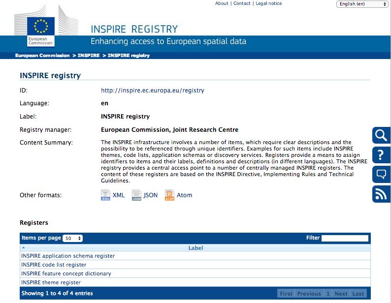
21 More information INSPIRE INSPIRE GeoPortal INSPIRE Registry INSPIRE data specifications Overview Data models atamodels Schemas
INSPIRE - A Legal framework for environmental and land administration data in Europe
 INSPIRE - A Legal framework for environmental and land administration data in Europe Dr. Markus Seifert Bavarian Administration for Surveying and Cadastre Head of the SDI Office Bavaria Delegate of Germany
INSPIRE Basics. Vlado Cetl European Commission Joint Research Centre. https://ec.europa.eu/jrc/
 INSPIRE Basics Vlado Cetl European Commission Joint Research Centre https://ec.europa.eu/jrc/ Serving society Stimulating innovation Supporting legislation Outline SDI? Why European SDI? INSPIRE Policy
INSPIREd solutions for Air Quality problems Alexander Kotsev
 INSPIREd solutions for Air Quality problems Alexander Kotsev www.jrc.ec.europa.eu Serving society Stimulating innovation Supporting legislation The European data puzzle The European data puzzle 24 official
European Directive (2007/2/EC) INSPIRE sharing data in an interoperable way
 INSPIRE sharing data in an interoperable way") European Directive (2007/2/EC) INSPIRE sharing data in an interoperable way Robert Tomas 7 th European Conference on Regional Geoscientific Cartography and Information Systems Bologna, 12 th -15 th June
European Directive (2007/2/EC) INSPIRE sharing data in an interoperable way Robert Tomas 7 th European Conference on Regional Geoscientific Cartography and Information Systems Bologna, 12 th -15 th June
Proposal for a DIRECTIVE OF THE EUROPEAN PARLIAMENT AND OF THE COUNCIL. establishing an infrastructure for spatial information in the Community
 Proposal for a DIRECTIVE OF THE EUROPEAN PARLIAMENT AND OF THE COUNCIL establishing an infrastructure for spatial information in the Community INSPIRE http://inspire.jrc.it/ Alessandro Annoni 1 EU Commission
Status of implementation of the INSPIRE Directive 2016 Country Fiches. COUNTRY FICHE Czech Republic
 Status of implementation of the INSPIRE Directive 2016 Country Fiches COUNTRY FICHE Czech Republic Introduction... 1 1. State of Play... 2 1.1 Coordination... 2 1.2 Functioning and coordination of the
Geological information for Europe : Towards a pan-european Geological Data Infrastructure
 Geological information for Europe : Towards a pan-european Geological Data Infrastructure Integrating geoscientific information for EU competitiveness Co-funded by the European Union European societal
Infrastructure for Spatial Information in Europe (INSPIRE)
") Infrastructure for Spatial Information in Europe (INSPIRE) 2011 GISCO Working Party 8-9.3.2012 INSPIRE is about improving access to spatial information: the environment doesn t stop at borders EU Geoportal
Infrastructure for Spatial Information in Europe (INSPIRE) 2011 GISCO Working Party 8-9.3.2012 INSPIRE is about improving access to spatial information: the environment doesn t stop at borders EU Geoportal
Infrastructure for Spatial Information in Europe (INSPIRE) Steve Peedell
 Steve Peedell") Infrastructure for Spatial Information in Europe (INSPIRE) Steve Peedell European Commission DG Joint Research Centre Institute for Environment and Sustainability ESDI Action Overview JRC, European Commission
Infrastructure for Spatial Information in Europe (INSPIRE) Steve Peedell European Commission DG Joint Research Centre Institute for Environment and Sustainability ESDI Action Overview JRC, European Commission
Roadmap to interoperability of geoinformation
 Roadmap to interoperability of geoinformation and services in Europe Paul Smits, Alessandro Annoni European Commission Joint Research Centre Institute for Environment and Sustainability paul.smits@jrc.it
INSPIRE Directive. Status June 2007
 INSPIRE Directive INfrastructure for SPatial InfoRmation in Europe Status June 2007 European Commission Directorate-General Environment Research, Science and Innovation Unit Rue de la Loi, 200 1049 Brussels
Plan4all (econtentplus project)
") Plan4all (econtentplus project) Karel CHARVAT 1, Tomáš MILDORF 2 1 Help service remote sensing, Ltd., Černoleská 1600, 256 01 Benešov u Prahy, Czech Republic charvat@bnhelp.cz 2 Department of Mathematics
Plan4all (econtentplus project) Karel CHARVAT 1, Tomáš MILDORF 2 1 Help service remote sensing, Ltd., Černoleská 1600, 256 01 Benešov u Prahy, Czech Republic charvat@bnhelp.cz 2 Department of Mathematics
Status of implementation of the INSPIRE Directive 2016 Country Fiches. COUNTRY FICHE Netherlands
 Status of implementation of the INSPIRE Directive 2016 Country Fiches COUNTRY FICHE Netherlands Introduction... 1 1. State of Play... 2 1.1 Coordination... 2 1.2 Functioning and coordination of the infrastructure...
Status of implementation of the INSPIRE Directive 2016 Country Fiches. COUNTRY FICHE Malta
 Status of implementation of the INSPIRE Directive 2016 Country Fiches COUNTRY FICHE Malta Introduction... 1 1. State of Play... 2 1.1 Coordination... 2 1.2 Functioning and coordination of the infrastructure...
Adding value to Copernicus services with member states reference data
 www.eurogeographics.org Adding value to Copernicus services with member states reference data Neil Sutherland neil.sutherland@os.uk GIS in the EU 10 November 2016 Copyright 2016 EuroGeographics 61 member
Implementing strategy for the Infrastructure for Spatial Information in Europe - INSPIRE Paul Smits
 Implementing strategy for the Infrastructure for Spatial Information in Europe - INSPIRE Paul Smits European Commission DG Joint Research Centre Institute for Environment and Sustainability Ispra, Italy
ESBN. Working Group on INSPIRE
 ESBN Working Group on INSPIRE by Marc Van Liedekerke, Endre Dobos and Paul Smits behalf of the WG members WG participants Marc Van Liedekerke Panos Panagos Borut Vrščaj Ivana Kovacikova Erik Obersteiner
INSPIRE Thematic Cluster on Topographic and Cadastral Reference data
 INSPIRE Thematic Cluster on Topographic and Cadastral Reference data Anja Hopfstock - facilitator www.jrc.ec.europa.eu Serving society Stimulating innovation Supporting legislation Status of Thematic cluster
Demonstration of a local SDI solution with several stakeholders in pilot areas in line with EU best practices
 EU Twinning project for the Agency of Land Relations and Cadaster (ALRC)- Organization, Streamlining and Computerization Process in Mapping in the Republic of Moldova. Demonstration of a local SDI solution
INSPIRE Monitoring and Reporting Implementing Rule Draft v2.1
 INSPIRE Infrastructure for Spatial Information in Europe INSPIRE Monitoring and Reporting Implementing Rule Draft v2.1 Title INSPIRE Monitoring and Reporting Implementing Rule v2.1 Creator DT Monitoring
Open Data meets Big Data
 Open Data meets Big Data Max Craglia, Sven Schade, Anders Friis European Commission Joint Research Centre www.jrc.ec.europa.eu Serving society Stimulating innovation Supporting legislation JRC is Technical
Progress of UN-GGIM: Europe Working Group A on Core Data
 INSPIRE KEN 13 December 2016 Progress of UN-GGIM: Europe Working Group A on Core Data François Chirié, Dominique Laurent, IGN France Plan Introduction Objectives of the working group with respect to INSPIRE
Report on the establishment of UN GGIM: Europe Item 14. 4th session of the Committee of Experts on UN-GGIM
 Report on the establishment of UN GGIM: Europe Item 14 1 Why regional European committees of UN GGIM? In the ECOSOC resolution 2011/24 on the UN GGIM: Emphasizes the importance of promoting national, regional
Status of implementation of the INSPIRE Directive 2016 Country Fiches. COUNTRY FICHE Finland
 Status of implementation of the INSPIRE Directive 2016 Country Fiches COUNTRY FICHE Finland Introduction... 1 1. State of Play... 2 1.1 Coordination... 2 1.2 Functioning and coordination of the infrastructure...
SPLAN-Natura Towards an integrated spatial planning approach for Natura th January, 2017 Brussels. Commissioned by DG Environment
 SPLAN-Natura 2000 Towards an integrated spatial planning approach for Natura 2000 Commissioned by DG Environment 17 th January, 2017 Brussels V. Simeonova (Ph.D.) Drivers towards integrating Biodiversity
Status of implementation of the INSPIRE Directive 2016 Country Fiches. COUNTRY FICHE Italy
 Status of implementation of the INSPIRE Directive 2016 Country Fiches COUNTRY FICHE Italy Introduction... 1 1. State of Play... 2 1.1 Coordination... 2 1.2 Functioning and coordination of the infrastructure...
Status of implementation of the INSPIRE Directive 2016 Country Fiches. COUNTRY FICHE Portugal
 Status of implementation of the INSPIRE Directive 2016 Country Fiches COUNTRY FICHE Portugal Introduction... 1 1. State of Play... 2 1.1 Coordination... 2 1.2 Functioning and coordination of the infrastructure...
The Swedish National Geodata Strategy and the Geodata Project
 The Swedish National Geodata Strategy and the Geodata Project Ewa Rannestig, Head of NSDI Co-ordination Unit, Lantmäteriet, ewa.rannstig@lm.se Ulf Sandgren, Project Manager Geodata Project, Lantmäteriet,
EuroGEOSS for Drought - Linking the European Drought Observatory to global and local scales
 EuroGEOSS for Drought - Linking the European Drought Observatory to global and local scales Barbara Hofer, Stefan Niemeyer, EC-JRC INSPIRE Conference 2010 Cracow June 24, 2010 Drought Relevance Droughts
The Danish Maritime Spatial Data Infrastructure (MSDI) Geodata of the Sea
 Geodata of the Sea") MSDI/MSP The Danish Maritime Spatial Data Infrastructure (MSDI) Geodata of the Sea Components of an infrastructure: DATA - metadata, datasets FUNCTIONALITY - spatial data services, web services and other
MSDI/MSP The Danish Maritime Spatial Data Infrastructure (MSDI) Geodata of the Sea Components of an infrastructure: DATA - metadata, datasets FUNCTIONALITY - spatial data services, web services and other
Status of implementation of the INSPIRE Directive 2016 Country Fiches. COUNTRY FICHE Croatia
 Status of implementation of the INSPIRE Directive 2016 Country Fiches COUNTRY FICHE Croatia Introduction... 1 1. State of Play... 2 1.1 Coordination... 2 1.2 Functioning and coordination of the infrastructure...
The state-of-the-art of the Finnish SDI. Arctic SDI WG Meeting
 The state-of-the-art of the Finnish SDI Arctic SDI WG Meeting Moscow 8.9.2011 Esa Tiainen Development Centre 1 NATIONAL LAND SURVEY DOWN TO EARTH Contents Legal framework Coordination structure Network
The contribution of EUREF to Inspire
 EUREF2010 SYMPOSIUM The contribution of EUREF to Inspire J. Torres, V. Bitenc, A. Caporali, P. Cruddace, L. Engberg, B. Garayt and H. Habrich (members of TWG-RS) June 2-4, 2010 Gävle 1 EUREF2010 SYMPOSIUM
Global Monitoring for Environment and Security (GMES)
") Global Monitoring for Environment and Security (GMES) Satellite Earth Observation for the Emergency Services Dr Nick Veck Presentation to the G-STEP Launch Univ. of Leicester 19 th June 2009 Contents of
Global Monitoring for Environment and Security (GMES) Satellite Earth Observation for the Emergency Services Dr Nick Veck Presentation to the G-STEP Launch Univ. of Leicester 19 th June 2009 Contents of
INSPIRE General Introduction & Service Architecture
 INSPIRATION Spatial Data Infrastructure in the Western Balkans INSPIRE General Introduction & Service Architecture 1st National INSPIRATION Workshop Croatia November 21-22, 2012 A multi-countryprojectfunded
Norwegian spatial data infrastructure supporting disaster risk management Norwegian Mapping Authority
 Norwegian spatial data infrastructure supporting disaster risk management Norwegian Mapping Authority Arvid Lillethun, Norwegian Mapping Authority Land and Poverty 2018 Conference, World Bank 19.-23. March
Global Geospatial Information Management Country Report Finland. Submitted by Director General Jarmo Ratia, National Land Survey
 Global Geospatial Information Management Country Report Finland Submitted by Director General Jarmo Ratia, National Land Survey Global Geospatial Information Management Country Report Finland Background
Progress of UN-GGIM: Europe Working Group A on Core Data
 PolicyKEN Budapest 29 November 2016 Progress of UN-GGIM: Europe Working Group A on Core Data François Chirié, Dominique Laurent, IGNF Core data context Background and purpose Aim of Work Group A to propose
Status of implementation of the INSPIRE Directive 2016 Country Fiches. COUNTRY FICHE Estonia
 Status of implementation of the INSPIRE Directive 2016 Country Fiches COUNTRY FICHE Estonia Introduction... 1 1. State of Play... 2 1.1 Coordination... 2 1.2 Functioning and coordination of the infrastructure...
Appropriation Directions for 2007
 INSPIRE in Sweden An Important Part of the National Geodata Strategy Monica Lagerqvist Nilsson Appropriation Directions for 2007 A commission to investigate the necessity to adjust the Swedish legislation
INSPIRing Geospatial Framework For Local Administrations
 This project is financed by the European Union and the Republic of Turkey Presented at the FIG Congress 2018, May 6-11, 2018 in Istanbul, Turkey National Programme for Turkey 2010 Instrument for Pre-Accession
The Added Value of Geospatial Data in a Statistical Office. Pedro Diaz Munoz Director Sectoral and Regional Statistics EUROSTAT European Commission
 The Added Value of Geospatial Data in a Statistical Office Pedro Diaz Munoz Director Sectoral and Regional Statistics EUROSTAT European Commission Why integrate Responsibility of all the information we
Economic and Social Council
 United Nations Economic and Social Council Distr.: General 2 July 2012 E/C.20/2012/10/Add.1 Original: English Committee of Experts on Global Geospatial Information Management Second session New York, 13-15
SWEDISH SDI DEVELOPMENT & IMPLEMENTATION OF INSPIRE
 SWEDISH SDI DEVELOPMENT & IMPLEMENTATION OF INSPIRE Christina Wasström, Lantmäteriet, 801 82 Gävle, Sweden, christina.wasstrom@lm.se ABSTRACT The Swedish Government and Parliament has given Lantmäteriet
The Global Fundamental Geospatial Data Themes Journey. April Clare Hadley WG Chair
 The Global Fundamental Geospatial Data Themes Journey April 2018 Clare Hadley WG Chair The Road to here Why Global? Why Geospatial? Why Fundamental? Why Themes? The route we took Where does the road go
16540/14 EE/cm 1 DG E 1A
 Council of the European Union Brussels, 5 December 2014 (OR. en) 16540/14 ENV 965 CULT 139 NOTE From: To: Subject: General Secretariat of the Council Delegations Charter of Rome on Natural and Cultural
INSPIRE in the context of EC Directive 2002/49/EC on Environmental Noise
 INSPIRE in the context of EC Directive 2002/49/EC on Environmental Noise Simon Shilton Acustica Ltd, United Kingdom Nigel Jones Extrium Ltd, United Kingdom About the Authors www.acustica.co.uk Acoustics
I&CLC2000 in support to new policy initiatives (INSPIRE, GMES,..)
") I&CLC2000 in support to new policy initiatives (INSPIRE, GMES,..) Manfred Grasserbauer, Director Joint Research Centre Institute for Environment and Sustainability 1 IMAGE 2000 European mosaic of satellite
I&CLC2000 in support to new policy initiatives (INSPIRE, GMES,..) Manfred Grasserbauer, Director Joint Research Centre Institute for Environment and Sustainability 1 IMAGE 2000 European mosaic of satellite
Benefits Realised from INSPIRE:
 Benefits Realised from INSPIRE: Max Craglia European Commission Joint Research Centre www.jrc.ec.europa.eu Serving society Stimulating innovation Supporting legislation Background to INSPIRE Europe is
Status of implementation of the INSPIRE Directive 2016 Country Fiches. COUNTRY FICHE Ireland
 Status of implementation of the INSPIRE Directive 2016 Country Fiches COUNTRY FICHE Ireland Introduction... 1 1. State of Play... 2 1.1 Coordination... 2 1.2 Functioning and coordination of the infrastructure...
Status of implementation of the INSPIRE Directive 2016 Country Fiches. COUNTRY FICHE Denmark
 Status of implementation of the INSPIRE Directive 2016 Country Fiches COUNTRY FICHE Denmark Introduction... 1 1. State of Play... 2 1.1 Coordination... 2 1.2 Functioning and coordination of the infrastructure...
a national geological survey perspective François ROBIDA BRGM (French Geological Survey)
") a national geological survey perspective François ROBIDA BRGM (French Geological Survey) Pre-Conference Seminar on Socio-Economic Value of Geospatial for National and Regional Development 21 August 2017,
a national geological survey perspective François ROBIDA BRGM (French Geological Survey) Pre-Conference Seminar on Socio-Economic Value of Geospatial for National and Regional Development 21 August 2017,
National Perspectives - Portugal. Margarida Almodovar
 National Perspectives - Portugal Margarida Almodovar margarida.almodovar@mam.gov.pt from base line to the external limit of the continental shelf behind 200 miles and according to UNCLOS definitions Economic
Economic and Social Council
 United Nations Economic and Social Council Distr.: General 18 July 2016 Original: English Committee of Experts on Global Geospatial Information Management Sixth session New York, 3-5 August 2016 Item 2
Establishing the National Spatial Data Infrastructure (NSDI) for Norway a joint effort by many stakeholders SPATIAL DATA FOR BENEFIT OF THE SOCIETY
 for Norway a joint effort by many stakeholders SPATIAL DATA FOR BENEFIT OF THE SOCIETY") Establishing the National Spatial Data Infrastructure (NSDI) for Norway a joint effort by many stakeholders SPATIAL DATA FOR THE BENEFIT OF SOCIETY OUTLINE Political background Norway digital - The Norwegian
Establishing the National Spatial Data Infrastructure (NSDI) for Norway a joint effort by many stakeholders SPATIAL DATA FOR THE BENEFIT OF SOCIETY OUTLINE Political background Norway digital - The Norwegian
econtentplus GS Soil
 econtentplus GS Soil General aims Assessment and strategic development of INSPIRE compliant Geodata-Services for European Soil Data BPN on basis of the EU 2007/2/EC (INSPIRE) Directive for Annex III theme
European Directive (2007/2/EC) INSPIRE sharing soil data in interoperable way
 INSPIRE sharing soil data in interoperable way") European Directive (2007/2/EC) INSPIRE sharing soil data in interoperable way EIONET Workshop on Soil, Ispra, 10 th -12 th December 2012 Robert Tomas, Ph.D European Commission Joint Research Centre Digital
European Directive (2007/2/EC) INSPIRE sharing soil data in interoperable way EIONET Workshop on Soil, Ispra, 10 th -12 th December 2012 Robert Tomas, Ph.D European Commission Joint Research Centre Digital
Geospatial Information Management, a Feasible Tool for Small Island Developing States?
 Geospatial Information Management, a Feasible Tool for Small Island Developing States? Hartmut Müller FIG Pacific Small Island Developing States Symposium, Policies and Practices for Responsible Governance
Natura 2000 and spatial planning. Executive summary
 Natura 2000 and spatial planning Executive summary DISCLAIMER The information and views set out in this study are those of the author(s) and do not necessarily reflect the official opinion of the Commission.
Status of implementation of the INSPIRE Directive 2016 Country Fiches. COUNTRY FICHE France
 Status of implementation of the INSPIRE Directive 2016 Country Fiches COUNTRY FICHE France Introduction... 1 1. State of Play... 2 1.1 Coordination... 2 1.2 Functioning and coordination of the infrastructure...
Model Generalisation in the Context of National Infrastructure for Spatial Information
 Model Generalisation in the Context of National Infrastructure for Spatial Information Tomas MILDORF and Vaclav CADA, Czech Republic Key words: NSDI, INSPIRE, model generalization, cadastre, spatial planning
The Baltic Sea Region Maritime Spatial Planning Data Expert Sub-group. First Report 2015/2016/
 The Baltic Sea Region Maritime Spatial Planning Data Expert Sub-group First Report 2015/2016/2017 21.04.2017. Contents 1. Glossary 2 2. Introduction. 3 3. MSP Data. 5 3.1. Input Data. 5 3.2 Output Data.
ESDIN Results from a Crossborder INSPIRE Preparatory Project. Jörgen Hartnor, Lantmäteriet.
 ESDIN Results from a Crossborder INSPIRE Preparatory Project Jörgen Hartnor, Lantmäteriet www.esdin.eu Ett econtentplus Best Practice Network projekt September 2008 February 2011 Coordinated by EuroGeographics
Harmonisation of geological data to support geohazard mapping: the case of eenvplus project
 Harmonisation of geological data to support geohazard mapping: the case of eenvplus project Carlo Cipolloni, Marco Pantaloni Geological Survey of Italy ISPRA Matija Krivic, Matevž Novak, Jasna Šinigoj
TheEuropean Location Framework
 TheEuropean Location Framework Presentation to: Author: Date: TN-ITS/INSPIRE session at INSPIRE Conference Olaf Magnus Østensen, ELF co-ordinator 18 June2014 The ELF project 15 national mapping authorities
INSPIRE in Sweden - an Important Part of the National Geodata Strategy
 INSPIRE in Sweden - an Important Part of the National Geodata Strategy Ewa RANNESTIG and Monica LAGERQVIST NILSSON, Sweden Key words: National Geodata Strategy, National Infrastructure for Spatial Information,
Floods 2014 a wake up call to natural hazards
 Floods 2014 a wake up call to natural hazards Floods affected 119 municipalities (out of 165) 22% of total population affected by floods More than 30 municipalities sustained extensive damage 57 lives
SDI-Challenges European perspective
 THE HIGH LEVEL FORUM ON GLOBAL GEOSPATIAL INFORMATION MANAGEMENT Seoul, Republic of Korea, 24-26 October 2011 Session 1: Challenges in geospatial policy formation and institutional arrangements SDI-Challenges
EuroGEOSS Protected Areas Pilot
 EuroGEOSS Protected Areas Pilot Max Craglia European Commission Joint Research Centre Part 1: the present MyNatura2000 Mobile app. Awareness raising & volunteered data collection. Natura2000 covers 18%
Emerging Trends in Institutional Arrangements Europe - Finland
 Emerging Trends in Institutional Arrangements Europe - Finland Arvo Kokkonen Deputy Director General National Land Survey of Finland 1 Contents Facts about Finland National Land Survey of Finland European
TWG BU State of Play November 2010
 TWG BU State of Play November 2010 TWG BU members General methodology Existing data Use cases User requirements Existing standards Modelling approach Next steps Plan of presentation TWG BU members TWG
INSPIRE Thematic Cluster on Elevation, Orthoimagery, Reference systems and Geographical grids
 INSPIRE Thematic Cluster on Elevation, Orthoimagery, Reference systems and Geographical grids Jordi Escriu - facilitator www.jrc.ec.europa.eu Serving society Stimulating innovation Supporting legislation
THE SEVILLE STRATEGY ON BIOSPHERE RESERVES
 THE SEVILLE STRATEGY ON BIOSPHERE RESERVES 1 VISION FOR BIOSPHERE RESERVES IN THE 21 ST CENTURY The international Seville Conference on Biosphere Reserves, organised by UNESCO, adopted a two-pronged approach,
ADVANTAGES OF GIS-INTEGRATED MARITIME DATA IN THE BLACK SEA REGION FOR MULTIPURPOSE USE
 INTERAGENCY INTERACTION IN CRISIS MANAGEMENT AND DISASTER RESPONSE 2017 ADVANTAGES OF GIS-INTEGRATED MARITIME DATA IN THE BLACK SEA REGION FOR MULTIPURPOSE USE Lyubka Pashova 1, Anna Kortcheva 2, Vasko
SDI Development in Georgia. Mari Khardziani Head of International Relations Unit National Agency of Public Registry
 SDI Development in Georgia Mari Khardziani Head of International Relations Unit National Agency of Public Registry Kehl, Germany September 5, 2017 2 National Agency of Public Registry Legal Entity of Public
Emergency Management Service (EMS) mapping
 mapping") GMES Emergency Management Service (EMS) mapping Frédéric BASTIDE GMES unit, European Commission UN-SPIDER Expert Meeting: "Crowdsource Mapping for Disaster Risk Management and Emergency Response" 3-5 December,
GMES Emergency Management Service (EMS) mapping Frédéric BASTIDE GMES unit, European Commission UN-SPIDER Expert Meeting: "Crowdsource Mapping for Disaster Risk Management and Emergency Response" 3-5 December,
INSPIRing effort. Peter Parslow Ordnance Survey December Various European approaches to managing an SDI
 INSPIRing effort Peter Parslow Ordnance Survey December 2015 Various European approaches to managing an SDI WHAT IS INSPIRE? A European Union Directive A community effort: http://inspire.ec.europa.eu/
Quality information for the Digital Agenda EuroGeographics contribution to the Digital Agenda for Europe
 Quality information for the Digital Agenda EuroGeographics contribution to the Digital Agenda for Europe Ingrid Vanden Berghe, EuroGeographics President high performance infrastructure quality contentinformation
Land Use in the context of sustainable, smart and inclusive growth
 Land Use in the context of sustainable, smart and inclusive growth François Salgé Ministry of sustainable development France facilitator EUROGI vice president AFIGéO board member 1 Introduction e-content+
A donor partner view. Olaf Magnus Østensen. 'Modernization of spatial data infrastructure to reduce risks and impacts of floods'
 A donor partner view Olaf Magnus Østensen 'Modernization of spatial data infrastructure to reduce risks and impacts of floods' About the EEA Grants programme http://eeagrants.org/ Beneficiary country Donor
What does EUREF considers as a realisation of EVRS?
 1 (1) DRAFT PM 2010-05-24 previous versions: 2010-03-08 2010-02-15 What does EUREF considers as a realisation of EVRS? Contents Contents...1 Purpose of document...1 Short review on activities towards a
Swedish Spatial Data Infrastructure and the National Geodata Strategy
 Submitted to the United Nations Committee of Experts on Global Geospatial Information Management Seventh Session New York, August 2018 Registration number 519-2018/4327 Country Report, Sweden Swedish Spatial
GIS Building Communities beyond National Borders (Building Successful Spatial Data Infrastructures) Nick Land, ESRI Europe
 Nick Land, ESRI Europe") GIS Building Communities beyond National Borders (Building Successful Spatial Data Infrastructures) Nick Land, ESRI Europe UK worst flooding in the last 60 years 350,000 households without drinking water
GIS Building Communities beyond National Borders (Building Successful Spatial Data Infrastructures) Nick Land, ESRI Europe UK worst flooding in the last 60 years 350,000 households without drinking water
Pilot Applications deployment
 Pilot Applications deployment ISPRA- Geological Survey of Italy Carlo Cipolloni Workshop INSPIRE Conference 2014 Aalborg 17 th June Scenarios >> Pilots: INSPIRE Data Themes In 10 pilots, 9 Scenarios, 3
EuroGeographics & INSPIRE. Nick Land, Executive Director of EuroGeographics
 EuroGeographics & INSPIRE Nick Land, Executive Director of EuroGeographics EuroGeographics A growing association 49 Members, 42 countries Topographic mapping, cadastre, land registry + Networked organisation
Ministry of ICT of I.R.IRAN
 The ECO 8/6 mill km 2 10 Slamic countries ~330 mill people Oil, Gas, Industries,Tourism 2 Issue transformation in last decade Problem solving needs more integrated approach More interaction &complexity
Ready for INSPIRE.... connecting worlds. European SDI Service Center
 Ready for INSPIRE Consultancy SOFTWARE T r a i n i n g Solutions... connecting worlds European SDI Service Center Increasing Added Value with INSPIRE and SDI Components INSPIRE In 2007, the European Commission
Plenary Session 2, part 2 A European shared information system
 3 rd GMES Forum 5 6 June 2003 Athens Plenary Session 2, part 2 A European shared information system Gordon McInnes Deputy Director European Environment Agency 1 I keep six honest serving men. They taught
Contract title: Technical assistance for multi-annual programming of future cross border cooperation programme in the Romania-Serbia cooperation area
 GOVERNMENT OF ROMANIA SERBIAN GOVERNMENT Contract title: Technical assistance for multi-annual programming of future cross border cooperation programme in the Romania-Serbia cooperation area Reference:
Country Fiche Lithuania
 Country Fiche Lithuania Updated June 2018 1. General information The Lithuanian maritime space is delimited by the Decree of the Government of the Republic of Lithuania of 6 December, 2004, No. 1597 and
Crisis Management and Natural Disasters Overview of JRC operational or pre-operational activities A. Annunziato, D. Al-Khudhairy
 Papagayo, Costarica 3-4 November 2009 Security Science and The Americas 1 Joint Research Centre (JRC) Crisis Management and Natural Disasters Overview of JRC operational or pre-operational activities A.
Space Weather & Critical Infrastructures
 Space Weather & Critical Infrastructures Italy Organisers EC JRC, MSB, UK Met Office Date and Venue 29-30 November 2016, JRC Ispra, Background Our modern technological infrastructures on the ground and
Recommendations for INSPIRE Spatial Data Services
 INSPIRE Infrastructure for Spatial Information in Europe Recommendations for INSPIRE Spatial Data Services Title Creator Recommendations for INSPIRE Spatial Data Services Spatial Data Services Working
Key Indicators for Territorial Cohesion & Spatial Planning Stakeholder Workshop - Project Update. 13 th December 2012 San Sebastián, Basque Country
 Key Indicators for Territorial Cohesion & Spatial Planning Stakeholder Workshop - Project Update 13 th December 2012 San Sebastián, Basque Country Key Aims Explore the use of territorial data in developing
CONFERENCE STATEMENT
 CONFERENCE STATEMENT We, the elected representatives from Canada, Denmark/Greenland, Finland, Iceland, Norway, Russia, Sweden and the United States of America; In collaboration with the indigenous peoples
We recommend you cite the published version. The publisher s URL is:
 Ludlow, D. and Khan, Z. (2011) GMES and INSPIRE: Harmonising cross-thematic environmental data for integrated intelligence. In: 2nd GMES Operational Workshop, Sofia, Bulgaria, 17th - 18th March 2011. Available
Recommendations for INSPIRE Spatial Data Services
 INSPIRE Infrastructure for Spatial Information in Europe Recommendations for INSPIRE Spatial Data Services Title Creator Recommendations for INSPIRE Spatial Data Services Spatial Data Services Working
Werner Kuhn University of Muenster Geog 176C Class Slides Based on JRC Inspire Documents Thanks to Max Craglia et al.
 INSPIRE Directive of the European Parliament and the Council establishing an Infrastructure for Spatial Information in the European Community Werner Kuhn University of Muenster Geog 176C Class Slides Based
COUNCIL OF THE EUROPEAN UNION. Brussels, 2 May /14 CULT 68
 COUNCIL OF THE EUROPEAN UNION Brussels, 2 May 2014 9129/14 CULT 68 NOTE from: General Secretariat of the Council to: Permanent Representatives Committee (Part 1) / Council No. prev. doc.: 8892/14 CULT
National Geospatial Platforms Solution to interoperability challenge in Europe. Antti Jakobsson Programme manager National Land Survey of Finland
 National Geospatial Platforms Solution to interoperability challenge in Europe Antti Jakobsson Programme manager National Land Survey of Finland 1 Questionnaire made in 2017: Google search: Public Geospatial