Off-Airport Landings
|
|
|
- Julia Doyle
- 5 years ago
- Views:
Transcription

1 Off-Airport Landings Thanks to Tim Wells for developing this presentation and making it available to the soaring community Additional photos by Wally Berry, 2018
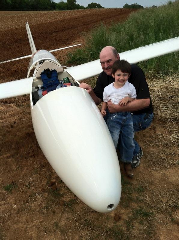
2 Waverly Hall
3
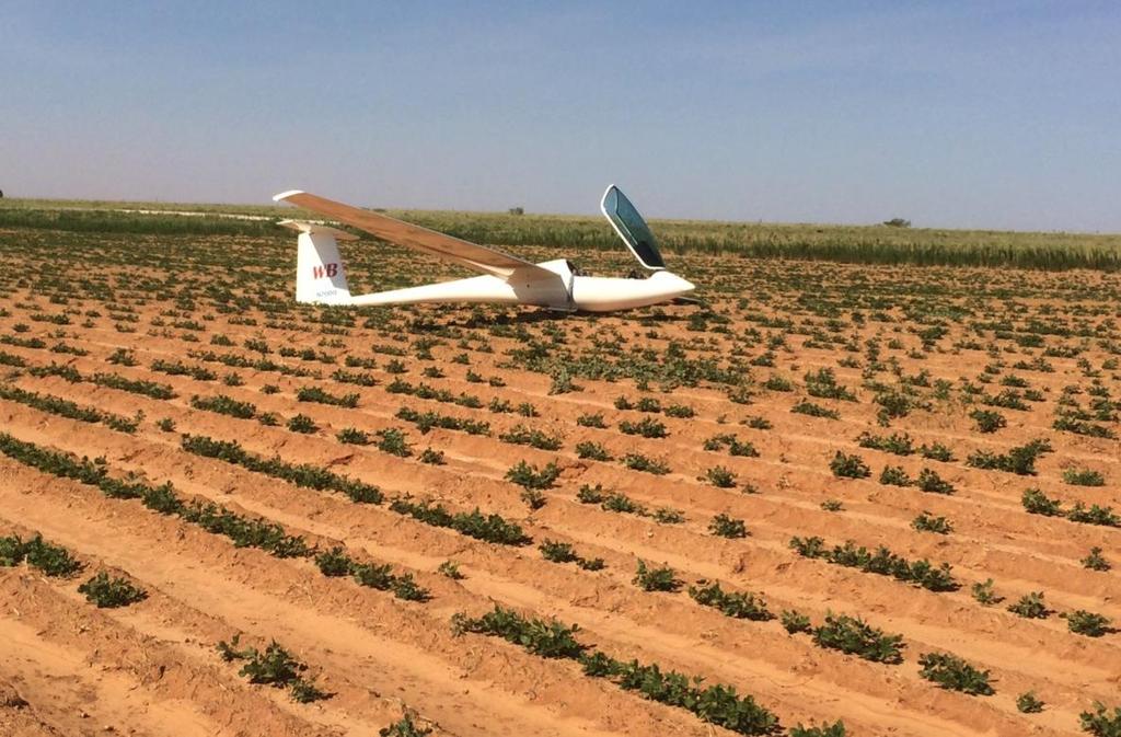
4 Chilhowee

5 Chilhowee (same contest)

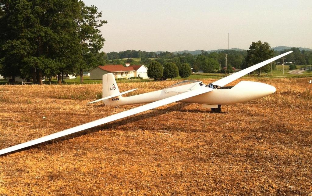
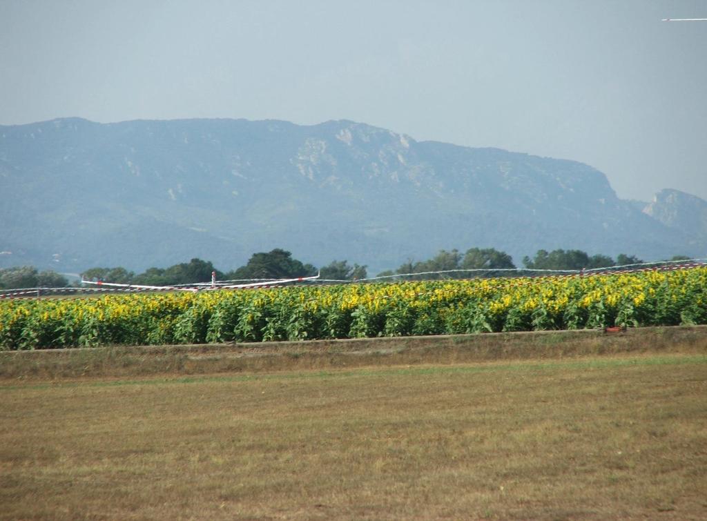
6 Caesar Creek
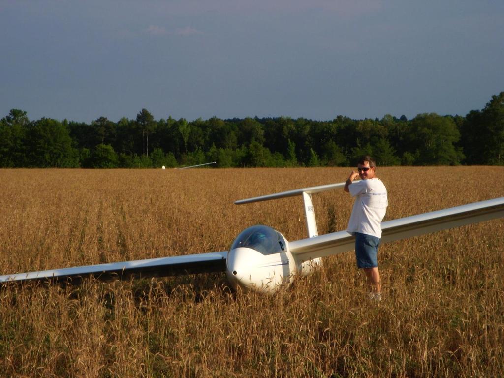
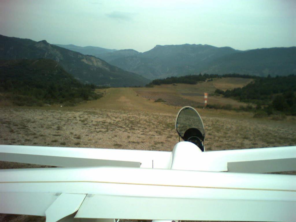
7 Hobbs
8 If you fly cross country, sooner or later, you will land out! The results of your first few land outs will have a profound effect on your future in soaring Failure painful and discouraging Success while disappointing, can be encouraging Preparation and practice WILL have a profound effect on your chances of success Trial and Error approach not recommended
9 What is Landing Out? Landing somewhere other than where you started Landing somewhere other than where you planned to land before the start of the flight
10 Where can Land Outs Occur? Another airport Farmer s field Lawn next to a girl s school Road Lake Trees Island in a river
11 Key Skills Required Situational Awareness Landing Options (varies with altitude) Field Selection Precision Landings Airspeed Control Situational Awareness Thinking ahead
12 A Test Will Follow This Presentation Your first (or next) off field landing!
13 Decision Points and Situational Awareness Aware of lift conditions around you, ahead, and behind. Is the day getting stronger, weakening, potential storms building? Wind Pay attention to terrain. Know where landable airports and fields are (around you, ahead, AND behind!)
14 Decision Points and Situational Rules of thumb: 3000 agl and above Keep Awareness 3000 agl down to 2000 agl Have potential landing areas identified (frequently ask yourself Where would I land if I had to land now?) agl down to 1000 agl Have best landing site(s) picked out. Continue to search for lift but stay within gliding range of
15 Major Hazards Wires Slopes Fences Wires
16 Other Hazards Rough terrain Ditches, roads Field too small Wind Difficult Approach Narrow Runway
17 Major Hazards Wires Slopes Fences Wires
18 Major Hazards Wires Slopes Fences Wires
19 Field Selection Altitude High General landable terrain awareness Airports in GPS Database
20 Field Selection Low Altitude Airport (maybe) Wires Wind/Slope Field Size Surface/crops Approach Ease of retrieve (least important)
21 Field Selection Wires (invisible from above!) Between two poles Between a pole and trees Between a road and a house Above or along any road Going to any kind of building Anywhere crossing a narrow field
22 Field Selection Sloped Field Always land up hill, regardless of wind Slope only visible when viewed from 90 degrees to landing direction Landing up hill, carry extra speed, close spoilers in flare Turn 90 degrees at end of rollout so glider won t roll backwards down the hill Landing across a slope not recommended
23
24
25 Field Selection Wind Direction GPS, smoke, lake surface, cloud shadows, waves in tall grass or crops Parallel to narrow valley between two ridges If you are not sure, probably doesn t matter Always land into the wind (unless) Light winds, difficult approach down wind end Sloped field
26 Field Selection Surface/Crops Freshly mowed hayfield best (no hay bales) Low crops (alfalfa) OK Freshly cultivated fields OK, but ground roll will be short. Look out for rocks. Avoid plowed fields if possible Avoid high crops, especially corn (if only option, flare and touch down at top of crop. Avoid pastures (rocks, animals) Discontinuities, wet areas
27
28 Field Selection Do not rely on small private airports you have not personally inspected or someone you trust has not recommended Assumption: GPS says there is an airport you can reach at 500 feet agl. Reality: Airport closed Runway too narrow Runway lights Owner hasn t mowed the field all year GPS says it s there, but I can t find it!
29 Outlanding Procedure Select several options by 2000 feet agl, radio off Select best field by 1200 feet agl Gear down, Fly full pattern at correct airspeed Use downwind to inspect field for rocks, holes, ditches, etc. Plan to touch down well into field If too high, use reverse pattern (never 360)
30 Outlanding Procedure NEVER change your mind once committed to the pattern If winds greater than 15 kts, expect turbulence Touch down with minimum energy But, watch out for wind shear Stop as quickly as possible
31 Outlanding Procedure Be flexible Short field? Land on diagonal Rolling surface? If possible land on a crest High trees on approach, but not for the adjacent field, which is unsuitable for landing? Fly around the trees and then line up for your chosen field on a diagonal.
32 After Landing Move glider clear so others can land Relations with landowner If possible, contact landowner Apologies, thanks No matter what, be polite Don t be too quick to offer payment for crop damage, but be agreeable to a reasonable payment Dealing with the curious public Don t let them cause further crop damage Retrieve Write down lat/long and clear retrieve directions before calling retrieve office!
33 Preparation at Home Gliderport Precision Landings (touchdown point and stopping point) Minimum energy touchdowns Landing without reference to altimeter (cover it up) Varied IP altitudes Experience with different wind conditions
34 Preparation when not flying While driving, look at fields, wires, crops, approaches, etc.
35 Staying in range of landable fields Use of GPS & glide computer Airport hopping Just because an airport is in the database.

36 Flatland Outlandings You can evaluate a field from the air The field that protects you is in view Getting to it is simple & obvious
37 Mountain Outlandings You must know the individual field Scouting may be necessary Field may not be visible until nearby Path to the field may not be direct or obvious
38 Problem areas Pastures Clear Cuts Roads Parks & recreational fields Golf courses Parking lots
39 Crashable areas Trees Water Sagebrush
40 Don t Do It areas Gravel pit Graveyard Orchard Grape Vineyard Inhabited area
41 Minimum safe field size it depends Approaches, obstacles Altitude Wind Glider Surface Pilot s skill & precision Ground loop, if necessary (stick forward)
42 Evaluating size Narrow looks long long looks narrow Wide looks short short looks wide Must have some idea about local fields Relative size of trees, power poles, buildings, etc.
43 Low Saves Don t believe all the stories about 200 foot saves Radio off Don t circle unless you can afford to lose 200 feet Low thermaling: coordinated turns plus 5-10 kts extra airspeed Steeper banks better than shallow Head out of the cockpit Wait for a thermal on a ridge with good field in reach Low experience, currency? Give it up at 800 feet
44 Low Saves (with an engine) Have a good field as a backup to the engine What altitude to start the engine? When did the engine last run? Good field available? Current in glider? If the engine does not start, FLY THE GLIDER!
45 Survival issues Mobile phone ELT use Radio Other gliders Airliners Survival kit
46 Summary Landouts are more risky than landing at the home airport, but with planning and preparation, they need not be excessively so Prepare, practice, plan, discipline Getting home always beats almost winning the day, but landing five miles short.

47 Good Luck! Fly Safe!
Bronze Badge. Blue Ridge Soaring Society New Castle, Virginia
 Bronze Badge Blue Ridge Soaring Society New Castle, Virginia SSA Badges A badge Solo flight. B badge 1/2 hour flight from 2000 tow. C badge Soaring instruction. Knowlegde of cross-country procedures. 2
Traffic and Weather. Soaring Safety Foundation. Tom Johnson CFIG
 Traffic and Weather Soaring Safety Foundation Tom Johnson CFIG Weather Contents Weather Gathering Sources Weather Acquisition Enroute Weather Analysis Weather Hazards Weather in the Landing Pattern Basic
At any moment, there are 2,000 lightning storms around the world.
 1 2 3 4 5 6 7 8 9 At any moment, there are 2,000 lightning storms around the world. Almost every day someone is struck by lightning. Most of these people survive with lifelong health problems but many
TAKEOFF CONSIDERATIONS...
 CHAPTER 4 TAKEOFFS TAKEOFF CONSIDERATIONS.................. 2-37 AIRSPEED.................................. 2-37 TAKEOFF POWER............................ 2-38 RUNWAY LENGTH REQUIREMENT.............. 2-39
Home Owners. Age Male/Female. Snow removal for his/her driveway or private property
 Buyer Personas Home Owners Home Owners Age 25-55 Male/Female Snow removal for his/her driveway or private property Uses and Preferences Products: Small to mid-size truck plows, UTV/ATV plows to keep driveways
Severe Weather Shelters
 Severe Weather Shelters When tornadoes and other severe weather affect your area, it is incredibly important that you know where a good shelter is. In general these are some characteristics of a GOOD tornado/severe
What is a map? Understanding your map needs
 What is a map? A map is simply a drawing or picture of a landscape or location. Maps usually show the landscape as it would be seen from above, looking directly down. As well as showing the landscape of
USING THE MILITARY LENSATIC COMPASS
 USING THE MILITARY LENSATIC COMPASS WARNING This presentation is intended as a quick summary, and not a comprehensive resource. If you want to learn Land Navigation in detail, either buy a book; or get
Map Reading & Compass Use
 Spring 2013 Kestrel Land Trust Page 2 / 10 Contents Map Basics... 3 Map Types... 3 Terrain Association... 4 Estimating Distance: Pacing... 4 Contour Lines... 5 Navigating with a Compass... 6 Compass Types...
IN VEHICLES: Do not try to outrun a tornado. Abandon your vehicle and hide in a nearby ditch or depression and cover your head.
 TORNADO SAFETY TORNADO! The very word strikes fear in many people. While a tornado is perhaps nature's most destructive storm, deaths and injuries can be prevented. By following Tornado Safety Rules, lives
IS YOUR BUSINESS PREPARED FOR A POWER OUTAGE?
 IS YOUR BUSINESS PREPARED FOR A POWER OUTAGE? Keeping your power on is our business Whether your business is large, small or somewhere in between, we understand that a power outage presents special challenges
TOEFL. Test of English as a Foreign Language. Reading
 TOEFL Test of English as a Foreign Language Reading For the Reading Section, you will be given 60-100 minutes to read 3 to 5 passages from academic texts and answer 36-70 questions. You have to read the
Whether you are driving or walking, if you come to a flooded road, Turn Around Don't Drown
 Whether you are driving or walking, if you come to a flooded road, Turn Around Don't Drown You will not know the depth of the water nor will you know the condition of the road under the water. Many people
Snow Cover. Snow Plowing and Removal Services Best Practices Guide. l
 Snow Cover Snow Plowing and Removal Services Best Practices Guide 2015 2016 www.hortica.com l 800.851.7740 During a recent trip to upstate NY, Hortica Loss Control representatives met with several insureds
Snow Plow Safety Quick Reference Guide
 PUBLIC WORKS INITIATIVE Snow Plow Safety Quick Reference Guide INTRODUCTION This quick reference guide highlights snow removal/snow plow safety practices. Its purpose is to help prevent personal injury
What Are Disasters? The Rescue Kids Trio!
 The Rescue Kids Trio! What Are Disasters? This manual was made possible through funding by the Council of Local Authorities for International Relations. Disasters and emergency preparedness Emergency preparedness
Tornadoes. Be able to define what a tornado is. Be able to list several facts about tornadoes.
 Tornadoes Be able to define what a tornado is. Be able to list several facts about tornadoes. 1. Where do tornadoes most U.S. is # 1 occur in the world? Tornadoes are most common in Tornado Alley. Tornado
Driving in Rural Areas. 82 percent of a miles of roadways are rural roads.
 Driving in Rural Areas 82 percent of a miles of roadways are rural roads. Different types of Roadways Rural roads are constructed of many different types of materials. Some are paved Others are not. Different
National Weather Service Morristown, Tennessee Lightning and Weather - What Every Trail Rider Needs to Know to Protect Themselves
 National Weather Service Morristown, Tennessee Lightning and Weather - What Every Trail Rider Needs to Know to Protect Themselves by David Gaffin Senior Forecaster Lightning Nature s Awesome Power Lightning
Civil Air Patrol Auxiliary of the United States Air Force
 Mountain Flying Qualification Course Civil Air Patrol Auxiliary of the United States Air Force Mountain Searching ELT Searches Conduct search at highest practical altitude to increase chance of detecting
Wind. Rain PAGE 01 CHAPTER 07 WEATHER CONDITIONS AND DRIVING
 PAGE 01 CHAPTER 07 WEATHER CONDITIONS AND DRIVING As a driver in Wisconsin, you will deal with many weather conditions. Knowing how the different weather conditions affect you and your driving is important.
3 Weather and Climate
 CHAPTER 22 3 Weather and Climate SECTION The Atmosphere KEY IDEAS As you read this section, keep these questions in mind: What are fronts? What are some types of severe weather? How is climate different
Earthquakes and Society
 CHAPTER 8 SECTION 3 Earthquakes Earthquakes and Society BEFORE YOU READ After you read this section, you should be able to answer these questions: Can scientists predict when earthquakes will happen? Why
AOG Add On Gauges FSWXR-2100 Users Manual Rev. 1.0 FSWXR Users Manual Rev. 1.0
 FSWXR 2100 Users Manual Rev. 1.0 Realistic simulation of the real Collins WXR2100 for Microsoft Flightsimulator 9 AOG FSWXR2100 Page 1 1. Introduction Weather is the one of uncontrollable factors in aviation.
Map reading made easy
 Map reading made easy 1 1. What is a map? A map is simply a drawing or picture (in 2-D) of a landscape or area of a country (in 3-D). It could be anything from a sketch map for a visitor to find your school
HURRICANE PREPAREDNESS GUIDE
 HURRICANE PREPAREDNESS GUIDE BE PREPARED! TABLE OF CONTENTS Basic Preparedness Tips... 3 Preparing Your Home... 4 What To Do... 5 Make a Hurricane Plan... 6 Important Information... 7 pacu.com 800.433.7228
Contents. Chapter 1 Introduction Chapter 2 Cyclones Chapter 3 Hurricanes Chapter 4 Tornadoes... 36
 Contents Chapter 1 Introduction.... 4 Chapter 2 Cyclones.... 14 Chapter 3 Hurricanes... 22 Chapter 4 Tornadoes.... 36 Chapter 5 The Perfect Storm... 52 Chapter 6 Hurricane Katrina... 62 Chapter 7 Joplin
COMMUNITY EMERGENCY RESPONSE TEAM FLOODS INTRODUCTION
 INTRODUCTION Floods are one of the most common hazards in the United States. A flood occurs any time a body of water rises to cover what is usually dry land. Flood effects can be local, impacting a neighborhood
3 Severe Weather. Critical Thinking
 CHAPTER 2 3 Severe Weather SECTION Understanding Weather BEFORE YOU READ After you read this section, you should be able to answer these questions: What are some types of severe weather? How can you stay
Bluff: 7:29 am Belen: 12:25 pm Airtime: 4.9 hrs Total PIC Time: Total Logged Time:
 Sunday, October 8, 2017 Cobra flight #605, PIC #618, 4 landings San Juan Goosenecks, Monument Valley, Tall Rocks, Royal Arch, Shiprock, Chaco, Blue Hole, Mt Taylor Plateau Bluff: 7:29 am Belen: 12:25 pm
While all thunderstorms are dangerous, the National Weather Service (NWS) defines a severe thunderstorm as one that:
 defines a severe thunderstorm as one that:") While all thunderstorms are dangerous, the National Weather Service (NWS) defines a severe thunderstorm as one that: Produces hail at least three-quarters of an inch in diameter. Has winds of 58 miles
While all thunderstorms are dangerous, the National Weather Service (NWS) defines a severe thunderstorm as one that: Produces hail at least three-quarters of an inch in diameter. Has winds of 58 miles
Re: Steep Slope Assessment for 2465 Waverly Drive, Blind Bay, BC; Legal Address: Lot 39, Section 18, Township 22, Range 10, Plan 25579, W6M, KDYD.
 OEL File 1563-1 May 30, 2017 Doug Wall PO Box 774 Salmon Arm, BC V1E 4N7 Re: Steep Slope Assessment for 2465 Waverly Drive, Blind Bay, BC; Legal Address: Lot 39, Section 18, Township 22, Range 10, Plan
Rock Scaling Recommendations Logan Creek Drive Cut Slope
 Rock Scaling Recommendations Logan Creek Drive Cut Slope US 50, Milepost DO 8.47 to DO 8.61 Douglas County, Nevada January 2008 MATERIALS DIVISION STATE OF NEVADA DEPARTMENT OF TRANSPORTATION MATERIALS
Map reading made easy
 Map reading made easy 1. What is a map? A map is simply a drawing or picture (in 2-D) of a landscape or area of a country (in 3-D). It could be anything from a sketch map for a visitor to find your school
Consumer Guide. Southwest Windpower 1801 W. Route 66 Flagstaff, AZ USA
 Consumer Guide wind turbine SITING Southwest Windpower 80 W. Route 66 Flagstaff, AZ 8600 USA www.windenergy.com Introduction Is wind power right for you? Wind generators are an effective source of renewable
Karl Reichle. Mark Owens. and. present :
 Connecticut s own Karl Reichle and Mark Owens present : Hey, Where s Connecticut? Cell phones If yours goes off, Don t worry,we know what you do for a living. Just step out into the hall and take care
2013 Tornado and Severe Weather Awareness Drill
 2013 Tornado and Severe Weather Awareness Drill Scheduled for Thursday April 18, 2013 The 2013 Tornado Drill will consist of a mock tornado watch and a mock tornado warning for all of Wisconsin. This is
Lightning Safety. MANSCEN Safety Office (573)
") Lightning Safety MANSCEN Safety Office (573) 596-0116 Lightning Facts 2 nd Leading Cause of Weather Deaths in the United States Kills ~ 100 / Year Kills ~ 10% of those Struck Lightning Facts Survivors
Lightning Safety MANSCEN Safety Office (573) 596-0116 Lightning Facts 2 nd Leading Cause of Weather Deaths in the United States Kills ~ 100 / Year Kills ~ 10% of those Struck Lightning Facts Survivors
2nd Grade. Wind, Water and Land.
 1 2nd Grade Wind, Water and Land 2015 11 23 www.njctl.org 2 Wind, Water and Land What is Wind? Wind Erosion Preventing Wind Erosion Water Erosion Sudden Water Erosion Preventing Water Erosion Landforms
EVENT. the tornado. Made with Love by Dr. Poppy Moon AnyWhere. Any Day
 EVENT DATE the tornado Any Day WHERE AnyWhere A Tornado!! A tornado is a violent rotating column of air extending from a thunderstorm to the ground what do tornadoes look like? A picture of a tornado A
Safety. BY Tom Gatchell FLITE LINES
 Safety BY Tom Gatchell From the desk of the Safety Czar : Warm weather has finally arrived and it has brought more flyers out on a day to day average. As your highly observant safety officer, I ve noted
Winter Weather Safety Tips. From your friends at South Brunswick Township Department of Public Works
 Winter Weather Safety Tips From your friends at South Brunswick Township Department of Public Works South Brunswick Township Department of Public Works is committed to providing timely, efficient, and
Severe Weather. Copyright 2006 InstructorWeb
 Severe Weather People need to know what the weather is going to do. Sometimes severe weather can happen. Severe weather can cause property damage, injuries to people and animals, and even loss of life.
Erosional Features. What processes shaped this landscape?
 Have you ever looked at the land around you and wondered what processes shaped what you see? Perhaps you see mountains, valleys, rivers, or canyons. Do you know how long these geologic features have been
Map reading made easy
 Map reading made easy 1. What is a map? A map is simply a drawing or picture (in 2-D) of a landscape or area of a country (in 3-D). It could be anything from a sketch map for a visitor to find your school
Map reading made easy
 Map reading made easy Maps can be great fun and they can lead you to all sorts of discoveries. They can help you get to know an area really well, because they pinpoint interesting places that are often
Downloaded from APPLICATION OF TRIGONOMETRY
 MULTIPLE CHOICE QUESTIONS APPLICATION OF TRIGONOMETRY Write the correct answer for each of the following : 1. Write the altitude of the sun is at 60 o, then the height of the vertical tower that will cost
USING THE MILITARY LENSATIC COMPASS
 USING THE MILITARY LENSATIC COMPASS WARNING This presentation is intended as a quick summary, and not a comprehensive resource. If you want to learn Land Navigation in detail, either buy a book; or get
Text Structure Extra Practice
 Text Structure Extra Practice Directions: Read the following passages and determine the text structure. Then, in the space below each paragraph, put information from the text into the appropriate graphic
USING THE MILITARY LENSATIC COMPASS
 USING THE MILITARY LENSATIC COMPASS WARNING This presentation is intended as a quick summary, and not a comprehensive resource. If you want to learn Land Navigation in detail, either buy a book; or get
Belen: 7:56 am Mid-Valley: 10:09 am Mid-Valley: 10:14 am Belen: 11:34 am Airtime: 3.5 hrs Total PIC Time: Total Logged Time: 1565.
 Tuesday, May 2, 2017 Cobra flight #582, PIC #595, 3 landings Amber Hills, Caldron of Hell, Valley of the Horses, Caldron, Puerco Elk, Belen, Rio Grande, Mid-Valley, Manzano Mountain Ridge Run Belen: 7:56
The mowed firebreaks are at least 10 wide and are usually 20. A rotary hay rake is used to clear larger firebreaks.
 The mowed firebreaks are at least 10 wide and are usually 20. A rotary hay rake is used to clear larger firebreaks. 24 Hand-raking is necessary to remove litter between the experimental prairie plots.
Floods. Floods COMMUNITY EMERGENCY RESPONSE TEAM FLOODS CONTENT INSTRUCTOR GUIDANCE
 Floods Floods Introduce this topic by explaining that floods are one of the most common hazards in the United States. A flood occurs any time a body of water rises to cover what is usually dry land. Display
Thunderstorms written by Alice Lee Folkins
 STAPLE HERE Cover Photo: A cloud-to-ground lightning strike during a nighttime thunderstorn. Taken by C. Clark. Released into the public domain by NOAA. Level D written by Alice Lee Folkins 2015 Elfrieda
How to Prepare for a Tornado
 Tornadoes Tornadoes How to Prepare for a Tornado Special Precautions for Mobile Home Dwellers What to Do During a Tornado Warning Responses After a Tornado Inspecting Buildings for Hidden Wind Damage Special
Aviation Maps: Aviation Maps: Chapter Ten. Chapter Ten. The Art of the Chart. The Art of the Chart. Page J1. The Lambert Conformal Conic Projection
 Page J1 Chapter Ten Chapter Ten viation Maps: viation Maps: The rt of the Chart The rt of the Chart The Lambert Conformal Conic Projection 1. [J2/Figure 1] When drawing lines on a Lambert Conformal Conic
How Two Pilots Flew Non-Stop Around the World
 08 November 2011 voaspecialenglish.com How Two Pilots Flew Non-Stop Around the World nasm.si.edu The Voyager hangs in the National Air and Space Museum in Washington (You can find an MP3 of this story
COLORING PAGES. Follow Raindy the Raindrop as he travels from your house out to sea.
 COLORING PAGES www.hcfcd.org Follow Raindy the Raindrop as he travels from your house out to sea. Raindy the Raindrop falls from the sky and lands on your house or in your neighborhood. Once he s on the
Severe Thunderstorms
 Severe Thunderstorms Severe Thunderstorms Explain that, while all thunderstorms are dangerous, the National Weather Service (NWS) defines a severe thunderstorm as one that: Display Slide Th-0 Produces
Summer Safety Campaign
 Summer Safety Campaign Author Day Month Year Overall classification of this briefing is. Summer Safety Campaign Key Emphasis Heat Injury Five steps of heat injury risk management Mild and extreme heat
The Pillowcase Project Learn. Practice. Share.
 The Pillowcase Project Learn. Practice. Share. LOCAL HAZARD RESOURCE Flood Preparedness Learning Objectives Students will be able to explain what causes flooding and what happens during a flood. Students
9.5 Troposphere. Describe the characteristics and importance of the troposphere. Explain temperature inversion and its role in the troposphere.
 9.5 Troposphere Describe the characteristics and importance of the troposphere. Explain temperature inversion and its role in the troposphere. Why is the troposphere important? All of the wind, rain, and
UNIT 1C. USING TOPOGRAPHIC MAPS WHERE IN THE WORLD... ARE YOU?
 UNIT 1C. USING TOPOGRAPHIC MAPS WHERE IN THE WORLD... ARE YOU? TIME 60-90 minutes LEVEL All BENCHMARKS Next Generation Science Standards MS-LS1.D Science & Engineering Practices Developing and Using Models
Table G - 6. Mitigation Actions Identified for Implementation by the City of Kent ( ) (From Wilkin County Master Mitigation Action Chart)
 (From Wilkin County Master Mitigation Action Chart)") Table G - 6. Actions Identified by the () (From Master Action Chart) Multi-Hazard Plan, 2017 Action Comments 5 All-Hazards Local Planning & Regulations Update the Operations Plan on an annual basis. Work
Table G - 6. Actions Identified by the () (From Master Action Chart) Multi-Hazard Plan, 2017 Action Comments 5 All-Hazards Local Planning & Regulations Update the Operations Plan on an annual basis. Work
BUSH NAV BUSH NAV DAY Navigation for Bush Navigation Day. November. WhitehorseD AY. Section 1 Registration, Maps & Checkpoints
 BUSH DAY Navigation for Bush Navigation Day Robert Kirwan, Nunawading SES W NW N NE E If you have little or no bush navigation experience then you will have been teamed up with members that have that experience
M o d u l e k A i r c r a f t A e r o d y n a m i c s, S t r u c t u r e s a n d S y s t e m s
 Category A B1 B2 B3 08 Instrument systems (ATA 31) Level 1 2 3 M o d u l e 1 3-0 8 k A i r c r a f t A e r o d y n a m i c s, S t r u c t u r e s a n d S y s t e m s I n s t r u m e n t S y s t e m s -
EROSIONAL FEATURES. reflect
 reflect Have you ever looked at the land around you and wondered what processes shaped what you see? Perhaps you see mountains, valleys, rivers, or canyons. Do you know how long these geologic features
TORNADOES. DISPLAY VISUAL A Tornado Is... Tornadoes can: Rip trees apart. Destroy buildings. Uproot structures and objects.
 TORNADOES Introduce tornadoes by explaining what a tornado is. DISPLAY VISUAL A Tornado Is... A powerful, circular windstorm that may be accompanied by winds in excess of 250 miles per hour. Tell the participants
Changes in Texas Ecoregions Copy the questions and answers
 Changes in Texas Ecoregions Copy the questions and answers 1. What are some kinds of damage that hurricanes cause? Roads and bridges might be washed away. Trees and power lines can be knocked down. Area
Gravity - What Goes Up, Must Come Down
 Gravity - What Goes Up, Must Come Down Source: Sci-ber Text with the Utah State Office of Education http://www.uen.org/core/science/sciber/trb3/downloads/literacy4.pdf Jump up in the air and you will fall
AS 410 Land Navigation. Chpt 4-1
 AS 410 Land Navigation Chpt 4-1 Overview Types of Maps Map Legends / Scales Latitude and Longitude Orienteering Why? Why important to learn how to read a compass and map? No cell phone coverage Mountain
Safety Issue: Types of weather emergencies and natural. Weather Emergencies
 Overview Safety Issue: Rapid and effective response to weather emergencies and other natural disasters whether during or after work hours takes forethought and careful planning. Types of weather emergencies
Town of Windsor. Department of Public Works
 Town of Windsor Department of Public Works 860.285.1855 TOWN OF WINDSOR PUBLIC WORKS SNOW REMOVAL PLAN In Windsor, as throughout the New England states, winter can bring a variety of weather conditions
Physics Motion Math. (Read objectives on screen.)
") Physics 302 - Motion Math (Read objectives on screen.) Welcome back. When we ended the last program, your teacher gave you some motion graphs to interpret. For each section, you were to describe the motion
Physics 302 - Motion Math (Read objectives on screen.) Welcome back. When we ended the last program, your teacher gave you some motion graphs to interpret. For each section, you were to describe the motion
Flood Scenario Worksheet
 Flood Scenario Worksheet Scenario adapted from: http://www.epa.gov/watersecurity/tools/trainingcd/simple/source/scenario-8/ssc8-0.pdf Simple Tabletop Exercise, Interdependency Natural Disaster Scenario,
LIGHTNING. If you can see it, take cover
 LIGHTNING If you can see it, take cover WHAT IS LIGHTNING? Lightning is a discharge of electricity produced by a thunderstorm Lightning is a powerful burst of electricity that happens very quickly during
1879-LDG-E. Leader s Guide
 ERI Safety Videos Videos for Safety Meetings 1879-LDG-E SEVERE WEATHER ALERT: ARE YOU PREPARED? Leader s Guide 2003, ERI Safety Videos SEVERE WEATHER ALERT: ARE YOU PREPARED? This easy-to-use Leader s
Preventing Runway Excursions. Landing on wet / Contaminated Runways
 Preventing Runway Excursions Landing on wet / Contaminated Runways Overview Introduction Definition Runway Condition Runway Condition Reporting Pilot Operational Aspects Landing Performance Airport Operational
An on-line glider pilot self-briefing system
 Background An on-line glider pilot self-briefing system Edward (Ward) Hindman The City College of New York, New York NY USA hindman@sci.ccny.cuny.edu Presented at the Soaring Society of America Convention,
Preventing Runway Excursions. Landing on wet / Contaminated Runways
 Preventing Runway Excursions Landing on wet / Contaminated Runways Overview Introduction Definition Runway Condition Runway Condition Reporting Pilot Operational Aspects Landing Performance Airport Operational
Transparency: Redoubt ash cloud
 Module 1 Investigation 3 Transparency: Redoubt ash cloud Aerial view of Redoubt Volcano during a continuous, low-level eruption of steam and ash December 18, 1989 Source: photo by W. White, USGS, http://www.avo.alaska.edu/avo3/volc/redou/photo.htm
Who Loves the Sun? Iguanas!
 Name Teacher Date / 5 ER.DFA2.2.R.RI.02: Identify and explain the main topic of a multiparagraph text as well as the focus of specific paragraphs within the text. Directions. Read the passage and select
Altus AFB Emergency Management. Emergency Preparedness. Building a Disaster Supply Kit
 Emergency Communication Plan When a disaster strikes, there is a chance that your family is not together. It is important to think about some of the following situations and make a plan just in case. Here
YOUR VEHICLE WINDOWS
 REDUCED VISIBILITY WHENEVER VISIBILITY IS REDUCED DRIVERS NEED MORE TIME TO USE THE IPDE PROCESS. YOU CAN MAINTAIN A SAFE INTENDED PATH OF TRAVEL BY: SLOWING DOWN TO GIVE YOURSELF MORE TIME SCANNING IN
Accident Prevention Program
 Thunderstorm Accident Prevention Program Thunderstorms - Don't Flirt...Skirt'Em Pilot's Beware! Within the route you intend to fly may lie a summer hazard in wait for the unwary--the Thunderstorm. The
Relative and Absolute Directions
 Relative and Absolute Directions Purpose Learning about latitude and longitude Developing math skills Overview Students begin by asking the simple question: Where Am I? Then they learn about the magnetic
Dunn County Snow Removal Policy
 Dunn County Snow Removal Policy OVERVIEW With the advent of another winter season in the northern plains comes the possibility of snow, freezing rain and slippery roadways, and area resident s concern
Welcome to our Emergency Preparedness Activity Book!
 Welcome to our Emergency Preparedness Activity Book! Having children understand the importance of emergency preparedness and coping with emergencies is a key element of emergency preparedness for families.
1/28/16. EGM101 Skills Toolbox. Map types. Political Physical Topographic Climate Resource Road. Thematic maps (use one of the above as backdrop)
") EGM101 Skills Toolbox Map types Political Physical Topographic Climate Resource Road Thematic maps (use one of the above as backdrop) Map Types Deriving information from maps Hydrographic Geological Soils
EGM101 Skills Toolbox Map types Political Physical Topographic Climate Resource Road Thematic maps (use one of the above as backdrop) Map Types Deriving information from maps Hydrographic Geological Soils
Kunjamma Father s younger brother s wife in Malayalam. For the teacher: Chittappan Father s younger brother in Malayalam.
 Today, there was a lot of activity at Maalu s house. Chittappan and his family were coming home after five years. Chittappan had got a job in a country called Abu Dhabi five years ago. Since then he had
Witless Bay Ecological Reserve
 Newfoundland Adventure by Fabiola Forns The land of fog and icebergs is jut a few hours north of us by plane. We visited last year and decided to make it a regular destination. Wherever you look, there
HEIGHT ALTITUDE FLIGHT LEVEL
 HEIGHT ALTITUDE FLIGHT LEVEL 1. Definition There are several ways to indicate the vertical position of aircraft and/or obstacles; each has another meaning and is used in a particular situation: 2. Units
Pilots watch the clouds, because clouds can indicate the kind of weather in store for a flight.
 Low stratus Cumulonimbus Pilots watch the clouds, because clouds can indicate the kind of weather in store for a flight. FILL IN THE BLANKS OR CIRCLE ONE: A. Stratus means flat or on one level. Low stratus
MET Lecture 34 Downbursts
 MET 4300 Lecture 34 Downbursts Downbursts A strong downdraft that originates within the lower part of a cumulus cloud or thunderstorms and spreads out at the surface Downbursts do not require strong thunderstorms
TRIGONOMETRY - Angle Of Elevation And Angle Of Depression Based Questions.
 TRIGONOMETRY - Angle Of Elevation And Angle Of Depression Based Questions. 1. A man 1.7 m tall standing 10 m away from a tree sees the top of the tree at an angle of elevation 50 0. What is the height
APPENDIX F PRE-COURSE WORK
 APPENDIX F PRE-COURSE WORK F-1 Pre-Course Work F-2 Pre-Course Work Intermediate Wildland Fire Behavior, S-290 Pre-Course Work The pre-course work is designed to ensure that students come to class with
What to do During a Lightning Storm.
 What to do During a Lightning Storm. What is Lightning Safety Tips During a Storm If Caught Outside Indoor Precautions Lightning Stories for around e Maritimes Lightning Storm Quiz Answers to Quiz What
7 LITTLE GREEN MARTIANS
 7 LITTLE GREEN MARTIANS Many People thought the first probes to land on the surface of Mars- Viking I and Viking II- would discover little green Martian men or some other form of extraterrestrial, so there
Controlling Processes That Change Land
 1 Name Date Controlling Processes That Change Land People try to control some of the processes that change land. To do this, people apply technology- the use of science to solve problems in everyday life.
Opening. Monster Guard. Teacher s Guide
 Teacher s Guide PLEASE NOTE: Students must complete the Initiation section of the Monster Guard app before they begin this activity, in order to gain access to the Thunderstorm & Lightning training mission.