USING THE MILITARY LENSATIC COMPASS
|
|
|
- Hillary Parrish
- 5 years ago
- Views:
Transcription


1 USING THE MILITARY LENSATIC COMPASS
2 WARNING This presentation is intended as a quick summary, and not a comprehensive resource. If you want to learn Land Navigation in detail, either buy a book; or get someone, who has the knowledge and skills, to teach you in person.
3 NOTE To get the ideas across presented on these slides, many figures, pictures, and calculations may not be to scale and may be exaggerated for clarity.
4 Note: Prior to being issued any training *equipment, you will be required to sign a statement of liability agreeing to pay for anything you damage or lose. All items will be inspected and inventoried prior to your signature and at the end of the training day too. If you do not intend to sign this statement, then you may be denied training. * You may use your own equipment.
5 Any Questions?
6 LAND NAVIGATION PRESENTATION PART 1 Module 4 Map Symbols

7 ... and now on with the... PRESENTATION
8 LAND NAVIGATION WITH MAP AND LENSATIC COMPASS
9 LAND NAVIGATION Why Learn Land Navigation? Training and practicing land navigation on foot provides the following everyday navigation (how not to get lost) benefits; - Tracking present location - Determining Distance - Sense of direction - How to read a topographic map -Terrain and map association - Spatial skills - Planning safe, practical routes - And more Navigational skills (Where am I?) (How far is it and am I there yet?) (Where do I want to go and where am I actually going?) (Do I understand the map?) (What hill or river am I looking at?) (Can I mentally visualize the landscape in 3D?) (Take a long safe route or a short risky route?) The best way to learn LAND NAVIGATION is to get "dirt time", that is, get out there with a map and compass! Navigation is not about finding yourself after you are lost (although that s what happens sometimes); it s about keeping track of your position as you move away from a known point. As you move you have to remain cognizant of the terrain you are leaving, of the terrain you are passing, and of the terrain that is ahead. Navigation in the wilderness means knowing your starting point, your destination, and your route to get there. These skills will allow you to venture farther off the beaten path than you ever thought before.
10 THIS PRESENTATION IS DIVIDED INTO FOUR PARTS PART 1 PART 2 PART 3 PART 4 Basic Land Navigation The Lensatic Compass module 1 The Topographic Map modules 2, 3, 4, The Land and Map Association modules 5, 6 Intermediate Land Navigation Making Sense of Direction module 7 Tracking Present Location modules 8, 9, 10, 11 Determining Travel Distance modules 12, 13, 14 Advance Land Navigation Navigation Methods to Stay On Course module 15 Additional Skills of Land Navigation module 16 Planning to Navigate module 17 Expert Land Navigation Navigation in different types of Terrain module 18 Night Navigation module 19 Sustainment module 20
11 THESE ARE THE TRAINING MODULES Module 1 Lensatic Compass parts and features, and how to sight the compass by two different methods. Module 2 Module 3 Module 4 Module 5 Module 6 Module 7 Module 8 Module 9 Module 10 Module 11 Module 12 Module 13 Module 14 Module 15 Module 16 Module 17 Module 18 Module 19 Module 20 Topo Map Margin what map margin data represents, map care, and how to properly fold a map. Topo Map Scale map sizes and how it affects amount of detail that will be shown. Topo Map Symbols you must understand them; to read and speak map language to others. Terrain Relief shows elevation, indicates terrain features and heights of natural features. Map Information what a protractor is for and how a map provides four kinds of information. Sense of Direction lateral drift, current bearing, obstacles, back azimuth, deliberate offset. Resection locate position with map only. Modified resection is with a map or compass. Intersection & Triangulation two methods to locate position by compass. Map Speaks Compass Language - there is no need to orient the map to find your position. Plotting Position Coordinates exact positioning, used to communicate to others with a map. Route Measure mapping straight-line distance, curvature distance, and slope distance. Pace Count using ranger pacing beads and estimating hiking speed. Travel Distance Estimation estimating by 100 meter rule, rule-of-thumb, and by time. Plan to Navigate in a group or alone, equipment, safety, responsibilities, route selection. Stay on Course advance reference points and advance baselines. Additional Land Navigation Skills estimate daylight, conserve energy, blisters, weather insight. Navigating Different Terrain special environments, featureless terrain, visibility, dense foilage. Night Navigation night adaptation, protecting night vision, navigate with lensatic compass. Sustainment maintaining skills, training others, setting up a land navigation course.
12 Any Questions?

13 PART 1 BASIC LAND NAVIGATION MODULE 4 The Topographic Map Information Symbols

14 THE TOPOGRPHIC MAP Without ever having been to a particular place, and with out talking to someone who has been there, you can already know quite a lot about it with a map. A map is a graphic representation of the earth s surface drawn to scale, as seen from above. It uses colors, lines, symbols, and labels to represent features found on the ground. However, the finest maps available are worthless unless the map user knows how to read them.
15 TOPOGRAPHIC MAP DESCRIPTION Reading a map is a language composed of lines, colors, and symbols. Five basic colors are used for Topographic Maps. Brown (Contour Lines) Black (Man Made Features, Roads, Trails) Blue (Water Features) Green (Vegetation) Red (Highway and Land Grids) Two minor colors Pink (Built up area, civilization) Purple (Updated Map Information) Symbols are used to represent the natural and man-made features of the earth. Lines show relief and elevation; it indicates variations in terrain features and heights of natural features. Every map has Margin Information about the map. Maps come in three scale sizes; SMALL, MEDIUM, and LARGE. Which affects the amount of area covered and detail that will be shown. A map is read for four basic kinds of information. Direction Distance Position Identification Maps must be taken care of and properly folded for field use.
16 Any Questions?
17 Map Symbols Symbols are used to represent the natural and man-made features of the earth. It is a map language that is simple to read and understand. BUT you must first know what the map symbols represent, in order to understand, read and speak map language to others. cem

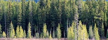
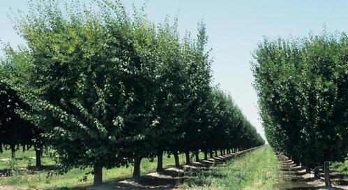
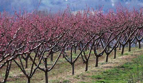
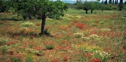
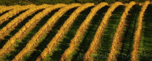

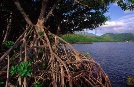
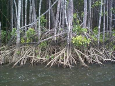
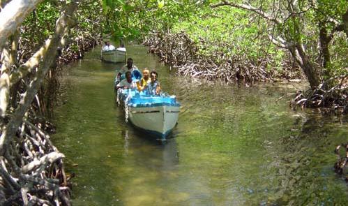
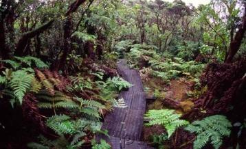
18 VEGETATION Map Symbols Woods Scrub Orchard Vineyard Mangrove


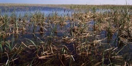
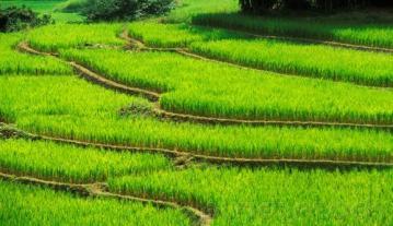
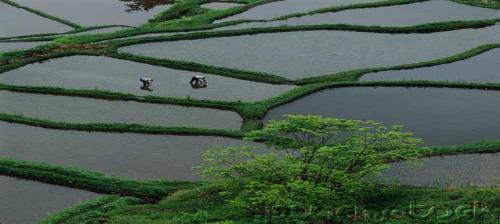
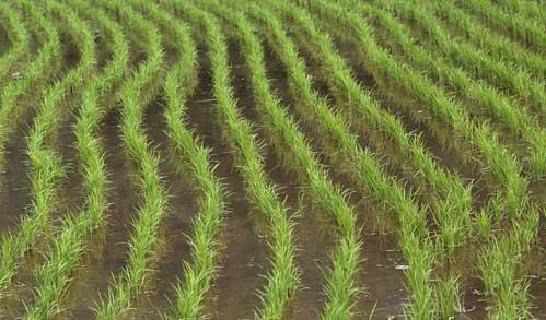

19 SUBMERGED AREAS AND BOGS Marsh or swamp Map Symbols Submerge marsh or swamp Wood marsh or swamp Submerge wood marsh or swamp Rice field Land subject to inundation


20 RIVERS, LAKES, AND CANALS Intermittent stream Map Symbols Perennial lake or pond Perennial stream Intermittent lake or pond Intermittent river Perennial river Well or spring Dry lake Small falls; small rapids Dam Large falls; large rapids Canal


21 MAN-MADE FEATURES and HIGHWAY & LAND GRIDS Built-up Areas Highway Map Symbols Buildings School Church Airports Road Dirt Road Bridge Land Grids Landing Strip Foot Bridge Cemetery cem Trail Mine Power Lines Gravel Pit Railroad
22 Any Questions?

23 Note: Prior to being issued any training *equipment, you will be required to sign a statement of liability agreeing to pay for anything you damage or lose. All items will be inspected and inventoried prior to your signature and at the end of the training day too. If you do not intend to sign this statement, then you may be denied training. * You may use your own equipment.

24 TESTING Now it is time for the following... Written exam Hands-on / Outdoors exam
25 THE END OF LAND NAVIGATION PRESENTATION PART 1 Module 4 Map Symbols
USING THE MILITARY LENSATIC COMPASS
 USING THE MILITARY LENSATIC COMPASS WARNING This presentation is intended as a quick summary, and not a comprehensive resource. If you want to learn Land Navigation in detail, either buy a book; or get
USING THE MILITARY LENSATIC COMPASS
 USING THE MILITARY LENSATIC COMPASS WARNING This presentation is intended as a quick summary, and not a comprehensive resource. If you want to learn Land Navigation in detail, either buy a book; or get
ANSWER SHEET PART 1 BASIC LAND NAVIGATION
 ANSWER SHEET PART 1 BASIC LAND NAVIGATION 1. Knowing these four basic skills, it is impossible to be totally lost; what are they? a. Track Present Location / Determine Distance / Sense of Direction / How
Using Map and Compass Together
 Using Map and Compass Together In situations where you foresee a potential evacuation on foot, where there are no roads, and no indication as to the direction of travel (i.e., road signs), it is recommended
AS 410 Land Navigation. Chpt 4-1
 AS 410 Land Navigation Chpt 4-1 Overview Types of Maps Map Legends / Scales Latitude and Longitude Orienteering Why? Why important to learn how to read a compass and map? No cell phone coverage Mountain
MILITARY TOPOGRAPHIC MAP II B170247XQ STUDENT HANDOUT
 UNITED STATES MARINE CORPS THE BASIC SCHOOL MARINE CORPS TRAINING COMMAND CAMP BARRETT, VIRGINIA 22134-5019 MILITARY TOPOGRAPHIC MAP II B170247XQ STUDENT HANDOUT Basic Officer Course Introduction Importance
Topographic Maps. Take Notes as you view the slides
 Topographic Maps Take Notes as you view the slides Lesson Objectives Define a topographic map and state its uses. Describe how contour lines show the elevations, shape, and slope of the land. Identify
ILLINOIS ARMY NATIONAL GUARD Marseilles Training Center 1700 Army Road Marseilles, IL
 ILLINOIS ARMY NATIONAL GUARD Marseilles Training Center 1700 Army Road Marseilles, IL 61341-9535 Land Navigation Course 104W Ph. (815)795-5701 INDEX Chapter 1 GENERAL Page Guidance for OIC/Test Administrator
PART 2 INTERMEDIATE LAND NAVIGATION
 PART 2 INTERMEDIATE LAND NAVIGATION USING THE MILITARY LENSATIC COMPASS WARNING This presentation is intended as a quick summary, and not a comprehensive resource. If you want to learn Land Navigation
Topographic Map Series:
 DEFINITION OF A MAP A MAP IS A GEOGRAPHIC PREPRESENTATION OF A PORTION OF THE EARTH S SURFACE DRAWN TO SCALE, AS SEEN FROM ABOVE. IT S USES COLORS, SYMBOLS AND LABELS TO REPRESENT FEATURES FOUND ON THE
Topo Map Tidbits. Adapted from: An original Creek Connections activity. Creek Connections, Box 10, Allegheny College, Meadville, Pennsylvania, 16335
 Topo Map Tidbits Adapted from: An original Creek Connections activity. Creek Connections, Box 10, Allegheny College, Meadville, Pennsylvania, 16335 Introduction to Topographic Maps Grade Level: Basic Duration:
Compass Basics. Quick Map Basics Review For Compass Use
 Compass Basics Quick Map Basics Review For Compass Use A topographic map tells you where things are and how to get to them, whether you're hiking, biking, hunting, fishing, or just interested in the world
Navigating with Map & Compass. Nevada County Sheriff s Search & Rescue
 Navigating with Map & Compass Nevada County Sheriff s Search & Rescue Objectives Very Practical Teach you how to go from point A to point B Go from the wilderness (real world) to a map and visa versa Agenda
Navigating for Scouts A Self-teaching Guide to Navigation with Map and Compass
 Don Burgess, November 2003 Materials topographic maps Navigating for Scouts A Self-teaching Guide to Navigation with Map and Compass metric ruler orienteering compass 30 M/5 Hamilton-Burlington 41 I/13
LESSON 2: INTRODUCTION TO TOPOGRAPHICAL MAPS
 LESSON 2: INTRODUCTION TO TOPOGRAPHICAL MAPS Finding your way if you become separated from a group. PURPOSE This lesson presents an overview of topographic maps. It describes their characteristics and
Map Reading & Compass Use
 Spring 2013 Kestrel Land Trust Page 2 / 10 Contents Map Basics... 3 Map Types... 3 Terrain Association... 4 Estimating Distance: Pacing... 4 Contour Lines... 5 Navigating with a Compass... 6 Compass Types...
***When doing the lab report write-up, be sure to follow the guidelines.***
 Topographic Maps Lab Vocabulary: topography - study of the shapes and features of the earth's surface elevation - height above sea level bench mark - a point that has been accurately measured for its position
HWA CHONG INSTITUTION NATIONAL POLICE CADET CORPS TOPOGRAPHY AND ORIENTEERING. Topography and Orienteering
 Topography and Orienteering 1. Introduction Orienteering is about using a topographic map and compass to find points in the landscape. It is fun and challenging, as one would need to take reference to
The Tacoma Mountaineers Wilderness Navigation
 The Tacoma Mountaineers Wilderness Navigation Navigation Fundamentals Navigation in mountainous terrain and wilderness areas requires a set of skills, of which using a map and compass is only one part.
Land Navigation Table of Contents
 Land Navigation Table of Contents Preparatory Notes to Instructor... 1 Session Notes... 5 Learning Activity: Grid Reference Four Figure... 7 Learning Activity: Grid Reference Six Figure... 8 Learning Activity:
PIE CHART FOR OBSERVATIONS
 PIE CHART FOR OBSERVATIONS Topic: Name: Date: A. B. C. D. GO.28.1 OBSERVATION CHART Name: Date: Item Description 1. 2. 3. 4. 5. 6. 7. 8. 9. 10. 11. 12. GO.28.2 PYRAMID Topic: Name: Date: GO.28.3 UPSIDE-DOWN
What is a map? Understanding your map needs
 What is a map? A map is simply a drawing or picture of a landscape or location. Maps usually show the landscape as it would be seen from above, looking directly down. As well as showing the landscape of
Topographic Maps and Landforms Geology Lab
 Topographic Maps and Landforms Geology Lab Ray Rector: Instructor Today s Lab Activities 1) Discussion of Last Week s Lab 2) Lecture on Topo Maps and Elevation Contours 3) Construct Topographic Maps and
B. Topographic maps are also called. contour maps
 Topographic Maps Introduction A. Topographic maps are essential tools in geologic and engineering studies because they show the configuration of Earth's surface in remarkable detail and permit one to measure
Map and Compass Skills
 Map and Compass Skills Grade levels: 5-12 In a Nutshell Given a map and compass, students will be able to find a location on the map, chart a course to that location with the compass, and find that location
NAVIGATION. 2. Marginal Information
 NAVIGATION 1. The Map Definition and Handling A map is a graphic representation, usually on a plane surface and at an established scale, of natural or artificial features on the surface of a part or a
California Cadet Corps Curriculum on Maps and Navigation. Map Reading LEADERS KNOW THE WAY
 California Cadet Corps Curriculum on Maps and Navigation Map Reading LEADERS KNOW THE WAY 5/22/2017 Map Reading Agenda A1. Introduction to Maps A2. Topographical Map Basics A3. Elevation and Terrain Features
CHAPTER 3 TARGET LOCATION. Section I
 CHAPTER 3 TARGET LOCATION Section I REQUIREMENTS FOR LOCATING TARGETS 3-1. TERRAIN-MAP ASSOCIATION a. One of the key requirements for the delivery of accurate predicted fire on a target is accurate target
Mapping Earth. Technology and Mapmaking
 CHAPTER 1 LESSON 2 Mapping Earth Technology and Mapmaking Key Concepts What can a topographic map tell you about the shape of Earth s surface? What can you learn from geologic maps about the rocks near
Scout Skills Mapping QUALITY TRAINING FOR QUALITY SCOUTING INFORMATION SHEET
 Scout Skills Mapping INFORMATION SHEET A map is a picture of a given area of what the ground looks like from directly above. When undertaking a journey, we need to be able to find our way around competently,
Butte County Fire Department
 Butte County Fire Department Basic Land Navigation Verification Sheet I verify that Print Supervisor s name has completed the Print Employee s name Basic Land Navigation self study guide on. Date Attached
ORIENTEERING. The challenge is to use the map to decide the best route to complete the course in the quickest time. Orienteering Map. Compass.
 ORIENTEERING Orienteering is similar to a cross-country race but you navigate using a map instead of following a set course. It is an outdoor sport where competitors navigate their own way, you can run,
56H. This system allows definition of points on the Earth s surface to within 100 meters. Page 20. Navigation Systems Basics of Maps
 Grid References Many maps are provided with the standard grid overlaying them. This provides a simple and accurate method for finding features on the map. It is a network of intersecting parallel lines
Orienteering Maps & Map Reading Latitude and Longitude Scale
 Orienteering Maps & Map Reading A map is a two-dimensional representation of the three-dimensional world you'll be hiking in. All maps will have some basic features in common and map reading is all about
The ABC's of Compass and Map STUDENT WORKBOOK
 The ABC's of Compass and Map STUDENT WORKBOOK 1 EXERCISE 1: Compass Part Identification Directions: Match the terms below with the correct parts on the compass diagram. NOTES: A. Azimuth Ring B. Compass
NAME DATE TOPOGRAPHIC MAPS. Activity 1: Topographic Map Investigation I: More Than a Road Map
 NAME DATE PARTNER(S) TOPOGRAPHIC MAPS Now you have seen how topographic maps can be generated to present the elevation of a terrain. Let s look at some topographic maps and learn how to interpret them.
Geography and Earth Science. Unit 5
 Geography and Earth Science Unit 5 Chapter 1 Map Skills Lesson 2 Introduction to Maps Key Terms What You Will Learn to Do Use map reading skills bar scale contrast elevation intermittent landforms legend
Surveying Prof. Bharat Lohani Department of Civil Engineering Indian Institute of Technology, Kanpur. Module - 11 Lecture No. # 01 Project surveys
 Surveying Prof. Bharat Lohani Department of Civil Engineering Indian Institute of Technology, Kanpur Module - 11 Lecture No. # 01 Project surveys (Refer Slide Time: 00:24) Welcome to this video lecture,
Introduction to Contour Maps
 Your web browser (Safari 7) is out of date. For more security, comfort and Activityengage the best experience on this site: Update your browser Ignore Introduction to Contour Maps What information does
MAPS AND THEIR CLASSIFICATION
 MAPPING MAPS AND THEIR CLASSIFICATION WHAT IS A MAP? A map is representation of the Earth's surface, showing how things are related to each other by distance, direction, and size. Maps are a way of showing
Red Star Navigation. Bearings:
 Red Star Navigation Bearings: The main focus in Red Star Navigation is how to use a compass and in particular compass bearings. It is important for cadets to describe bearings as this will assist them
Lab Topographic Maps. Name: Partner: Purpose. Background Information
 Lab Topographic Maps Name: Partner: Purpose The purpose of this lab is to familiarize you with graphic representations of the Earth s surface primarily maps. Simple line maps show the spatial relationship
Activities: Map and Compass
 Activities: Map and Compass Determining General Directions Modified with permission from Outdoor Living Skills Series: Map and Compass, Missouri Department of Conservation Overview: Students use the sun
About places and/or important events Landmarks Maps How the land is, hills or flat or mountain range Connected to maps World Different countries
 What do you think you know about geography? About places and/or important events Landmarks Maps How the land is, hills or flat or mountain range Connected to maps World Different countries What do you
Chapter 1 Overview of Maps
 Chapter 1 Overview of Maps In this chapter you will learn about: Key points when working with maps General types of maps Incident specific maps Map legend and symbols Map sources A map is a navigational
OA Guide to Map & Compass - Part 1
 OA Guide to Map and Compass - Part 1 OA Guide to Map & Compass - Part 1 part of The Backpacker's Field Manual by Rick Curtis published by Random House 1998 Buy it now at Amazon.com This material is taken
Mapping Earth. How are Earth s surface features measured and modeled?
 Name Mapping Earth How are Earth s surface features measured and modeled? Before You Read Before you read the chapter, think about what you know about maps Record your thoughts in the first column Pair
OA Guide to Map & Compass. The Backpacker's Field Manual by Rick Curtis
 OA Guide to Map & Compass part of The Backpacker's Field Manual by Rick Curtis Published by Random House 1998 This material is taken from Chapter 6 - Wilderness Travel from The Backpackers Field Manual
Lesson 2 Introduction to Maps. Key Terms
 Lesson 2 Introduction to Maps U.S. ARMY Key Terms J R O T C WHAT YOU WILL LEARN TO DO Use map reading skills bar scale contrast elevation intermittent landforms legend man-made marginal information orient
Earth Science Regents Reading Topographic Maps
 Earth Science Regents Reading Topographic Maps Name Period Quick Tutorial on Degrees, Minutes, and Seconds of Latitude and Longitude A degree of latitude on the surface of the earth is about 70 miles long.
ORIENTEERING I.E.S. JUANA DE CASTILLA ORIENTEERING. 3rd E.S.O. SECOND TERM P.E. DEPARTMENT
 3rd E.S.O. SECOND TERM 1 Orientation is the set of systems that allows us to recognize at all times: The situation of the cardinal points The place where we are The direction to take to reach the desired
Notes and Summary pages:
 Topographic Mapping 8.9C Interpret topographical maps and satellite views to identify land and erosional features and predict how these shapes may be reshaped by weathering ATL Skills: Communication taking
EARTH SCIENCE KEY UNIT 2-H
 EARTH SCIENCE KEY UNIT 2-H UNIT 2 MODELS & DIMENSIONS OF EARTH I. Model = ANYTHING THAT REPRESENTS THE PROPERTIES OF AN OBJECT OR SYSTEM A. Types and examples of models: 1. PHYSICAL Provides us with information
Map reading made easy
 Map reading made easy 1. What is a map? A map is simply a drawing or picture (in 2-D) of a landscape or area of a country (in 3-D). It could be anything from a sketch map for a visitor to find your school
1. The topographic map below shows a depression contour line on Earth's surface.
 1. The topographic map below shows a depression contour line on Earth's surface. Points A, B, C, and D represent surface locations. Contour line elevations are in feet. Which profile best shows the topography
Module 4 Educator s Guide Overview
 Module 4 Educator s Guide Overview Paths Module Overview This module looks at many different kinds of paths and considers why paths are where they are and how they look from space. Paths are usually not
Different types of maps and how to read them.
 Different types of maps and how to read them. A map is a picture or representation of the Earth's surface, showing how things are related to each other by distance, direction, and size. Maps have been
Adventure Racing Navigation Supplies. Table Top Adventure Race & Navigation Challenge. Preview
 Adventure Racing Navigation Supplies Table Top Adventure Race & Navigation Challenge 12 Navigation Challenges for Map and Compass Navigation Volume 1. June 2009 Presented by AR Navigation Supplies, Inc.
Erosional Features. What processes shaped this landscape?
 Have you ever looked at the land around you and wondered what processes shaped what you see? Perhaps you see mountains, valleys, rivers, or canyons. Do you know how long these geologic features have been
Date: UNI. world. *Dedicated to
 Name: Date: UNI IT THREE 2D and 3D model s of the natural world *Dedicated to Name: Date: ABSTRACT T AND RATIONALE A topographic map is a type of map that depicts the detail and quantitative representation
LECTURE NOTE ENGINEERING SURVEYING
 LECTURE NOTE ENGINEERING SURVEYING LECTURE 1 Introduction: Surveying is defined as taking a general view of, by observation and measurement determining the boundaries, size, position, quantity, condition,
Map reading made easy
 Map reading made easy Maps can be great fun and they can lead you to all sorts of discoveries. They can help you get to know an area really well, because they pinpoint interesting places that are often
APPENDIX A GLOSSARY. Appendix A.1
 APPENDIX A GLOSSARY Appendix A.1 Appendix A.2 Back Bearing A back bearing is measured from the object to your position. It is the exact opposite of a direct bearing. Base Line An imaginary line on the
Topographic Maps. More than a Road Map
 Topographic Maps More than a Road Map What is a Topographic Map? Scaled representation of features on the surface of the Earth such as roads, rivers, and plains Provides information about land elevations
King County Explorer Search and Rescue. Course B Map & Compass
 King County Explorer Search and Rescue Course B Map & Compass Disclaimer The intent of this presentation is to provide a basic overview of maps, compasses, and location finding. It is not meant to be a
BUSH NAV BUSH NAV DAY Navigation for Bush Navigation Day. November. WhitehorseD AY. Section 1 Registration, Maps & Checkpoints
 BUSH DAY Navigation for Bush Navigation Day Robert Kirwan, Nunawading SES W NW N NE E If you have little or no bush navigation experience then you will have been teamed up with members that have that experience
Army Cadet Navigation
 Army Cadet Navigation Chapter 1-Using a Map Chapter 2-Using a Compass Chapter 3- Using a GPS Chapter 4- Navigating In Winter Types of Maps: 2 Map Care 3 Marginal Information 5 Conventional Signs 6 Contour
Scout Skills Mapping INFORMATION SHEET. Town Maps
 Scout Skills Mapping 0845 300 1818 INFORMATION SHEET A map is a picture of a given area of what the ground looks like from directly above. When undertaking a journey, we need to be able to find our way
Map reading made easy
 Map reading made easy 1 1. What is a map? A map is simply a drawing or picture (in 2-D) of a landscape or area of a country (in 3-D). It could be anything from a sketch map for a visitor to find your school
EROSIONAL FEATURES. reflect
 reflect Have you ever looked at the land around you and wondered what processes shaped what you see? Perhaps you see mountains, valleys, rivers, or canyons. Do you know how long these geologic features
LAND NAVIGATION 2-1. DEFINITION
 LAND NAVIGATION MAPS Cartography is the art and science of expressing the known physical features of the earth graphically by maps and charts. No one knows who drew, molded, laced together, or scratched
Butte County Fire Department
 Butte County Fire Department Basic Land Navigation Verification Sheet I verify that Print Supervisor's name Print Employee's name has completed the Basic Land Navigation self study guide on Date Attached
Exploring the boundaries of your built and natural world. Geomatics
 Exploring the boundaries of your built and natural world Geomatics Before the Luxor brought magic to the Las Vegas strip and before the South LRT extension in Edmonton gave residents a new route to travel,
REVISION: MAPWORK 18 SEPTEMBER 2014
 REVISION: MAPWORK 18 SEPTEMBER 2014 Lesson Description In this lesson we revise: Various mapwork calculations Summary Relative Position Bearing is the angular (angle) distance between two points True Bearing
Navigation. A question. Take a map and remove the actual map and what are you left with?
 Map reading is part art and part skill. The art comes from practice and the skill from following a few simple rules. Here BGMA will take a step-by-step look at how to become a good (dare we say, skilled)
From Science Olympiad Student Center
 1 of 10 3/5/13 8:18 AM Forums Wiki Test Exchange Image Gallery Score Tracker Road Scholar From Science Olympiad Student Center In Road Scholar, Forum Threads Tests There are no images available for this
Aileen Buckley, Ph.D. and Charlie Frye
 An Information Model for Maps: Towards Production from GIS Databases Aileen Buckley, Ph.D. and Charlie Frye Researchers, ESRI GIS vs. cart GIS Outline of the presentation Introduction Differences between
GTECH 201 Geographic Methods
 GTECH 201 Geographic Methods Map Quiz What is Geography? Administravia Course web site Accounts, printing, email (Hunter only) Send me an email with: name, geo courses taken, major/minor, Fr/So/Jr/Sr Types
Basic Map Skills for the Outdoors
 Geography 80-20 80% of what there is to know, for 20% of the sweat Basic Map Skills for the Outdoors Map Scale Map source: US Geological Survey Four ways to indicate map scale: Representative fraction
Principals and Elements of Image Interpretation
 Principals and Elements of Image Interpretation 1 Fundamentals of Photographic Interpretation Observation and inference depend on interpreter s training, experience, bias, natural visual and analytical
Topographic Maps Lab
 Geoscience 190 Environmental Geoscience Topographic Maps Lab To represent mountain belts and landforms, geologists work extensively with maps. A very important type of map used for scientific, engineering,
UNIT 1C. USING TOPOGRAPHIC MAPS WHERE IN THE WORLD... ARE YOU?
 UNIT 1C. USING TOPOGRAPHIC MAPS WHERE IN THE WORLD... ARE YOU? TIME 60-90 minutes LEVEL All BENCHMARKS Next Generation Science Standards MS-LS1.D Science & Engineering Practices Developing and Using Models
The Navigator s Dozen
 www.meadowsdofe.org.uk leaders@meadowsdofe.org.uk The Navigator s Dozen The 12 most important mountain navigation skills 1. Symbols and Grid References 1 2. Map scales and measuring distances 2 3. Setting
Map Reading & Navigation
 60 Chapter 6 Map Reading & Navigation Navigation is a skill which allows you to determine your own position and the location of your destination, on a map or on the ground, and to plan and follow the best
Chapter 3 Models of the Earth. 3.1 Finding Locations on the Earth. 3.1 Objectives
 Chapter 3 Models of the Earth 3.1 Finding Locations on the Earth 3.1 Objectives Explain latitude and longitude. How can latitude and longitude be used to find locations on Earth? How can a magnetic compass
Chapter 6 Mapping and Online Tools
 Chapter 6 Mapping and Online Tools The stream site you monitor is just part of a much larger system. When analyzing stream health, it is important to take a holistic view by considering the entire watershed.
Wayne E. Sirmon GEO 301 World Regional Geography
 Wayne E. Sirmon GEO 301 Geography 301 Geography 301 MAP: A graphic representation of a portion of the earth s surface dawn to scale, as seen from above. Types of Maps Climate maps give general information
Map reading. From the beginner to the advanced map reader
 Map reading From the beginner to the advanced map reader 1 Contents What is a map? 3 Understanding your map needs 3 Map symbols explained 4 Map scale: What it means 5 Understanding your map 1. The basics
Map reading notes. It is a very useful kind of map that shows the topography of an area, i.e whether it is flat, undulating, rugged or mountainous
 Introduction Map reading notes In the course of 2 or 3 years course, Candidates will be exposed to topographical maps from tropical countries such as Mauritius, Tanzania, Zimbabwe and Jamaica. Many of
Parts of a Map. Map Skills. The Title. There are 4 main parts of a map: The Title The Compass Rose The Map Key The Scale
 Map Skills Parts of a Map There are 4 main parts of a map: The Title The Compass Rose The Map Key The Scale The Title The title of the map is usually at the top and describes the topic of the map Example:
1. Origins of Geography
 II. ORIGINS AND BRANCHES OF GEOGRAPHY My Notes A. Origins of Geography Unit One 6 Before carefully examining the tools of the geographer, it would be useful to examine the origins and roots of this ancient
CONTOUR MAPS This Enrichment4You e-guide provides a brief overview of contour maps In this e-guide you will: Sample file
 GEOLOGY CONTOUR MAPS CONTOUR MAPS This Enrichment4You e-guide provides a brief overview of contour maps In this e-guide you will: *Learn Basic Facts About Contour Maps *Make a 3-D Contour Map Geology Contour
MODULE SEVEN - NAVIGATION MATERIALS
 1 MODULE SEVEN - NAVIGATION MATERIALS CONTENTS Explain the map and how to interpret Marginal Information 2-3 (IO 2I10) [Navigation Pam - paras 117-123] Calculate and plot 4 and 6 figure Grid References
Guided Notes Topographic Maps
 Guided Notes Topographic Maps Map scale Straight line distance Curved line distance Rules of Isolines Contour Lines Hachured Lines Possible elevations Slope & Gradient Direction of River Flow Topographic
Practice Questions. (4) It connects points of equal air temperature. Which of the following items is a model? lithosphere and the troposphere?
 It connects points of equal air temperature. Which of the following items is a model? lithosphere and the troposphere?") Practice Questions Directions Review the Test-Taking Strategies section of this book. Then answer the folowing questions. Read each question carefuly and answer with a correct choice or response. Part
Practice Questions Directions Review the Test-Taking Strategies section of this book. Then answer the folowing questions. Read each question carefuly and answer with a correct choice or response. Part
What you learned. Lecture 27: Class Summary. Maps and geodesy. How you learned it
 What you learned Geography 12: Maps and Spatial Reasoning Lecture 27: Class Summary Professor Keith Clarke Map geometry, construction and content Practical map use, reading and navigation Map representation
Chapter 3 SECTION 1 OBJECTIVES
 Chapter 3 SECTION 1 OBJECTIVES Distinguish between latitude and longitude and locate coordinates on maps. Explain how latitude and longitude can be used to locate places on Earth s surface. Explain the
Introduction to Cartography Part I
 Introduction to Cartography Part I Introduction to Cartography Maps vs. Globes General Types of Maps Standard Map Features Maps versus Globes Map: a representation of the world, or part of it, in two dimensions
LEADING CADET. Navigation with Map and Compass Navigation is about knowing where you are on the map
 LEADING CADET Navigation with Map and Compass Navigation is about knowing where you are on the map Revision Notes Learning Outcome 1 Be able to find a position with an Ordnance Survey map using the physical
Federal Emergency Management Agency, Public Domain.
 Federal Emergency Management Agency, Public Domain. LIMITED LICENSE TO MODIFY. These PowerPoint slides may be modified only by teachers currently teaching the Science and Global Issues SEPUP course to