WRF SOLAR FORECASTING
|
|
|
- Jason Parker
- 6 years ago
- Views:
Transcription

1 Juan Luis Bosch, Chi Chow, Mohammad Jamaly, Matt Lave, Ben Kurtz, Patrick Mathiesen, Andu Nguyen, Anders Nottrott, Bryan Urquhart, Israel Lopez Coto, Handa Yang, Oytun Babacan, Ryan Hanna, Iman Gohari, Guang Wang, Ozge Serifoglu Mechanical & Environmental Engineering, Jan Kleissl, Associate Professor, Center for Renewable Resources and Integration, University of California, San Diego WRF SOLAR FORECASTING


2 Project Sponsors and Partners CPUC CSI Solar RD&D Program


3 Motivation and Tools Goal: Reduce reserve requirements and integration costs. Horizon: > Intra-hour (5 min dispatch, 15 min pre-dispatch) > Day ahead: unit commitment Tools: Sky imagery, Stochastic Learning, NWP


4 Time Space and Time Scales of Solar Forecasts Tool: 1 day Sky Clouds there ft, +-3% Imager Satellite Clouds exist +- 2 miles, +- 10% NWP Clouds likely CAISO 1 hour 10 min EPRI 1 min FPL 10 sec 1 sec Distance Point Yards / meters km / miles 10 miles 1000 miles


5 June 2010, 0630 PST Clear Sky Index SolarAnywhere WRF Marine Layer Solar Forecasting Cloud Evaporation Time -Evaluation period May October 2013

6 Marine Stratocumulus - Mechanisms More stratocu with: Stronger inversion Cooler SST Enhanced cold air advection Bennetts, D., McCallum, E., and Nicholls, S., Stratocumulus: An introductory account. The Meteorological Magazine. 115, Myers, T. A., and J. R. Norris, 2013: Observational evidence that enhanced subsidence reduces subtropical marine boundary layer cloudiness. 6 J. Climate, in press.

7 High-resolution, cloud-assimilating NWP at UCSD: day-ahead (40 h) solar forecasts across Southern California. 2.5 km and 15 min resolution.

8 High-Resolution WRF is used to improve forecast accuracy 1) High-resolution to resolve small scale clouds and coastal gradients Domain Resolution (km) Points Size x x 1500 km x x 496 km x x 133 km 2) Vertically dense spacing near surface (50 pts below 3 km) 3) Physics options chosen to promote marine layer clouds Physics Option Microphysics Radiation - LW Radiation - SW PBL Cumulus Land-Surface Thompson RRTMG Dudhia MYNN Kain-Fritsch Noah 8
9 Model and Cloud Data Assimilation Observations Cloud Analysis System WRF Model Initialization - Pre-processing - Ingest NAM To improve accuracy, clouds are populated in initial conditions GOES Imagery Direct Comparison Cloud Contingency Table Cloud Building/Clearing Spin-Up Time (2 hrs) Initial Cloud Fields Direct Cloud Assimilation - Cloud hydrometeors are modified in initial conditions WRF model simulates cloud evolution - Evaporation - Deformation - Condensation Updated Model Fields - q Vapor RUC methodology - Benjamin, et al., 2004, 2007, etc. 40 h forecast


10 GOES Δq v NAM B.C. Satellite Imagery Direct Cloud Assim. WRF Model Temperature Inversion Irradiance Forecast


11 WRF-CLDDA Simulation of Marine Layer Dissipation 6/13/2011

12 6/13/2011 Simulated Marine Layer Evolution by Cross Section
 of irradiance - Validated against NAM and WRF - Nearest neighbor interpolation to WRF grid Slight under-prediction Offshore (too thick of clouds) rmae is highest along")
13 Forecast Performance SolarAnywhere (SAW) Analysis - Provides spatial coverage (0.01 ) of irradiance - Validated against NAM and WRF - Nearest neighbor interpolation to WRF grid Slight under-prediction Offshore (too thick of clouds) rmae is highest along coast - WRF is less biased/more accurate - Small coastal strip (~10-20 km has highest error)


14 TOD Error Dependence: Error is largest for early morning hours NAM WRF-CLDDA rmbe Large improvement over the ocean Coastal Strip WRF Error NAM Error 14

15 Joint PDF of Clear Sky Index at Coastline Observed NAM WRF kt* Joint-PDF * kt GHI GHI CSK WRF-CLDDA matches observation Error Intra-Day Day-Ahead (% GHI CSK ) Pers NAM WRF- NA WRF- CLDDA Pers. NAM WRF- NA WRF- CLDDA - Predicts ML reformation rmbe Error rmae rrmse rstderr

16 Error Regime A: Inaccurately characterized ML ML Dissipation Irradiance over-predictions
 Strength (K) Accurate ML Days Inaccurate ML Days -293 0.")
17 sunrise ML Dissipation Occurs - T increases after sunrise - Vertical mixing/dissipation - Either T is too high or q v is too low Inversion is simulated as too strong and at a low altitude - Less water added in assimilation Height (m) Strength (K) Accurate ML Days Inaccurate ML Days


18 Error Regime B: Reverse Clearing-Type Days Irradiance underprediction
19 - Characterized by high night-time temperature inversions - Easy to predict occurrence - DA method invalid WRF - Cool temperatures aloft - Strong onshore (westerly) flow WRF-CLDDA MBE (W m -2 ) MAE (W m -2 ) Orographically lifted clouds are too thick in model
20 WRF ENSEMBLES FOR SOLAR FORECASTING
21 Generating Variability in ML Cloud Burn-off Times Most NWP are biased dry and fail to predict daytime stratocu over land. Evaluate sensitivity of GHI forecasts: Multi-model ensembles: various combinations of microphysics, pbl, radiation, cumulus schemes. Multi-parameter ensembles: vary mixing length, heat transfer coefficients etc. > Mixing length within the PBL determine exchange of heat and moisture > alp parameters determining the dominant mixing length alp1: surface layer alp2: pbl alp3: top of pbl/entrainment Finding: Moisture Flux > Entrainment Rate > Turbulent Mixing 21
22 Sensitivity of coastal cloud to mixing length - alp1, alp2, and alp3 were changed to extreme values - Change in total water content, temperature, and clouds was observed - Single day 6/15/2011 typical marine layer type day - No cloud assimilation - All heat plots are deviations from RAP General Conclusions - As alp1 or alp2+alp3 increased, the cloud cover persisted longer over the coast - Together the effect was largest Increasing alp1/alp2/alp3 delays the dissipation of cloud cover and reduces irradiance 22


23 Increased alp2/alp3 Increased alp1 time Q cloud deviation from RAP - In general clouds are thicker inland for increased alp - Extend further inland - Higher water content Slight delay (more gentle slope to coast) z = 175 m z = 700 m Time Evolution of Cross section - Clouds slightly delayed in burning off - Likely due to higher water content 23

24 Total water content (q Cloud + q Vapor + q Rain ) deviation from RAP Increased q t over water Increased alp2/alp3 Reduced q t over land Increased alp1 Within PBL - Alp1 has a larger impact on q t than alp2/alp3 - Greater moisture transport from ocean [1] z = 175 m z = 700 m Large difference between land and water - Increased transport from water surface helps sustain coastal clouds - Water is generally reduced over land - At times, advection moves cloud water over land, helping delay the dissipation (at 1 in plot) 24
25 Conclusions of this sensitivity analysis - Increasing alp1 or alp2+alp3 will increase cloud cover in coastal areas - Clouds with higher water content - Likely because of increased water transport from ocean surface that is subsequently advected over land - Total water content increases over water within PBL - Total water content decreases over land within PBL - Temperature generally increases with increasing alp1 or alp2+alp3 However, unrealistic alp values had to be used to change coastal clouds How can we make the water results (e.g. more water transport, increasing cloud water content, and reducing cloud dissipation rates) occur over land? - Is ocean vertical transport of water sustaining the clouds? - Heating profiles over water are much smaller as well - Land Surface Model? 25

26 Land surface models RUC LSM RAP using standard PBL parameters and RUC LSM (dashed line) - MYNN scheme is optimized to use RUC LSM - RAP+RUC LSM persists clouds for much longer RUC - NOAH 26


27 Heat exchange coefficients are similar - RAP+RUC is more efficient at transferring heat HFX QFX FLHC FLQC q HFX FLHC Water exchange coefficients are much greater in RAP+RUC LSM - Greatest near coast - Difference over land only 27
 0.")
28 Identification of Multi-Model Ensemble Members - WRF v MODIS 20 land use categories - 12, 4 and 1.3 km horizontal resolution - 75 vertical levels - 48 ensemble members - 24 hour spin up Global Horizontal Irradiance SolarAnywhere GOES derived (visible channel) 0.01 o horizontal resolution 30 minutes temporal resolution Agglomerative Hierarchical clustering marine layer (thick clouds) x y = x i y 2 Metric Euclidean distance i N =1 Linkage Complete (max distance between pairs) Clusters number Reducing the SD for each cluster 28
29 Relative Euclidean Distance Identification of Multi-Model Ensemble Members Cumulus = Simplified Arakawa Schubert (SAS) Cumulus = Kain - Fritsch Cumulus scheme is most important distinction. 29
![GHI Bias GHI Bias Mean Evolution of 2 and 8 Cluster Members 2 Members 8 Members Kain - Fritsch SAS Hour [PST] Hour [PST] New SAS cumulus scheme provides more](/docs-images/72/67264580/images/30-0.jpg "clouds Unbiased mornings Too cloudy afternoons Largest bias around 1000 PST for the Kain Fritsch cumulus option around 1400 PST for the new SAS cumulus option")
30 GHI Bias GHI Bias Mean Evolution of 2 and 8 Cluster Members 2 Members 8 Members Kain - Fritsch SAS Hour [PST] Hour [PST] New SAS cumulus scheme provides more clouds Unbiased mornings Too cloudy afternoons Largest bias around 1000 PST for the Kain Fritsch cumulus option around 1400 PST for the new SAS cumulus option 30

31 Relevance analysis of WRF outputs for postprocessing Automatic Relevance Determination (ARD) based on ANNs. Hyper-parameters control the weights distribution associated with each input. High are associated with low relevance inputs.
32 Data WRF runs for to using member P1M10C14S4. Target: 1 hour moving average GHI. Measured GHI for coastal station. 32
33 Preliminary Results A single member of the ensemble is analyzed. Most relevant WRF outputs obtained include: Shortwave downward flux (GHI, as expected) Clear sky shortwave downward flux Soil temperature Ground heat flux Accumulated total cumulus precipitation Other instantaneous and accumulated shortwave fluxes
34 Post-processing of WRF output (1 ensemble) Persistence GHI (t) = GHI (t -24h) Equal weights method Ensemble average Euclidean based weights method weights proportional to the inverse of the euclidean distance Gradient descent method weights selection based on the minimization of the RMSD Analog method Analogs selected based on several meteorological variables (ghi, psfc, hgt850, hgt700, pblh, invmag, t2, RH2, windmag, and winddir) Artificial neural networks (Optimized by Genetic Algorithm) 1 hidden layer with 3 neurons, 100 chromosomes with 5000 generations. 34
35 Postprocessing Results 15 training days CBD is a coastal station (0.7 mi from the shore) All methods improve the overall performance of each individual ensemble member ANN GA and analogues method present the best performance, similar to the persistence. 35
36 WRF Conclusions WRF with cloud assimilation is much less biased than the NAM and significantly more accurate - Predict ML frequency accurately (whereas NAM rarely predicts ML) - ML evening reformation is accurate Two primary error regimes remain: - Days in which the ML dissipates too quickly (despite assimilation of clouds) - Trough days in which clouds are high (and cloud assimilation assumptions are invalid) Setting up marine layer solar forecast ensemble for SDG&E 36
37 Sky Imager Forecasting


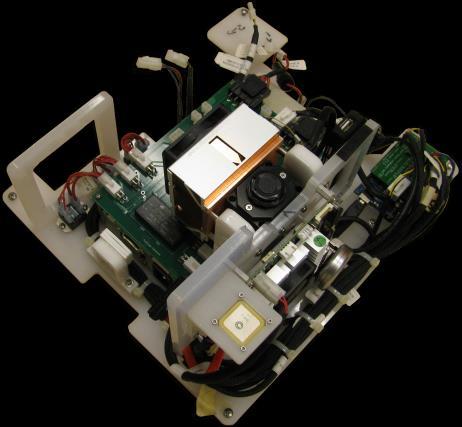

38 Advanced Sky Imagers Hardware Development 2 years development 1 year of testing 4 deployments ready for commercialization

39 High Dynamic Range Imaging


 Clear")


40 Cloud Tracking raw image RBR RBR - CSL binary image cloud motion ray tracing of direct solar beam sky imager cloudmap Sky Imager Clouds detected using red-blue ratio (RBR) Clear sky library (CSL) provides detection reference Binary image projected to sky (cloudmap) Ray tracing provides ground shadows forecast domain
The Center for Renewable Resource Integration at UC San Diego
 The Center for Renewable Resource Integration at UC San Diego Carlos F. M. Coimbra ccoimbra@ucsd.edu; solarwind.ucsd.edu Jan Kleissl and Byron Washom UCSD Center of Excellence in Renewable Resources and
Solar irradiance modelling over Belgium using WRF-ARW :
 Solar irradiance modelling over Belgium Sensitivity analysis of Mellor-Yamada- Nakanishi-Niino (MYNN) boundary layer scheme parameters Beaumet J., Fettweis X., Doutreloup S. & Erpicum M. Meteoclim, PhD
Importance of Numerical Weather Prediction in Variable Renewable Energy Forecast
 Importance of Numerical Weather Prediction in Variable Renewable Energy Forecast Dr. Abhijit Basu (Integrated Research & Action for Development) Arideep Halder (Thinkthrough Consulting Pvt. Ltd.) September
UC San Diego UC San Diego Electronic Theses and Dissertations
 UC San Diego UC San Diego Electronic Theses and Dissertations Title Advanced Numerical Weather Prediction Techniques for Solar Irradiance Forecasting : : Statistical, Data-Assimilation, and Ensemble Forecasting
A Community Gridded Atmospheric Forecast System for Calibrated Solar Irradiance
 A Community Gridded Atmospheric Forecast System for Calibrated Solar Irradiance David John Gagne 1,2 Sue E. Haupt 1,3 Seth Linden 1 Gerry Wiener 1 1. NCAR RAL 2. University of Oklahoma 3. Penn State University
Short-term Solar Forecasting
 Short-term Solar Forecasting Presented by Jan Kleissl, Dept of Mechanical and Aerospace Engineering, University of California, San Diego 2 Agenda Value of Solar Forecasting Total Sky Imagery for Cloud
An Integrated Approach to the Prediction of Weather, Renewable Energy Generation and Energy Demand in Vermont
 1 An Integrated Approach to the Prediction of Weather, Renewable Energy Generation and Energy Demand in Vermont James P. Cipriani IBM Thomas J. Watson Research Center Yorktown Heights, NY Other contributors
SDG&E Meteorology. EDO Major Projects. Electric Distribution Operations
 Electric Distribution Operations SDG&E Meteorology EDO Major Projects 2013 San Diego Gas & Electric Company. All copyright and trademark rights reserved. OCTOBER 2007 WILDFIRES In 2007, wildfires burned
CARLOS F. M. COIMBRA (PI) HUGO T. C. PEDRO (CO-PI)
 HUGO T. C. PEDRO (CO-PI)") HIGH-FIDELITY SOLAR POWER FORECASTING SYSTEMS FOR THE 392 MW IVANPAH SOLAR PLANT (CSP) AND THE 250 MW CALIFORNIA VALLEY SOLAR RANCH (PV) PROJECT CEC EPC-14-008 CARLOS F. M. COIMBRA (PI) HUGO T. C. PEDRO
HIGH-FIDELITY SOLAR POWER FORECASTING SYSTEMS FOR THE 392 MW IVANPAH SOLAR PLANT (CSP) AND THE 250 MW CALIFORNIA VALLEY SOLAR RANCH (PV) PROJECT CEC EPC-14-008 CARLOS F. M. COIMBRA (PI) HUGO T. C. PEDRO
Addressing Diurnal Temperature Biases in the WRF Model
 Addressing Diurnal Temperature Biases in the WRF Model Jeffrey Massey University of Utah Collaborators: Jim Steenburgh, Jason Knievel, Sebastian Hoch, Josh Hacker Long term 2-m temperature verification
CLOUD VELOCITY ESTIMATION FROM AN ARRAY OF SOLAR RADIATION MEASUREMENTS
 CLOUD VELOCITY ESTIMATION FROM AN ARRAY OF SOLAR RADIATION MEASUREMENTS Juan L. Bosch Yuehai Zheng Jan Kleissl Department of Mechanical and Aerospace Engineering Center for Renewable Resources and Integration
Solar Nowcasting with Cluster-based Detrending
 Solar Nowcasting with Cluster-based Detrending Antonio Sanfilippo, Luis Pomares, Daniel Perez-Astudillo, Nassma Mohandes, Dunia Bachour ICEM 2017 Oral Presentation 26-29June 2017, Bari, Italy Overview
An Operational Solar Forecast Model For PV Fleet Simulation. Richard Perez & Skip Dise Jim Schlemmer Sergey Kivalov Karl Hemker, Jr.
 An Operational Solar Forecast Model For PV Fleet Simulation Richard Perez & Skip Dise Jim Schlemmer Sergey Kivalov Karl Hemker, Jr. Adam Kankiewicz Historical and forecast platform Blended forecast approach
Méso-NH simulations of Fog and Stratocumulus Clouds in Los Angeles
 Méso-NH simulations of Fog and Stratocumulus Clouds in Los Angeles Rui Salgado (Univ. Évora) João Teixeira, Marcin Kurowski and Kay Suselj (JPL) 1/17 Motivation May Grey and June Gloom In California, people
P2.11 THE LAKE SHADOW EFFECT OF LAKE BREEZE CIRCULATIONS AND RECENT EXAMPLES FROM GOES VISIBLE SATELLITE IMAGERY. Frank S. Dempsey
 P2.11 THE LAKE SHADOW EFFECT OF LAKE BREEZE CIRCULATIONS AND RECENT EXAMPLES FROM GOES VISIBLE SATELLITE IMAGERY Frank S. Dempsey 1. ABSTRACT The lake shadow effect is a component of the lake breeze circulation
Arctic System Reanalysis Provides Highresolution Accuracy for Arctic Studies
 Arctic System Reanalysis Provides Highresolution Accuracy for Arctic Studies David H. Bromwich, Aaron Wilson, Lesheng Bai, Zhiquan Liu POLAR2018 Davos, Switzerland Arctic System Reanalysis Regional reanalysis
A SOLAR AND WIND INTEGRATED FORECAST TOOL (SWIFT) DESIGNED FOR THE MANAGEMENT OF RENEWABLE ENERGY VARIABILITY ON HAWAIIAN GRID SYSTEMS
 DESIGNED FOR THE MANAGEMENT OF RENEWABLE ENERGY VARIABILITY ON HAWAIIAN GRID SYSTEMS") ALBANY BARCELONA BANGALORE ICEM 2015 June 26, 2015 Boulder, CO A SOLAR AND WIND INTEGRATED FORECAST TOOL (SWIFT) DESIGNED FOR THE MANAGEMENT OF RENEWABLE ENERGY VARIABILITY ON HAWAIIAN GRID SYSTEMS JOHN
ALBANY BARCELONA BANGALORE ICEM 2015 June 26, 2015 Boulder, CO A SOLAR AND WIND INTEGRATED FORECAST TOOL (SWIFT) DESIGNED FOR THE MANAGEMENT OF RENEWABLE ENERGY VARIABILITY ON HAWAIIAN GRID SYSTEMS JOHN
DRAFT: CLOUD VELOCITY ESTIMATION FROM AN ARRAY OF SOLAR RADIATION MEASUREMENTS
 Proceedings of the ASME 212 6th International Conference on Energy Sustainability & 1th Fuel Cell Science, Engineering and Technology Conference ES/FUELL 212 August 1-18, 212, San Diego, California, USA
COMPARISON OF CLEAR-SKY MODELS FOR EVALUATING SOLAR FORECASTING SKILL
 COMPARISON OF CLEAR-SKY MODELS FOR EVALUATING SOLAR FORECASTING SKILL Ricardo Marquez Mechanical Engineering and Applied Mechanics School of Engineering University of California Merced Carlos F. M. Coimbra
ESCI 344 Tropical Meteorology Lesson 7 Temperature, Clouds, and Rain
 ESCI 344 Tropical Meteorology Lesson 7 Temperature, Clouds, and Rain References: Forecaster s Guide to Tropical Meteorology (updated), Ramage Tropical Climatology, McGregor and Nieuwolt Climate and Weather
Differing Effects of Subsidence on Marine Boundary Layer Cloudiness
 Differing Effects of Subsidence on Marine Boundary Layer Cloudiness Joel Norris* Timothy Myers C. Seethala Scripps Institution of Oceanography *contact Information: jnorris@ucsd.edu Subsidence and Stratocumulus
Weather report 28 November 2017 Campinas/SP
 Weather report 28 November 2017 Campinas/SP Summary: 1) Synoptic analysis and pre-convective environment 2) Verification 1) Synoptic analysis and pre-convective environment: At 1200 UTC 28 November 2017
CHARACTERIZATION OF IRRADIANCE VARIABILITY USING A HIGH- RESOLUTION, CLOUD-ASSIMILATING NWP
 CHARACTERIZATION OF IRRADIANCE VARIABILITY USING A HIGH- RESOLUTION, CLOUD-ASSIMILATING NWP Patrick Mathiesen Jan Kleissl University of California, San Diego 9500 Gilman Dr. La Jolla, CA, 92093 Craig Collier
Development and Validation of Polar WRF
 Polar Meteorology Group, Byrd Polar Research Center, The Ohio State University, Columbus, Ohio Development and Validation of Polar WRF David H. Bromwich 1,2, Keith M. Hines 1, and Le-Sheng Bai 1 1 Polar
Weather Research and Forecasting Model. Melissa Goering Glen Sampson ATMO 595E November 18, 2004
 Weather Research and Forecasting Model Melissa Goering Glen Sampson ATMO 595E November 18, 2004 Outline What does WRF model do? WRF Standard Initialization WRF Dynamics Conservation Equations Grid staggering
WRF Model Simulated Proxy Datasets Used for GOES-R Research Activities
 WRF Model Simulated Proxy Datasets Used for GOES-R Research Activities Jason Otkin Cooperative Institute for Meteorological Satellite Studies Space Science and Engineering Center University of Wisconsin
The Atmospheric Boundary Layer. The Surface Energy Balance (9.2)
") The Atmospheric Boundary Layer Turbulence (9.1) The Surface Energy Balance (9.2) Vertical Structure (9.3) Evolution (9.4) Special Effects (9.5) The Boundary Layer in Context (9.6) What processes control
The Atmospheric Boundary Layer Turbulence (9.1) The Surface Energy Balance (9.2) Vertical Structure (9.3) Evolution (9.4) Special Effects (9.5) The Boundary Layer in Context (9.6) What processes control
2012 AHW Stream 1.5 Retrospective Results
 2012 AHW Stream 1.5 Retrospective Results Ryan D. Torn, Univ. Albany, SUNY Chris Davis, Wei Wang, Jimy Dudhia, Tom Galarneau, Chris Snyder, James Done, NCAR/NESL/MMM Overview Since participation in HFIP
P1.3 DIURNAL VARIABILITY OF THE CLOUD FIELD OVER THE VOCALS DOMAIN FROM GOES IMAGERY. CIMMS/University of Oklahoma, Norman, OK 73069
 P1.3 DIURNAL VARIABILITY OF THE CLOUD FIELD OVER THE VOCALS DOMAIN FROM GOES IMAGERY José M. Gálvez 1, Raquel K. Orozco 1, and Michael W. Douglas 2 1 CIMMS/University of Oklahoma, Norman, OK 73069 2 NSSL/NOAA,
Advanced Hurricane WRF (AHW) Physics
 Physics") Advanced Hurricane WRF (AHW) Physics Jimy Dudhia MMM Division, NCAR 1D Ocean Mixed-Layer Model 1d model based on Pollard, Rhines and Thompson (1973) was added for hurricane forecasts Purpose is to represent
Advanced Hurricane WRF (AHW) Physics Jimy Dudhia MMM Division, NCAR 1D Ocean Mixed-Layer Model 1d model based on Pollard, Rhines and Thompson (1973) was added for hurricane forecasts Purpose is to represent
MxVision WeatherSentry Web Services Content Guide
 MxVision WeatherSentry Web Services Content Guide July 2014 DTN 11400 Rupp Drive Minneapolis, MN 55337 00.1.952.890.0609 This document and the software it describes are copyrighted with all rights reserved.
weather forecast Improving NOAA models for energy Stan Benjamin, Boulder, CO USA Joseph Olson, Curtis Alexander, Eric James,
 Lamont, OK X Obs radar 5h HRRR Forecast Improving NOAA weather forecast models for energy Stan Benjamin, Joseph Olson, Curtis Alexander, Eric James, Dave Turner, Melinda Marquis NOAA Earth System Research
Evaluating Satellite Derived and Measured Irradiance Accuracy for PV Resource Management in the California Independent System Operator Control Area
 Evaluating Satellite Derived and Measured Irradiance Accuracy for PV Resource Management in the California Independent System Operator Control Area Thomas E. Hoff, Clean Power Research Richard Perez, ASRC,
IMPROVING CLOUD PREDICTION IN WRF THROUGH THE USE OF GOES SATELLITE ASSIMILATION
 IMPROVING CLOUD PREDICTION IN WRF THROUGH THE USE OF GOES SATELLITE ASSIMILATION Andrew T. White*, Arastoo P. Biazar, Richard T. McNider, Kevin Doty, Maudood Khan Earth System Science Center, The University
The skill of ECMWF cloudiness forecasts
 from Newsletter Number 143 Spring 215 METEOROLOGY The skill of ECMWF cloudiness forecasts tounka25/istock/thinkstock doi:1.21957/lee5bz2g This article appeared in the Meteorology section of ECMWF Newsletter
The document was not produced by the CAISO and therefore does not necessarily reflect its views or opinion.
 Version No. 1.0 Version Date 2/25/2008 Externally-authored document cover sheet Effective Date: 4/03/2008 The purpose of this cover sheet is to provide attribution and background information for documents
Uncertainties in planetary boundary layer schemes and current status of urban boundary layer simulations at OU
 Uncertainties in planetary boundary layer schemes and current status of urban boundary layer simulations at OU Xiaoming Hu September 16 th @ 3:00 PM, NWC 5600 Contributors: Fuqing Zhang, Pennsylvania State
The Planetary Boundary Layer and Uncertainty in Lower Boundary Conditions
 The Planetary Boundary Layer and Uncertainty in Lower Boundary Conditions Joshua Hacker National Center for Atmospheric Research hacker@ucar.edu Topics The closure problem and physical parameterizations
COMPARISON OF CLEAR-SKY MODELS FOR EVALUATING SOLAR FORECASTING SKILL
 COMPARISON OF CLEAR-SKY MODELS FOR EVALUATING SOLAR FORECASTING SKILL Ricardo Marquez Mechanical Engineering Applied Mechanics School of Engineering University of California Merced Merced, California 95343
Changes in Cloud Cover and Cloud Types Over the Ocean from Surface Observations, Ryan Eastman Stephen G. Warren Carole J.
 Changes in Cloud Cover and Cloud Types Over the Ocean from Surface Observations, 1954-2008 Ryan Eastman Stephen G. Warren Carole J. Hahn Clouds Over the Ocean The ocean is cloudy, more-so than land Cloud
National Center for Atmospheric Research Research Applications Laboratory Renewable Energy
 National Center for Atmospheric Research Research Applications Laboratory Renewable Energy Dr. Sue Ellen Haupt, Director & Dr. Branko Kosovic, Program Manager Weather Systems & Assessment Program Research
11 days (00, 12 UTC) 132 hours (06, 18 UTC) One unperturbed control forecast and 26 perturbed ensemble members. --
 132 hours (06, 18 UTC) One unperturbed control forecast and 26 perturbed ensemble members. --") APPENDIX 2.2.6. CHARACTERISTICS OF GLOBAL EPS 1. Ensemble system Ensemble (version) Global EPS (GEPS1701) Date of implementation 19 January 2017 2. EPS configuration Model (version) Global Spectral Model
APPENDIX 2.2.6. CHARACTERISTICS OF GLOBAL EPS 1. Ensemble system Ensemble (version) Global EPS (GEPS1701) Date of implementation 19 January 2017 2. EPS configuration Model (version) Global Spectral Model
Polar WRF. Polar Meteorology Group Byrd Polar and Climate Research Center The Ohio State University Columbus Ohio
 Polar WRF David H. Bromwich, Keith M. Hines, Lesheng Bai and Sheng-Hung Wang Polar Meteorology Group Byrd Polar and Climate Research Center The Ohio State University Columbus Ohio Byrd Polar and Climate
A WRF-based rapid updating cycling forecast system of. BMB and its performance during the summer and Olympic. Games 2008
 A WRF-based rapid updating cycling forecast system of BMB and its performance during the summer and Olympic Games 2008 Min Chen 1, Shui-yong Fan 1, Jiqin Zhong 1, Xiang-yu Huang 2, Yong-Run Guo 2, Wei
Large-Eddy Simulations of Tropical Convective Systems, the Boundary Layer, and Upper Ocean Coupling
 DISTRIBUTION STATEMENT A. Approved for public release; distribution is unlimited. Large-Eddy Simulations of Tropical Convective Systems, the Boundary Layer, and Upper Ocean Coupling Eric D. Skyllingstad
5. General Circulation Models
 5. General Circulation Models I. 3-D Climate Models (General Circulation Models) To include the full three-dimensional aspect of climate, including the calculation of the dynamical transports, requires
The Fifth-Generation NCAR / Penn State Mesoscale Model (MM5) Mark Decker Feiqin Xie ATMO 595E November 23, 2004 Department of Atmospheric Science
 Mark Decker Feiqin Xie ATMO 595E November 23, 2004 Department of Atmospheric Science") The Fifth-Generation NCAR / Penn State Mesoscale Model (MM5) Mark Decker Feiqin Xie ATMO 595E November 23, 2004 Department of Atmospheric Science Outline Basic Dynamical Equations Numerical Methods Initialization
The Fifth-Generation NCAR / Penn State Mesoscale Model (MM5) Mark Decker Feiqin Xie ATMO 595E November 23, 2004 Department of Atmospheric Science Outline Basic Dynamical Equations Numerical Methods Initialization
Post-processing of solar irradiance forecasts from WRF Model at Reunion Island
 Available online at www.sciencedirect.com ScienceDirect Energy Procedia 57 (2014 ) 1364 1373 2013 ISES Solar World Congress Post-processing of solar irradiance forecasts from WRF Model at Reunion Island
A GSI-based convection-allowing EnKF and ensemble forecast system for PECAN
 A GSI-based convection-allowing EnKF and ensemble forecast system for PECAN Aaron Johnson, Xuguang Wang, Samuel Degelia University of Oklahoma, Norman, OK 26 May 2016 7 th EnKF Data Assimilation Workshop,
Climate Modeling Component
 Nevada Infrastructure for Climate Change Science, Education, and Outreach Climate Modeling Component Regional Climate Modeling: Methodological issues and experimental designs John Mejia, Darko Koracin,
Near-surface Measurements In Support of Electromagnetic Wave Propagation Study
 DISTRIBUTION STATEMENT A. Approved for public release; distribution is unlimited. Near-surface Measurements In Support of Electromagnetic Wave Propagation Study Qing Wang Meteorology Department, Naval
Improved rainfall and cloud-radiation interaction with Betts-Miller-Janjic cumulus scheme in the tropics
 Improved rainfall and cloud-radiation interaction with Betts-Miller-Janjic cumulus scheme in the tropics Tieh-Yong KOH 1 and Ricardo M. FONSECA 2 1 Singapore University of Social Sciences, Singapore 2
Temporal downscaling of irradiance data via Hidden Markov Models on Wavelet coefficients: Application to California Solar Initiative data
 Temporal downscaling of irradiance data via Hidden Markov Models on Wavelet coefficients: Application to California Solar Initiative data Jörg Wegener, Matthew Lave, Jennifer Luoma and Jan Kleissl February,
Near-surface weather prediction and surface data assimilation: challenges, development, and potential data needs
 Near-surface weather prediction and surface data assimilation: challenges, development, and potential data needs Zhaoxia Pu Department of Atmospheric Sciences University of Utah, Salt Lake City, Utah,
Assessment of the Noah LSM with Multi-parameterization Options (Noah-MP) within WRF
 within WRF") Assessment of the Noah LSM with Multi-parameterization Options (Noah-MP) within WRF Michelle Harrold, Jamie Wolff, and Mei Xu National Center for Atmospheric Research Research Applications Laboratory and
Assessment of the Noah LSM with Multi-parameterization Options (Noah-MP) within WRF Michelle Harrold, Jamie Wolff, and Mei Xu National Center for Atmospheric Research Research Applications Laboratory and
AIR MASSES. Large bodies of air. SOURCE REGIONS areas where air masses originate
 Large bodies of air AIR MASSES SOURCE REGIONS areas where air masses originate Uniform in composition Light surface winds Dominated by high surface pressure The longer the air mass remains over a region,
David John Gagne II, NCAR
 The Performance Impacts of Machine Learning Design Choices for Gridded Solar Irradiance Forecasting Features work from Evaluating Statistical Learning Configurations for Gridded Solar Irradiance Forecasting,
Boundary layer equilibrium [2005] over tropical oceans
![Boundary layer equilibrium [2005] over tropical oceans](/thumbs/96/128963638.jpg "Boundary layer equilibrium [2005] over tropical oceans") Boundary layer equilibrium [2005] over tropical oceans Alan K. Betts [akbetts@aol.com] Based on: Betts, A.K., 1997: Trade Cumulus: Observations and Modeling. Chapter 4 (pp 99-126) in The Physics and Parameterization
Boundary layer equilibrium [2005] over tropical oceans Alan K. Betts [akbetts@aol.com] Based on: Betts, A.K., 1997: Trade Cumulus: Observations and Modeling. Chapter 4 (pp 99-126) in The Physics and Parameterization
Incorporation of 3D Shortwave Radiative Effects within the Weather Research and Forecasting Model
 Incorporation of 3D Shortwave Radiative Effects within the Weather Research and Forecasting Model W. O Hirok and P. Ricchiazzi Institute for Computational Earth System Science University of California
Operational quantitative precipitation estimation using radar, gauge g and
 Operational quantitative precipitation estimation using radar, gauge g and satellite for hydrometeorological applications in Southern Brazil Leonardo Calvetti¹, Cesar Beneti¹, Diogo Stringari¹, i¹ Alex
Remote Sensing and Sensor Networks:
 SDG&E Meteorology Remote Sensing and Sensor Networks: Providing meteorological intelligence to support system operations Mike Espinoza Project Manager Steven Vanderburg Senior Meteorologist Brian D Agostino
Land Surface Processes and Their Impact in Weather Forecasting
 Land Surface Processes and Their Impact in Weather Forecasting Andrea Hahmann NCAR/RAL with thanks to P. Dirmeyer (COLA) and R. Koster (NASA/GSFC) Forecasters Conference Summer 2005 Andrea Hahmann ATEC
Unified Cloud and Mixing Parameterizations of the Marine Boundary Layer: EDMF and PDF-based cloud approaches
 DISTRIBUTION STATEMENT A. Approved for public release; distribution is unlimited. Unified Cloud and Mixing Parameterizations of the Marine Boundary Layer: EDMF and PDF-based cloud approaches Joao Teixeira
1. CLIMATOLOGY: 2. ATMOSPHERIC CHEMISTRY:
 What is meteorology? A. METEOROLOGY: an atmospheric science that studies the day to day changes in the atmosphere 1. ATMOSPHERE: the blanket of gas that surrounds the surface of Earth; the air 2. WEATHER:
Sensitivity of precipitation forecasts to cumulus parameterizations in Catalonia (NE Spain)
") Sensitivity of precipitation forecasts to cumulus parameterizations in Catalonia (NE Spain) Jordi Mercader (1), Bernat Codina (1), Abdelmalik Sairouni (2), Jordi Cunillera (2) (1) Dept. of Astronomy and
Sensitivity of precipitation forecasts to cumulus parameterizations in Catalonia (NE Spain) Jordi Mercader (1), Bernat Codina (1), Abdelmalik Sairouni (2), Jordi Cunillera (2) (1) Dept. of Astronomy and
Preliminary results. Leonardo Calvetti, Rafael Toshio, Flávio Deppe and Cesar Beneti. Technological Institute SIMEPAR, Curitiba, Paraná, Brazil
 HIGH RESOLUTION WRF SIMULATIONS FOR WIND GUST EVENTS Preliminary results Leonardo Calvetti, Rafael Toshio, Flávio Deppe and Cesar Beneti Technological Institute SIMEPAR, Curitiba, Paraná, Brazil 3 rd WMO/WWRP
GEOGRAPHY EYA NOTES. Weather. atmosphere. Weather and climate
 GEOGRAPHY EYA NOTES Weather and climate Weather The condition of the atmosphere at a specific place over a relatively short period of time Climate The atmospheric conditions of a specific place over a
Polar Weather Prediction
 Polar Weather Prediction David H. Bromwich Session V YOPP Modelling Component Tuesday 14 July 2015 A special thanks to the following contributors: Kevin W. Manning, Jordan G. Powers, Keith M. Hines, Dan
InSAR measurements of volcanic deformation at Etna forward modelling of atmospheric errors for interferogram correction
 InSAR measurements of volcanic deformation at Etna forward modelling of atmospheric errors for interferogram correction Rachel Holley, Geoff Wadge, Min Zhu Environmental Systems Science Centre, University
Downscaling West African climate: uncertainties, sensitivity to the model physics and regional variability
 Downscaling West African climate: uncertainties, sensitivity to the model physics and regional variability Benjamin Pohl, Johanna Ramarohetra, Benjamin Sultan, Arona Diedhiou, Gaëlle de Coëtlogon, Serge
SOLAR POWER FORECASTING BASED ON NUMERICAL WEATHER PREDICTION, SATELLITE DATA, AND POWER MEASUREMENTS
 BASED ON NUMERICAL WEATHER PREDICTION, SATELLITE DATA, AND POWER MEASUREMENTS Detlev Heinemann, Elke Lorenz Energy Meteorology Group, Institute of Physics, Oldenburg University Workshop on Forecasting,
Charles A. Doswell III, Harold E. Brooks, and Robert A. Maddox
 Charles A. Doswell III, Harold E. Brooks, and Robert A. Maddox Flash floods account for the greatest number of fatalities among convective storm-related events but it still remains difficult to forecast
Mesoscale meteorological models. Claire L. Vincent, Caroline Draxl and Joakim R. Nielsen
 Mesoscale meteorological models Claire L. Vincent, Caroline Draxl and Joakim R. Nielsen Outline Mesoscale and synoptic scale meteorology Meteorological models Dynamics Parametrizations and interactions
Water Balance in the Murray-Darling Basin and the recent drought as modelled with WRF
 18 th World IMACS / MODSIM Congress, Cairns, Australia 13-17 July 2009 http://mssanz.org.au/modsim09 Water Balance in the Murray-Darling Basin and the recent drought as modelled with WRF Evans, J.P. Climate
Weather Forecasting. March 26, 2009
 Weather Forecasting Chapter 13 March 26, 2009 Forecasting The process of inferring weather from a blend of data, understanding, climatology, and solutions of the governing equations Requires an analysis
The impact of rain on ocean wave evolution and its feedback to the atmosphere
 HAROKOPIO UNIVERSITY OF ATHENS DEPARTMENT OF GEOGRAPHY ATMOSPHERE AND CLIMATE DYNAMICS GROUP (ACDG) http://meteoclima.gr Coastal Hydrology and Surface Processes linked to Air/Sea Modeling: 1 st community
Radiative Climatology of the North Slope of Alaska and the Adjacent Arctic Ocean
 Radiative Climatology of the North Slope of Alaska and the Adjacent Arctic Ocean C. Marty, R. Storvold, and X. Xiong Geophysical Institute University of Alaska Fairbanks, Alaska K. H. Stamnes Stevens Institute
Mechanical Turbulence Wind forms eddies as it blows around hanger, stands of trees or other obstructions
 Turbulence Low-level Turbulence below 15,000 feet consists of Mechanical Turbulence Convective Turbulence Frontal Turbulence Wake Turbulence Mechanical Turbulence Wind forms eddies as it blows around hanger,
Numerical Weather Prediction: Data assimilation. Steven Cavallo
 Numerical Weather Prediction: Data assimilation Steven Cavallo Data assimilation (DA) is the process estimating the true state of a system given observations of the system and a background estimate. Observations
Numerical simulation of marine stratocumulus clouds Andreas Chlond
 Numerical simulation of marine stratocumulus clouds Andreas Chlond Marine stratus and stratocumulus cloud (MSC), which usually forms from 500 to 1000 m above the ocean surface and is a few hundred meters
A Global Atmospheric Model. Joe Tribbia NCAR Turbulence Summer School July 2008
 A Global Atmospheric Model Joe Tribbia NCAR Turbulence Summer School July 2008 Outline Broad overview of what is in a global climate/weather model of the atmosphere Spectral dynamical core Some results-climate
INVESTIGATION FOR A POSSIBLE INFLUENCE OF IOANNINA AND METSOVO LAKES (EPIRUS, NW GREECE), ON PRECIPITATION, DURING THE WARM PERIOD OF THE YEAR
, ON PRECIPITATION, DURING THE WARM PERIOD OF THE YEAR") Proceedings of the 13 th International Conference of Environmental Science and Technology Athens, Greece, 5-7 September 2013 INVESTIGATION FOR A POSSIBLE INFLUENCE OF IOANNINA AND METSOVO LAKES (EPIRUS,
Proceedings of the 13 th International Conference of Environmental Science and Technology Athens, Greece, 5-7 September 2013 INVESTIGATION FOR A POSSIBLE INFLUENCE OF IOANNINA AND METSOVO LAKES (EPIRUS,
Motivation & Goal. We investigate a way to generate PDFs from a single deterministic run
 Motivation & Goal Numerical weather prediction is limited by errors in initial conditions, model imperfections, and nonlinearity. Ensembles of an NWP model provide forecast probability density functions
A Study of Convective Initiation Failure on 22 Oct 2004
 A Study of Convective Initiation Failure on 22 Oct 2004 Jennifer M. Laflin Philip N. Schumacher NWS Sioux Falls, SD August 6 th, 2011 Introduction Forecasting challenge: strong forcing for ascent and large
Air Quality Screening Modeling
 Air Quality Screening Modeling 2007 Meteorology Simulation with WRF OTC Modeling Committee Meeting September 16, 2010 Baltimore, MD Presentation is based upon the following technical reports available
Impact of different cumulus parameterizations on the numerical simulation of rain over southern China
 Impact of different cumulus parameterizations on the numerical simulation of rain over southern China P.W. Chan * Hong Kong Observatory, Hong Kong, China 1. INTRODUCTION Convective rain occurs over southern
Atmospheric Moisture, Precipitation, and Weather Systems
 Atmospheric Moisture, Precipitation, and Weather Systems 6 Chapter Overview The atmosphere is a complex system, sometimes described as chaotic in nature. In this chapter we examine one of the principal
Chapter 6. Cloud Development and Forms
 Cloud Formation Chapter 6 Cloud Development and Forms Condensation (i.e. clouds,fog) results from: Diabatic cooling (important for fog) Adiabatic cooling (important for clouds) Clouds form due to adiabatic
OUTPUTS AND ERROR INDICATORS FOR SOLAR FORECASTING MODELS
 OUTPUTS AND ERROR INDICATORS FOR SOLAR FORECASTING MODELS Mathieu DAVID Hadja Maïmouna DIAGNE Philippe LAURET PIMENT University of La Reunion 97715 Saint Denis Cedex 9 Reunion Island mathieu.david@univ-reunion.fr
Evaluation of Global Horizontal Irradiance Derived from CLAVR-x Model and COMS Imagery Over the Korean Peninsula
 ew & Renewable Energy 2016. 10 Vol. 12, o. S2 ISS 1738-3935 http://dx.doi.org/10.7849/ksnre.2016.10.12.s2.13 [2016-10-PV-002] Evaluation of Global Horizontal Irradiance Derived from CLAVR-x Model and COMS
ATMOSPHERIC CIRCULATION AND WIND
 ATMOSPHERIC CIRCULATION AND WIND The source of water for precipitation is the moisture laden air masses that circulate through the atmosphere. Atmospheric circulation is affected by the location on the
NSF 2005 CPT Report. Jeffrey T. Kiehl & Cecile Hannay
 NSF 2005 CPT Report Jeffrey T. Kiehl & Cecile Hannay Introduction: The focus of our research is on the role of low tropical clouds in affecting climate sensitivity. Comparison of climate simulations between
Operational Uses of Bands on the GOES-R Advanced Baseline Imager (ABI) Presented by: Kaba Bah
 Presented by: Kaba Bah") Operational Uses of Bands on the GOES-R Advanced Baseline Imager (ABI) Presented by: Kaba Bah Topics: Introduction to GOES-R & ABI ABI individual bands Use of band differences ABI derived products Conclusions
Operational Uses of Bands on the GOES-R Advanced Baseline Imager (ABI) Presented by: Kaba Bah Topics: Introduction to GOES-R & ABI ABI individual bands Use of band differences ABI derived products Conclusions
Forecasting of Optical Turbulence in Support of Realtime Optical Imaging and Communication Systems
 Forecasting of Optical Turbulence in Support of Realtime Optical Imaging and Communication Systems Randall J. Alliss and Billy Felton Northrop Grumman Corporation, 15010 Conference Center Drive, Chantilly,
Jordan G. Powers Kevin W. Manning. Mesoscale and Microscale Meteorology Laboratory National Center for Atmospheric Research Boulder, CO
 Jordan G. Powers Kevin W. Manning Mesoscale and Microscale Meteorology Laboratory National Center for Atmospheric Research Boulder, CO Background : Model for Prediction Across Scales Global atmospheric
Remote Sensing Applications for Land/Atmosphere: Earth Radiation Balance
 Remote Sensing Applications for Land/Atmosphere: Earth Radiation Balance - Introduction - Deriving surface energy balance fluxes from net radiation measurements - Estimation of surface net radiation from
Application and Evaluation of the Global Weather Research and Forecasting (GWRF) Model
 Model") Application and Evaluation of the Global Weather Research and Forecasting (GWRF) Model Joshua Hemperly, Xin-Yu Wen, Nicholas Meskhidze, and Yang Zhang* Department of Marine, Earth, and Atmospheric Sciences,
Application and Evaluation of the Global Weather Research and Forecasting (GWRF) Model Joshua Hemperly, Xin-Yu Wen, Nicholas Meskhidze, and Yang Zhang* Department of Marine, Earth, and Atmospheric Sciences,
What you need to know in Ch. 12. Lecture Ch. 12. Atmospheric Heat Engine
 Lecture Ch. 12 Review of simplified climate model Revisiting: Kiehl and Trenberth Overview of atmospheric heat engine Current research on clouds-climate Curry and Webster, Ch. 12 For Wednesday: Read Ch.
Moisture, Clouds, and Precipitation: Clouds and Precipitation. Dr. Michael J Passow
 Moisture, Clouds, and Precipitation: Clouds and Precipitation Dr. Michael J Passow What Processes Lift Air? Clouds require three things: water vapor, a condensation nucleus, and cooling Cooling usually
AN ARTIFICIAL NEURAL NETWORK BASED APPROACH FOR ESTIMATING DIRECT NORMAL, DIFFUSE HORIZONTAL AND GLOBAL HORIZONTAL IRRADIANCES USING SATELLITE IMAGES
 AN ARTIFICIAL NEURAL NETWORK BASED APPROACH FOR ESTIMATING DIRECT NORMAL, DIFFUSE HORIZONTAL AND GLOBAL HORIZONTAL IRRADIANCES USING SATELLITE IMAGES Yehia Eissa Prashanth R. Marpu Hosni Ghedira Taha B.M.J.