Air Quality Screening Modeling
|
|
|
- Timothy Lester
- 5 years ago
- Views:
Transcription
1 Air Quality Screening Modeling 2007 Meteorology Simulation with WRF OTC Modeling Committee Meeting September 16, 2010 Baltimore, MD
2 Presentation is based upon the following technical reports available from the OTC Sensitivity testing of WRF Physics parameterizations and protocol for meteorological modeling in support of Regional SIP air quality modeling in the Ozone Transport Region (OTR) Assessment of 2007 WRF meteorological modeling in support of regional air quality modeling in the Ozone Transport Region (OTR)
3 Simulated WRF meteorological fields were found to be acceptable, based on performance metrics for surface level temperature, wind speed and direction, water vapor, precipitation, wind profilers, cloud cover, and planetary boundary layer height (PBL) Design Approach and Conclusions Collaborative process with other RPOs, with assistance from University of Maryland Participant States were GA, IA, MD, NC, NY, and VA Setup benchmark and sensitivity simulations to develop a common configuration
4 Initial Work Goal was to ensure that WRF simulation performed by each State modeling center would yield no differences in the simulated meteorological fields by the use of a common set of input data prepared by UMD for a 20 day period in summer and winter of 2007 with an agreed upon vertical and horizontal framework for WRF simulation This benchmark effort however showed significant differences between the state simulations, suggesting the need for a common configuration of hardware/software system Using a static compiled executable WRF code with 8 CPUs and a common operating system (OS), the numerical differences between the state modeling centers were found to be minimal
5 WRF Sensitivity Comparison Goal: To determine a suitable configuration for annual simulation Selection: Planetary Boundary Layer (PBL) Schemes: ACM2, MYJ, YSU, and modified Blackadar Microphysics: WSM5 and WSM6 Land Surface: NOAH and PX Time Periods: Summer and Winter Periods Comparison Analysis: Techniques Development Laboratory (TDL) data wind speed (with/without calms), temperature and humidity from National Weather Service (NWS) Clean Air Status and Trends Network (CASTNet) data wind speed and temperature Wind profiler data from NWS Satellite cloud cover data from UMD Precipitation data from NWS
6 Selected Configuration for 2007 OTC WRF WRF version 3.1 North American Mesoscale model (NAM) analyses fields as input to 36 km, and 12 km domains in a 2 way nested mode OBSGRID for enhance nudging with observed data Model runs were at five and half days block with 12 hours overlap Annual Modeling Model Options WSM6 microphysics RRTM long and shortwave radiation Pleim Xiu land surface and surface layer models Modified Blackadar planetary boundary layer (PBL) scheme Kain Fritsch cumulus parameterization Applied analysis nudging for winds above and below PBL Applied analysis nudging for temperature and moisture above PBL only

7 WRF Modeling domains at 36 and 12 km, and the 12 km Air Quality Modeling domain shown shaded, and the MANE-VU domain shown in blue
8 WRF simulation Assessment TDL Data Monthly Statistics Wind Speed: WRF over predicted (positive bias) in winter months, and negative bias in summer months. The normalized bias is higher in summer due to observed low wind speeds Temperature: WRF predictions exhibit positive bias in winter and negative bias in summer Humidity: WRF overestimated observed humidity Overall: WRF Performance is in line with acceptable range of bias reported for meteorological modeling systems

9 An Example Over the 12 km domain wind speed monthly statistics comparing simulation against TDL data Wind Speed Jan Feb March April May June July Aug Sept Oct Nov Dec Sample_Size Mean_Obs Mean_Model STD_Obs STD_Model Mean_Bias STD_bias RMSE Normalized_Mean_Bias (%) Mean_Fractional_Bias (%) Mean_Error Normalized_Mean_Error (%) Mean Fractional_Error (%) Correlation_Coefficient

10 Similarly for temperature comparison monthly statistics over 12 km domain Temperature Jan Feb March April May June July Aug Sept Oct Nov Dec Sample_Size Mean_Obs Mean_Model STD_Obs STD_Model Mean_Bias STD_bias RMSE Normalized_Mean_Bias (%) Mean_Fractional_Bias (%) Mean_Error Normalized_Mean_Error (%) Mean Fractional_Error (%) Correlation_Coefficient

11 An Example Over the MANEVU region at 12 km grid spacing Wind Speed monthly statistics comparing WRF simulation against TDL data Wind Speed Jan Feb March April May June July Aug Sept Oct Nov Dec Sample_Size Mean_Obs Mean_Model STD_Obs STD_Model Mean_Bias STD_bias RMSE Normalized_Mean_Bias (%) Mean_Fractional_Bias (%) Mean_Error Normalized_Mean_Error (%) Mean Fractional_Error (%) Correlation_Coefficient

12 An Example Over the MANEVU region at 12 km grid spacing Temperature monthly statistics comparing WRF simulation against TDL data Temperature Jan Feb March April May June July Aug Sept Oct Nov Dec Sample_Size Mean_Obs Mean_Model STD_Obs STD_Model Mean_Bias STD_bias RMSE Normalized_Mean_Bias (%) Mean_Fractional_Bias (%) Mean_Error Normalized_Mean_Error (%) Mean Fractional_Error (%) Correlation_Coefficient
13 Comparison of WRF and TDL daily Wind Speed and bias for August 2007 over 12 km entire domain and MANEVU Region Wind Speed (m/sec) TDL Comparison - August, Observed Modeled Bias Wind Speed (m/sec) TDL Comparison (MANEVU areas) - August, Observed Modeled Bias Date Date -2
14 Comparison of WRF and TDL daily Temperature and bias for August 2007 over 12 km entire domain and MANEVU Region 305 TDL Comparison - August, Observed Modeled TDL Comparison (MANEVU areas) - August, Observed Modeled Temperature (K) Bias Temperature (K) Bias Date Date
15 Comparison of WRF and TDL daily humidity and bias for August 2007 over 12 km entire domain and MANEVU Region Humidity (g/kg) TDL Comparison - August, Observed Modeled Bias Humidity (g/kg) TDL Comparison (MANEVU areas) - August, Observed Modeled Bias Date Date -2-3 WRF predicts the observed double peak However, it overpredicts the early morning peak and underpredicts the day time minimum
16 CASTNet Data Wind Speed: WRF over predicted wind speed compared to measured by CASTNet Temperature: WRF predicted higher temperatures than those measured by CASTNet Note: Unlike NWS TDL, CASTNet data were not used in the FDDA (four dimensional data assimilation) or nudging process Also, CASTNet measurements are at rural stations
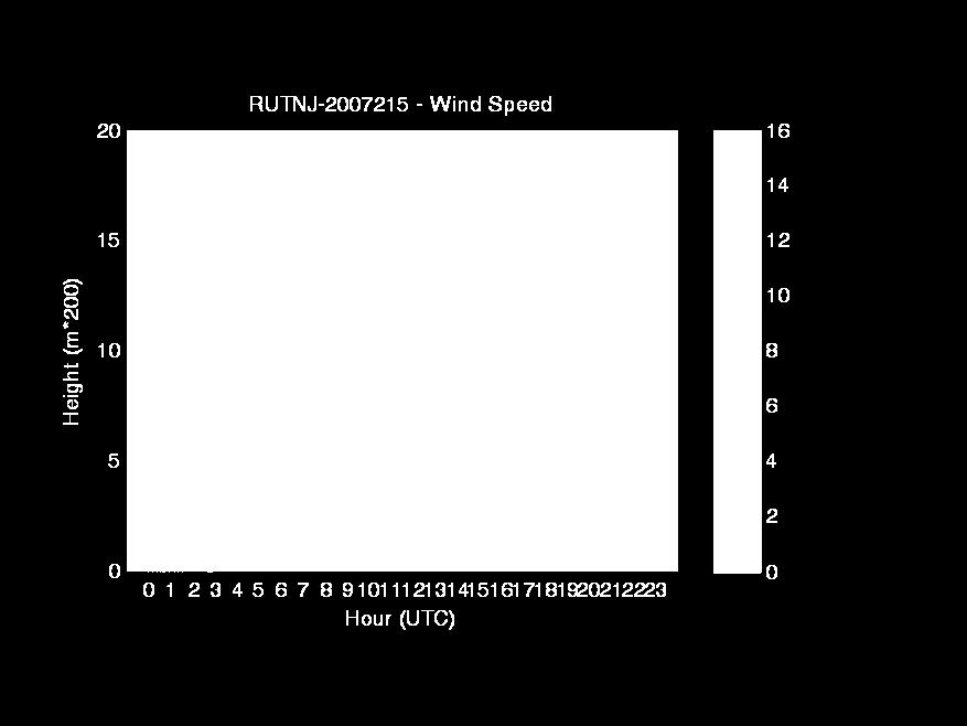
17 Over the 12 km domain wind speed monthly statistics comparing WRF simulation against CASTNet data Wind Speed Jan Feb March April May June July Aug Sept Oct Nov Dec Sample_Size Mean_Obs Mean_Model STD_Obs STD_Model Mean_Bias STD_bias RMSE Normalized_Mean_Bias (%) Mean_Fractional_Bias (%) Mean_Error Normalized_Mean_Error (%) Mean Fractional_Error (%) Correlation_Coefficient
18 Wind Profiler Data Five sites: Baltimore, MD (BLTMD), Rutgers, NJ (RUTNJ), Stowe, MA (STWMA), Charlotte, NC (CHANC), and Raleigh, NC (RALNC) Qualitative comparison of the measured vertical profile of wind speed with WRF predictions
19
20
21
22

23 BLTMD BLUE: Wind Profiler RED: WRF
24 RUTNJ BLUE: Wind Profiler RED: WRF

25 STWMA BLUE: Wind Profiler RED: WRF
26 Comparison of Observed and WRF Cloud Fraction Using GOES 12 satellite observations derived cloud fraction from UMD s Surface Radiation Budget (SRB) Cloud fraction estimates are made on an hourly basis at 0.5 resolution for an area bounded by W longitude and N latitude MCIP processed cloud fraction using WRF output
27 Comparison of Cloud fraction based on observed (SRB) and WRF predicted (MCIP) for August 2, 2007 at 1700 General agreement in pattern over the domain
28 Comparison of Cloud fraction based on observed (SRB) and WRF predicted (MCIP) for August 3, 2007 at 1700 General agreement in pattern over the domain
29 Planetary Boundary Layer (PBL) Height Comparison Lidar based observed PBL height at CCNY WRF based PBL height at CCNY grid and maximum value of 9 by 9 grid surrounding CCNY grid The maximum of the 9 by 9 grid is found to be closer to Lidar based observed PBL height
 with 1 to 1 line and best")
30 Comparison of PBL heights from Lidar and WRF at the CCNY grid during 2007 Data are from 1000 to 1300 hrs (EST) with 1 to 1 line and best fit
31 Precipitation Obtained NCEP gridded stage 4 precipitation data from measurements Compared against WRF estimate on a monthly accumulation basis Overall WRF performed fairly well over non summer months, in terms of amount and pattern Over the months of April through September, WRF overpredicted precipitation amounts, except for August for which the model is found to under predict the precipitation because of passage of Hurricane Dean in late August
32 Comparison of precipitation based on measured (Stage 4) and predicted (WRF) for the month of January 2007
33 Comparison of precipitation based on measured (Stage 4) and predicted (WRF) for the month of August 2007
34 Summary and Conclusions WRF simulations shows good comparison with NWS TDL surface based measurements Similarly good comparison was noted with CASTNet data WRF captured the cloud coverage pattern when compared with satellitebased data WRF simulated Low level jets (LLJ) and compares well with wind profiler data WRF based estimates of Planetary Boundary Layer (PBL) heights compared well with Lidar based PBL heights at New York City location WRF simulated precipitation patterns are found to match well with measurements
Meteorological Modeling using Penn State/NCAR 5 th Generation Mesoscale Model (MM5)
") TSD-1a Meteorological Modeling using Penn State/NCAR 5 th Generation Mesoscale Model (MM5) Bureau of Air Quality Analysis and Research Division of Air Resources New York State Department of Environmental
TSD-1a Meteorological Modeling using Penn State/NCAR 5 th Generation Mesoscale Model (MM5) Bureau of Air Quality Analysis and Research Division of Air Resources New York State Department of Environmental
Ozone Transport Commission. Modeling Committee. Editor: Debra Baker MDE. Contributors. Debra Baker MDE. Tom Downs ME DEP.
 Sensitivity Testing of WRF Physics Parameterizations for Meteorological Modeling and Protocol in Support of Regional SIP Air Quality Modeling in the OTR Ozone Transport Commission Modeling Committee Editor:
ANNUAL WRF SIMULATIONS FOR THE UTAH BUREAU OF LAND MANAGEMENT S AIR RESOURCE MANAGEMENT STRATEGY (ARMS) AIR QUALITY MODELING
 AIR QUALITY MODELING") ANNUAL WRF SIMULATIONS FOR THE UTAH BUREAU OF LAND MANAGEMENT S AIR RESOURCE MANAGEMENT STRATEGY (ARMS) AIR QUALITY MODELING Kenneth Craig*, Stephen Reid, Garnet Erdakos Sonoma Technology, Inc., Petaluma,
ANNUAL WRF SIMULATIONS FOR THE UTAH BUREAU OF LAND MANAGEMENT S AIR RESOURCE MANAGEMENT STRATEGY (ARMS) AIR QUALITY MODELING Kenneth Craig*, Stephen Reid, Garnet Erdakos Sonoma Technology, Inc., Petaluma,
Overview of Maryland s Upper Air Profilers
 Overview of Maryland s Upper Air Profilers Dave Krask, Manager MDE Air Monitoring Program EPA/NACAA Monitoring Meeting January 10, 2013 Martin O Malley, Governor Anthony G. Brown, Lt. Governor Robert M.
Di Wu, Xiquan Dong, Baike Xi, Zhe Feng, Aaron Kennedy, and Gretchen Mullendore. University of North Dakota
 Di Wu, Xiquan Dong, Baike Xi, Zhe Feng, Aaron Kennedy, and Gretchen Mullendore University of North Dakota Objectives 3 case studies to evaluate WRF and NAM performance in Oklahoma (OK) during summer 2007,
Simulation studies for Lake Taihu effect on local meteorological environment. Ren Xia
 Simulation studies for Lake Taihu effect on local meteorological environment Ren Xia 2017.05.12 1 Outline Background Experimental design Result and discussion Next work Background Taihu Lake is the largest
Assessment of the Noah LSM with Multi-parameterization Options (Noah-MP) within WRF
 within WRF") Assessment of the Noah LSM with Multi-parameterization Options (Noah-MP) within WRF Michelle Harrold, Jamie Wolff, and Mei Xu National Center for Atmospheric Research Research Applications Laboratory and
Assessment of the Noah LSM with Multi-parameterization Options (Noah-MP) within WRF Michelle Harrold, Jamie Wolff, and Mei Xu National Center for Atmospheric Research Research Applications Laboratory and
Water Balance in the Murray-Darling Basin and the recent drought as modelled with WRF
 18 th World IMACS / MODSIM Congress, Cairns, Australia 13-17 July 2009 http://mssanz.org.au/modsim09 Water Balance in the Murray-Darling Basin and the recent drought as modelled with WRF Evans, J.P. Climate
Comprehensive Analysis of Annual 2005/2008 Simulation of WRF/CMAQ over Southeast of England
 Comprehensive Analysis of Annual 2005/2008 Simulation of WRF/CMAQ over Southeast of England The 13 th International Conference on Harmonization within Atmospheric Dispersion Modelling for Regulatory Purposes
Wind conditions based on coupling between a mesoscale and microscale model
 Wind conditions based on coupling between a mesoscale and microscale model José Laginha Palma and Carlos Veiga Rodrigues CEsA Centre for Wind Energy and Atmospheric Flows Faculty of Engineering, University
Uncertainties in planetary boundary layer schemes and current status of urban boundary layer simulations at OU
 Uncertainties in planetary boundary layer schemes and current status of urban boundary layer simulations at OU Xiaoming Hu September 16 th @ 3:00 PM, NWC 5600 Contributors: Fuqing Zhang, Pennsylvania State
Creating Meteorology for CMAQ
 Creating Meteorology for CMAQ Tanya L. Otte* Atmospheric Sciences Modeling Division NOAA Air Resources Laboratory Research Triangle Park, NC * On assignment to the National Exposure Research Laboratory,
IMPROVING CLOUD PREDICTION IN WRF THROUGH THE USE OF GOES SATELLITE ASSIMILATION
 IMPROVING CLOUD PREDICTION IN WRF THROUGH THE USE OF GOES SATELLITE ASSIMILATION Andrew T. White*, Arastoo P. Biazar, Richard T. McNider, Kevin Doty, Maudood Khan Earth System Science Center, The University
Draft Report. Prepared for: Regional Air Quality Council 1445 Market Street, Suite 260 Denver, Colorado Prepared by:
 Draft Report Evaluation of Preliminary MM5 Meteorological Model Simulation for the June-July 2006 Denver Ozone SIP Modeling Period Focused on Colorado Prepared for: Regional Air Quality Council 1445 Market
Development and Validation of Polar WRF
 Polar Meteorology Group, Byrd Polar Research Center, The Ohio State University, Columbus, Ohio Development and Validation of Polar WRF David H. Bromwich 1,2, Keith M. Hines 1, and Le-Sheng Bai 1 1 Polar
Jordan G. Powers Kevin W. Manning. Mesoscale and Microscale Meteorology Laboratory National Center for Atmospheric Research Boulder, Colorado, USA
 Jordan G. Powers Kevin W. Manning Mesoscale and Microscale Meteorology Laboratory National Center for Atmospheric Research Boulder, Colorado, USA Background : Model for Prediction Across Scales = Global
The Fifth-Generation NCAR / Penn State Mesoscale Model (MM5) Mark Decker Feiqin Xie ATMO 595E November 23, 2004 Department of Atmospheric Science
 Mark Decker Feiqin Xie ATMO 595E November 23, 2004 Department of Atmospheric Science") The Fifth-Generation NCAR / Penn State Mesoscale Model (MM5) Mark Decker Feiqin Xie ATMO 595E November 23, 2004 Department of Atmospheric Science Outline Basic Dynamical Equations Numerical Methods Initialization
The Fifth-Generation NCAR / Penn State Mesoscale Model (MM5) Mark Decker Feiqin Xie ATMO 595E November 23, 2004 Department of Atmospheric Science Outline Basic Dynamical Equations Numerical Methods Initialization
Development and Testing of Polar WRF *
 Development and Testing of Polar WRF * David H. Bromwich, Keith M. Hines and Le-Sheng Bai Polar Meteorology Group Byrd Polar Research Center The Ohio State University Columbus, Ohio *Supported by NSF,
PRELIMINARY EXPERIENCES WITH THE MULTI-MODEL AIR QUALITY FORECASTING SYSTEM FOR NEW YORK STATE
 PRELIMINARY EXPERIENCES WITH THE MULTI-MODEL AIR QUALITY FORECASTING SYSTEM FOR NEW YORK STATE Prakash Doraiswamy 1,,*, Christian Hogrefe 1,2, Winston Hao 2, Brian Colle 3, Mark Beauharnois 1, Ken Demerjian
Improved rainfall and cloud-radiation interaction with Betts-Miller-Janjic cumulus scheme in the tropics
 Improved rainfall and cloud-radiation interaction with Betts-Miller-Janjic cumulus scheme in the tropics Tieh-Yong KOH 1 and Ricardo M. FONSECA 2 1 Singapore University of Social Sciences, Singapore 2
COSMIC GPS Radio Occultation and
 An Impact Study of FORMOSAT-3/ COSMIC GPS Radio Occultation and Dropsonde Data on WRF Simulations 27 Mei-yu season Fang-Ching g Chien Department of Earth Sciences Chien National and Taiwan Kuo (29), Normal
WRF Model Simulated Proxy Datasets Used for GOES-R Research Activities
 WRF Model Simulated Proxy Datasets Used for GOES-R Research Activities Jason Otkin Cooperative Institute for Meteorological Satellite Studies Space Science and Engineering Center University of Wisconsin
EVALUATION OF PEANUT DISEASE DEVELOPMENT FORECASTING. North Carolina State University, Raleigh, North Carolina
 P244 EVALUATION OF PEANUT DISEASE DEVELOPMENT FORECASTING John A. McGuire* 1, Mark S. Brooks 1, Aaron P. Sims 1, Barbara Shew 2, and Ryan Boyles 1 1 State Climate Office of North Carolina, 2 Department
WRF-RTFDDA Optimization and Wind Farm Data Assimilation
 2009, University Corporation for Atmospheric Research. All rights reserved. WRF-RTFDDA Optimization and Wind Farm Data Assimilation William Y.Y. Cheng, Yubao Liu, Yuewei Liu, and Gregory Roux NCAR/Research
The Climate of Grady County
 The Climate of Grady County Grady County is part of the Central Great Plains, encompassing some of the best agricultural land in Oklahoma. Average annual precipitation ranges from about 33 inches in northern
Jackson County 2013 Weather Data
 Jackson County 2013 Weather Data 61 Years of Weather Data Recorded at the UF/IFAS Marianna North Florida Research and Education Center Doug Mayo Jackson County Extension Director 1952-2008 Rainfall Data
Downscaling and Probability
 Downscaling and Probability Applications in Climate Decision Aids May 11, 2011 Glenn Higgins Manager, Environmental Sciences and Engineering Department Downscaling and Probability in Climate Modeling The
Application and Evaluation of the Global Weather Research and Forecasting (GWRF) Model
 Model") Application and Evaluation of the Global Weather Research and Forecasting (GWRF) Model Joshua Hemperly, Xin-Yu Wen, Nicholas Meskhidze, and Yang Zhang* Department of Marine, Earth, and Atmospheric Sciences,
Application and Evaluation of the Global Weather Research and Forecasting (GWRF) Model Joshua Hemperly, Xin-Yu Wen, Nicholas Meskhidze, and Yang Zhang* Department of Marine, Earth, and Atmospheric Sciences,
Weather Research and Forecasting Model. Melissa Goering Glen Sampson ATMO 595E November 18, 2004
 Weather Research and Forecasting Model Melissa Goering Glen Sampson ATMO 595E November 18, 2004 Outline What does WRF model do? WRF Standard Initialization WRF Dynamics Conservation Equations Grid staggering
Sensitivity of precipitation forecasts to cumulus parameterizations in Catalonia (NE Spain)
") Sensitivity of precipitation forecasts to cumulus parameterizations in Catalonia (NE Spain) Jordi Mercader (1), Bernat Codina (1), Abdelmalik Sairouni (2), Jordi Cunillera (2) (1) Dept. of Astronomy and
Sensitivity of precipitation forecasts to cumulus parameterizations in Catalonia (NE Spain) Jordi Mercader (1), Bernat Codina (1), Abdelmalik Sairouni (2), Jordi Cunillera (2) (1) Dept. of Astronomy and
2012 AHW Stream 1.5 Retrospective Results
 2012 AHW Stream 1.5 Retrospective Results Ryan D. Torn, Univ. Albany, SUNY Chris Davis, Wei Wang, Jimy Dudhia, Tom Galarneau, Chris Snyder, James Done, NCAR/NESL/MMM Overview Since participation in HFIP
EVALUATION OF THE WRF METEOROLOGICAL MODEL RESULTS FOR HIGH OZONE EPISODE IN SW POLAND THE ROLE OF MODEL INITIAL CONDITIONS Wrocław, Poland
 EVALUATION OF THE WRF METEOROLOGICAL MODEL RESULTS FOR HIGH OZONE EPISODE IN SW POLAND THE ROLE OF MODEL INITIAL CONDITIONS Kinga Wałaszek 1, Maciej Kryza 1, Małgorzata Werner 1 1 Department of Climatology
Jordan G. Powers Kevin W. Manning. Mesoscale and Microscale Meteorology Laboratory National Center for Atmospheric Research Boulder, CO
 Jordan G. Powers Kevin W. Manning Mesoscale and Microscale Meteorology Laboratory National Center for Atmospheric Research Boulder, CO Background : Model for Prediction Across Scales Global atmospheric
Western- State Air Quality Modeling Study (WSAQS) Weather Research Forecast 2014 Meteorological Model Application/Evaluation
 Weather Research Forecast 2014 Meteorological Model Application/Evaluation") Western- State Air Quality Modeling Study (WSAQS) Weather Research Forecast 2014 Meteorological Model Application/Evaluation Prepared for: Tom Moore Western Regional Air Partnership c/o CIRA, Colorado
Western- State Air Quality Modeling Study (WSAQS) Weather Research Forecast 2014 Meteorological Model Application/Evaluation Prepared for: Tom Moore Western Regional Air Partnership c/o CIRA, Colorado
MM5 v3.6.1 and WRF v3.5.1 model comparison of standard and surface energy variables in the development of the planetary boundary layer
 doi:10.5194/gmd-7-2693-2014 Author(s) 2014. CC Attribution 3.0 License. MM5 v3.6.1 and WRF v3.5.1 model comparison of standard and surface energy variables in the development of the planetary boundary
1.2 Annual Meteorological Modeling in Support of Visibility Improvement in the Southeast US
 1.2 Annual Meteorological Modeling in Support of Visibility Improvement in the Southeast US Donald T. Olerud, Jr.* and Aaron P. Sims Baron Advanced Meteorological Systems, Raleigh, NC Michael Abraczinskas
A COMPARISON OF VERY SHORT-TERM QPF S FOR SUMMER CONVECTION OVER COMPLEX TERRAIN AREAS, WITH THE NCAR/ATEC WRF AND MM5-BASED RTFDDA SYSTEMS
 A COMPARISON OF VERY SHORT-TERM QPF S FOR SUMMER CONVECTION OVER COMPLEX TERRAIN AREAS, WITH THE NCAR/ATEC WRF AND MM5-BASED RTFDDA SYSTEMS Wei Yu, Yubao Liu, Tom Warner, Randy Bullock, Barbara Brown and
Atmospheric processes leading to extreme flood events
 Atmospheric processes leading to extreme flood events A. P. Dimri School of Environmental Sciences Jawaharlal Nehru University New Delhi, India apdimri@hotmail.com Observational and modelling limitations
Source apportionment of fine particulate matter over the Eastern U.S. Part I. Source sensitivity simulations using CMAQ with the Brute Force method
 S1 SUPPORTING MATERIAL Source apportionment of fine particulate matter over the Eastern U.S. Part I. Source sensitivity simulations using CMAQ with the Brute Force method Michael Burr and Yang Zhang Department
A WRF-based rapid updating cycling forecast system of. BMB and its performance during the summer and Olympic. Games 2008
 A WRF-based rapid updating cycling forecast system of BMB and its performance during the summer and Olympic Games 2008 Min Chen 1, Shui-yong Fan 1, Jiqin Zhong 1, Xiang-yu Huang 2, Yong-Run Guo 2, Wei
Application of the Weather Research and Forecasting Model for Air Quality Modeling in the San Francisco Bay Area
 VOLUME 52 J O U R N A L O F A P P L I E D M E T E O R O L O G Y A N D C L I M A T O L O G Y SEPTEMBER 2013 Application of the Weather Research and Forecasting Model for Air Quality Modeling in the San
The Climate of Payne County
 The Climate of Payne County Payne County is part of the Central Great Plains in the west, encompassing some of the best agricultural land in Oklahoma. Payne County is also part of the Crosstimbers in the
2012 and changes to the Rapid Refresh and HRRR weather forecast models
 2012 and 2013-15 changes to the Rapid Refresh and HRRR weather forecast models 31 October 2012 Stan Benjamin Steve Weygandt Curtis Alexander NOAA Earth System Research Laboratory Boulder, CO FPAW - 2012
The Climate of Kiowa County
 The Climate of Kiowa County Kiowa County is part of the Central Great Plains, encompassing some of the best agricultural land in Oklahoma. Average annual precipitation ranges from about 24 inches in northwestern
Wen Xu* Alberta Environment and Sustainable Resource Development, Edmonton, Alberta, Canada
 Air Quality and Acid Deposition Simulation of South Athabasca Oil Sands Area Applying WRF, CMAQ and CALPUFF Models, and Model Performance Evaluations of WRF and CMAQ Models Wen Xu* Alberta Environment
Preliminary Experiences with the Multi Model Air Quality Forecasting System for New York State
 Preliminary Experiences with the Multi Model Air Quality Forecasting System for New York State Prakash Doraiswamy 1, Christian Hogrefe 1,2, Winston Hao 2, Brian Colle 3, Mark Beauharnois 1, Ken Demerjian
Land Data Assimilation at NCEP NLDAS Project Overview, ECMWF HEPEX 2004
 Dag.Lohmann@noaa.gov, Land Data Assimilation at NCEP NLDAS Project Overview, ECMWF HEPEX 2004 Land Data Assimilation at NCEP: Strategic Lessons Learned from the North American Land Data Assimilation System
The Climate of Bryan County
 The Climate of Bryan County Bryan County is part of the Crosstimbers throughout most of the county. The extreme eastern portions of Bryan County are part of the Cypress Swamp and Forest. Average annual
The Climate of Marshall County
 The Climate of Marshall County Marshall County is part of the Crosstimbers. This region is a transition region from the Central Great Plains to the more irregular terrain of southeastern Oklahoma. Average
The Global Weather Research and Forecasting (GWRF) Model: Model Evaluation, Sensitivity Study, and Future Year Simulation
 Model: Model Evaluation, Sensitivity Study, and Future Year Simulation") Atmospheric and Climate Sciences, 2012, 2, 231-253 doi:10.4236/acs.2012.23024 Published Online July 2012 (http://www.scirp.org/journal/acs) The Global Weather Research and Forecasting (GWRF) Model: Model
Atmospheric and Climate Sciences, 2012, 2, 231-253 doi:10.4236/acs.2012.23024 Published Online July 2012 (http://www.scirp.org/journal/acs) The Global Weather Research and Forecasting (GWRF) Model: Model
Evaluating winds and vertical wind shear from Weather Research and Forecasting model forecasts using seven planetary boundary layer schemes
 WIND ENERGY Wind Energ. 2014; 17:39 55 Published online 28 October 2012 in Wiley Online Library (wileyonlinelibrary.com)..1555 RESEARCH ARTICLE Evaluating winds and vertical wind shear from Weather Research
The Climate of Pontotoc County
 The Climate of Pontotoc County Pontotoc County is part of the Crosstimbers. This region is a transition region from the Central Great Plains to the more irregular terrain of southeast Oklahoma. Average
Maximization of Historical Severe Precipitation Events over American, Yuba and Feather River Basins
 Maximization of Historical Severe Precipitation Events over merican, Yuba and Feather River Basins M. L. Kavvas 1, K. Ishida 1, S. Jang 1, N. Ohara 2, Z.Q.Chen 3, and M. nderson 3 1 University Of California,
Interannual variation of MODIS NDVI in Lake Taihu and its relation to climate in submerged macrophyte region
 Yale-NUIST Center on Atmospheric Environment Interannual variation of MODIS NDVI in Lake Taihu and its relation to climate in submerged macrophyte region ZhangZhen 2015.07.10 1 Outline Introduction Data
Regents Earth Science Unit 7: Water Cycle and Climate
 Regents Earth Science Unit 7: Water Cycle and Climate Name Section Coastal and Continental Temperature Ranges Lab # Introduction: There are large variations in average monthly temperatures among cities
WRAP 2002 Visibility Modeling: Emission, Meteorology Inputs and CMAQ Performance Evaluation
 WRAP 2002 Visibility Modeling: Emission, Meteorology Inputs and CMAQ Performance Evaluation Gail Tonnesen, Bo Wang, Chao-Jung Chien, Zion Wang, Mohammad Omary University of California, Riverside Zac Adelman,
The model simulation of the architectural micro-physical outdoors environment
 The model simulation of the architectural micro-physical outdoors environment sb08 Chiag Che-Ming, De-En Lin, Po-Cheng Chou and Yen-Yi Li Archilife research foundation, Taipei, Taiwa, archilif@ms35.hinet.net
D.Carvalho, A, Rocha, at 2014 Applied Energy. Report person:zhang Jiarong. Date:
 A discussion on the paper "WRF wind simulation and wind energy production estimates forced by different reanalyses : Comparision with observed data for Portugal." D.Carvalho, A, Rocha, at 2014 Applied
ABSTRACT 3 RADIAL VELOCITY ASSIMILATION IN BJRUC 3.1 ASSIMILATION STRATEGY OF RADIAL
 REAL-TIME RADAR RADIAL VELOCITY ASSIMILATION EXPERIMENTS IN A PRE-OPERATIONAL FRAMEWORK IN NORTH CHINA Min Chen 1 Ming-xuan Chen 1 Shui-yong Fan 1 Hong-li Wang 2 Jenny Sun 2 1 Institute of Urban Meteorology,
Arctic System Reanalysis Provides Highresolution Accuracy for Arctic Studies
 Arctic System Reanalysis Provides Highresolution Accuracy for Arctic Studies David H. Bromwich, Aaron Wilson, Lesheng Bai, Zhiquan Liu POLAR2018 Davos, Switzerland Arctic System Reanalysis Regional reanalysis
Evaluation of nonlocal and local planetary boundary layer schemes in the WRF model
 Evaluation of nonlocal and local planetary boundary layer schemes in the WRF model Bo Xie,Jimmy C. H. Fung,Allen Chan,and Alexis Lau Received 31 October 2011; revised 13 May 2012; accepted 14 May 2012;
The Climate of Seminole County
 The Climate of Seminole County Seminole County is part of the Crosstimbers. This region is a transition region from the Central Great Plains to the more irregular terrain of southeastern Oklahoma. Average
The Climate of Murray County
 The Climate of Murray County Murray County is part of the Crosstimbers. This region is a transition between prairies and the mountains of southeastern Oklahoma. Average annual precipitation ranges from
The Model Simulation of the Architectural Micro-Physical Outdoors Environment
 The Model Simulation of the Architectural Micro-Physical Outdoors Environment Che-Ming Chiang 1, De-En Lin 2, Po-Cheng Chou 3, Yen-Yi Li 3 1 Department of Architecture, National Cheng Kung University,
The Climate of Texas County
 The Climate of Texas County Texas County is part of the Western High Plains in the north and west and the Southwestern Tablelands in the east. The Western High Plains are characterized by abundant cropland
P1.34 MULTISEASONALVALIDATION OF GOES-BASED INSOLATION ESTIMATES. Jason A. Otkin*, Martha C. Anderson*, and John R. Mecikalski #
 P1.34 MULTISEASONALVALIDATION OF GOES-BASED INSOLATION ESTIMATES Jason A. Otkin*, Martha C. Anderson*, and John R. Mecikalski # *Cooperative Institute for Meteorological Satellite Studies, University of
Evaluation of nonlocal and local planetary boundary layer schemes in the WRF model
 JOURNAL OF GEOPHYSICAL RESEARCH, VOL. 117,, doi:10.1029/2011jd017080, 2012 Evaluation of nonlocal and local planetary boundary layer schemes in the WRF model Bo Xie, 1 Jimmy C. H. Fung, 1,2 Allen Chan,
Variational data assimilation of lightning with WRFDA system using nonlinear observation operators
 Variational data assimilation of lightning with WRFDA system using nonlinear observation operators Virginia Tech, Blacksburg, Virginia Florida State University, Tallahassee, Florida rstefane@vt.edu, inavon@fsu.edu
P1.2 SENSITIVITY OF WRF MODEL FORECASTS TO DIFFERENT PHYSICAL PARAMETERIZATIONS IN THE BEAUFORT SEA REGION
 P1.2 SENSITIVITY OF WRF MODEL FORECASTS TO DIFFERENT PHYSICAL PARAMETERIZATIONS IN THE BEAUFORT SEA REGION Jeremy R. Krieger *, Jing Zhang Arctic Region Supercomputing Center, University of Alaska Fairbanks
Simulating orographic precipitation: Sensitivity to physics parameterizations and model numerics
 Simulating orographic precipitation: Sensitivity to physics parameterizations and model numerics 2nd COPS-Meeting, 27 June 2005 Günther Zängl Overview A highly idealized test of numerical model errors
Modeling Study of Atmospheric Boundary Layer Characteristics in Industrial City by the Example of Chelyabinsk
 Modeling Study of Atmospheric Boundary Layer Characteristics in Industrial City by the Example of Chelyabinsk Lenskaya Olga Yu.*, Sanjar M. Abdullaev South Ural State University, Chelyabinsk, *ecolcsu@gmail.com
A Study of Convective Initiation Failure on 22 Oct 2004
 A Study of Convective Initiation Failure on 22 Oct 2004 Jennifer M. Laflin Philip N. Schumacher NWS Sioux Falls, SD August 6 th, 2011 Introduction Forecasting challenge: strong forcing for ascent and large
SIMULATION OF ATMOSPHERIC STATES FOR THE CASE OF YEONG-GWANG STORM SURGE ON 31 MARCH 2007 : MODEL COMPARISON BETWEEN MM5, WRF AND COAMPS
 SIMULATION OF ATMOSPHERIC STATES FOR THE CASE OF YEONG-GWANG STORM SURGE ON 31 MARCH 2007 : MODEL COMPARISON BETWEEN MM5, WRF AND COAMPS JEONG-WOOK LEE 1 ; KYUNG-JA HA 1* ; KI-YOUNG HEO 1 ; KWANG-SOON
Numerical Prediction of Tropical Cyclones (PAGASA Experience)
") Numerical Prediction of Tropical Cyclones (PAGASA Experience) BONIFACIO G. PAJUELAS Philippine Atmospheric, Geophysical and Astronomical Services Administration (PAGASA) Science Garden, Agham Road, Diliman,
Numerical Prediction of Tropical Cyclones (PAGASA Experience) BONIFACIO G. PAJUELAS Philippine Atmospheric, Geophysical and Astronomical Services Administration (PAGASA) Science Garden, Agham Road, Diliman,
Influences of PBL Parameterizations on Warm-Season Convection-Permitting Regional Climate Simulations
 Influences of PBL Parameterizations on Warm-Season Convection-Permitting Regional Climate Simulations Stan Trier (NCAR/MMM) Andreas Prein (NCAR/ASP) and Changhai Liu (NCAR/RAL) GEWEX Convection-Permitting
An analysis of Wintertime Cold-Air Pool in Armenia Using Climatological Observations and WRF Model Data
 An analysis of Wintertime Cold-Air Pool in Armenia Using Climatological Observations and WRF Model Data Hamlet Melkonyan 1,2, Artur Gevorgyan 1,2, Sona Sargsyan 1, Vladimir Sahakyan 2, Zarmandukht Petrosyan
THE IMPACT OF GROUND-BASED GPS SLANT-PATH WET DELAY MEASUREMENTS ON SHORT-RANGE PREDICTION OF A PREFRONTAL SQUALL LINE
 JP1.17 THE IMPACT OF GROUND-BASED GPS SLANT-PATH WET DELAY MEASUREMENTS ON SHORT-RANGE PREDICTION OF A PREFRONTAL SQUALL LINE So-Young Ha *1,, Ying-Hwa Kuo 1, Gyu-Ho Lim 1 National Center for Atmospheric
The Climate of Haskell County
 The Climate of Haskell County Haskell County is part of the Hardwood Forest. The Hardwood Forest is characterized by its irregular landscape and the largest lake in Oklahoma, Lake Eufaula. Average annual
APPENDIX G-7 METEROLOGICAL DATA
 APPENDIX G-7 METEROLOGICAL DATA METEOROLOGICAL DATA FOR AIR AND NOISE SAMPLING DAYS AT MMR Monthly Normals and Extremes for Honolulu International Airport Table G7-1 MMR RAWS Station Hourly Data Tables
The impact of rain on ocean wave evolution and its feedback to the atmosphere
 HAROKOPIO UNIVERSITY OF ATHENS DEPARTMENT OF GEOGRAPHY ATMOSPHERE AND CLIMATE DYNAMICS GROUP (ACDG) http://meteoclima.gr Coastal Hydrology and Surface Processes linked to Air/Sea Modeling: 1 st community
Near-surface weather prediction and surface data assimilation: challenges, development, and potential data needs
 Near-surface weather prediction and surface data assimilation: challenges, development, and potential data needs Zhaoxia Pu Department of Atmospheric Sciences University of Utah, Salt Lake City, Utah,
5.0 WHAT IS THE FUTURE ( ) WEATHER EXPECTED TO BE?
 WEATHER EXPECTED TO BE?") 5.0 WHAT IS THE FUTURE (2040-2049) WEATHER EXPECTED TO BE? This chapter presents some illustrative results for one station, Pearson Airport, extracted from the hour-by-hour simulations of the future period
5.0 WHAT IS THE FUTURE (2040-2049) WEATHER EXPECTED TO BE? This chapter presents some illustrative results for one station, Pearson Airport, extracted from the hour-by-hour simulations of the future period
Current and Future Impacts of Wildfires on PM 2.5, Health, and Policy in the Rocky Mountains
 Current and Future Impacts of Wildfires on PM 2.5, Health, and Policy in the Rocky Mountains Yang Liu, Ph.D. STAR Grants Kick-off Meeting Research Triangle Park, NC April 5, 2017 Motivation The Rocky Mountains
2003 Water Year Wrap-Up and Look Ahead
 2003 Water Year Wrap-Up and Look Ahead Nolan Doesken Colorado Climate Center Prepared by Odie Bliss http://ccc.atmos.colostate.edu Colorado Average Annual Precipitation Map South Platte Average Precipitation
Colorado s 2003 Moisture Outlook
 Colorado s 2003 Moisture Outlook Nolan Doesken and Roger Pielke, Sr. Colorado Climate Center Prepared by Tara Green and Odie Bliss http://climate.atmos.colostate.edu How we got into this drought! Fort
Memo. I. Executive Summary. II. ALERT Data Source. III. General System-Wide Reporting Summary. Date: January 26, 2009 To: From: Subject:
 Memo Date: January 26, 2009 To: From: Subject: Kevin Stewart Markus Ritsch 2010 Annual Legacy ALERT Data Analysis Summary Report I. Executive Summary The Urban Drainage and Flood Control District (District)
Variability of Reference Evapotranspiration Across Nebraska
 Know how. Know now. EC733 Variability of Reference Evapotranspiration Across Nebraska Suat Irmak, Extension Soil and Water Resources and Irrigation Specialist Kari E. Skaggs, Research Associate, Biological
Projected change in the East Asian summer monsoon from dynamical downscaling
 Copyright KIOST, ALL RIGHTS RESERVED. Projected change in the East Asian summer monsoon from dynamical downscaling : Moisture budget analysis Chun-Yong Jung 1,2, Chan Joo Jang 1*, Ho-Jeong Shin 1 and Hyung-Jin
Meteorological Data recorded at Armagh Observatory from 1795 to 2001: Volume I - Daily, Monthly and Annual Rainfall
 Meteorological Data recorded at Armagh Observatory from 1795 to 2001: Volume I - Daily, Monthly and Annual Rainfall 1838-2001 A. M. García-Suárez, C.J. Butler, D. Cardwell, A.D.S. Coughlin, A. Donnelly,
Climatology of Surface Wind Speeds Using a Regional Climate Model
 Climatology of Surface Wind Speeds Using a Regional Climate Model THERESA K. ANDERSEN Iowa State University Mentors: Eugene S. Takle 1 and Jimmy Correia, Jr. 1 1 Iowa State University ABSTRACT Long-term
Jackson County 2014 Weather Data
 Jackson County 2014 Weather Data 62 Years of Weather Data Recorded at the UF/IFAS Marianna North Florida Research and Education Center Doug Mayo Jackson County Extension Director 1952-2008 Rainfall Data
Jackson County 2018 Weather Data 67 Years of Weather Data Recorded at the UF/IFAS Marianna North Florida Research and Education Center
 Jackson County 2018 Weather Data 67 Years of Weather Data Recorded at the UF/IFAS Marianna North Florida Research and Education Center Doug Mayo Jackson County Extension Director 1952-2008 Rainfall Data
P Hurricane Danielle Tropical Cyclogenesis Forecasting Study Using the NCAR Advanced Research WRF Model
 P1.2 2004 Hurricane Danielle Tropical Cyclogenesis Forecasting Study Using the NCAR Advanced Research WRF Model Nelsie A. Ramos* and Gregory Jenkins Howard University, Washington, DC 1. INTRODUCTION Presently,
VERIFICATION OF HIGH RESOLUTION WRF-RTFDDA SURFACE FORECASTS OVER MOUNTAINS AND PLAINS
 VERIFICATION OF HIGH RESOLUTION WRF-RTFDDA SURFACE FORECASTS OVER MOUNTAINS AND PLAINS Gregory Roux, Yubao Liu, Luca Delle Monache, Rong-Shyang Sheu and Thomas T. Warner NCAR/Research Application Laboratory,
Changing Hydrology under a Changing Climate for a Coastal Plain Watershed
 Changing Hydrology under a Changing Climate for a Coastal Plain Watershed David Bosch USDA-ARS, Tifton, GA Jeff Arnold ARS Temple, TX and Peter Allen Baylor University, TX SEWRU Objectives 1. Project changes
An Integrated Approach to the Prediction of Weather, Renewable Energy Generation and Energy Demand in Vermont
 1 An Integrated Approach to the Prediction of Weather, Renewable Energy Generation and Energy Demand in Vermont James P. Cipriani IBM Thomas J. Watson Research Center Yorktown Heights, NY Other contributors
The Impacts of GPSRO Data Assimilation and Four Ices Microphysics Scheme on Simulation of heavy rainfall Events over Taiwan during June 2012
 The Impacts of GPSRO Data Assimilation and Four Ices Microphysics Scheme on Simulation of heavy rainfall Events over Taiwan during 10-12 June 2012 Pay-Liam LIN, Y.-J. Chen, B.-Y. Lu, C.-K. WANG, C.-S.
Operational quantitative precipitation estimation using radar, gauge g and
 Operational quantitative precipitation estimation using radar, gauge g and satellite for hydrometeorological applications in Southern Brazil Leonardo Calvetti¹, Cesar Beneti¹, Diogo Stringari¹, i¹ Alex
A Snow-Ratio Equation and Its Application to Numerical Snowfall Prediction
 644 W E A T H E R A N D F O R E C A S T I N G VOLUME 23 A Snow-Ratio Equation and Its Application to Numerical Snowfall Prediction KUN-YOUNG BYUN, JUN YANG,* AND TAE-YOUNG LEE Laboratory for Atmospheric
608 SENSITIVITY OF TYPHOON PARMA TO VARIOUS WRF MODEL CONFIGURATIONS
 608 SENSITIVITY OF TYPHOON PARMA TO VARIOUS WRF MODEL CONFIGURATIONS Phillip L. Spencer * and Brent L. Shaw Weather Decision Technologies, Norman, OK, USA Bonifacio G. Pajuelas Philippine Atmospheric,